BigIslandVideoNews posted an abridged version of today’s USGS Media Conference Call:
Here’s the full unabridged audio recording. Below, I take notes/paraphrase, for anyone who’s especially interested in the nitty gritty of what’s going on with the volcano.
Meanwhile, Kilauea continues to follow the recent status quo, summed up in HVO’s afternoon Kilauea update.
The Lower East Zone’s unnamed giant booms in its cone, fountains rising to 165 feet, lava cascading out of it at 15mph.
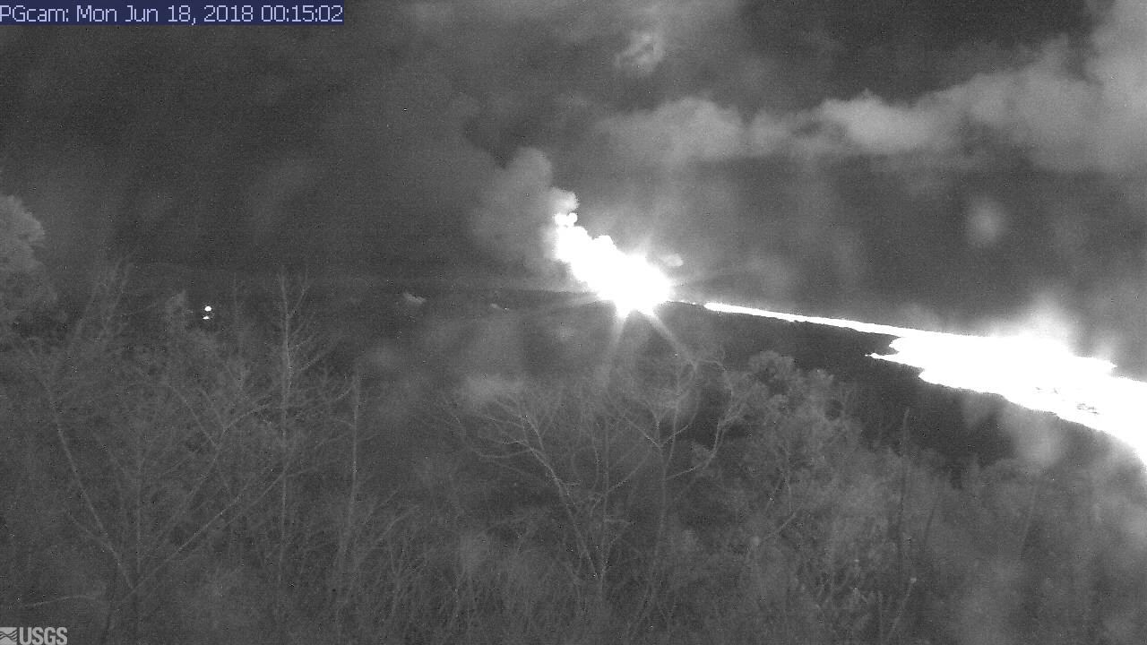
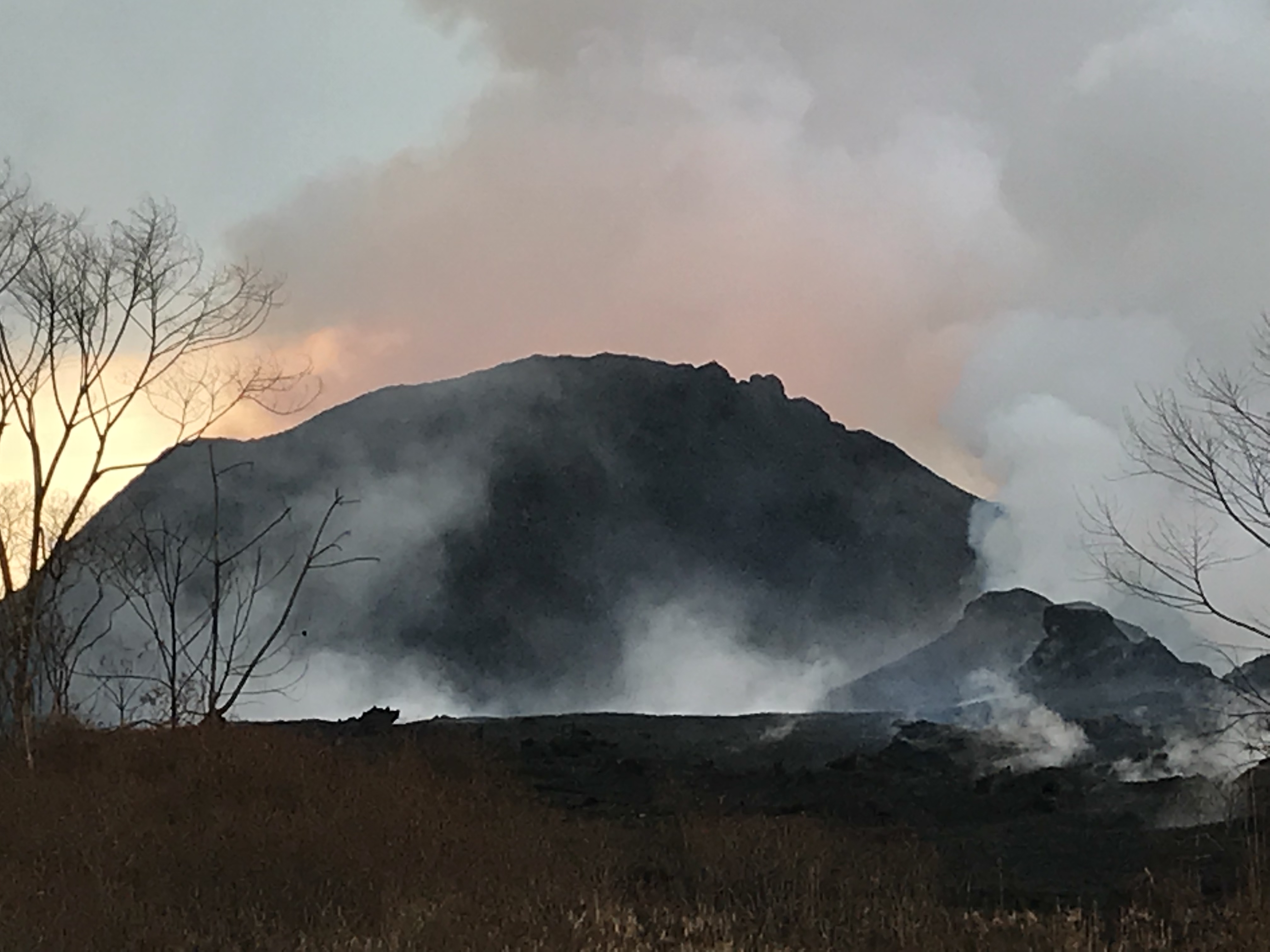
USGS: Pu’u continues to make bid for naming. (Full-sized)Fissures 16/18 keep oozing or spattering. “Incandescence (visible in PGcam to the left of fissure 8 most nights) and mild spattering were observed from Fissure 6.”
“The flow field is relatively stable with little change to its size and shape for the past few days…”
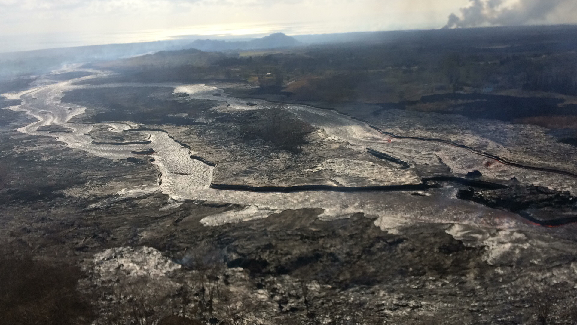
USGS: “Occasionally, minor amounts of lava briefly spill over the lava channel levees. The spill overs are the shiny gray lobes along the channel margins… View to the east, with the plume in the upper right showing the location of the ocean entry.” (Full-sized)
“Observations are also collected on a daily basis from cracks in the area of Highway 130; no changes in temperature, crack width, or gas emissions have been noted for several days…”
At the summit, the daily subsurface explosion occured at 6:26am HST. “The resulting gas plume, reported to be brief and nearly devoid of ash, was observed to 5,000 to 7,000 ft above sea level.”
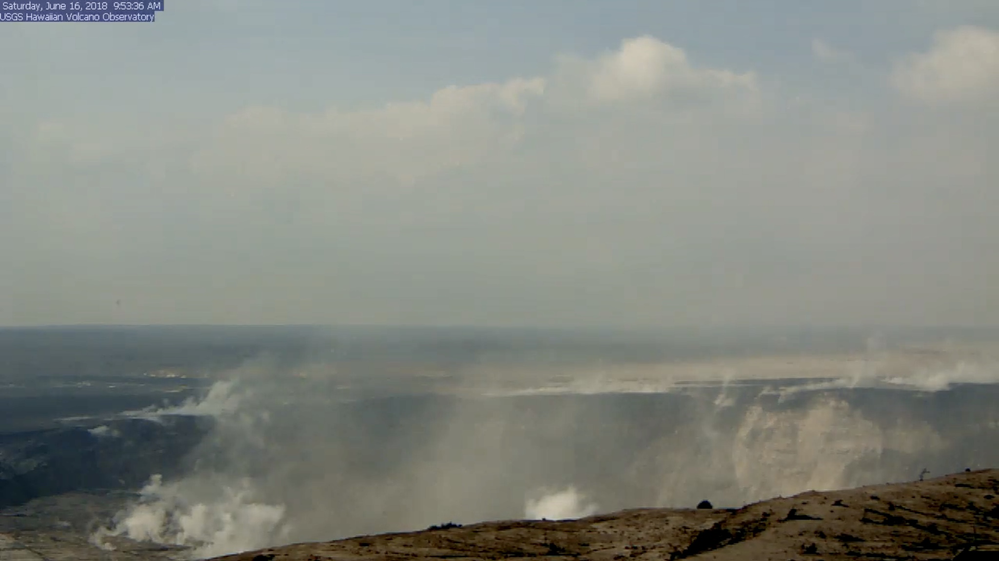
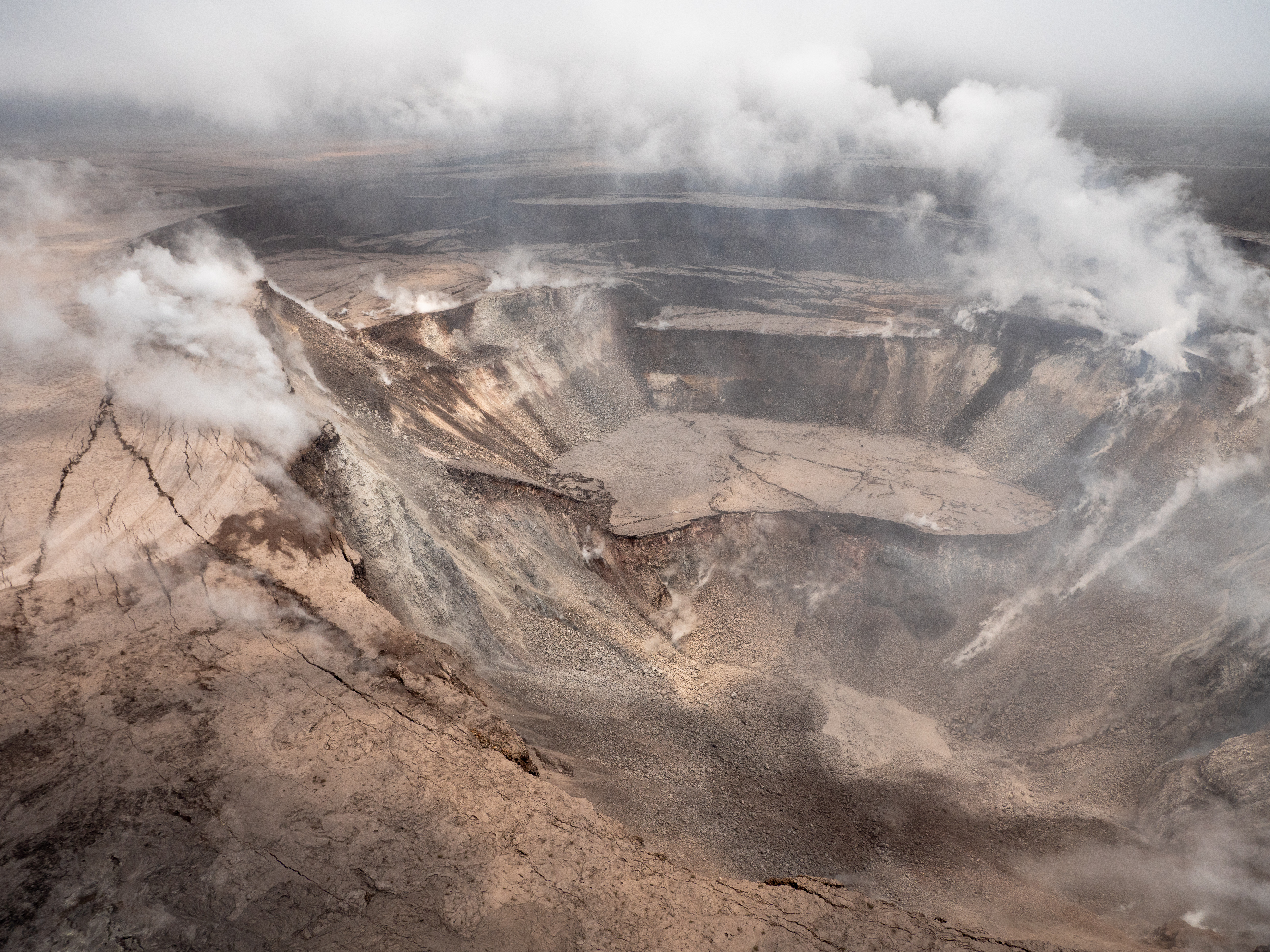
USGS: “Inward slumping of the rim and walls of Halema‘uma‘u continues in response to ongoing subsidence at the summit. Sulfur dioxide emissions from the volcano’s summit have dropped to levels that are about half those measured prior to the onset of the current episode of eruptive activity. This gas and very minor amounts of ash are being transported downwind, with small bursts of ash and gas accompanying intermittent explosive activity. The view is from Volcano House, looking toward the west.” (Full-sized)
This is the eighth day in a a row the daily event has released the energy of a 5.3 earthquake. For the month of June, they’ve all fallen in a range of 5.0 to 5.4.
“After this morning’s explosive event, seismicity at Kīlauea’s summit is slowly increasing. Inward slumping of the rim and walls of Halemaʻumaʻu continues in response to ongoing subsidence at the summit.”
Below the cut: a little local news, one of Mick Kalber’s best overflights of the Fissure 8/Kapoho area, and the work of a must-see photographer.
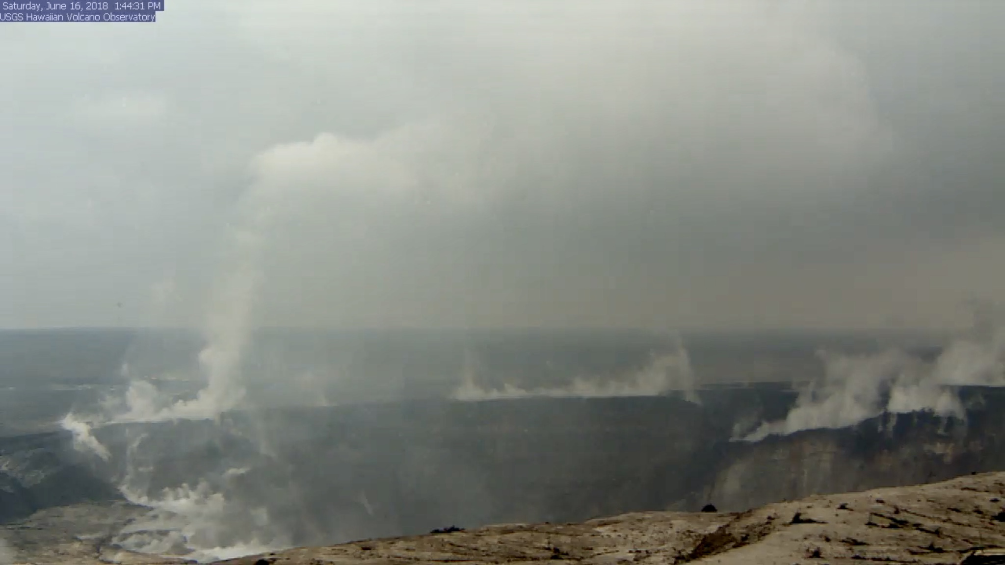
HVO’s Kilauea Summit Livestream caught today’s Halema’uma’u “subsurface explosion” (is that what we’re calling them now?) and — wow!
Halema’uma’u BEFORE: screengrab of USGS/HVO Kilauea Livestream before the day’s explosive event. I’ve boosted the exposure to bring out details. (Jun 16, 2018)
(a few hours later, when, luckily, it was still possible to rewind the livestream back to the time of the explosion, since I missed it.)
Halema’uma’u Crater AFTER: screengrab of USGS/HVO Kilauea Livestream taken later in the day after the dust had settled. Look at that big chunk of the rim that dropped on the right!
We’ve been hearing about subsidence, slumping, and rockfalls for weeks, but there’s nothing quite like seeing it, even if the video’s a bit fuzzy. I took the liberty of saving a clip:
Radar showed the plume was less than 7000 feet, and as usual the energy release checked in at 5.3.
While I rewound the livestream to grab that clip before it fell off the “back” of the livestream conveyor belt, it looks like I jumped right over this:
There was still a column of steam at that spot when I checked an hour later, but I don’t recall it spinning.
Okay, enough fiddling with the livestream.
What else happened today? Same as the last few days, to the point that I had to double-check the date on today’s HVO Kilauea status report. Fissure 8’s cone is holding at 170 feet, fountains currently around 185-200 feet. Fissure 16/18 continues to ooze.
The lava river is running as fast as ever:
Despite the increased vog due to lack of tradewinds, that’s the clearest overflight video I’ve seen in days.
Mick Kalber notes the pahoehoe channel now cuts all the way through the a’a field to the ocean, which may explain recent videos of lava racing at amazing speeds…
USGS: “Photograph taken during helicopter overflight captures fissure 8 lava fountain.” This one’s wonderfully moody with subtle textures close up. (Full-sized)
Lava fountains rise and fall, but the river they feed remains the same: a vigorously-flowing channel down to a wide ocean entry, with occasional small overflows slopping over the levees (banks). Last night, Fissure 8’s fountains were reaching 200 feet; today they dropped again to 100-130 feet with bursts up to 180. Its cinder cone, built of spatter and tephra falling around the fountains, is now 170 feet tall.
When is somebody going to name this pu’u?
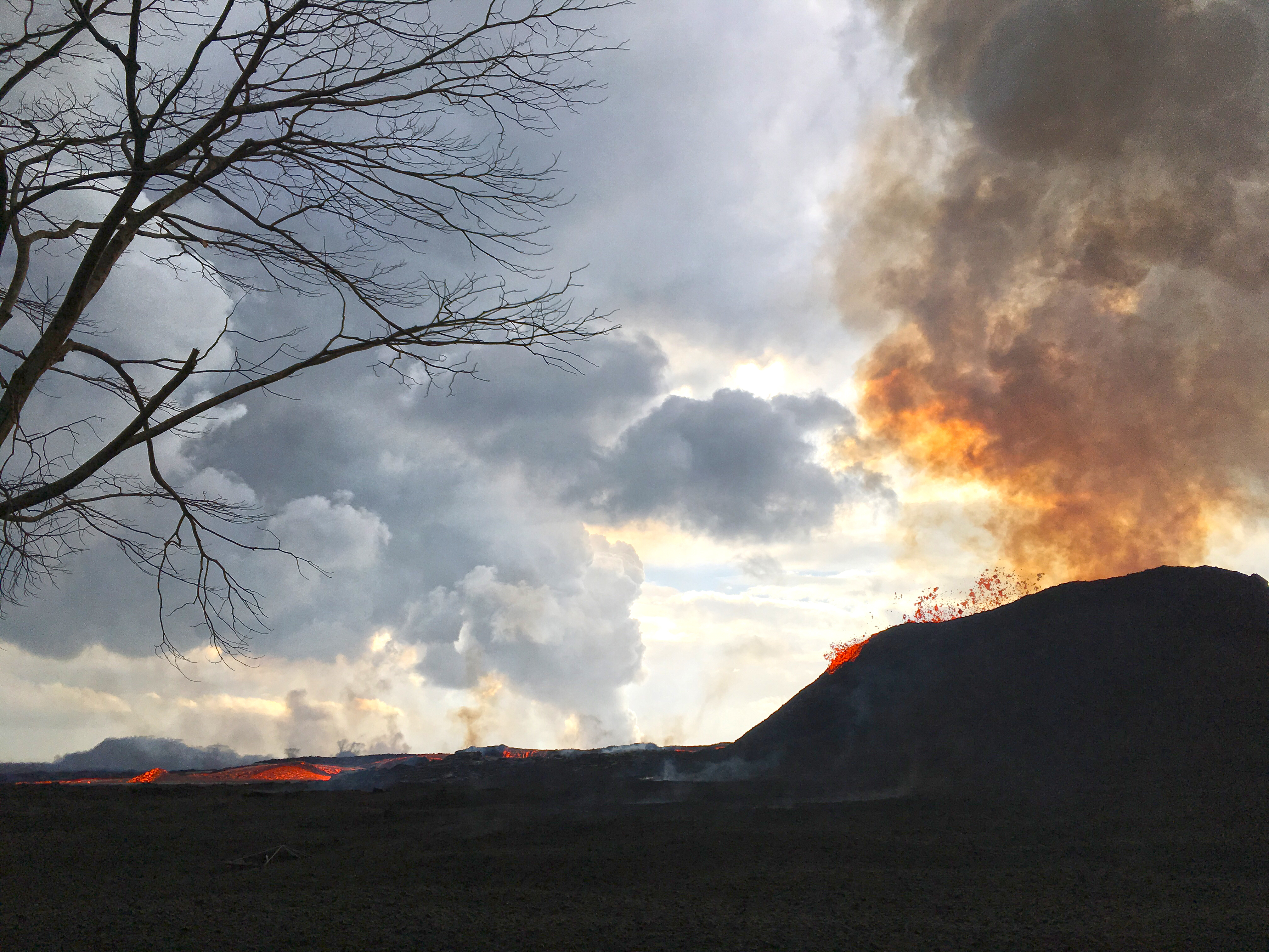
USGS: “Lava fountains from Fissure 8 reach heights of 200 ft overnight. The cinder and spatter cone that is building around the fissure is now about 165 ft at its highest point. At times, fissure activity is hidden behind the cinder and spatter cone, as shown in this image.” (Full-sized)
Frequency of earthquakes ramped up Thursday night, with more M3s than before. Today’s M5.3 summit explosion was late, finally popping at 11:56am, sending up an ash-poor (?) cloud 10,000 feet. HVO: “It didn’t produce a distinct plume, which is why we say ‘ash and gases’ instead.” This cycle of daily explosive events has been going on since May 26 or 29, depending on how rigidly one defines the pattern.
For a decade before that, there had been an active lava lake at its summit, nestled inside Halemaʻumaʻu Crater inside a larger caldera. There was also a side vent on the volcano’s shoulder, Puʻu ʻŌʻō, erupting lava for 35 years.
On April 30, the pipes burst under Puʻu ʻŌʻō. All the lava from it and the summit lava lake drained down a “rift zone” (faults and cracks) to a residential area 25 miles away, on the southeast tip of the island. Lava started erupting in the Lower East Rift Zone (LERZ) on May 3, and continued through early August.
With all that magma (lava when it’s underground) draining away from the summit of the volcano, Halemaʻumaʻu Crater fell in, and the larger caldera around it sank hundreds of feet as well, revealing sulfur banks and other features not seen since Mark Twain visited in the 1800s. These changes didn’t happen all at once, but in stages. During July there were almost daily collapses with shaking equivalent to an M5.3 earthquake (see my video archive).
For a video summary of this eruption and those that preceded it, see this excellent 10-minute history of Kilauea’s eruptions.
This blog is a record of the 2018 Kīlauea eruption, with photos, videos, and info from scientists who study it. I posted daily for the first three months of the eruption, and switched to weekly after the lava in the LERZ stopped gushing and the summit stopped collapsing in on itself.
There’s still a little activity— this volcano almost never goes completely quiet— but for now, residents are holding their breath to see if this eruption is really and truly over.
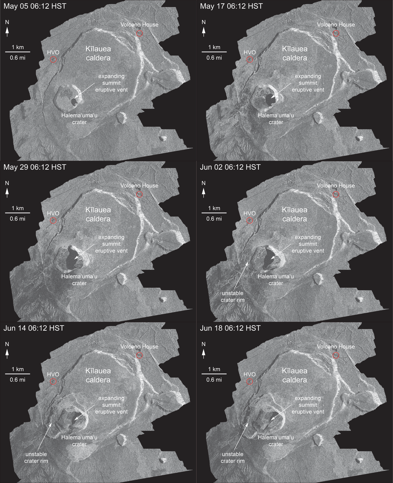
Thanks to the Italian Space Agency for taking a radar satellite image of Kilauea about once a week:
USGS: “May 5 and June 18 at about 6:00 a.m.[…]The last five images in the sequence, from May 29-June 18, show the development of several cracks outside Halema‘uma‘u (also seen in recent UAS footage of the crater) and inward slumping of a large portion of the western, southwestern, and northern crater rim. Much of this motion appears to be coincident with the small explosions from the summit that have taken place on a near daily basis over the past 3 weeks.” (Full-sized)Yes, HVO and the Jaggar Museum have evacuated, and artwork has been moved to safety.
About timestamp 0:30 in June 13 overflight video, Madame Pele’s profile appears in the partly-cooled lava. Mahalo to Tutu Pele, to Mick Kalber for his tireless aerial videography, and to my mother for pointing her out to me. [Although it sounds like Mick took the day off, and I should thank Mick’s co-photographer lavajavadude.]Respect.
Now, how do I transition from that back to the science side of Kilauea?
Today’s Eruption Summary
Last night and today, Fissure 8’s fountains have rebounded to 200 feet, but the cinder/spatter cone they’ve built is so tall they’re just peeking out:
USGS: “The Fissure 8 viewed from the north at 7:50 AM. The cone is roughly 50 m (165 ft) high at is peak, and a plume of sulfur dioxide and other volcanic gases rises as an orange tinge from the erupting lava fountains (hidden within the cone). Lava is still flowing out of the vent unabated as a full channel. To the left of the cone, a standing wave of lava can be seen in the channel.” (Full-sized)
Fissures 16 and 17 continue to “ooze,” to borrow the USGS’ technical term.
Fissure 8’s lava river remains fast, wide and healthy. It stays incandescent red rather than skimmed over for many miles, which shows just how hot and voluminous it is (26,000 gallons/second). It’s entering the ocean along a dramatically broad front (second half of video clip):
Today’s summit explosion (energy equivalent of M5.3, like clockwork) occurred at 3:19am HST, with an ash plume to 6,000 feet. Again, there were lots of earthquakes in the hours leading up to it, then they dropped off, and now they’re ramping back up to the next explosion. This pattern must be getting pretty old for the nearby residents of Volcano.
Wow. Photo: Elizabeth Kekedi – CD Thurs, 6/14 6AM HVO reports ash explosion early this morning at the Kilauea Summit. Beware of ash fallout throughout Kau. Community meeting on vog/ash, today 5:30 p.m. @ Ocean View Community Center #kilauea#KilaueaVolcano#punapic.twitter.com/U5fF00PF0w
Lower East Rift Zone: Fissure 8 continues to build its oblong cinder and spatter cone. Overnight fountain heights were 130-140 ft, up to 53m (174ft) by the afternoon. Fissures 16 and 18 continue weak activity.
USGS: “Fissure 8 fountains to heights of 130-140 ft. The lava spatter chills and the fragments are building a cone on the downwind side, now nearly as tall as the fountain itself.” (Full-sized)
Fissure 8’s lava flow had a “towering” steam plume at its ocean entry point this morning. Areas of offshore upwelling have become more dispersed.
The daily summit explosion was at 3:39am, equivalent to M5.4 earthquake, with an ash plume 7-8K feet (NWS radar has been repaired). Slumping and subsidence continue at Halema’uma’u, and SO2 emissions remain about half pre-event levels.
Before and After: Changes at Halema’uma’u
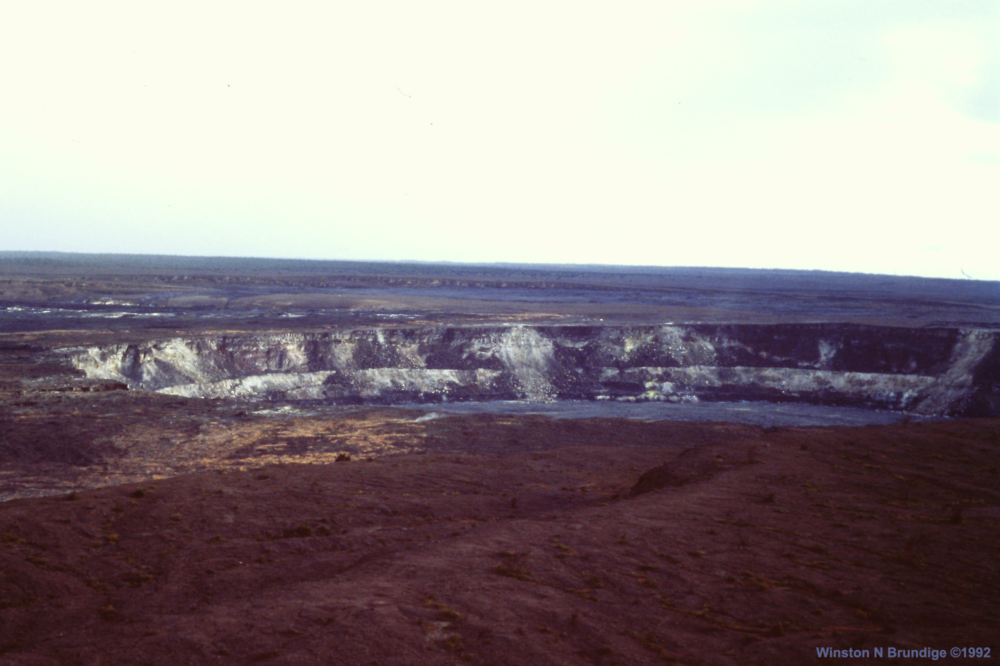
Here’s a good view of Halema’uma’u taken at Hawaii Volcanoes National Park, April 19, 2018 by Christoph Strässler (Creative Commons):
Gorgeous photo of Halema’uma’u Crater and its lava lake, April 19, 2018 by Christoph Strässler (Creative Commons). See his photo album for more images from this visit.
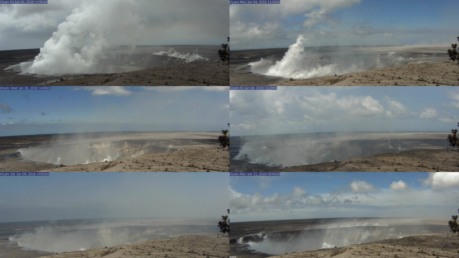
Compare with this animation from HVO webcam June 1-10, or the new drone footage later in this post.
USGS: “A series of wide-angle webcam images, captured by a camera in HVO’s observation tower between June 1 and June 10, 2018, show ongoing subsidence around Halema‘uma‘u at the summit of Kīlauea in this animated GIF.” (Full-sized)
Today’s Kilauea news daily digest is full of science, science, science! the usual slew of incredible pictures. Also, some glimmers of hope for lava evacuees, although as usual bureaucracy moves at the speed of of dirt.
Summit: Today’s “Type A” explosion occurred at 1:52am. It produced almost no ash this time, although there’s still light ash and SO2 coming out of the crater from time to time. The view of the continued slumping/subsidence of Halema’uma’u crater is impressive (also see Jun 9 video on Twitter):
USGS: “Events at the summit of Kīlauea over the past few weeks have dramatically reshaped Halema‘uma‘u, shown here in this aerial view, which looks west across the crater. The obvious flat surface (photo center) is the former Halema‘uma‘u crater floor, which has subsided at least 100 m (about 300 ft) during the past couple weeks. Ground cracks circumferential to the crater rim can be seen cutting across the parking lot (left) for the former Halema‘uma‘u visitor overlook (closed since 2008). The deepest part of Halema‘uma‘u (foreground) is now about 300 m (1,000 ft) below the crater rim. The Halema‘uma‘u crater rim and walls continue to slump inward and downward with ongoing subsidence at Kīlauea’s summit.” (Full-sized)
Fissure 8’s cluster of vents is erupting up to 160ft today. With the cinder cone that’s built up around them, they’re mostly hidden. It’s entering the ocean today along a broad front. Fissure 16/18 are spattering weakly; this is the “weak activity” reported for the past few days. Apart from that, the Lower East Rift Zone is quiet, although other fissures are still releasing gasses.
Fissure 8 on #Kilauea's Lower East Rift Zone #LERZ – a nursery of volcanic bombs and spatter. Expanding volcanic gases rip the clots of lava apart as they rise through the air, forming ejecta of myriad shape and size. Photos taken on June 11. pic.twitter.com/E9iYbD9Zp8
The good news is, Fissure 8’s lava flow has built up such high, broad banks that unless it overflows them, it probably won’t cover many more homes or cut off new areas. The bad news is, the lava river could still break its levees, and there’s no guarantee other fissures won’t reactivate. USGS field crews reported a “non-erupting crack” in the Lower East Rift Zone with “temperatures as high as 430°C (806°F).”
Note, however, high temps may not indicate imminent changes. USGS clarified on Facebook: “This was at Fissure 10, which has long displayed high temperatures (fortunately, no SO2 was detected). It does not mean an eruption there is imminent, but rather it is a place where various superheated gases are escaping.” Similarly, there’s been high temps at the cracks across Highway 130, which have steamed but so far not erupted at all.
Somewhat abbreviated Daily Digest today because I started late, and then took forever transcribing 11AM conference call. But the stunning pictures keep coming…
Once again the USGS media conference call at 11AM is full of so much juicy info I’ve moved it to a separate post rather than make my daily digest 10 pages long.
BigIslandVideo hasn’t put their edited/abridged version up, which they usually enhance with recent video footage. But they cut a lot of the Q&A anyway.
Below are my paraphrase/notes on the full, unabridged conference call (I skipped a non-geology questions where answer is “Agency X handles that; ask them.”]