HVO’s Kilauea Summit Livestream caught today’s Halema’uma’u “subsurface explosion” (is that what we’re calling them now?) and — wow!
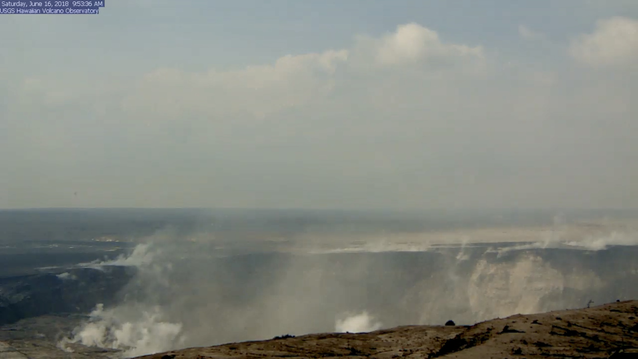
(a few hours later, when, luckily, it was still possible to rewind the livestream back to the time of the explosion, since I missed it.)
We’ve been hearing about subsidence, slumping, and rockfalls for weeks, but there’s nothing quite like seeing it, even if the video’s a bit fuzzy. I took the liberty of saving a clip:
Radar showed the plume was less than 7000 feet, and as usual the energy release checked in at 5.3.
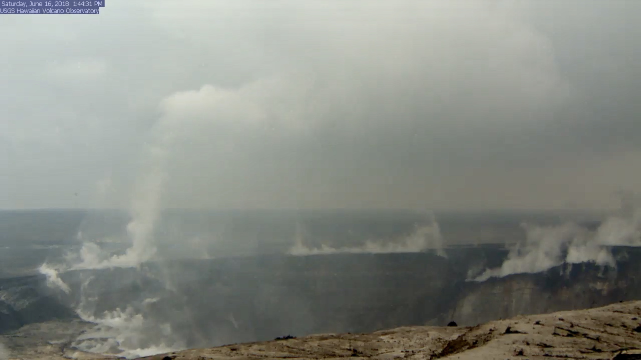
While I rewound the livestream to grab that clip before it fell off the “back” of the livestream conveyor belt, it looks like I jumped right over this:
Live stream has a large vortex coming and going on the left https://t.co/WjfKsXyT4z #webcam #halemaumau #Hawaii #hvnp #hppa #volcano #Kilauea #lava #NEWSで妄想 #KilaueaVolcano #LeilaniEstates #BigIsland #eruption #Kapoho #SaturdayMotivation pic.twitter.com/3v50WboOMa
— lavapix.com (@lavapixcom) June 16, 2018
There was still a column of steam at that spot when I checked an hour later, but I don’t recall it spinning.
Okay, enough fiddling with the livestream.
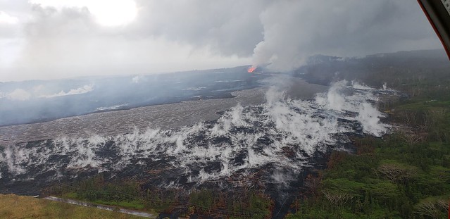
What else happened today? Same as the last few days, to the point that I had to double-check the date on today’s HVO Kilauea status report. Fissure 8’s cone is holding at 170 feet, fountains currently around 185-200 feet. Fissure 16/18 continues to ooze.
The lava river is running as fast as ever:
Despite the increased vog due to lack of tradewinds, that’s the clearest overflight video I’ve seen in days.
Mick Kalber notes the pahoehoe channel now cuts all the way through the a’a field to the ocean, which may explain recent videos of lava racing at amazing speeds…
Fissure 8 Pumping out some serious Lava this evening!!“To use this video in a commercial player or in broadcasts, please email licensing@storyful.com”
Posted by Ken Boyer Photography on Friday, June 15, 2018
I know, I know, I posted it already, but that was a copy shared by a reporter. The original is HD, and I prefer to feature the original photographer (Ken Boyer).
Notice the slower-moving, cooler lava near the margin of the river.
USGSVolcanoes says, “we’ve seen the video, and we’re fairly sure it hasn’t been altered. Lava in the channel could flow faster if the channel constricts, or if there is an increase in the volume of lava being erupted. We don’t think there has been a volume increase, but that’s not confirmed.”
Here’s today’s USGS photo of the Unnamed Cone of Fissure 8.
Pu’u O’o would be proud.
The ocean entry has stabilized, apart from the Vacationland area where the southern edge of the flow is expanding a little further south.
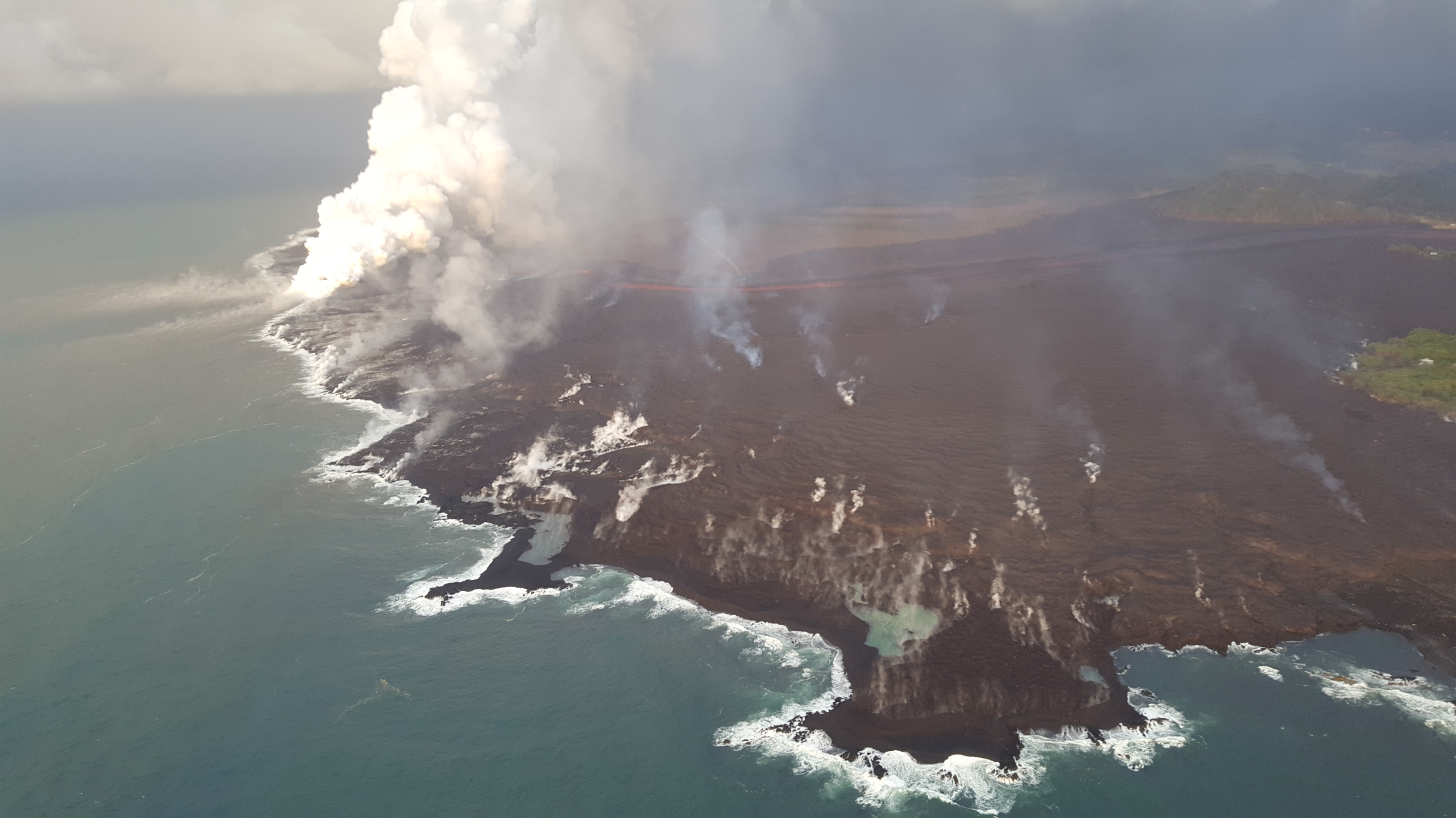
Be sure to view the full version on that one; the lava channel feeding it is clearly visible.
Here’s another photo worth zooming. Notice the red glow of the lava on the underside of the laze plume. Kapoho Crater is peeking out in the background.
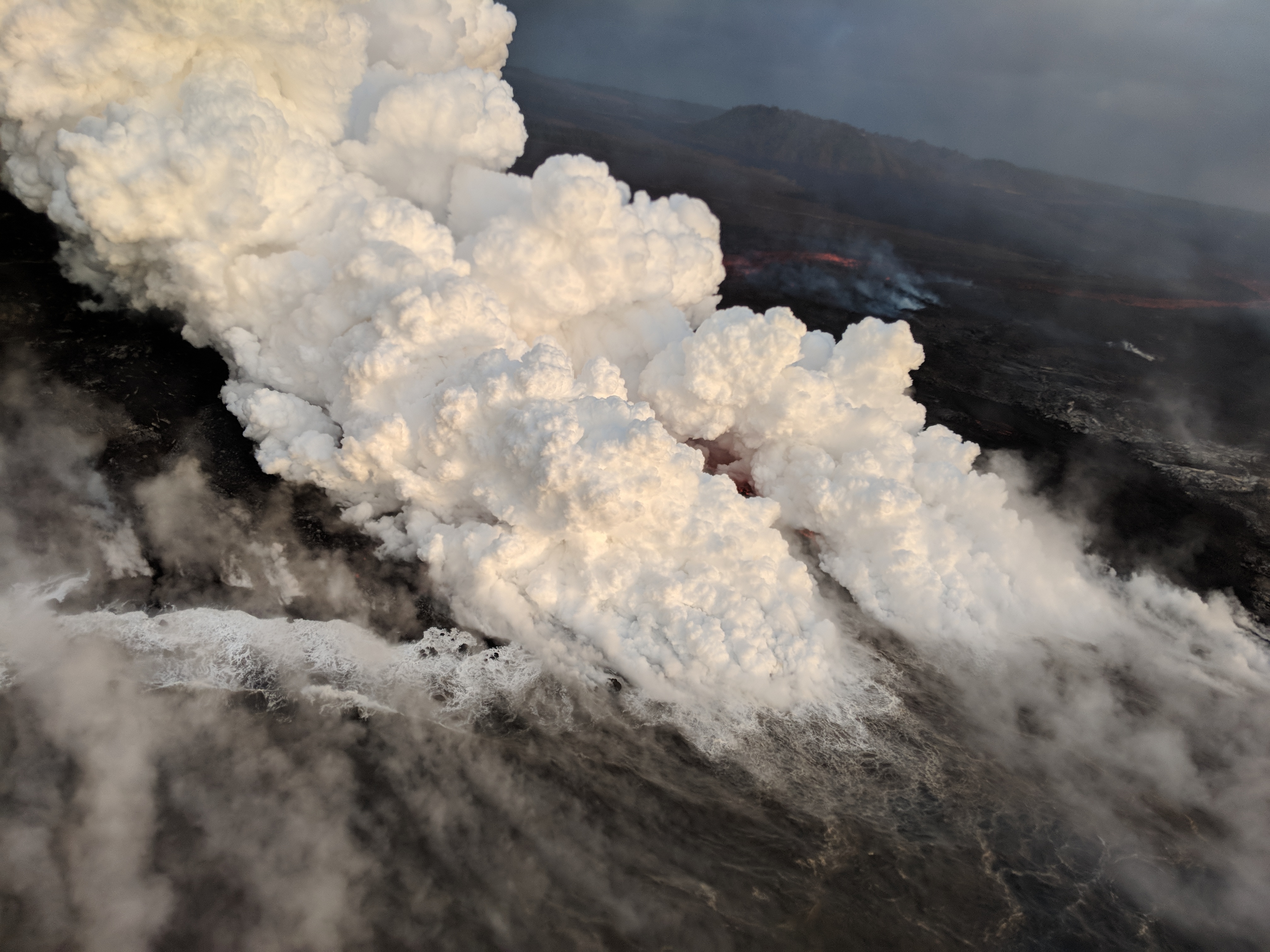
Answering a question about laze, USGS said, “Acid rain is a common consequence of volcanic plumes. We have already observed a little bit resulting from the fissure 8 plume, and the ocean entry is acidic enough to contribute as well. It can damage plants, and isn’t good for animals either.”
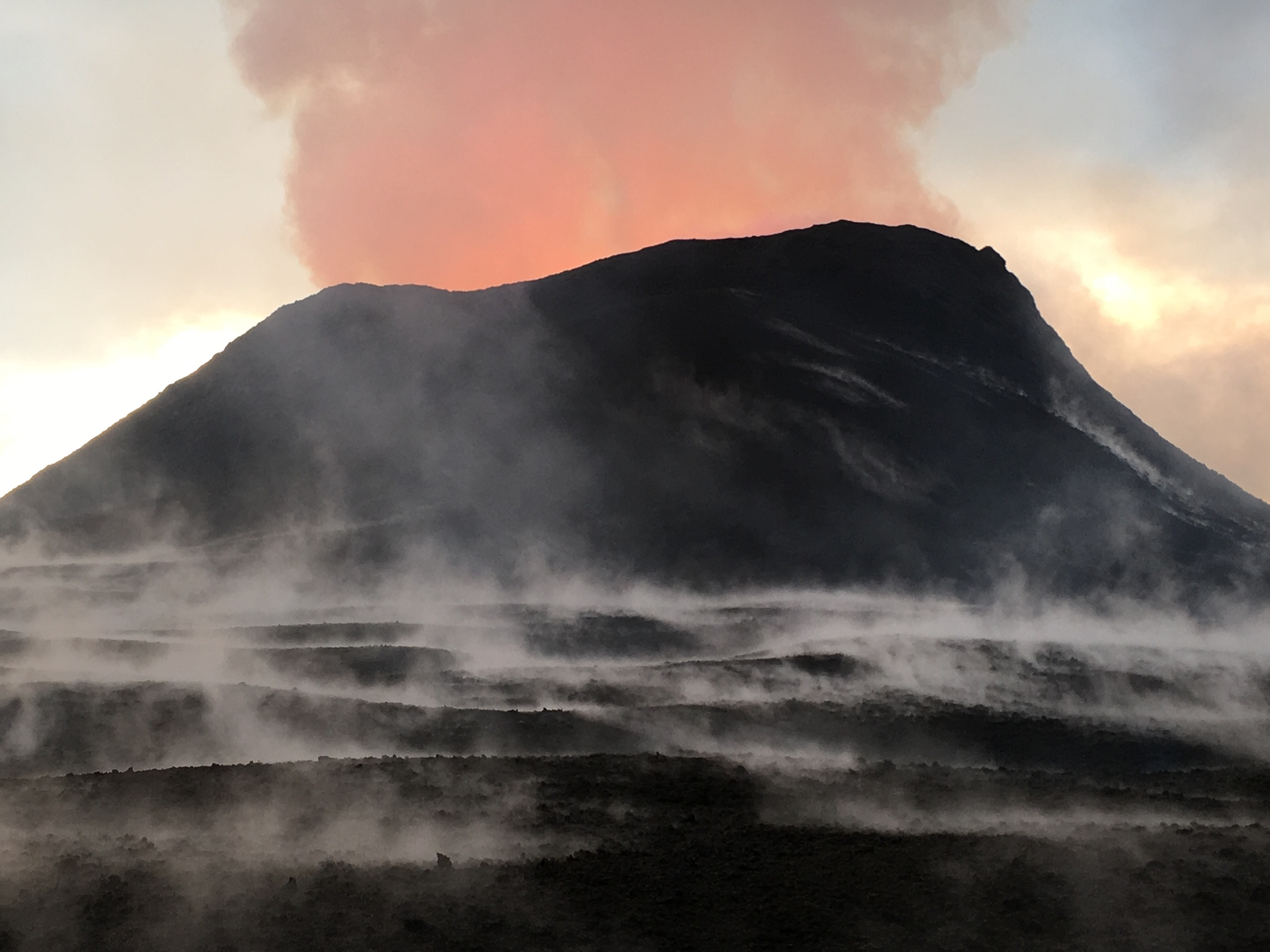
And here’s another view of Halema’uma’u’s newest scars. How long until that large slumped block in the middle of the photo lets go?
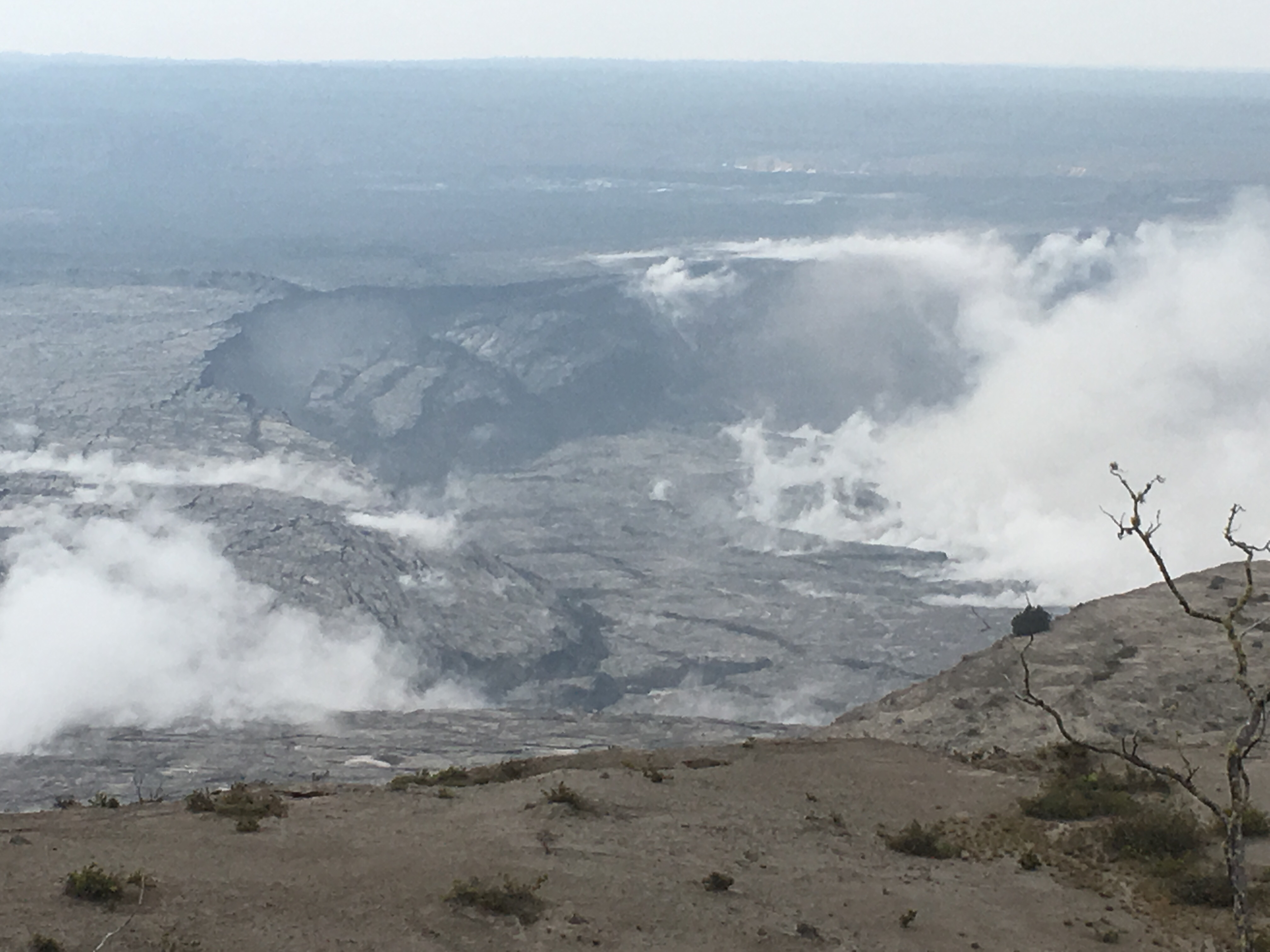
Stephen Sparrow commented on this photo: “Would it be exaggerating to say that “massive” amounts of the caldera floor (what used to be between the active magma from the cliff that Jaggar sits on top off) have collapsed? At the top mid-left of the photo, it looks like 30-50 feet of the floor has collapsed.”
USGS reply: “Portions of Halema`uma`u have dropped by hundreds of meters, and the area that is being affected by slumping is expanding. The caldera floor on the Volcano House side seems relatively stable, but on the HVO side certainly is sinking into the growing crater.”
Are you talking about at the summit? Since major slumping into #Halemaumau began, the deepest part of the crater is about 300m (still above water table) – we haven't seen significant deepening, just additional slumping from the side walls into the deeper parts of the crater.
— USGS Volcanoes🌋 (@USGSVolcanoes) June 16, 2018
Another question: Could the changes to the summit permanent? USGS: “We don’t know right now. It’s possible that the style of eruption of the last 35 years is over, but Kilauea has had multiple cycles where magma moved downrift and then returned (eventually) to the summit: [link]”
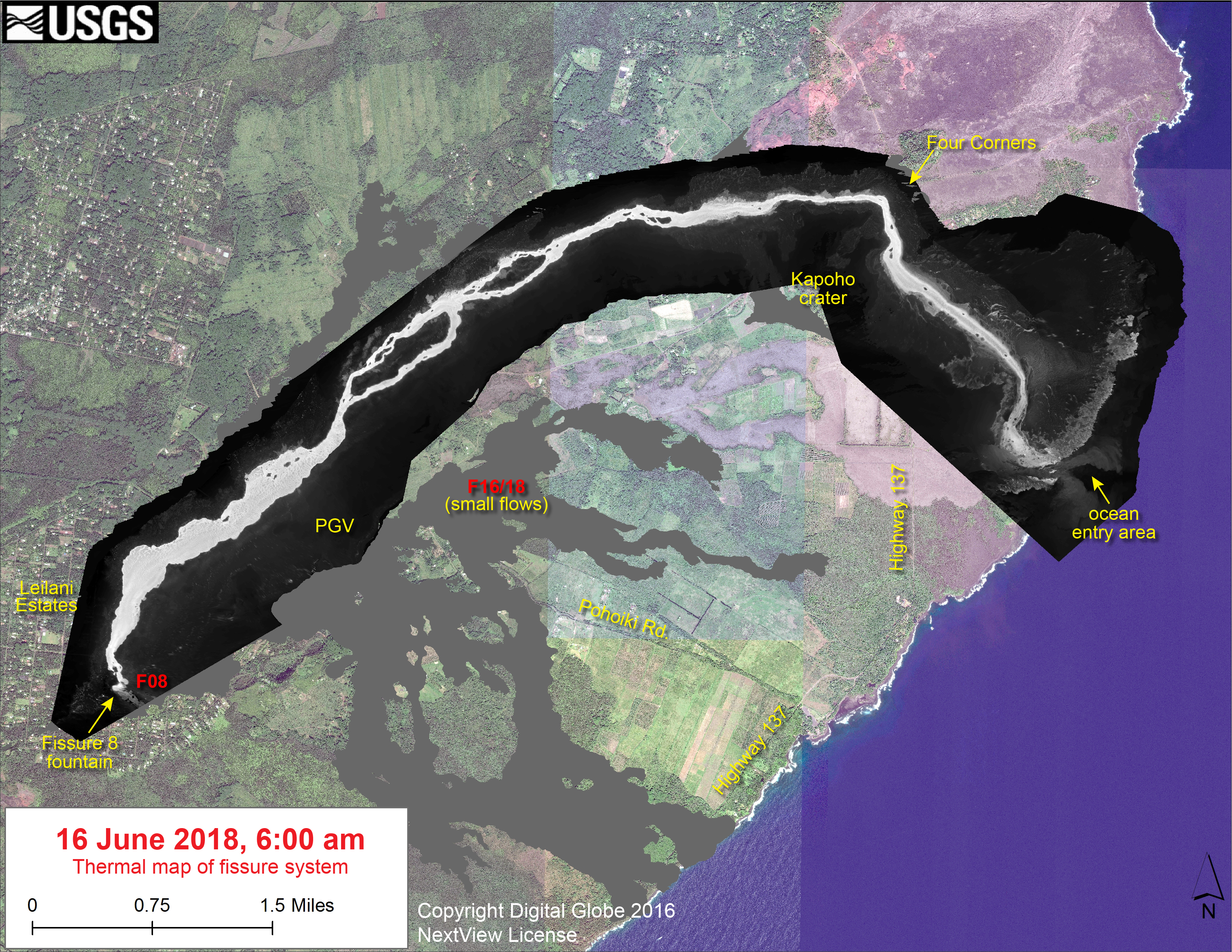
Thermal Map of Lava field June 16
If white = hottest, I think it’s getting even hotter. Or at least, the channel’s narrower (and presumably faster) for a longer distance around Kapoho Crater before it finally starts to spread out and cool.
More tidbits from USGS on social media:
“Channel depth is probably about 6 feet, but we cannot be certain. The estimate is based upon depth measurements of no-longer-active lava channels in other parts of Hawaii.”
Eek. How do geologists know whether lava’s safe to stand on? “The surface of pahoehoe lava flows cool enough to walk on about an hour or so after they’ve been emplaced, but interior remains hot so have to move quick.”
But of course, there’s always a risk: geologist George Ulrich had an incredibly narrow escape taking samples at a Pu’u O’o in 1985. (Nightmare fodder, but amazingly, he survived without permanent injury.)
Thank you for your amazing work. I'd say "stay safe", but the ghost of David Johnston reminded me you have a job to do, and you will do what you have to to keep the rest of us informed and protected.
— Reynardo the Fox (@Reynardo_red) June 17, 2018
On a less grim but more random note, the USGS says it’s using rechargeable batteries and solar panels to power the webcams and livestream at the HVO.
From Civil Defense and Other Agencies
Hey, I remember walking on this trail in 86!
This is not the first time Hawai‘i Volcanoes National Park has sustained earthquake damage. In 1983, a M-6.7 earthquake destroyed a section of Crater Rim Drive. The old road was refurbished as "Earthquake Trail." USGS Photo. pic.twitter.com/yHqbK1BUgQ
— Hawaii Volcanoes NPS (@Volcanoes_NPS) June 16, 2018
Civil defense alerts today reprised the standard evacuation / disaster recovery / volcanic hazards precautions. Also, they had to defend residents from another growing hazard: conspiracy theorists and scaremongers:
Civil Defense Authorities are advising people that official sources of information regarding the current East Rift Zone Eruption are obtained from agencies responsible for monitoring the volcano. Be aware of posters who speculate on the movement of active lava flows. This information has not been supported by official observations. Radio messages from the Hawaii Civil Defense Agency, along with information on official government websites and social media platforms will continue to relay accurate and current eruption information. We encourage you to only act on officially released information
There is no immediate threat at this time. Hawaiian Volcano Observatory continues to closely monitor the eruption and works hand in hand with the Hawaii Civil Defense Agency to provide updates.
You will be notified of any changes that will affect your safety.
We are on watch 24-hours a day for your safety.
This is your Hawai‘i County Civil Defense Agency.
Sigh.
Palate cleanser: another image from yesterday’s stunning Civil Defense overflight photo album:
From Local News Outlets
- Eruption news
KITV: “Saturday’s explosive event at Halemaumau Crater”
HNN: “Lava now covers more than 9 square miles on Hawaii Island” 5,914 acres is the latest total. Also, the number homes destroyed has been revised to 497 confirmed. No word on total structures lost (barns, orchid greenhouses, etc) - Human impact
HSA: “Big Island disaster survivors flow into a FEMA aid center on opening day.”
HSA: “Illness keeps Big Isle Mayor Kim off the job — at least for a day” Back at the first responders meeting at 6:30am the next day. - Miscellaneous
“Take pictures at your own risk: Lava loiterers face jail time, $5000 penalty.” I try to stick to social media photos and vids from people who aren’t in the leave-or-be-arrested evacuations zones. However, sometimes I cave in. (Also, I’m not sure how far the exclusion zone extends north of the lava flow near Kapoho.) - “Dispatches from Volcano” coined a portmanteau that’s right up there with vog and laze: exploquake. More importantly, he describes exactly what it feels like to experience one from Volcano village.
Social Media Roundup
#Hawaii Volcano Myths:
Kilauea isn't an explosive volcano & lava moves very slow on the Big Island.#Hawaii Volcano Facts:
Kilauea is indeed explosive, & has had explosive events nearly daily for the last few weeks. Lava is moving FAST; some estimates peg movement in flow 40mph+— the Weatherboy (@theWeatherboy) June 17, 2018
That sounds high to me, but who knows? Even the eggheads are having trouble solving this one.
We are waiting on @USGSVolcanoes to publish an estimate on how fast lava is flowing in Ken Boyer's video from last night… Estimates vary dramatically. #LeilaniEstates #KilaueaVolcano https://t.co/aGhc8ZVNrX
— Dane duPont (@GeoGolfHawaii) June 16, 2018
I suspect the USGS will remain mum on this subject until they get some drones up to check.
The highest lava flow speeds on record are ~60 km/hr at Mauna Loa (#Hawaii) in 1950 and Nyiragongo (DR Congo) in 1977.
— Simon Carn (@simoncarn) June 16, 2018
The 1977 Nyiragongo flow was a lava lake breaching and draining— not down into its interior, but bursting out the side of a dangerously steep (and chemically odd) stratovolcano. Reported speeds were up to 100 kph.
This is one of those cases where I wonder if the photographer was allowed to be there. I think he may be using a telephoto from the Noni Farms side of the flow.
Also, while skimming his Instagram, I hit this image from two weeks ago:
The contrast between human orderliness and the chaotic, destructive yet creative side of Mother Nature is striking.
The grassroots community efforts during this eruption have impressed me all along. (When this is all over, someone needs to do a compare and contrast study with 1960 Kapoho to see the impact of the internet on emergency response and rapid community organization.)
📷 @bruceomori Tephra covers a home in #leilaniestates #eruption #lava #hawaii #kilauea https://t.co/hf8kEpCZrO pic.twitter.com/19xUCvB25W
— TCoak19 (@TCoak19) June 16, 2018
Great @USGSVolcanoes video shows time of June 15th explosive event at Kilauea summit; I cropped (to "zoom in") & trimmed: ground motion starts at ~6 sec (look left of USGS logo), then rockfalls (brown cloud), then explosive ash plume (lighter). Video speeds up about halfway. pic.twitter.com/Gfmsua8eVs
— Jascha Polet (@CPPGeophysics) June 16, 2018
Oh for heavens sakes. What's she trying for now…. To be seen by the Space Station!? #KilaueaErupts #kilauea #LeilaniEstatesEruption #lanipuna #lowerpuna #puna #Pahoa #lavaflows #lavaflow pic.twitter.com/74B3h2QB2c
— Tay Austin (@Jasamsdestiny) June 17, 2018
Already done. 😏 pic.twitter.com/nXbTa19qmT
— Darren Potter (@dapotter42) June 17, 2018