Before and after: Halema’uma’u in 1992 & 2018
Left: November 1992, photo by Winston Brundige*
Right: Screengrab of HVO webcam on June 19, 2018
*used with permission. Thanks, Dad.
Before and after: May vs June 2018
Left: USGS photo from Volcano House, May 19, 2018
Right: USGS photo from Volcano House, June 13, 2018
- Halemaʻumaʻu before this started: 1 km (0.6 mi) across, 85 m (~280 ft) deep.
- Halema’uma’u Jun 15, 2018: 1 X 1.3 km (0.6 to 0.8 mi) dimensions, 370 m (1,210 ft) deep.
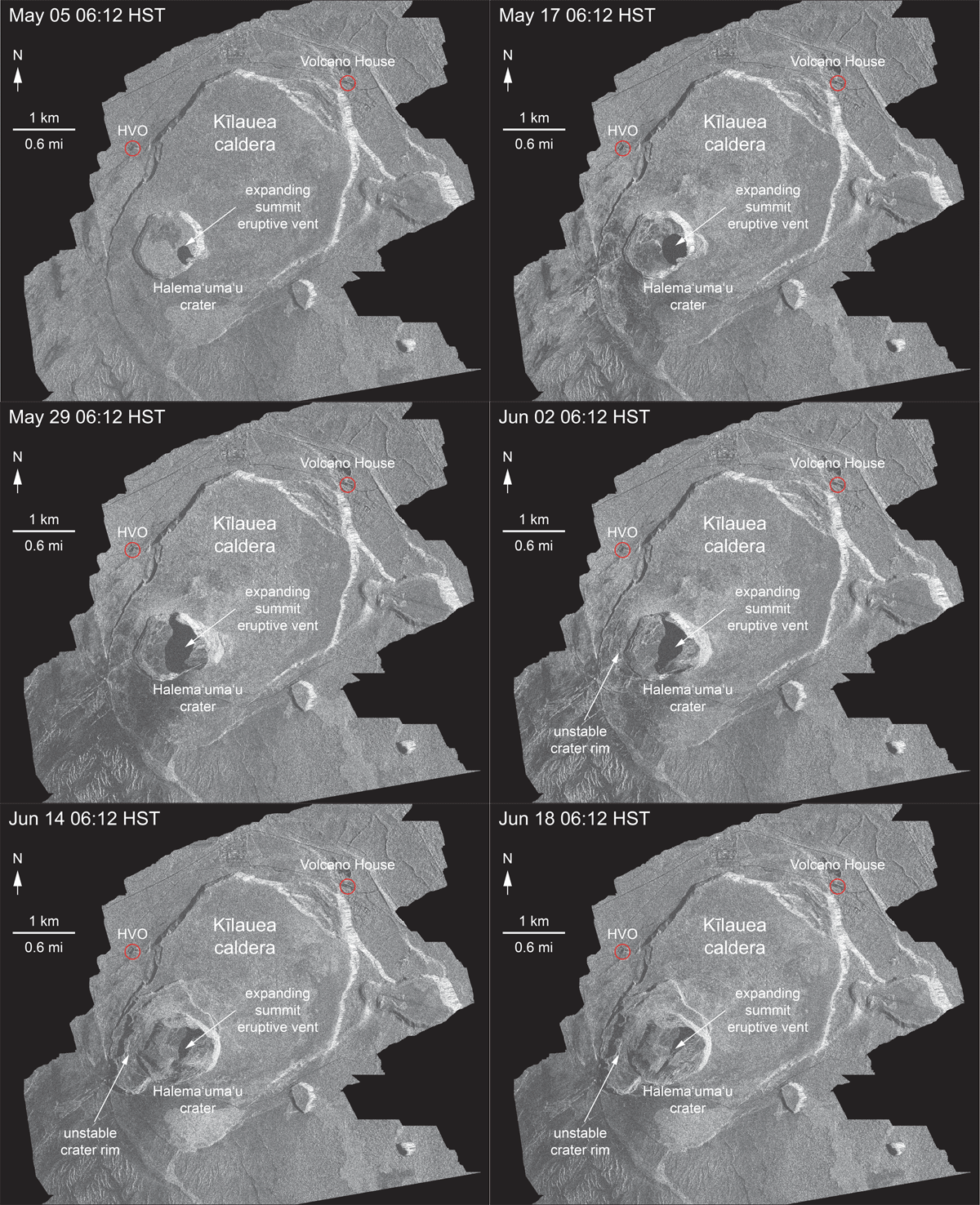
Radar Images, May 5-June 18
Thanks to the Italian Space Agency for taking a radar satellite image of Kilauea about once a week:

28 Days At kilauea Summit, May-June 2018

Views of Halema’uma’u Over the Years
Continue reading Changes to Halema’uma’u Crater, Kilauea Summit


