Today’s Eruption Summary
One gets the sense that crisis mode is giving way to some sort of new normal, as it did during the decades of the Pu’u O’o eruption. Not that one can ever call this normal:
Still, public meetings are no longer dominated by talk about lava, fissures, and SO2 so much as how to collect on insurance and find housing. The USGS has dropped weekend video briefings to give its staff a much-needed break (alerts/info are still posted on the HVO website). Hawaiian news outlets are reverting to a more typical news cycle, with only 1-2 new Kilauea updates a day.
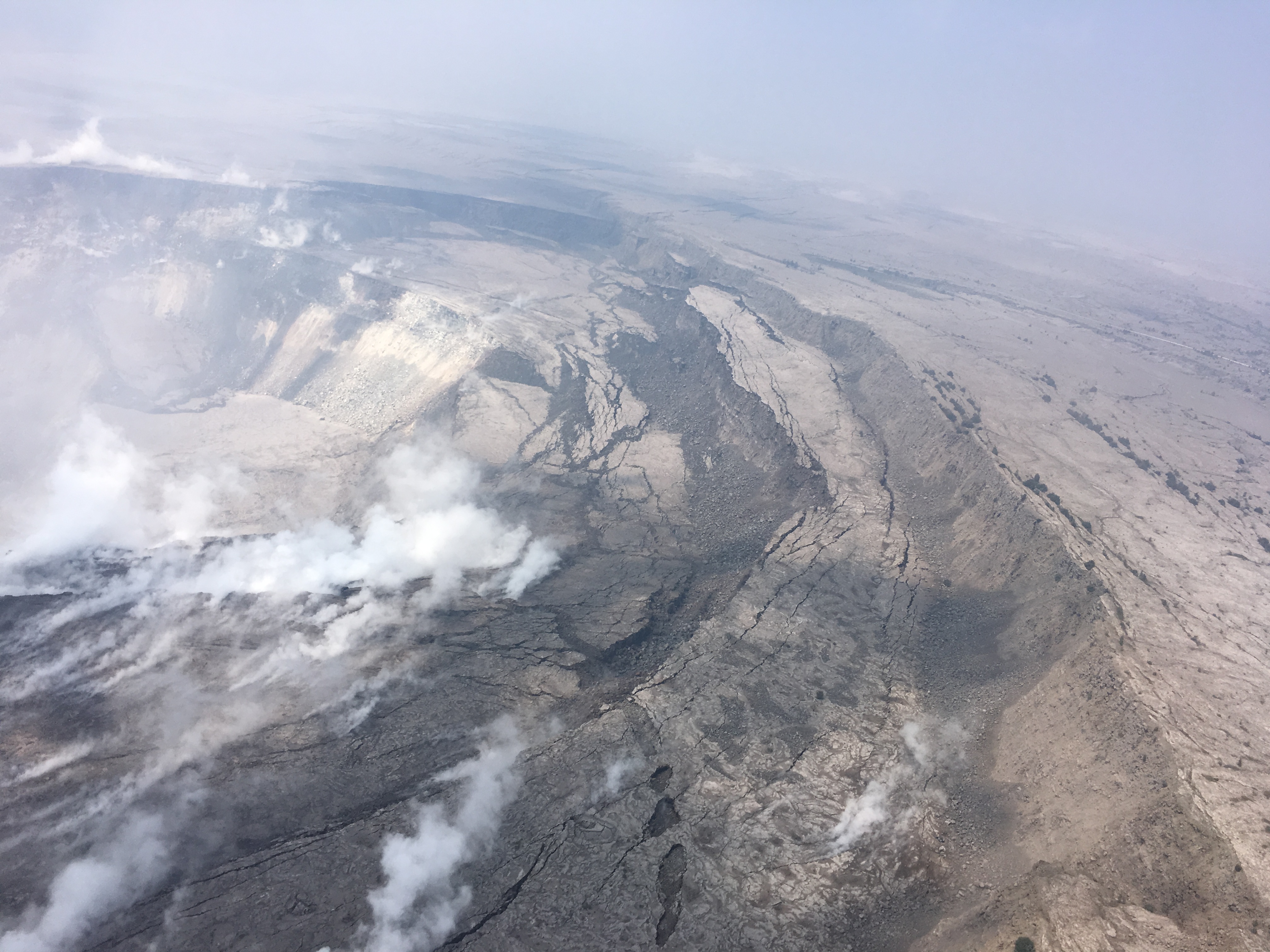
At the summit, steam/ash explosions continue their recent pattern. Today’s explosion registered as M5.2 at 4:48am, shaking the village of Volcano; it was felt as far away as Hilo. (Local radar is still out, but the ash cloud was small, less than 10,000 feet, since satellites can spot bigger ones).
Halema’uma’u is looking very ragged around the edges:
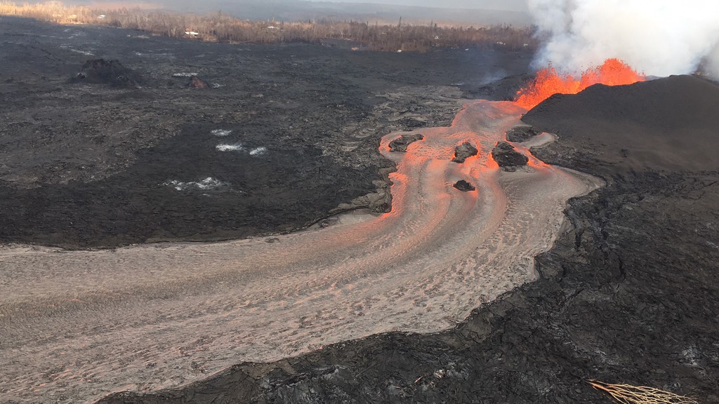
In the Lower East Rift Zone, Fissure 8’s fountain has tapered off slightly, down to 130-160ft with occasional bursts up to 200ft, but its lava river is still going strong. As of 6:30am, the new lava delta at Kapoho had grown to 200 acres. An elevated section of the flow near Lava Tree State Park caused some concern this afternoon when it started overflowing its levee, but it settled back into the main channel without a major breakout.
[another amazing Fissure 8 overflight video from Mick; here’s his notes, including rough estimate from USGS: 6-9 million cubic yards per day!]
The Pu’u O’o webcam has even more scunge on it today than yesterday, when there was a few rockfalls and a brief plume of “rock dust.” There were more rockfalls this morning. Earthquake activity under Pu’u O’o is still negligible, however.
I’m running late tonight, so here’s a somewhat abbreviated weekend edition of USGS info, eruption news, images and videos, including timelapses of the summit and fissure 8 for the past week: