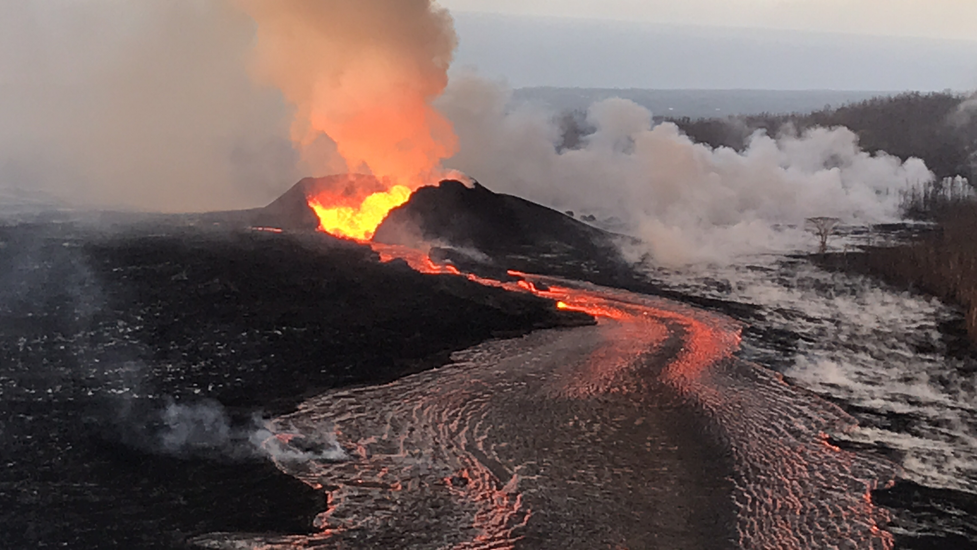
USGS: ” Lava continues to erupt at a high rate from Fissure 8 and flow within the established channel to the ocean. No channel overflows were observed during this morning’s overflight. The fountains have built a horseshoe-shaped cone as lava fragments are intermittently hurled onto and over the growing rim. Lava exiting the cone forms a series of standing waves in the uppermost section of the channel.” (Full-sized)
Fissure 8 continues as usual, sending its lava river down to the ocean at Kapoho, with a “dominant ocean entry on the south edge of the flow front…producing a large laze plume.” Minor, brief overflows upstream aren’t traveling past previous lava flows. Fissure 6 is inactive; 16 incandescent; 22 woke up and was fountaining weakly during the USGS morning overflight.
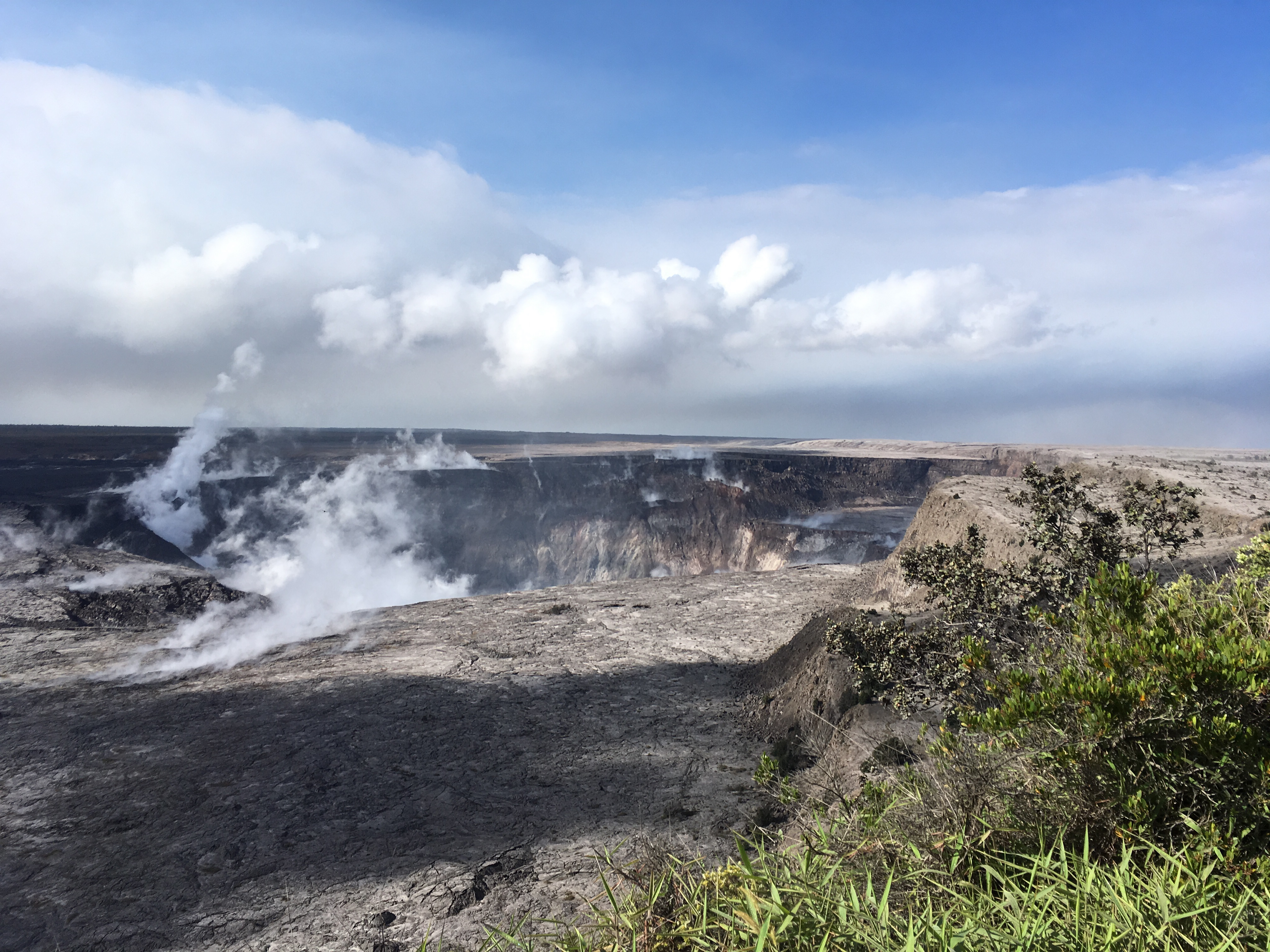
USGS: “Halema’uma’u crater at 8:30 a.m., view is toward the south. Several benches are clearly visible within the crater. The benches are sections of the former crater rim and adjacent Kīlauea caldera floor that have incrementally dropped or slumped into the crater as the summit area has subsided since early May.” (Full-sized)
Seismicity at the summit was “elevated overnight” according to today’s only HVO status update at 8:45 am. There appeared to be a lot of rockfalls/isolated slippages on the livestream today, especially on the left rim, but the really-truly “collapse explosion” (as USGS is now calling them) occurred at 6:52pm, 5.3 energy equivalent, 500 foot ash plume.
I spent this afternoon putting together a gif of the last 28 days of HVO wide angle Kilauea images, using screencaps I’ve taken supplemented with screengrabs from the same webcam archived by Hawaii247: