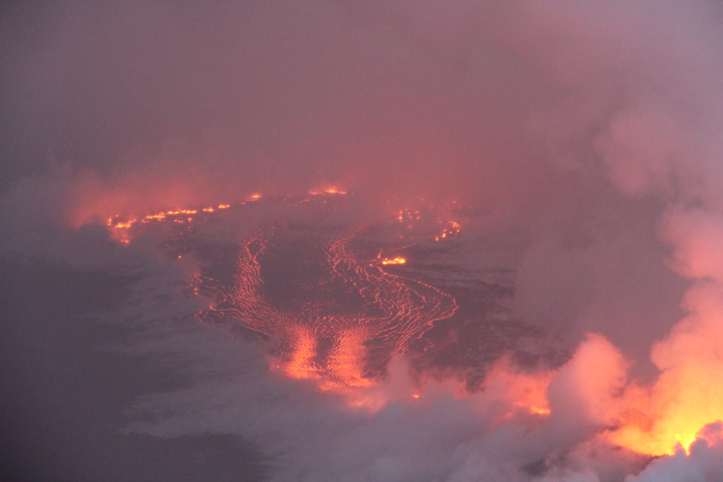
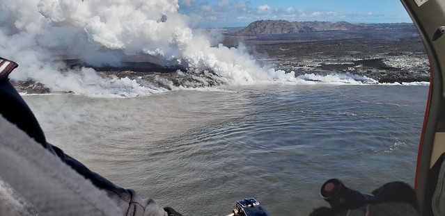
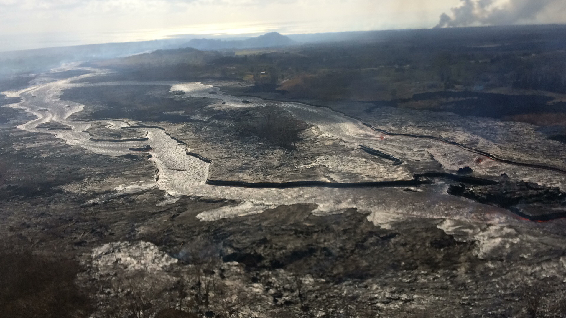
July 9, 2018. USGS: “Lava entering the ocean as seen through steam and rain early this morning.” (Full-sized)
Today’s Eruption Summary
Wild weather, overflows and significant channel reorganization have made the Lower East Rift Zone more interesting today than those living near Bryson’s cinder pit would like.
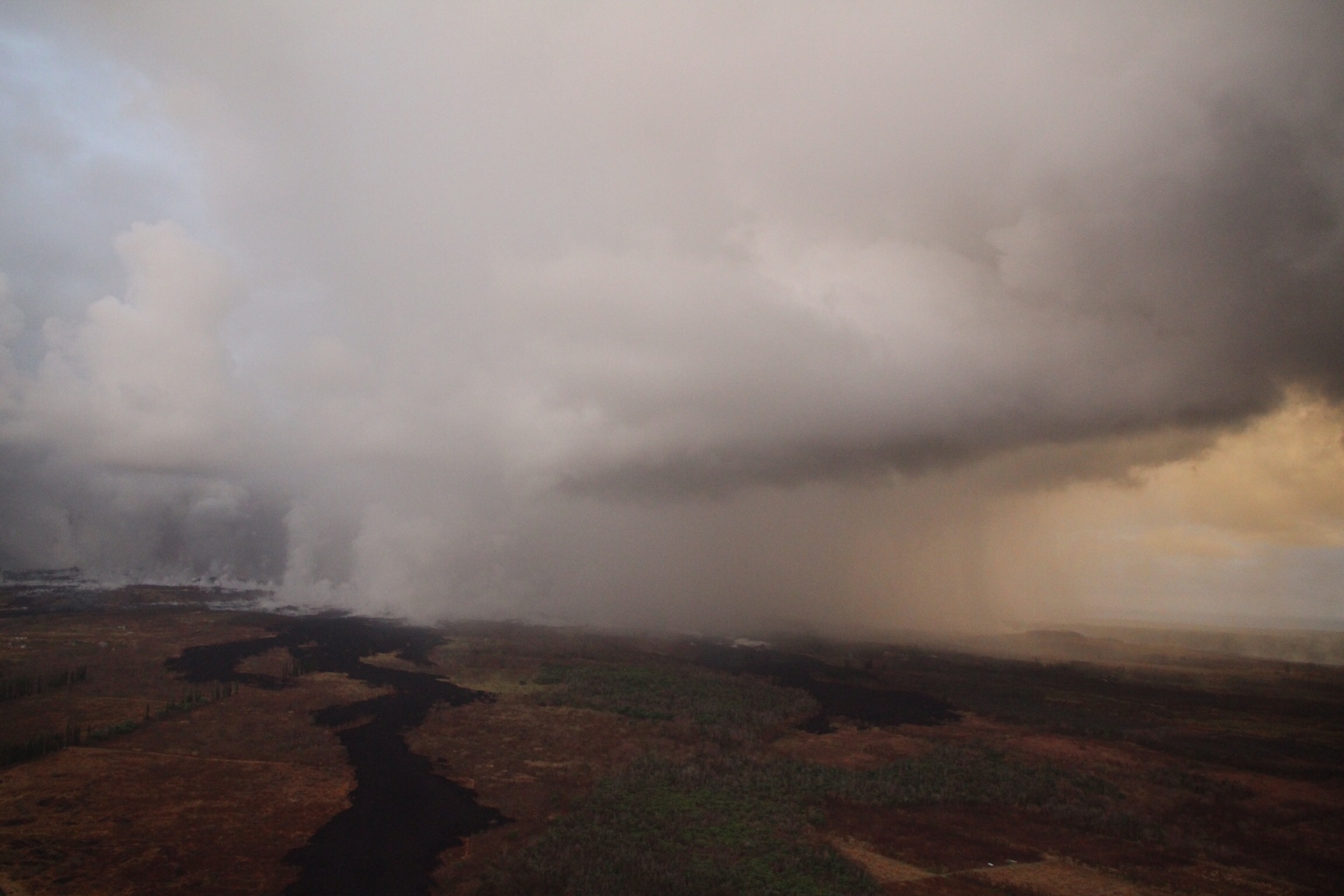
July 9, 2018. USGS: “This photograph taken during this morning’s overflight shows heavy, localized rain at fissure 8 in Leilani Estates.” (Full-sized)
Sunrise overflights by the USGS and @hotseathawaii spotted a torrential downpour centered directly over the upper lava flow (above). A rain gauge in Leilani Estates measured 9.22″ rainfall at 7am for the past 24 hours; another just a little farther away measured 6″ over the same span. All that updraft, convection and condensation even produced a modest… lavaspout…? captured on video (strong language warning):
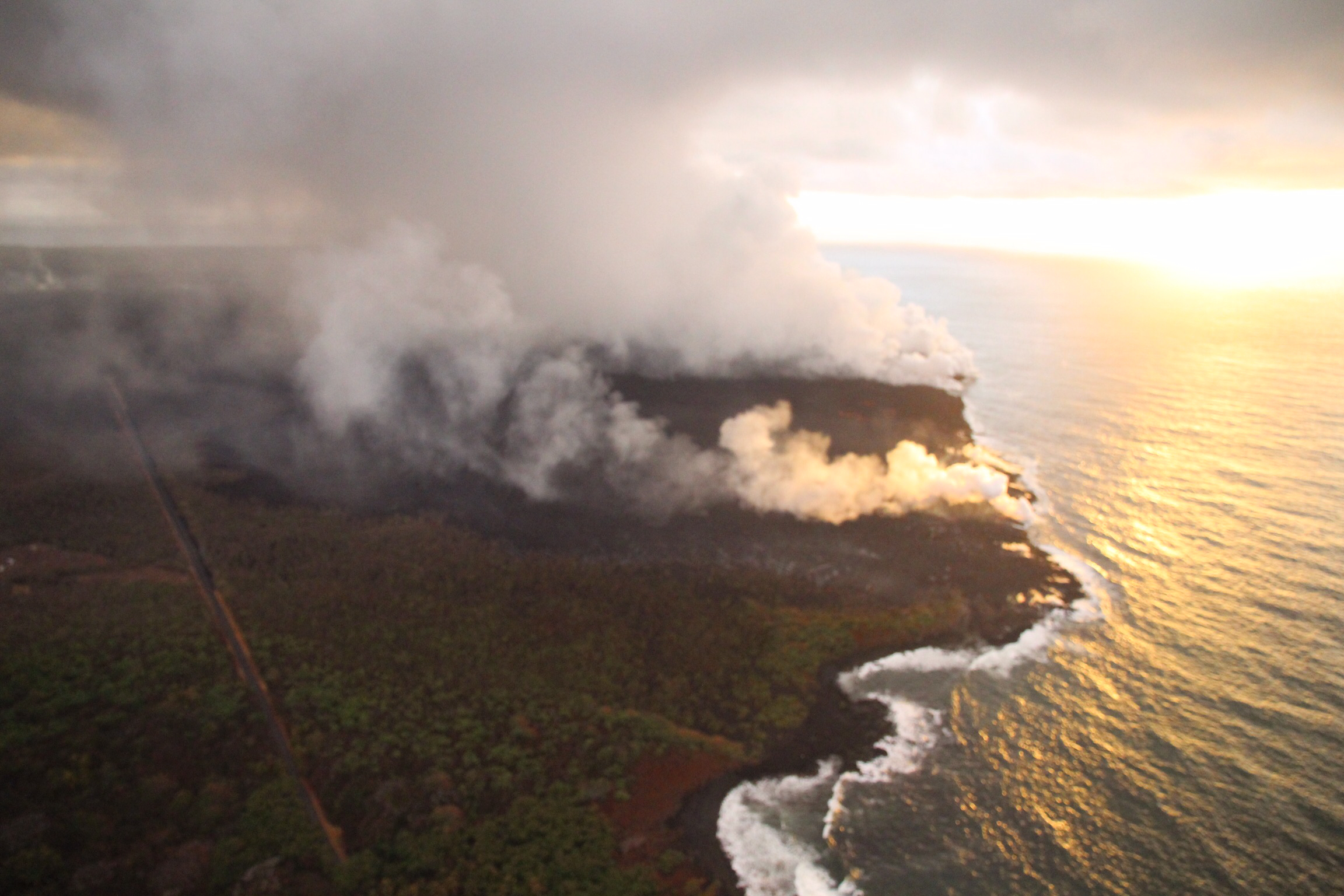
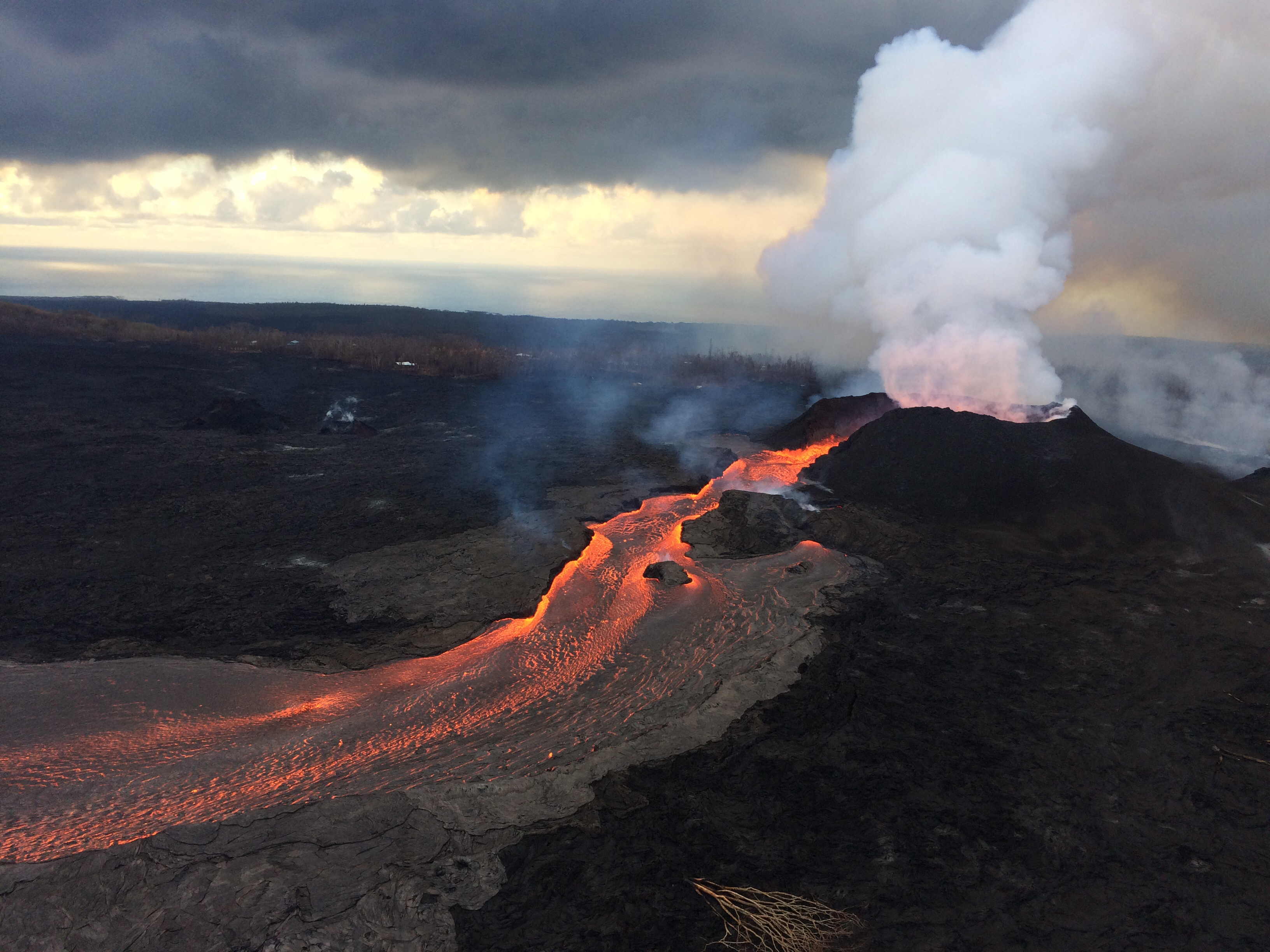
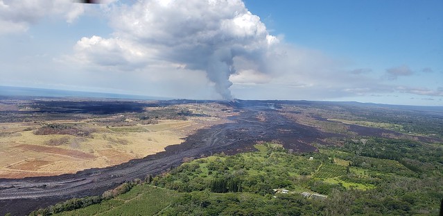
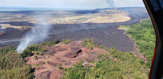
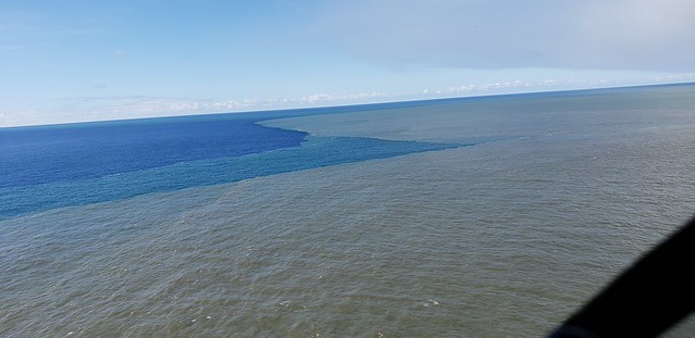
The Kapoho end of the LERZ eruption was even more chaotic. Over the weekend, several non-USGS sources had reported that lava was starting to shift back to the south after passing Kapoho Crater, forming a slow-moving flow headed for Ahalanui Ponds (and sparing 3 of the 4 remaining Kapoho Beach Lots houses). This morning, HVO status updates confirmed the change: “The main lava channel has reorganized and is nearly continuous to the ocean on the south side of the flow, expanding the south margin by several hundred meters.” Also, while the ocean entry was still a very broad 2.5 mile front at sunrise, it’s started to coalesce a bit and shift towards the south:
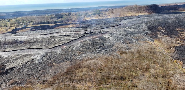
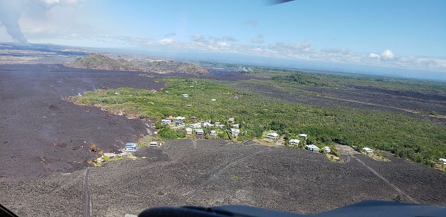
July 9, 2018 (later in the morning; can’t be afternoon because of sun position). USGS: “Sourthern end of the active fissure 8 flow margin north of the Analannui Park [sic], known as the warm ponds. The flow margin is estimated to be about 500 m (0.3 mi) from the park.” (Full-sized)However, blockages in the braided section of the lava river caused further havoc later in the day. HVO’s afternoon status update reported that, “Early this afternoon, observers reported multiple overflows occurring along both sides of the main lava channel, in an area extending from near the ‘Y’ intersection at Pohoiki Road eastwards to an area just west of Kapoho Crater. Overflows on the upper part of the channel did not extend beyond areas previously covered in lava. Overflows further down the channel have reached beyond the flow field, including one flow lobe that is moving northeast from the main channel towards Cinder Rd.”
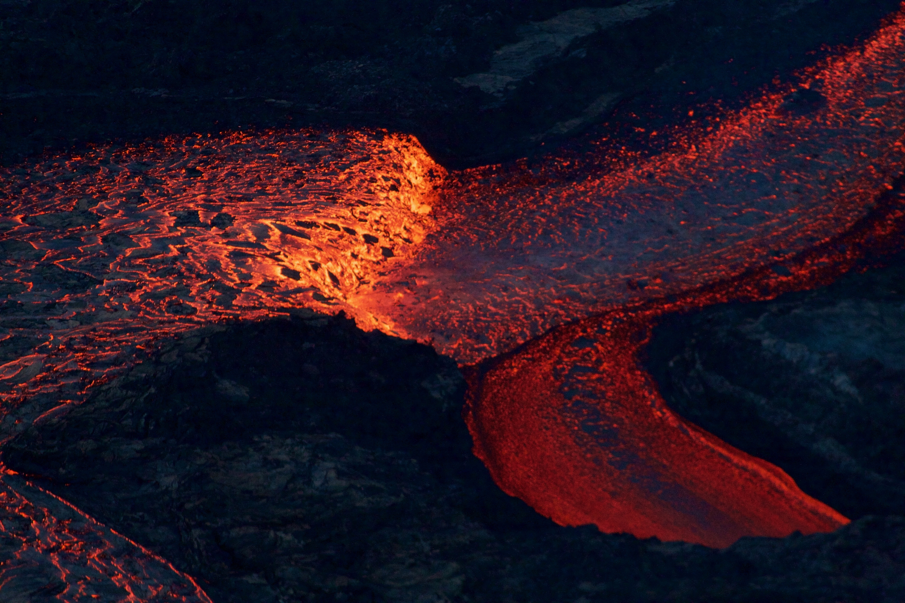
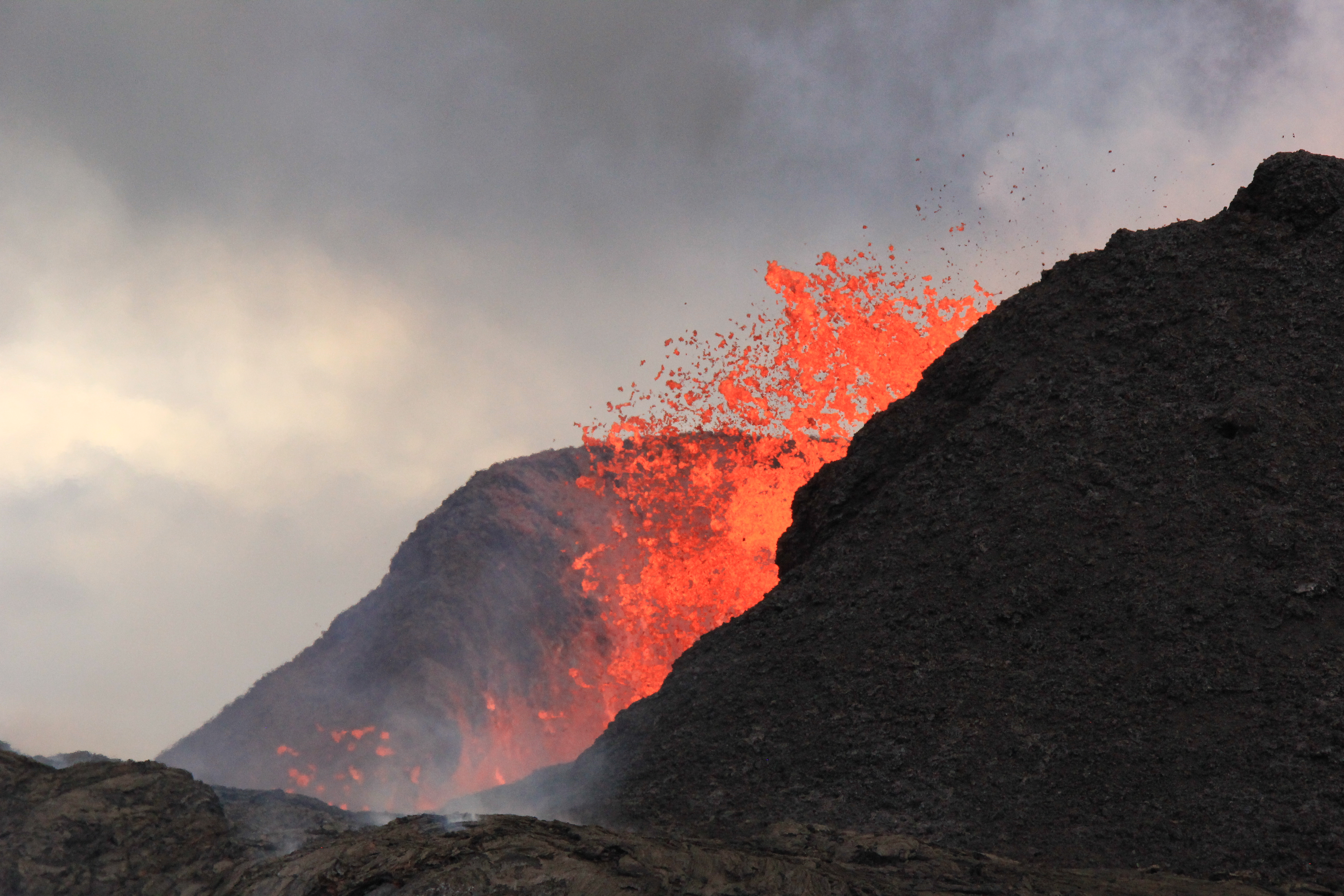
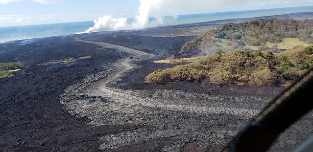
July 9, 2018. USGS: “The lower section of the fissure 8 lava channel appears to be almost completely crusted over, and the lava level in the channel was lower during this morning’s overflight.” (Full-sized)
[HVO afternoon status update cont’d] “Based on information from ground observers and morning and afternoon overflights, the lower part of the main lava channel has undergone significant reorganization. In particular, the channel that had been open near Four Corners is now mostly crusted over, and plumes from ocean entry are significantly reduced. It is likely this is due to a blockage that formed in the early morning in the main channel upstream of Kapoho Crater. Flow volumes coming out of Fissure 8 remain significant, and it is possible that changes in flow channels will continue to occur in the coming days.”
Meanwhile, up at the summit, it’s business as usual. This morning’s collapse event occurred at 9:20am, registering once again as 5.3:
USGS posted yesterday’s thermal map first thing this morning, plus a 2pm map today showing these changes:
July 5, 2018: USGS: “Near the Kapoho Crater, in the area called Four Corners, the lava channel makes a 90-degree bend. After lava exits the bend, it makes a short drop to form a lavafall. A side channel makes a short surface diversion before rejoining the existing channel.” (Full-sized)
Today’s eruption summary
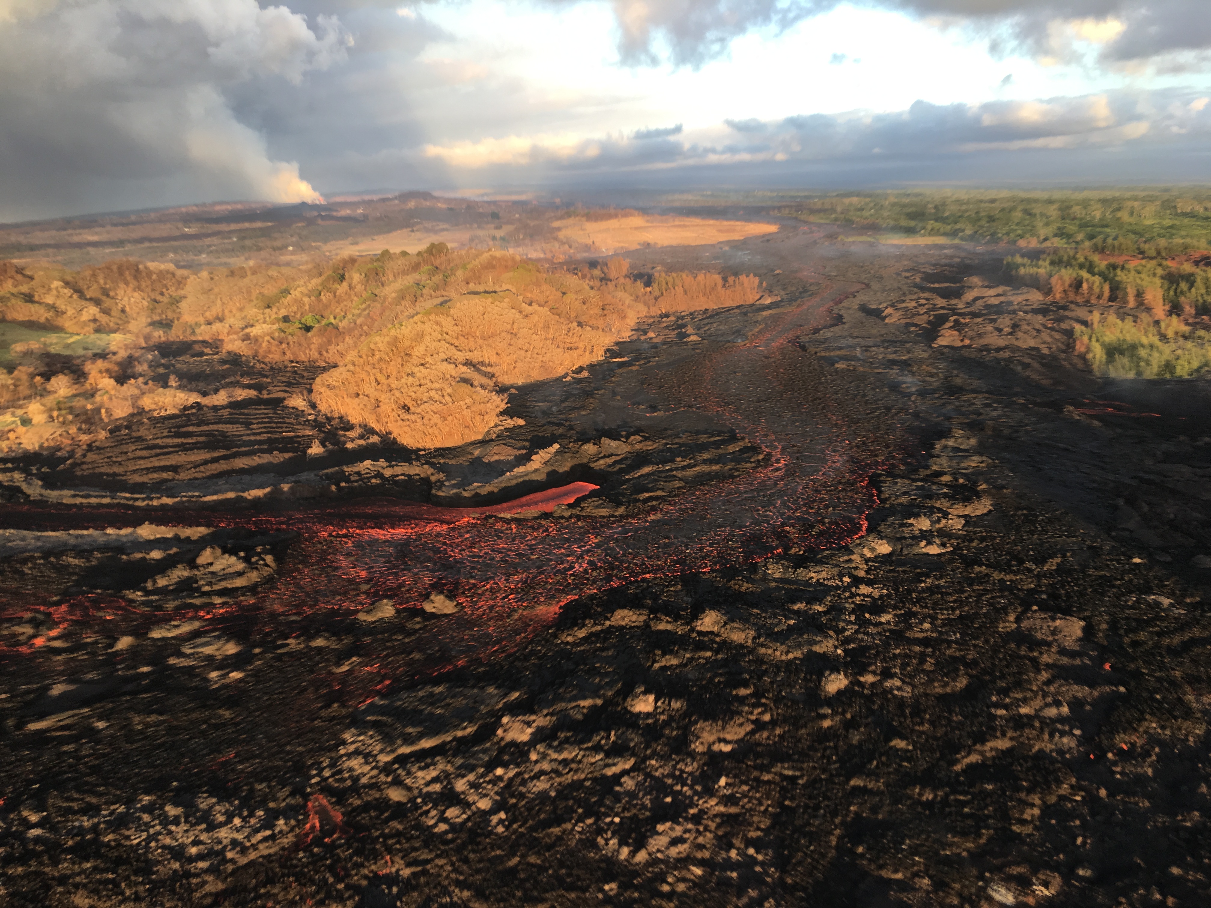
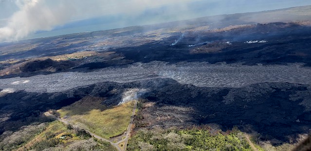
The LERZ eruption continues with minor variations. This morning’s USGS overflight crew observed that Fissure 8’s fountain and lava level in the upper channel appeared to be slightly lower. However, the lava flow rate down at Kapoho Beach Lots —where there were only a few houses left, as of this morning — seems to have picked up slightly. Meanwhile, overflows spilling out from the constricted turn around Kapoho Crater have nearly reached Beach Rd about 0.2 miles north of Four Corners. Lava continues to enter the ocean along a very broad front, mostly on the northern side of the delta.
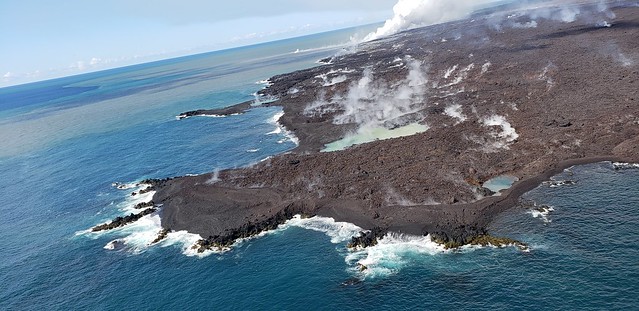
July 5, 2018. USGS: “Lava enters the sea along the Kapoho coastline, building a delta that is now over 555 acres in size.” ( full-sized )
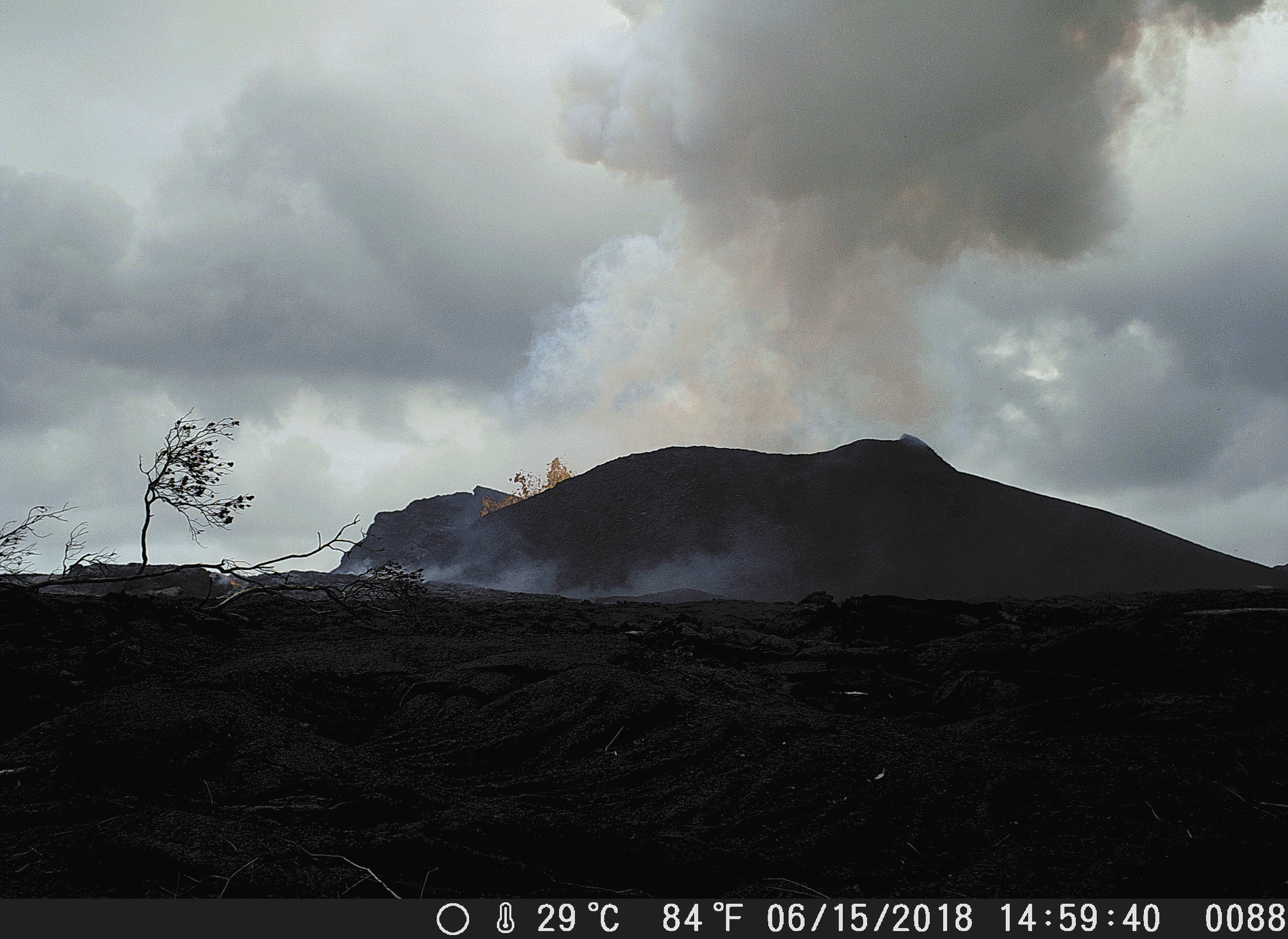
Fissure 22 is “sporadically spattering,” and its flow may have stalled.
At the summit, today’s collapse/explosion occurred at 1:20 PM HST, registering as a magnitude 5.2. Once again, I noticed rockfalls picking up about a minute before the big shake, although it might be coincidence (they’re happening at other times of the day as well):
The Italian Space Agency has posted a new satellite radar image of Kilauea Caldera, showing the ongoing subsidence across much of the crater floor (you may have to view full-sized version for the animation):
USGS: “This animated GIF shows a sequence of radar amplitude images that were acquired by the Agenzia Spaziale Italiana CosmoSkyMed satellite system. The images illustrate changes to the caldera area of Kīlauea Volcano that occurred between May 5 and July 4 at about 6:00 a.m. HST…Over time, expansion of the summit eruptive vent within Halema‘uma‘u crater and the widening of Halema‘uma‘u itself are obvious. Starting in late May, the development of several cracks outside Halema‘uma‘u is clear, and inward slumping of a large portion of the western, southwestern, and northern crater rim begins. Much of this motion appears to be coincident with the small explosions from the summit that have taken place on a near daily basis since early June. The most recent radar scene, from July 4, shows continued motion along cracks over a broader area of the caldera floor, extending east of Halema‘uma‘u (these cracks are the scarps seen in recent photographs from the Keanakākoʻi overlook area).” (Full-sized)
By the way, if anyone else was confused by recent Hawaii Tribune Herald articles that said SO2 levels had climbed tenfold at the summit, I checked with @USGSVolcanoes, who suggested a minor mixup. That increase is occurring down in the Lower East Rift Zone. At the summit, according to Kyle Anderson during today’s media conference call, SO2 levels have dropped to the level they were before the lava lake first appeared.
Today’s entry is going to be a challenge, because my computer chose a holiday to go pau. Arthritis and dodgy vision versus voice dictation and tablet — who will win?
July 4, 2018. USGS: “USGS scientist observes the glow of fissure 8 fountain and channel within Leilani Estates. Steam rises from cracks and hot spots within the tephra deposit surrounding the cone. Frequent observations of the cone and channel are made throughout the day and night to track changes that could lead to signfiicant breakouts beyond the current flow field.” (Full-sized)
Today’s eruption summary
The LERZ eruption continues pretty much as usual, with a few minor embellishments to keep field crews on their toes.
Today’s HVO update noted that Fissure 8 “has been pulsing with more vigorous output in 1-3 minute bursts.” When asked for clarification, USGSVolcanoes replied, “No true indication of change.” F8 continues to send lava downriver to Kapoho, where lava is oozing out along most of the broad front and encroaching on Kapoho Ag and Beach Lots properties.
Fissure 22 continues to spatter intermittently and produce a short, sluggish flow:
Wednesday, July 4, 2018, 5:45 am – Kilauea's east rift zone overflight: Fissure 22 continues to spatter bits of lava…
…and it still looks like a kid’s science experiment. (It’s hard to tell from overhead, but it’s a perfect steep-sided cone.)
Remember how the lava channel clogged up temporarily around the bend at Kapoho Crater yesterday? It’s still having problems:
July 4, 2018. USGS: “The lava channel from fissure 8 jumped its banks near Kapoho Crater where the channel makes a 90 degree bend. The flow within the channel was diverted around a constricted area and joined the channel again “downstream” to the south (left).” (Full-sized )
I lucked out this morning and caught @HotSeatHawaii ‘s sunrise overflight live, which offered a good view this. Part of the lava is going wide instead of making the sharp turn, though it joins back up around the bend. (More photos below.)
Today’s summit collapse/explosion occurred at 10:19 AM HST. The view was fairly clear today, and the rockfalls were spectacular:
On June 26, 2018, Deputy Scientist-in-Chief of the Hawaii Volcano Observatory, Steve Brantley, gave a ten-minute slideshow at the Puna Community Meeting in Pahoa. Video of the meeting is posted here. Steve Brantley’s talk starts at 35:00 in that video.
BigIslandVideoNews excerpted half of his talk in this video, which they overlaid with footage from a June 24 USGS drone overflight of the summit:
Below is my transcript of the complete talk, including images that match or approximate his slides.
Steve Brantley (USGS):
Hello, everybody. Thank you for coming out.
I’ll just describe a few things occurring in the Lower East Rift Zone and then summarize the activity up at the summit at the very end.
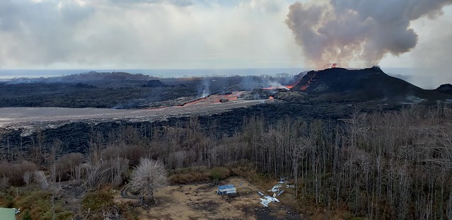
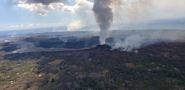
Fissure 8 is status quo. Today’s HVO Kiluaea status report says its cone is now 180feet tall. Its flow front has broadened southwards, widening to two miles, moving south on shore as well as continuing to expand offshore (lava delta acreage: ~405). The main channel/ocean entry remains on the southern side of the front, with minor entries in a 1-kilometer zone.
The lava Fissure 22 is weakly active; no activity observed at 16/18.
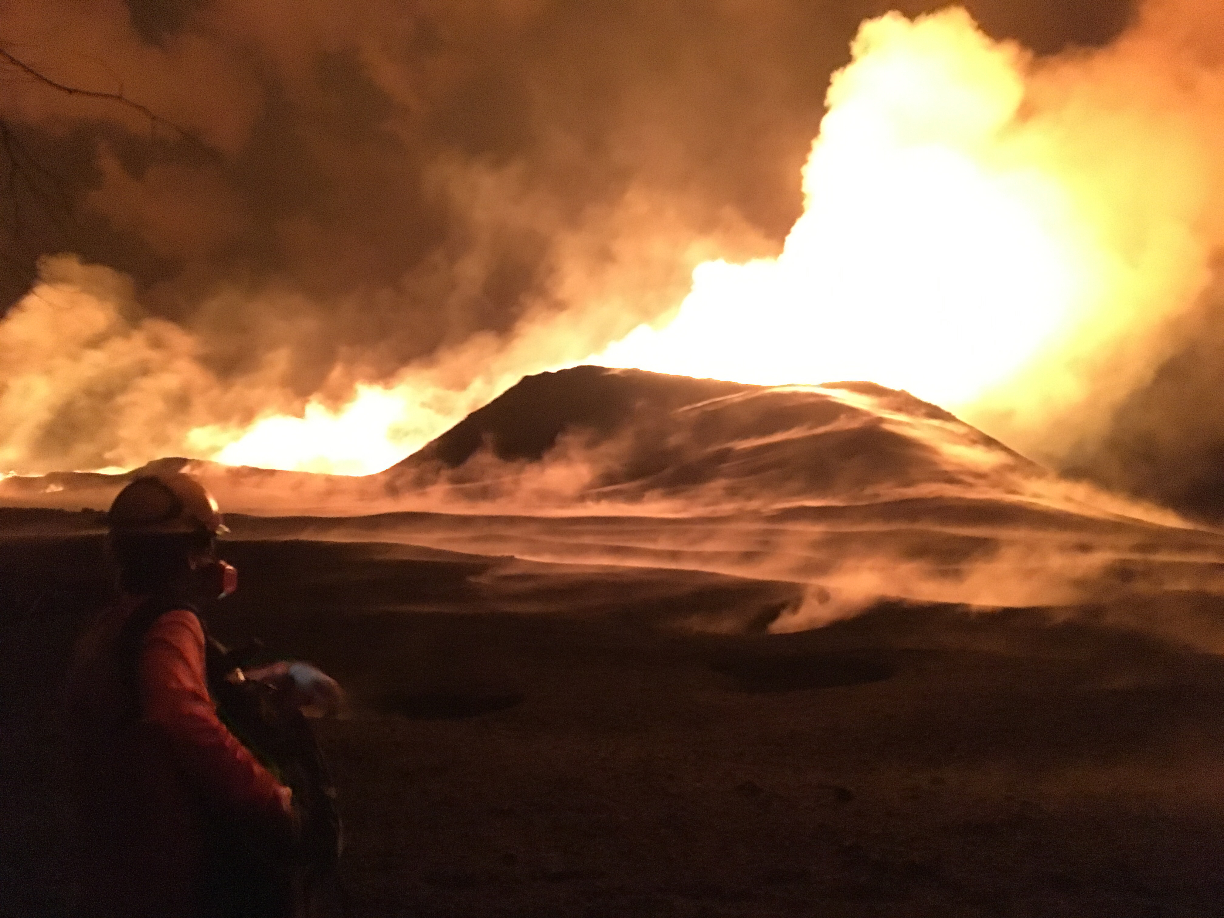
USGS: “This animated gif shows the fissure 8 tephra (cinder and spatter) cone morphology changes between June 15 and 24, 2018. During this time a shoulder grew on the channel side of the cone as the vent shifted from being two distinct fountains to three, then to a single source of voluminous roiling. The cone height is about 47 m (154 ft) from the hardened lava surface on which it was built.” Note: This isn’t a webcam but a temporary camera they set up; they have to download pictures manually. (Full-sized)
According to Mike Zoeller (UHI) at today’s 11AM conference call, the lava delta is advancing at less than 50m/day; it was 200/day a week ago. The southern edge of the flow is a kilometer from Ahalanui Beach Park. Over the weekend, he observed top lava speeds of 25kph (15.5mph); Leslie Gordon (USGS) saw it max out at 35kph (21.75mph) last Friday night.
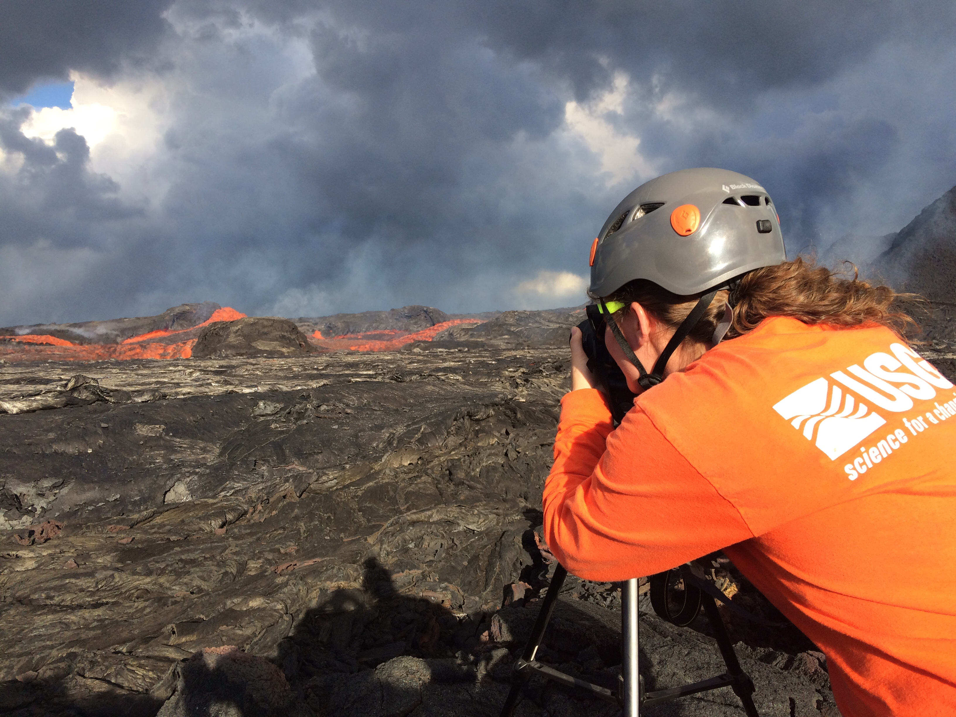
USGS: “USGS Hawaiian Volcano Observatory geology field crews maintain watch over the eruptive activity in the lower East Rift Zone and at Kīlauea’s summit. Here, a geologist documents the behavior of lava as it exits the Fissure 8 cone. Lava enters the upper channel traveling as fast as 30 km/hour (18 mi/hour).” (Full-sized)
After yesterday’s collapse explosion at 4:12, seismicity dropped from a high of 25-35 quakes an hour down to less than 10, but had started to creep up again and was averaging 30 by dawn. On the livestream, I observed clouds of ash/dust in the crater’s interior at various times during the day. Today’s collapse explosion occurred at 5:03pm, equivalent of a 5.3, ash-poor plume rising less than 2000 feet.
Jun 24: chasing rainbows and lava with Mick Kalber. He was checking on a lava spillover uncomfortably near his house! (Helicopter noise)
Reminder: HVO downgraded Kilauea’s aviation alert to ORANGE last night, because ash explosions have rarely risen above 10,000 feet since May.
The new news today is that HVO/USGS downgraded Kilauea’s FAA warning level:
“Since late May, these collapse/explosion events have rarely produced significant ash plumes rising more than 10,000 feet above sea level where they can pose a significant hazard to aviation. For this reason, HVO is reducing the aviation color code from RED to ORANGE.”
June 24, 2018. USGS early morning overflight of Fissure 8. (Full-sized)
I almost feel like the recent code downgrades for Kilauea and Mauna Loa were a tacit rebuttal of the scaremongers trying to conjure an island-wide catastrophe out of hot air. But I suppose I’m being as irrational as they are. There were specific numbers and criteria for both these status changes.
Down at the LERZ, status quo continues. Fissure 8’s lava fountains are vigorous but seldom peep over the cone they’ve built (now 180′). Minor overflows spill out near the head of the lava river without going far. The ocean entry is concentrated mostly at the main lava channel channel near the south end of the lava delta, but some fans out along a 1km stretch.
USGS: “The spatter cone at fissure 8 is now about 55 m (180 ft) tall. Lava fountains rise only occasionally above that point, sending a shower of tephra (cooled lava fragments) over the rim.” (Full-sized)
Today’s collapse explosion went off at 4:12pm, M5.3, partly hidden on the livestream by a dust cloud from rockfalls 4 minutes earlier. Just as yesterday, I noticed the “collapse explosion” started with a visible camera shake, unlike earlier rockfalls that made me think, “Waaaaait— was that it?” The explosion itself didn’t send up much dust past the rim of Halema’uma’u. About a minute later, dust from caldera wall rockfalls (I think?) blew past.
Below: Rockfalls, dust cloud, then I fast forwarded to the collapse explosion.
Today’s USGS Kilauea update gave additional details for yesterday’s explosion which probably apply to today’s as well: “Seismicity dropped abruptly from a high of 25-30 earthquakes per hour (many in the magnitude 2-3 range) prior to the collapse explosion down to 10 or less earthquakes per hour afterwards. Within 4 hours seismicity began to creep up again averaging about 25 earthquakes per hour by daybreak (June 24)” i.e. about 14 hours later.
Fissure 8 just keeps on going, as if it’s settling in for a Pu’u O’o eruption rather than a 1955/1960 eruption. Once again, there’s minor overflows upriver that don’t go anywhere. The ocean entry is mostly via the channel on the south side of the lava delta, but there’s also trickles along a kilometer-wide stretch of shore. Fissure 22 showed incandescence but no lava during the USGS morning overflight.
The USGS was skimpy on images today but gave us a treat: a timelapse of what they call “lava boats.”
Here’s their explanation: “Geologists captured this time-lapse video of the perched lava channel issuing from fissure 8 on Kīlauea’s lower East Rift Zone. Rafts of accreted lava move down stream and look like boats moving down a river. These are termed lava balls or lava boats and form when portions of the fissure 8 cone or levees break away and are rafted down stream. As they move along in the channel, additional lava can cool to their surface to form accretionary lava balls.”
After lots of minor earthquakes and rockfalls that sent up small plumes of dust, the daily summit “collapse explosion” occurred at 4:34pm. It sent up a 2000-foot plume, once again equivalent to 5.3 earthquake. Again, I couldn’t resist a video capture:
The runup to today’s explosion was impressive. There was one cascade of dust and rubble all the way around the walls that I would’ve taken for the day’s explosive event, except that there was no camera shake beforehand. Doubtless it was one of these:
There’s not much news today, so let’s hitch a ride with the Hawaii County Fire Department and follow the lava river to the ocean. But first….
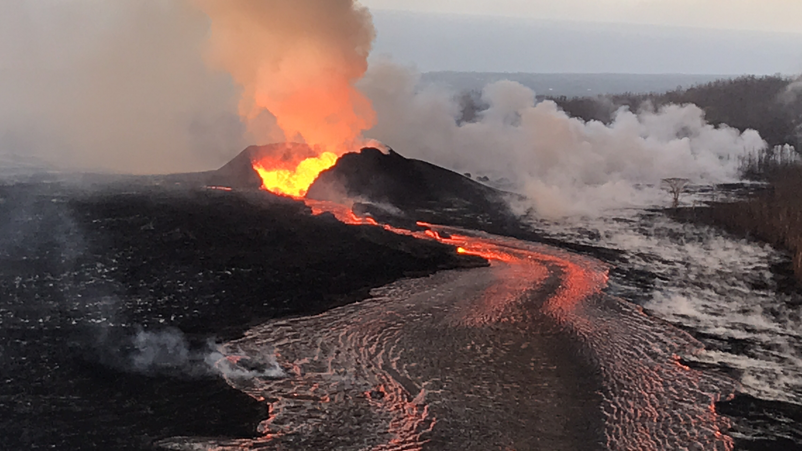
USGS: “On June 23, 2018 at 4:32 p.m. HST after approximately 17 hours of elevated seismicity, a collapse explosion occurred at the summit if Kīlauea. The energy released by the event was equivalent to a magnitude 5.3 earthquake. During the intense shaking, rockfalls cascaded down the northern margin of the caldera wall just below Uwēkahuna Bluff sending rock dust into the air.” (Full-sized)
More on Lava Boats
I’d asked about the “lava boats” before that video was posted: “What’s forming those so-called “lava bergs”? Are they chunks off the sides of the levees? Do they indicate erosion/undermining of lava channel’s banks analogous to meanders of an H20 river, with risk of wearing through?”
@USGSVolcanoes offered some additional info in response: “They are chunks of the sides of levees as well as bits of the cone. As lava moves by them in the channel, they can be coated, dislodged, etc. Different than water – lava cools against cooler surfaces (channel sides) & we’ve started to see portions roofing over (forming tubes).” And when someone else asked if the whole 8 mile channel might become a lava tube: “It’s a possibility, but not necessarily guaranteed. It’s easier in places where the channel is already narrow.”
Which doesn’t answer my question about erosion/meanders, but looking back, they answered another question about braided lava channels on June 11 with this paper, which emphasizes that viscosity is a major factor in lava flows, whereas in H2O it’s particles in water.
Someone else’s Q on “lava boats”: ” Are these what’s floating beyond the ocean entry? USGS: That’s a different process. The chunks floating beyond the ocean entry are bits of very bubble-rich lava-rock. When lava enters the sea there is sometimes an explosive process that expels rocks – the heat of the rock combined with the amount of bubbles causes these pieces to float for a while. Eventually, they cool, fill with water, and sink.
Awkward place to stick this, but so I don’t forget: this week’s HVO “Volcano Watch” newsletter focused on “Mauna Loa Back to Normal.“
More USGS on Social Media
Q: What will happen if the summit collapse continues? USGS: There are several options: It could enlarge #Halemaumau to a point and then the explosive activity could stop, or it could enlarge the crater and the explosions could change character.
Aha! It turns out the USGS posted photos today only on Facebook. Someday when things calm down, they need to comb their social media channels and make sure they’ve archived everything on the HVO website and/or USGS media library.
USGS: “Fissure 8 fountain, as observed from the Leilani Estates subdivision. USGS-HVO crews noted that during the overnight hours, the lava fountain typically reached heights similar to the height of the cinder cone, with sporadic bursts sending lava higher than the cone (as pictured in this image). USGS image taken June 23, 2018, around 12:46 AM.” (Full-sized)USGS: “HVO field crews are on site in the lower East Rift Zone, tracking the fountains, lava flows, and spattering from Fissure 8 as conditions allow and are reporting information to Hawaii County Civil Defense. Crews also make measurements and observations of ground cracks in the area, as shown in this image taken near fissure 9. USGS image taken during the afternoon of June 22, 2018.” (Full-sized)USGS: “View of the lava channel from ground level, with the Kapoho Crater in the upper left. The active channel is the horizontal silver-colored line in the upper third of the photo. Lava travels about 5 miles per hour in this area. USGS image taken during the afternoon of June 22, 2018.” (Full-sized)
If the USGS is too busy to post photos, the Hawai’i County Fire Department takes up the slack. (Unlike Facebook, Flickr is Google-able). Today Civil Defense shared their latest photo album, and once again I’m impressed by the definition of the camera they’re using compared to everybody else.
A small sample:
Looking southeast towards the “Y” junction at Pokoihi Rd, Kapoho Rd and 132 (Google Map) with Puna Geothermal Ventures in the background on the left:
Left and right, as different as night and day:
A disagreeable neighbor:
Looking towards the new lava delta:
Past the Lava Rooster house (near that mast):
Past the Cinder Pit:
Around Kapoho Crater (and former Green Lake):
To the sea. (Note upwelling.)
New land.
Effects extend offshore…
So far, so lucky. (Note the 1960 lava flow with roads on it.)
(warning: helicopter noise)
Sorry, got carried away. But there’s another 98 photos/videos in that album, including video all along the route and detailed views of houses, farms, even a dock.
While we wait for daily explosions, the people living on Kilauea endure earthquake swarms, as Dispatches from Volcano describes today. Also, he waxes eloquent on the topic of naming Fissure 8.
STill More Photography/Videos
First up, Mick Kalber getting up close and personal with whatever it’s called. Good views of a spillover, Fissure 22 incandescence, and the red lava at the ocean entry. (Blog post on this overflight)
A lot of the landscape resembles a hell-like atmosphere. The stench of sulfur, the rumble of the lava boil, and death as far as the eye can see. It's both magical and extraordinarily sad. #KilaueaEruptionpic.twitter.com/XWzQcbDX4u
USGS: ” Lava continues to erupt at a high rate from Fissure 8 and flow within the established channel to the ocean. No channel overflows were observed during this morning’s overflight. The fountains have built a horseshoe-shaped cone as lava fragments are intermittently hurled onto and over the growing rim. Lava exiting the cone forms a series of standing waves in the uppermost section of the channel.” (Full-sized)
Fissure 8 continues as usual, sending its lava river down to the ocean at Kapoho, with a “dominant ocean entry on the south edge of the flow front…producing a large laze plume.” Minor, brief overflows upstream aren’t traveling past previous lava flows. Fissure 6 is inactive; 16 incandescent; 22 woke up and was fountaining weakly during the USGS morning overflight.
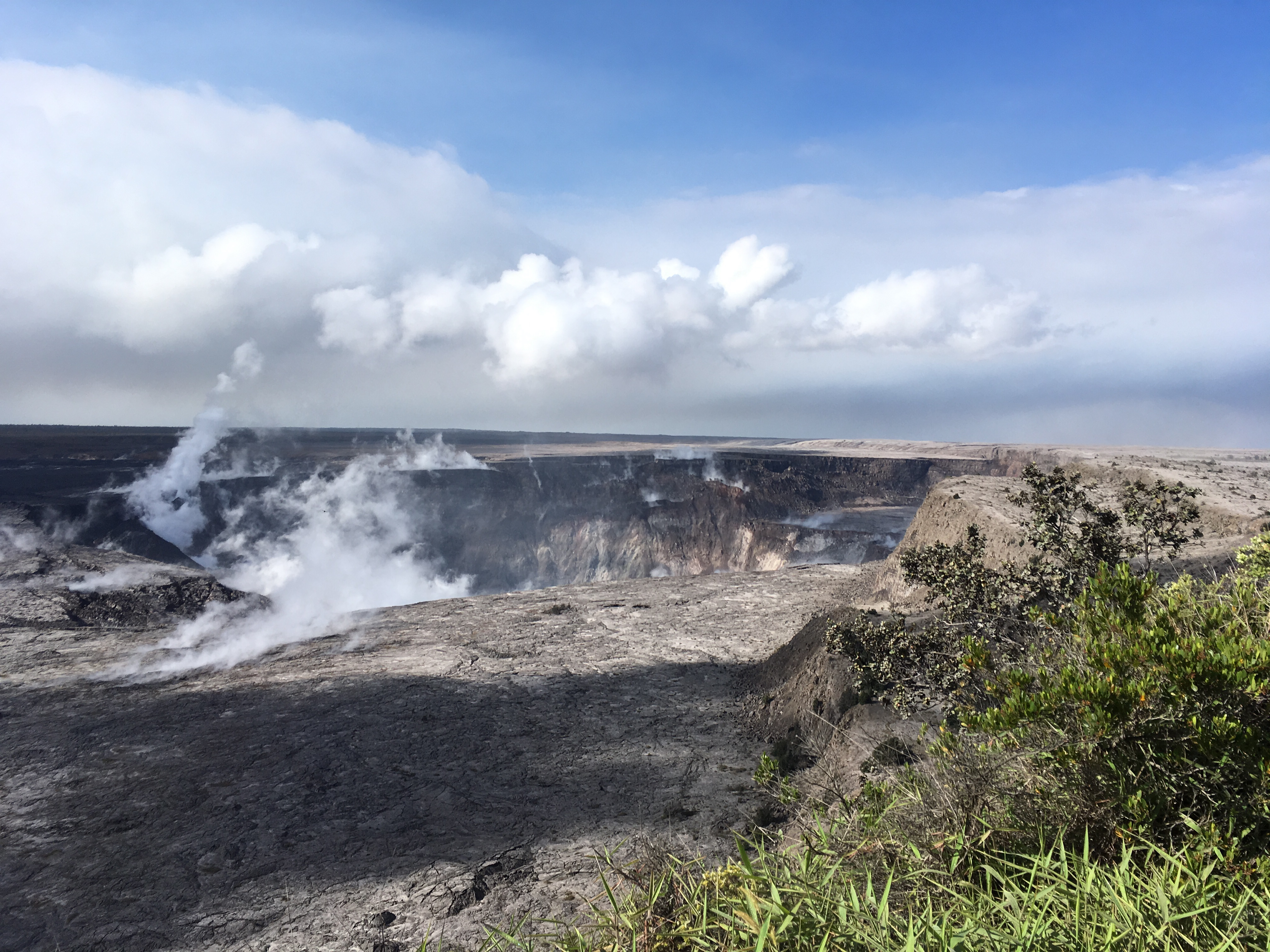
USGS: “Halema’uma’u crater at 8:30 a.m., view is toward the south. Several benches are clearly visible within the crater. The benches are sections of the former crater rim and adjacent Kīlauea caldera floor that have incrementally dropped or slumped into the crater as the summit area has subsided since early May.” (Full-sized)
Seismicity at the summit was “elevated overnight” according to today’s only HVO status update at 8:45 am. There appeared to be a lot of rockfalls/isolated slippages on the livestream today, especially on the left rim, but the really-truly “collapse explosion” (as USGS is now calling them) occurred at 6:52pm, 5.3 energy equivalent, 500 foot ash plume.
I spent this afternoon putting together a gif of the last 28 days of HVO wide angle Kilauea images, using screencaps I’ve taken supplemented with screengrabs from the same webcam archived by Hawaii247:
Meanwhile, Kilauea continues to follow the recent status quo, summed up in HVO’s afternoon Kilauea update.
The Lower East Zone’s unnamed giant booms in its cone, fountains rising to 165 feet, lava cascading out of it at 15mph.
USGS: Pu’u continues to make bid for naming. (Full-sized)Fissures 16/18 keep oozing or spattering. “Incandescence (visible in PGcam to the left of fissure 8 most nights) and mild spattering were observed from Fissure 6.”
“The flow field is relatively stable with little change to its size and shape for the past few days…”
USGS: “Occasionally, minor amounts of lava briefly spill over the lava channel levees. The spill overs are the shiny gray lobes along the channel margins… View to the east, with the plume in the upper right showing the location of the ocean entry.” (Full-sized)
“Observations are also collected on a daily basis from cracks in the area of Highway 130; no changes in temperature, crack width, or gas emissions have been noted for several days…”
At the summit, the daily subsurface explosion occured at 6:26am HST. “The resulting gas plume, reported to be brief and nearly devoid of ash, was observed to 5,000 to 7,000 ft above sea level.”
USGS: “Inward slumping of the rim and walls of Halema‘uma‘u continues in response to ongoing subsidence at the summit. Sulfur dioxide emissions from the volcano’s summit have dropped to levels that are about half those measured prior to the onset of the current episode of eruptive activity. This gas and very minor amounts of ash are being transported downwind, with small bursts of ash and gas accompanying intermittent explosive activity. The view is from Volcano House, looking toward the west.” (Full-sized)
This is the eighth day in a a row the daily event has released the energy of a 5.3 earthquake. For the month of June, they’ve all fallen in a range of 5.0 to 5.4.
“After this morning’s explosive event, seismicity at Kīlauea’s summit is slowly increasing. Inward slumping of the rim and walls of Halemaʻumaʻu continues in response to ongoing subsidence at the summit.”
Below the cut: a little local news, one of Mick Kalber’s best overflights of the Fissure 8/Kapoho area, and the work of a must-see photographer.