I didn’t realize I’d missed one of Steve Brantley’s excellent 10-minute slideshow presentations at the weekly Puna Community Meetings. This one took place on Tuesday, June 12 at Pahoa High School.
I learn something from every one of these talks, which sum up Kilauea eruption activity of the past week in a way that’s easy for the general public to understand without talking down to them.
Video of meeting is archived here. Steve’s presentation starts at timestamp 42:10. Where possible, I’ll be including images in my transcript which match his slides.
(Steve Brantley is a USGS geologist, deputy-scientist-in-charge of Hawaiian Volcano Observatory.)
Transcript
Hello everybody. Thank you for coming out again and thank you for your perseverance. I’ll show a couple slides of what’s been happening down in this part of the neighborhood and end with some slides of the summit area, which continues to change very dramatically.
So this is the overview slide I’ve showed for the past few times. It gives you the overall picture. It’s an image, cartoon, from the summit area all the way out to the eastern tip of the island. The summit area here [under “Kilauea Caldera” label], eastern tip [down by “Kapoho Crater”], with a cross section showing you the general picture of the magma reservoir system from the summit of the volcano down through the East Rift Zone and into the Lower East Rift Zone.
At a 3PM press conference, Jim Kauahikaua (USGS geophysicist) described in detail the subsidence at Halema’uma’u. He also talks about a patch of “upwelling” where lava has entered ocean at Kapoho and seems to be traveling along ocean floor, heating water above it.
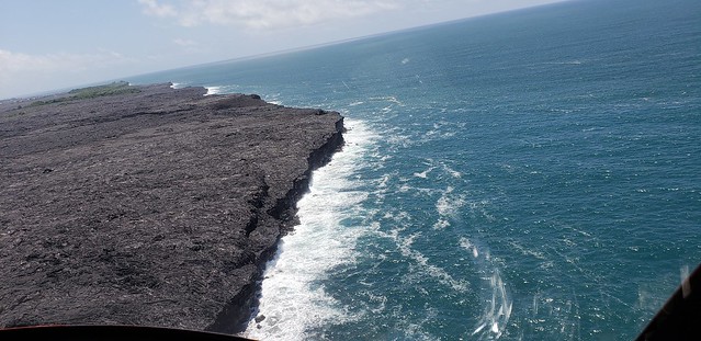
Fissure8’s “three closely space fountains” are starting to climb down, reported at 115-130 feet last night, and “fluctuating heights from below the 115 ft high spatter cone around it up to 180 feet” this afternoon. But its lava flow is still full to its banks, entering the ocean in Kapoho with minor steam explosions. “Weak lava activity” was spotted at fissure 16/18 last night.
USGS: “The three closely spaced lava fountains at fissure 8 reached maximum heights of 115-130 feet overnight. Lava fragments falling from the fountains are building a cinder-and-spatter cone around the erupting vent, with the bulk of the fragments falling on the downwind side of the cone. Fissure 8 continues to feed a channelized lava flow that reaches the ocean at Kapoho.” (Full-sized)
Last night, Kilauea’s summit hiccuped: there was a small explosion at 12:46am, after which, seismicity did not drop off until after another, larger explosion at 4:43am like the ones we’ve seen lately (registered as M5.4).
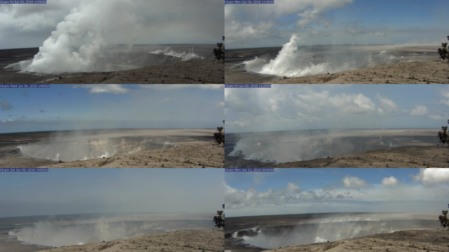
USGS: “A series of wide-angle webcam images, captured by a camera in HVO’s observation tower between June 1 and June 10, 2018, show ongoing subsidence around Halema‘uma‘u at the summit of Kīlauea in this animated GIF.” (Full-sized)
Since Saturday, Fissure 8’s gas emissions have been much higher than last week, whereas summit SO2 is half what it was before the current eruption. (I’m not sure why HVO’s Kilauea alerts report “volcanic gasses” for one and only SO2 for the other.)
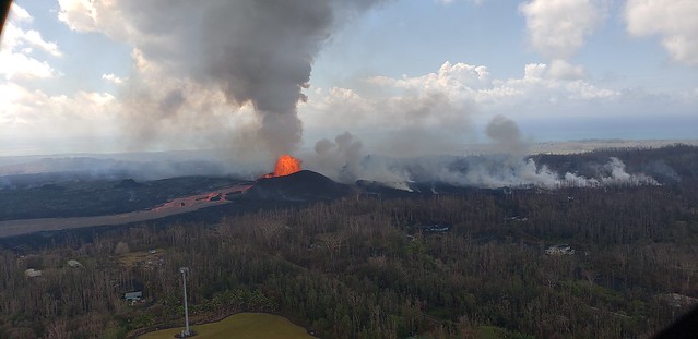
(The “Lava Livestream” house is still safe, if marooned, near white mast):
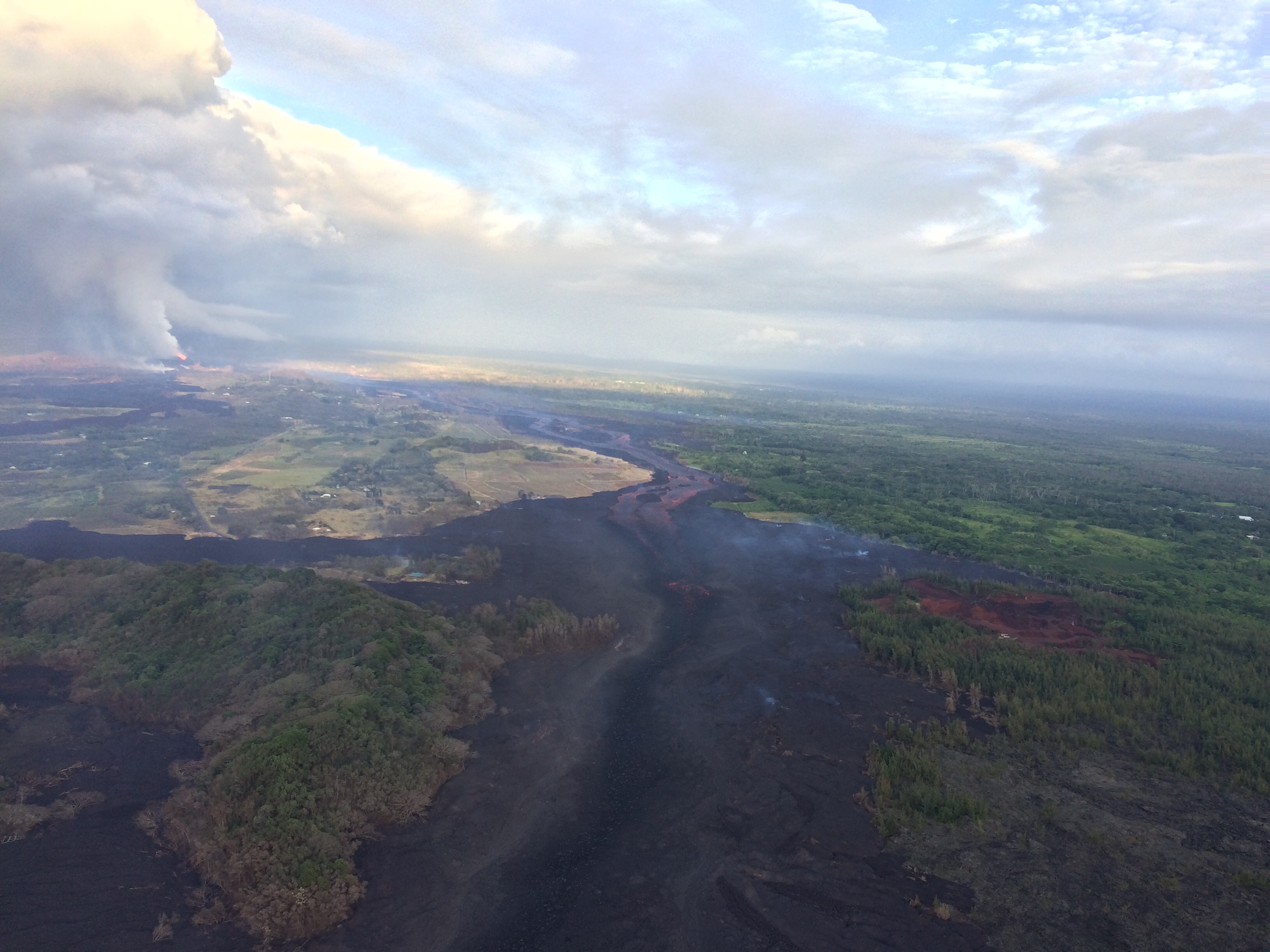
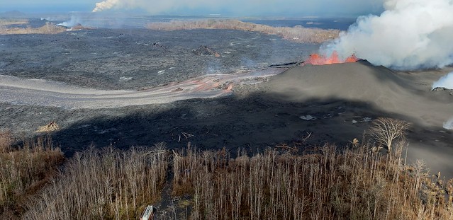
USGS: “Aerial view of the fissure 8 lava channel on Kīlauea Volcano’s lower East Rift Zone in the vicinity of the Kapoho cone, with fissure 8 fountains visible in the distance (upper left). Helicopter overflights of the eruption site are routinely scheduled to check for any new outbreaks of lava and to collect GPS data on the active flow—information that’s needed to make the flow field maps that are posted on HVO’s website” (Full-sized)
Here’s a double feature from Mick Kalber’s daily overflights— below is his June 11 lava video, but I missed his June 10 flyover vid and lava update notes.
Below the cut: more great images, overflight vids, and some interesting USGS answers to questions on social media.
Fissure 8’s eight-mile lava river and the summit’s daily explosion have followed their usual pattern of the past two weeks. However, volcanic gas emissions at the Lower East Rift Zone doubled on Saturday compared to the past week, while SO2 emissions from Halema’uma’u are about half what they were before this current eruption started.
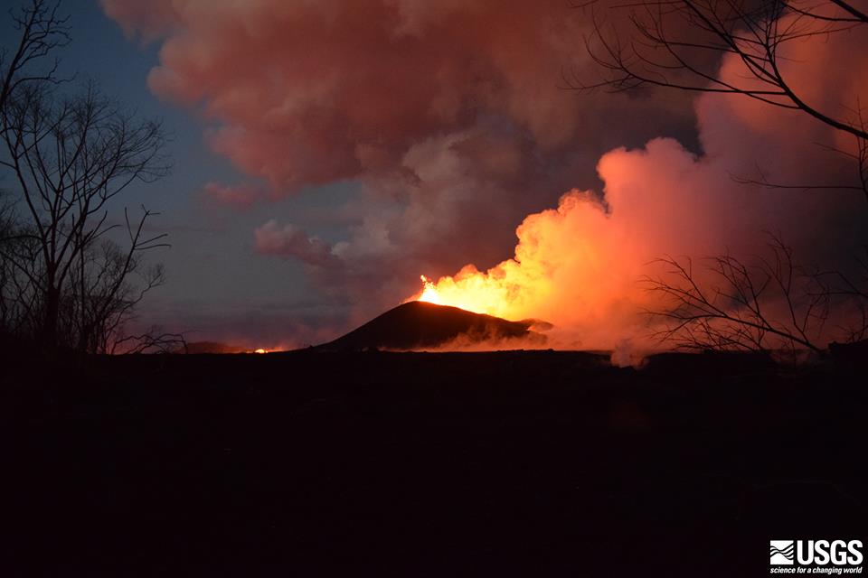
USGS: “The fissure 8 cone and lava fountaining viewed at 8PM HST on June 9 from a location on Kupono Street. The incandescence to the left is lava in the active channel.” BELOW: June 10 Hawaii Fire Department Overflight, ocean entry plume in far distance.
Are those two facts linked? I dunno. I’ll be interested to hear if/when lava samples collected from the Fissure 8 flow start to show signs they came down from the summit instead of Pu’u O’o.
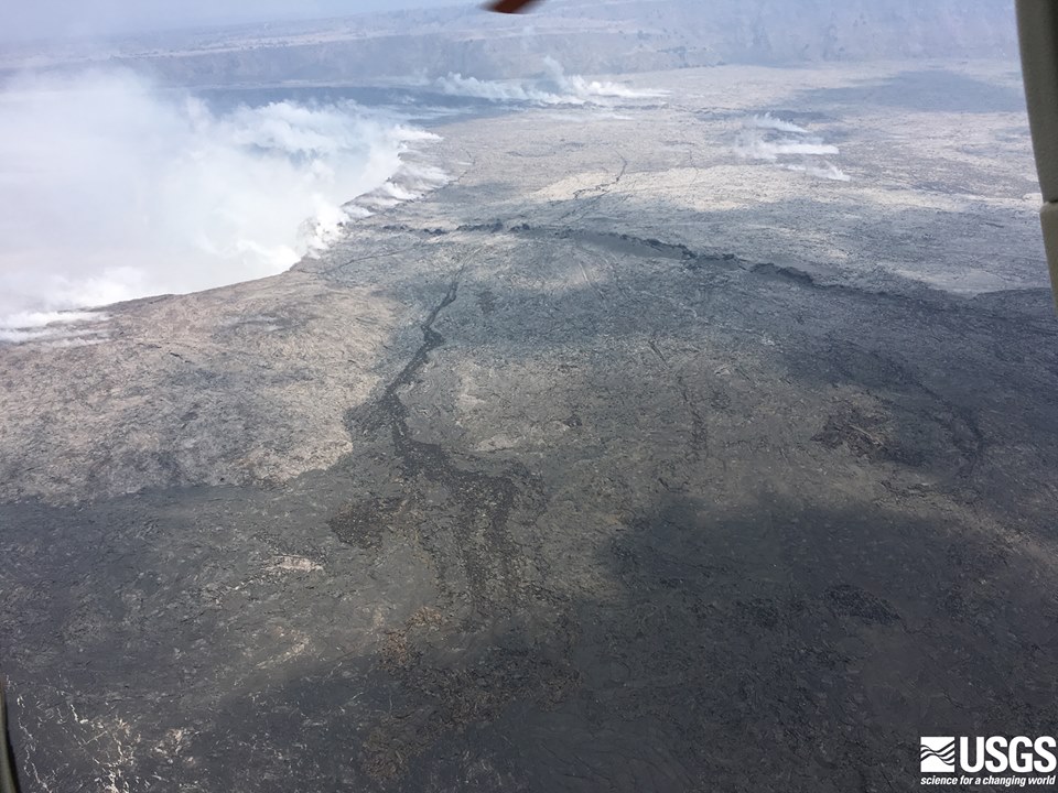
USGS: “The northern rim of Halema’uma’u Crater at Kilauea’s summit on June 9, from the noon helicopter overflight. The floor of the Kilauea Caldera is showing prominent cracking from the ongoing subsidence, and the steaming cracks in the background have been observed for several days now.”
Before-and-After Halema’uma’u 2017 vs 2018
I found a July 2017 screencap from HVO’s panorama webcam, so here’s an animation fading from it to today’s view. Check out the full-sized animation; you can really see how much Halema’uma’u has enlarged.
Be warned, there’s some sad news, especially in the social media section at the end. This is a natural disaster, and it’s hard, even if it provides some amazing visuals and fascinating science as compensation. But they can’t make up for what’s lost.
I came across this interesting paper on the last lava flow to threaten Lower Puna, just 3-4 years ago. It brings home just how remarkable the current eruption is.
Poland’s paper says that the Pu’u O’o lava flow (Episode 61e) that started June 27, 2014 was the longest at Kilauea in the past 500 years.* It eventually reached a length of ~20 km (12.43 miles), butit took until March 2015 to get there. Its average rate of speed was 0-500 meters a day.
By contrast, Fissure 8’s current flow started on May 26, 2018, and covered 13 km (8 miles) to the ocean by the evening of June 3 (eight days). At times it exceeded 500 meters per hour.
This explains a lot.
I wondered why some residents of the Kapoho area said their evacuation orders came with “no warning,” or they didn’t bother to evacuate their belongings, or they didn’t think the lava would reach their house, even though the eruption had started a month before, and lava had been moving their way for a week.
But they’re used to the Pu’u O’o eruption of the past 35 years, which took years and years to reach and cover the community of Kalapana. The current eruption is covering as much ground in a week as Pu’u O’o took months to cover. And Pu’u O’o was traveling farther than any eruption in 500 years.
No wonder people were caught flat-footed!
Below: I created an animation of 3 HVO/USGS maps to show Pu’u O’o vs current Lower East Rift Zone lava flows.
Maps used to create this animation:
USGS April 30 map of Pu’u O’o active lava flow (pink, Episode 61g, May 24, 2016-Apr 30, 2018) and older Pu’u O’o flows (gray, Jan 3, 1983-Apr 30, 2018)
USGS May 2 map showing magma was moving into Lower East Rift Zone (inferred by earthquakes); Pu’u O’o lava flows of past 35 years shown in pale pink, episode 61g in dark pink. The 2014-2015 (episode 61e) flow is the light Y-shaped area extending to the northeast. (Sorry, I don’t have acreage numbers for episode 61g, or for that matter final totals for the Pu’u O’o lava flows.)
USGS June 10 map of active lava flows in Puna (Lower East Rift Zone) since May 3, 2018, with current flows in pink and historical flows (including the 2014 Pu’u O’o mentioned in that paper) in purple.
In short, the current 2018 eruption is hotter, faster, and covering so much ground that it’s surprising even to geologists, let alone residents. This is not the kind of volcanic eruption they’re used to.
*(Pu’u O’o’s 35-year eruption was exceeded by the 60-year Ailā‘au eruption that created the Thurston Lava Tube in the 1400s. After which, Kilauea caldera collapsed, and there were 300 years of explosive eruptions before Kilauea reverted to effusive (lava) eruptions. But don’t panic: we’re nowhere near 60 years of continuous lava flows even now. Also, two weeks ago the USGS said that only about 2% of the volume of magma in Kilauea’s magma chamber has erupted since May 3, and it’s still being resupplied from below.)
One gets the sense that crisis mode is giving way to some sort of new normal, as it did during the decades of the Pu’u O’o eruption. Not that one can ever call this normal:
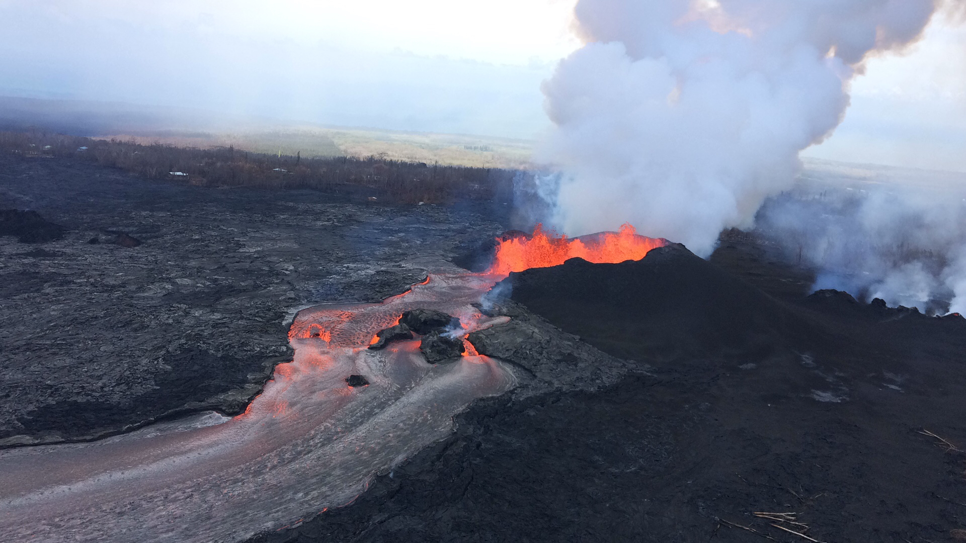
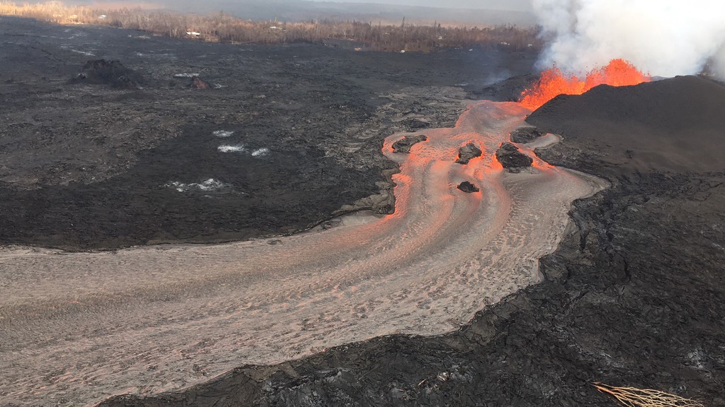
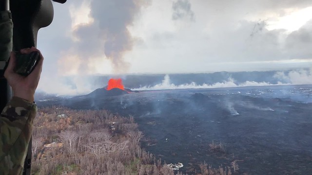
USGS: “Fissure 8 and lava channel in the lower East Rift Zone of Kīlauea Volcano during this afternoon’s overflight, with no apparent slowing in the eruption rate. The lava channel remained incandescent all the way around Kapoho Crater before entering the ocean.” (Full-sized)
Still, public meetings are no longer dominated by talk about lava, fissures, and SO2 so much as how to collect on insurance and find housing. The USGS has dropped weekend video briefings to give its staff a much-needed break (alerts/info are still posted on the HVO website). Hawaiian news outlets are reverting to a more typical news cycle, with only 1-2 new Kilauea updates a day.
At the summit, steam/ash explosions continue their recent pattern. Today’s explosion registered as M5.2 at 4:48am, shaking the village of Volcano; it was felt as far away as Hilo. (Local radar is still out, but the ash cloud was small, less than 10,000 feet, since satellites can spot bigger ones).
Halema’uma’u is looking very ragged around the edges:
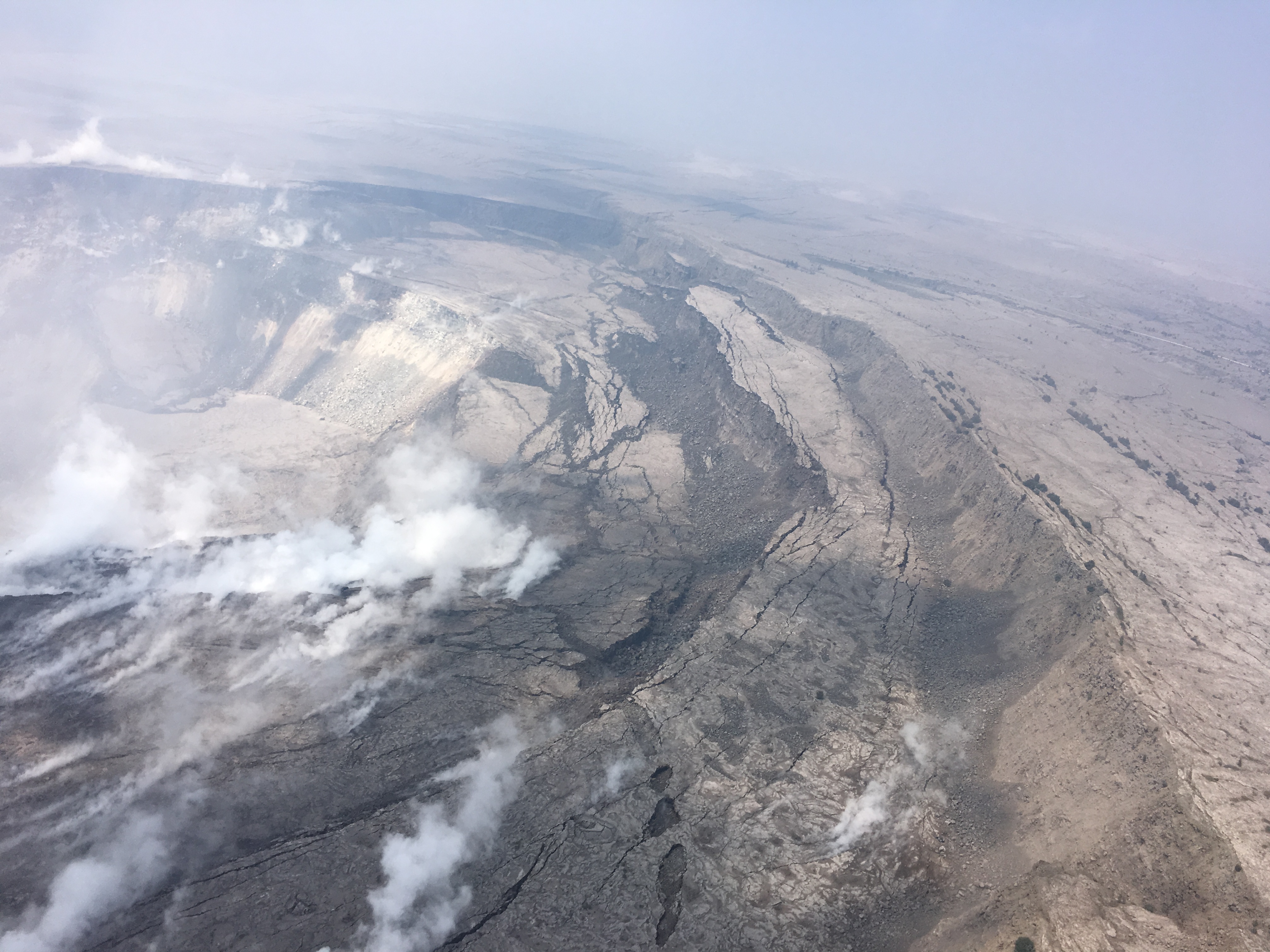
USGS: “Cracking and slumping of the Halema‘uma‘u crater walls are clearly evident in this aerial view captured during HVO’s overflight of Kīlauea’s summit this morning. Steam plumes have been rising from within the crater, as well as from cracks adjacent to the crater.” (Full-sized)
In the Lower East Rift Zone, Fissure 8’s fountain has tapered off slightly, down to 130-160ft with occasional bursts up to 200ft, but its lava river is still going strong. As of 6:30am, the new lava delta at Kapoho had grown to 200 acres. An elevated section of the flow near Lava Tree State Park caused some concern this afternoon when it started overflowing its levee, but it settled back into the main channel without a major breakout.
I’m running late tonight, so here’s a somewhat abbreviated weekend edition of USGS info, eruption news, images and videos, including timelapses of the summit and fissure 8 for the past week:
Fissure 8 continues to do its thing (fountains up to 230 ft today), pumping a vast river of lava towards Kapoho. Its flow front is about a mile wide where it meets the ocean. USGS reported ~190 acres of new land added to Hawaii as of noon. Some or all of this may be temporary, since “lava deltas” tend to collapse.
[Above: 2 photos from Hawaii County Fire Department’s extensive videos/photos for June 8. Good to browse if you’re checking on homes in Kapoho.]
Summit activity continues to follow its geyser-like cyclical pattern. Earthquakes increased until 2:44 AM, when there was an explosion (equivalent of M5.4), after which seismicity died down. Pu’u O’o also had a small earthquake (3.2) and rockfalls today, sending up a red plume of ash. (Still hunting for photos, but it’s been reported several places.)
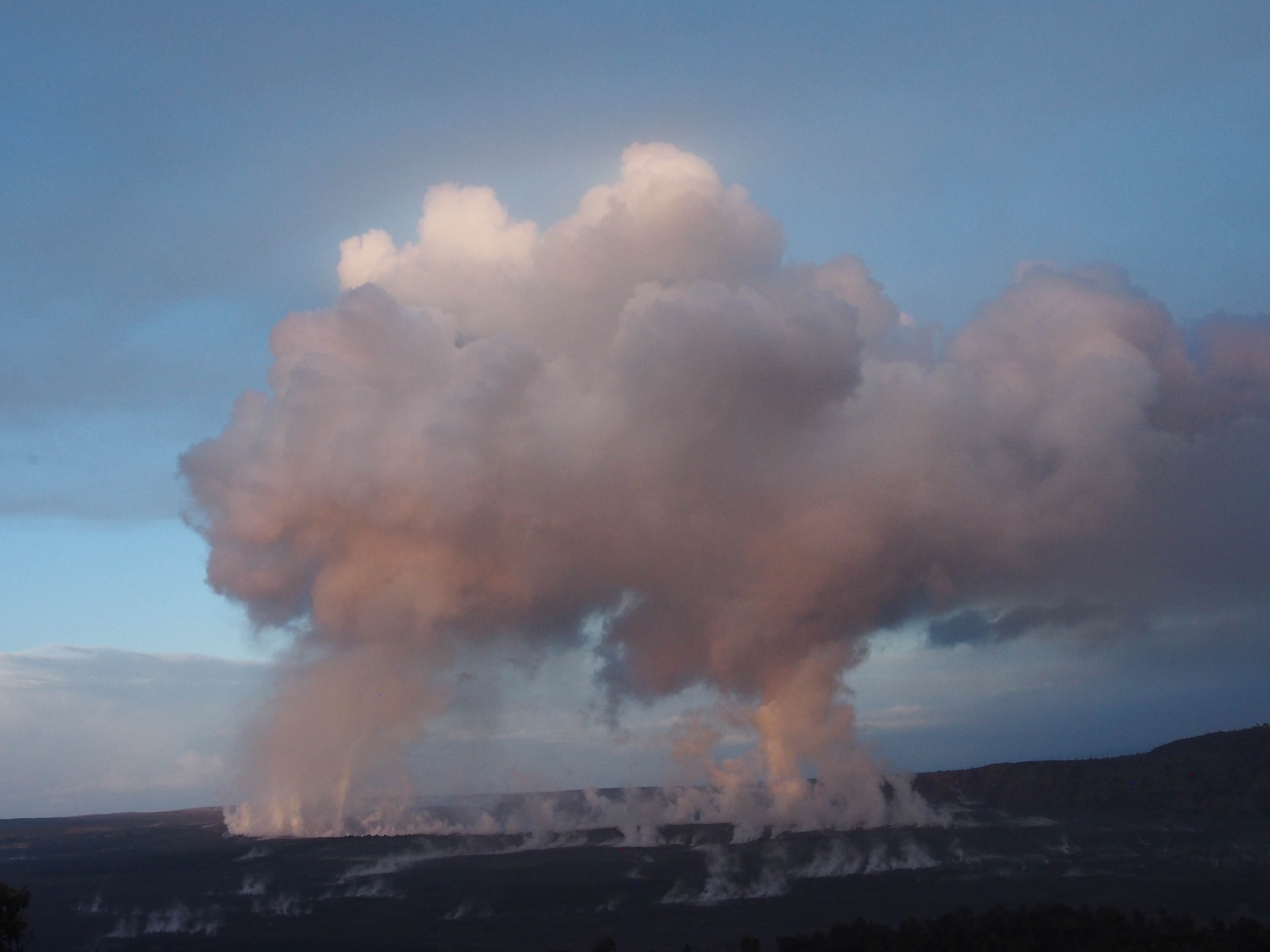
USGS: “Outgassing from Halema‘uma‘u produced twin pillars that rose in the still morning air and merged into a towering cap above the summit of Kīlauea just after sunrise.” (Full-sized)
East and southeasterly winds sent an unpleasant amount of vog over Hilo and the Saddle. This will continue through Saturday, then tradewinds come to the rescue.
These days, it seems like every time we think the eruption’s settled into a kind of equilibrium, it ramps up its activity in one way or another, so I’m sure this headline will be obsolete by morning.
But for today, Kilauea’s new status quo still holds: increasing numbers of summit earthquakes leading up to an ash/gas explosion (yesterday’s was 5.6); fissure 8 pouring out a river of lava adding new real estates to former Kapoho Bay. Updated count in homes lost jumps to ~600, most during the past week when 8’s wide flow covered shore communities.
“Lava fountaining at Fissure 8 fluctuated with heights varying between 190 and 215 feet. This activity is feeding a lava channel flowing east to the ocean entry in the Kapoho Bay area. The noon overflight found that the delta is about 1.2 mi wide in the Vacationland/Waopae area and observed the flow was expanding northward through Kapoho Beachlots. A large area of upwelling offshore suggests the presence of lava flowing on the ocean floor in that area.” —HVO alert June 7, 4:24 HST
Easterly winds tomorrow may blow more vog, particulates, and Pele’s hair over populated areas to the west.
No significant changes; afternoon overflight grounded due to bad weather; summit seismicity climbing, and a small explosion is expected overnight based on patterns of previous events. pic.twitter.com/qVj0nqn4ge
This is something that hasn’t really come up, and I think it’s important to hear: a frank reply from USGS Wendy Stovall and Leslie Gordon during a media conference call about the psychological impact of this eruption on scientists.
Images, more videos, and info (including science segment of this conference call) after the cut.
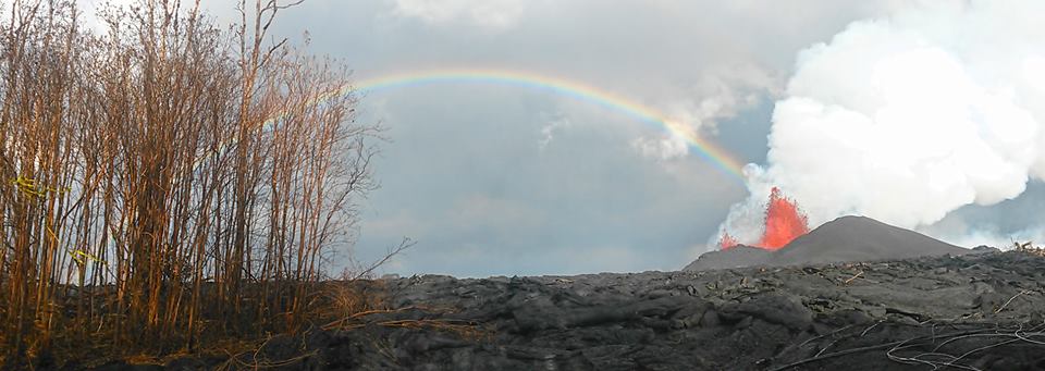
USGS/HVO photo of Fissure 8, spatter cone and rainbow, June 6.
Today’s Eruption Update:
Last night, USGS scientist Steve Brantley explained the current eruption in an informative 10 minute talk. I transcribed it as a separate post, but here’s a rough summary: Magma heading down to the Lower East Rift Zone is causing the summit to deflate. Deflation is causing a pattern of more and more earthquakes over 30-50 hours until the summit releases the strain with an explosion, accompanied by an ash cloud.
Sure enough, there was an M5.6 explosion and 10,000 foot ash cloud at 4:32pm. HVO’s Twitter account had a great impromptu Q&A session about it (see below).
Meanwhile, down in the Lower East Rift Zone, Fissure 8 shows no signs of slowing. It’s wiped out Vacationland and nearly all of Kapoho Beach Lots, and is continuing to create new (crumbly, hazardous) beachfront real estate.
USGS has also been posting some striking imagery today.
Video description: “HVO’s mid-day overflight on June 5 shows ongoing partial collapse of Halema‘uma‘u at the summit of Kīlauea Volcano. To the north of the former visitor Overlook parking area (closed in 2008) is the site of the former lava lake—now a deep hole piled with wall-rock rubble. The western portion of Halema‘uma‘u has moved down and toward the center of the crater as new cracks form on the caldera floor to the west. Kīlauea’s summit continues to subside due to withdrawal of magma towards the volcano’s East Rift Zone.”
They’ve also posted drone footage of Fissure 8 lava flow on June 3. Houses give a sense of scale: