August 27: After Fire, Flood (Hurricane Lane)

August 22, 2018. USGS: “Parts of Kīlauea’s caldera floor are now a jumble of down-dropped blocks and surface cracks. HVO field crews carefully hiked along Crater Rim Drive yesterday to verify the locations of USGS benchmarks (lower left), which will be used for additional geophysical work that will help document the recent summit changes. The view is to the northwest with one flank of Mauna Loa visible in the distance (upper right).” (Full-sized)
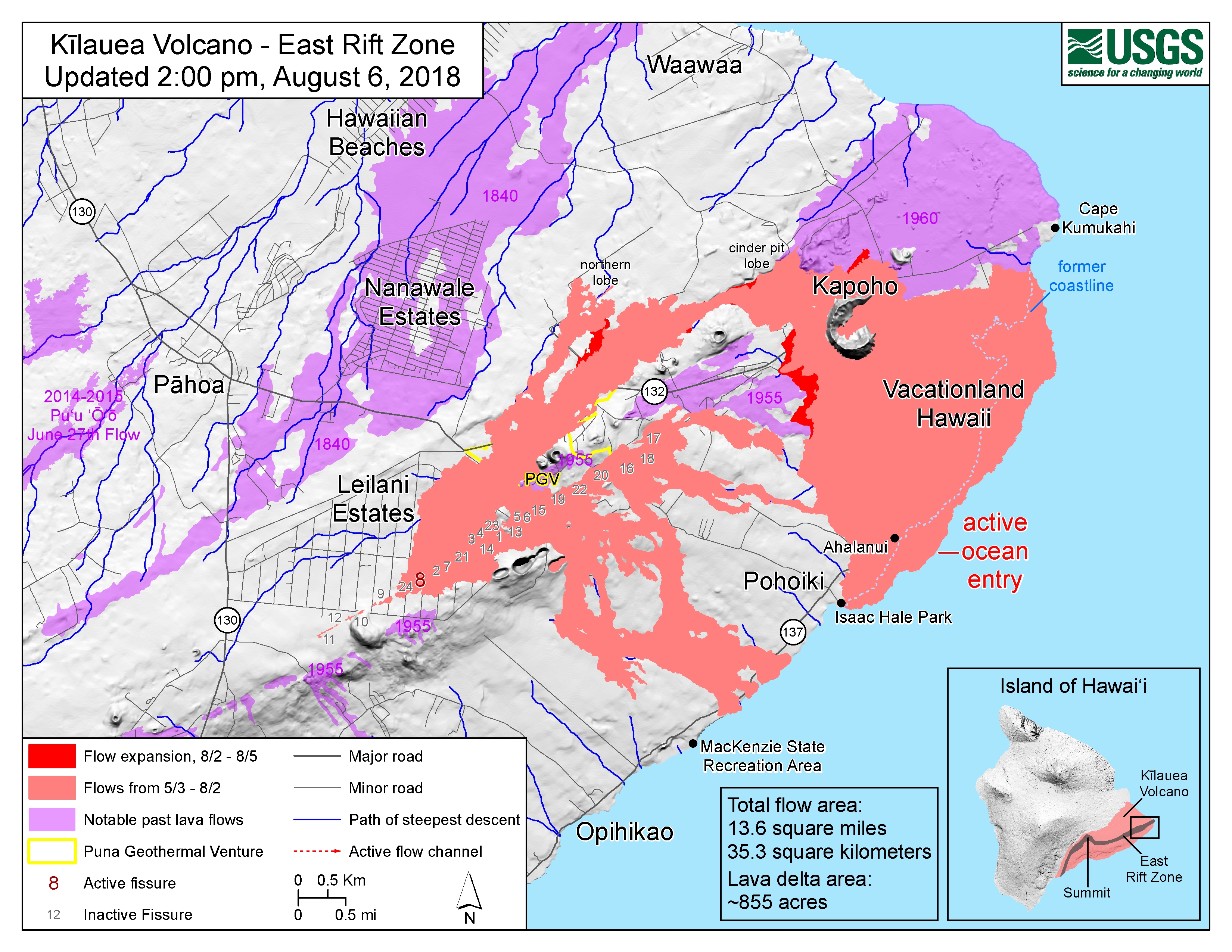
Weekly Eruption Summary

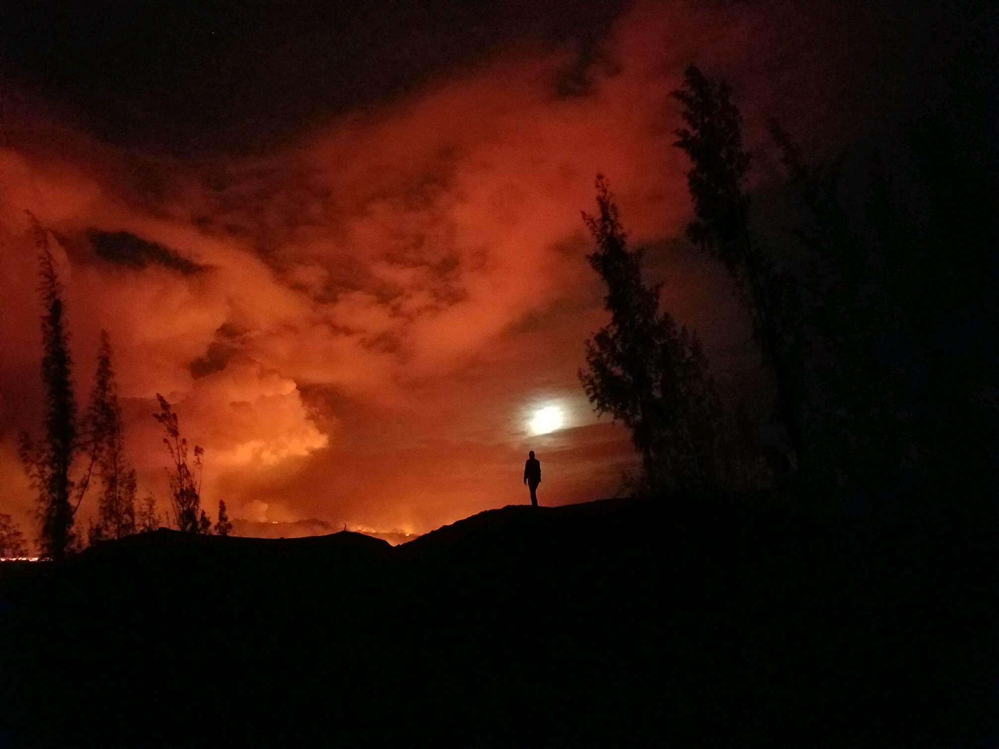
After a busy few months, Kilauea continues to rest with only a pilot light on, so to speak. This week’s big news was that Hurricane Lane passed offshore of the Big Island on Thursday through Saturday, causing extensive flash flooding. But there’s still a little news to report on the dying (?) embers of Kilauea’s 2018 eruption.

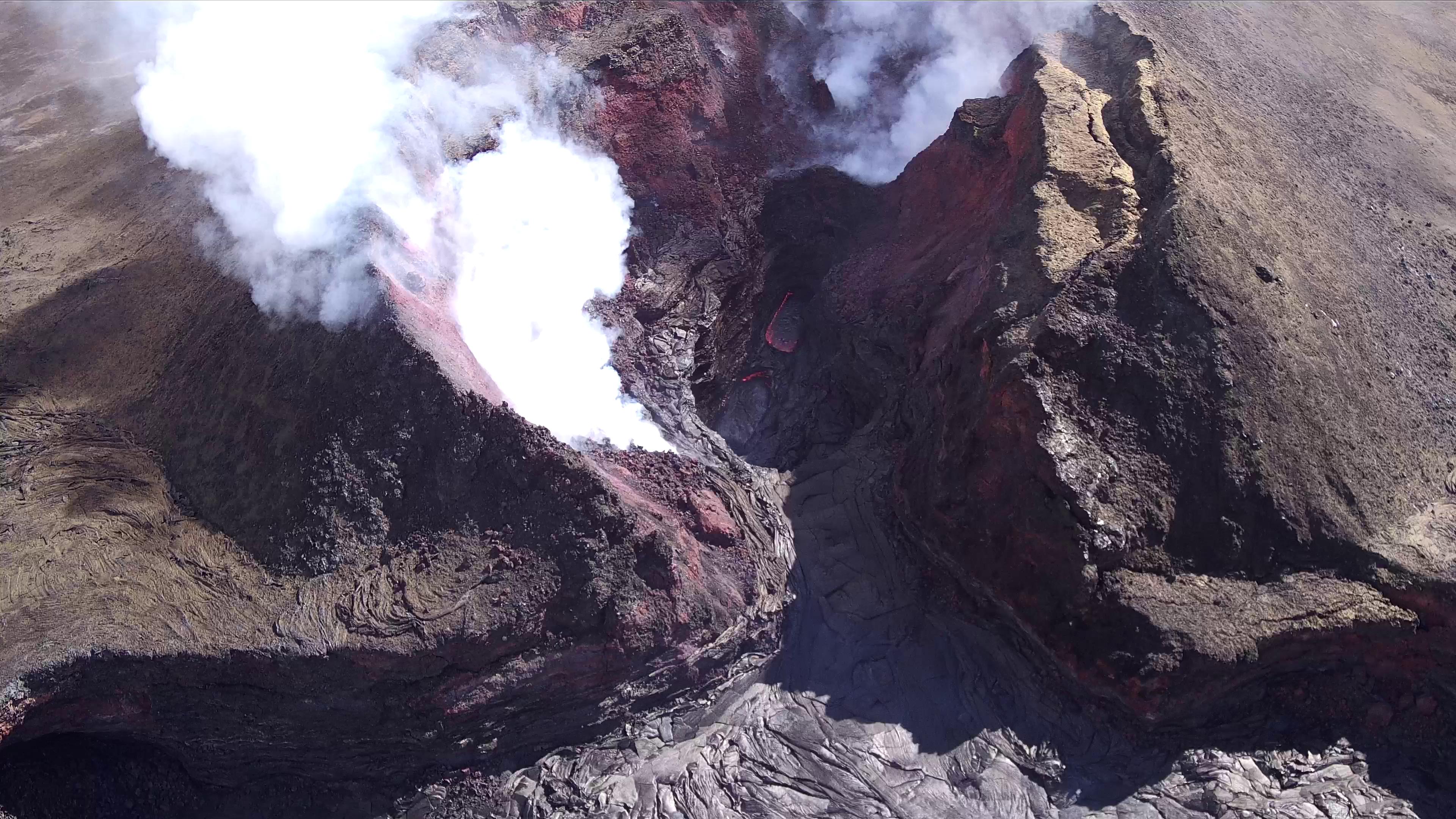
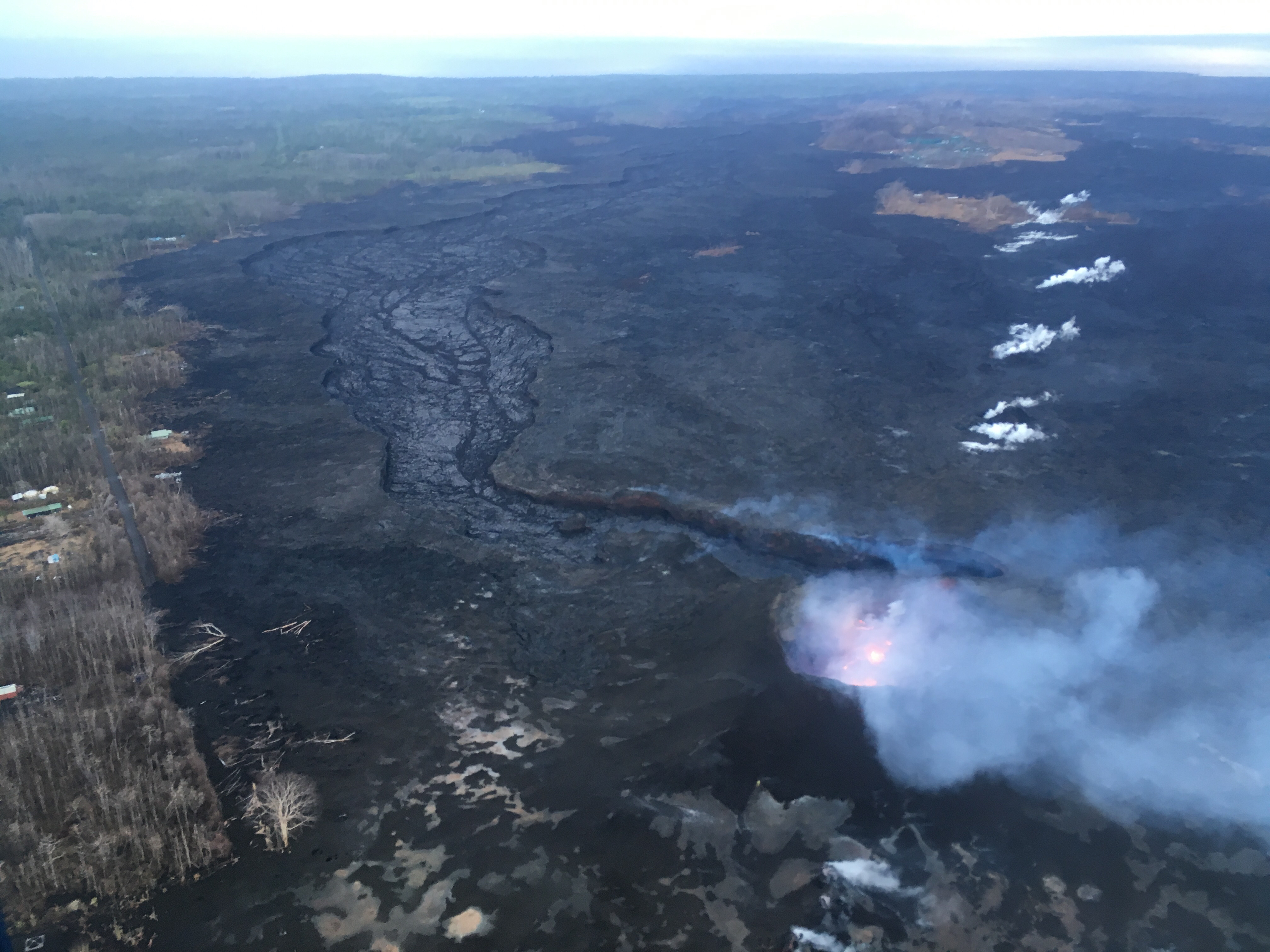
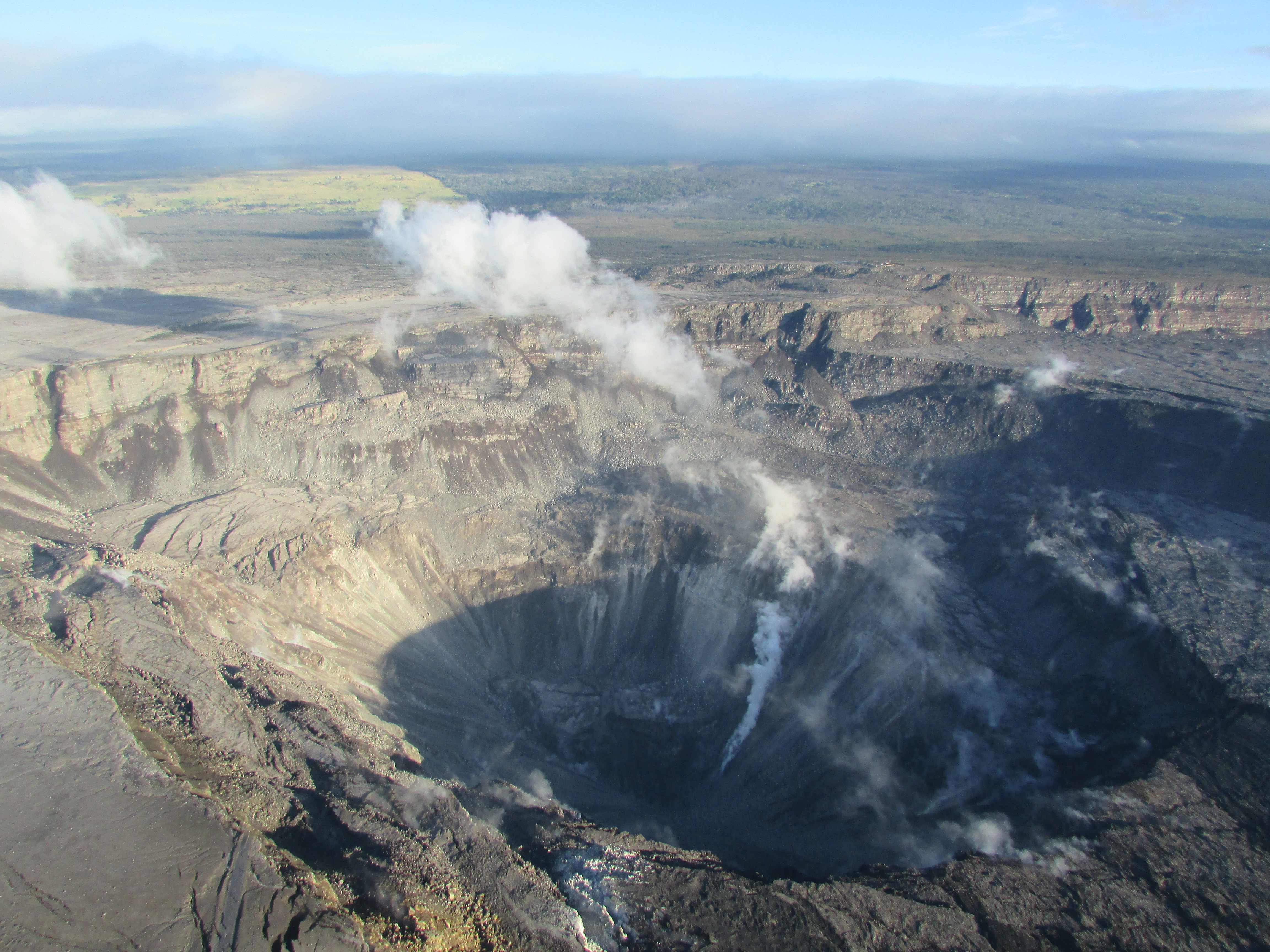
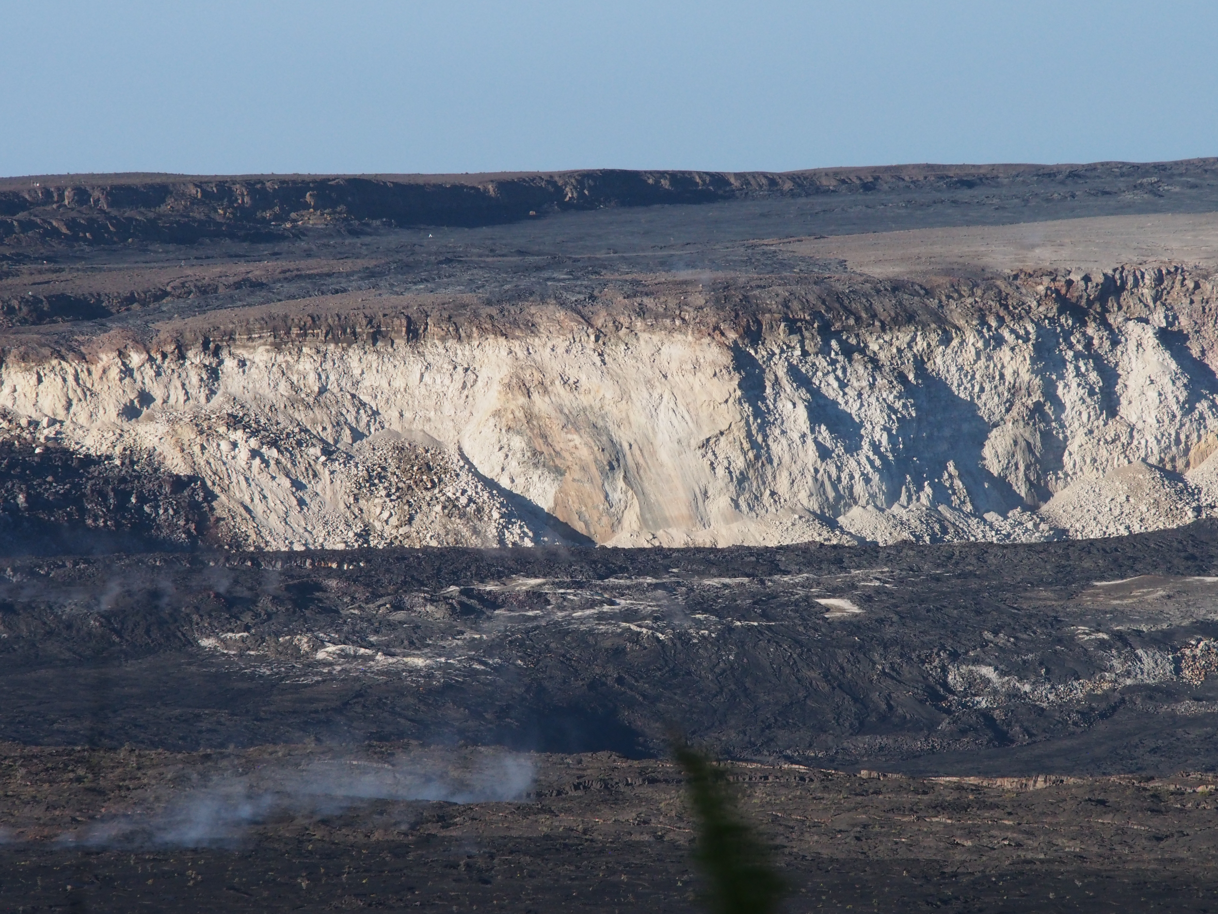
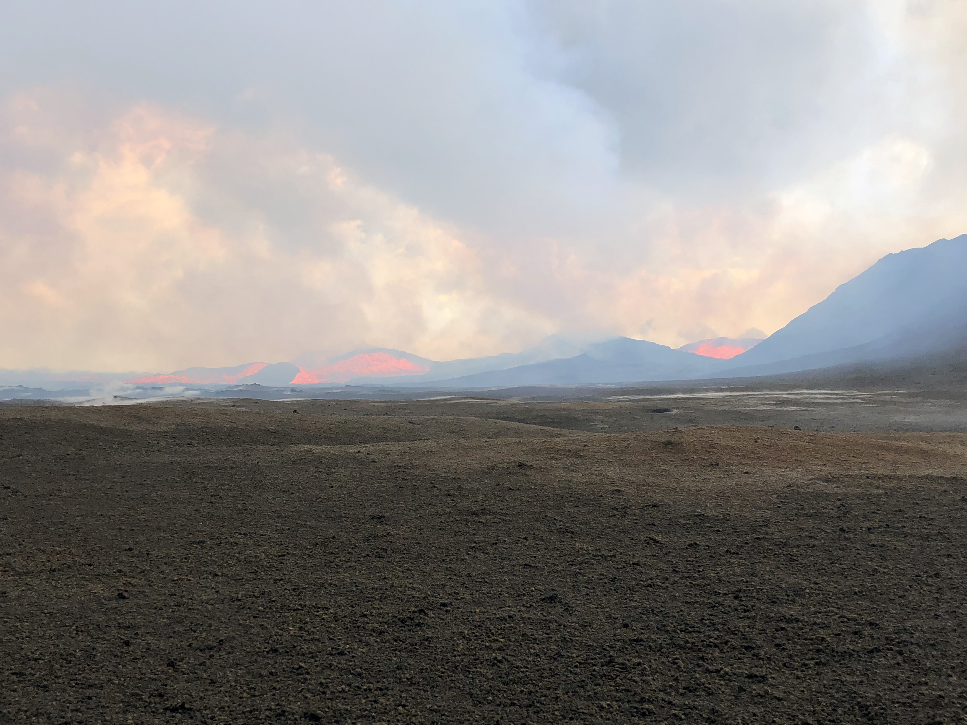
On Friday morning, the Hawaii County Fire Department observed a small lava pond still visible deep in Fissure 8’s cone. For most of the week, there was no visible activity apart from a few small jets deep in the cone throwing weak spatter on Monday morning:

August 20, 2018. USGS: “This morning, USGS scientists flying over fissure 8 noticed a change in the vent from yesterday. Gas jets were throwing spatter—fragments of glassy lava (light gray deposits)—from small incandescent areas deep within the cone. This activity is an indication that the lower East Rift Zone eruption may be paused rather than pau (over).” (Full-sized)

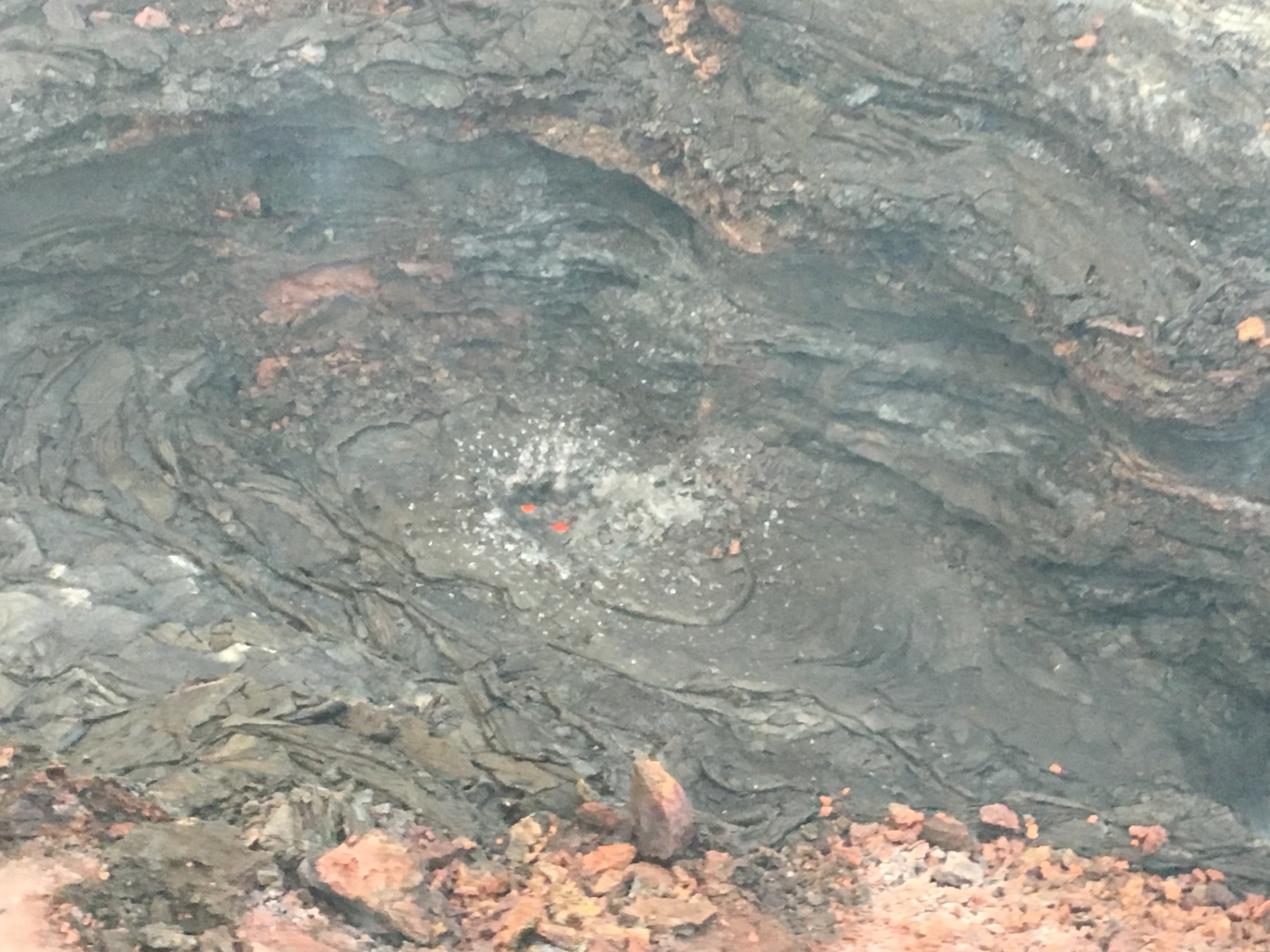
The sputtery jets proved to be temporary:

August 21, 2018. USGS: “Southward facing aerial view of the fissure 8 cone. The two small areas of incandescence, gas jetting, and spatter from yesterday photograph appeared crusted over today.” (Full-sized)

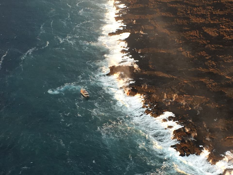
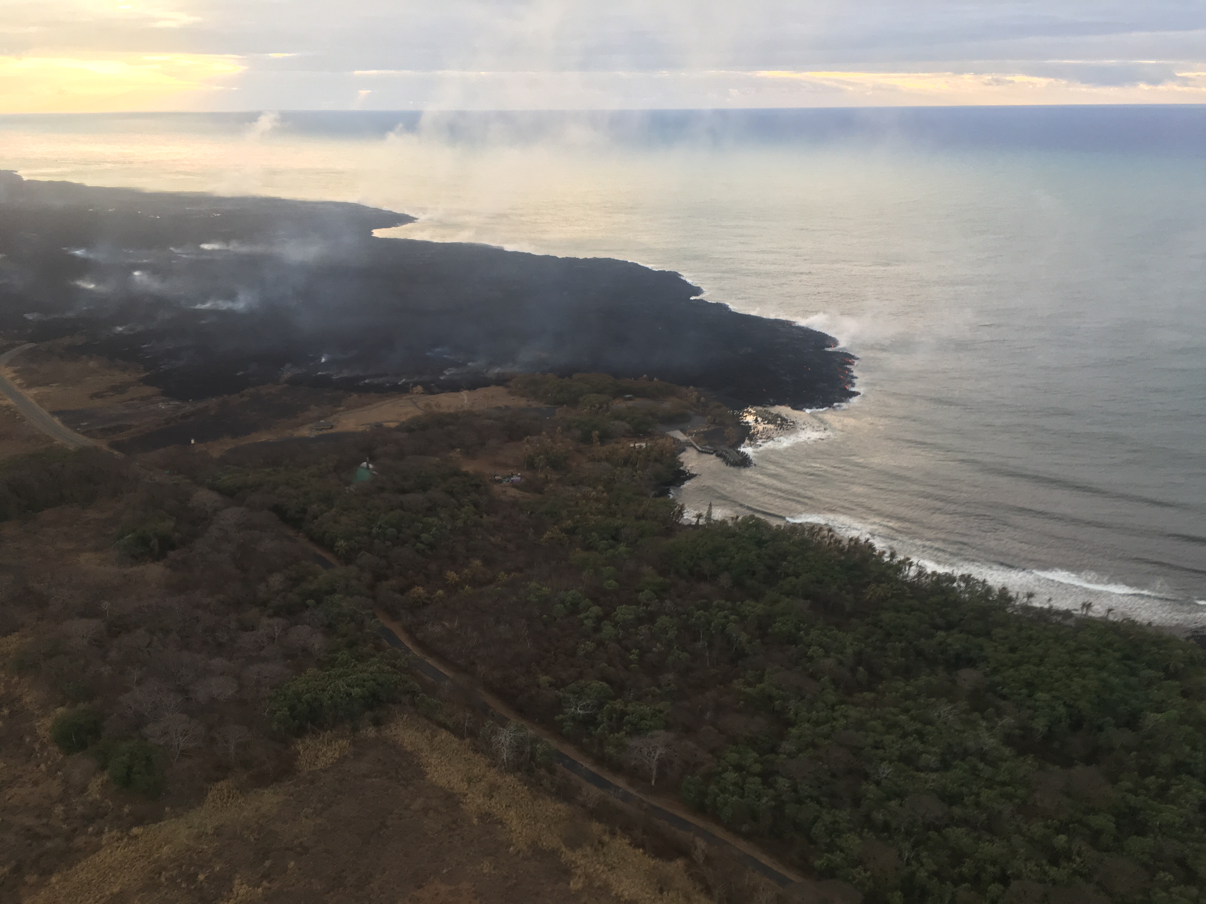
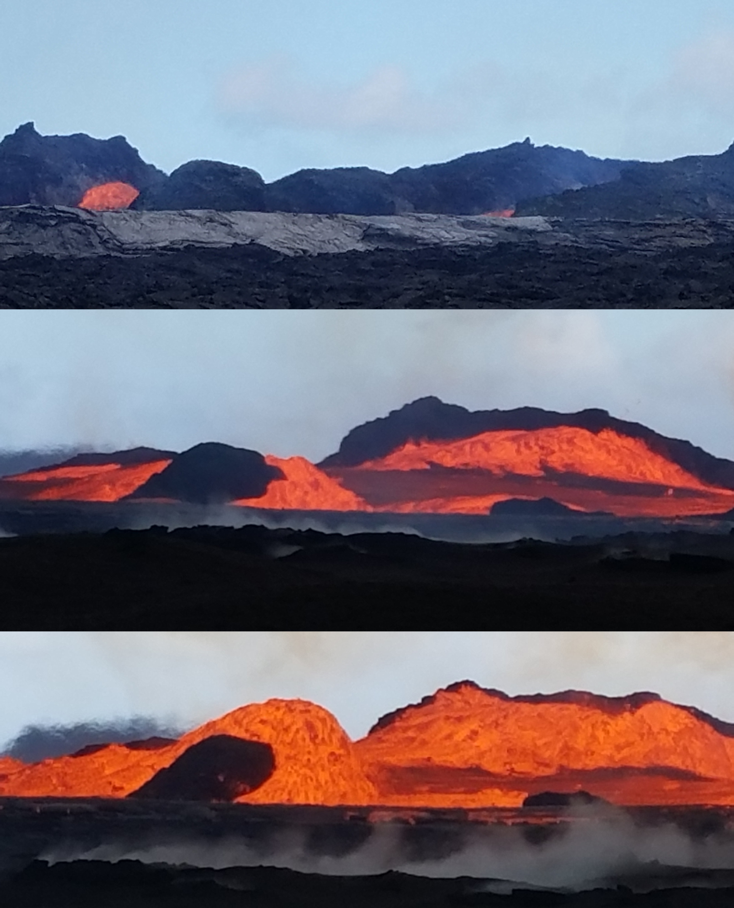
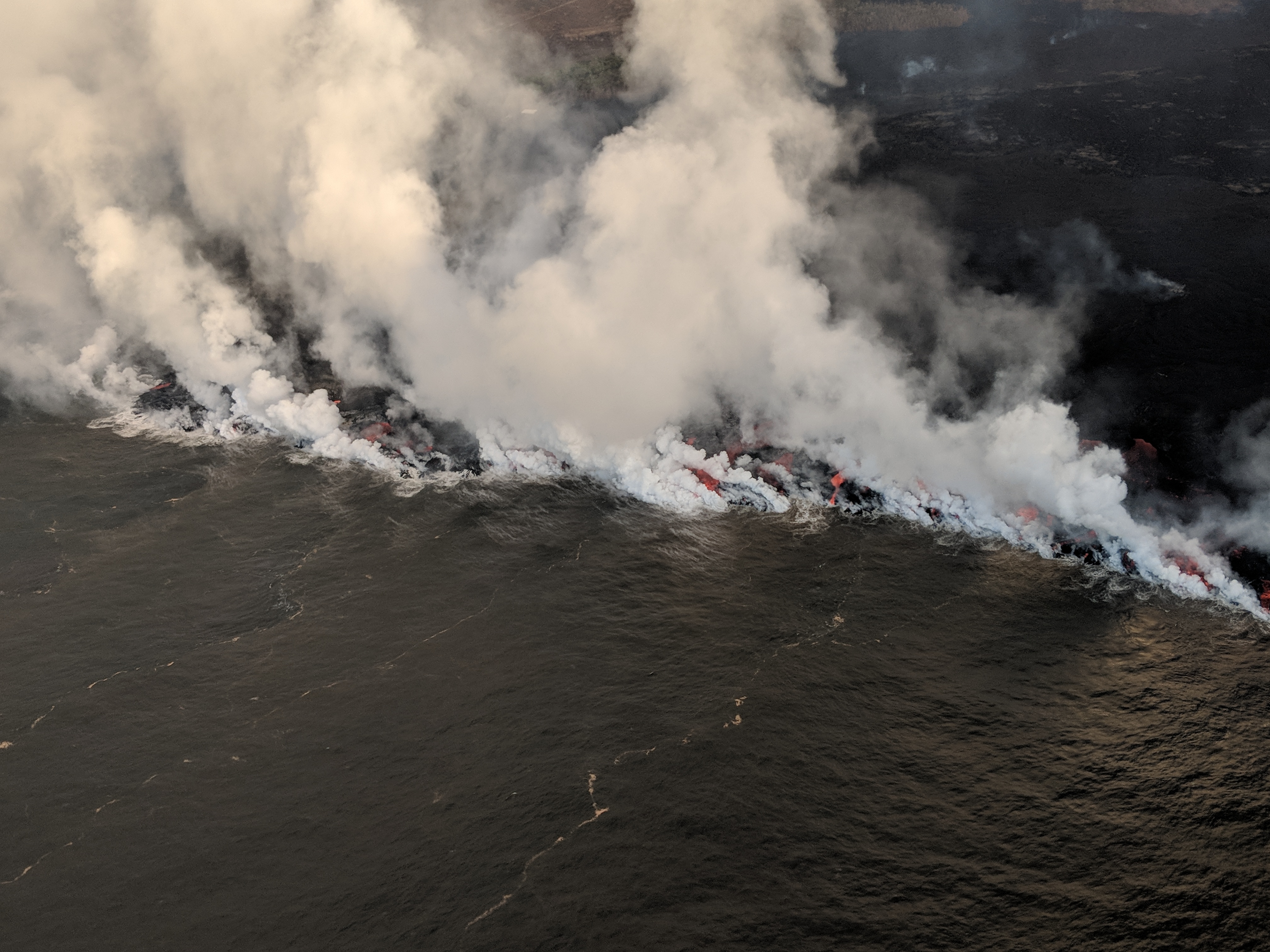
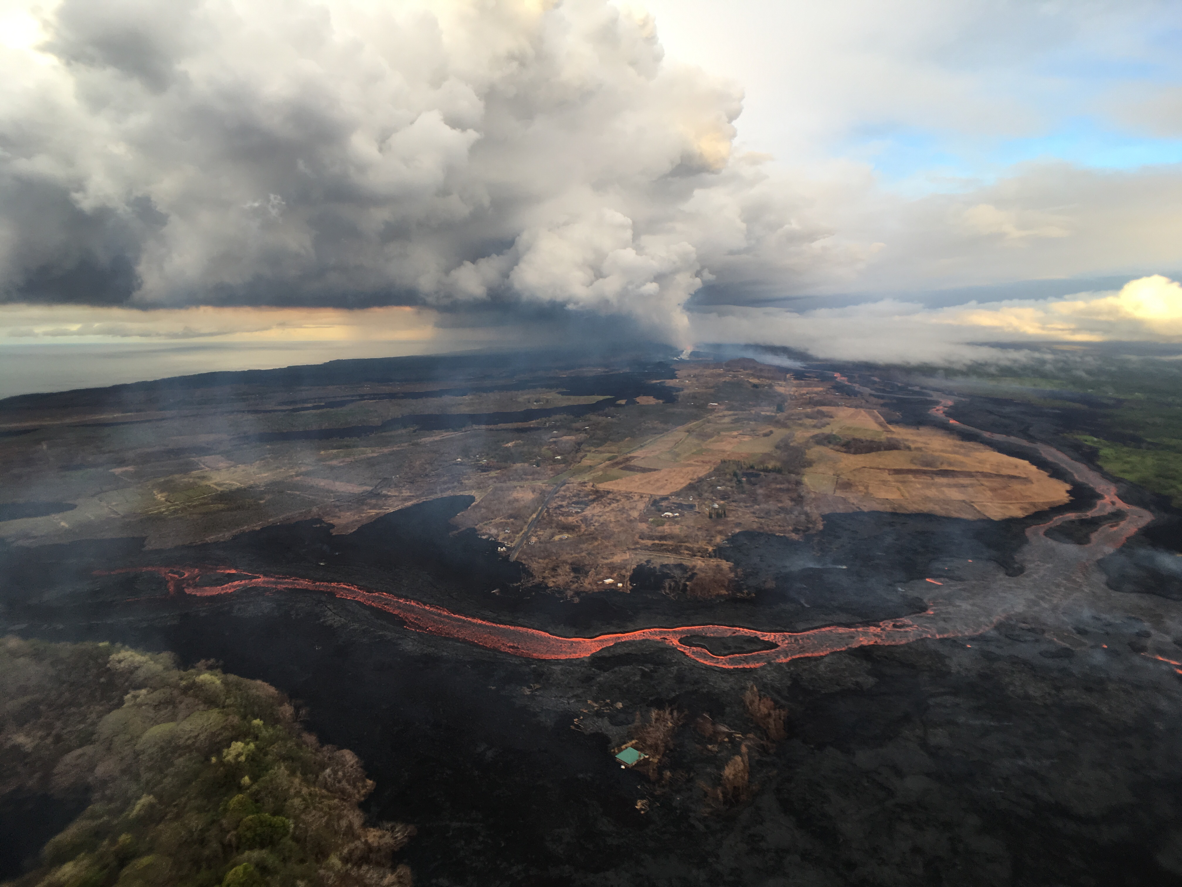
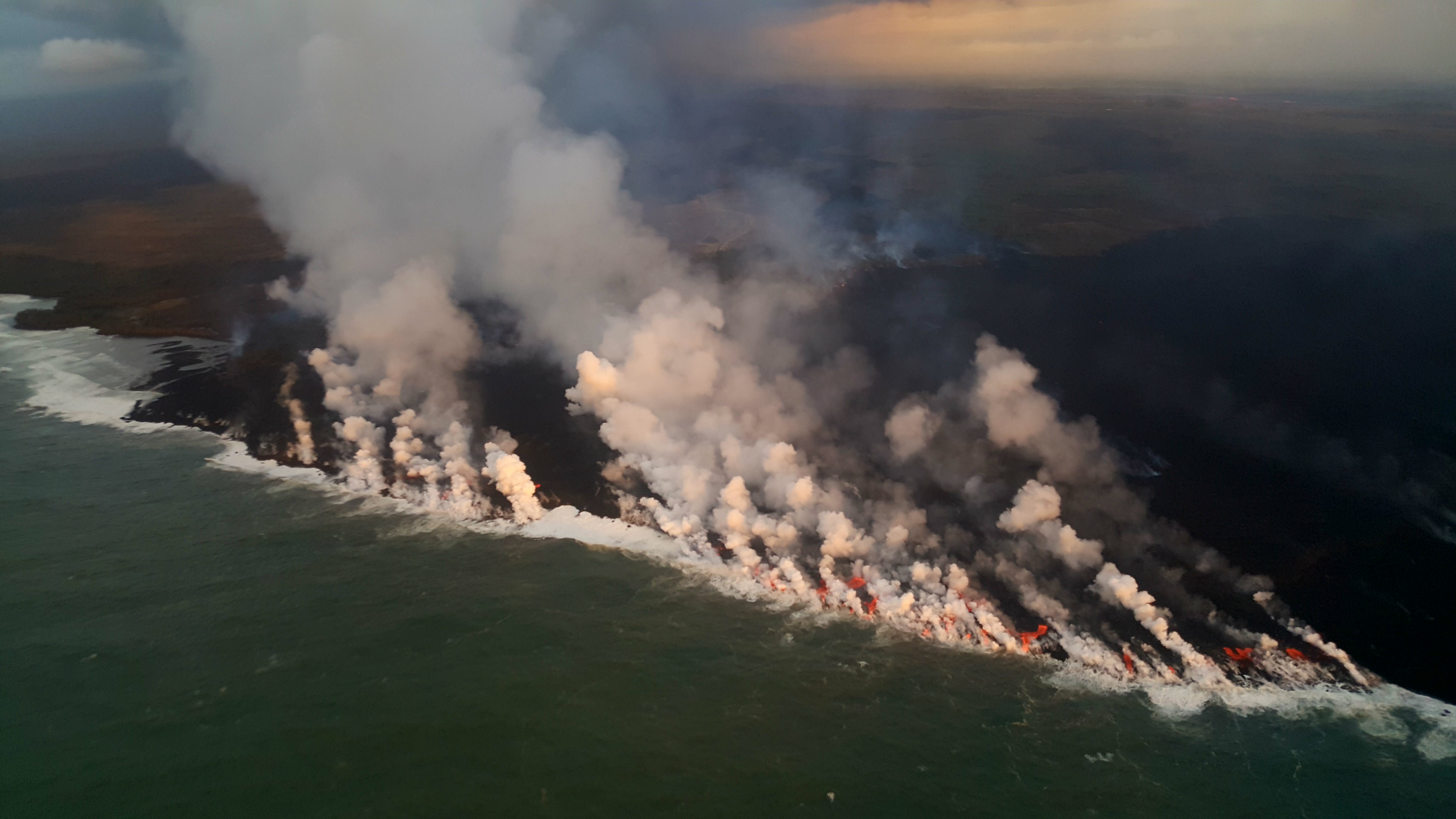
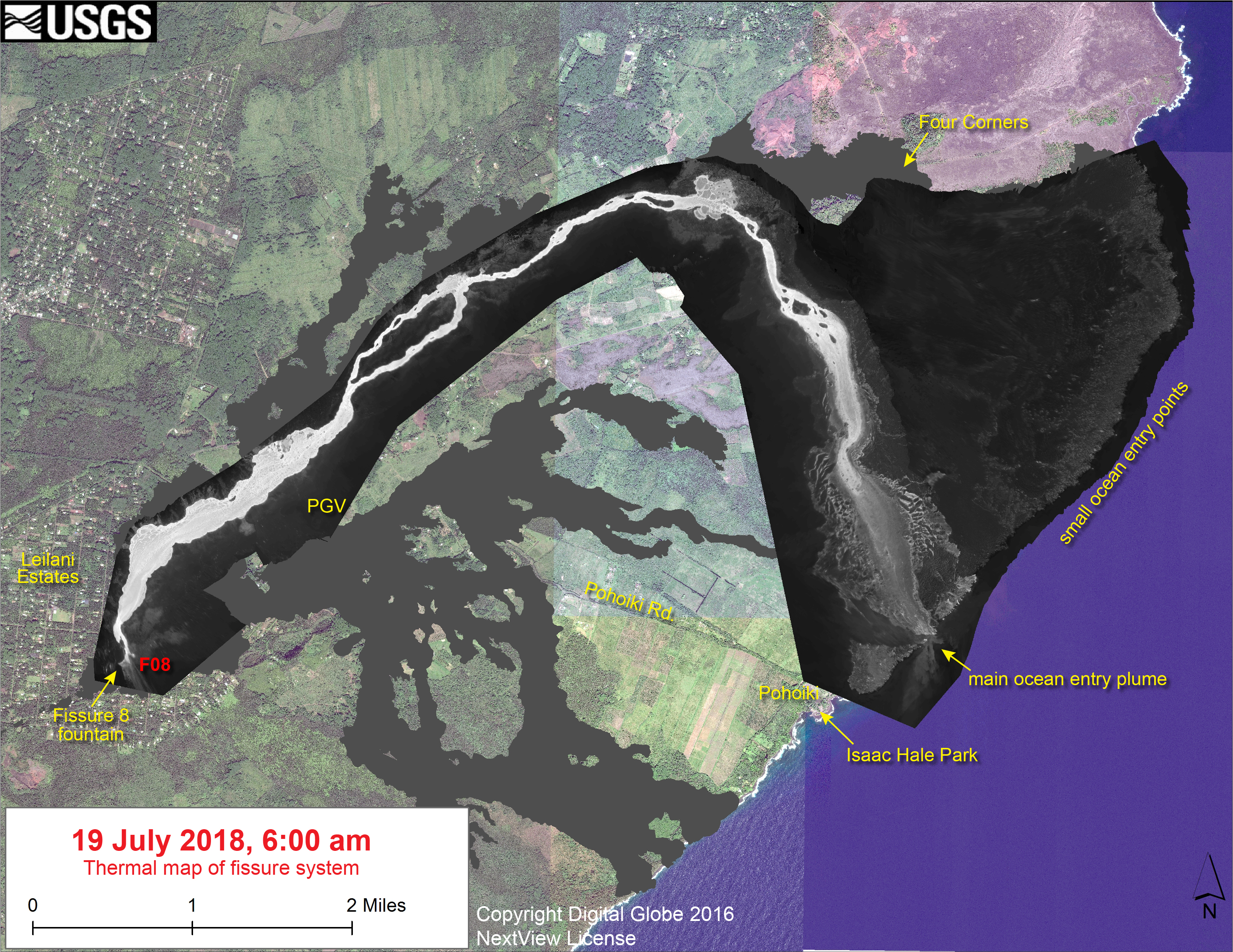
Down at the ocean at Kapoho, there were a few weak dribbles of lava continuing to drain out of the delta at the beginning of the week:

August 20, 2018. USGS photo of residual lava entering ocean, posted on their facebook page here.

Sulfur dioxide emissions continue to be very low both at the summit and the coast. In fact, on Tuesday, they dropped too low in the Lower East Rift Zone for instruments to measure, although not too low for highly-sensitive human noses to detect.

Video from August 17 posted on the 20th— full-sized version here.

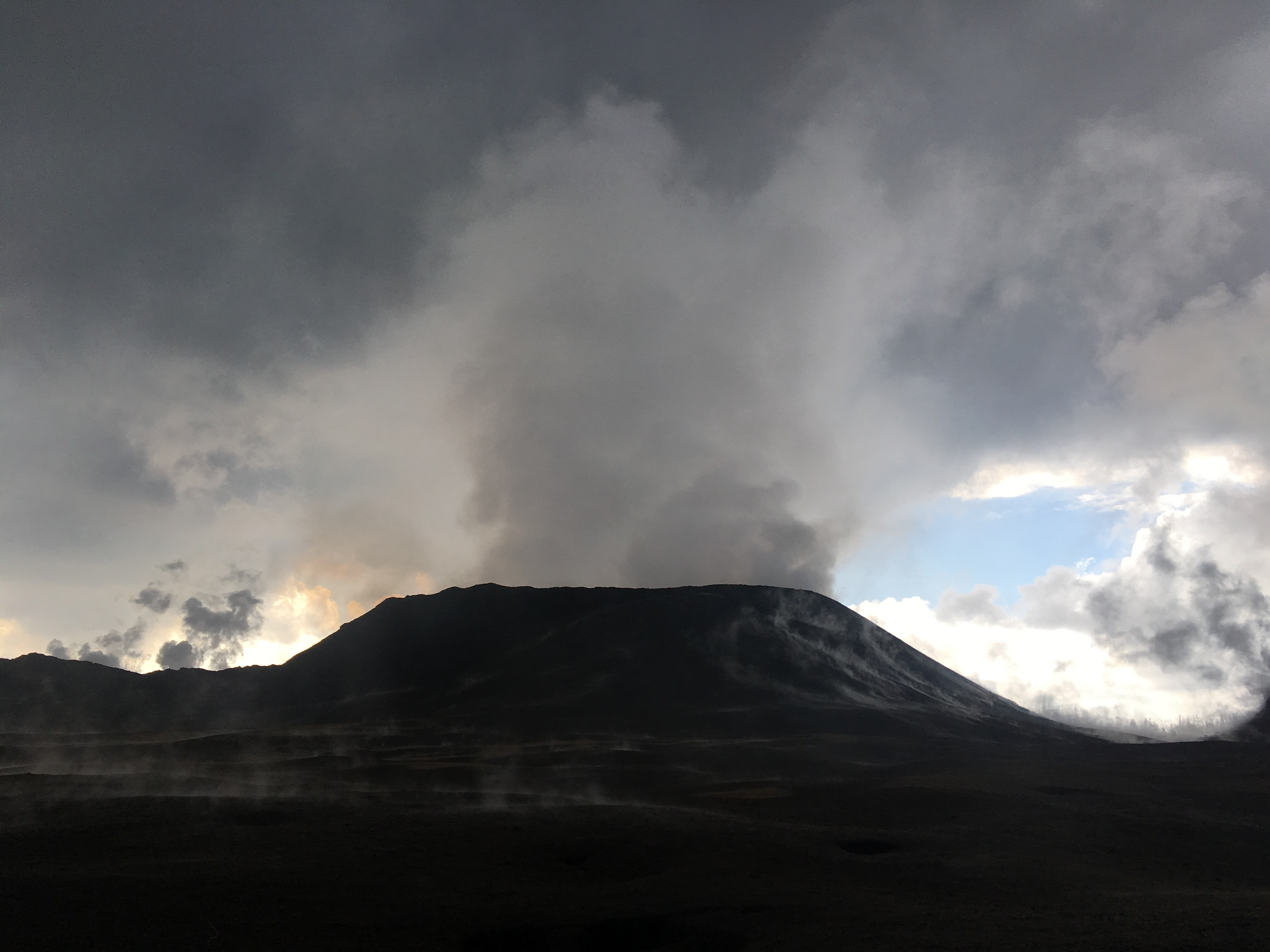
Heavy rain from Hurricane Lane on Friday and Saturday put a hold on USGS overflights and field observations and knocked out a few sensors on the east side of the island. But Kilauea’s extensive sensor network means there was no gap in volcano monitoring, and field crews were on call just in case.

The hurricane had no impact on the volcano apart from heavy rainfall hitting hot rocks and turning to steam in Pu’u O’o’s crater and on the not-yet-cooled lava flows of the LERZ. There were some reports of local white-out conditions from this steam. Rain may also have triggered a few rockfalls at the summit.

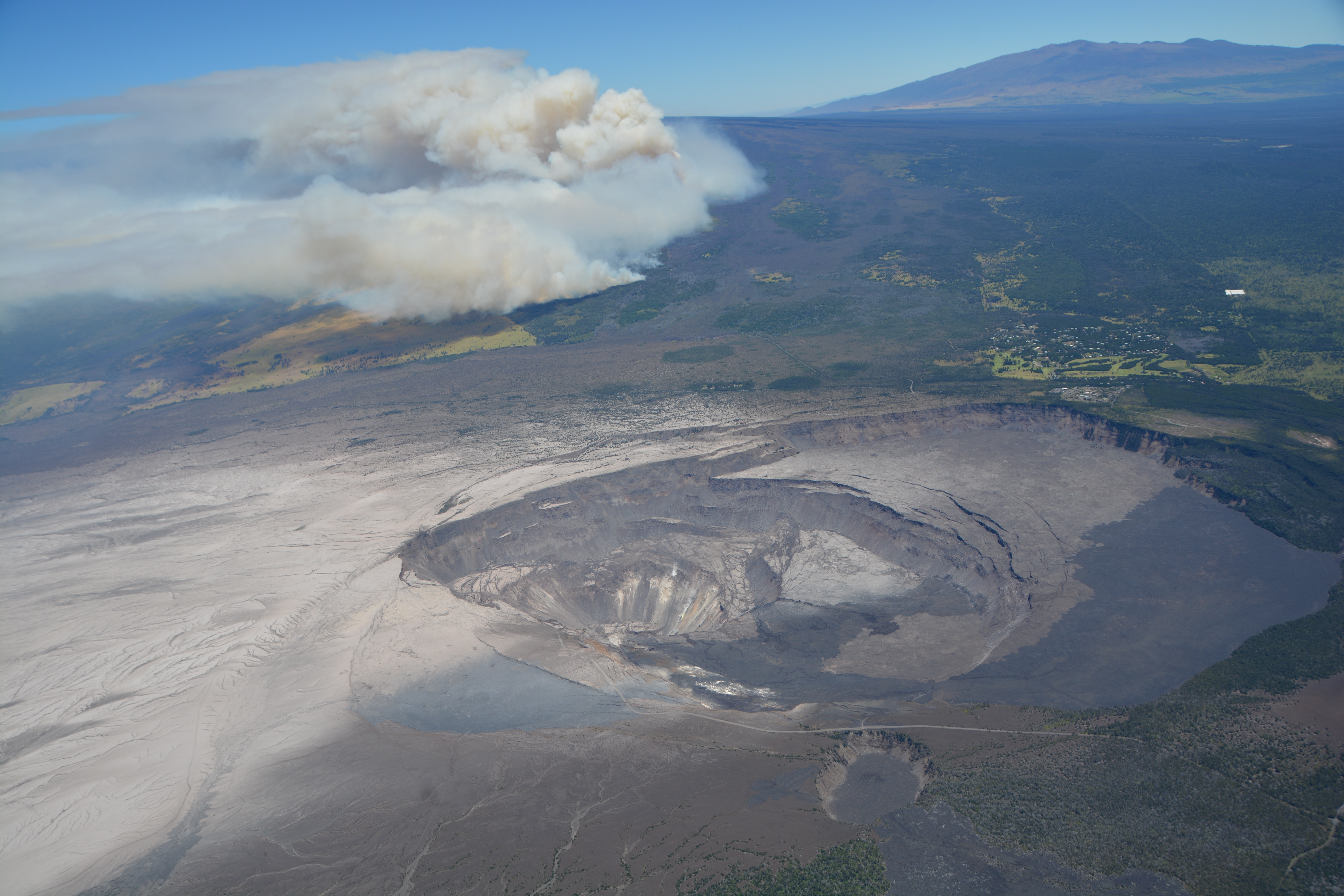
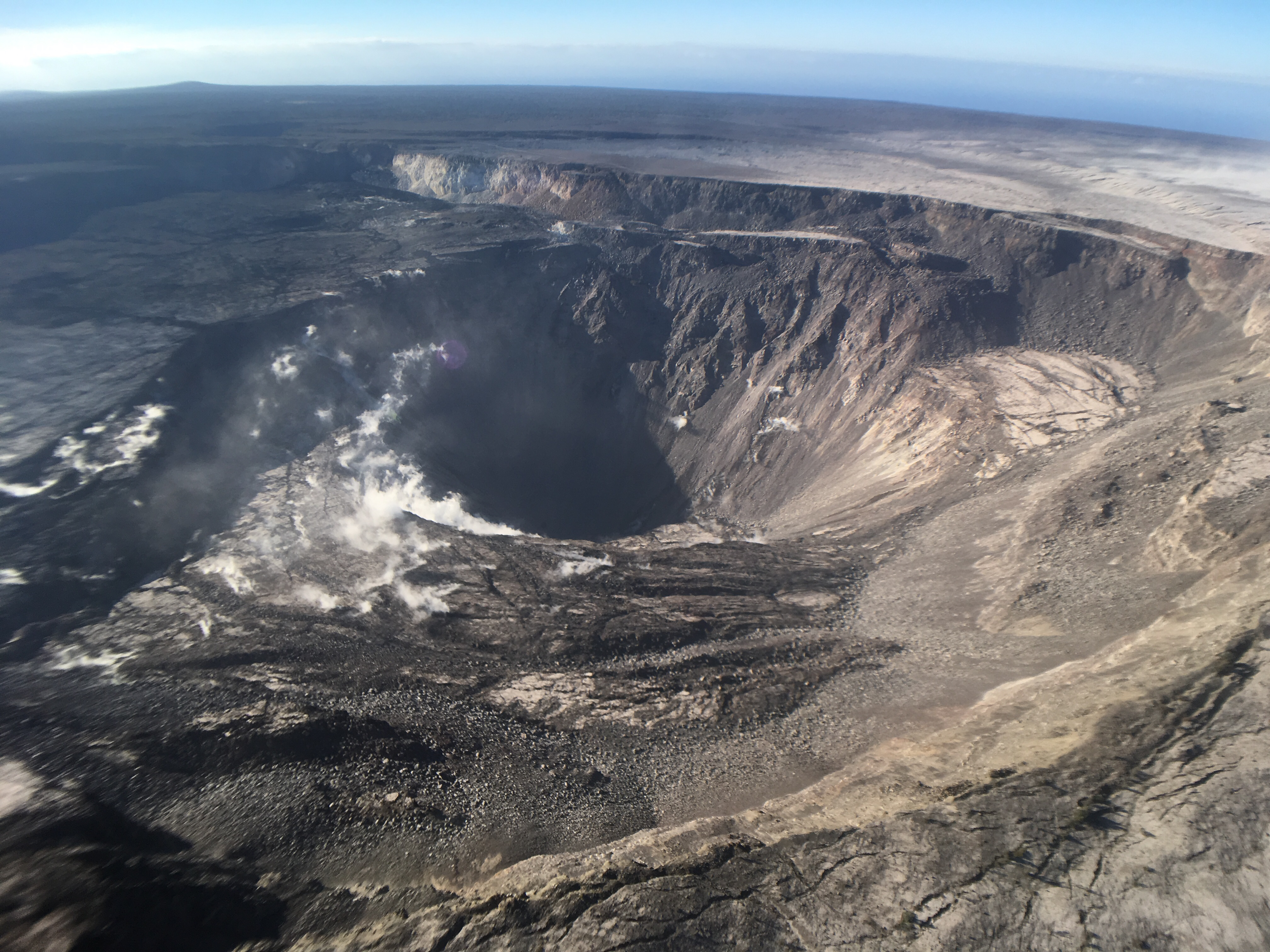
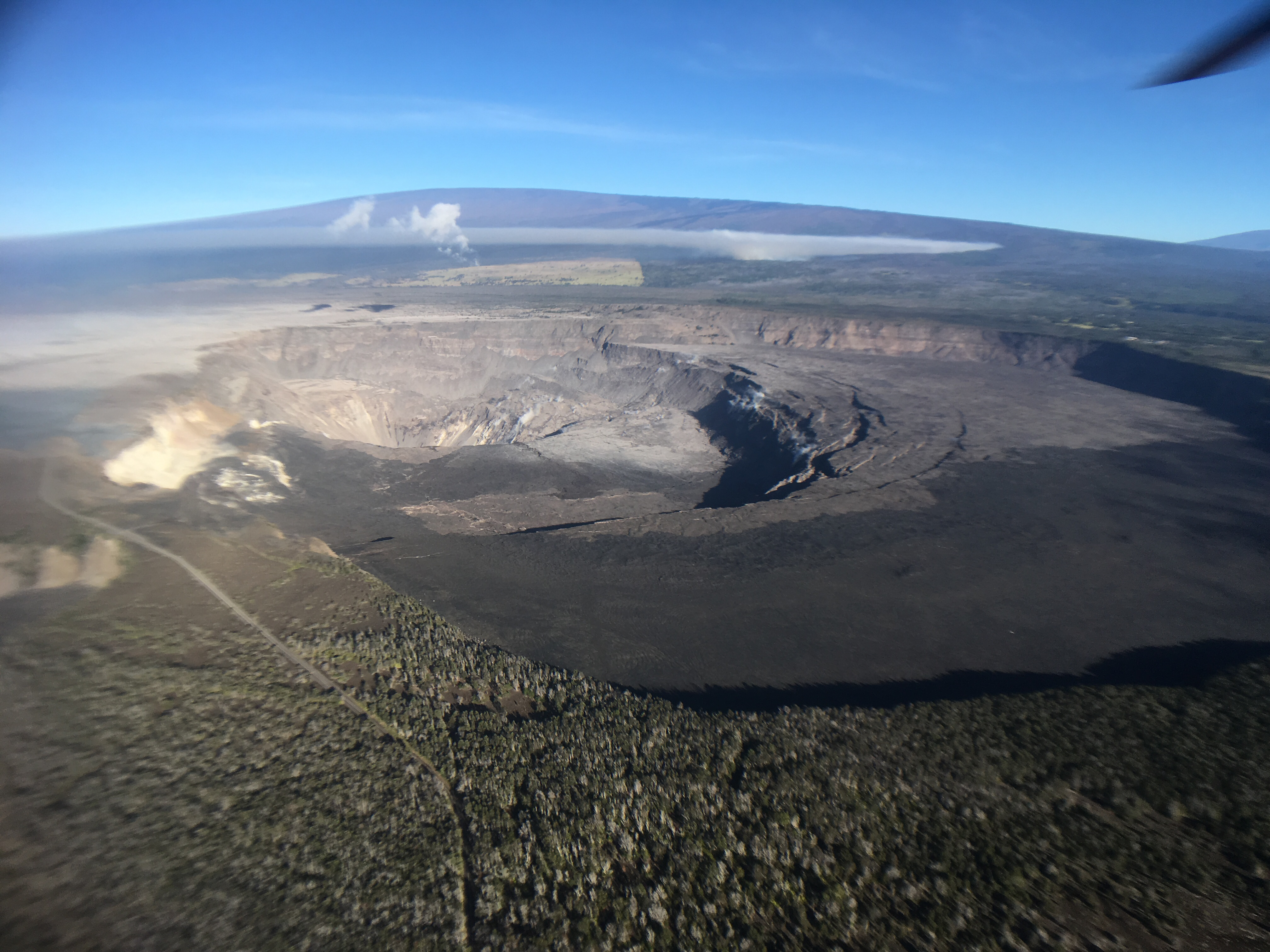
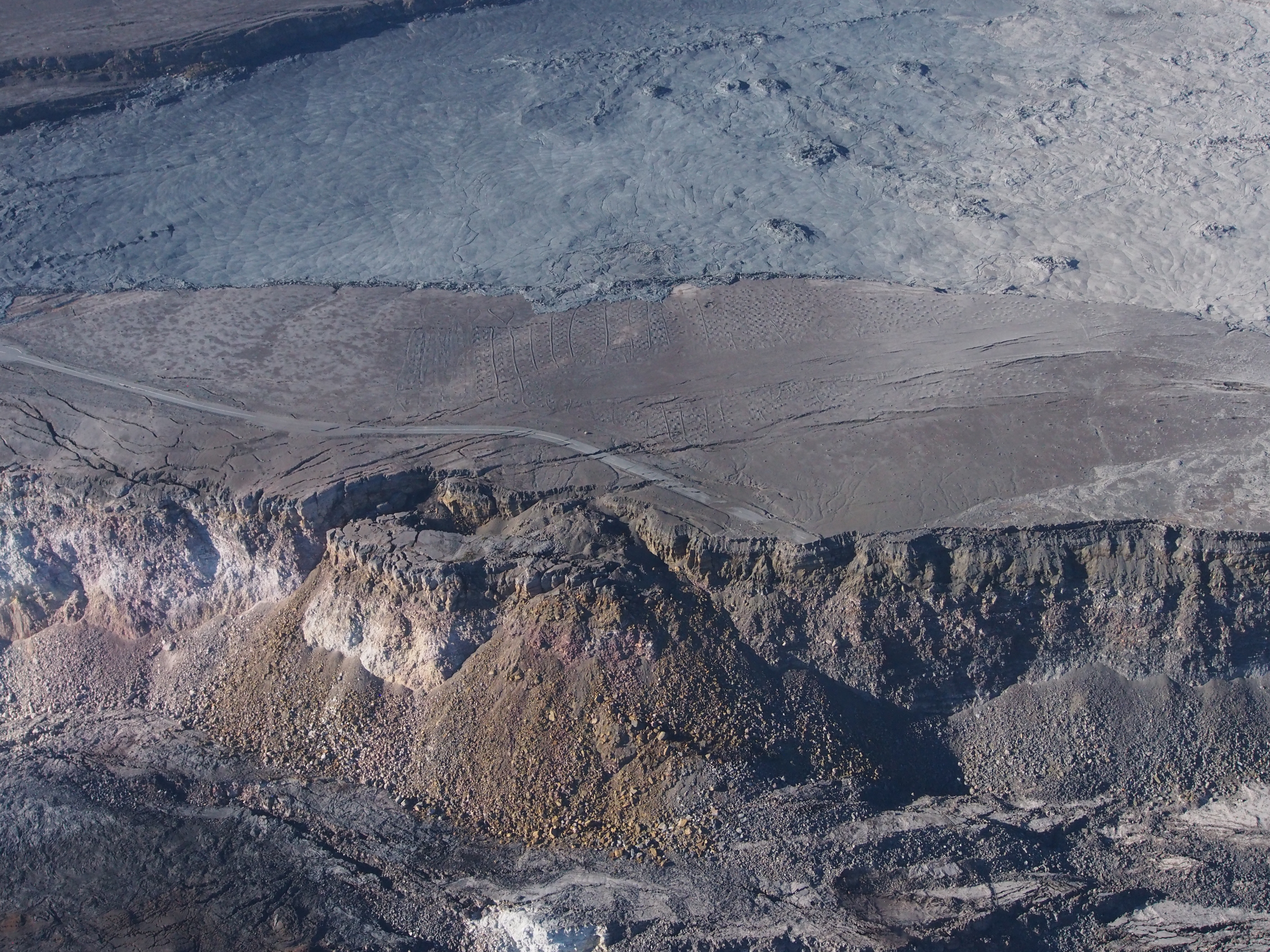
The other big Kilauea news this week is that Hawaii Volcanoes National Park has set a target reopening date for September 22, aiming to reopen at least the Visitor Center and (they hope) some kind of viewing area from which visitors will be able to see the new, larger Halema’uma’u Crater. They’re also hoping to open Volcano House, but they need to check the stability of the cliffs on which it stands.

USGS Volcano Watch

Whoops! I think I missed last week’s edition. This is Hawaiian Volcano Observatory’s weekly column with photos and in-depth information on some aspect of Kilauea.

Continue reading August 27: After Fire, Flood (Hurricane Lane)

August 19: The Lull Continues

This Week’s Eruption Activity

Negligible. There’s a few residual bits of lava oozing into the ocean at Ahalanui. Otherwise, there’s not much going on at the summit or LERZ.

[In case Tweet above isn’t showing, here’s the 3D Fissure 8 video on HVO website.]

USGS: “This thermal map shows the fissure system and lava flows as of 6 am on Wednesday, August 15 [2018]. Residual lava in the Fissure 8 flow continues to drain, feeding numerous small ocean entries. In the Fissure 8 cone there was a single, small lava pond.” (Full-sized)
On Friday August 19, HVO lowered ground alert levels, just as they lowered aviation alert levels after the ash explosions stopped. Here’s the official notice:

In light of the reduced eruptive activity at Kīlauea Volcano over the last several days, HVO is lowering the Alert Level for ground based hazards from WARNING to WATCH. This change indicates that the hazards posed by crater collapse events (at the Kīlauea summit) and lava flows (Lower East Rift Zone; LERZ) are diminished. However, the change does not mean with absolute certainty that the LERZ eruption or summit collapses are over. It remains possible that eruption and collapse activity could resume.

[…]

Remarks: Background and Prognosis

Kīlauea Volcano has remained quiet for well over a week now, with no collapse events at the summit since August 2. Except for a small, crusted-over pond of lava deep inside the fissure 8 cone and a few scattered ocean entries, lava ceased flowing in the LERZ channel on August 6. Sulfur dioxide (SO2) emissions rates at the summit and LERZ are also drastically reduced (the combined rate is lower than at any time since late 2007).

It remains too soon to tell if this diminished activity represents a temporary lull or the end of the LERZ lava flows and/or summit collapses. In 1955, similar pauses of 5 and 16 days occurred during an 88-day-long LERZ eruption. During the Mauna Ulu eruption (1969-1974), a 3.5 month pause occurred in late 1971.

HVO will continue to record detailed visual observations and scrutinize incoming seismic, deformation, and gas data, looking for evidence of significant movement of magma or pressurization as would be expected if the system was building toward renewed activity.

Also on Friday, the National Park Service issued a media release and gave select local media a guided tour of the summit. Lots of info, and worth seeing:

This Week’s USGS Photos From Summit to Sea

Continue reading August 19: The Lull Continues

August 12: Pele Is Still Sleeping, Part 1

August 11, 2018. USGS: “The UAS team (Unmanned Aircraft Systems) flew a mission over fissure 8 to assess conditions within the cinder cone. As shown, fissure 8 contains two small ponds deep within its crater. One pond slowly circulates with an incandescent surface while the other pond is stagnant with a crusted top.” (Fuil-sized)
Weekly Eruption summary

So it’s finally arrived, the end (or at least intermission) of Fissure 8’s endless outpouring of lava from May 27 to August 4. The shutdown happened at the end of last week over a period of just 2-3 days.

August 11, 2018. USGS: “The fissure 8 cinder cone is currently about 30 m (100 ft) tall with a very broad base. Sulfur dioxide (SO2) emissions are low, reflecting the diminished activity of the lava ponds in the cone.” (Full-sized)

Fissure 8 isn’t quite dead. There’s lava pooled deep down the cone, bubbling weakly. Residual lava is still draining out of the lava delta into the ocean, some of it quite near the now-famous Pohoiki Boat Ramp. But most of the surface channels have drained and solidified.

August 11, 2018. USGS: “Close view of the Pohoiki boat ramp during this morning’s overflight. The southern-most flow margin has not advanced significantly toward the Pohoiki boat ramp, but black sand and larger fragments from the entry areas have washed ashore to create a sand bar and beach at this site. Geologists observed several small lava streams trickling into the sea along the souther portion of the lava delta, producing weak laze plumes.” (Full-sized)

The volcano’s summit has settled, too. The caldera floor isn’t inflating or deflating, and the swarms of earthquakes and summit collapses have stopped.

So now the question becomes: how long do geologists, national park staff and residents wait before deciding it’s safe to start repairing the damage? Past Lower East Rift Zone eruptions have paused for days, even weeks. So scientists and officials continue to warn that this eruption could resume at any time.

August 7, 2018. USGS: “Civil Air Patrol captured this image of Kīlauea’s summit yesterday (August 7, 2018), providing a stunning view of Halema‘uma‘u and the collapsed area within the caldera. Prevailing trade winds have blown much of the ash emitted during earlier explosions to the southwest (left), where thin layers of light-colored volcanic ash now blanket the landscape. Plumes of smoke rising from the flank of Mauna Loa were from a brush fire that continues burning today. Mauna Kea is visible on the upper right horizon; the crater visible at bottom center is Keanakāko‘i.” (Full-sized)

This week’s Volcano Watch column from Hawaiian Volcano Observatory, written August 9, addresses exactly that question:

“Is Kīlauea Volcano’s summit and rift zone activity pau or paused?”

Also, it looks like I missed an August 6 USGS news media briefing discussing the eruption’s apparent shutdown (full audio).

Now let’s look back at recent images and videos posted on HVO’s Photo & Video Chronology page, which only shows the 10 most recent posts— so these are visible there now, but won’t be in the future.

First of all, remembering past collapse events— with sound! Full-sized video posted here, or a faster-loading small version on Twitter:

Continue reading August 12: Pele Is Still Sleeping, Part 1

August 6: Kīlauea Falls Quiet

August 6, 2018. USGS: “Kīlauea’s summit remains quiet following the most recent collapse event on August 2 at 11:55 a.m. HST. This quiet is a significant departure from the pattern of episodic seismicity and continuous deformation over the past several months, with very low rates of seismicity continuing today. Deformation at the summit as measured by tiltmeter and GPS instruments slowed and virtually stopped between August 4 and 5. This view of Halema‘uma‘u is toward the southeast.” (Full-sized)

Today’s Eruption Summary

Little lava is leaving Fissure 8 today. It’s still bubbling away within the cone, but the channel below it is crusted over, with only residual lava draining down towards Ahalanui and the edge of Isaac Hale Park, and almost no laze plume. The summit’s seismicity is way down, and there’s almost no inflation or deflation since August 3. Now the question becomes: is this a temporary pause, or is this eruption really over?

(Full-sized version of this video)

Today’s Volcano update (12:49 PM HST) paints a picture of a pause – but we’re not yet ready to say if it’s a full stop.  https://volcanoes.usgs.gov/volcanoes/kilauea/status.html

@USGSVolcanoes on Twitter

August 6, 2018. USGS: ” This morning’s overflight revealed a weak to moderately active pond of lava bubbling within the fissure 8 cone, but no visible supply of lava from fissure 8 into the channel. The perched channel and braided sections downstream were essentially crusted over with some incandescence noted. Active flow in the channel was observed immediately west Kapoho Crater.” (Full-sized)
August 6, 2018. USGS: “There were small active lava ooze outs at the coast in the vicinity of the former Kapoho Bay and Ahalanui, and the laze plume was greatly diminished. Active lava is close to the Pohoiki boat ramp but did not advanced significantly toward it over the weekend.” (Full-sized)
August 6, 2018. USGS: “High-elevation view of Halema‘uma‘u and the larger Kīlauea Crater from this morning’s overflight, with Mauna Loa in the background. HVO and NPS Jaggar Museum are located on bluffs at the far side of the crater in the center of the view. Note the smoke plume from a still-burning brushfire on the lower flank of Mauna Loa.” (Full-sized)
August 6, 2018. USGS: “This photo shows a portion of the Crater Rim Drive that led from the east to the Halema‘uma‘u parking area, which slid into the growing crater weeks ago. Note a slump block located below and near where the road ends at Halema‘uma‘u. The September 1982 lava flow can be seen in the top of the photograph.” (Full-sized)

By the way, while trying to track down photos of the September 1982 lava flow, I found an old webpage (No datestamp, but Internet Archive first scraped it in 1999) with some interesting aerial photos of Kīlauea Caldera from the 70s and 80s. It would be fun to try to match the 1974 aerial photo with a new one, but I haven’t seen one taken from that high yet.

August 6, 2018, 2 pm HST. Latest USGS map of Lower East Rift Zone. (Full-sized)

At the top of this post, I posted Mick Kalber’s overflight video from this morning. Bruce Omori posted his photos and notes from this flight on the Lava Update blog, same post mirrored on Facebook with a few more observations:

Lava Update for Monday, Aug 6, 2018, 6:00 am – Kilauea's lower east rift zone overflight:Kīlauea's eruptive activity…

Posted by Extreme Exposure Fine Art Gallery on Monday, August 6, 2018

July 28: Mini-Update Plus New Images of Summit

New Image of Halema’uma’u – July 28, 2018
July 28, 2018. USGS: “Aerial view of the summit crater from this morning’s overflight. Zoom in to see HVO and the Park’s Jaggar Museum on the caldera rim (right side of photo).” (Full-sized)

Note the light green mostly-treeless area in background at left, and then zoom in to find museum & observatory on rim at right. Then compare with:

April 13, 2018
BEFORE the big event: Kilauea caldera, April 13, 2018. USGS: “The museum and HVO are perched on the caldera rim (middle right), with the slopes of Mauna Loa visible in the background.” (Full-sized)
Today’s Eruption Summary

Summit collapse event at 2:37 am HST, July 28, 2018. Energy release equivalent to M5.4. Minor overflows on Fissure 8’s channel reported a few hours afterwards. At the coast, the SW edge of the flow remains stalled 175 m from Pohoiki boat ramp, with ocean entry a few hundred meters to its east.

Road crews are monitoring cracks on Highway 130 after increased gas emissions were detected there.

Also, notwithstanding longer intervals between recent summit collapses and a few days where the lava channel seemed lower, HVO doesn’t see any strong indications the eruption is weakening:

More photos from today

Continue reading July 28: Mini-Update Plus New Images of Summit

July 27: Fissure 8 Lava Pulses, Misc Photos

Even though I finished my July 26 post last night at 1 am my time, HVO posted a few more photos after that. They show Fissure 8 pulsing, varying in lava output, not just due to summit collapses but simply as natural fluctuations.

July 26, 2018. Fissure 8 lava pulses. (Full-sized)

Caption: Pulses of lava from the fissure 8 vent sometimes occur every few minutes. These photographs, taken over a period of about 4 minutes, show the changes that occur during these pulses. Initially, lava within the channel is almost out of sight. A pulse in the system then creates a banked lava flow that throws spatter (fragments of molten lava) onto the channel margin. After the third photo was taken, the lava level again decreased to nearly out of sight.

(I often compare volcanic activity to weather— it’s essentially geological weather, with currents and flow and updrafts from deep within the Earth, only the medium is solid and molten rock rather than air and water. When people are asking for volcanic forecasts, they’re asking for weather forecasts, and should expect the same kinds of variability as rainstorms.)

And here’s a night view they posted in the wee hours of this morning (Jul 27):

July 26, 2018. USGS: “Nighttime view of fissure 8 lava as it exits the vent and feeds into the channel.” (Full-sized)

And while I’m at it, here’s the photos for the afternoon of July 27. HVO might post more later tonight.

Continue reading July 27: Fissure 8 Lava Pulses, Misc Photos

July 22: History Uncovered As Other Historical Places Covered

July 22, 2018. Posted by USGS on Facebook: “A telephoto view into the fissure 8 cinder cone, taken during the early morning helicopter overflight.”
Today’s Eruption Summary

Status quo. No significant overflows today from Fissure 8’s lava river. USGS morning overflight put the southern margin of the coastal flow field at 500 m from boat ramp at Isaac Hale Park. In other words, not much movement in that direction.

Summit collapse occurred while I was writing up this post, as expected:  8:54 pm HST, back to an energy equivalent of M5.3 on reviewing readings, they upped this one to 5.5! Let’s see whether that results in an early-morning Fissure 8 surge tomorrow, er, today, Monday.

July 22, 2018. USGS: “The main ocean entry, as observed early this morning, was located a few hundred meters (yards) northeast of the southern flow margin, which remains about 500 m (0.3 mi) from the boat ramp at the Isaac Hale Park.” (Full-sized)

When the National Park opens again, they’re going to have a new— or rather, very old— landmark that I confess I’m rather excited about, although it’s not quite as photogenic as a lava lake. Mark Twain would’ve seen this during his visit in 1866:

July 22, 2018. USGS: “Collapse of Kīlauea’s caldera floor has exposed South Sulphur Bank, prominent in the mid-19th century but covered as lava flows filled the caldera. The flat top of the white deposit shows how high the caldera fill reached. As the caldera floor dropped in mid-June 2018, South Sulphur Bank was again exposed. The height of the bank, now more than 65 m (213 ft), increases about 2.5 m (9 ft) with each collapse event at Kīlauea’s summit. On the caldera floor, white patches lie along spatter ramparts formed in 1971 and 1974.” (Full-sized)

As we approach the 3-month mark, the USGS is beginning to supplement its daily reports on the eruption itself with recognition of scientists and support crew who have been working 24/7 to monitor, collect scientific data and inform civil defense and the public since this eruption began. The drone crew worked overtime last night after being grounded by weather then night before:

July 22, 2018. USGS: “The Unmanned Aircraft Systems (UAS) team frequently works into the night, flying aircraft (also referred to as drones) that hover over the active lava channel to collect data and look for changes, such as significant channel overflows. The moon (bright white area above the UAS team scientist) is partially obscured by clouds.” (Full-sized)

Two maps today, one assembled from yesterday morning’s overflights and one from 2 o’clock this afternoon:

Continue reading July 22: History Uncovered As Other Historical Places Covered

July 21: Short Update Tonight

July 21, 2018. USGS: ” Fissure 8, source of the white gas plume in the distance, continues to erupt lava into the channel heading northeastward from the vent. Near Kapoho Crater (lower left), the channel turns south, sending lava toward the coast, where it enters the ocean in the Ahalanui area (shown in next photo). Channel overflows are visible in the lower right.” (Full-sized)
Today’s Eruption Summary

Status quo. Fissure 8’s lava river continues inexorably to the Ahalanui Beach area. At the coast, the flow has nearly stalled in its southern expansion, but according to Civil Defense has crept within ¼ mile of Pohoiki boat ramp.

July 21, 2018. USGS: “This aerial view, looking to the southwest, shows the most vigorous ocean entry of the fissure 8 flow, which is located a few hundred meters (yards) northeast of the southern flow margin.” (Full-sized)North of the main ocean entry, a few small pahoehoe lobes are still dribbling into the sea along the rest of the delta.

Today’s summit collapse event occurred at 9:43 am, registering as M5.4 for a change. It was preceded by widespread rockfalls about 3 minutes earlier, which I included in the video capture (jittery livestream signal notwithstanding):

Here’s the Northeast Caldera Rim livestream capture (collapse only, not foreshocks). USGS tweeted that “the output has increased somewhat at fissure 8” after today’s collapse.

Here’s how it sounded in Volcano (plus wind chimes):

Our Daily 5.3 😂Notice the chimes in the background.

Posted by Ken Boyer on Saturday, July 21, 2018

No new LERZ maps today, since the lava’s basically holding position. Here’s the most recent thermal map from July 19 again, since my post had a broken link yesterday.

Today’s main news is that this weeek’s HVO Volcano Watch column covers littoral/hydrovolcanic explosions, and the USGS photo chronology today offered some rare glimpses of geologists on the job: Continue reading July 21: Short Update Tonight

July 17: Steve Brantley USGS Talk at Pahoa

Here’s a transcript of this week’s presentation from HVO Deputy-Scientist-in-Charge Steve Brantley at the Tuesday Pahoa Community Meeting.

I’m going to start with a broad overview of the eruption so far. We’re 80 days into the eruption [since the floor dropped on Puʻu ʻŌʻō, I think] about now, so I want to provide a little bit of context, in terms of similar activity or un-similar activity in the past 200 years. And then we’ll do a quick summary of what’s happened in the past week.

Continue reading July 17: Steve Brantley USGS Talk at Pahoa

July 18: One Moving Lava Flow Atop Another?!

July 18, 2018. USGS: “The fissure 8 cone (right) and proximal lava channel were partially obscured by volcanic gas emissions this morning. In concert with surges in the eruptive activity, lava levels were fluctuating over periods of about five minutes. Deposits of tephra (airborne lava fragments, such as Pele’s hair) blanket the foreground area.” (Full-sized)
Today’s Eruption Summary

Fissure 8 surged after last night’s summit collapse and sent brief-lived overflows towards Nohea Street and on both sides of the channel further down. Civil Defense reported an unspecified number of structures lost; Janet Snyder of the Mayor’s office said one in the mandatory evacuation zone of Leilani Estates.

Other fissures remain quiet.

July 18, 2018. USGS: “An increase in lava supply overnight produced several lava channel overflows that threatened homes on Nohea street in the Leilani Estates subdivision; farther downstream, lava overflowed both sides of the channel. By mid-morning, the overflows had stalled (flow shown here). For scale, a person’s leg and boot are just visible on the right center edge of this photo.” (Full-sized)

Past Kapoho Crater, a pulse of a’a made its way to the ocean, overriding the existing channelized flow on the south side of the delta. Ooze-outs continue here and there along the edge of the delta.

July 18, 2018. USGS: “Several lobes of fissure 8 lava are entering the ocean along a broad front, with the southwestern edge of the entry shown here. The southern margin of the lava flow was about 700 m (0.4 mi) from the Pohoiki boat ramp this morning.” (Full-sized)

We’ll have to wait another day to see how summit collapses look from the new Northeast Caldera Rim livestreamToday’s occurred at 1:28 am July 18. They seem to be spaced farther out, but it still registered as a M5.3.

July 18 Lower East Rift Zone Map
July 18, 2018. USGS: “Map as of 10:00 a.m. HST, July 18, 2018. The south ocean entry area was obscured by laze (acidic steam plume), so the southern boundary of the lava flow is approximate on this map.” (Full-sized)

And the smoke from a fire on the saddle area of Mauna Loa this evening is NOT a volcanic eruption.

Continue reading July 18: One Moving Lava Flow Atop Another?!