July 6: Living With the 1% Possibility of Caldera Collapse

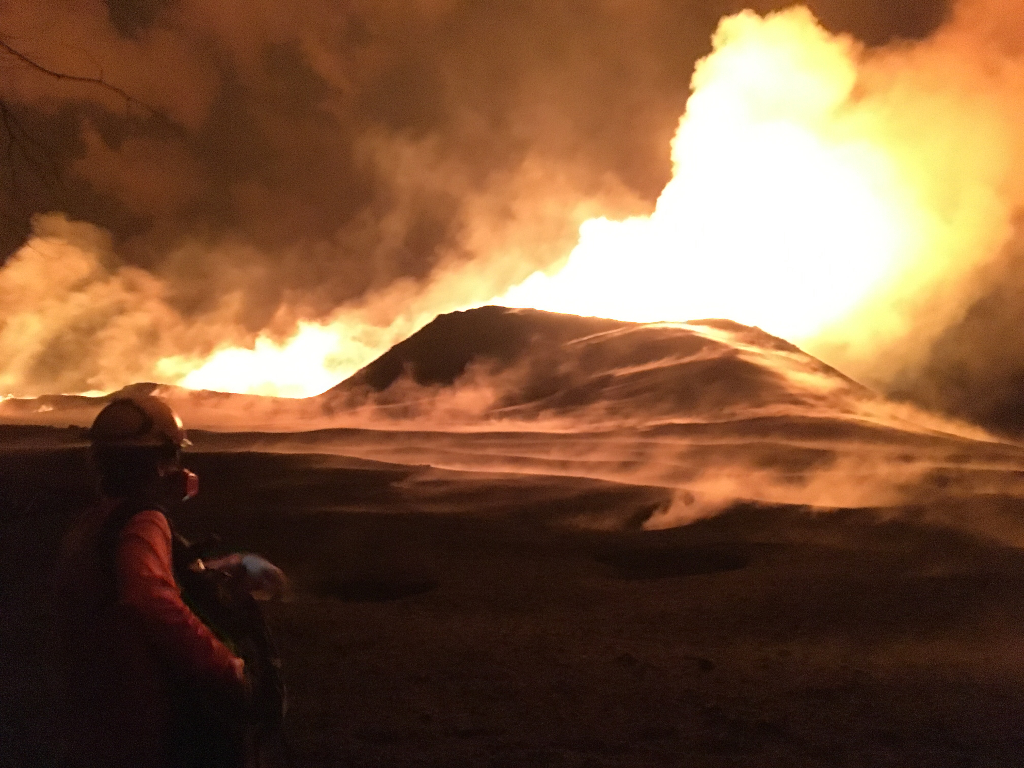
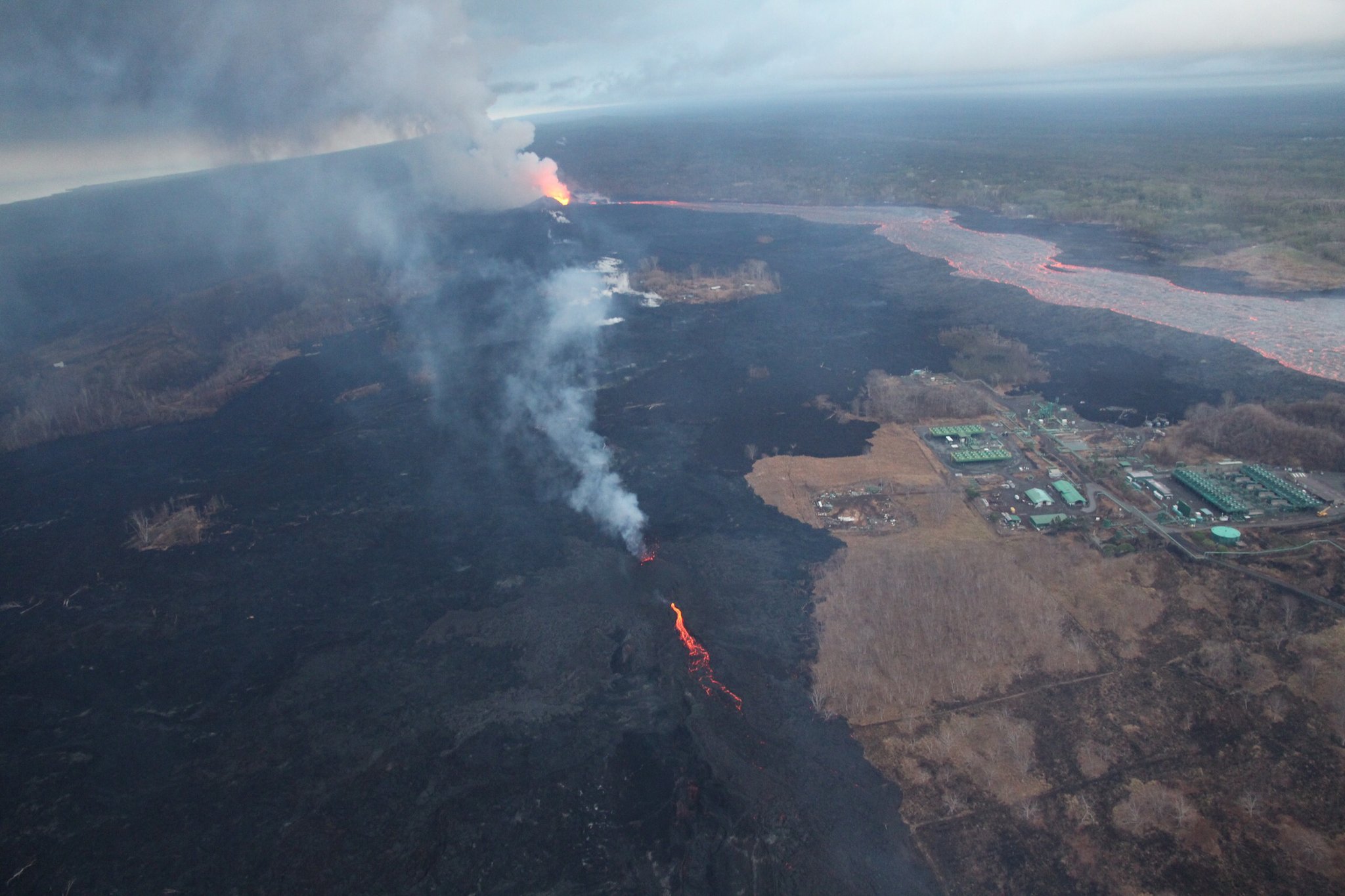
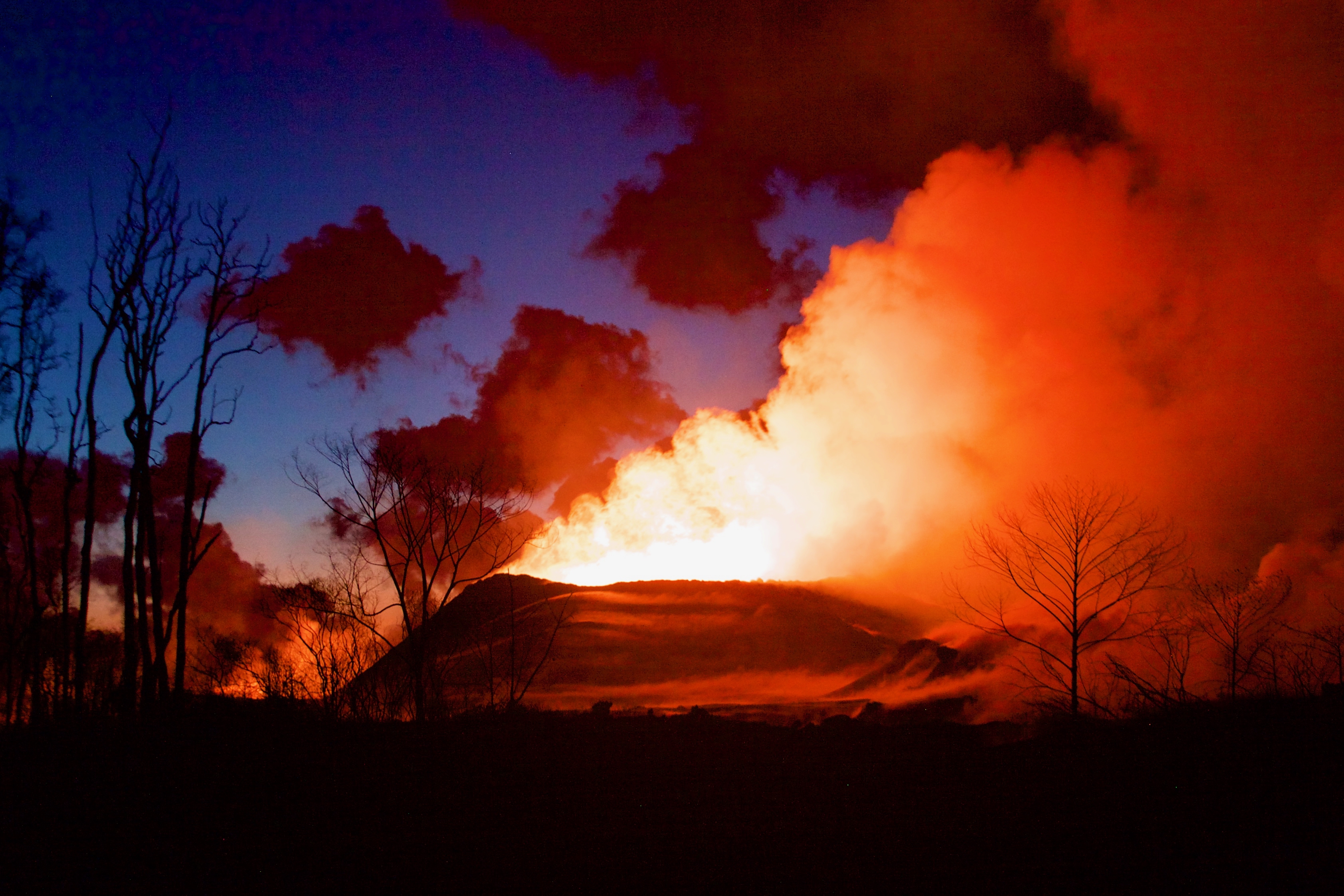
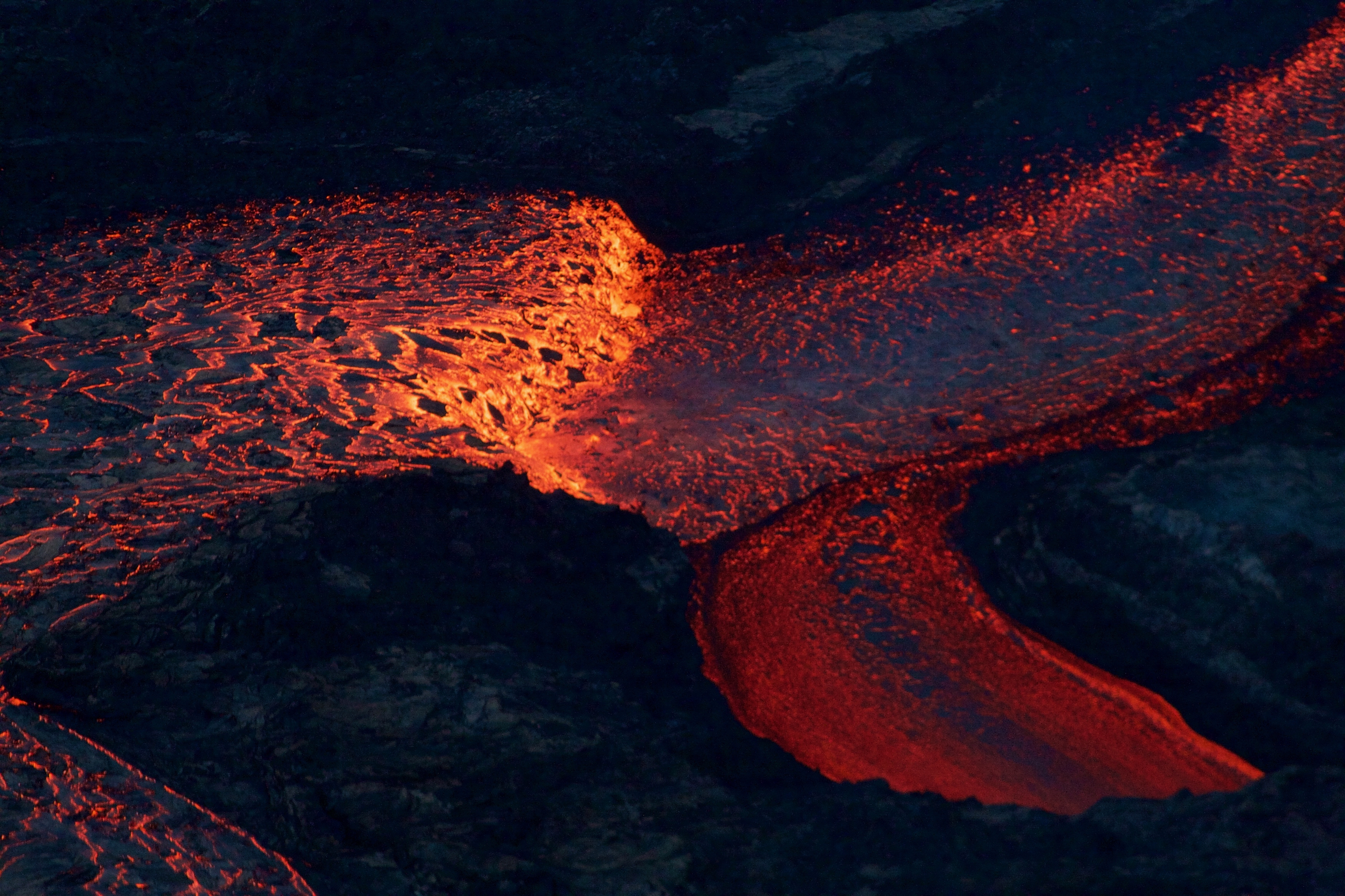
USGS, July 6, 2018. Dawn at Fissure 8. (Full-sized)
Today’s Eruption Summary

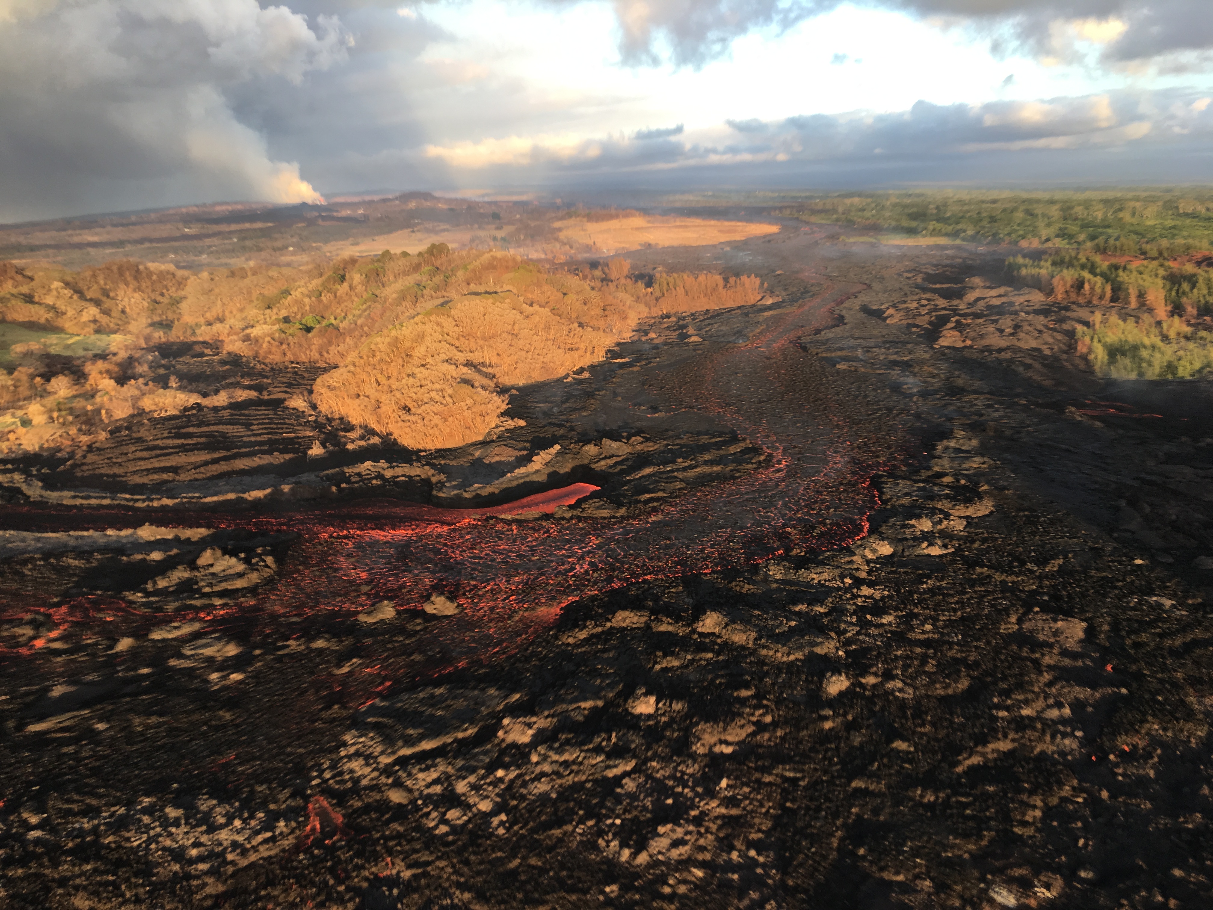
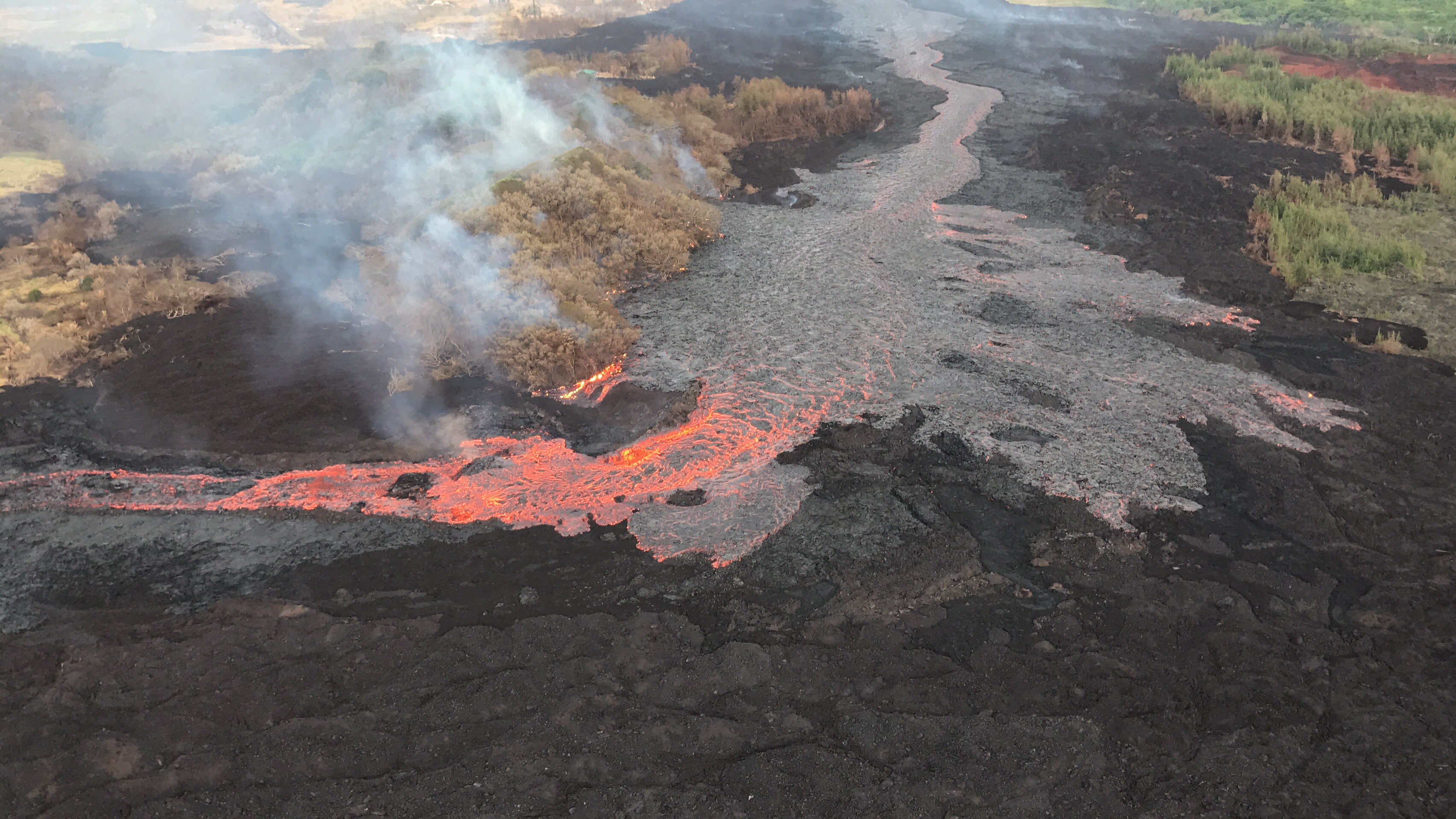
The Lower East Rift Zone eruption continues pretty much as usual: Fissure 8 feeding a lava river with occasional short-lived overflows. The main lava channel no longer reaches the ocean, but crusts over a half mile from shore and dives into the lava delta, oozing out at multiple points on the northern side. One especially large “ooze-out” makes a short flow on the north side of the flow field near the last few Kapoho Beach Lot Houses, a few of which are hanging on. Fissure 22 is weakly spattering with a weak flow to its east. Today’s summit explosion occurred at 6:04pm, equivalent of M5.3. Thick fog obscured the livestream view.
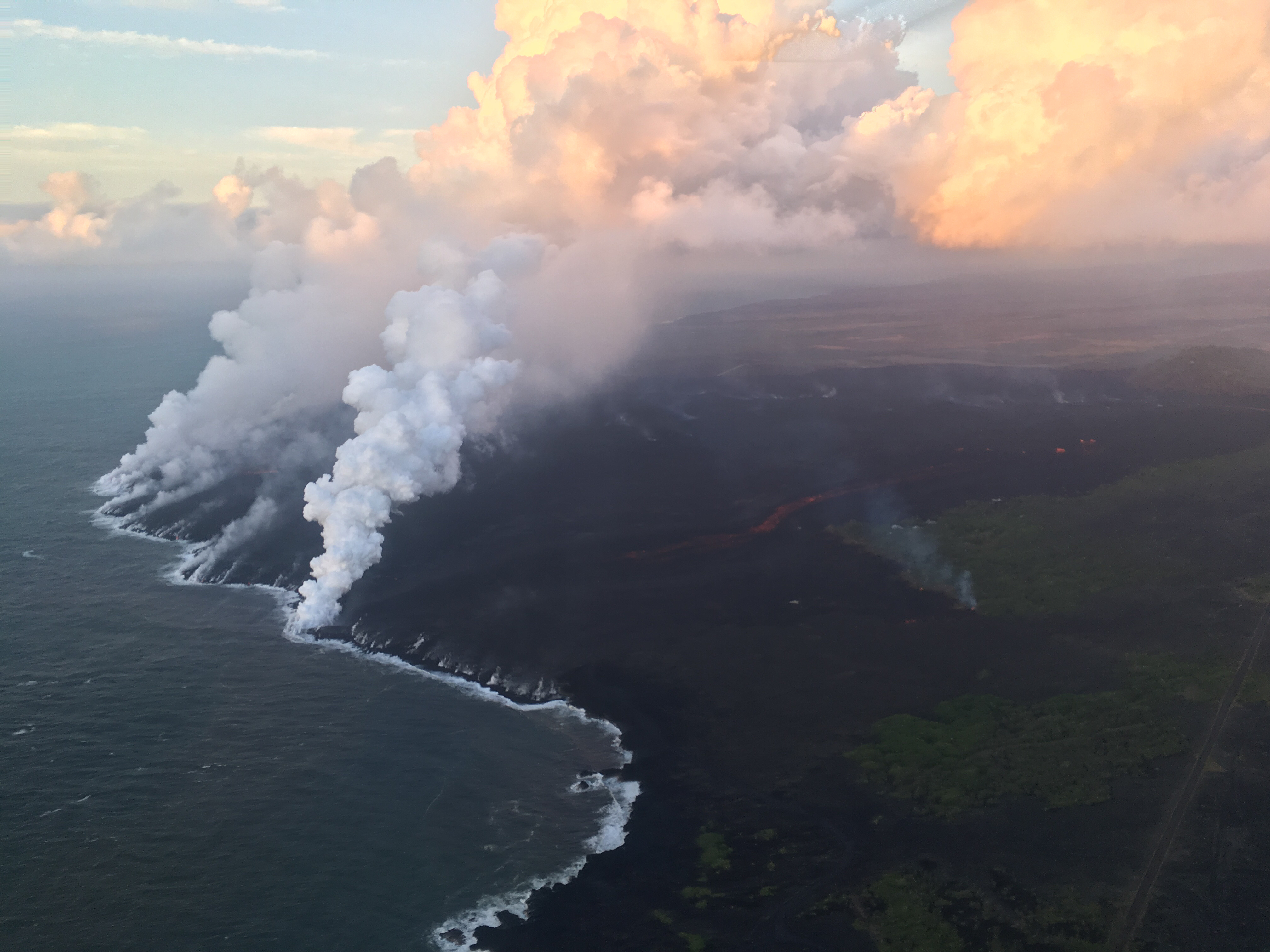
July 6, 2018, USGS. Ocean Entry at Kapoho. (Full-sized)

So that’s all routine, if a volcanic eruption can ever be routine. The big news today actually took place last night (see what happens when I finish my posts early?):

July 5 Volcano Community Meeting

Thursday evening, there was an important community meeting in Volcano Village. Mayor Harry Kim, the USGS and Civil Defense outlined the extremely unlikely but potentially life-threatening (to people near the summit) possibility of large-scale caldera collapse. I’ve transcribed the meeting here. BigIslandVideoNews excerpted the crucial 4-minute presentation from HVO’s Tina Neal:

Preceding this meeting was a long-expected document from USGS: Volcanic Hazard at the Summit of Kīlauea UpdateWhile the Kīlauea Summit Earthquakes FAQ explained what is happening, this new update to a May 8th report summarizes what the USGS thinks might happen at the summit before this sequence is over, based on the volcano’s distant past.

During the Q&A session, a resident asked about the odds for the worst-case scenario, a large-scale caldera collapse with explosive activity. Harry Kim took the mike from Tina Neal and said, “Like you, we always like to know percentage odds. And she knows; I asked her that. And I’d like to answer because she said, ‘One percent.'” [Tina went on to explain how they arrive at such probabilities; she wasn’t being flippant.]

Another reassuring quote from the Q&A session:

Don Swanson: “I think that the evidence we have today looks to me as if [the subsidence/collapse] is going to be confined to within the caldera, because the outermost circumferential fractures that have been occurring on the caldera floor have not extended outward in the last 2-3 weeks or so. So to me, that suggests that they may be defining the outermost limit of potential caldera collapse.”
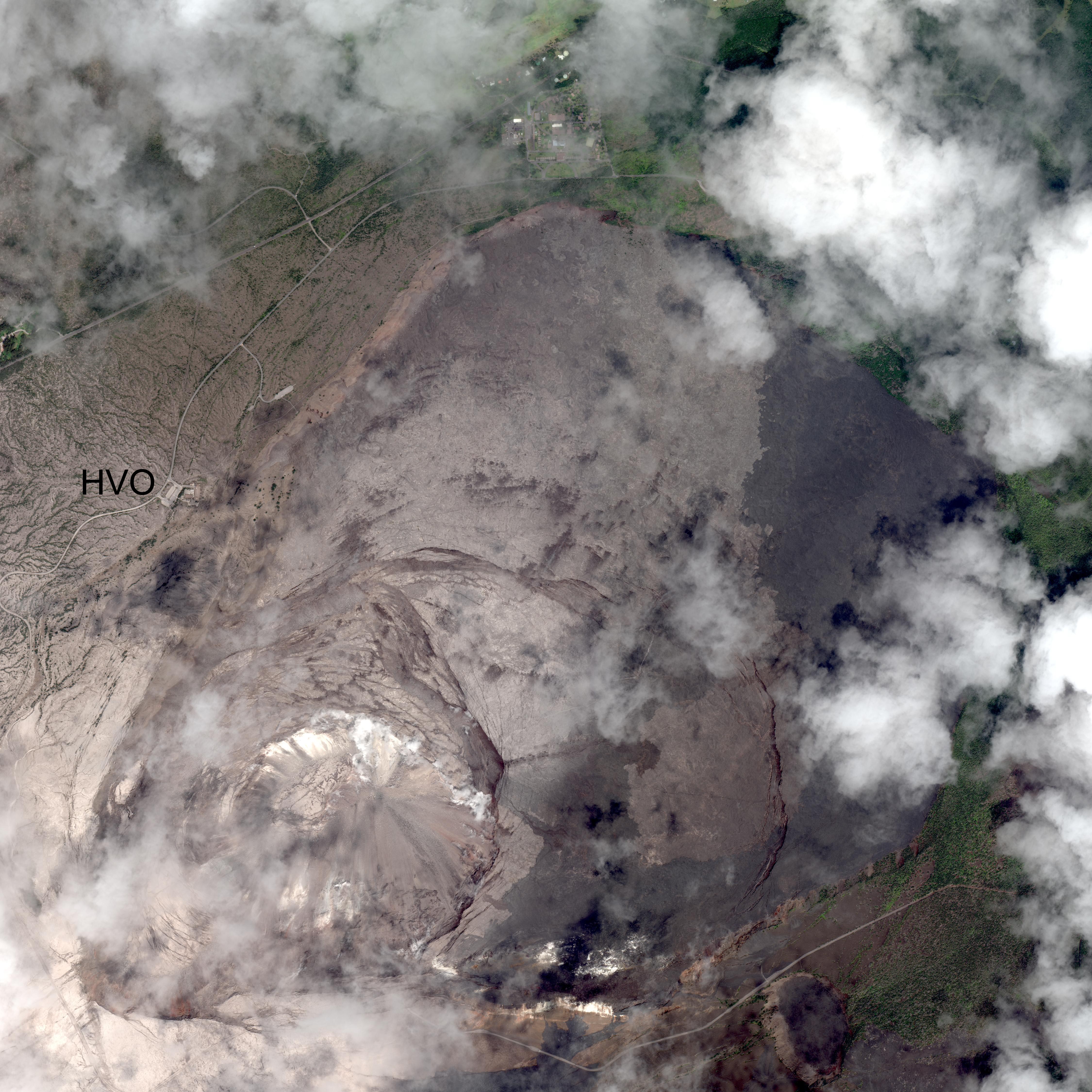
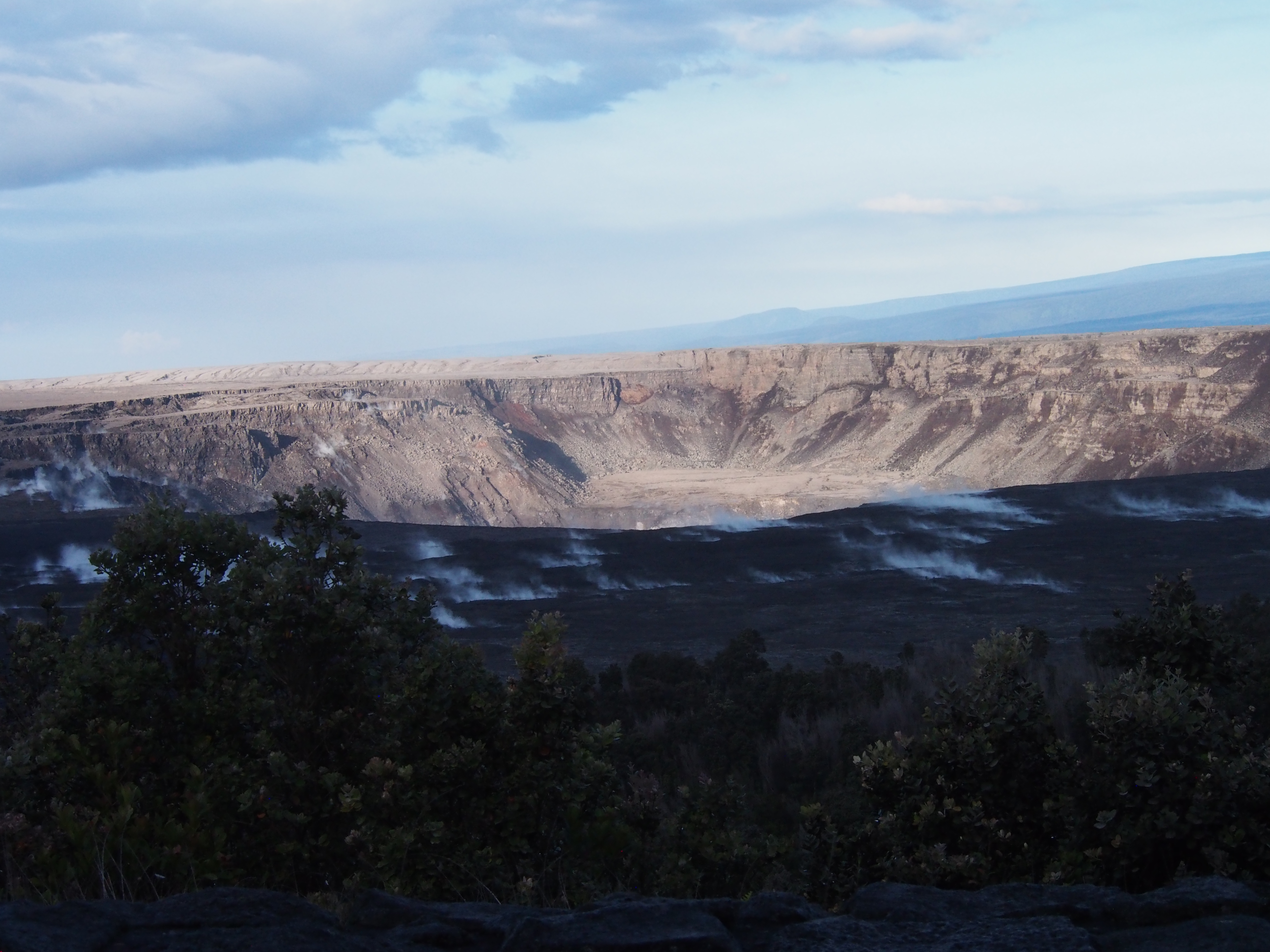
USGS: “The WorldView-3 satellite acquired this view of Kīlauea’s summit on July 3. Despite a few clouds, the area of heaviest fractures in the caldera is clear. Views into the expanding Halema‘uma‘u crater reveal a pit floored by rubble. HVO, on the northwest caldera rim, is labeled.” (Full-sized)

Continue reading July 6: Living With the 1% Possibility of Caldera Collapse
July 5: Volcano Community Meeting

Informing the public without panicking them about an extremely unlikely but life-threatening hazard is tricky. So it’s taken the USGS a while to release this document which they’ve been promising the residents of Volcano:

On HVO website: Volcanic Hazard at the Summit of Kīlauea Update [summary: “This document is a guide for understanding current activity and hazard at and around the summit of Kīlauea Volcano. Here, we summarize activity from late April through the present, detail possible future outcomes, and review hazards associated with these outcomes.”]  Presumably it’s called an “update” because it supplements the June 26 “Frequently Asked Questions About Kīlauea Volcano’s Summit Earthquakes” FAQ. [EDIT: No, actually, it’s an update to the May 8th “Preliminary Analysis of Current Explosion Hazards at the Summit“]

This was the chief topic of Thursday’s Volcano Village meeting, led not by the National Park Service this time, but by Civil Defense Administrator Tal Magno.

Here’s the FULL video of the meeting. BigIslandVideoNews excerpted the most important part, HVO Scientist-in-Charge Tina Neal’s 4-minute talk:

Partial Transcript

Continue reading July 5: Volcano Community Meeting

July 5: Lava Takes Aim at Last of Kapoho Beach Lots

July 5, 2018: USGS: “Near the Kapoho Crater, in the area called Four Corners, the lava channel makes a 90-degree bend. After lava exits the bend, it makes a short drop to form a lavafall. A side channel makes a short surface diversion before rejoining the existing channel.” (Full-sized)
Today’s eruption summary

The LERZ eruption continues with minor variations. This morning’s USGS overflight crew observed that Fissure 8’s fountain and lava level in the upper channel appeared to be slightly lower. However, the lava flow rate down at Kapoho Beach Lots —where there were only a few houses left, as of this morning — seems to have picked up slightly.  Meanwhile, overflows spilling out from the constricted turn around Kapoho Crater have nearly reached Beach Rd about 0.2 miles north of Four Corners. Lava continues to enter the ocean along a very broad front, mostly on the northern side of the delta.

July 5, 2018. USGS: “Lava enters the sea along the Kapoho coastline, building a delta that is now over 555 acres in size.” ( full-sized )

Fissure 22 is “sporadically spattering,” and its flow  may have stalled.

At the summit, today’s collapse/explosion occurred at  1:20 PM HST, registering as a magnitude 5.2. Once again, I noticed rockfalls picking up about a minute before the big shake, although it might be coincidence (they’re happening at other times of the day as well):

The Italian Space Agency has posted a new satellite radar image of Kilauea Caldera, showing the ongoing subsidence across much of the crater floor (you may have to view full-sized version for the animation):

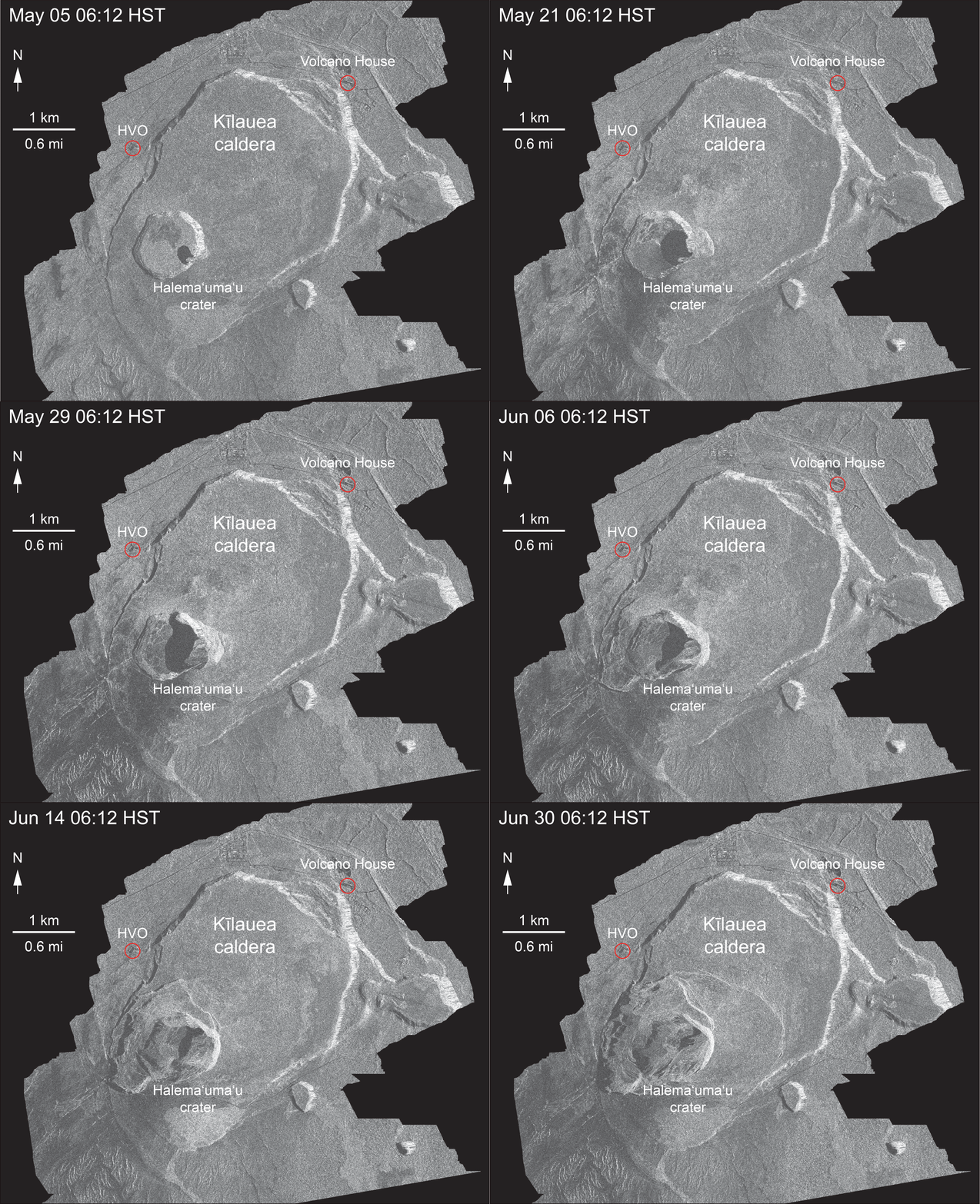
USGS: “This animated GIF shows a sequence of radar amplitude images that were acquired by the Agenzia Spaziale Italiana CosmoSkyMed satellite system. The images illustrate changes to the caldera area of Kīlauea Volcano that occurred between May 5 and July 4 at about 6:00 a.m. HST…Over time, expansion of the summit eruptive vent within Halema‘uma‘u crater and the widening of Halema‘uma‘u itself are obvious. Starting in late May, the development of several cracks outside Halema‘uma‘u is clear, and inward slumping of a large portion of the western, southwestern, and northern crater rim begins. Much of this motion appears to be coincident with the small explosions from the summit that have taken place on a near daily basis since early June. The most recent radar scene, from July 4, shows continued motion along cracks over a broader area of the caldera floor, extending east of Halema‘uma‘u (these cracks are the scarps seen in recent photographs from the Keanakākoʻi overlook area).” (Full-sized)

By the way, if anyone else was confused by recent Hawaii Tribune Herald articles that said SO2 levels had climbed tenfold at the summit, I checked with @USGSVolcanoes, who suggested a minor mixup. That increase is occurring down in the Lower East Rift Zone. At the summit, according to Kyle Anderson during today’s media conference call, SO2 levels have dropped to the level they were before the lava lake first appeared.


Continue reading July 5: Lava Takes Aim at Last of Kapoho Beach Lots

July 5: USGS Media Conference Call

Between computer troubles (fixed now!) and that all-important Volcano Village meeting last Thursday evening, I missed the July 5 11am USGS media conference call. Here’s the archived audio file.

It was short, but for completeness’ sake, here’s a transcript.

[Note: Posted July 9, 3.30pm HST, backdated to keep it in correct order chronologically.]

Continue reading July 5: USGS Media Conference Call

July 4: Fireworks Every Day In Hawai’i

Today’s entry is going to be a challenge, because my computer chose a holiday to go pau. Arthritis and dodgy vision versus voice dictation and tablet — who will win?

July 4, 2018. USGS: “USGS scientist observes the glow of fissure 8 fountain and channel within Leilani Estates. Steam rises from cracks and hot spots within the tephra deposit surrounding the cone. Frequent observations of the cone and channel are made throughout the day and night to track changes that could lead to signfiicant breakouts beyond the current flow field.” (Full-sized)
Today’s eruption summary

The LERZ eruption continues pretty much as usual, with a few minor embellishments to keep field crews on their toes.

Today’s HVO update noted that Fissure 8 “has been pulsing with more vigorous output in 1-3 minute bursts.” When asked for clarification, USGSVolcanoes replied, “No true indication of change.” F8 continues to send lava downriver to Kapoho, where lava is oozing out along most of the broad front and encroaching on Kapoho Ag and Beach Lots properties.

Fissure 22 continues to spatter intermittently and produce a short, sluggish flow:

Wednesday, July 4, 2018, 5:45 am – Kilauea's east rift zone overflight: Fissure 22 continues to spatter bits of lava…

Posted by Extreme Exposure Fine Art Gallery on Wednesday, July 4, 2018

…and it still looks like a kid’s science experiment. (It’s hard to tell from overhead, but it’s a perfect steep-sided cone.)

Remember how the lava channel clogged up temporarily around the bend at Kapoho Crater yesterday? It’s still having problems:

July 4, 2018. USGS: “The lava channel from fissure 8 jumped its banks near Kapoho Crater where the channel makes a 90 degree bend. The flow within the channel was diverted around a constricted area and joined the channel again “downstream” to the south (left).” (Full-sized )

I lucked out this morning and caught @HotSeatHawaii ‘s sunrise overflight live, which offered a good view this. Part of the lava is going wide instead of making the sharp turn, though it joins back up around the bend. (More photos below.)

Today’s summit collapse/explosion occurred at 10:19 AM HST. The view was fairly clear today, and the rockfalls were spectacular:

Continue reading July 4: Fireworks Every Day In Hawai’i

July 3: Lava Boats Cause Overflows

July 3, 2018. USGS: “Fissure 8 and the upper lava channel, viewed from the early morning helicopter overflight of the lower East Rift Zone. Recent heavy rains have soaked into the still-warm tephra and the moisture rises as steam (right side of lava channel).” (Full-sized)
Today’s Eruption Summary

Kilauea’s double eruption continues with little change, except for a few more spillovers. Fissure 8 is feeding its lava river, which continues to ooze out along a broad front on the northern side of the delta and into Kapoho Beach Lots. Fissure 22 continues to spatter intermittently and send out a less-than-impressive flow.

About a dozen Kapoho homes have succumbed to lava over the past week, and more are expected to go. The National Weather Service also reports that there were about 1,200 lightning strikes between 7am and 2pm yesterday during Monday’s lava-boosted thunderstorm in Lower Puna.

Today’s summit explosion occurred at 2:17am HST, with enough clouds that radar couldn’t find a plume (if any). Just to prove seismometers aren’t stuck, the magnitude registered as 5.1. Seismicity is back up to 20-30 quakes per hour after the lull.

July 3, 2018. USGS: “Inward slumping of Halema‘uma‘u continues in response to ongoing subsidence at Kīlauea Volcano’s summit. This image, taken from a temporary observation post located at Volcano House, shows steep walls on the western side of the crater and sloping piles of rubble from rockfall events.” (Full-sized)

Not to be superstitious or anything,  but geologists need to stop giving Pele ideas. During yesterday’s media conference call, Mike Zoellner said, “They [lava boats] do present a risk, because if the flow of the channel jams them against the side and it contacts the levee, that disrupts the flow of the channel. It could divert either the flow itself or the lava going around the boat out of the channel.”

Sure enough, HVO’s Photo & Video Chronology documented a mini-drama today:

July 3, 2018. USGS: “Evolution of a blocked channel, photo 1. A blockage of rafted material within the lava channel causes lava to flow over its banks near the Kapoho cone. In this section of the lava channel a cold lava flow from the 1960 eruption forms a barrier on the north side, which initially directed the channel to the southeast. A constriction in the channel formed at the bend where chunks of cooled rafted lava were able to accumulate and block the flow.” (Full-sized)
July 3, 2018. USGS: ” Evolution of a blocked channel, image 2: While observing this area of the fissure 8 lava channel near Kapoho cone during the morning overflight, geologists witnesed an “apartment-building-sized” blockage within the channel give way and be pushed down stream by the pressurized lava behind. The dark portion within the red channel is the freed blockage. Lava continues to overflow behind the bend and form a cooled black crust. The more quickly flowing lava at the bend has very little crust.” (Full-sized)

See below for a few more photos of this from the Hawai’i County Fire Department.

Continue reading July 3: Lava Boats Cause Overflows

July 2: Fissure 8 Making Its Own Thunderstorms

Today’s Eruption Summary

No major changes in the past 24 hours, except that the lava channel was full and spilling over its levees in a number of places this morning (as seen in this photo by Bruce Omori). For the most part, they weren’t venturing past the boundaries of earlier flows:

Monday, July 2, 2018, 5:45 am – Kilauea's east rift zone overflight: A number of breaches of the channels can be seen here, as the fresher lava appears more silvery than the older.

Posted by Extreme Exposure Fine Art Gallery on Monday, July 2, 2018

Fissure 8 continues roaring along. With slack tradewinds today, it managed to whip up enough pyrocumulus to set off some localized thunderstorms. Fissure 22 is still spattering and feeding a small flow that’s going nowhere fast. At the ocean end of Fissure 8’s channel, lava is oozing out along a broad part of the lava delta and chewing further into what’s left of Kapoho Beach Lots:

Monday, July 2, 2018, 5:45 am – Kilauea's east rift zone overflight: Homes and property in Kapoho are being consumed by the flow's expanding northern boundary.

Posted by Extreme Exposure Fine Art Gallery on Monday, July 2, 2018

The latest summit explosion occurred at 1:24am HST July 2, the usual M5.3, with an ash plume ~1200 feet high. Immediately before, there were about 20-25 earthquakes an hour (a little less than in recent days) and dropped to 5/hour immediately afterwards (again, a little less).

[Below is a USGS video of the June 30 collapse/explosion as seen from Volcano House, I think, which gives a good view of the rockfalls all along the bluffs of the caldera walls]:

I haven’t mentioned LERZ seismicity in some time,  because it’s been low for weeks. But I notice that section of HVO’s daily Kilauea update was amended starting yesterday. Since May, it’s reported “relatively low seismicity” and “low amplitude background tremor” with “numerous small earthquakes” in the LERZ plus occasional “higher amplitude tremor” near the ocean entry. Now it’s added, “Low amplitude tremor increased slightly on June 29 associated with renewed activity at Fissure 22.”

More Photos from USGS

Continue reading July 2: Fissure 8 Making Its Own Thunderstorms

June 28: USGS on Latest Changes to Kīlauea Caldera [Pt. 3 of 3]

This post got long, so I’ve moved the Q&A session to Part 3. Again, I’m transcribing what HVO geologists had to say at the June 28 Volcano Village community meeting.

Part 1 was Kyle Anderson’s talk on seismicity and ground deformation— lots of nitty gritty science— while Part 2 was Don Swanson’s slideshow of some of the visible changes he’s observed within Kīlauea Caldera, with a lot of photos I haven’t seen anywhere else.

Here’s the video of the whole meeting.

Here’s my transcription of the Q&A session. A lot of these questions have already been answered online, but I like hearing direct, personal responses from some of the senior HVO scientists:

Continue reading June 28: USGS on Latest Changes to Kīlauea Caldera [Pt. 3 of 3]

July 2: USGS Media Conference Call

This is my transcript of the July 2, 2018 11am USGS press briefing, which covered lava-created thunderstorms, whirlwinds, and rain; laze-induced lightning; and lava boats. Additionally, Mike Zoellner mentioned findings of a sonar expedition to measure the lava extending on the ocean floor.

Soundfile is archived here. BigIslandVideoNews has also posted most of it, overlaid with recent video footage:

Participants:

  • Leslie Gordon, USGS Public Affairs
  • Jessica Ferracane, Hawaii Volcanoes Nat’l Park Public Affairs
  • Robert Ballard, NWS
  • Mike Zoeller, HVO & Center for the Study of Active Volcanoes, UHI
  • Brian Shiro, seismologist, USGS/HVO

Transcript note: I omit salutations/pleasantries, jumping straight to news and information. Also I usually summarize questions to provide just enough context for USGS responses.

Kilauea Status Update

Continue reading July 2: USGS Media Conference Call

July 1: Fissure 22 Is Back; Kilauea Caldera Is Sinking

Fissure 8 gushes on unchallenged and unchanged, while Fissure 22 — remember the chief subject of Lavacam?— has started spattering 50-80m and sending out a modest lava flow headed NE along the edge of previous flows.

USGS photo from morning overflight, July 1, 2018. Fissure 8 in the distance, Fissure 22 in the middle ground across from PGV. (Full-sized)

Down at the coast, lava continues to ooze out from under much of the northern part of the delta along a broad front, with “pasty” lava squeezing out in several places along Kapoho Beach Lots.

As of 8:30pm 11pm HST, I’m waiting for confirmation of the next summit collapse/explosion.

Besides Fissure 22 reactivating in earnest, the news today is that new digital elevation maps and satellite images give us a clear view of the subsidence of Kilauea Caldera around Halema’uma’u, which has begun to show in livestream and webcam views lately.

First of all, USGS seismologist Kyle Anderson posted this color-coded slide of caldera ground deformation in his Thursday evening talk:

The colors compare the new June 19, 2018 drone-surveillance digital elevation map with a DEM of the caldera captured in 2009. Presumably the light gray areas within Halema’uma’u don’t correspond to anything on the older map, so can’t be compared. Green patches are earthquakes over the past few days indicating stress. And “300+ ft” marks the last known position of the NPIT GPS sensor before it sank out of radio contact. (Full-sized)

Next, the Italian Space Agency’s trusty Cosmo-Skymed satellite has sent us another radar survey of Kilauea. Even though I’d observed dramatic subsidence of the caldera floor in recent livestream and webcam images, the last frame of this animation made me gasp:

USGS: “This animated GIF shows a sequence of radar amplitude images that were acquired by the Agenzia Spaziale Italiana CosmoSkyMed satellite system. The images illustrate changes to the caldera area of Kīlauea Volcano that occurred between May 5 and June 30 at about 6:00 a.m. HST[…] Over time, expansion of the summit eruptive vent within Halema‘uma‘u crater and the widening of Halema‘uma‘u itself are clear. Starting in late May, the development of several cracks outside Halema‘uma‘u is clear, and inward slumping of a large portion of the western, southwestern, and northern crater rim begins. Much of this motion appears to be coincident with the small explosions from the summit that have taken place on a near daily basis since early June. The most recent radar scene, from June 30, shows the formation of cracks over a broader area of the caldera floor, extending east of Halema‘uma‘u (these cracks are the scarps seen in recent photographs from the Keanakākoʻi overlook area). We expect this slumping to continue as long as the collapse events and overall subsidence persist. (Full-sized)
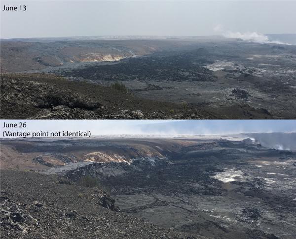
We are well on our way to a nested caldera, with Halema’uma’u taking up over half the larger caldera floor. I’m hoping those earthquakes indicate where the edge of the new inner caldera will be, but I’m not a geologist. Here’s those scarps they mentioned, posted a few days ago:

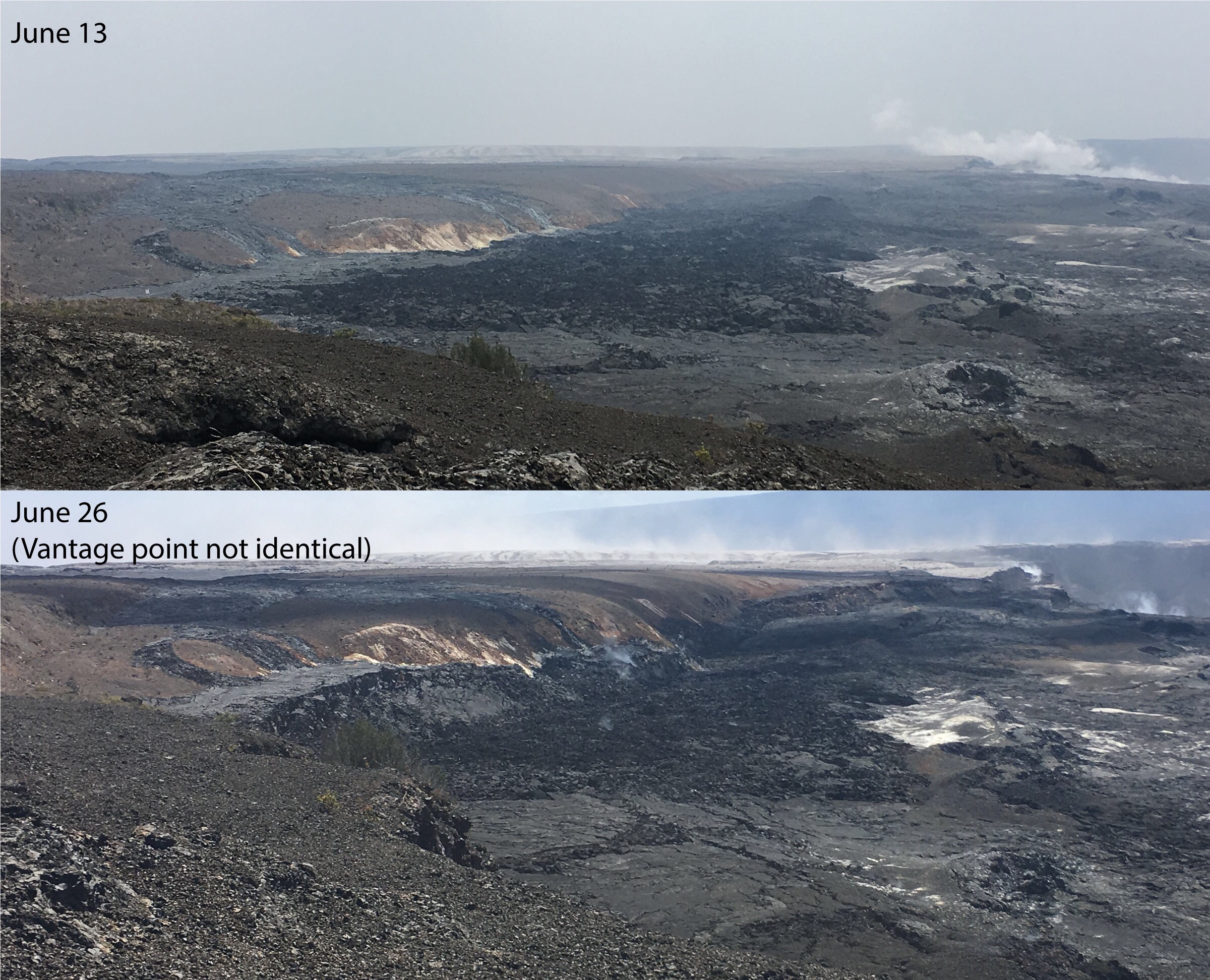
USGS: “Comparison of photographs taken on June 13 and 26 from near Keanakāko’i Crater overlook in Hawai’i Volcanoes National Park shows a subsidence scarp that formed as the Kīlauea Crater floor subsided. Scientists estimate the dramatic dropping of the crater floor in this area occurred sometime between June 23 and 26. The view is to the west. Halema‘uma‘u crater is in upper right.” (Full-sized)

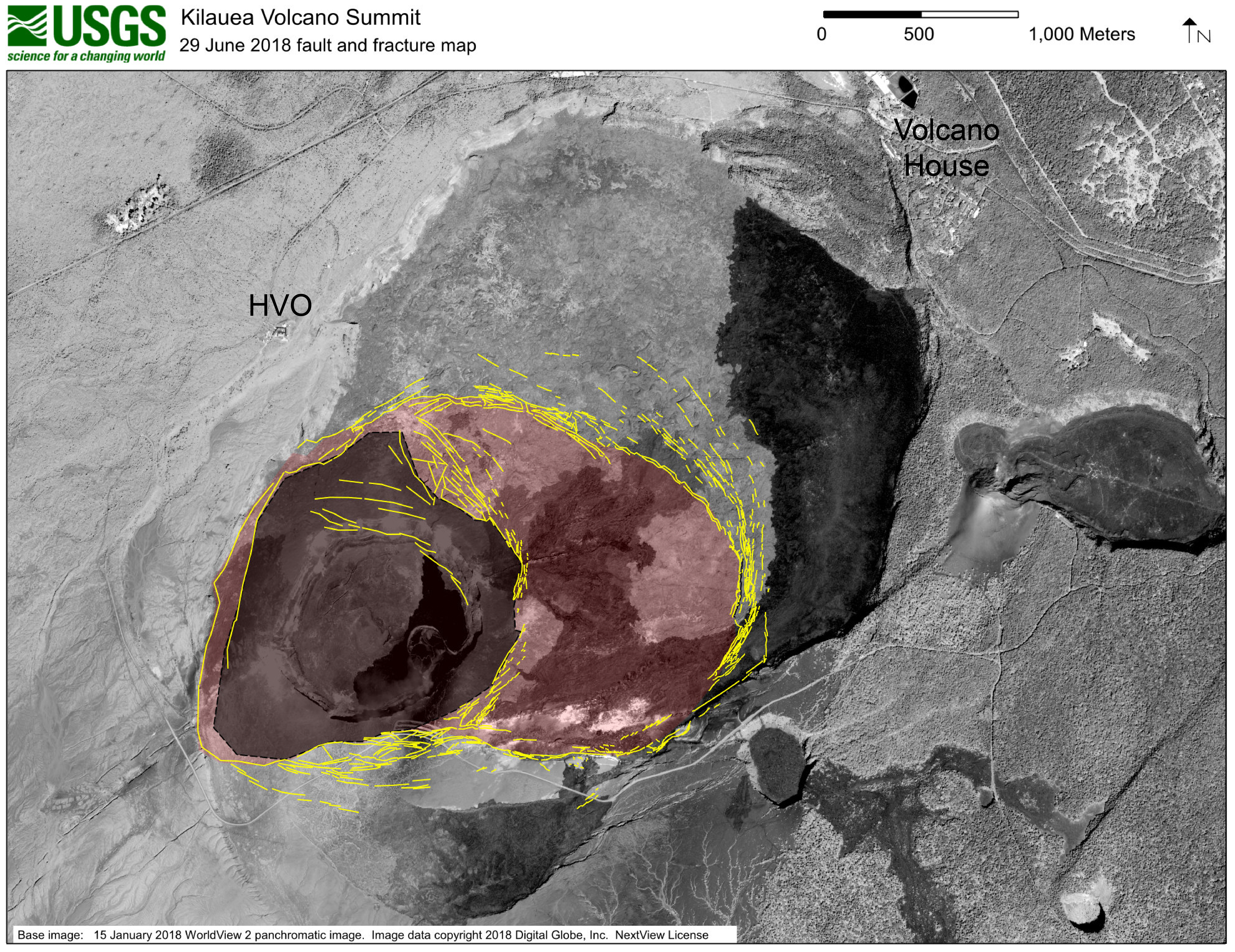
Last but not least, the USGS posted this map of the fracturing around Halema’uma’u. Note that the diagram is projected onto a satellite photo of the pre-May caldera, so there’s a ghostly image of the Halema’uma’u we remember in that dark gray area.

USGS: “This map shows major fractures in yellow (as of June 29) on a base image acquired by the WorldView-2 satellite before the current sequence of events began at Kīlauea. The area of major subsidence has expanded east and south, and slightly west, of the main Halema‘uma‘u crater area. The large, red-shaded area east of Halema‘uma‘u is moving down within a scarp-bounded area, as seen in recent photographs of the summit. Some fractures have also formed to the east-northeast of the red-shaded area of accelerated motion, and also on the south caldera rim where parts of the caldera wall have slumped into the rapidly moving caldera floor below. The dark gray-shaded area within the red shaded area shows the region of most significant down dropping and is currently the deepest part of Kīlauea caldera.” (Full-sized)

So there you have it.  Who would’ve thought the draining of the lava lake, which was minuscule compared to the whole summit caldera, would’ve had a domino effect this large?


The rest of this post is a fairly sparse weekend roundup of a few news stories, videos and photos, plus of course the usual science geeking with USGS. Which leaves you time to browse the USGS Thursday evening talk I transcribed today!
Continue reading July 1: Fissure 22 Is Back; Kilauea Caldera Is Sinking