September 2: A Few Signs of Life Deep in Fissure 8


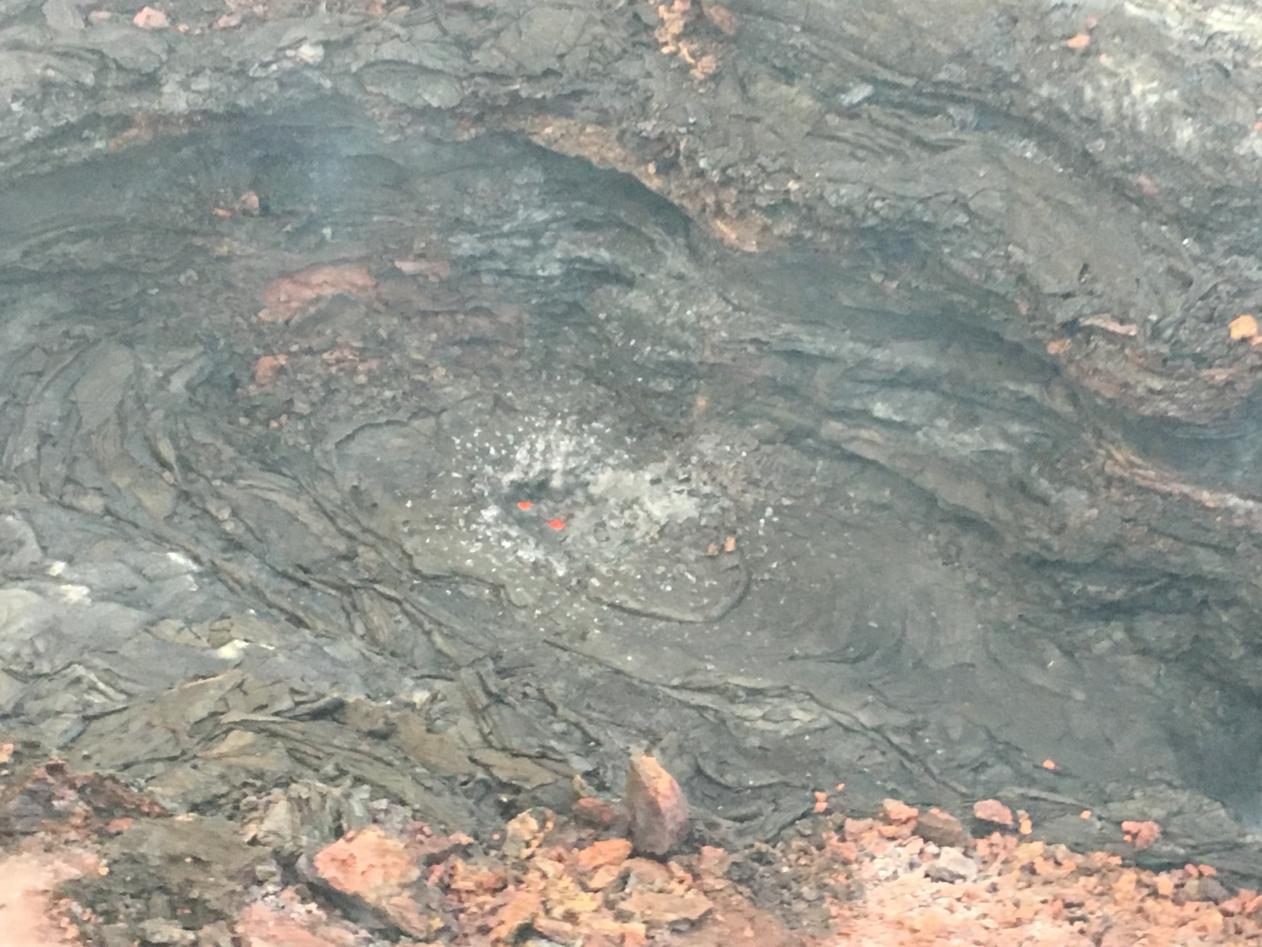
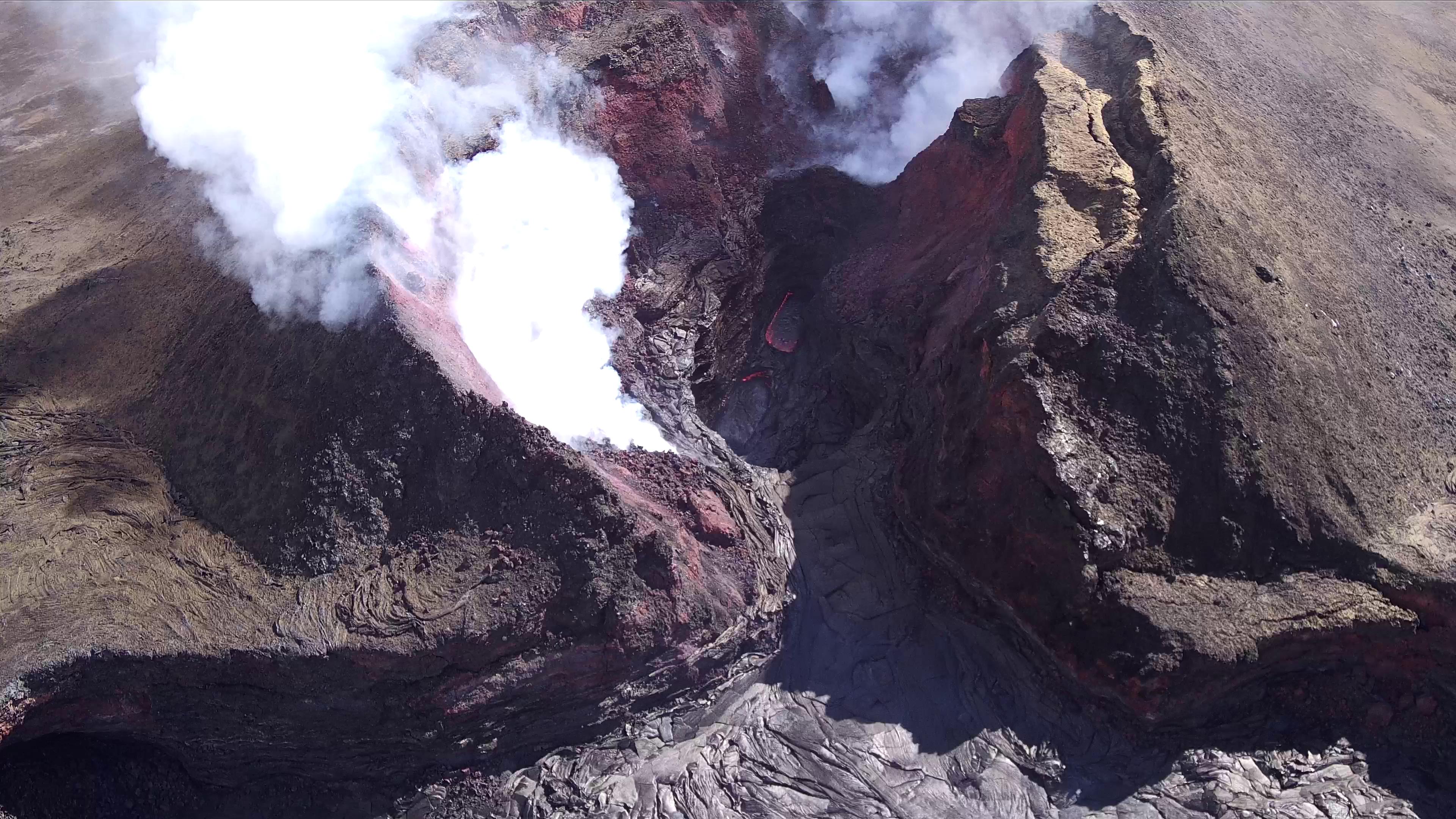
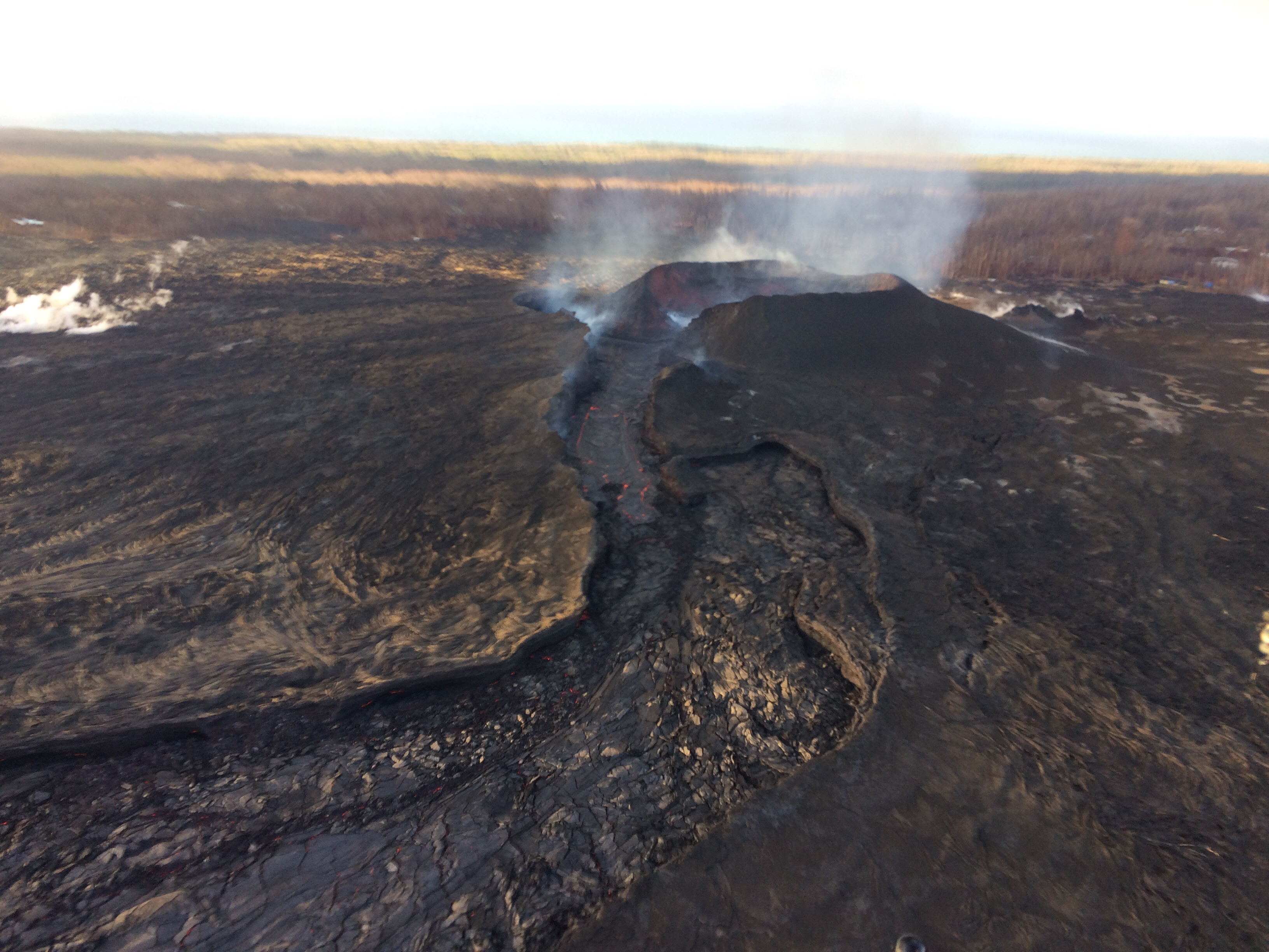
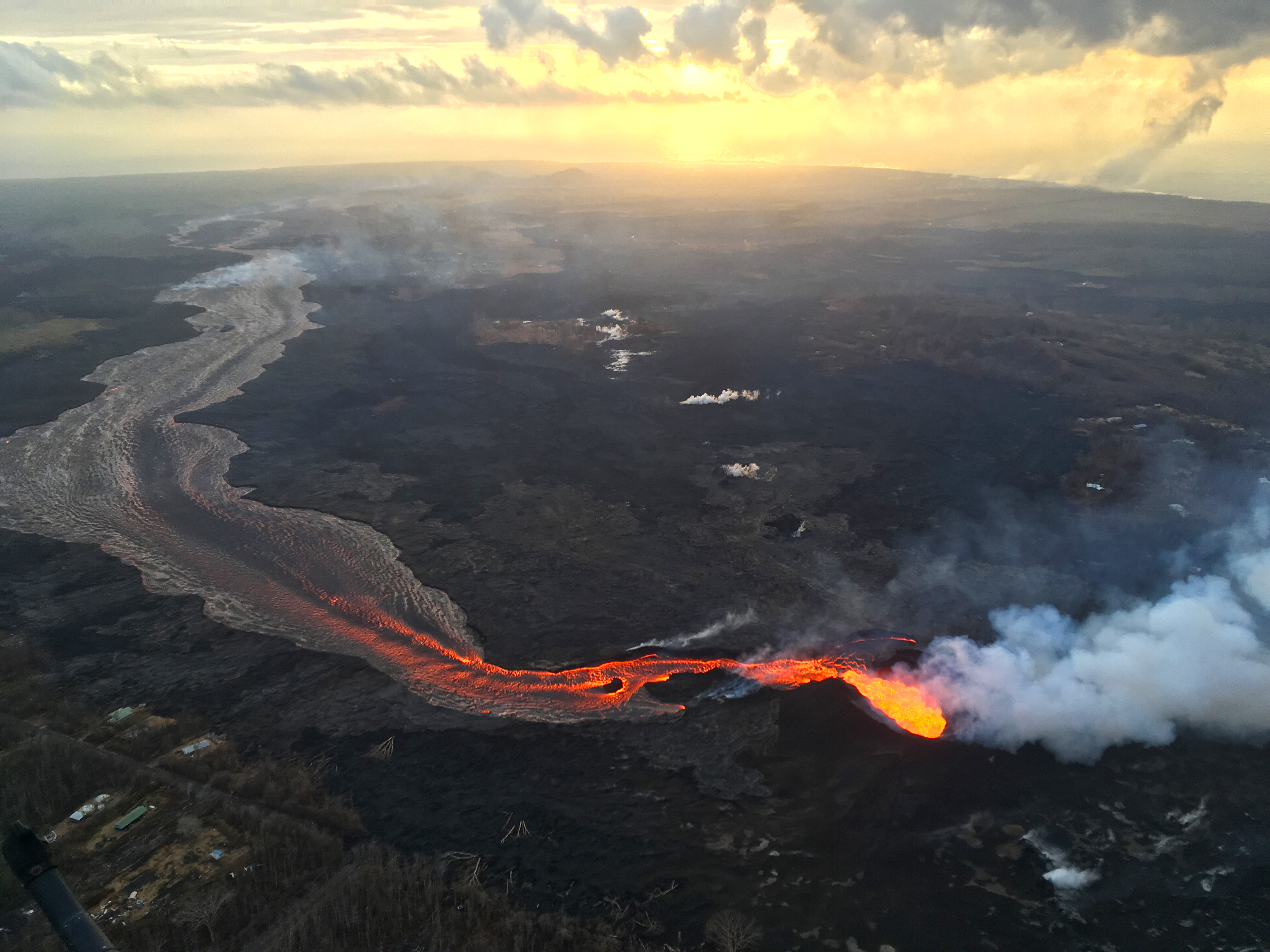
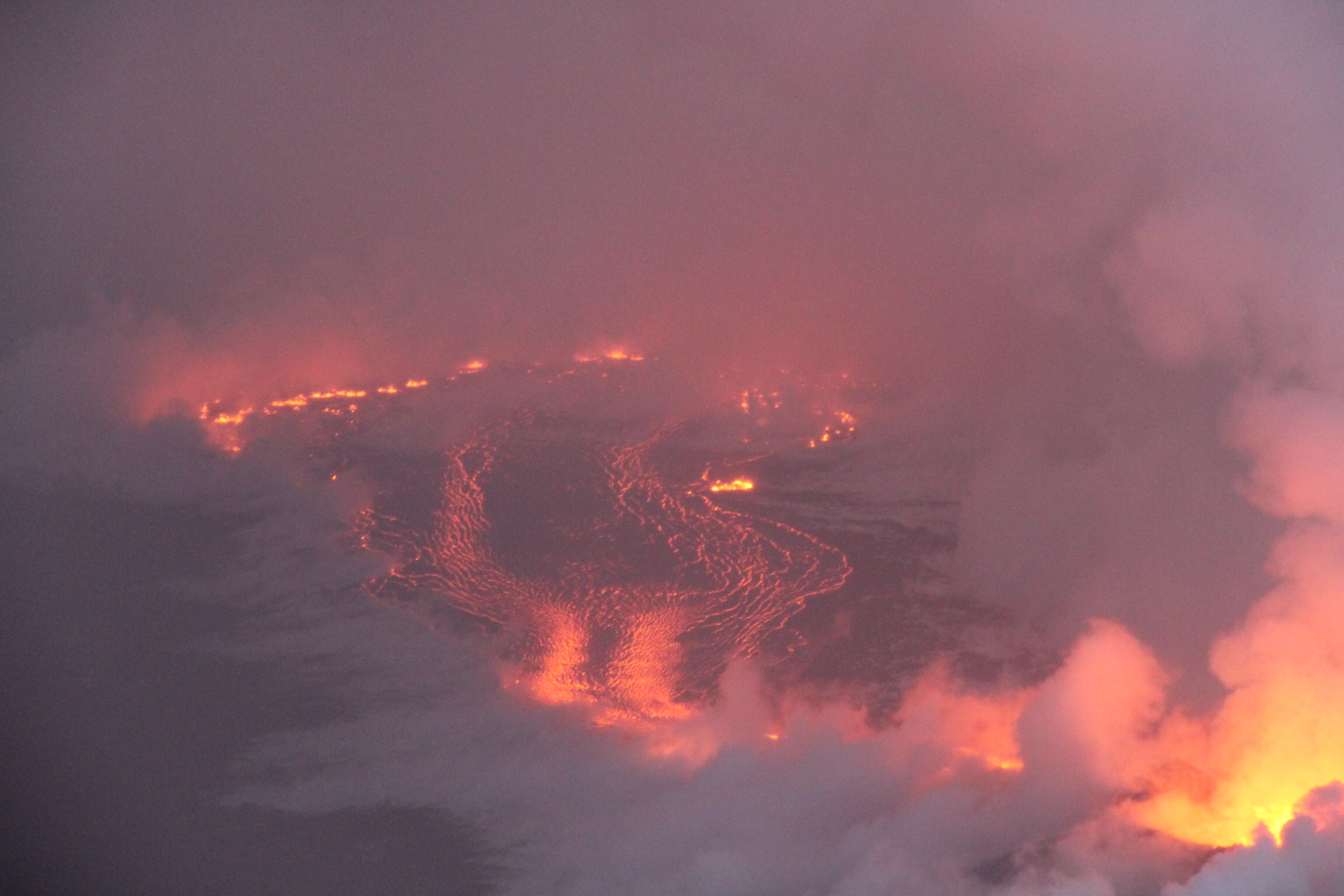
Saturday, Sep 1, 2018, 6:00 pm – Kilauea's lower east rift zone overflight: Another angle of fissure 8, with a small lava pond within.

Posted by Extreme Exposure Fine Art Gallery on Sunday, September 2, 2018

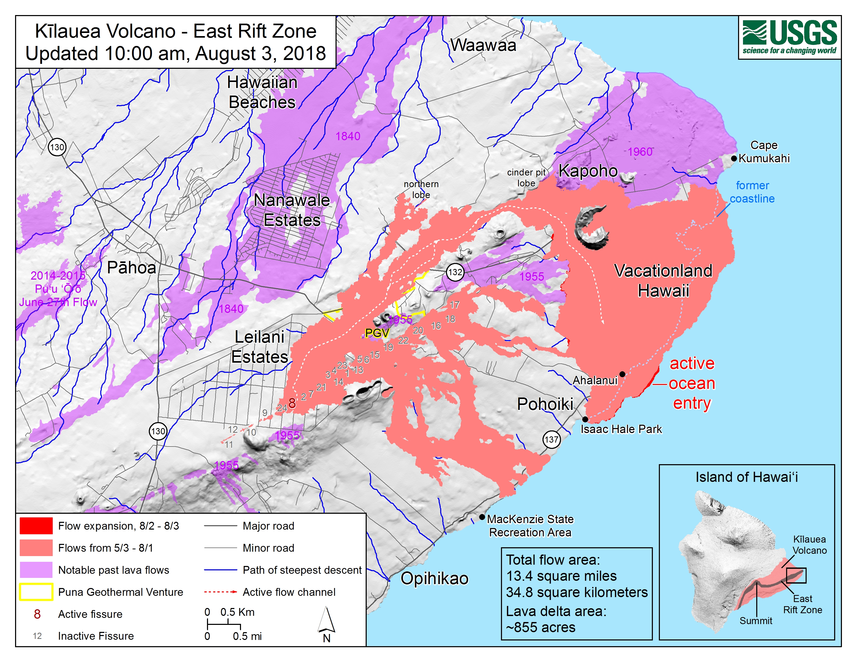
This Week’s Eruption Summary

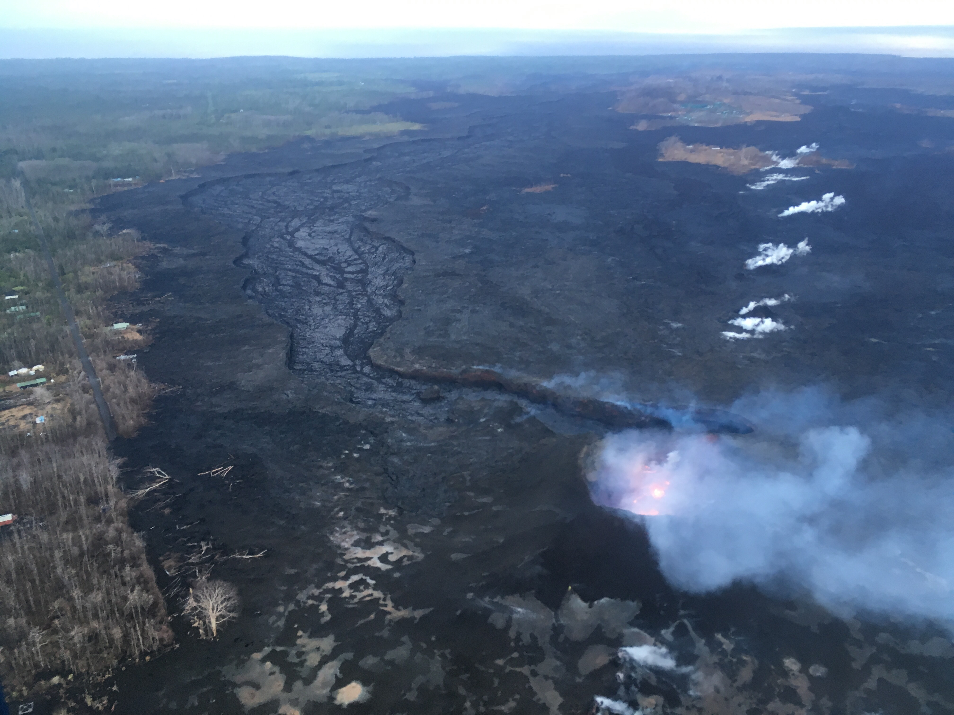
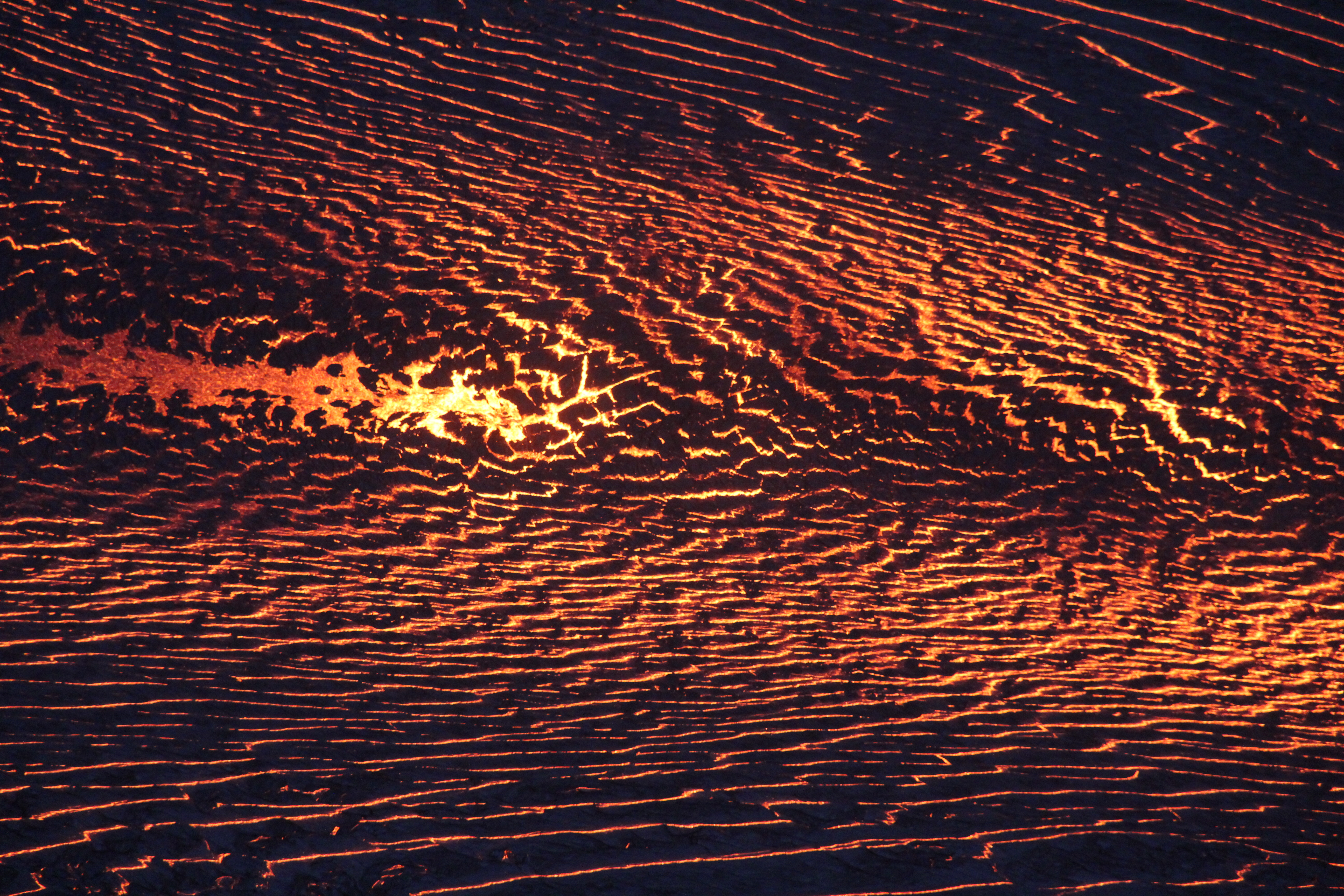
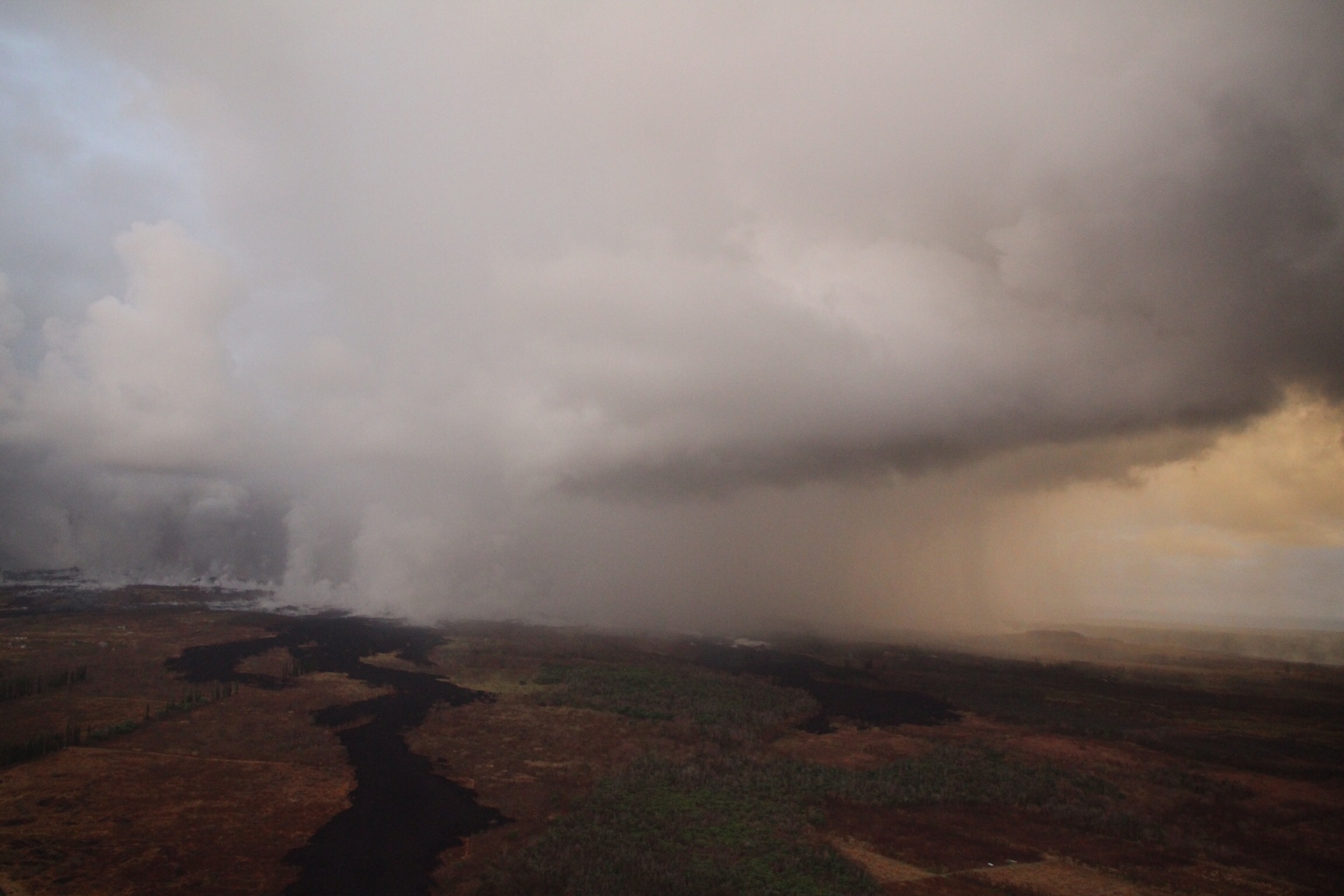
While no glow or incandescence was reported within Fissure 8’s cone for most of the week, Saturday 9/1 showed a few life signs remain in the LERZ: weak spattering from one spot, and in the evening new lava came out to cover most of the crater floor. But its sides have been slumping and falling in, as have the levees of the now solidified lava channel. While Fissure 8 and some of the surrounding vents continue to steam and fume, SO2 emissions remain low there and at the summit.

August 30, 2018. USGS: “The fissure 8 lava channel (center) and levee (foreground), looking toward the northwest. Loose rubble and Pele’s hair (lower right) are strewn across the levee surface.” (Full-sized)

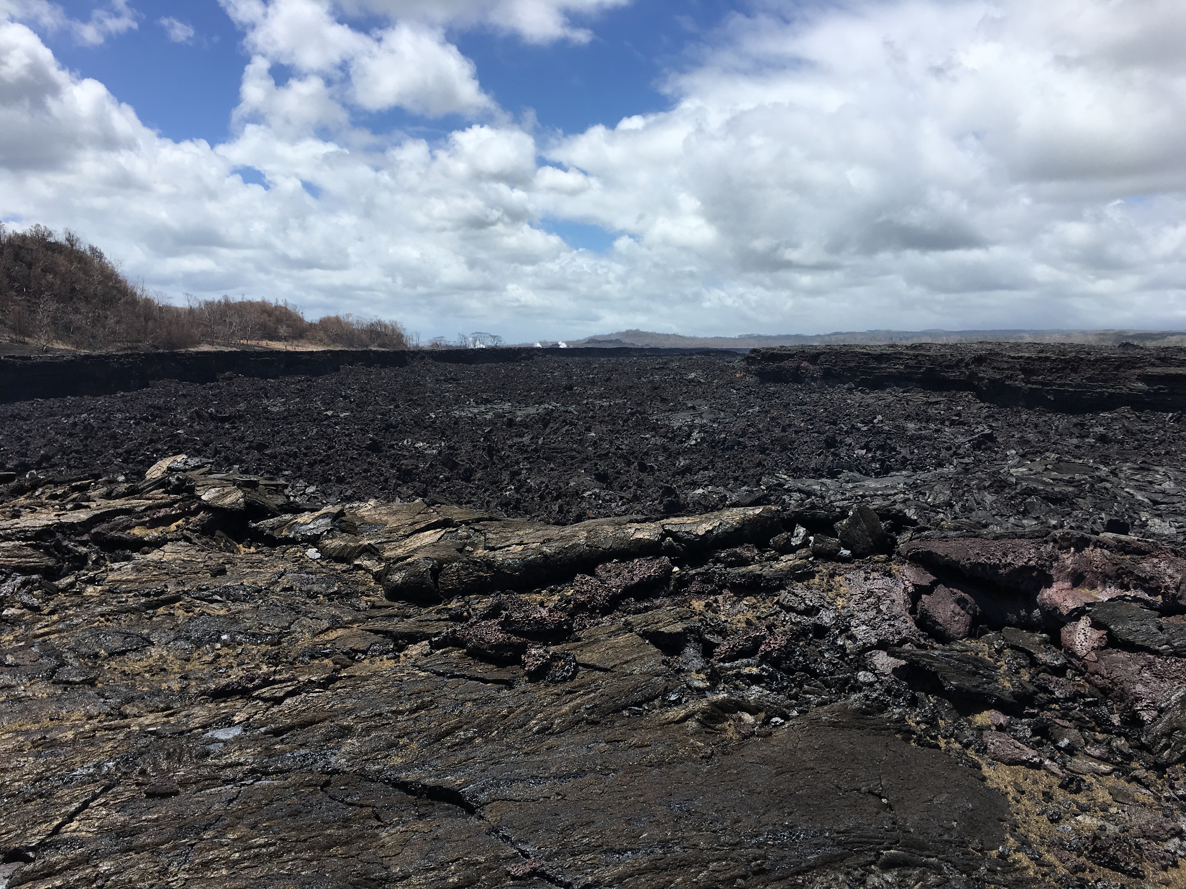
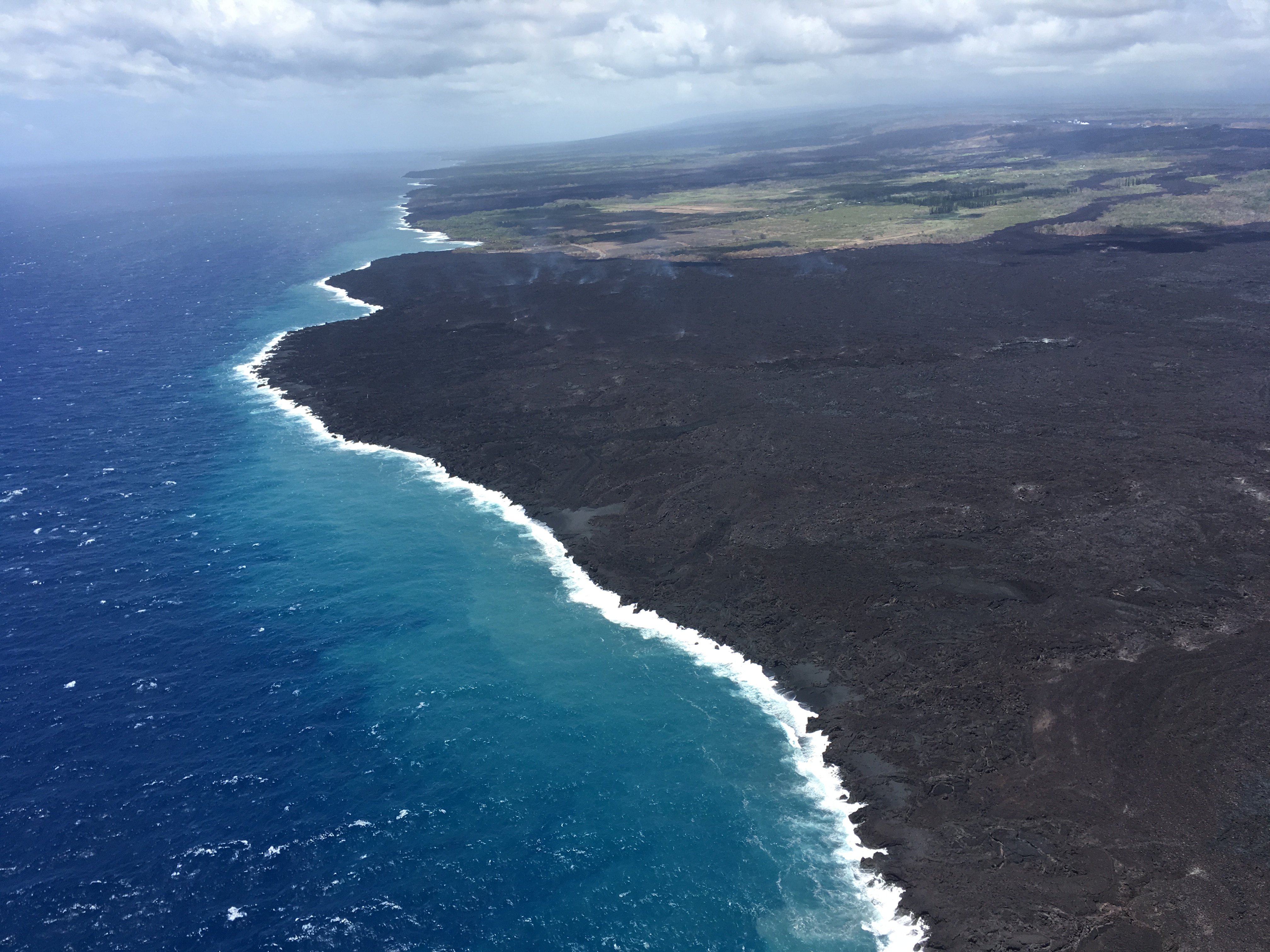
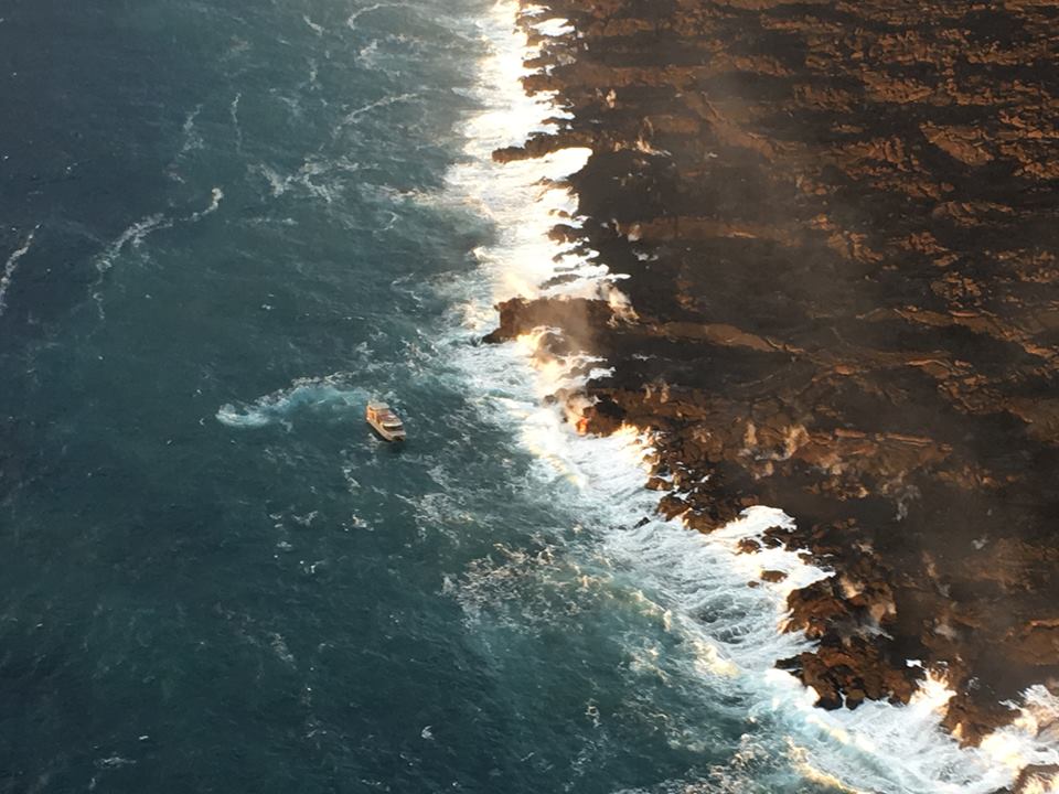
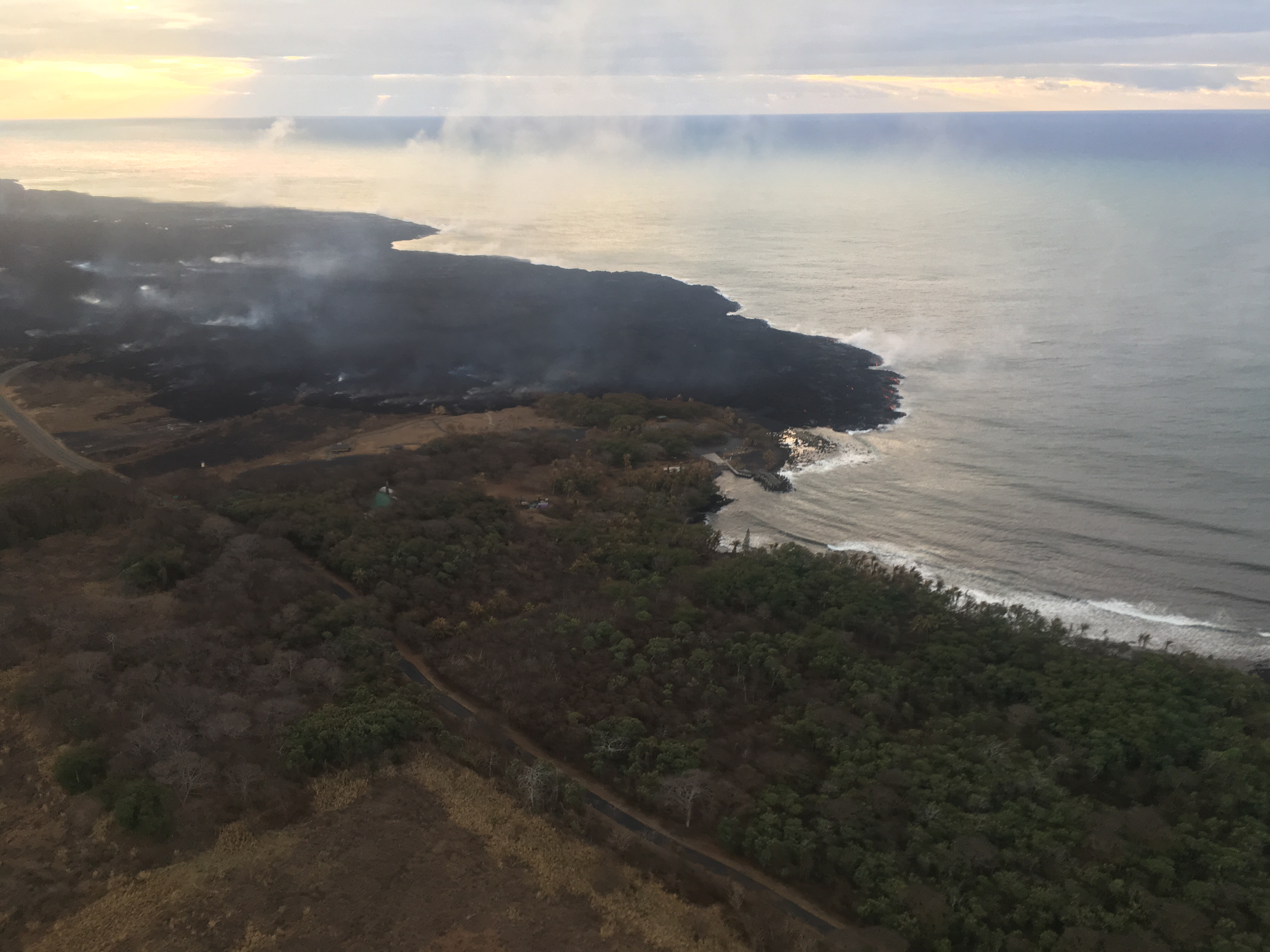
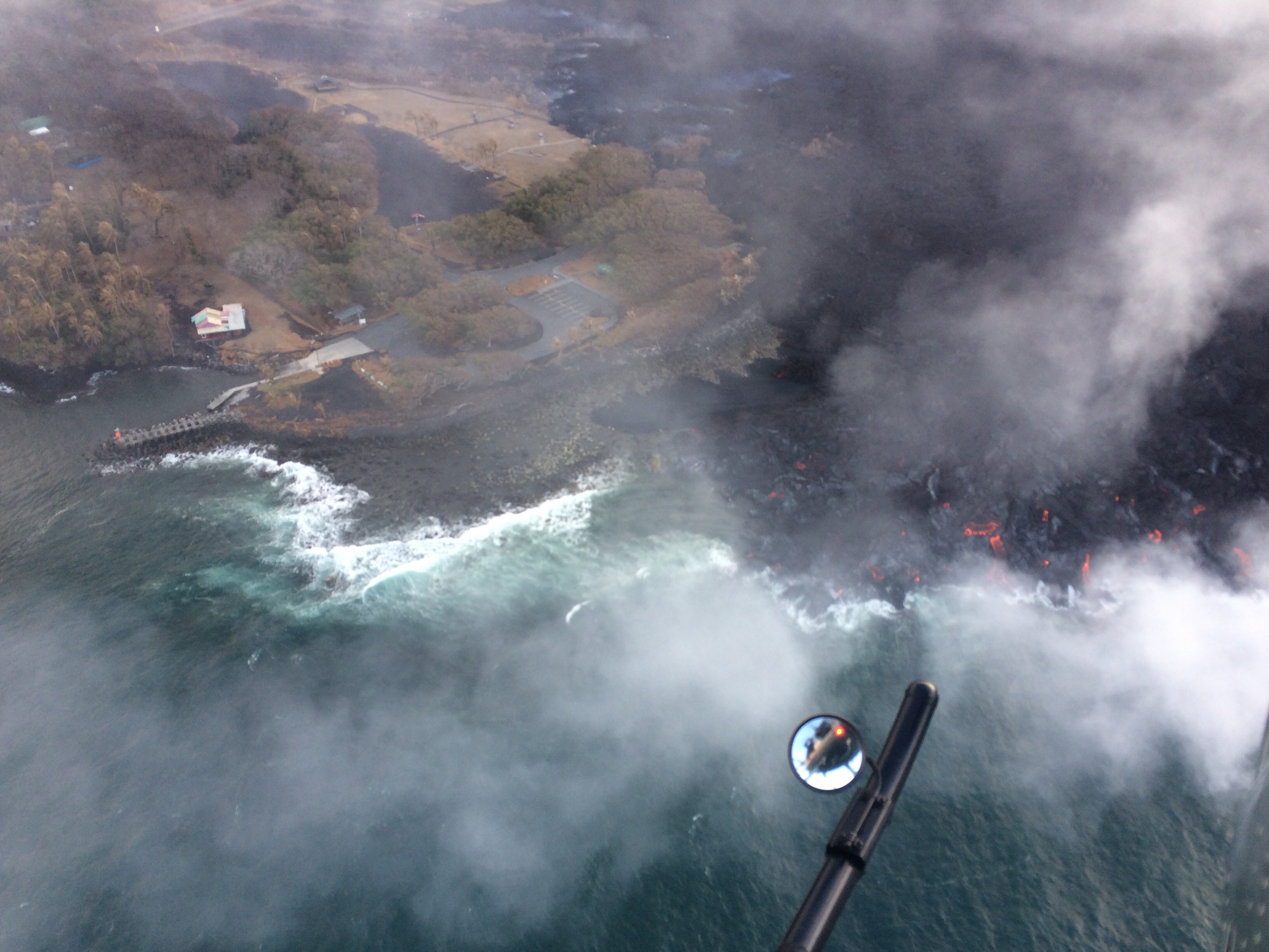
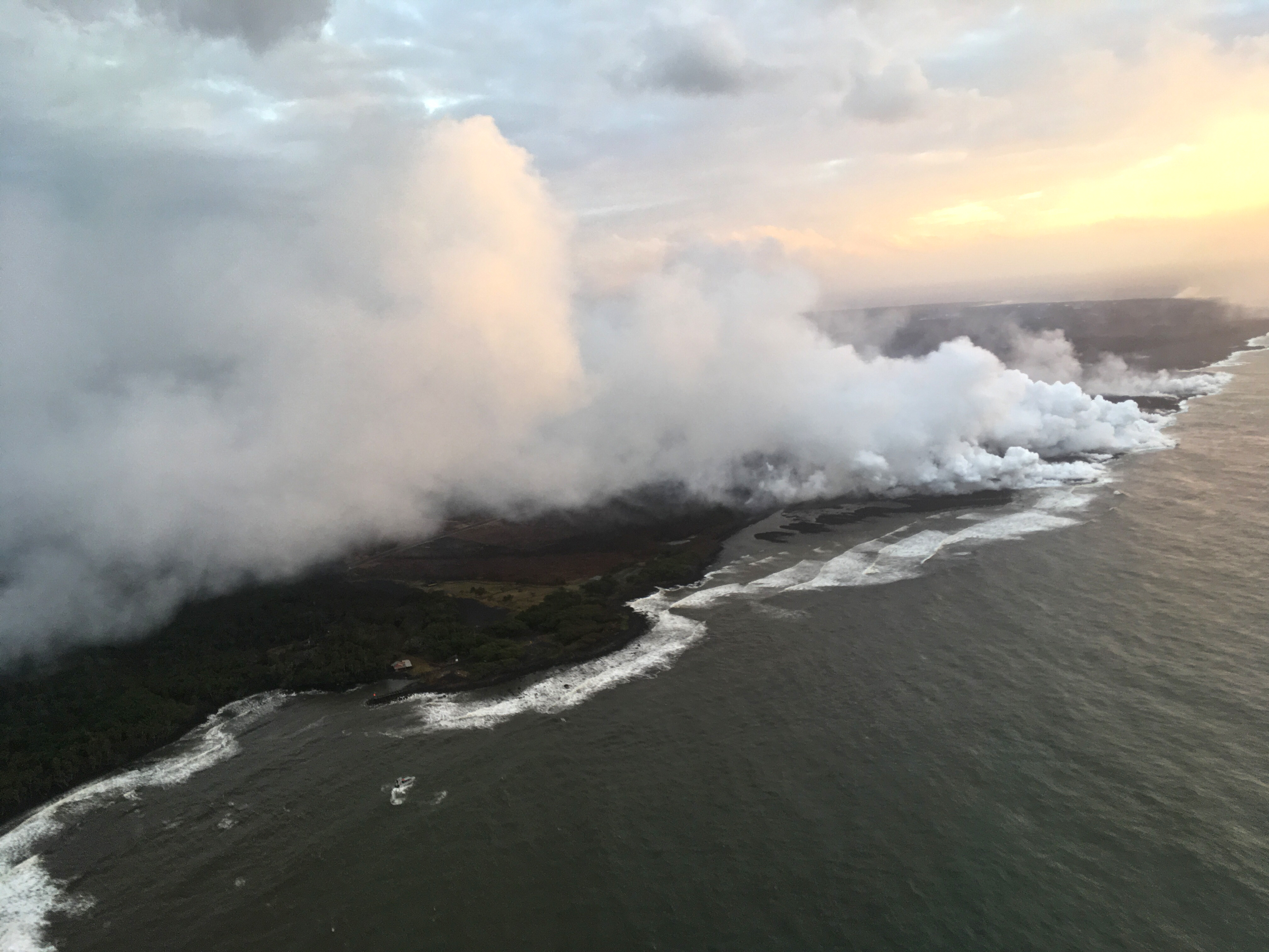
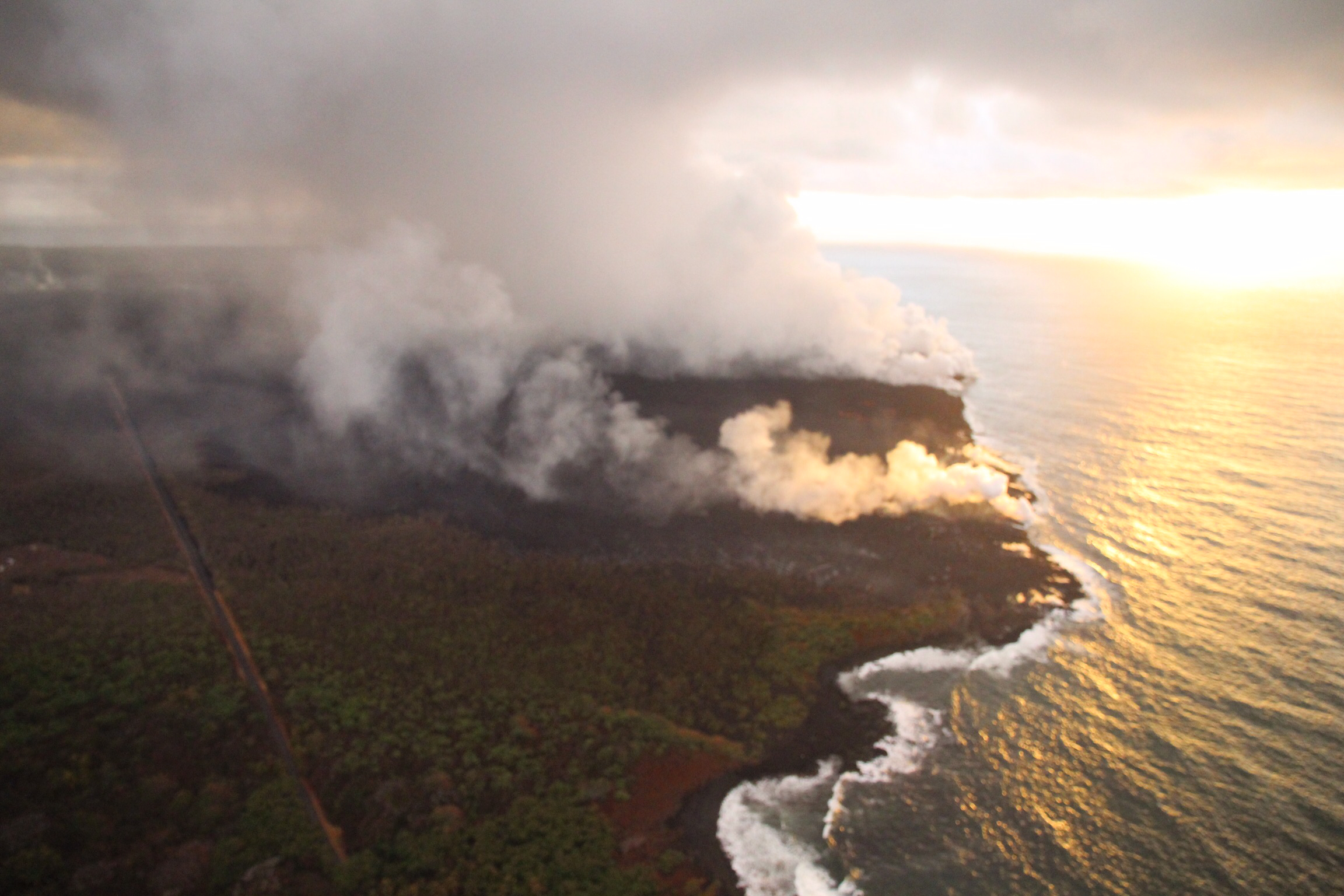
No active ocean entries have been seen for the past few days, suggesting that all the residual lava from Fissure 8 has stagnated or drained out.

August 30, 2018. USGS: “Lower East Rift Zone lava flows entering the ocean have built a lava delta over 875 acres in size, but no active ocean entries were observed by HVO geologists on this morning’s overflight. View to the southwest.” (Full-sized)

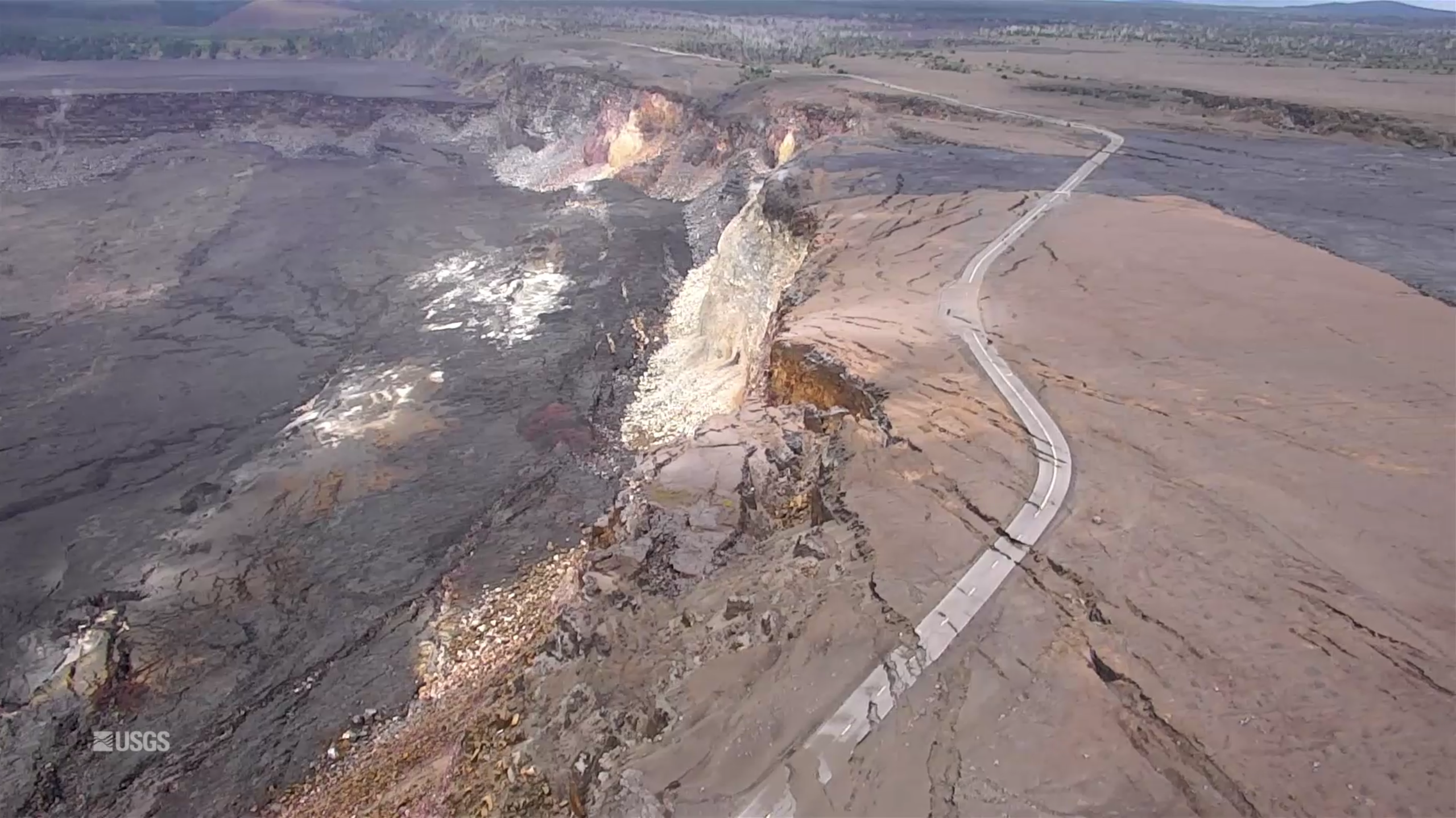
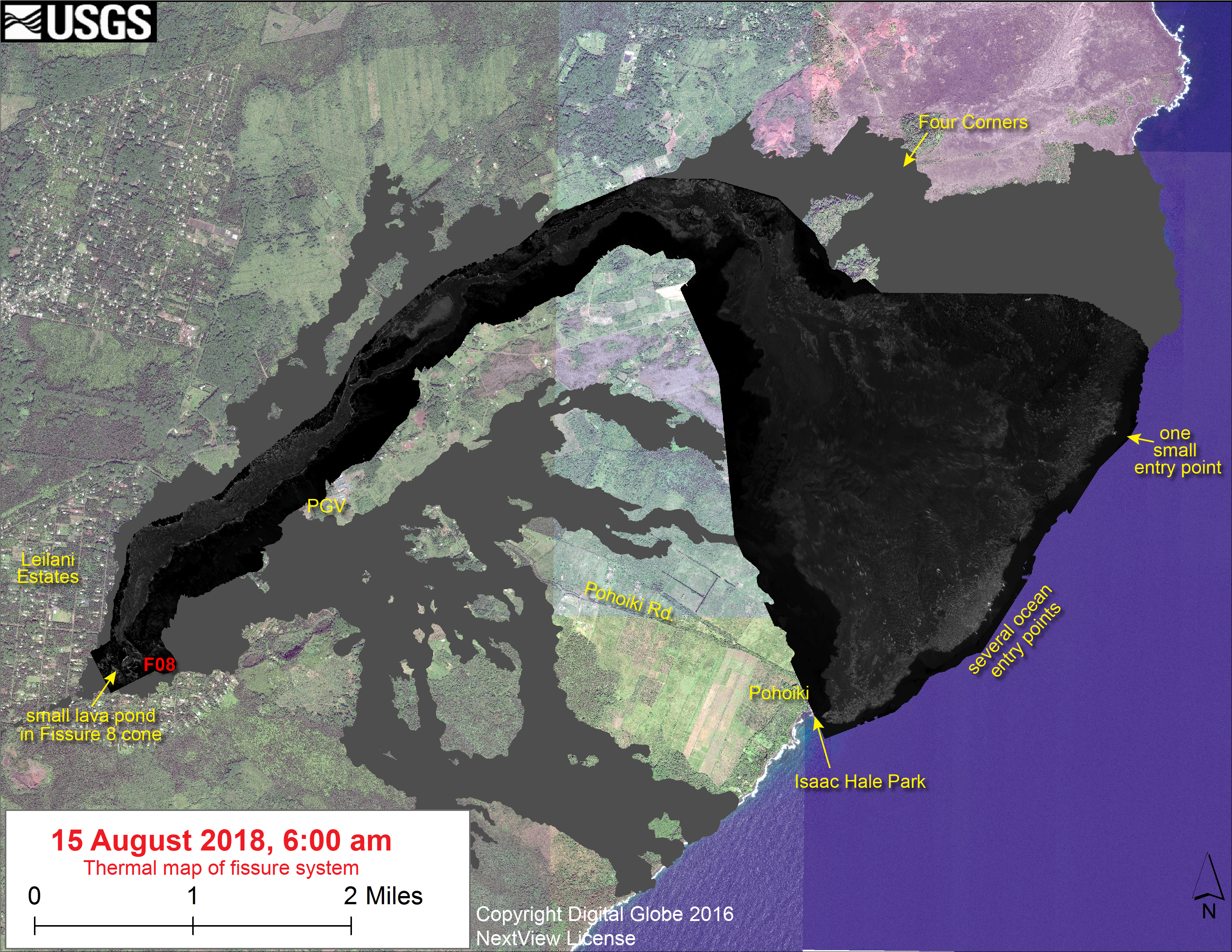
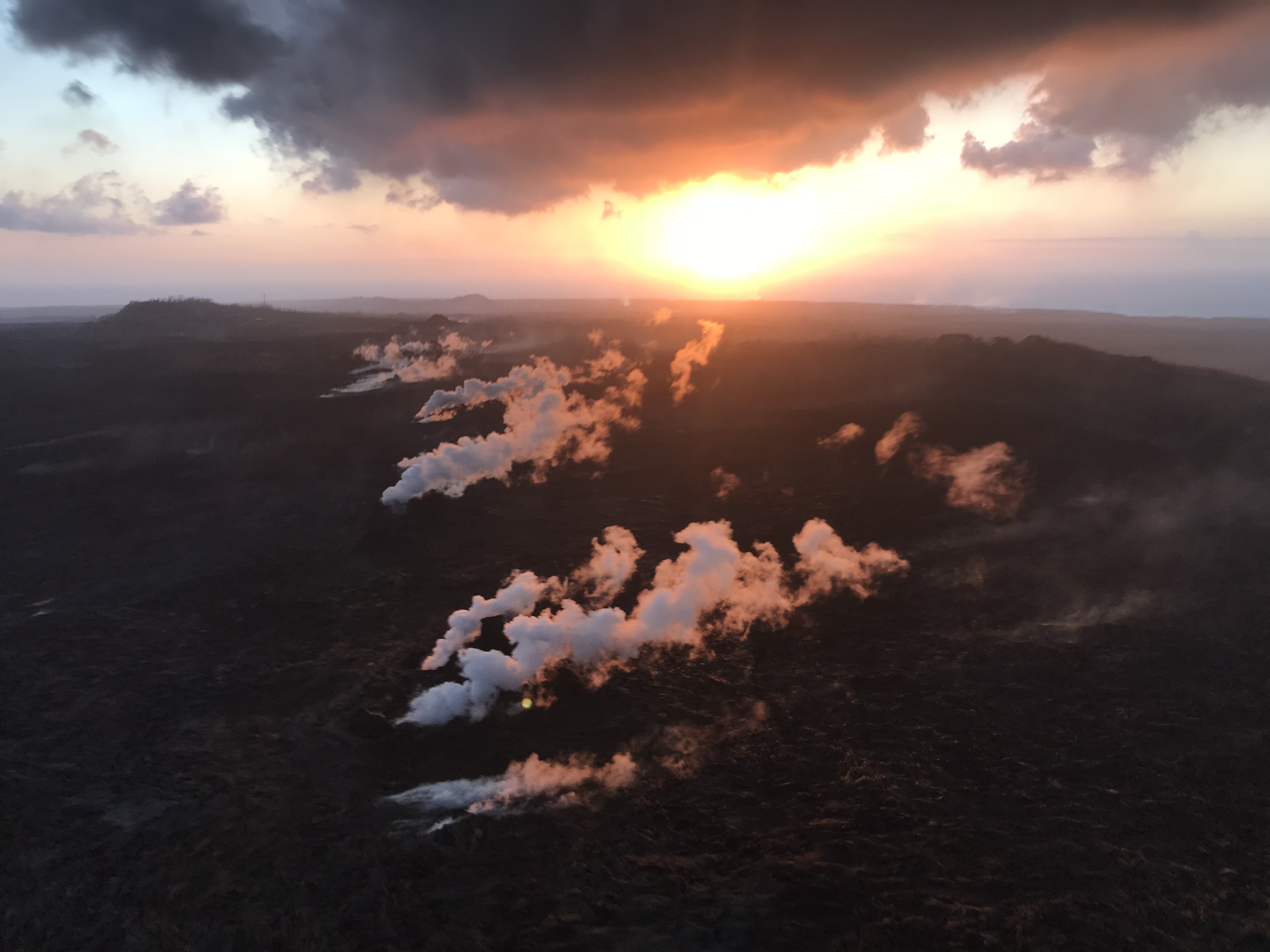
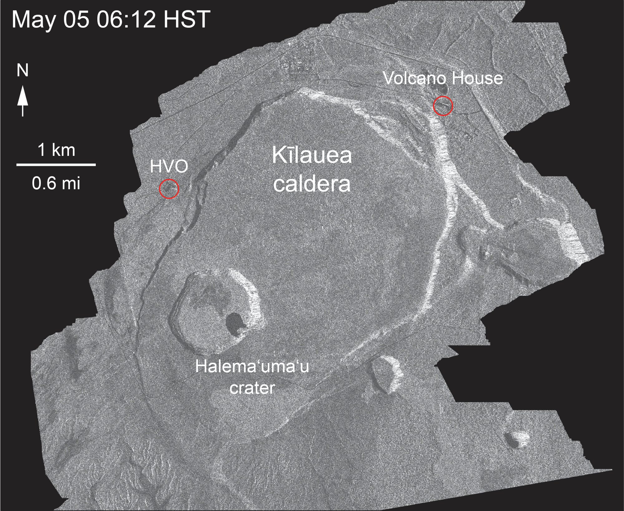
This week has been a time of repair and taking stock. USGS geologists have been replacing lost or damaged monitoring stations (including the UWE tiltmeter, back on HVO’s deformation page). The drone crews have been out after Hurricane Lane came through to take new detailed aerial surveys of Kilauea’s summit (August 30 video) and Fissure 8 (August 21 video).

Screencap from August 30, 2018 UAV video survey of Kilauea summit.

They also posted an updated timelapse video of HVO’s panorama cam of Halema’uma’u from April 14 through August 20:

This week’s Volcano Watch newsletter from HVO describes how “Scientific community lends a hand to measure Kīlauea’s changing shape.” This eruption required all hands on deck and every last scrap of equipment they had, and then some.

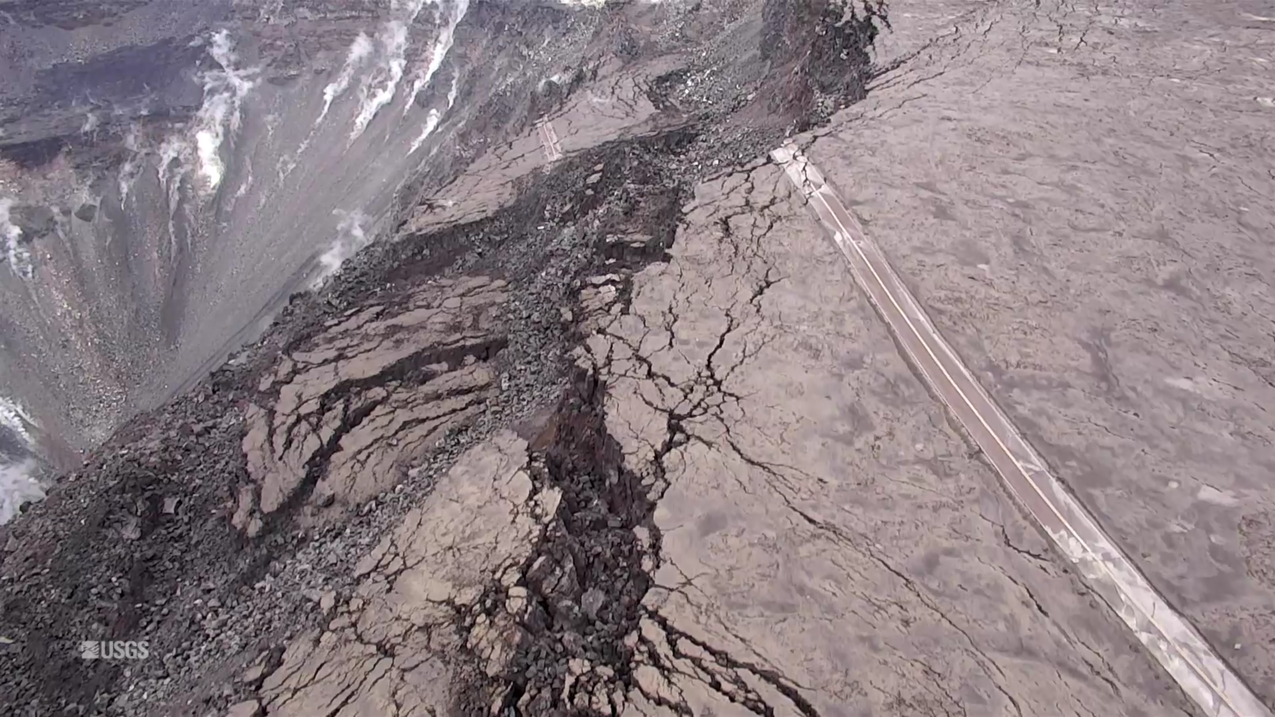
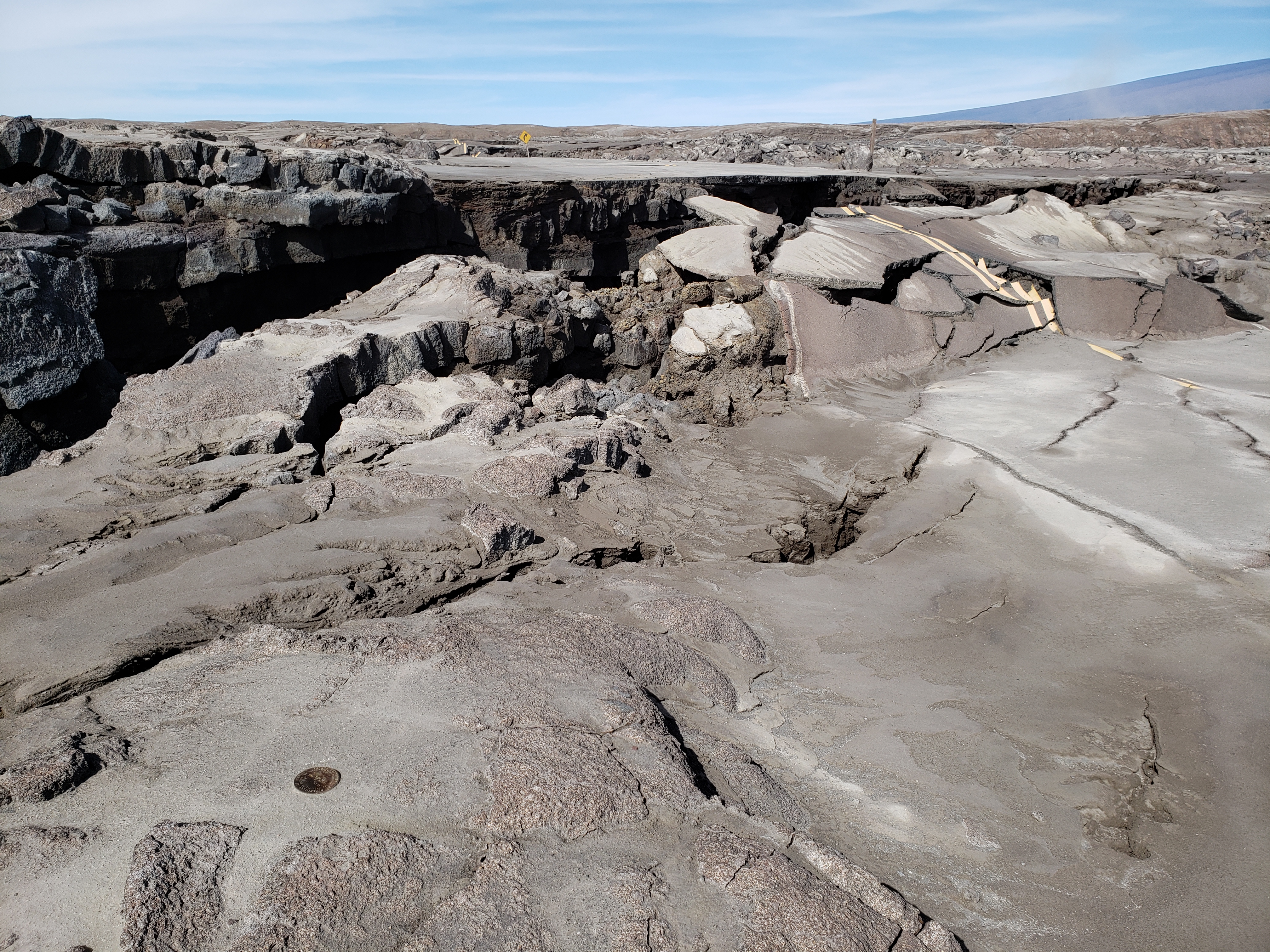
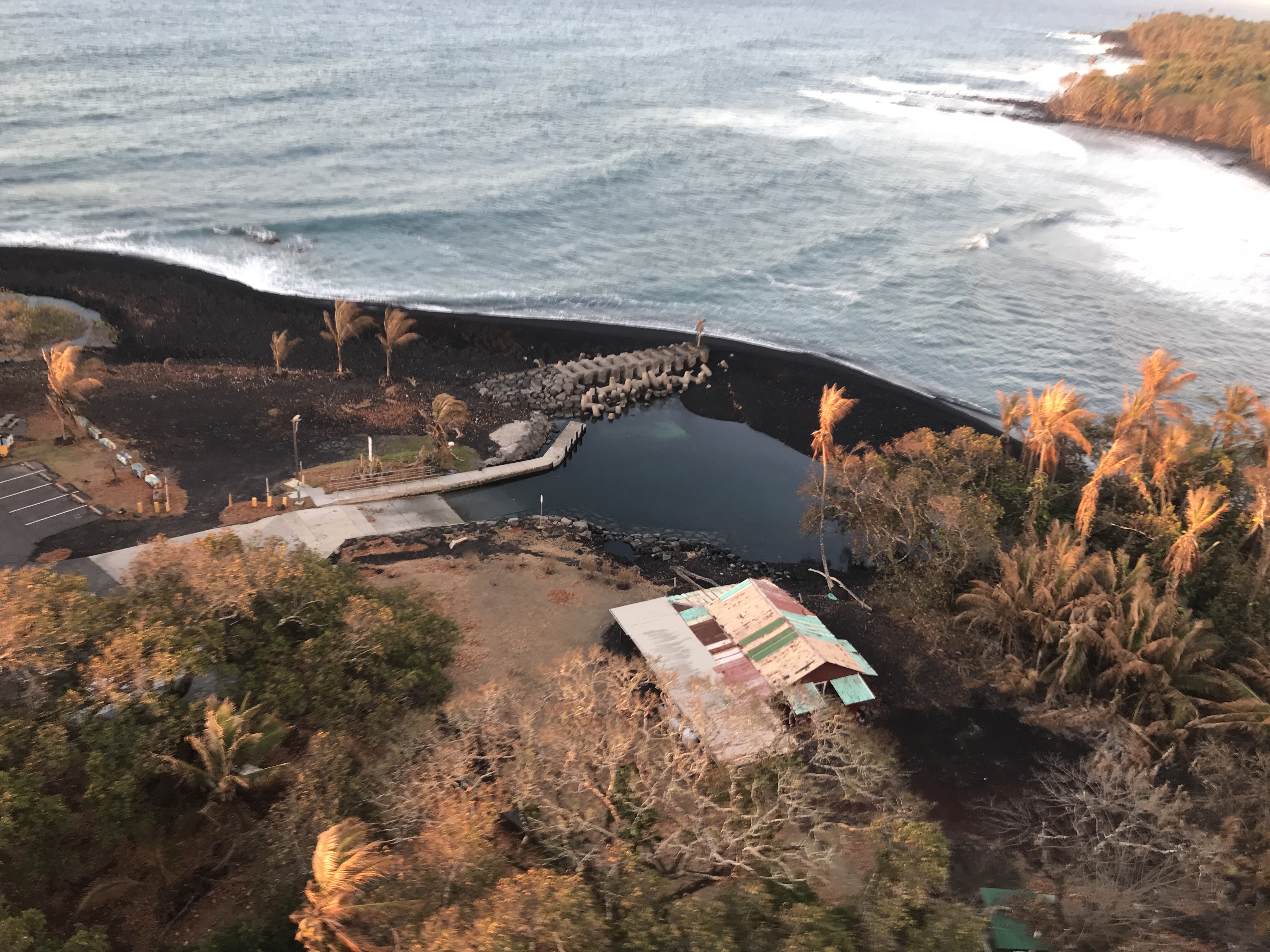
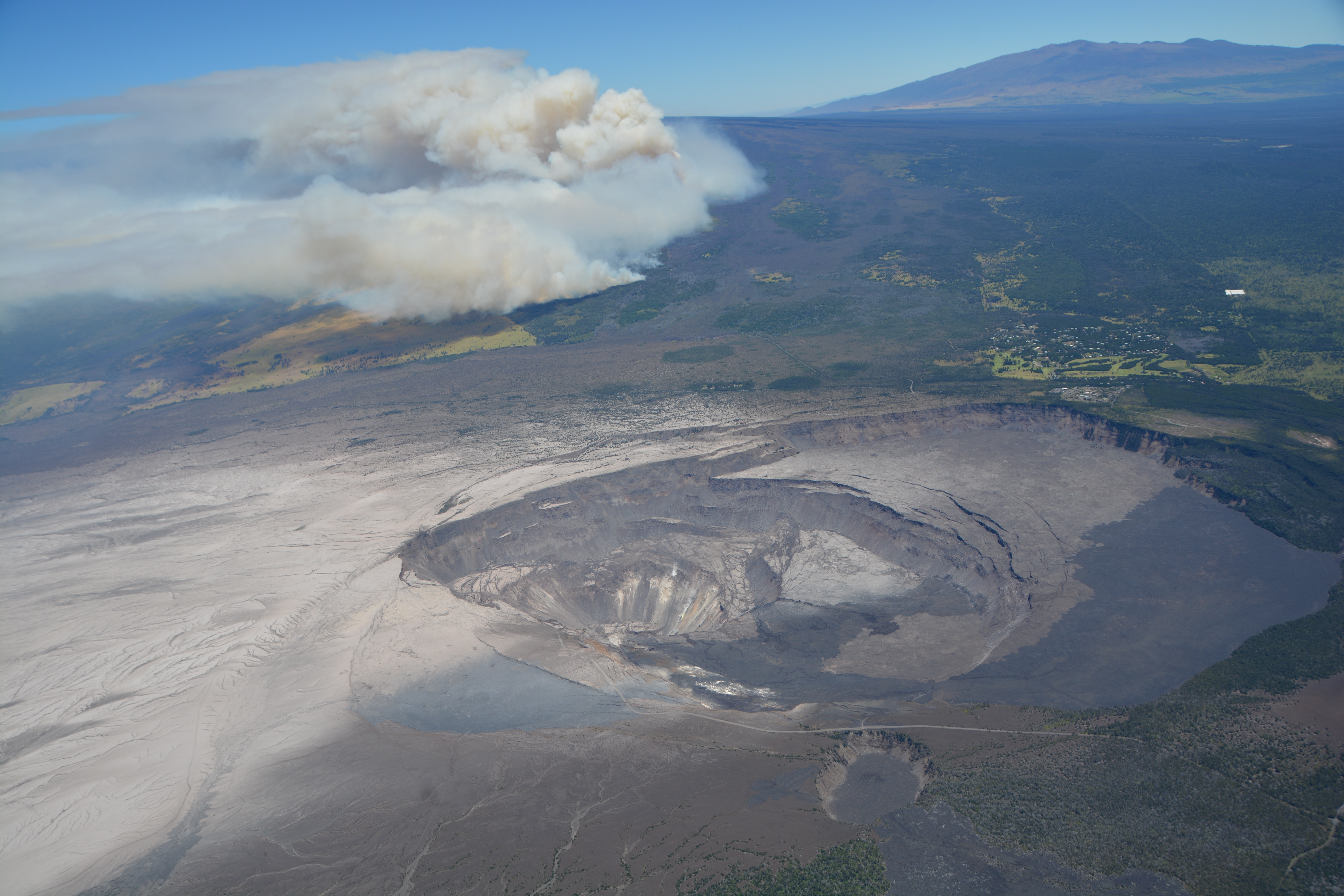
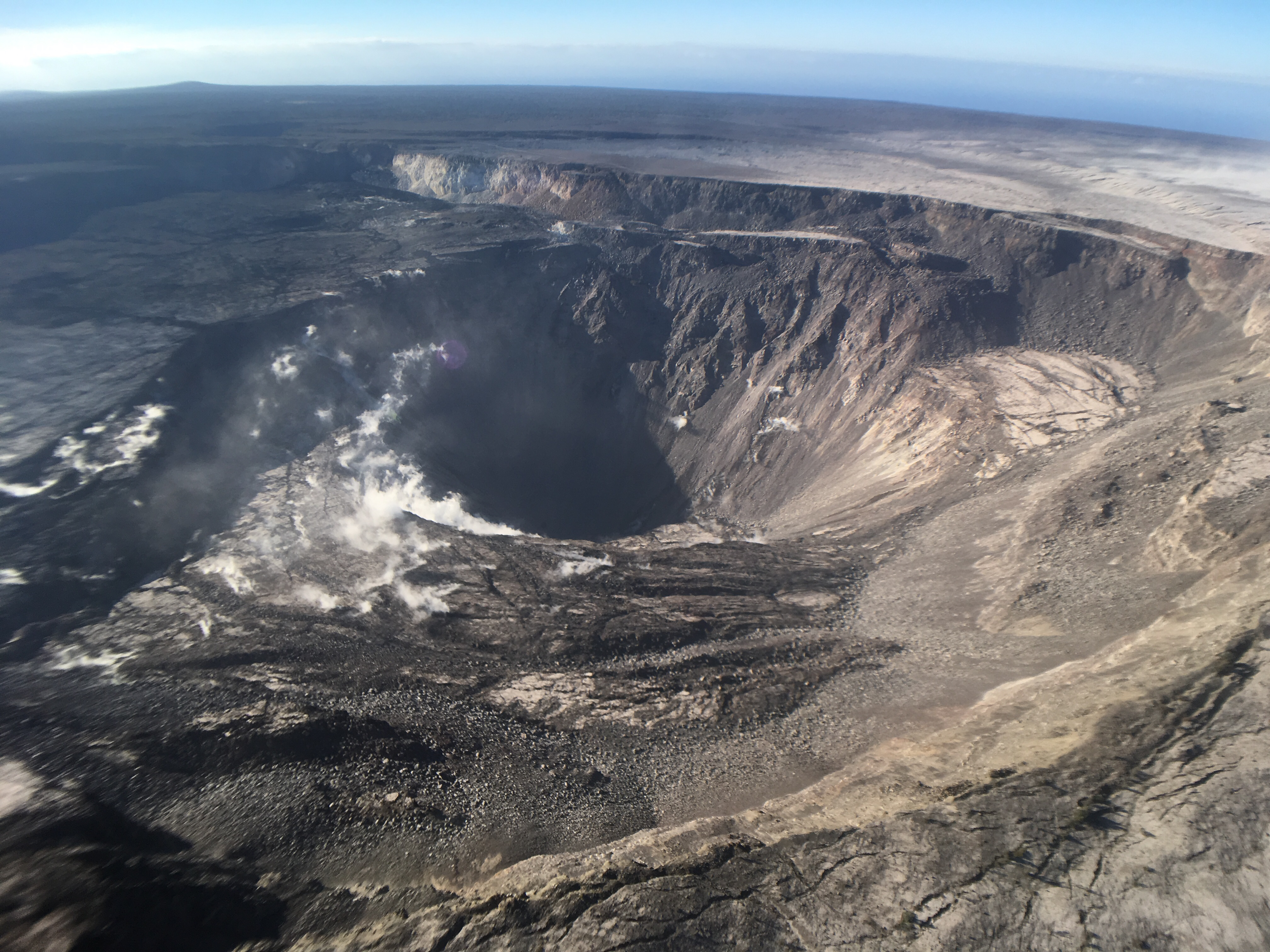
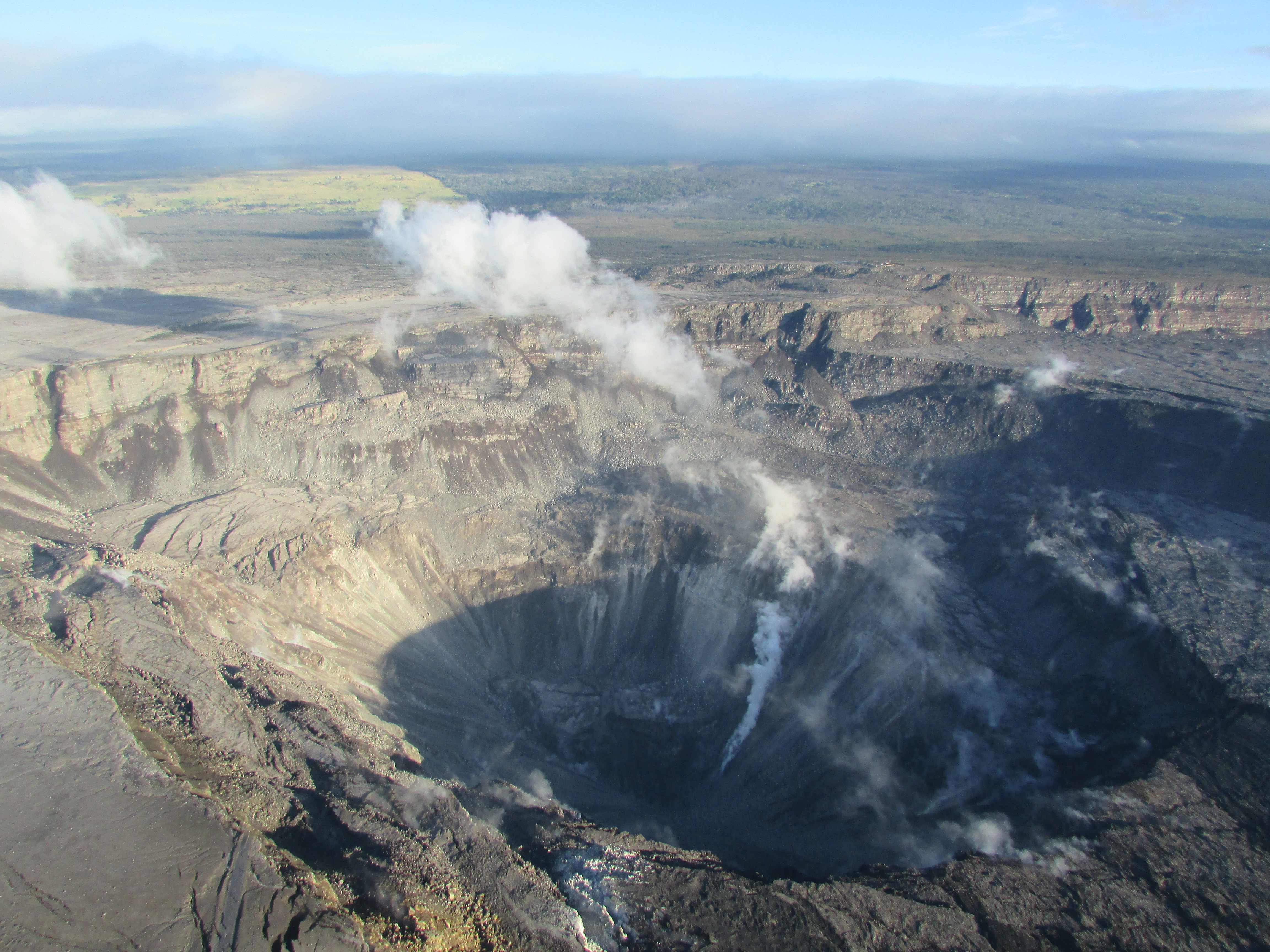
Another screencap from the August 30 drone survey of Halema’uma’u Crater and its surroundings. Piece of Crater Rim Drive a long way down in the crater.More photos after the cut, plus some notes on the park’s status.


Continue reading September 2: A Few Signs of Life Deep in Fissure 8

August 27: After Fire, Flood (Hurricane Lane)

August 22, 2018. USGS: “Parts of Kīlauea’s caldera floor are now a jumble of down-dropped blocks and surface cracks. HVO field crews carefully hiked along Crater Rim Drive yesterday to verify the locations of USGS benchmarks (lower left), which will be used for additional geophysical work that will help document the recent summit changes. The view is to the northwest with one flank of Mauna Loa visible in the distance (upper right).” (Full-sized)
Weekly Eruption Summary

After a busy few months, Kilauea continues to rest with only a pilot light on, so to speak. This week’s big news was that Hurricane Lane passed offshore of the Big Island on Thursday through Saturday, causing extensive flash flooding. But there’s still a little news to report on the dying (?) embers of Kilauea’s 2018 eruption.

On Friday morning, the Hawaii County Fire Department observed a small lava pond still visible deep in Fissure 8’s cone. For most of the week, there was no visible activity apart from a few small jets deep in the cone throwing weak spatter on Monday morning:

August 20, 2018. USGS: “This morning, USGS scientists flying over fissure 8 noticed a change in the vent from yesterday. Gas jets were throwing spatter—fragments of glassy lava (light gray deposits)—from small incandescent areas deep within the cone. This activity is an indication that the lower East Rift Zone eruption may be paused rather than pau (over).” (Full-sized)

The sputtery jets proved to be temporary:

August 21, 2018. USGS: “Southward facing aerial view of the fissure 8 cone. The two small areas of incandescence, gas jetting, and spatter from yesterday photograph appeared crusted over today.” (Full-sized)

Down at the ocean at Kapoho, there were a few weak dribbles of lava continuing to drain out of the delta at the beginning of the week:

August 20, 2018. USGS photo of residual lava entering ocean, posted on their facebook page here.

Sulfur dioxide emissions continue to be very low both at the summit and the coast. In fact, on Tuesday, they dropped too low in the Lower East Rift Zone for instruments to measure, although not too low for highly-sensitive human noses to detect.

Video from August 17 posted on the 20th— full-sized version here.

Heavy rain from Hurricane Lane on Friday and Saturday put a hold on USGS overflights and field observations and knocked out a few sensors on the east side of the island. But Kilauea’s extensive sensor network means there was no gap in volcano monitoring, and field crews were on call just in case.

The hurricane had no impact on the volcano apart from heavy rainfall hitting hot rocks and turning to steam in Pu’u O’o’s crater and on the not-yet-cooled lava flows of the LERZ. There were some reports of local white-out conditions from this steam. Rain may also have triggered a few rockfalls at the summit.

The other big Kilauea news this week is that Hawaii Volcanoes National Park has set a target reopening date for September 22, aiming to reopen at least the Visitor Center and (they hope) some kind of viewing area from which visitors will be able to see the new, larger Halema’uma’u Crater. They’re also hoping to open Volcano House, but they need to check the stability of the cliffs on which it stands.

USGS Volcano Watch

Whoops! I think I missed last week’s edition. This is Hawaiian Volcano Observatory’s weekly column with photos and in-depth information on some aspect of Kilauea.

Continue reading August 27: After Fire, Flood (Hurricane Lane)

August 19: The Lull Continues

This Week’s Eruption Activity

Negligible. There’s a few residual bits of lava oozing into the ocean at Ahalanui. Otherwise, there’s not much going on at the summit or LERZ.

[In case Tweet above isn’t showing, here’s the 3D Fissure 8 video on HVO website.]

USGS: “This thermal map shows the fissure system and lava flows as of 6 am on Wednesday, August 15 [2018]. Residual lava in the Fissure 8 flow continues to drain, feeding numerous small ocean entries. In the Fissure 8 cone there was a single, small lava pond.” (Full-sized)
On Friday August 19, HVO lowered ground alert levels, just as they lowered aviation alert levels after the ash explosions stopped. Here’s the official notice:

In light of the reduced eruptive activity at Kīlauea Volcano over the last several days, HVO is lowering the Alert Level for ground based hazards from WARNING to WATCH. This change indicates that the hazards posed by crater collapse events (at the Kīlauea summit) and lava flows (Lower East Rift Zone; LERZ) are diminished. However, the change does not mean with absolute certainty that the LERZ eruption or summit collapses are over. It remains possible that eruption and collapse activity could resume.

[…]

Remarks: Background and Prognosis

Kīlauea Volcano has remained quiet for well over a week now, with no collapse events at the summit since August 2. Except for a small, crusted-over pond of lava deep inside the fissure 8 cone and a few scattered ocean entries, lava ceased flowing in the LERZ channel on August 6. Sulfur dioxide (SO2) emissions rates at the summit and LERZ are also drastically reduced (the combined rate is lower than at any time since late 2007).

It remains too soon to tell if this diminished activity represents a temporary lull or the end of the LERZ lava flows and/or summit collapses. In 1955, similar pauses of 5 and 16 days occurred during an 88-day-long LERZ eruption. During the Mauna Ulu eruption (1969-1974), a 3.5 month pause occurred in late 1971.

HVO will continue to record detailed visual observations and scrutinize incoming seismic, deformation, and gas data, looking for evidence of significant movement of magma or pressurization as would be expected if the system was building toward renewed activity.

Also on Friday, the National Park Service issued a media release and gave select local media a guided tour of the summit. Lots of info, and worth seeing:

This Week’s USGS Photos From Summit to Sea

Continue reading August 19: The Lull Continues

August 13: Pele Is Sleeping, Part 2

August 13, 2018. USGS: “Ocean entries were small and scattered this morning, but lava had made no significant advance toward Isaac Hale Beach Park. The Pohoiki boat ramp remains intact, but access from it to the open bay has been cut off by a sand bar that extends from the jetty to the shore. As molten lava streams into the ocean, it shatters into small glassy fragments, forming black sand that’s transported along the coast by longshore currents.” (Full-sized)
Eruption Summary: the Lull continues

Fissure 8 is still emitting a gas plume, and lava circulates weakly within the cone. Residual lava is still draining into the ocean near Pohoiki. Gas emissions at the summit, Pu’u O’o, and even the Lower East Rift Zone are low.

August 13, 2018. USGS: “During their overflight this morning, HVO scientists observed no new activity at any of the lower East Rift Zone fissures. At the fissure 8 vent, a “puddle” of sluggish lava remained in the cone. No other incandescent lava was seen along the fissure 8 channel, except at the ocean entry. Some other fissures were steaming, as seen here.” (Full-sized)

[This post is a followup to yesterday’s, where I reviewed HVO news, photos and videos from the past week. Here, I’m covering everything else: local news media outlets, images/videos from local photographers, and a week’s worth of good Q&A from HVO/USGS on social media.]

Miscellaneous SCIENCE-y news

Timelapse of Kilauea Caldera Aug 2-9

August 12 LERZ Overflight

The latest from the @HotSeatHawaii gang. Mick Kalber’s August 12 video shows a few fingers of red lava dribbling out of the delta, and Pohoiki’s new sandbar which is currently blocking the boat ramp, but that can be moved. There’s a quick sweep over the weakly steaming fissures of the LERZ and a glimpse into Fissure 8’s cone, and then they tried to take a distant look at Kilauea’s summit:

Here’s Mick’s observations from this flight.

Bruce Omori posted photos of the same flight on Facebook, including:

Continue reading August 13: Pele Is Sleeping, Part 2

August 12: Pele Is Still Sleeping, Part 1

August 11, 2018. USGS: “The UAS team (Unmanned Aircraft Systems) flew a mission over fissure 8 to assess conditions within the cinder cone. As shown, fissure 8 contains two small ponds deep within its crater. One pond slowly circulates with an incandescent surface while the other pond is stagnant with a crusted top.” (Fuil-sized)
Weekly Eruption summary

So it’s finally arrived, the end (or at least intermission) of Fissure 8’s endless outpouring of lava from May 27 to August 4. The shutdown happened at the end of last week over a period of just 2-3 days.

August 11, 2018. USGS: “The fissure 8 cinder cone is currently about 30 m (100 ft) tall with a very broad base. Sulfur dioxide (SO2) emissions are low, reflecting the diminished activity of the lava ponds in the cone.” (Full-sized)

Fissure 8 isn’t quite dead. There’s lava pooled deep down the cone, bubbling weakly. Residual lava is still draining out of the lava delta into the ocean, some of it quite near the now-famous Pohoiki Boat Ramp. But most of the surface channels have drained and solidified.

August 11, 2018. USGS: “Close view of the Pohoiki boat ramp during this morning’s overflight. The southern-most flow margin has not advanced significantly toward the Pohoiki boat ramp, but black sand and larger fragments from the entry areas have washed ashore to create a sand bar and beach at this site. Geologists observed several small lava streams trickling into the sea along the souther portion of the lava delta, producing weak laze plumes.” (Full-sized)

The volcano’s summit has settled, too. The caldera floor isn’t inflating or deflating, and the swarms of earthquakes and summit collapses have stopped.

So now the question becomes: how long do geologists, national park staff and residents wait before deciding it’s safe to start repairing the damage? Past Lower East Rift Zone eruptions have paused for days, even weeks. So scientists and officials continue to warn that this eruption could resume at any time.

August 7, 2018. USGS: “Civil Air Patrol captured this image of Kīlauea’s summit yesterday (August 7, 2018), providing a stunning view of Halema‘uma‘u and the collapsed area within the caldera. Prevailing trade winds have blown much of the ash emitted during earlier explosions to the southwest (left), where thin layers of light-colored volcanic ash now blanket the landscape. Plumes of smoke rising from the flank of Mauna Loa were from a brush fire that continues burning today. Mauna Kea is visible on the upper right horizon; the crater visible at bottom center is Keanakāko‘i.” (Full-sized)

This week’s Volcano Watch column from Hawaiian Volcano Observatory, written August 9, addresses exactly that question:

“Is Kīlauea Volcano’s summit and rift zone activity pau or paused?”

Also, it looks like I missed an August 6 USGS news media briefing discussing the eruption’s apparent shutdown (full audio).

Now let’s look back at recent images and videos posted on HVO’s Photo & Video Chronology page, which only shows the 10 most recent posts— so these are visible there now, but won’t be in the future.

First of all, remembering past collapse events— with sound! Full-sized video posted here, or a faster-loading small version on Twitter:

Continue reading August 12: Pele Is Still Sleeping, Part 1

August 6: Kīlauea Falls Quiet

August 6, 2018. USGS: “Kīlauea’s summit remains quiet following the most recent collapse event on August 2 at 11:55 a.m. HST. This quiet is a significant departure from the pattern of episodic seismicity and continuous deformation over the past several months, with very low rates of seismicity continuing today. Deformation at the summit as measured by tiltmeter and GPS instruments slowed and virtually stopped between August 4 and 5. This view of Halema‘uma‘u is toward the southeast.” (Full-sized)

Today’s Eruption Summary

Little lava is leaving Fissure 8 today. It’s still bubbling away within the cone, but the channel below it is crusted over, with only residual lava draining down towards Ahalanui and the edge of Isaac Hale Park, and almost no laze plume. The summit’s seismicity is way down, and there’s almost no inflation or deflation since August 3. Now the question becomes: is this a temporary pause, or is this eruption really over?

(Full-sized version of this video)

Today’s Volcano update (12:49 PM HST) paints a picture of a pause – but we’re not yet ready to say if it’s a full stop.  https://volcanoes.usgs.gov/volcanoes/kilauea/status.html

@USGSVolcanoes on Twitter

August 6, 2018. USGS: ” This morning’s overflight revealed a weak to moderately active pond of lava bubbling within the fissure 8 cone, but no visible supply of lava from fissure 8 into the channel. The perched channel and braided sections downstream were essentially crusted over with some incandescence noted. Active flow in the channel was observed immediately west Kapoho Crater.” (Full-sized)
August 6, 2018. USGS: “There were small active lava ooze outs at the coast in the vicinity of the former Kapoho Bay and Ahalanui, and the laze plume was greatly diminished. Active lava is close to the Pohoiki boat ramp but did not advanced significantly toward it over the weekend.” (Full-sized)
August 6, 2018. USGS: “High-elevation view of Halema‘uma‘u and the larger Kīlauea Crater from this morning’s overflight, with Mauna Loa in the background. HVO and NPS Jaggar Museum are located on bluffs at the far side of the crater in the center of the view. Note the smoke plume from a still-burning brushfire on the lower flank of Mauna Loa.” (Full-sized)
August 6, 2018. USGS: “This photo shows a portion of the Crater Rim Drive that led from the east to the Halema‘uma‘u parking area, which slid into the growing crater weeks ago. Note a slump block located below and near where the road ends at Halema‘uma‘u. The September 1982 lava flow can be seen in the top of the photograph.” (Full-sized)

By the way, while trying to track down photos of the September 1982 lava flow, I found an old webpage (No datestamp, but Internet Archive first scraped it in 1999) with some interesting aerial photos of Kīlauea Caldera from the 70s and 80s. It would be fun to try to match the 1974 aerial photo with a new one, but I haven’t seen one taken from that high yet.

August 6, 2018, 2 pm HST. Latest USGS map of Lower East Rift Zone. (Full-sized)

At the top of this post, I posted Mick Kalber’s overflight video from this morning. Bruce Omori posted his photos and notes from this flight on the Lava Update blog, same post mirrored on Facebook with a few more observations:

Lava Update for Monday, Aug 6, 2018, 6:00 am – Kilauea's lower east rift zone overflight:Kīlauea's eruptive activity…

Posted by Extreme Exposure Fine Art Gallery on Monday, August 6, 2018

August 5: Pele Taking It Easy This Week

“Since May 16, 2018, the crater depth has more than tripled and the diameter has more than doubled.” ~ HVO

Kilauea summit changes, 2018. USGS: “Here’s another ‘then and now’ look at Halema‘uma‘u (view is to north). At left, Halema‘uma‘u, as we once knew it, and the active lava lake within the crater are visible on April 13, 2018. At right is a comparable view captured on July 28, 2018, following recent collapses of the crater. The Hawai‘i Volcanoes National Park Jaggar Museum and USGS-HVO can be seen perched on the caldera rim (middle right) with the slopes of Mauna Loa in the background.” (Full-sized)
Current Eruption Summary

Volcanic activity has decreased over the past few days, at both the summit and down in the Lower East Rift Zone. However, as HVO warns us (and has stated many times), eruptions wax and wane, and can even stop and start up again. So we don’t yet know whether Pele’s winding down or simply taking a breather.

But for the moment, at least, Fissure 8 is putting out much less lava than before— in fact, this morning (August 5) its level is so far down that it’s barely feeding the channel. Lava levels were already lower and sluggish, and today the river is mostly crusted over and/or moving as thicker, crumbly a’a flows. However, blockages downstream are still causing overflows and breakouts.

“View of the fissure 8 cone and spillway from HVO’s overflight early this morning, during which geologists observed eruptive activity that was much less vigorous than in past days.” (Full-sized)

Despite the slowdown at the source, lava continues to ooze into the ocean along a long section of the southern flow front. It’s edged a little bit closer to the boat ramp and local park that’s become a symbol for residents mourning the loss of so many other beloved places:

August 5, 2018. USGS: ” A diffuse laze plume afforded a clear view of Isaac Hale Beach Park and the ocean entry, which was being fed across a broad front by viscous pāhoehoe. Lava was oozing laterally, but was still about 70 m (230 ft) southeast of the Pohoiki boat ramp as of this morning.” (Full-sized)

Lava tour boat operator Ikaika Marzo did not see any signs of slowdown at the flow front this morning, and he reported that lava has claimed claimed another popular local surf spot called “Dead Trees.”

At the summit, intervals between collapse events are lengthening. As of 5 pm August 5, it’s been over three days since the last summit collapse event. Today’s mini-update on HVO’s website states:

Rates of seismicity and deformation at summit and lava output from fissure 8 have decreased since most recent collapse event at 11:55 am HST August 2. Too soon to tell if the decrease will persist. Hazardous conditions remain.

Lower East Rift Zone USGS lava map as of 10 am, August 3. (Full-sized)
Friday, August 3 USGS Thermal Map of Lower East Rift Zone as of 12:30 pm. (Full-sized)
Latest Satellite Imagery

The most recent scenes, acquired on August 1, 2, and 5, show little overall motion, which is consistent with the slowing of deformation in the summit area over the past few days. — HVO

Kilauea Caldera satellite radar imagery, May 5-August 5, 2018. (Full-sized)
Volcano Watch, August 3

And on August 3— before today’s significant lava decrease at Fissure 8— HVO posted out its weekly Volcano Watch column:

Outline of the rest of this post:
  • Summary of USGS presentation at Thursday Volcano Village meeting
  • Review of USGS eruption images from past few days (plus video)
  • News and Kilauea-related information from other official agencies
  • Kilauea-related headlines from local news media
  • Overflight photos/videos of LERZ from @Hotseathawaii, etc
  • USGS Q&A about eruption (and recent signs of change) on social media

Continue reading August 5: Pele Taking It Easy This Week

July 28: Mini-Update Plus New Images of Summit

New Image of Halema’uma’u – July 28, 2018
July 28, 2018. USGS: “Aerial view of the summit crater from this morning’s overflight. Zoom in to see HVO and the Park’s Jaggar Museum on the caldera rim (right side of photo).” (Full-sized)

Note the light green mostly-treeless area in background at left, and then zoom in to find museum & observatory on rim at right. Then compare with:

April 13, 2018
BEFORE the big event: Kilauea caldera, April 13, 2018. USGS: “The museum and HVO are perched on the caldera rim (middle right), with the slopes of Mauna Loa visible in the background.” (Full-sized)
Today’s Eruption Summary

Summit collapse event at 2:37 am HST, July 28, 2018. Energy release equivalent to M5.4. Minor overflows on Fissure 8’s channel reported a few hours afterwards. At the coast, the SW edge of the flow remains stalled 175 m from Pohoiki boat ramp, with ocean entry a few hundred meters to its east.

Road crews are monitoring cracks on Highway 130 after increased gas emissions were detected there.

Also, notwithstanding longer intervals between recent summit collapses and a few days where the lava channel seemed lower, HVO doesn’t see any strong indications the eruption is weakening:

More photos from today

Continue reading July 28: Mini-Update Plus New Images of Summit

July 17: New and Old Views of Halema’uma’u

July 17, 2018. USGS: “During this morning’s overflight, USGS scientists captured this image of sunrise above Kīlauea’s lower East Rift Zone. Fissure 8 continues to feed a channelized lava flow that reaches the ocean, forming a large plume at the coast (upper right).” (Full-sized)
Today’s Eruption Summary

And we’re back to routine, except that Fissure 8’s providing a minor puzzle to keep HVO busy. Yesterday it didn’t exhibit the surge behavior that’s been typical after summit collapses for the week or so. Today, nowhere near the time of a collapse event, “surging was noted at the Fissure 8 cone during the [morning] overflight but had stopped by the time ground crews arrived to verify it.” Otherwise, the channel’s lava level was low this morning. No other were fissures active.

July 17, 2018. USGS: ” During their overflight, scientists used a telephoto lens to photograph the surface of the fissure 8 lava channel. Incandescent lava is visible through pieces of darker crust that forms as the flow surface cools. Note the apparent symmetry on either side of the channel center, where lava flows more quickly than it does along the channel margins—a visual representation of flow velocity across the channel width.” (Full-sized)

Both the strong southern ocean entry and weak “ooze-outs” north along the edge of the lava delta continue. Onshore, the southern margin of the flow front was reported to be half a mile from the Pohoiki boat ramp this morning. Unfortunately, that flow edge has stalled but not stopped, and a DLNR official warned Isaac Hale Park is still within its sights.

July 17, 2018. USGS: “South margin of the fissure 8 lava flow ocean entry. As of this morning, the flow was about 750 m (just under 0.5 mi) from the Pohoiki boat ramp.” (Full-sized)

We’re still awaiting the next summit collapse, which looks like it’s going to thwart HVO’s new “Northeast Caldera Rim” livestream by happening at night.

Speaking of the northeast rim, here’s the July 12 collapse event with sound from that vantage point:

Also out today is this impressive new Kīlauea Digital Elevation Model.

The split-second info card at the end says the floor of Halemaʻumaʻu Crater has dropped 450 m (1480 ft). Prior to the current eruption, it was 85 m (~280 feet) deep. So it’s about 1760 feet deep now. (World Trade Center One is 1776.)

Continue reading July 17: New and Old Views of Halema’uma’u

June 9: Fissure 8 Rearranges the Furniture

July 9, 2018. USGS: “Lava entering the ocean as seen through steam and rain early this morning.” (Full-sized)
Today’s Eruption Summary

Wild weather, overflows and significant channel reorganization have made the Lower East Rift Zone more interesting today than those living near Bryson’s cinder pit would like.

July 9, 2018. USGS: “This photograph taken during this morning’s overflight shows heavy, localized rain at fissure 8 in Leilani Estates.” (Full-sized)

Sunrise overflights by the USGS and @hotseathawaii spotted a torrential downpour centered directly over the upper lava flow (above). A rain gauge in Leilani Estates measured 9.22″ rainfall at 7am for the past 24 hours; another just a little farther away measured 6″ over the same span. All that updraft, convection and condensation even produced a modest… lavaspout…? captured on video (strong language warning):

The Kapoho end of the LERZ eruption was even more chaotic. Over the weekend, several non-USGS sources had reported that lava was starting to shift back to the south after passing Kapoho Crater, forming a slow-moving flow headed for Ahalanui Ponds (and sparing 3 of the 4 remaining Kapoho Beach Lots houses). This morning, HVO status updates confirmed the change: “The main lava channel has reorganized and is nearly continuous to the ocean on the south side of the flow, expanding the south margin by several hundred meters.” Also, while the ocean entry was still a very broad 2.5 mile front at sunrise, it’s started to coalesce a bit and shift towards the south:

July 9, 2018 (later in the morning; can’t be afternoon because of sun position). USGS: “Sourthern end of the active fissure 8 flow margin north of the Analannui Park [sic], known as the warm ponds. The flow margin is estimated to be about 500 m (0.3 mi) from the park.” (Full-sized)
However, blockages in the braided section of the lava river caused further havoc later in the day. HVO’s afternoon status update reported that, “Early this afternoon, observers reported multiple overflows occurring along both sides of the main lava channel, in an area extending from near the ‘Y’ intersection at Pohoiki Road eastwards to an area just west of Kapoho Crater. Overflows on the upper part of the channel did not extend beyond areas previously covered in lava. Overflows further down the channel have reached beyond the flow field, including one flow lobe that is moving northeast from the main channel towards Cinder Rd.”

July 9, 2018. USGS: “The lower section of the fissure 8 lava channel appears to be almost completely crusted over, and the lava level in the channel was lower during this morning’s overflight.” (Full-sized)

[HVO afternoon status update cont’d] “Based on information from ground observers and morning and afternoon overflights, the lower part of the main lava channel has undergone significant reorganization. In particular, the channel that had been open near Four Corners is now mostly crusted over, and plumes from ocean entry are significantly reduced. It is likely this is due to a blockage that formed in the early morning in the main channel upstream of Kapoho Crater. Flow volumes coming out of Fissure 8 remain significant, and it is possible that changes in flow channels will continue to occur in the coming days.”

Meanwhile, up at the summit, it’s business as usual. This morning’s collapse event occurred at 9:20am, registering once again as 5.3:

USGS posted yesterday’s thermal map first thing this morning, plus a 2pm map today showing these changes:

Continue reading June 9: Fissure 8 Rearranges the Furniture