July 5: Lava Takes Aim at Last of Kapoho Beach Lots

July 5, 2018: USGS: “Near the Kapoho Crater, in the area called Four Corners, the lava channel makes a 90-degree bend. After lava exits the bend, it makes a short drop to form a lavafall. A side channel makes a short surface diversion before rejoining the existing channel.” (Full-sized)
Today’s eruption summary

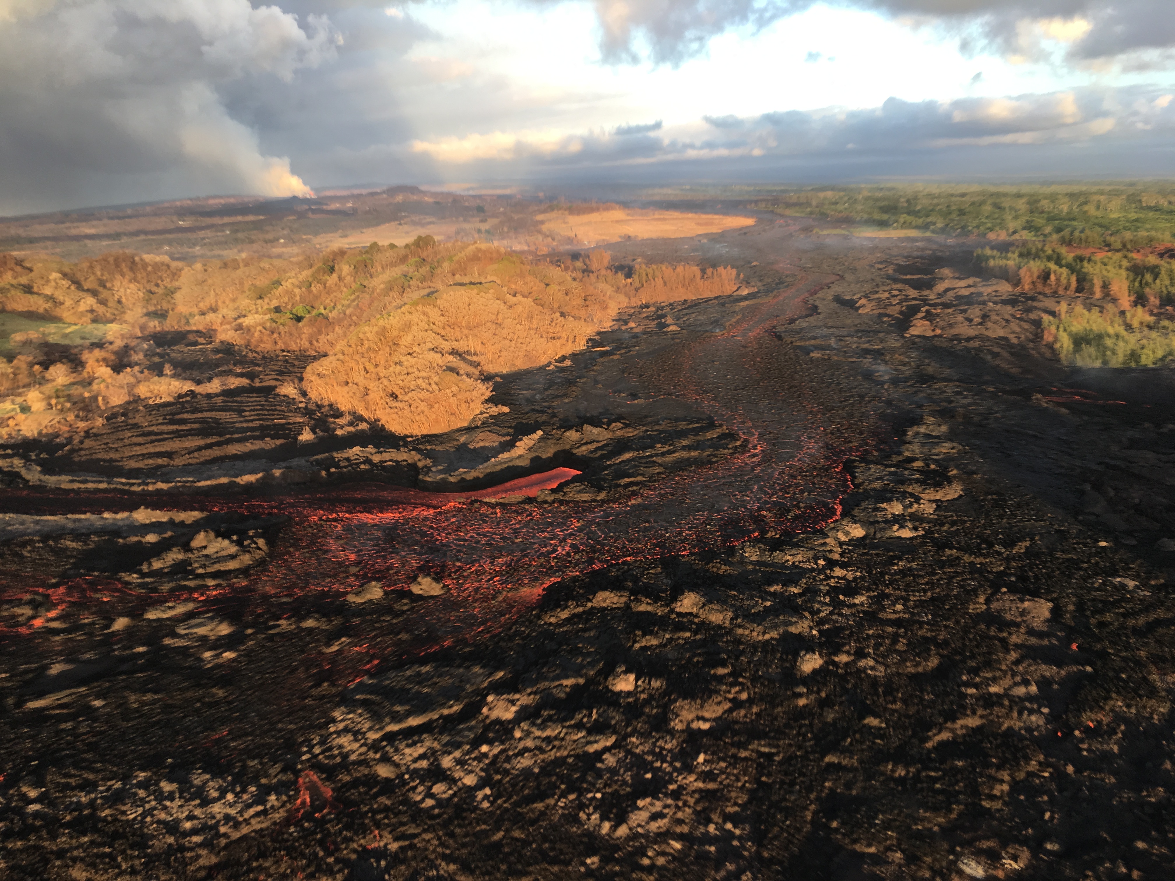
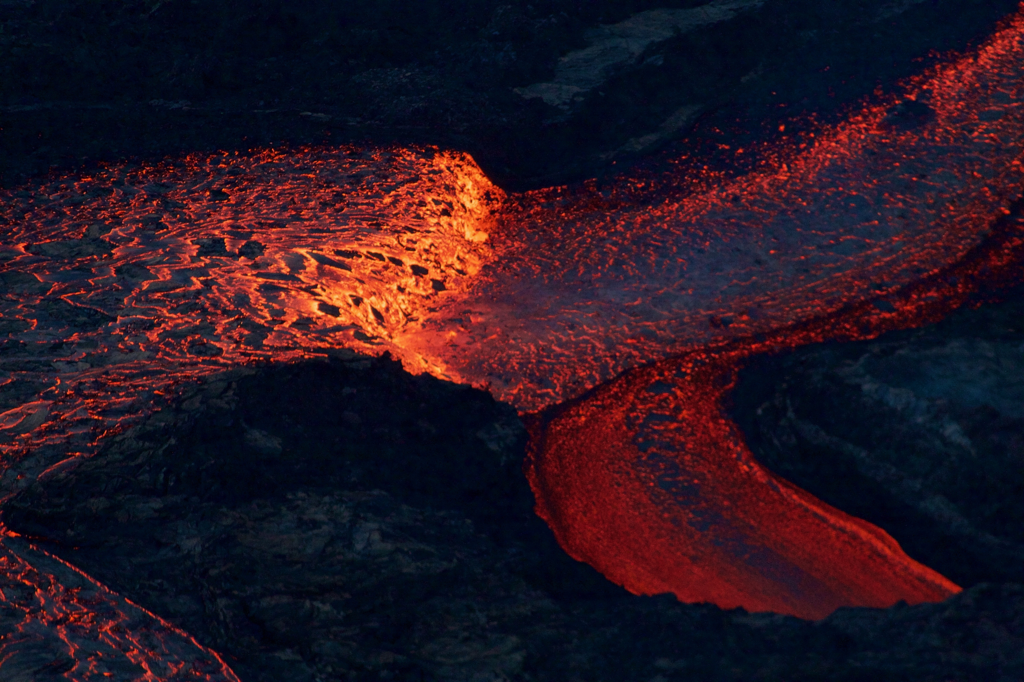
The LERZ eruption continues with minor variations. This morning’s USGS overflight crew observed that Fissure 8’s fountain and lava level in the upper channel appeared to be slightly lower. However, the lava flow rate down at Kapoho Beach Lots —where there were only a few houses left, as of this morning — seems to have picked up slightly.  Meanwhile, overflows spilling out from the constricted turn around Kapoho Crater have nearly reached Beach Rd about 0.2 miles north of Four Corners. Lava continues to enter the ocean along a very broad front, mostly on the northern side of the delta.

July 5, 2018. USGS: “Lava enters the sea along the Kapoho coastline, building a delta that is now over 555 acres in size.” ( full-sized )

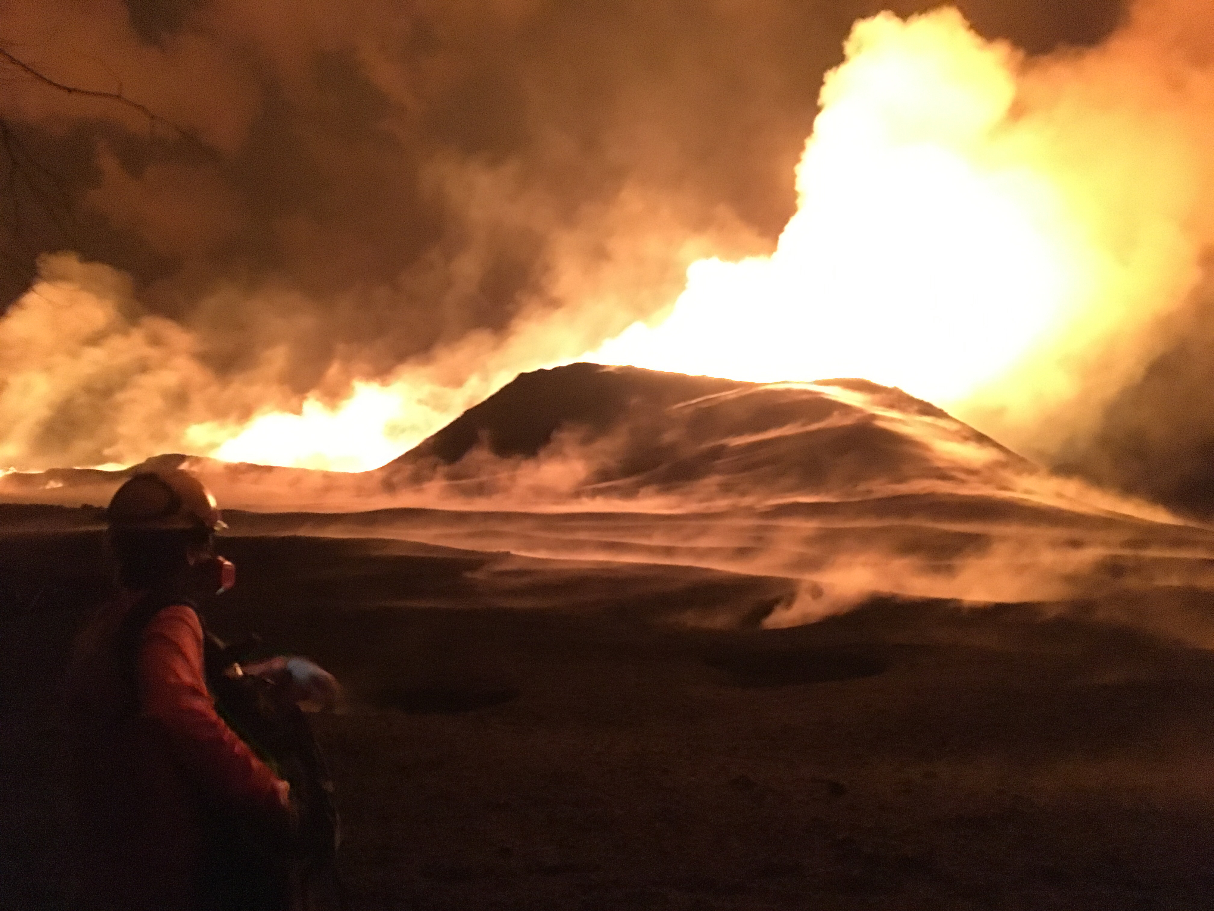
Fissure 22 is “sporadically spattering,” and its flow  may have stalled.

At the summit, today’s collapse/explosion occurred at  1:20 PM HST, registering as a magnitude 5.2. Once again, I noticed rockfalls picking up about a minute before the big shake, although it might be coincidence (they’re happening at other times of the day as well):

The Italian Space Agency has posted a new satellite radar image of Kilauea Caldera, showing the ongoing subsidence across much of the crater floor (you may have to view full-sized version for the animation):

USGS: “This animated GIF shows a sequence of radar amplitude images that were acquired by the Agenzia Spaziale Italiana CosmoSkyMed satellite system. The images illustrate changes to the caldera area of Kīlauea Volcano that occurred between May 5 and July 4 at about 6:00 a.m. HST…Over time, expansion of the summit eruptive vent within Halema‘uma‘u crater and the widening of Halema‘uma‘u itself are obvious. Starting in late May, the development of several cracks outside Halema‘uma‘u is clear, and inward slumping of a large portion of the western, southwestern, and northern crater rim begins. Much of this motion appears to be coincident with the small explosions from the summit that have taken place on a near daily basis since early June. The most recent radar scene, from July 4, shows continued motion along cracks over a broader area of the caldera floor, extending east of Halema‘uma‘u (these cracks are the scarps seen in recent photographs from the Keanakākoʻi overlook area).” (Full-sized)

By the way, if anyone else was confused by recent Hawaii Tribune Herald articles that said SO2 levels had climbed tenfold at the summit, I checked with @USGSVolcanoes, who suggested a minor mixup. That increase is occurring down in the Lower East Rift Zone. At the summit, according to Kyle Anderson during today’s media conference call, SO2 levels have dropped to the level they were before the lava lake first appeared.


Continue reading July 5: Lava Takes Aim at Last of Kapoho Beach Lots

July 4: Fireworks Every Day In Hawai’i

Today’s entry is going to be a challenge, because my computer chose a holiday to go pau. Arthritis and dodgy vision versus voice dictation and tablet — who will win?

July 4, 2018. USGS: “USGS scientist observes the glow of fissure 8 fountain and channel within Leilani Estates. Steam rises from cracks and hot spots within the tephra deposit surrounding the cone. Frequent observations of the cone and channel are made throughout the day and night to track changes that could lead to signfiicant breakouts beyond the current flow field.” (Full-sized)
Today’s eruption summary

The LERZ eruption continues pretty much as usual, with a few minor embellishments to keep field crews on their toes.

Today’s HVO update noted that Fissure 8 “has been pulsing with more vigorous output in 1-3 minute bursts.” When asked for clarification, USGSVolcanoes replied, “No true indication of change.” F8 continues to send lava downriver to Kapoho, where lava is oozing out along most of the broad front and encroaching on Kapoho Ag and Beach Lots properties.

Fissure 22 continues to spatter intermittently and produce a short, sluggish flow:

Wednesday, July 4, 2018, 5:45 am – Kilauea's east rift zone overflight: Fissure 22 continues to spatter bits of lava…

Posted by Extreme Exposure Fine Art Gallery on Wednesday, July 4, 2018

…and it still looks like a kid’s science experiment. (It’s hard to tell from overhead, but it’s a perfect steep-sided cone.)

Remember how the lava channel clogged up temporarily around the bend at Kapoho Crater yesterday? It’s still having problems:

July 4, 2018. USGS: “The lava channel from fissure 8 jumped its banks near Kapoho Crater where the channel makes a 90 degree bend. The flow within the channel was diverted around a constricted area and joined the channel again “downstream” to the south (left).” (Full-sized )

I lucked out this morning and caught @HotSeatHawaii ‘s sunrise overflight live, which offered a good view this. Part of the lava is going wide instead of making the sharp turn, though it joins back up around the bend. (More photos below.)

Today’s summit collapse/explosion occurred at 10:19 AM HST. The view was fairly clear today, and the rockfalls were spectacular:

Continue reading July 4: Fireworks Every Day In Hawai’i

July 2: Fissure 8 Making Its Own Thunderstorms

Today’s Eruption Summary

No major changes in the past 24 hours, except that the lava channel was full and spilling over its levees in a number of places this morning (as seen in this photo by Bruce Omori). For the most part, they weren’t venturing past the boundaries of earlier flows:

Monday, July 2, 2018, 5:45 am – Kilauea's east rift zone overflight: A number of breaches of the channels can be seen here, as the fresher lava appears more silvery than the older.

Posted by Extreme Exposure Fine Art Gallery on Monday, July 2, 2018

Fissure 8 continues roaring along. With slack tradewinds today, it managed to whip up enough pyrocumulus to set off some localized thunderstorms. Fissure 22 is still spattering and feeding a small flow that’s going nowhere fast. At the ocean end of Fissure 8’s channel, lava is oozing out along a broad part of the lava delta and chewing further into what’s left of Kapoho Beach Lots:

Monday, July 2, 2018, 5:45 am – Kilauea's east rift zone overflight: Homes and property in Kapoho are being consumed by the flow's expanding northern boundary.

Posted by Extreme Exposure Fine Art Gallery on Monday, July 2, 2018

The latest summit explosion occurred at 1:24am HST July 2, the usual M5.3, with an ash plume ~1200 feet high. Immediately before, there were about 20-25 earthquakes an hour (a little less than in recent days) and dropped to 5/hour immediately afterwards (again, a little less).

[Below is a USGS video of the June 30 collapse/explosion as seen from Volcano House, I think, which gives a good view of the rockfalls all along the bluffs of the caldera walls]:

I haven’t mentioned LERZ seismicity in some time,  because it’s been low for weeks. But I notice that section of HVO’s daily Kilauea update was amended starting yesterday. Since May, it’s reported “relatively low seismicity” and “low amplitude background tremor” with “numerous small earthquakes” in the LERZ plus occasional “higher amplitude tremor” near the ocean entry. Now it’s added, “Low amplitude tremor increased slightly on June 29 associated with renewed activity at Fissure 22.”

More Photos from USGS

Continue reading July 2: Fissure 8 Making Its Own Thunderstorms