June 8: A Voggy, Voggy Day

Today’s eruption summary

…Status quo continues another day.

Kilauea, HI - East Rift Zone Eruption Event - 06/08/18 Photos and Video

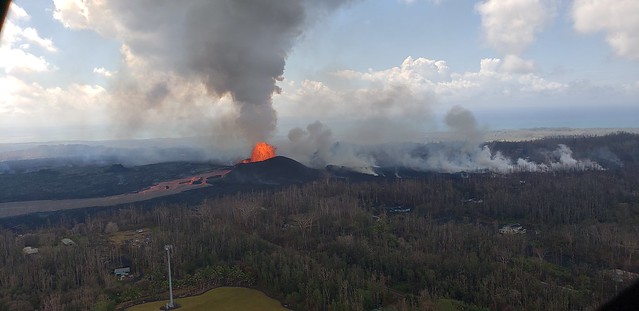
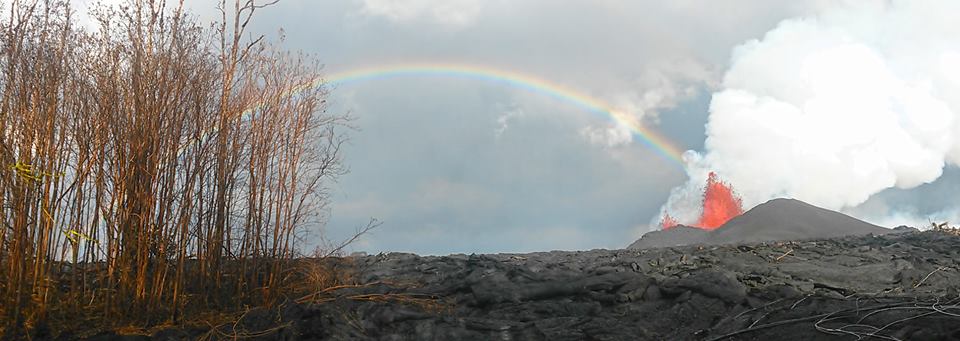
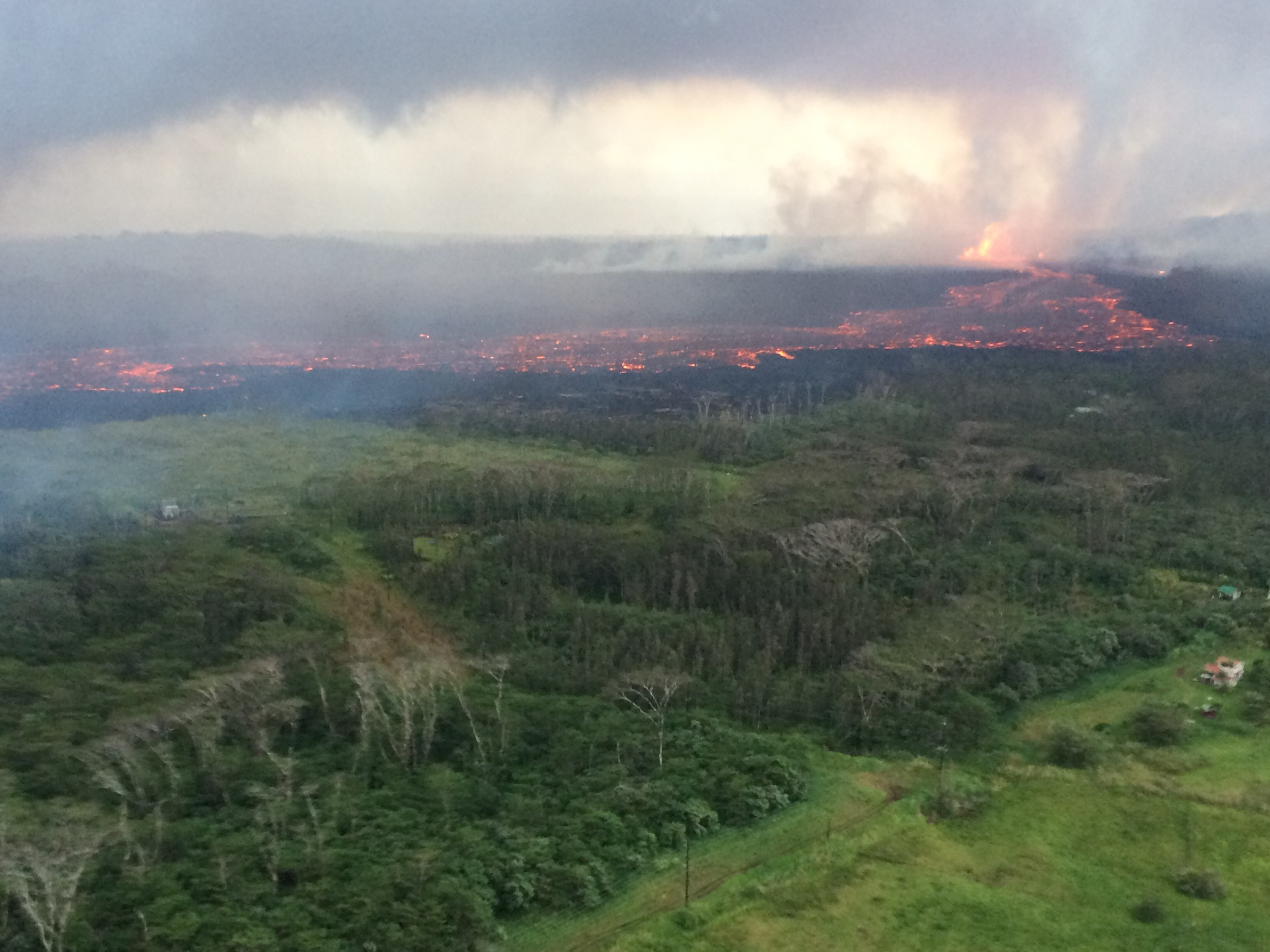
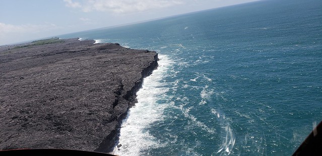
Fissure 8 continues to do its thing (fountains up to 230 ft today), pumping a vast river of lava towards Kapoho. Its flow front is about a mile wide where it meets the ocean. USGS reported ~190 acres of new land added to Hawaii as of noon. Some or all of this may be temporary, since “lava deltas” tend to collapse.

Kilauea, HI - East Rift Zone Eruption Event - 06/08/18 Photos and Video

[Above: 2 photos from Hawaii County Fire Department’s extensive videos/photos for June 8. Good to browse if you’re checking on homes in Kapoho.] 

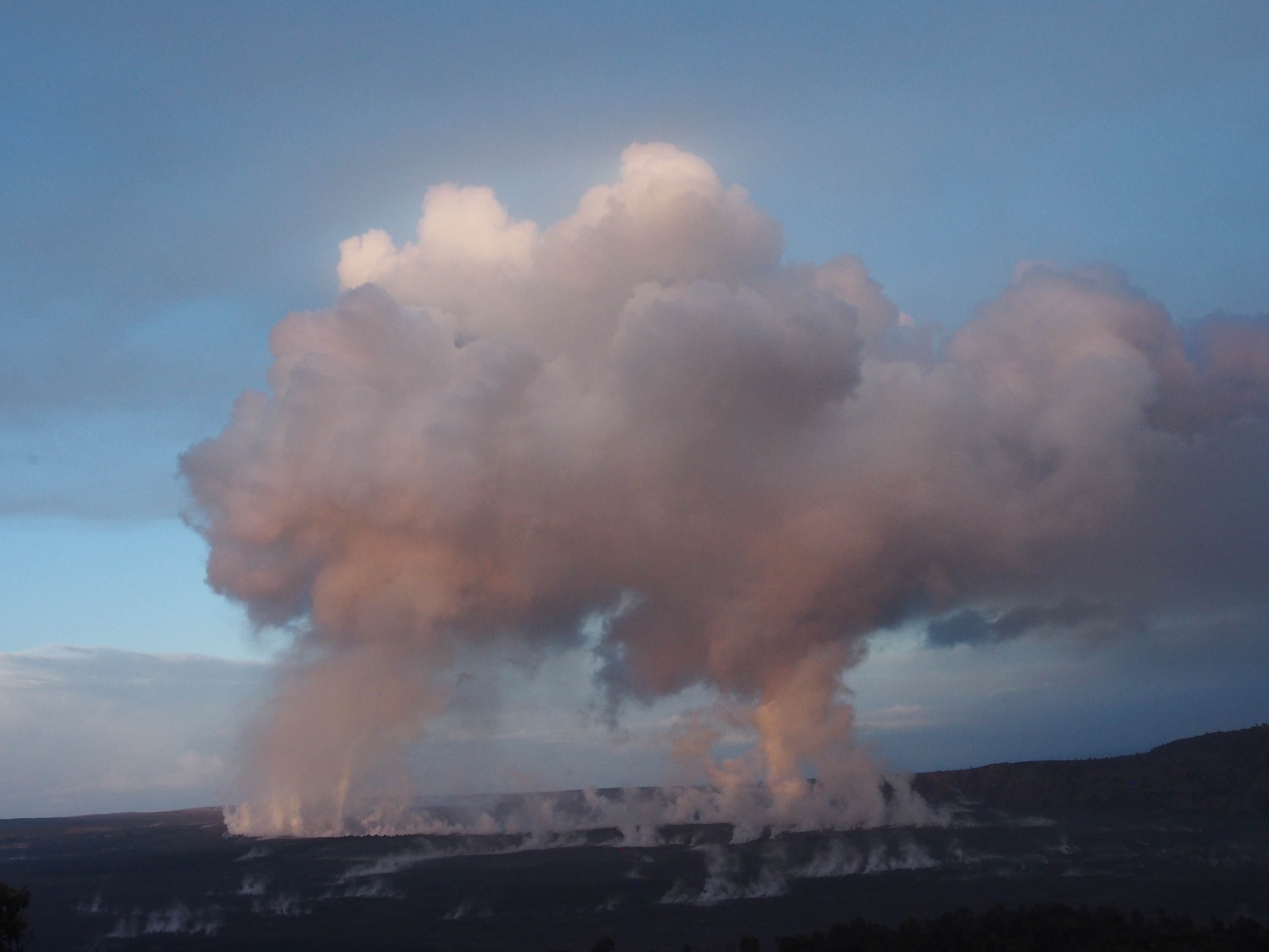
Summit activity continues to follow its geyser-like cyclical pattern. Earthquakes increased until 2:44 AM, when there was an explosion (equivalent of M5.4), after which seismicity died down.  Pu’u O’o also had a small earthquake (3.2) and rockfalls today, sending up a red plume of ash. (Still hunting for photos, but it’s been reported several places.)

USGS: “Outgassing from Halema‘uma‘u produced twin pillars that rose in the still morning air and merged into a towering cap above the summit of Kīlauea just after sunrise.” (Full-sized)

East and southeasterly winds sent an unpleasant amount of vog over Hilo and the Saddle. This will continue through Saturday, then tradewinds come to the rescue.

Today’s Kilauea Alerts, Videos, Images, and Eruption News

Continue reading June 8: A Voggy, Voggy Day

June 6: Summit Explosions Explained (And Predicted!)

USGS/HVO photo of Fissure 8, spatter cone and rainbow, June 6.
Today’s Eruption Update:

Last night, USGS scientist Steve Brantley explained the current eruption in an informative 10 minute talk. I transcribed it as a separate post, but here’s a rough summary: Magma heading down to the Lower East Rift Zone is causing the summit to deflate. Deflation is causing a pattern of more and more earthquakes over 30-50 hours until the summit releases the strain with an explosion, accompanied by an ash cloud.

Sure enough, there was an M5.6 explosion and 10,000 foot ash cloud at 4:32pm. HVO’s Twitter account had a great impromptu Q&A session about it (see below).

Meanwhile, down in the Lower East Rift Zone, Fissure 8 shows no signs of slowing. It’s wiped out Vacationland and nearly all of Kapoho Beach Lots, and is continuing to create new (crumbly, hazardous) beachfront real estate.

USGS has also been posting some striking imagery today.

Video description: “HVO’s mid-day overflight on June 5 shows ongoing partial collapse of Halema‘uma‘u at the summit of Kīlauea Volcano. To the north of the former visitor Overlook parking area (closed in 2008) is the site of the former lava lake—now a deep hole piled with wall-rock rubble. The western portion of Halema‘uma‘u has moved down and toward the center of the crater as new cracks form on the caldera floor to the west. Kīlauea’s summit continues to subside due to withdrawal of magma towards the volcano’s East Rift Zone.”

They’ve also posted drone footage of Fissure 8 lava flow on June 3. Houses give a sense of scale:

(Link to video description)

Here’s this morning’s USGS helicopter overflight of Fissure 8:

More images, lots of great geology info below the cut. But first, a 2-minute USGS briefing, since we skipped yesterday’s:

Continue reading June 6: Summit Explosions Explained (And Predicted!)

June 5: Steve Brantley (USGS) Sums Up Eruption So Far

At a public talk in Pahoa, Hawaiian Volcano Observatory Deputy-Scientist-in-Charge Steve Brantley gave a 10-minute talk on the 2018 Kilauea eruption sequence so far.

I was going to summarize it in my June 6 Kilauea daily digest. However, it’s so useful I’ve transcribed it in full below.

The full community meeting is archived here, with Steve Brantley’s presentation starting at 44:30. BigIslandVideoNeed has excerpted it below, but they don’t usually show the slides he was showing. I’m going to be putting those back in, matching or approximating the photos he selected.

Steve Brantley, HVO/USGS: “Good evening and thank you for coming out tonight. […]

Continue reading June 5: Steve Brantley (USGS) Sums Up Eruption So Far

May 30: Pele Makes A Run For Four Corners

Today’s Eruption Summary

In fact, the current lava eruptions in Puna are as hot as Hawaii’s lava will ever get. “It can’t get hotter than where we are,” Stovall added. “We are pretty much tapping mantle temperatures right now.”

Honolulu Civil Beat

USGS Photo – Caption: “Lava flow erupted from fissure 8, photographed during HVO’s early morning overflight today. The lava channel was estimated to be about 100 feet wide.” (Full-sized)

Fissure 8 is beauty & the beast. Since Saturday it’s been pumping out a huge volume of lava, creating pahoehoe and even a’a flows that occasionally surge up to ~600yards/hour. Yesterday its main flow headed NE, skirted the geothermal plant, crossed and followed Hwy 132 for a while, and then started downslope past Noni Farms towards Four Corners, threatening to cut off Kapoho and Lower Puna.

Amazing overflight photo of Fissure 8 and its lava flow taken on May 29 by Hawaii Civil Defense. (Full-sized)

In the early morning hours, officials went door-to-door in the Kapoho area ordering emergency evacuations.  Newly-paved Beach Rd was pressed into service as a one-way evacuation route from Four Corners to Hawaiian Beaches. But it’s a race against time, as the lava is headed for that very road.

[ETA: Mick Kalber’s flyover. He’s always got notes on the video’s page.]

I saw no PGV news today, which is good. The summit produced yet more ash & earthquakes, one a pretty good thump (Mag 5.3 at 10:57am, no tsunami). Meanwhile, Fissure 18 is sending a channelized flow towards Hwy 137, just a little east of last week’s flows to the ocean:

TUESDAY EVENING IN PAHOA: USGS BRIEFING

Continue reading May 30: Pele Makes A Run For Four Corners

May 28: Rivers of Fire, Lava Livestream is back

Today’s Eruption Summary

About 7PM yesterday, a large pahoehoe flow suddenly burst out and went galloping through Leilani Estates. Civil Defense called for emergency evacuations. Firefighters had to guide one person to safety (with assistance of drone team tracking lava) when the flow covered his drivewayUSGS and Civil Defense reported that vigorous fountains 7 and especially 8 were responsible for the outbreak: fountaining 150-200 feet high, they built up a spatter rampart 100 feet tall and fueled a monster pahoehoe 20-40 feet thick. Speed augmented by the perched lava pond breaching (dam gave way, basically).

You can get a sense of last night’s outbreak from this timelapse of the Lower East Rift Zone webcam over the past few days.

The flows from yesterday slowed and stopped this morning. Most of the day’s activity was fairly subdued, with “only a minor ooze of residual lava” making it down to the ocean. But this evening, fissure 8 and other vents went into overdrive again, pouring out rivers of lava and prompting more emergency evacuations (Civil Defense notice) (HVO/USGS Alert).

Lava livestream

Honolulu Civil Beat is back to let us watch nature’s pyrotechnics from about 2km away and a crucial 200 feet up.

It’s mesmerizing to watch, but a sobering sight as well, knowing homes downstream are burning and some people are in danger. 

I can’t watch now; I have a post to write. Where was I? Continue reading May 28: Rivers of Fire, Lava Livestream is back

May 23: USGS Presentation on Puna Lava Eruption So Far

Tuesday evening, USGS Volcanologist Steve Brantley gave a  presentation in Pahoa High School. A lot of it is fairly simple, recapping the eruption for residents of Puna. I’ve covered most of what he does in previous posts. But there are a few new tidbits.

His takeaway is worth seeing if you don’t read/watch the rest:

…until that balance is reached, or something else changes, we expect magma to continue moving from the summit reservoir into the rift zone and further down into the Lower East Rift Zone. So that suggests that we’re in it for the long haul. We don’t know how long this eruption’s going to last, but for now, it looks like it’s just going to continue.

Full transcript below the cut.

Continue reading May 23: USGS Presentation on Puna Lava Eruption So Far