September 2: A Few Signs of Life Deep in Fissure 8


Saturday, Sep 1, 2018, 6:00 pm – Kilauea's lower east rift zone overflight: Another angle of fissure 8, with a small lava pond within.

Posted by Extreme Exposure Fine Art Gallery on Sunday, September 2, 2018

This Week’s Eruption Summary

While no glow or incandescence was reported within Fissure 8’s cone for most of the week, Saturday 9/1 showed a few life signs remain in the LERZ: weak spattering from one spot, and in the evening new lava came out to cover most of the crater floor. But its sides have been slumping and falling in, as have the levees of the now solidified lava channel. While Fissure 8 and some of the surrounding vents continue to steam and fume, SO2 emissions remain low there and at the summit.

August 30, 2018. USGS: “The fissure 8 lava channel (center) and levee (foreground), looking toward the northwest. Loose rubble and Pele’s hair (lower right) are strewn across the levee surface.” (Full-sized)

No active ocean entries have been seen for the past few days, suggesting that all the residual lava from Fissure 8 has stagnated or drained out.

August 30, 2018. USGS: “Lower East Rift Zone lava flows entering the ocean have built a lava delta over 875 acres in size, but no active ocean entries were observed by HVO geologists on this morning’s overflight. View to the southwest.” (Full-sized)

This week has been a time of repair and taking stock. USGS geologists have been replacing lost or damaged monitoring stations (including the UWE tiltmeter, back on HVO’s deformation page). The drone crews have been out after Hurricane Lane came through to take new detailed aerial surveys of Kilauea’s summit (August 30 video) and Fissure 8 (August 21 video).
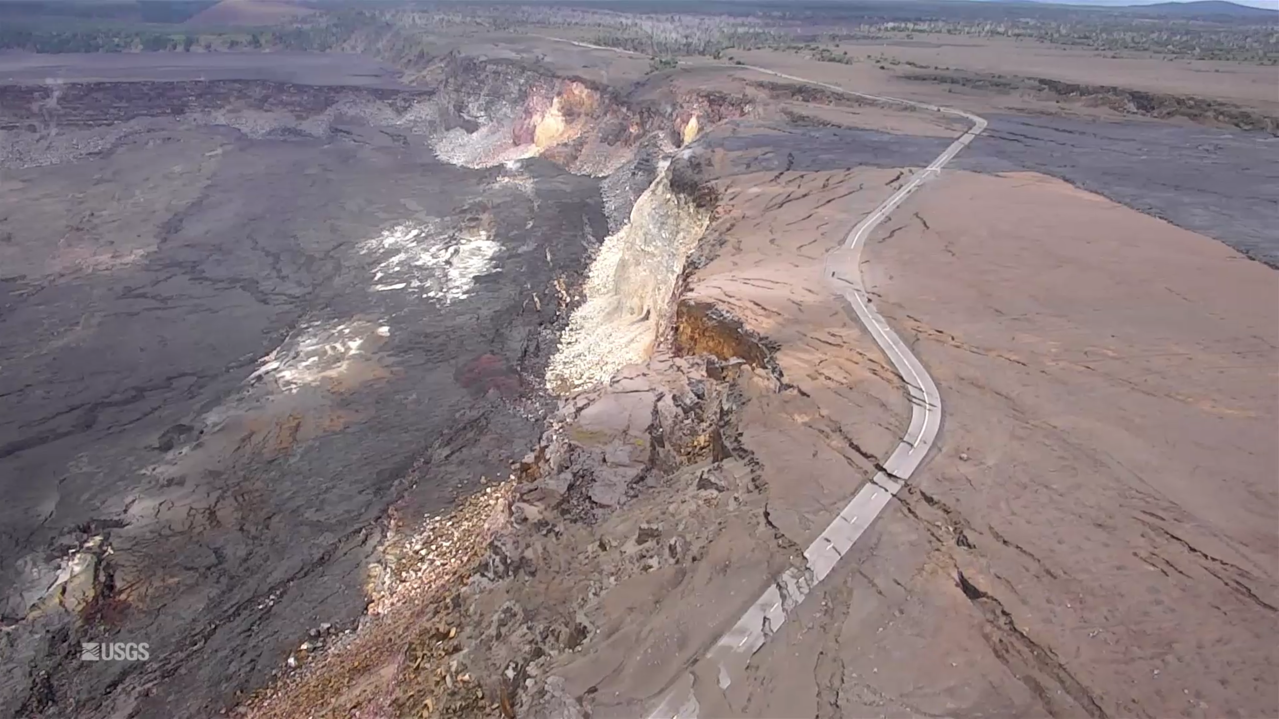
Screencap from August 30, 2018 UAV video survey of Kilauea summit.

They also posted an updated timelapse video of HVO’s panorama cam of Halema’uma’u from April 14 through August 20:

This week’s Volcano Watch newsletter from HVO describes how “Scientific community lends a hand to measure Kīlauea’s changing shape.” This eruption required all hands on deck and every last scrap of equipment they had, and then some.

Another screencap from the August 30 drone survey of Halema’uma’u Crater and its surroundings. Piece of Crater Rim Drive a long way down in the crater.More photos after the cut, plus some notes on the park’s status.


Continue reading September 2: A Few Signs of Life Deep in Fissure 8
June 26: Drone Video of Halema’uma’u Crater

Today’s Eruption Summary

Kilauea’s double eruption continues with no significant changes: Fissure 8 is still pumping out lava,  and the summit is continuing to settle. The ocean entry has expanded to two miles wide, with its southern edge creeping south just onshore.

Here’s a timelapse of all the USGS lava flow maps since lava started moving away from fissures in May:

Fissure 22 is sputtering and sending out tepid little lava flows that don’t go anywhere, while Fissures 16/18 were “incandescent” during the morning overflight.

June 26th’s collapse explosion waited a full 29+ hours, just to keep us on our toes, occurring at 10:41pm HST.  The energy release was 5.4 with a 1000-foot ash plume.

Yesterday’s Mick Kalber Overflight:

While the daily collapse explosions at Kilauea’s summit haven’t sent up much ash lately, they’re still giving off a voggy burp of sulfur dioxide. And some of the ash that fell earlier is still blowing around and irritating communities at the southwest end of the island:

USGS: “Recent explosive events haven’t produced significant ash plumes from the summit, but downwind communities may still experience ashfall when previously erupted ash is remobilized. On authorized permission from Hawai‘i Volcanoes National Park, our Unmanned Aircraft Systems crew is conducting gas measurements at Pu‘u ‘Ō‘ō. They snapped this photograph from Chain of Craters Road – a plume of remobilized ash is clearly visible along the horizon. It is rising from the Ka‘ū Desert and blowing to the southwest.” (Full-sized)

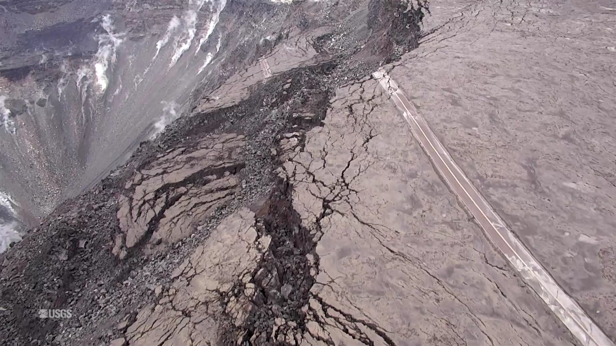
The big news today is that the USGS posted new drone footage of Halema’uma’u Crater.

Full video below. If you want extra drama, here’s a version with a soundtrack added.

HVO/Jaggar Museum are the low dun-colored buildings (same color as the bluff they’re sitting on, well-camouflaged) swing into view at the top of the screen around 2:30 and are middle of screen at 2:40 just before it shifts to a new view. (The larger, more conspicuous buildings near the beginning of the video are the old Kilauea Military Camp and the Volcano Golf Country Club).

Here’s an aerial photo of Halema’uma’u from April 13, 2018 for comparison, with Jaggar Museum/HVO at the top of those stairstep bluffs in the background, middle right. Here’s another view of the two buildings.

USGS caption for today’s drone video:

Continue reading June 26: Drone Video of Halema’uma’u Crater