Saturday, Sep 1, 2018, 6:00 pm – Kilauea's lower east rift zone overflight: Another angle of fissure 8, with a small lava pond within.
Posted by Extreme Exposure Fine Art Gallery on Sunday, September 2, 2018
This Week’s Eruption Summary
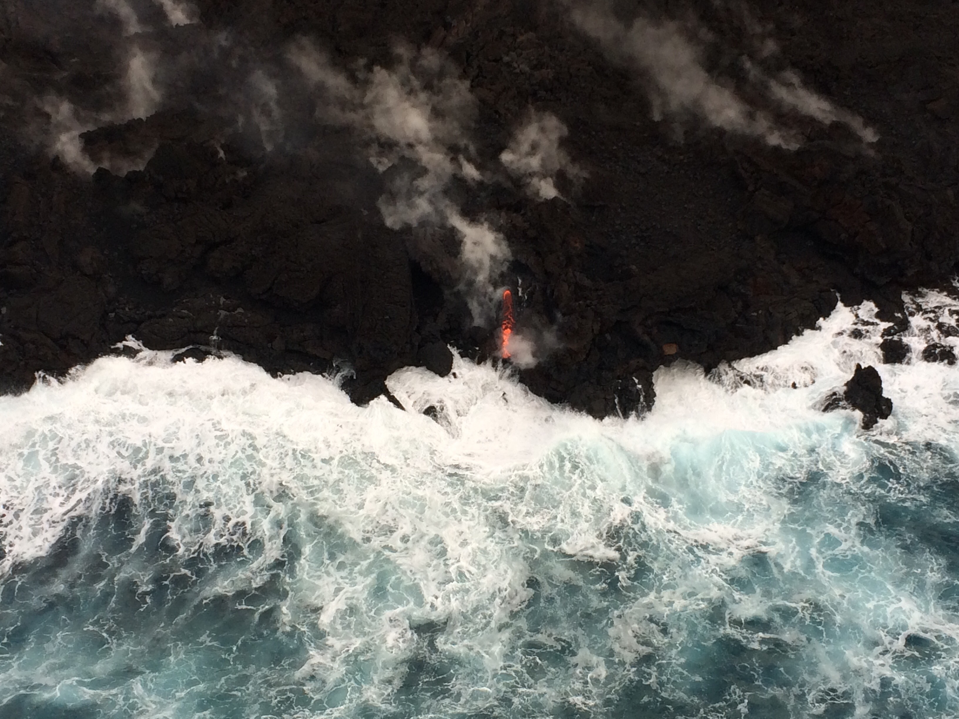
While no glow or incandescence was reported within Fissure 8’s cone for most of the week, Saturday 9/1 showed a few life signs remain in the LERZ: weak spattering from one spot, and in the evening new lava came out to cover most of the crater floor. But its sides have been slumping and falling in, as have the levees of the now solidified lava channel. While Fissure 8 and some of the surrounding vents continue to steam and fume, SO2 emissions remain low there and at the summit.
No active ocean entries have been seen for the past few days, suggesting that all the residual lava from Fissure 8 has stagnated or drained out.
This week has been a time of repair and taking stock. USGS geologists have been replacing lost or damaged monitoring stations (including the UWE tiltmeter, back on HVO’s deformation page). The drone crews have been out after Hurricane Lane came through to take new detailed aerial surveys of Kilauea’s summit (August 30 video) and Fissure 8 (August 21 video).
They also posted an updated timelapse video of HVO’s panorama cam of Halema’uma’u from April 14 through August 20:
Time-lapse video captures dramatic changes at #Kilauea Volcano's summit April 14 to August 20, 2018. At present, seismicity and ground deformation are negligible. https://t.co/tZott5ZBgM pic.twitter.com/mlWUbtqC9s
— USGS Volcanoes🌋 (@USGSVolcanoes) August 28, 2018
This week’s Volcano Watch newsletter from HVO describes how “Scientific community lends a hand to measure Kīlauea’s changing shape.” This eruption required all hands on deck and every last scrap of equipment they had, and then some.
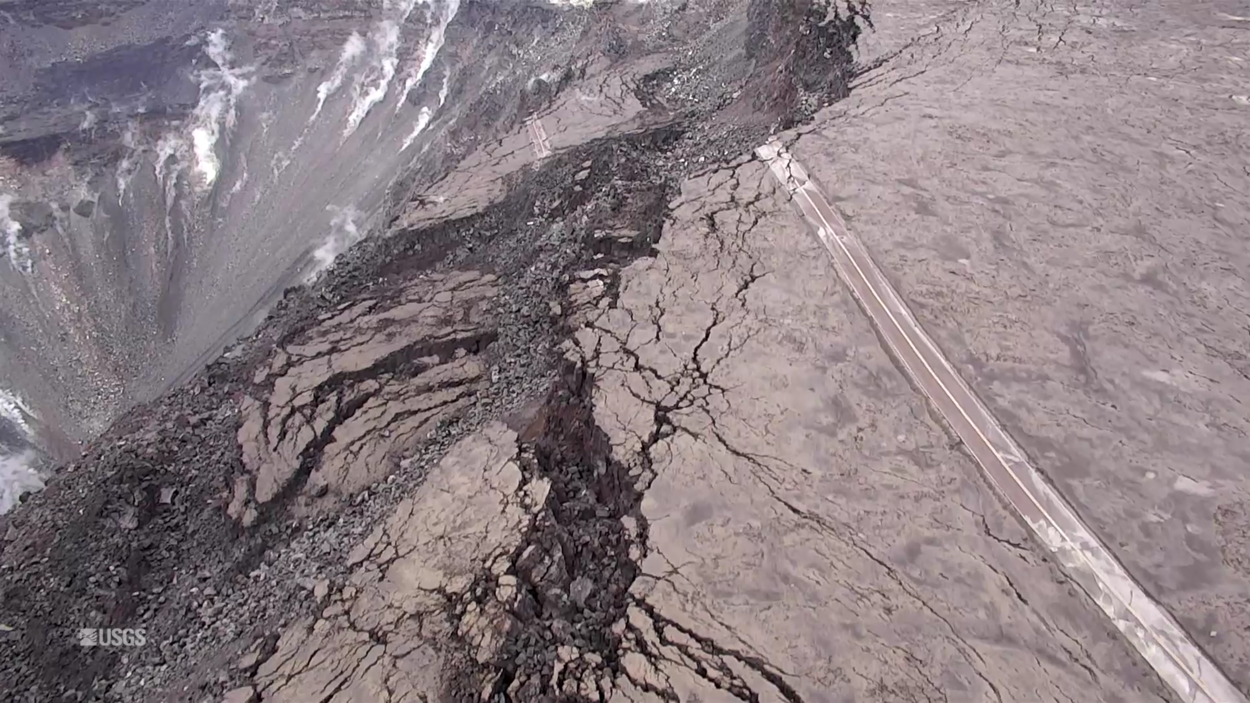
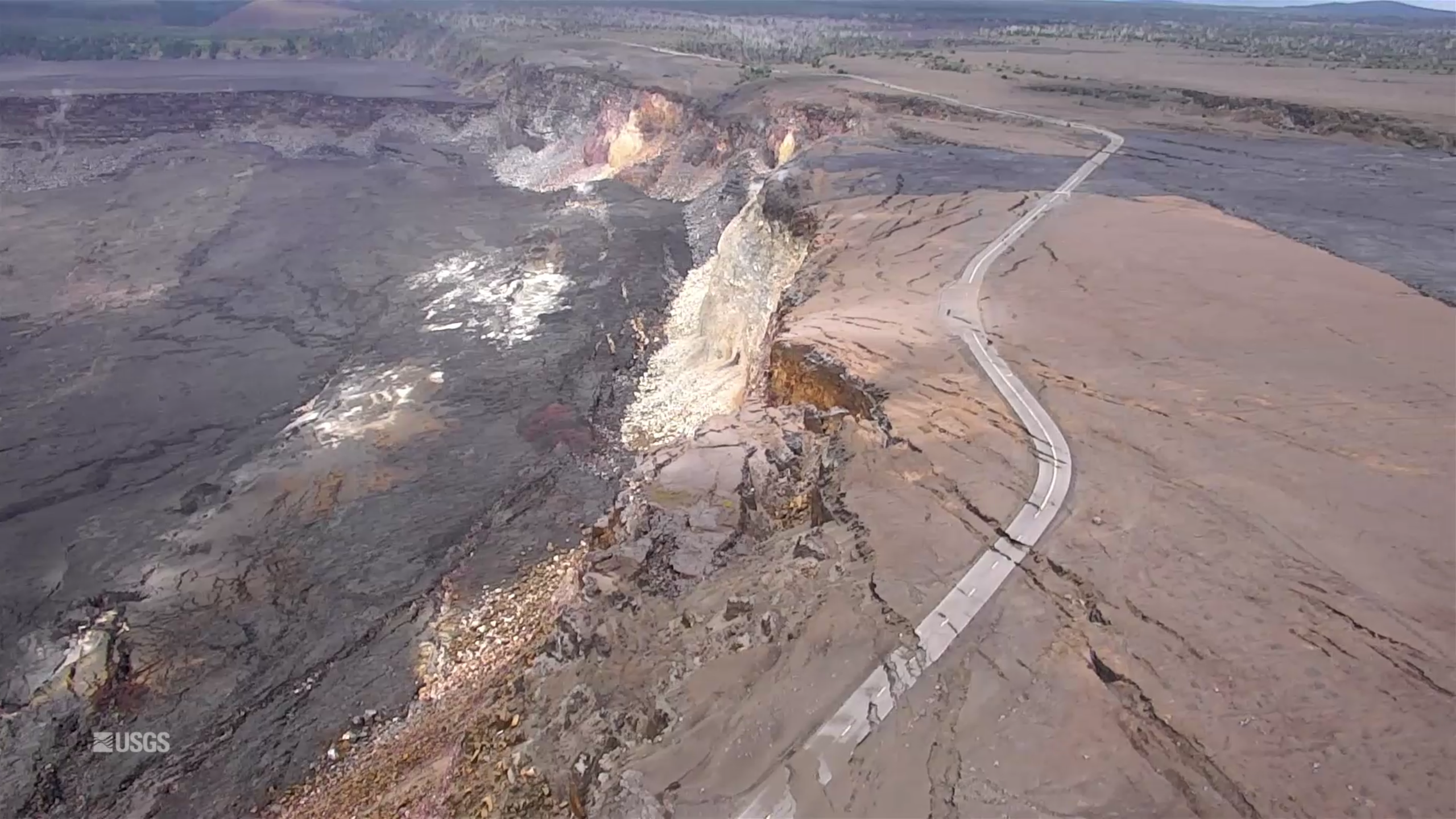
Another screencap from the August 30 drone survey of Halema’uma’u Crater and its surroundings. Piece of Crater Rim Drive a long way down in the crater.More photos after the cut, plus some notes on the park’s status.
Fissure 8 earlier in the week:

The next one is best viewed full-sized on a computer screen.

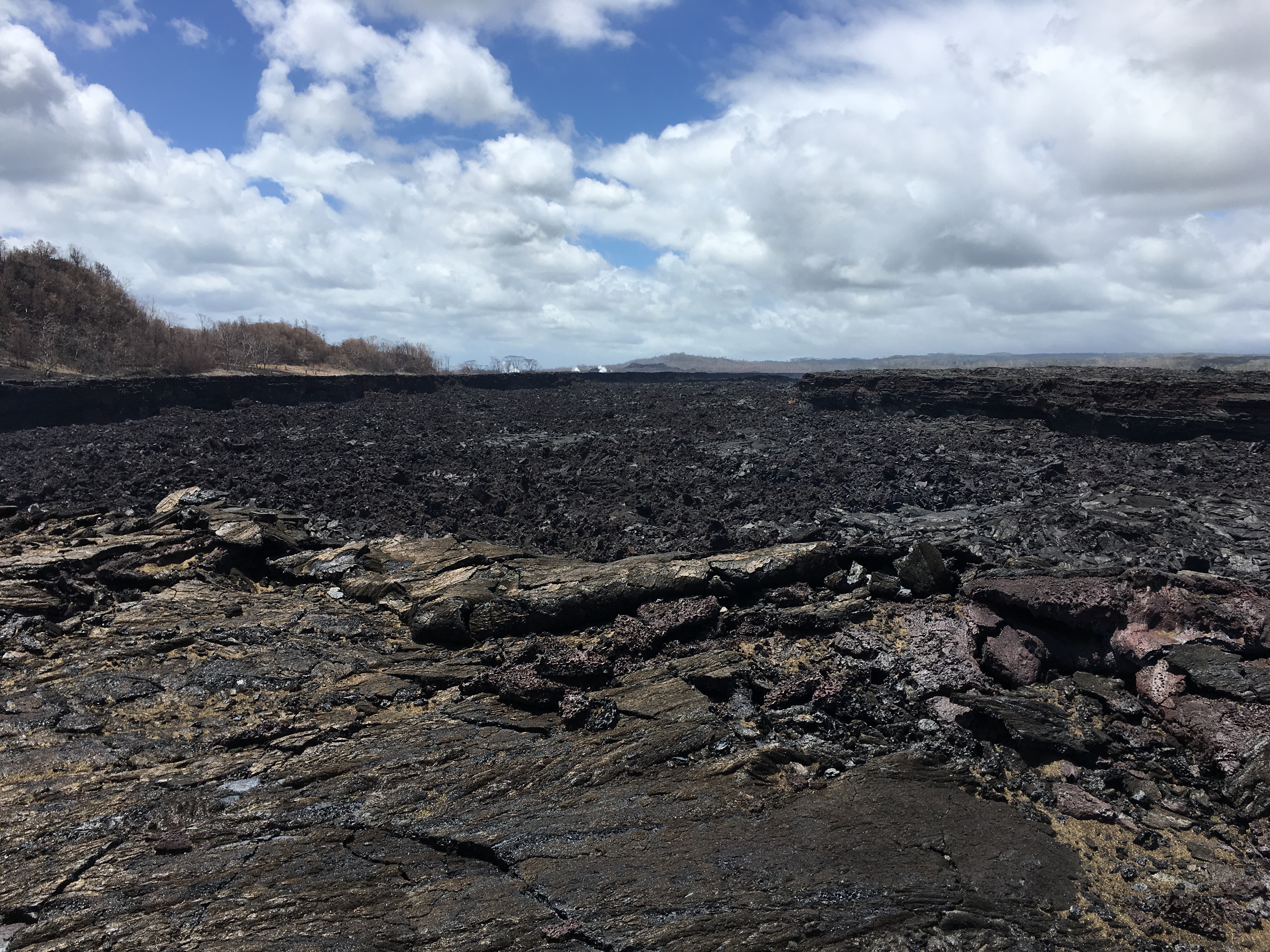
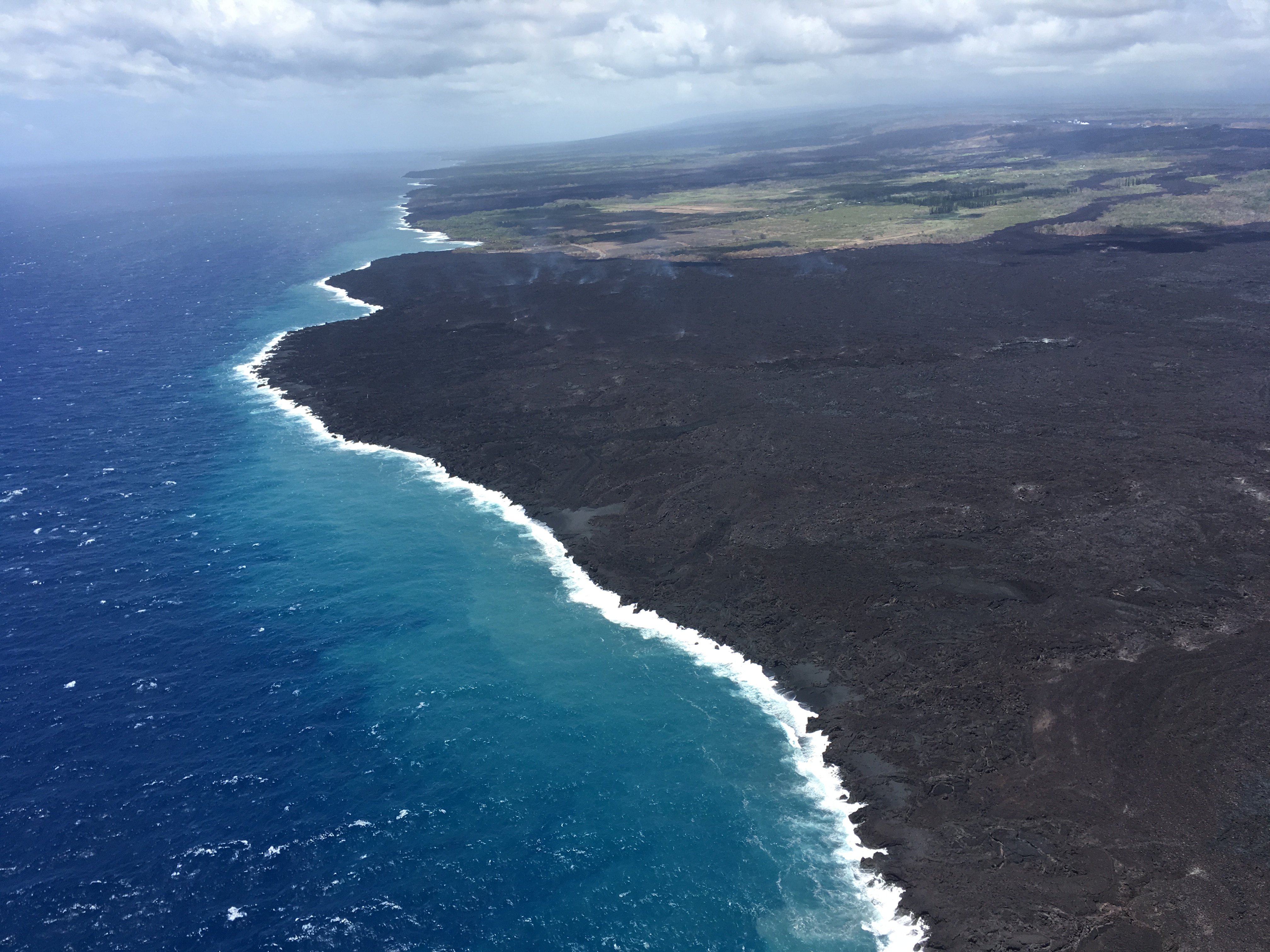
A few scenes from the new lava field (as always, be sure to note full-sized trees for scale):

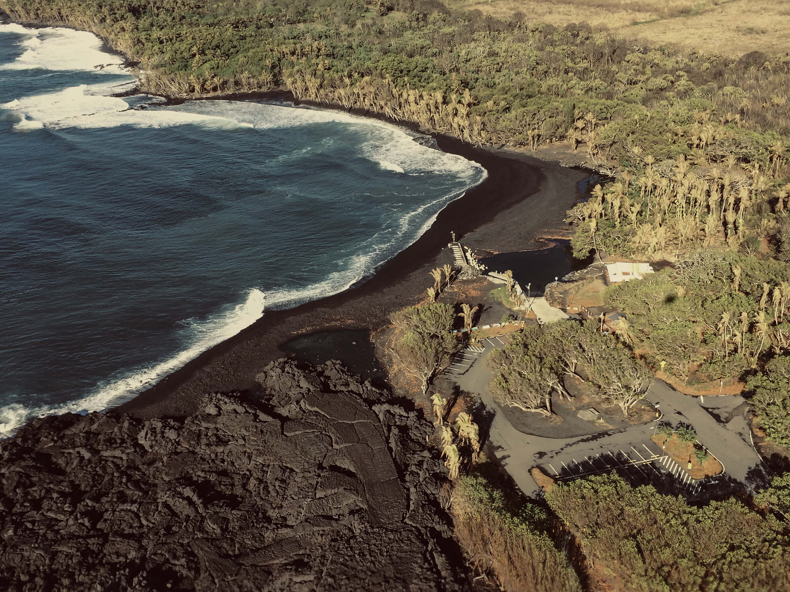
And one more check on Pohoiki:
From Other Agencies
With Kilauea quiet, eyes turn to Hawaii Volcanoes National Park’s efforts to reopen. HVNP has created an updates page reporting on their progress. They’ve also been hosting “Talk story” gatherings at their Kahaku Unit, which was farther away from the summit and stayed open, inviting residents and visitors to weigh in on “what the future of the park should look like.”
Now that #HurricaneLane is finally gone, #HVNPRecovery can continue. What happens after you reconnect a waterline that’s been broken for weeks? You got to flush it real good!
NPS Video pic.twitter.com/9v9HqTnXSS
— Hawaii Volcanoes NPS (@Volcanoes_NPS) August 27, 2018
These green tags are placed on park buildings signifying they have been inspected for structural hazards and determined to be safe for employees and partners to occupy. Find out the latest #HVNPRecovery efforts: https://t.co/A5xL2gtaOZ
NPS Photos: J. Christensen pic.twitter.com/CQV9CufTE8
— Hawaii Volcanoes NPS (@Volcanoes_NPS) August 29, 2018
Assessments of popular trails reveal damage from tens of thousands of earthquakes that occurred between May and August. What comes next after damage assessments? Learn about the stages of #HVNPRecovery by visiting https://t.co/A5xL2gtaOZ
NPS Photos: J.Christensen pic.twitter.com/lN2JKMg9kW
— Hawaii Volcanoes NPS (@Volcanoes_NPS) August 30, 2018
From Local News Agencies
Nice synopsis from BIVN (accompanying Sep 1 article: “Kilauea Summit Update — National Park Opening Details”
Articles noting activity (what there was of it) this week, just in case anyone stumbles across this blog later trying to track activity day by day:
- HNN (Sep 2): “HVO reluctant to call Kilauea eruption ‘completely over’ after new glow seen“
- BIVN (Sep 2): “Lava In Fissure 8 Prompts New Civil Defense Message” (Text of message)
- HSA (Aug 31): “Kilauea’s fissure 8 cone, flow field are not showing any glow“
- HTH (Aug 31): “No lava spotted at fissure 8” [Or at the ocean entry]
- HSA (Aug 28): “Fissure 8 glow not seen during morning overflight“
- BIVN (Aug 27): “No Incandescent Lava Seen In Fissure 8, But Lots of Steam“
- HSA (Aug 27): “Kilauea update: glow deep in fissure 8 no longer visible“
And all the other Kilauea-related news.
- HTH: “Hawaii Volcanoes National Park ‘can’t wait to welcome the world back’“
- HTH: “Hawaii Volcanoes National Park makes progress toward Sept. 22 reopening“
- HNN: “As lava activity slows, Pahoa emergency shelter set to close soon“
- HSA: “Pahoa evacuation shelter to close Sept. 17“
- HTH: “2 checkpoints removed from Highway 137“
- HSA: “Checkpoint closures signal end of Kilauea disaster may be near“
- HSA: “11 cited for sneaking into Hawai’i Volcanoes National Park“
- HTH: “Despite another down month, Hawaii tourism agencies optimistic for turnaround“
- HTH: “Enrollment in Ka’u-Keaau-Pahoa area unaffected by eruption“
- HSA: “Recovery from Kilauea eruption might cost $800M“
- HSA: “SBA loans for Kilauea eruption recovery exceed $30 million“
- HPR: “Governor Praises FEMA Support During Disasters“
- And Dispatches From Volcano asks: “Have we learned anything?“
This video and article is making the rounds of mainland ABC affiliates (i.e. it’s the first Kilauea news many mainlanders have seen in months):
“Forces of nature: How Kilauea eruption, Hurricane Lane flooding changed Hawaiian landscape”
Also, for what it’s worth, there’s a Cat 4 Hurricane, Norman, heading towards the Central Pacific. Currently forecast to pass well NE of Hawai’i, but it’s a ways out and may have some impacts.
Aug 29 Helicopter Overflight of LERZ
Really good views of the now solidified lava channel starting around 0:50; I think increased steam from Hurricane Lane was marking the edges of the levees:
That bitty island is back, by the way. Good clear views of the lava delta now that laze isn’t hiding it.
Bruce Omori posted 14 photos plus observations on this overflight on Facebook. A few excerpts:
Wednesday, Aug 29, 2018, 6:00 am – Kilauea's lower east rift zone overflight: The growing new sandbar at Pohoiki has created a cool shore break, and has also trapped a few bodies of water.
Posted by Extreme Exposure Fine Art Gallery on Thursday, August 30, 2018
Wednesday, Aug 29, 2018, 6:00 am – Kilauea's lower east rift zone overflight: Rising steam along the edges of the perched channel accentuated the path of channelized flow toward the sea.
Posted by Extreme Exposure Fine Art Gallery on Thursday, August 30, 2018
Wednesday, Aug 29, 2018, 6:00 am – Kilauea's lower east rift zone overflight: Two trees…
Posted by Extreme Exposure Fine Art Gallery on Thursday, August 30, 2018
Bruce also posted 9 photos and observations from a Saturday, Sep 1 evening overflight in which he observed some activity down in the Fissure 8 cone.
Someone posted one of Bruce’s photos of Fissure 8 from his late Saturday overflight to the USGS Facebook page. USGS replied:
“This is pretty minor activity, and is a common sort of process as eruptive vents wane — they tend to burp a few times before going completely quiet, but larger reactivations are also possible, which is why vigilance and care continue to be requirements. We’ll have geologists out this morning to check on Fissure 8.”
USGS Q&A on Social Media
Questions have dried to a trickle, along with the tin hat conspiracy theorists predicting dire things that didn’t come true.
Again on Facebook (which doesn’t let us embed, grr):
Q: [Trying to get an idea of size of Fissure 8 cone]
USGS: Assuming a one-story building is ~12 ft high, a 13-story office building would fit inside the fissure 8 cone.
Q: What would you expect to see for a “closing” rift? At what rate would the intrusion cool? And how would it be noticeable?
USGS: We are still monitoring crack temperatures and carefully watching for ground deformation trends in the lower East Rift Zone. The most recent deformation results in the LERZ do not show patterns that would be consistent with rift opening or closing. If the subsurface magma intrusion is cooling, those effects are not yet strong enough to be detectable. Neither do we see signs of inflation/reactivation. To answer your second question, cooling may take decades. Some of the first lavas to erupt in LERZ were leftover from the 1955 eruption – the thick and viscous magma was reheated and pushed out ahead of new magma coming down the East Rift Zone.
Q: Current SO2 rates? Signs of magma returning to summit?
USGS: Sulfur dioxide emission rates at the summit, Puʻu ʻŌʻō, and lower East Rift Zone are all drastically reduced; the combined rate (< 1,000 t/d) is lower than at any time since late 2007. Seismicity, deformation and tilt at the summit are negligible. We continue to monitor for trends about what might happen next.
Q (posted Aug 30): When do we call it pau?
USGS: It’s possible that the slowdown reflects the end of the LERZ eruption and summit subsidence but we are going to hold off calling it pau at the moment. We’ve essentially flat-lined and are watching for trends now. Is the system going to repressurize? Continue to subside? We are tracking the subtle clues (gases, seismicity, ground deformation) that might give us an indication where we are headed.
No ponding, but whiteout conditions were reported in the lower East Rift Zone's lava field due due to steam produced by heavy rainfall on still-hot (but not flowing) lava flows.
— USGS Volcanoes🌋 (@USGSVolcanoes) September 1, 2018
At this point, probably around 100 feet or less. It's lost quite a bit of height to slumping into the crater.
— USGS Volcanoes🌋 (@USGSVolcanoes) August 29, 2018
Depending on the thickness, it could be months or even years. Lava is a very good insulator, so it can be cool enough to walk on within hours after erupting, but still hot inside for quite a while after.
— USGS Volcanoes🌋 (@USGSVolcanoes) August 29, 2018
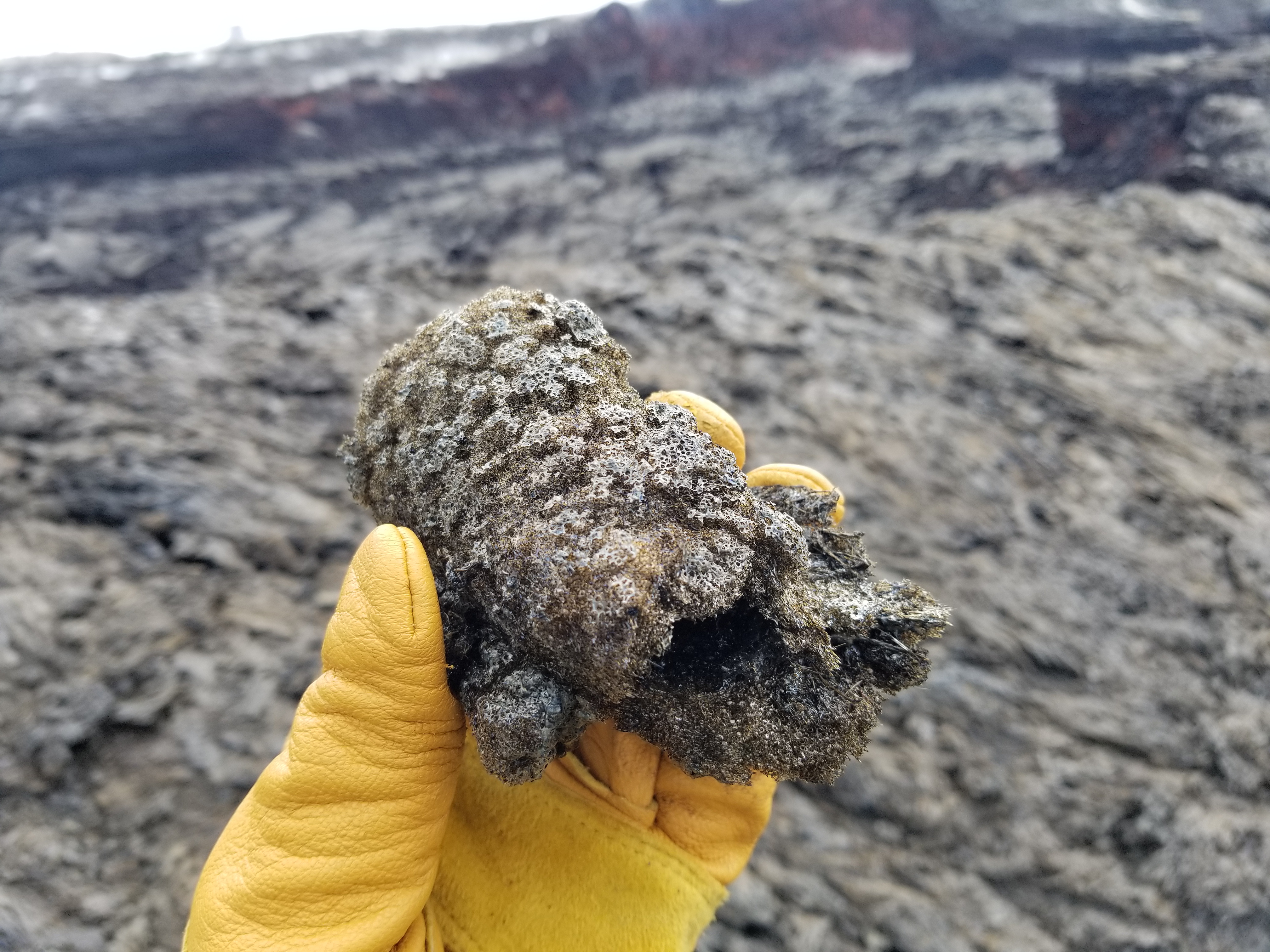
Those are tephra that oxidized (rusted) in the heat and steam from the fissure. It's pretty common in cinder cones, since it's so easy for gases to percolate through the loose deposits that make up the cone.
— USGS Volcanoes🌋 (@USGSVolcanoes) August 29, 2018
The crater floor is at about the same depth as the water table. Prior to May, heat from the magma reservoir beneath the crater kept water away (it was heated to steam). It isn't clear if water can make its way back or if the magma reservoir repressurizes and a lava lake returns.
— USGS Volcanoes🌋 (@USGSVolcanoes) September 1, 2018
Monitoring stations play a very important role now. Thus far, the seismic, GPS and tilt have essentially flat-lined. We are watching for trends in repressurization (none observed). Has supply diminished?
— USGS Volcanoes🌋 (@USGSVolcanoes) August 31, 2018
The Hawaii County Civil Defense Agency is tracking that information, saying the eruption destroyed more than 700 homes and damaged infrastructure, including four state highways. More info at https://t.co/r4dU4OwgAt
— USGS Volcanoes🌋 (@USGSVolcanoes) September 1, 2018
In some places, the flows are probably thicker than 10 m (~33 feet). People retain ownership of their land even if it is covered in lava, although new land created offshore belongs to the state. Some rebuilding could be possible, but it's a fairly inhospitable environment.
— USGS Volcanoes🌋 (@USGSVolcanoes) August 29, 2018
Other Social Media
At this point #Kilauea and related tags are a wasteland as far as current information; scaremongers are posting several-month-old videos (some not even of Kilauea) as if it’s still happening.
But here’s one diamond in the sludge:
Kilauea summit before and after images (January 3 & August 31) #KilaueaEruption https://t.co/C04Oqk8yTV pic.twitter.com/TvS54X33yI
— Hawaii 24/7 (@Hawaii247) September 2, 2018