Today’s Eruption Summary:
Status quo continues, with Fissure 8 feeding a large, fast-flowing channel to the ocean, where it’s entering on the south side of the lava delta today. Upstream along the river, there’s occasional spillovers, but these never travel far from the levees. Top speeds on June 18 were measured at 20mph, by the way. Fissures 6 and 16 have reverted to fuming. (I see no white speck left of Fissure 8 on the LERZ webcam [correction: it’s back at 9:45pm]). Today’s summit explosion occurred at 4:22am (5.3ish), with a minor ash plume rising 6,000 feet above sea level (2000 feet above Kilauea).
Saying Goodbye (At Least For Now)
USGS image taken June 18, 2018.”
Today’s big news was confirmation that Jaggar Museum has evacuated its exhibits:
Dramatic changes are taking place at the summit of Kīlauea. Yesterday we had to remove the artifacts from Jaggar Museum, which has endured considerable earthquake damage over the last few weeks. Learn more about our collection: https://t.co/ouVJu1E3jo#KilaueaErupts#Kilauea pic.twitter.com/BtmvCVooPJ
— Hawaii Volcanoes NPS (@Volcanoes_NPS) June 20, 2018
Hawaii Volcanoes NPS: “The cracks on the floor are from earthquake damage. Structural damage from the quakes may have already compromised the building. The observation deck has a new and noticeable tilt. The bigger worry is the increasing and dangerous instability of the crater rim under the building.”
Meanwhile, HVO staff is “making arrangements to remove as much archival and historical material as possible from the buildings,” They’re so busy monitoring this eruption that I think they may need to hire movers:
HVO staff visit the observatory to assess earthquake and subsidence damage: cracks, buckling, books tossed from shelves. Scientists working from temporary digs at UH-Hilo. https://t.co/bzZaUAkYUI pic.twitter.com/2e15vcWpbq
— USGS Volcanoes🌋 (@USGSVolcanoes) June 21, 2018
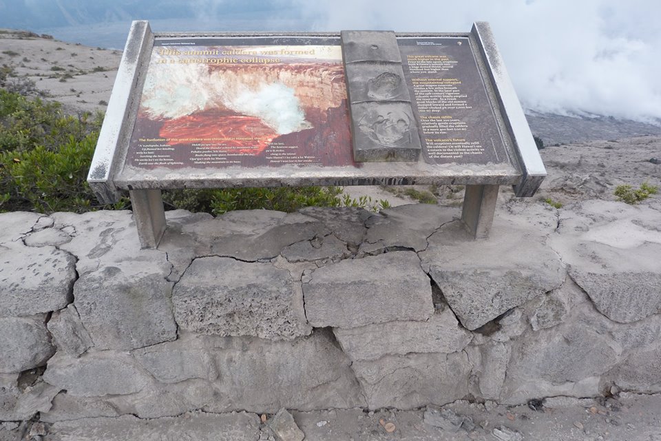
Outside, it’s time to bid farewell to the old Halema’uma’u overlook & parking lot:
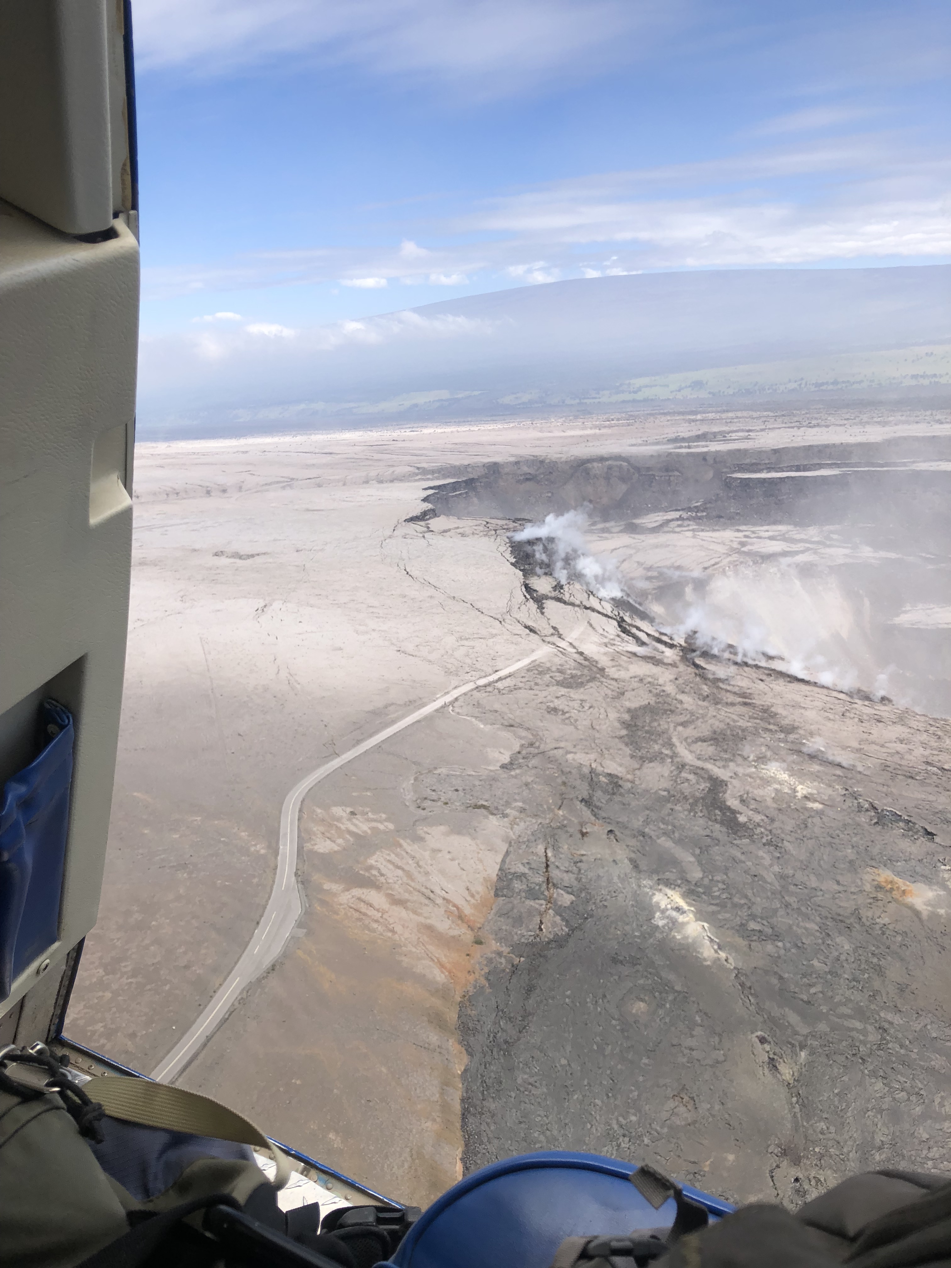
More USGS PHOTOS
Replacement for the old North Pit GPS station that fell in, maybe?
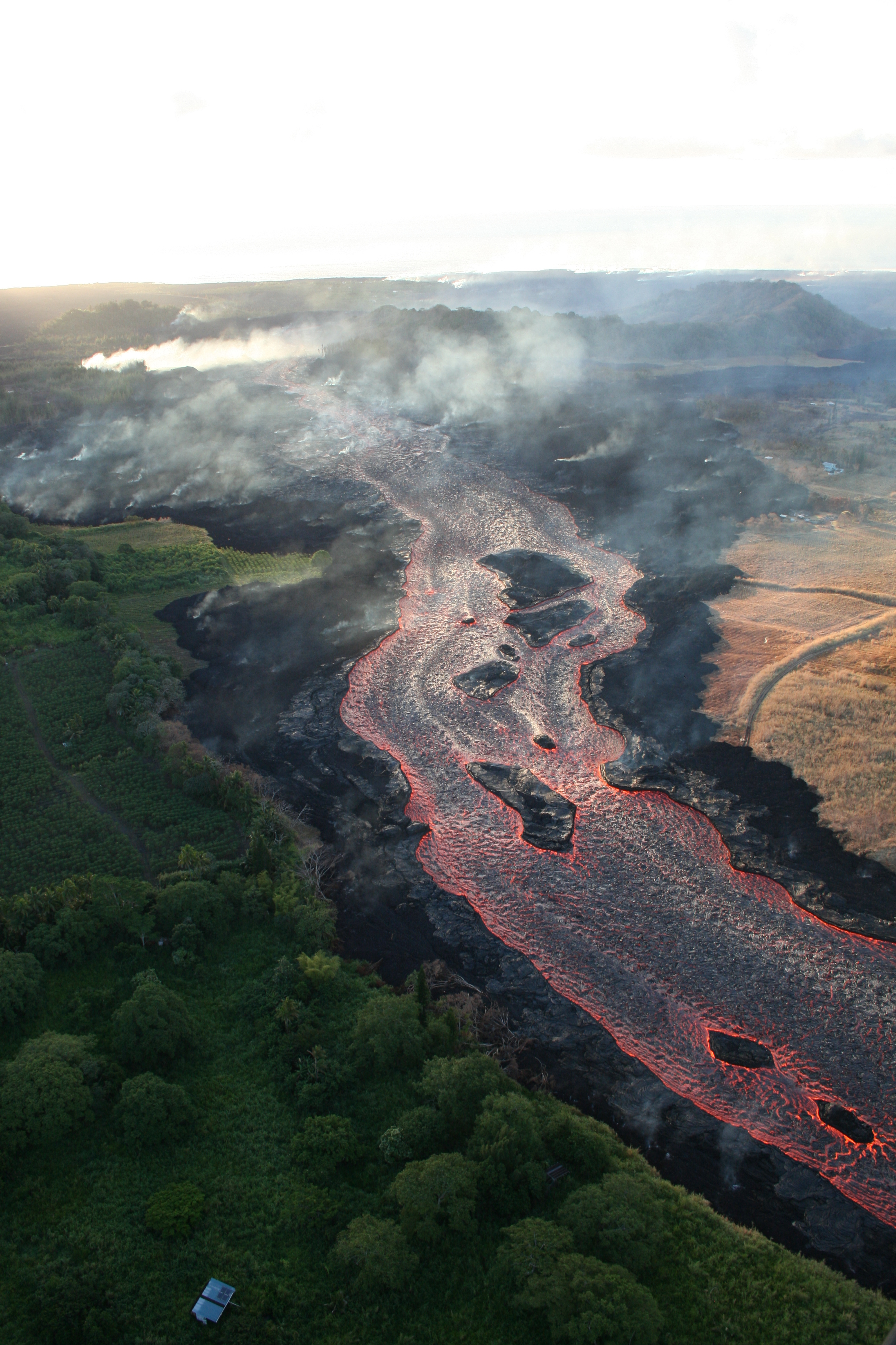
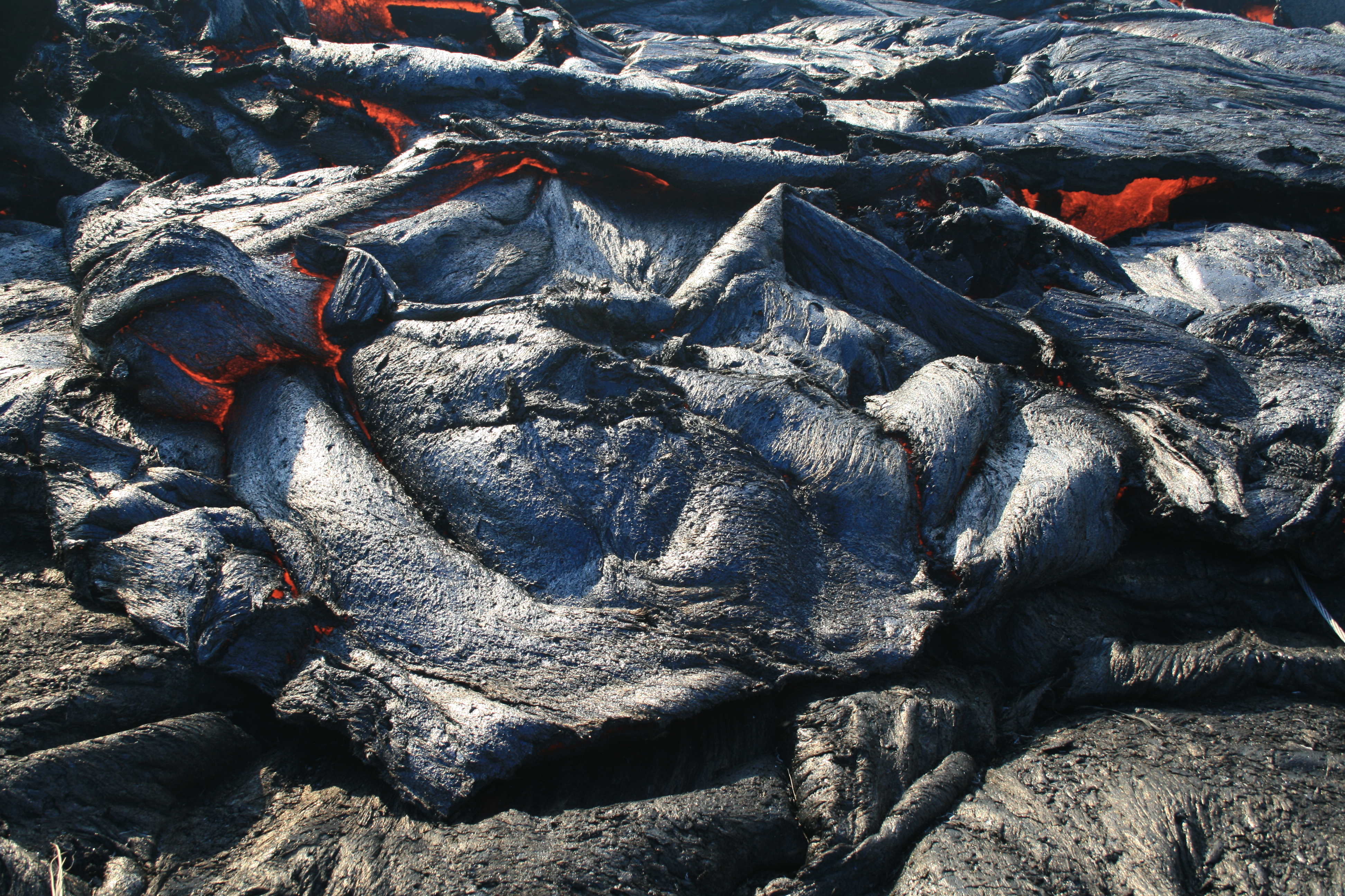
Meanwhile, the star player and chief menace of the Lower East Rift Zone is still pumping out thousands of gallons of lava a second:

It looks like that channel to the right of what used to be “Pele’s face” has crusted over to make a lava tube, or at least a lava arch.


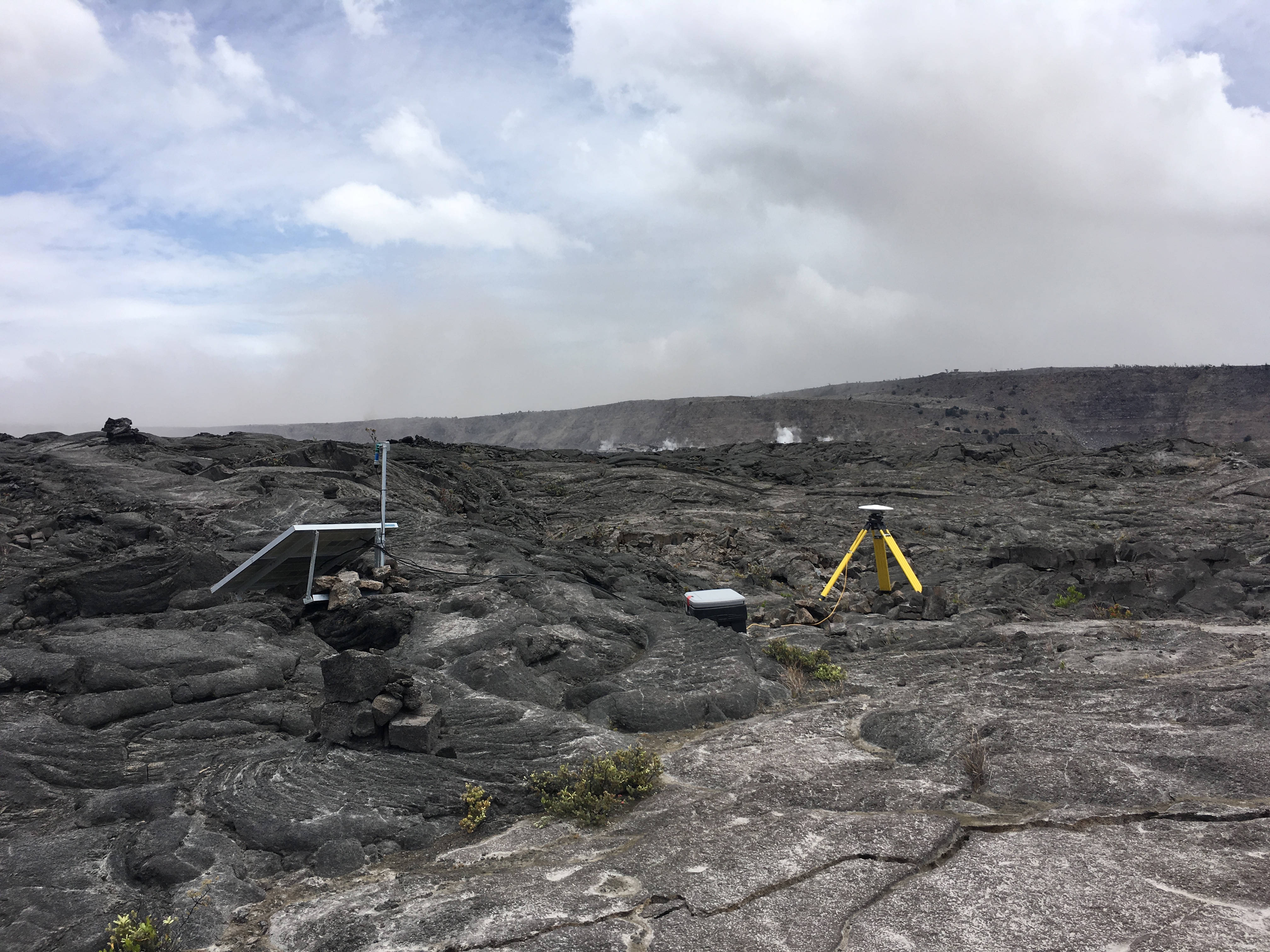
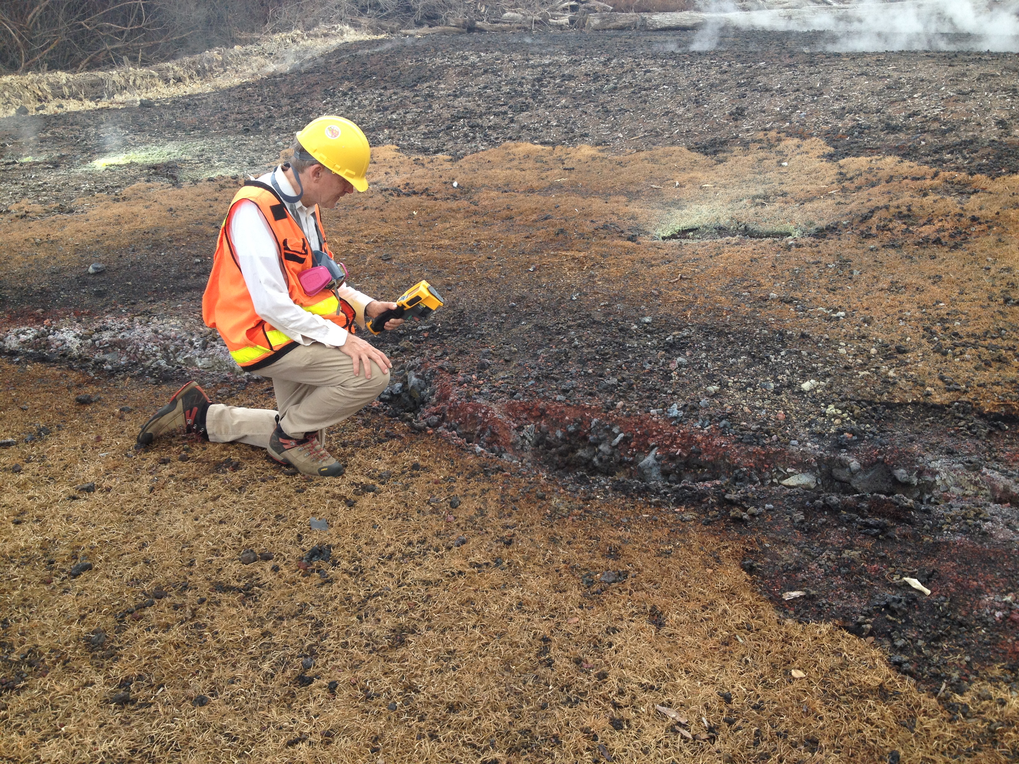
Last but not least, geologists on the job. This one’s a little hard to see:
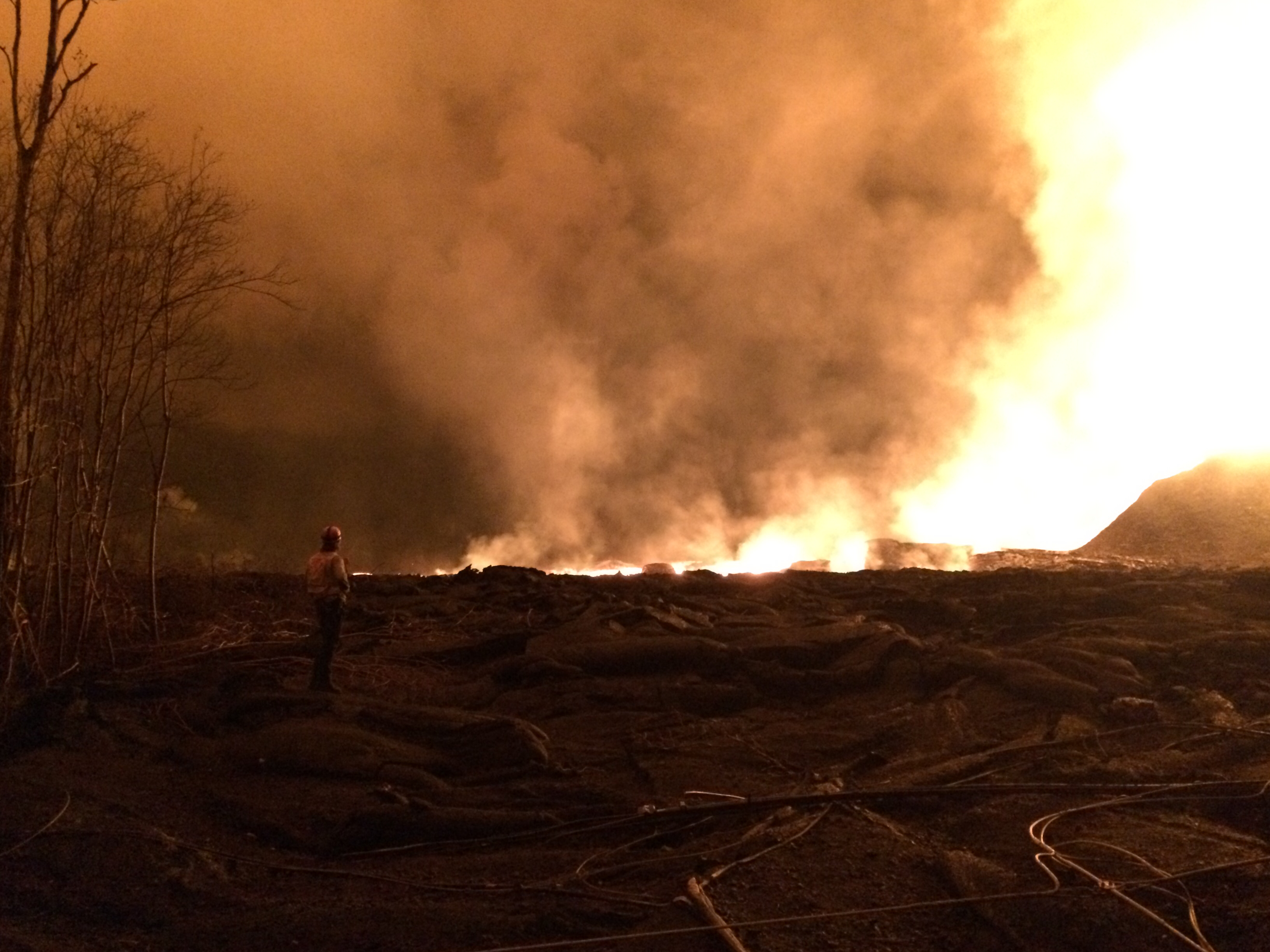
We’re missing out on some of the nitty gritty details that geologists will probably be debating for years. For example, what signals can they use to detect when a fissure’s about to reactivate, if Fissure 10 has registered temperatures like this, yet it doesn’t?
June 20 Lava Field Map

Fissure 8 From Space
Astronaut aboard the ISS:
The pumpkin orange lava flows of #Kilauea aglow during the predawn hours over the Pacific Ocean. #Hawaii pic.twitter.com/N9k8uVfn6n
— Ricky Arnold (@astro_ricky) June 20, 2018
And from a high-resolution mapping satellite:
Sentinel1 interferogram (originally tweeted by @USGSVolcanoes) also showing some motion on the Koa'e Fault System (white box and arrow)? pic.twitter.com/XB6Yzzgdek
— Jascha Polet (@CPPGeophysics) June 20, 2018
More @USGSVOlcanoes Q&A
Q: Can you tell us where the overflows are?
A: It’s hard to map the smaller ones, particularly if they erupt onto existing lava flows, but the larger ones are marked in red on our maps.
Q: Are overflows still going or part of levees now?
A: The overflows that we have seen aren’t moving beyond the existing flow fields, but we are monitoring them regularly to make sure that doesn’t change. Most just flow over the levees and downhill rather than adding much to their height.
Q: How do you measure speed of lava?
A: It’s tricky! The radar gun is basically the same sort of thing police use to track car speeds, but sometimes it has trouble with very hot objects. Which can be a bit of a problem with lava flows…”
Q: Is there a graph of Kilauea’s lava lake level over time?
A: Yes, in “Preliminary Analysis of Current Explosion Hazards at the Summit of Kilauea Volcano, May 8, 2018 – Cooperator Report to Hawaii Volcanoes National Park”
Q: What’s the current height?
A: The lava lake has not been visible for some time. Geophysical and chemical evidence (in the plumes) suggests that magma-water interaction has occurred, but there has been no way to directly measure the lava lake level since early to mid-May.
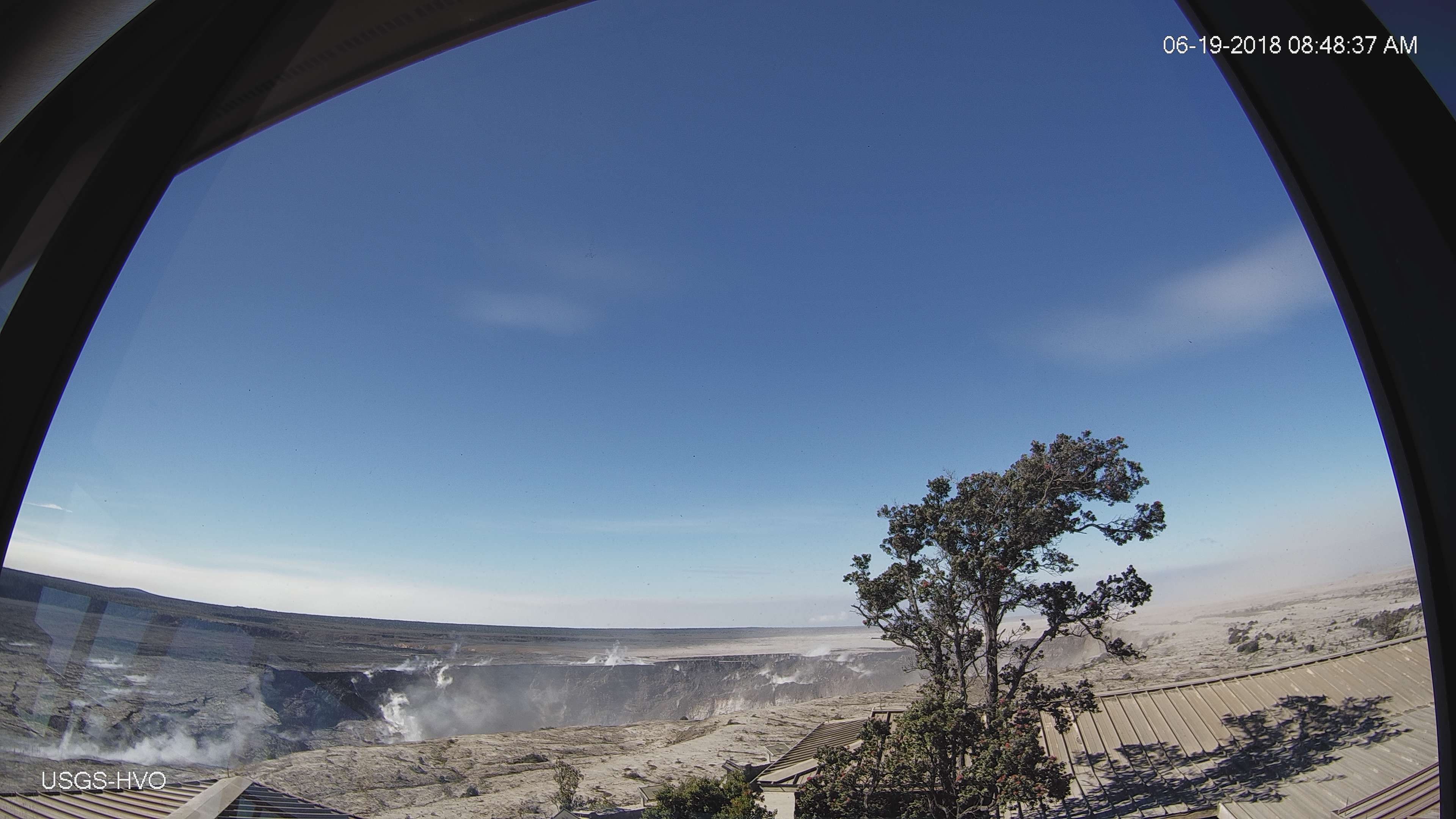
Q: The ohia tree [in HVO wide-angle webcam] looks so healthy. Can they tolerate SO2 better than other trees?
A: The ōhiʻa lehua trees are very well adapted to withstanding sulfur dioxide. They’re often among the first plants to colonize new lava flows on Kilauea: [Link: Native Plants of Hawai’i]
From Local News Outlets
- HSA: “Lava output far outpaces previous eruptions”
- HNN: “Lava ‘bergs,’ rapids and flows part of a bizarre new normal on the Big Island”
- HNN: “Hawaii Volcanoes National Park to host free events amid eruptions, ashfalls”
- HTH: “Public viewing area for eruption discussed, but not guaranteed”
- HSA: “More than 1,000 Big Isle residents affected by Kilauea eruption register with FEMA”
- KITV: “Lava affected residents are urged to register for FEMA assistance, no county letter needed”
- HNN: “Church breaks ground on village of micro-homes for lava evacuees”
- HNN: “‘You rebuild and you survive’: Displaced residents find creative housing solutions amid eruptions”
- BIN: “EDS and Salvation Army Volunteers Assisting in Puna”
- HTH: “Kim to remain in hospital another day”
- HSA: “Eruption has cost state and county agencies more than $5.8 million”
- HCB: “Big Island: Council Rejects Tax Hike to Replace Revenue Lost to Eruption”
- HTH: “County, state legislators working on plan for special session to help Puna”
Moment of Aloha
Dispatches from the Volcano ditched poetic Hawaiian today to give some facts and figures, buried amongst all the HVO info that even I didn’t catch. Chiefly:
- Halema’uma’u 6 weeks ago: half mile across, 280 feet deep.
- Halema’uma’u June 15: 1 x 1.3 km or 0.6 x 0.8 mi, 370 m (1210 ft) deep!
Photographers / Social Media
#LeilaniEstatesEruption #KilaueaVolcano UPDATE: New aerial footage taken this afternoon captures the Kapoho ocean entry where a large, vigorous plume of laze billowing upward can be seen from miles away as lava rushes across #LERZ https://t.co/wzrhtOYh5Y @HawaiiNewsNow #HINews pic.twitter.com/2I4NY0n2je
— Mileka Lincoln (@MilekaLincoln) June 21, 2018
Interesting to see the laze plume generate lightning, which is a phenomena not yet seen in Hawaii.@NWSHonolulu https://t.co/FKDX6bY4eI
— the Weatherboy (@theWeatherboy) June 21, 2018
May 2016 pic.twitter.com/cM7UqH3h8p
— Timothy Castantine🕴 (@Castantine) June 20, 2018
Ha! I found one of the now gone Caldera Overtook Parking Lot. Taken from the perspective of a high point on the Kilauea Iki Crater hiking trail.
Gives an idea of the scale of the collapse. pic.twitter.com/50OwZJe8CO
— Timothy Castantine🕴 (@Castantine) June 20, 2018
A short video from @anthonyquintano's overflight of #Kilauea lava fissure #8 on the morning of June 19, 2018. #KilaueaEruption #Hawaii pic.twitter.com/nt6Dcxy9pF
— Honolulu Civil Beat (@CivilBeat) June 20, 2018