Today’s Eruption Summary
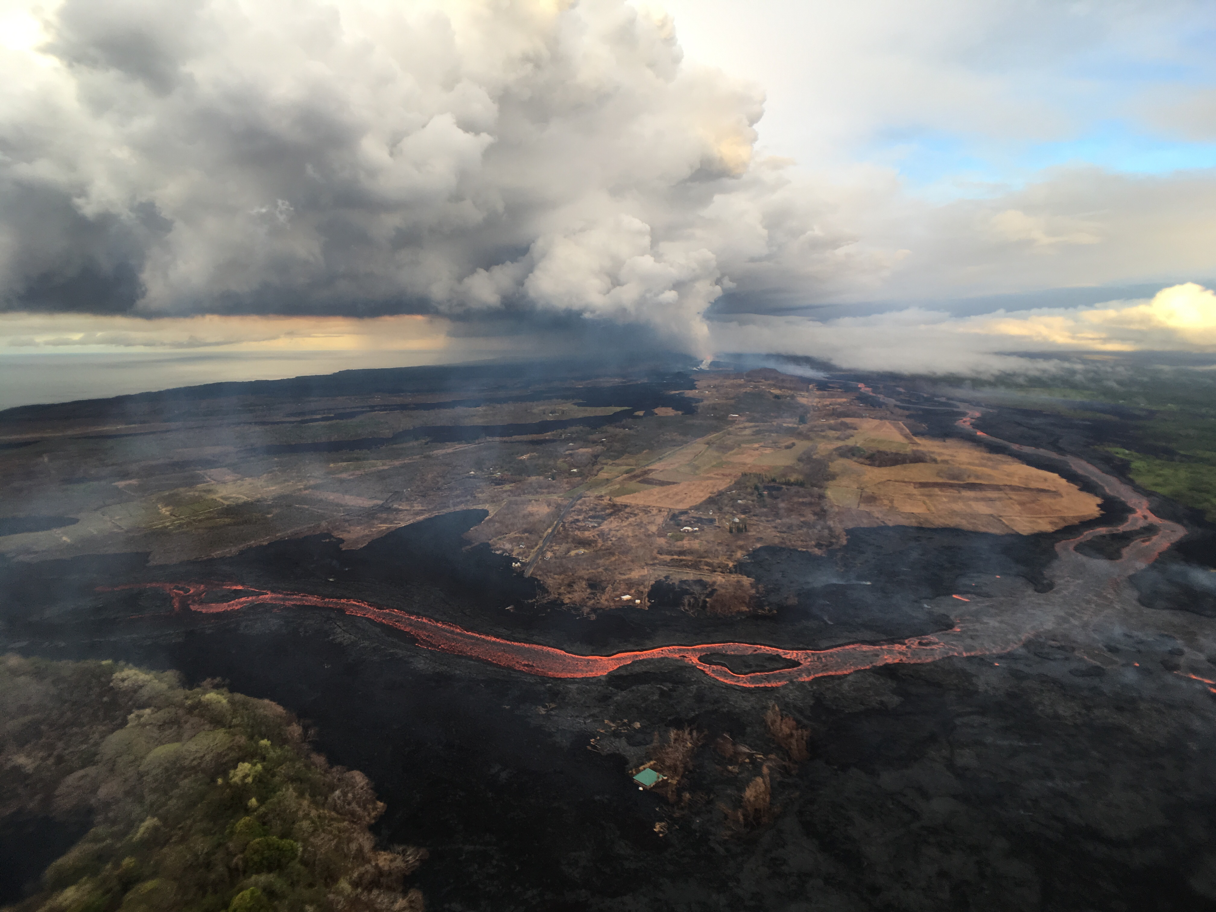
Status quo. Fissure 8’s lava river continues inexorably to the Ahalanui Beach area. At the coast, the flow has nearly stalled in its southern expansion, but according to Civil Defense has crept within ¼ mile of Pohoiki boat ramp.

July 21, 2018. USGS: “This aerial view, looking to the southwest, shows the most vigorous ocean entry of the fissure 8 flow, which is located a few hundred meters (yards) northeast of the southern flow margin.” (Full-sized)North of the main ocean entry, a few small pahoehoe lobes are still dribbling into the sea along the rest of the delta.
Today’s summit collapse event occurred at 9:43 am, registering as M5.4 for a change. It was preceded by widespread rockfalls about 3 minutes earlier, which I included in the video capture (jittery livestream signal notwithstanding):
Here’s the Northeast Caldera Rim livestream capture (collapse only, not foreshocks). USGS tweeted that “the output has increased somewhat at fissure 8” after today’s collapse.
Here’s how it sounded in Volcano (plus wind chimes):
Our Daily 5.3 😂Notice the chimes in the background.
Posted by Ken Boyer on Saturday, July 21, 2018
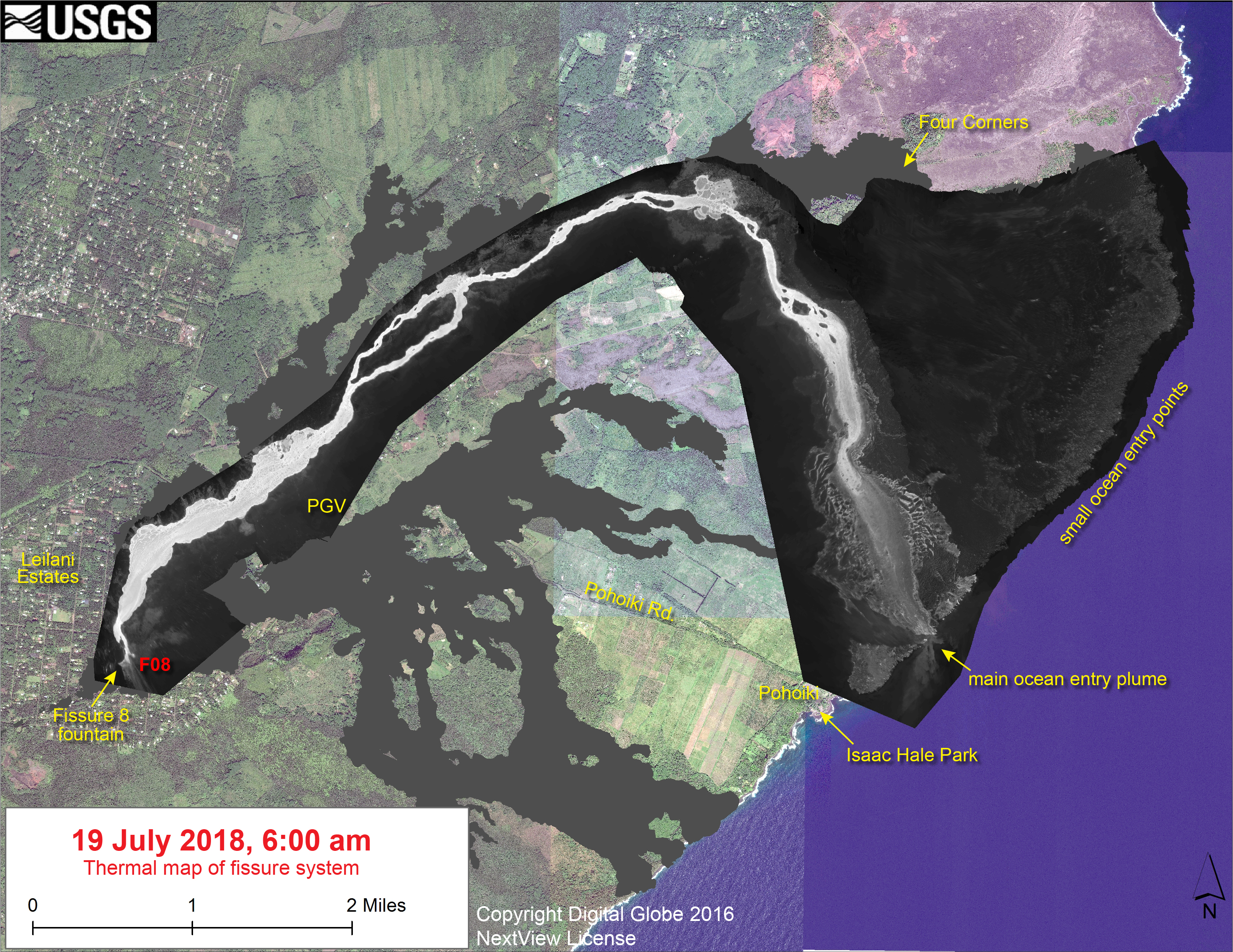
No new LERZ maps today, since the lava’s basically holding position. Here’s the most recent thermal map from July 19 again, since my post had a broken link yesterday.
Today’s main news is that this weeek’s HVO Volcano Watch column covers littoral/hydrovolcanic explosions, and the USGS photo chronology today offered some rare glimpses of geologists on the job: Continue reading July 21: Short Update Tonight