Here’s a transcript of this week’s presentation from HVO Deputy-Scientist-in-Charge Steve Brantley at the Tuesday Pahoa Community Meeting.
I’m going to start with a broad overview of the eruption so far. We’re 80 days into the eruption [since the floor dropped on Puʻu ʻŌʻō, I think] about now, so I want to provide a little bit of context, in terms of similar activity or un-similar activity in the past 200 years. And then we’ll do a quick summary of what’s happened in the past week.
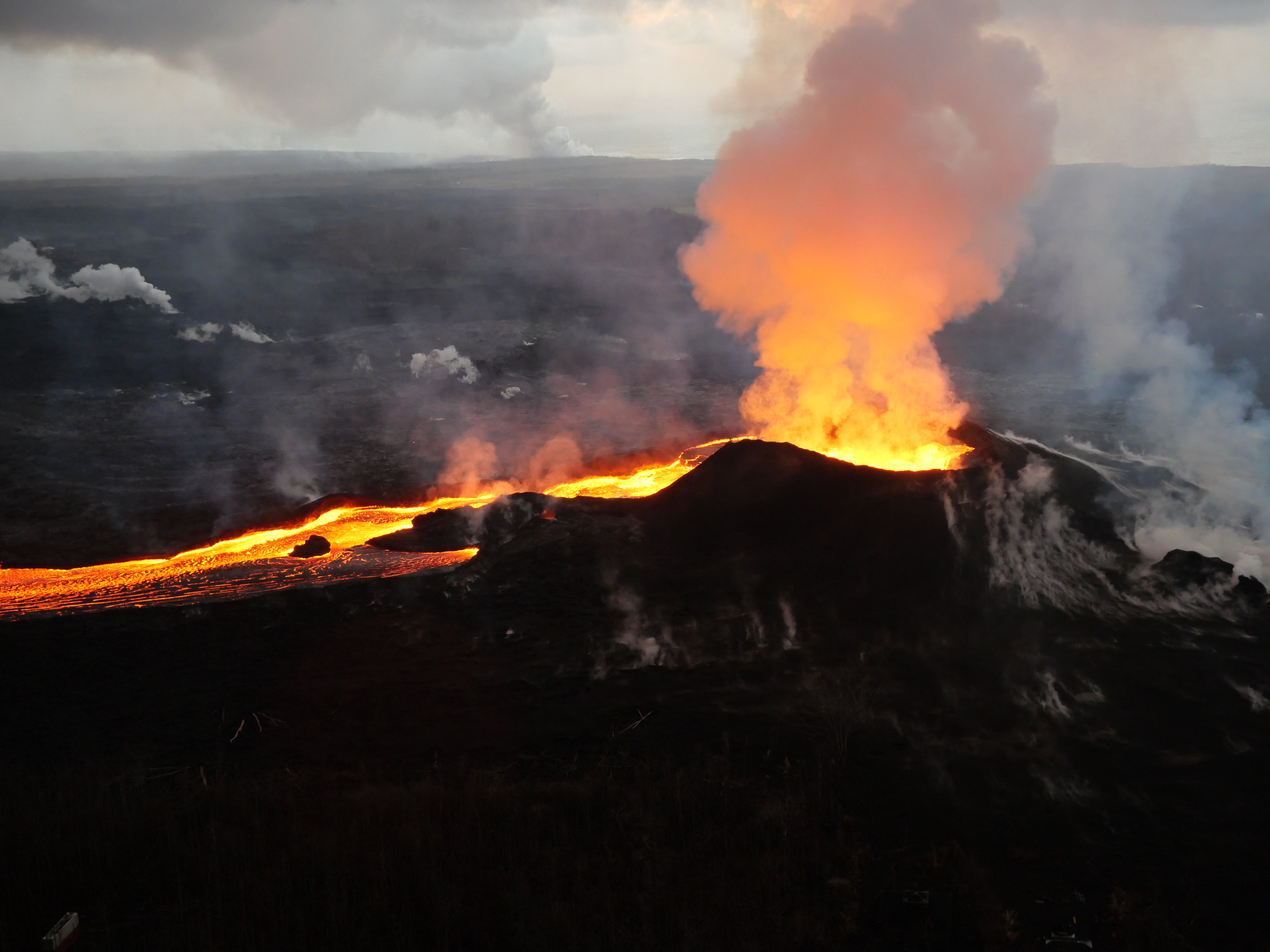
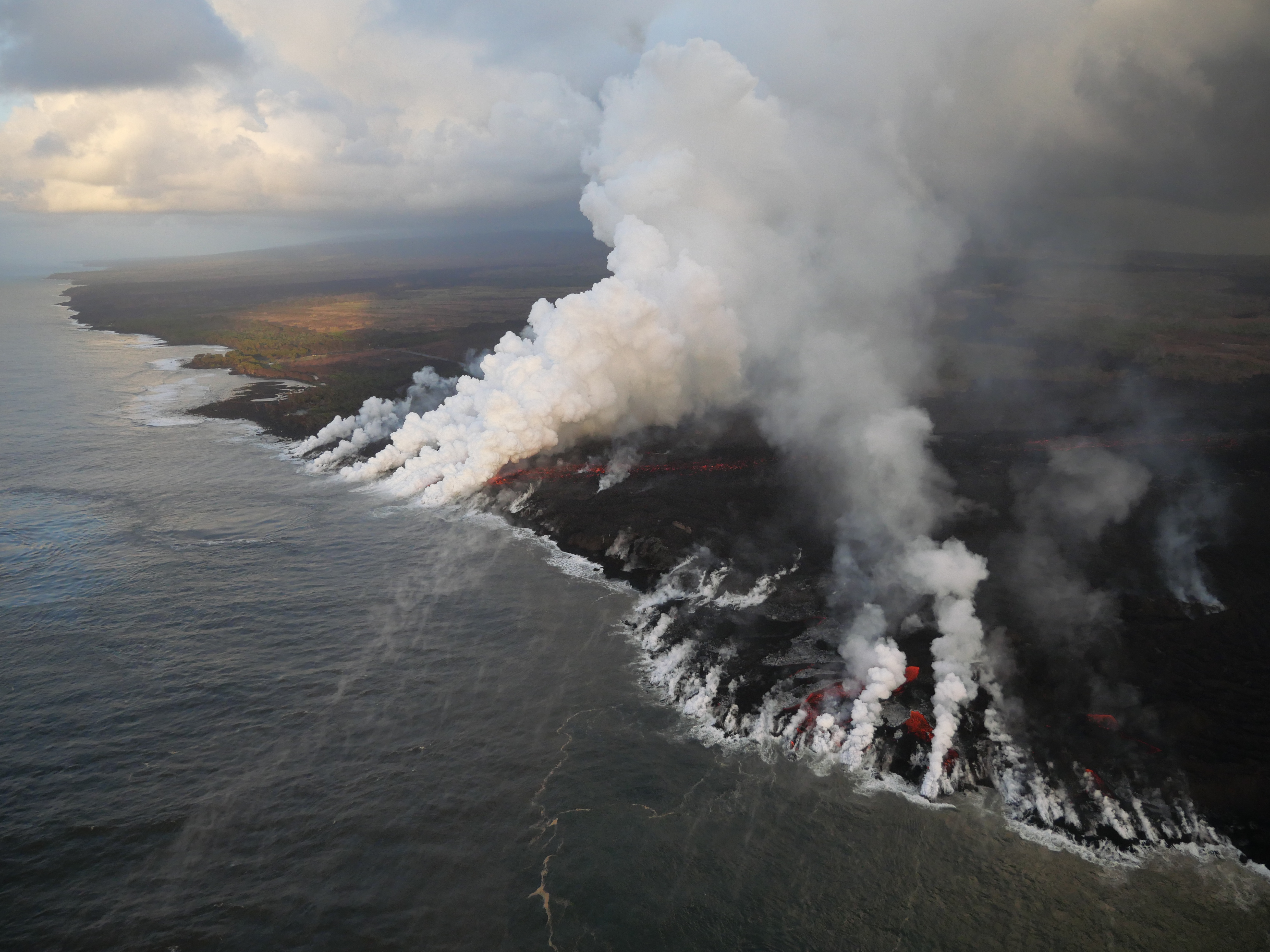
July 14, 2018. USGS: ” Early morning view of fissure 8 and lava channel looking toward the east. Laze plume from the ocean entry is visible in distance (left of the fissure 8 plume). Geologists did not observe activity from any of the other fissures during this morning’s overflight.” (Full-sized)
Today’s Eruption Summary
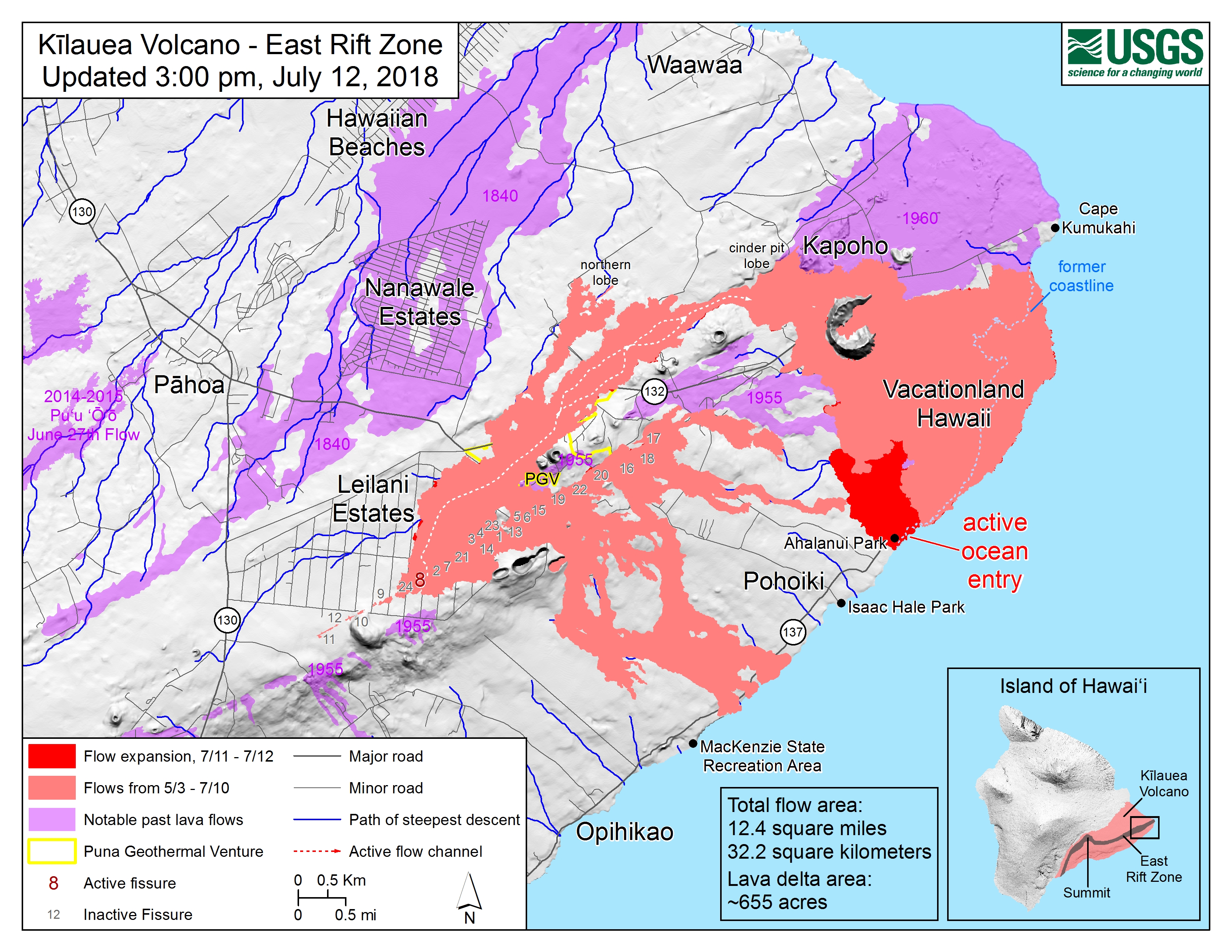
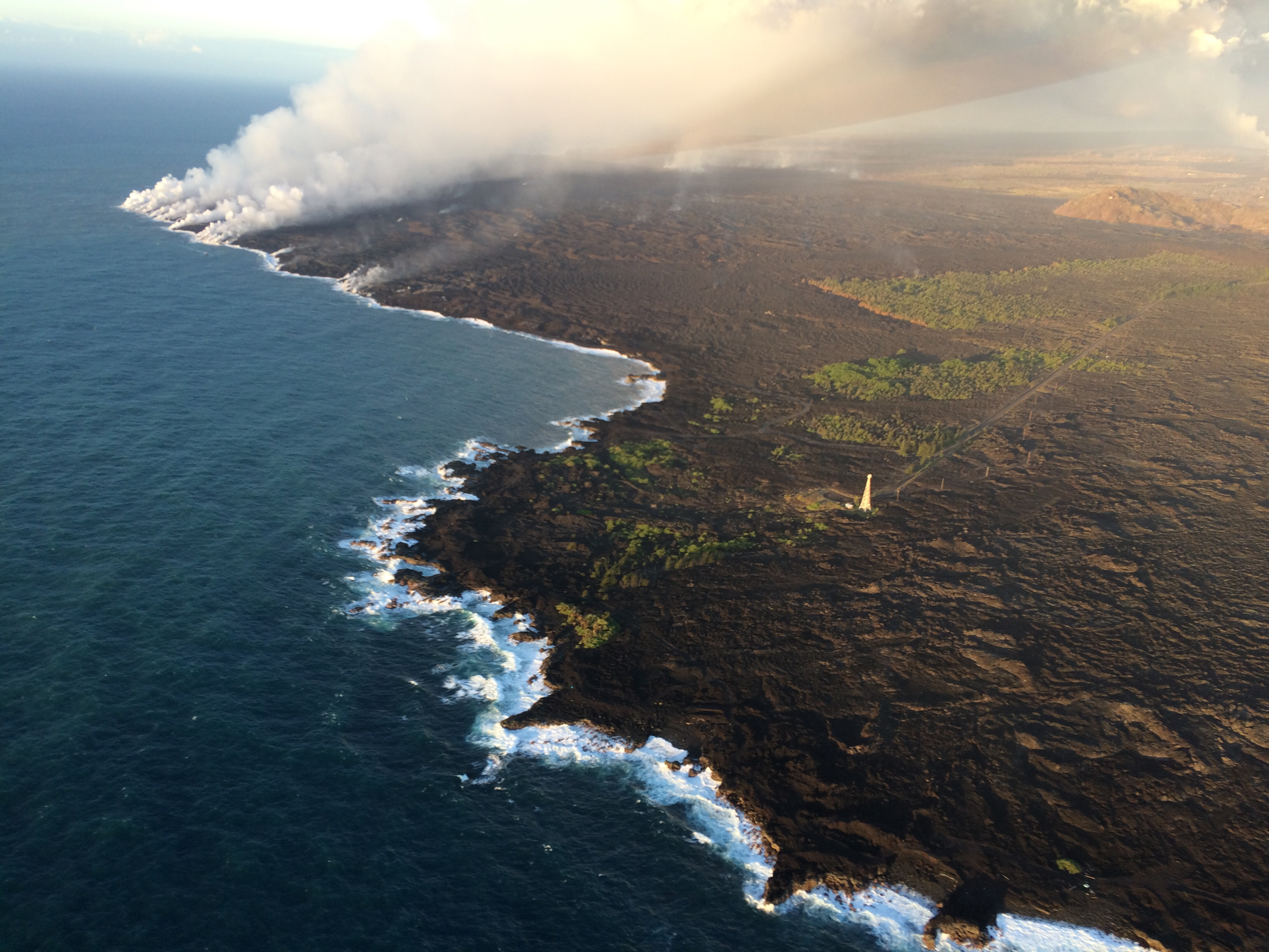
The Lower East Rift Zone eruption has settled back into a routine. Unfortunately, that routine includes the far end of Fissure 8’s lava flow crawling south along the coast, eating landmarks in its path. Isaac Hale Park/Pohoiki boat ramp (see flow map) is next in line. The morning USGS overflight reported that the flow front was about 1km away.
Friday evening, July 13, 2018, 6:00 pm – Kilauea's east rift zone overflight: Lava continues to pour into the sea at…
Fissure 8 continues to erupt into its perched channel, with its volume surging after yesterday’s 7:08pm summit collapse (Mag 5.3) and returning to lower levels by morning. That pulse caused a brief overflow on the east/southeast of the channel a short way downstream from the vent, but it stayed on the apron of previous flows.
The channelized a’a flow west of Kapoho Crater continues to be the main conduit to the ocean and to the active flow expanding southwards along the shore. North of this, lava continues to “ooze out” at various points along the June-early July flow front, whose length now totals 6km (3.7 miles).
July 14, 2018. USGS: “White laze plumes mark locations where lava enters the ocean over a broad area. An open lava channel flows into the ocean at the southern-most plume (middle) near the southern flow margin. The boat ramp at Pohoiki is about 940 m (0.58 mi) farther south of the flow margin. View is toward the west-southwest.” (Full-sized)
While there’s no sign of activity at any fissures besides 8, the tiny island that popped up just offshore of Kapoho yesterday is still there for now.
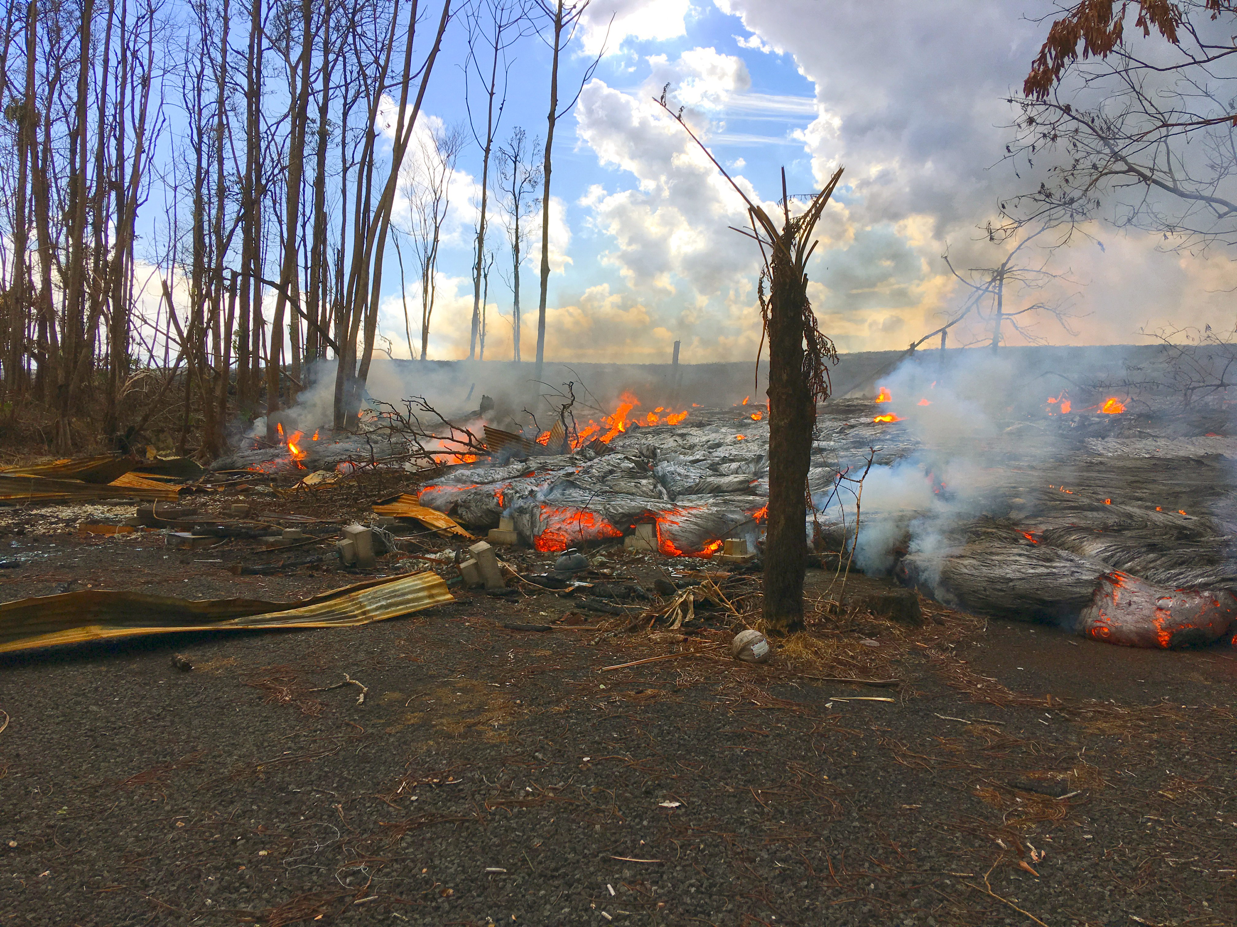
July 11, 2018. USGS: “A pāhoehoe flow fed by overflows from the fissure 8 lava channel was active along Nohea Street in the Leilani Estates subdivision this morning.” (Full-sized)
Today’s Eruption Summary
Quite a lot happened today in the LERZ. Fissure 8 started overflowing again about 8:30-9am this morning. Unfortunately, some spillouts on the north side extended past the edges of previous flows, destroying three more homes in Leilani Estates, two on Luana St, one on Nohea.
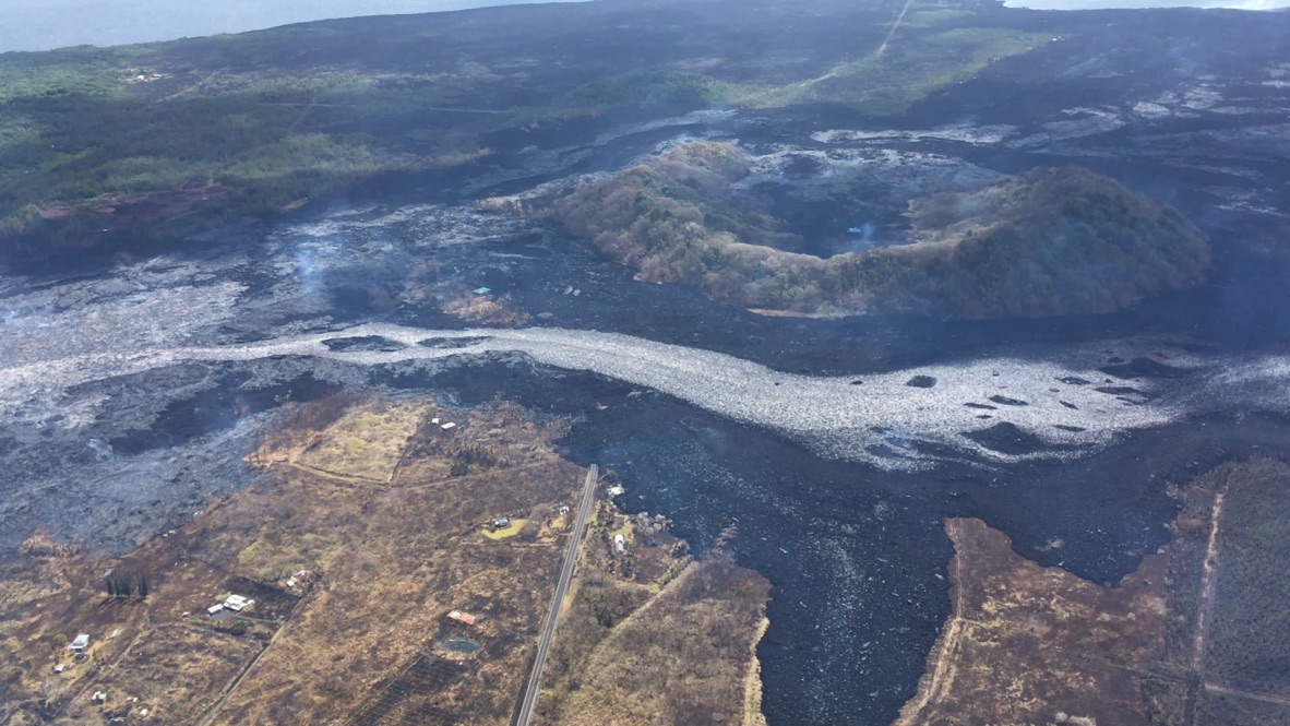
Another blockage just west of Kapoho Crater last night diverted much of the main lava channel around the west side of the crater’s cone, rejoining the main flow field on the other side. It created a channelized a’a flow which skirted the southern edge of the existing lava field, and was a quarter mile from the coast and Ahalanui Warm Pond by noon. [Update 10pm HST: I’m seeing several unconfirmed reports on social media that it and Kua O Ka La Charter School were taken by lava late Wednesday afternoon or early evening.]
However, some lava is still being supplied to earlier ocean entry areas, either by still-molten lava that’s permeated the lava delta, or by a lesser supply of new lava following the old route around Kapoho Crater. This lava is working on building a point (it’s still not the easternmost point of the island, although the angle of the left-hand photo makes it appear so):
New lava channel on south side of existing channel and wraps around west side of Kapoho cone, lava within 2,000 ft of the coast at Ahalanui Beach Park. Summit collapse event occurred at 5:46 AM HST.https://t.co/7sDZqcOJ5spic.twitter.com/kkt3wI7XAy
Interestingly, today’s tardy summit collapse at 5:46am (M5.3 as usual) seems to have had some effect upon Fissure 8. There’s been speculation that might be occurring, but it wasn’t confirmed until now. According to the HVO update: “The collapse/explosive event this morning was followed by an increase in lava from the fissure 8 vent which has produced small overflows from the upper channel that are threatening a few homes on Nohea and Luana streets.”
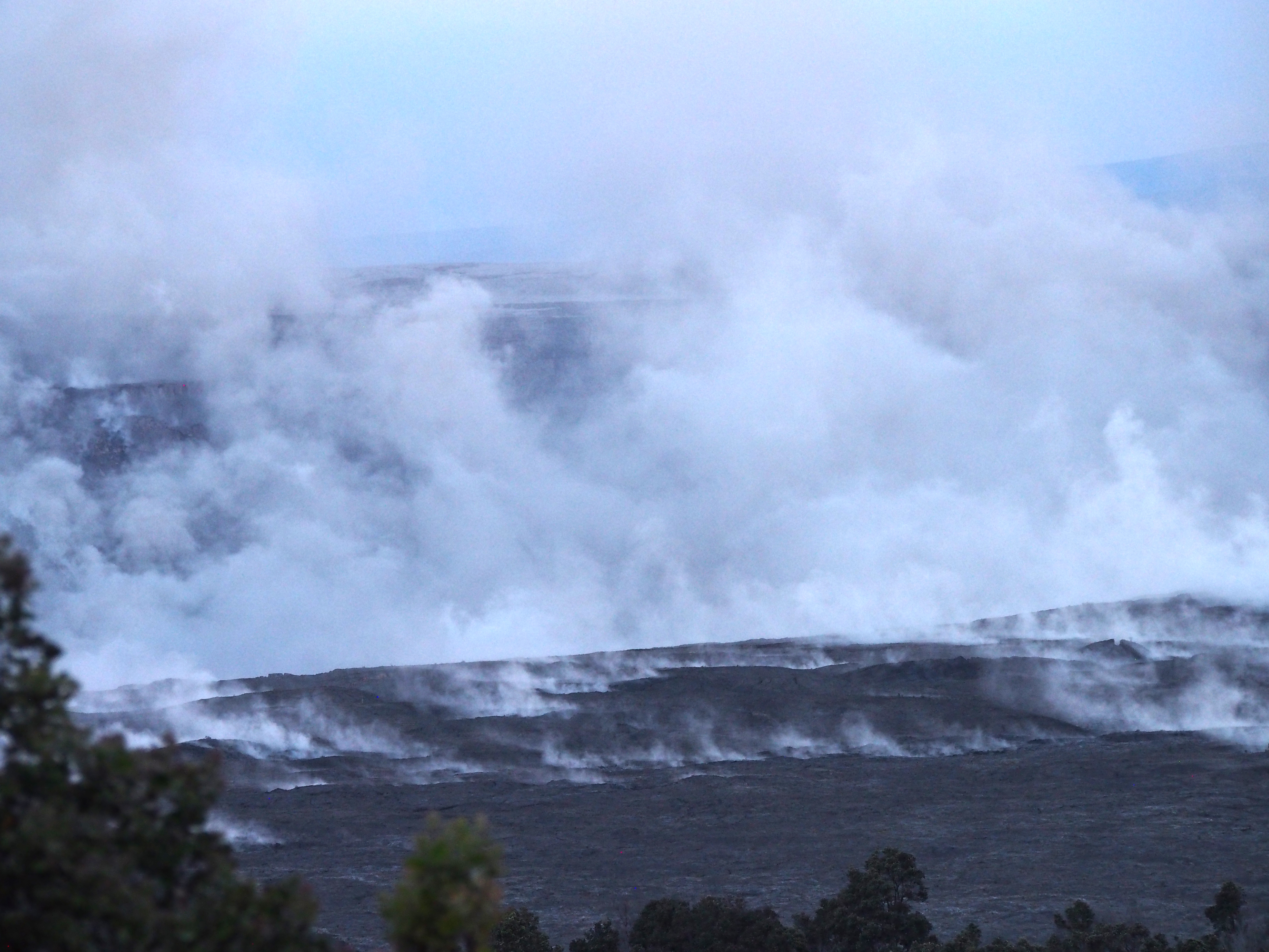
July 11, 2018. USGS— in fact this is another Don Swanson photo, according to the FB caption: “A telephoto view of the eastern edge of Halema‘uma‘u taken just two minutes after today’s (July 11) 5:45 a.m. HST collapse explosion event. Steam is intermixed with minor ash that imparts a pinkish-brown color to the plume. The energy released by the event was equivalent to a magnitude-5.3 earthquake.” (Full-sized)
Fissure 22 continues to sputter quietly and intermittently, so the sluggish flow it was emitting a week or so ago has cooled.

