May 22: Reactivated Fissures Near Geothermal Plant

News media have finally gotten wind of Civil Beat’s livestream. Some have gotten the homeowner’s permission to film broadcasts on the same porch, so you may hear them if you tune in. At other times, the homeowners or friends they’ve let use the house stop by. It’s surreal yet oddly comforting to hear the homey noises of people, a pet parkeet (?), and wild chickens outside while towering, terrifying yet magnificent lava fountains boom and chuff.

As for the big picture, we’re starting to settle into a routine with Kilauea’s ongoing double eruption:

(1) Lava in Lower East Rift Zone

  • Lava fountains/flows in the Lower East Rift Zone continue vigorously, claiming more land and displacing more residents in Lower Puna.
  • Some fissures stop, but others reactivate. See HVO maps for what’s active.
  • Coast guard, police are trying to keep spectators away from lava entry into ocean; toxic “laze” plume from lava/seawater interaction is dangerous.
  • Puna residents are concerned about lava now encroaching on Puna Geothermal Venture site, because PVG’s lack of transparency and tardiness in capping wells has not been reassuring. (see HNN reporter Mileka Lincoln’s brief, damming synopsis). Lava-breached wells might emit toxic hydrogen sulfide.
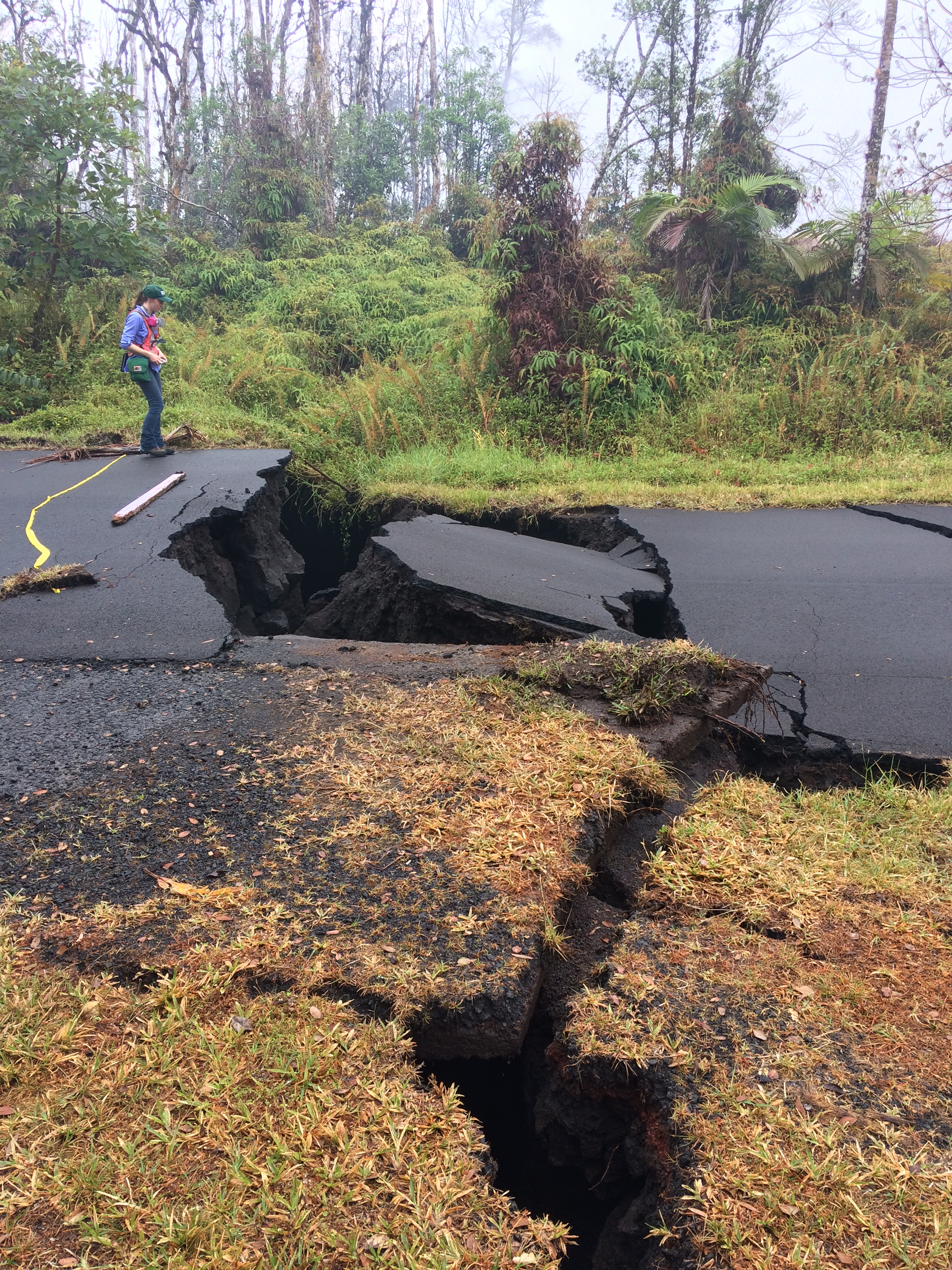
  • Leilani Estates, where fissures started, doesn’t have much erupting now but cracks in some roads are now chasms (photo).
  • Lava is now faster, hotter, more voluminous due to clearing out old lava from 1955 that was pooled under rift zone; now it’s fresh lava from drained Pu’u O’o.

(2) Kilauea Summit Ash Explosions

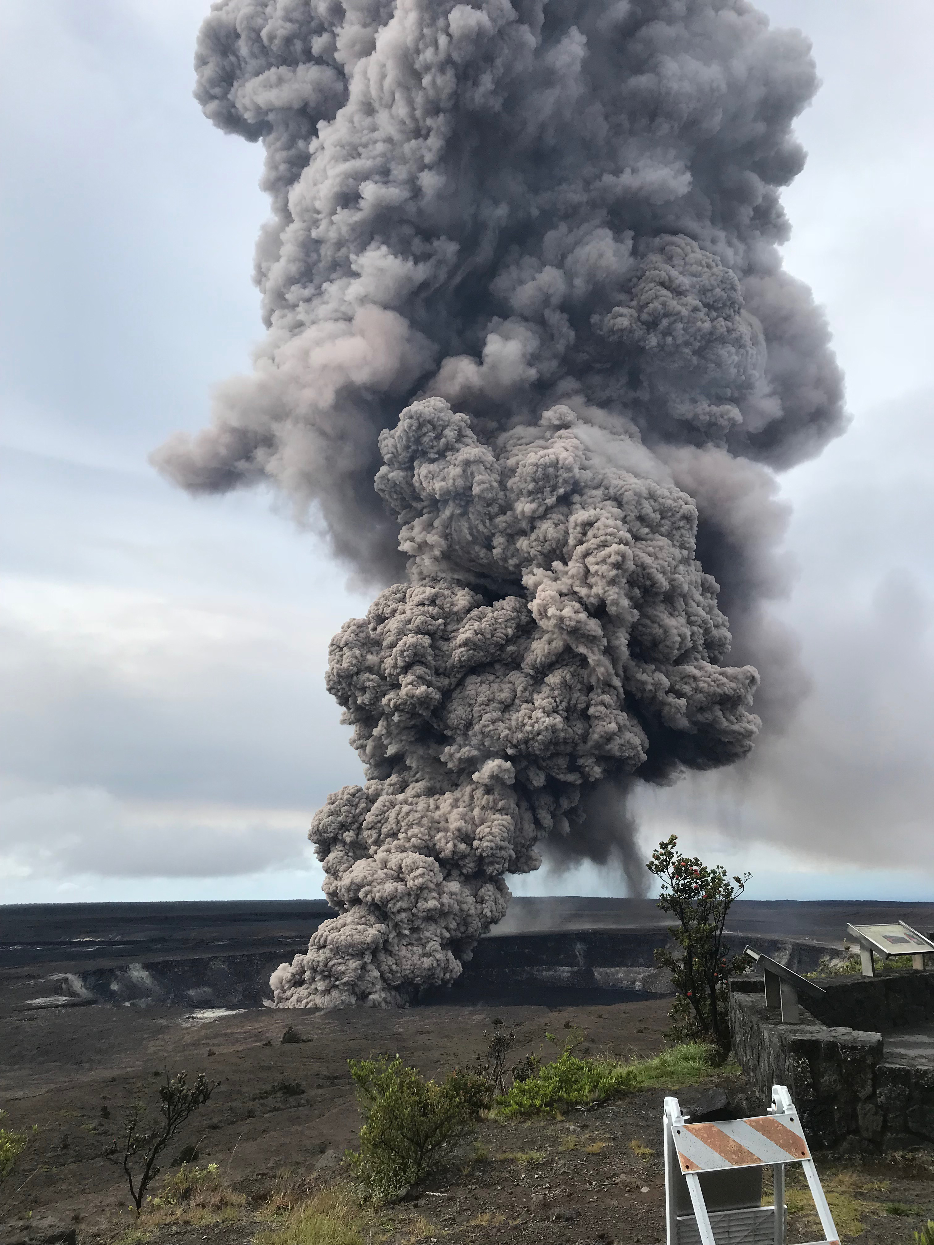
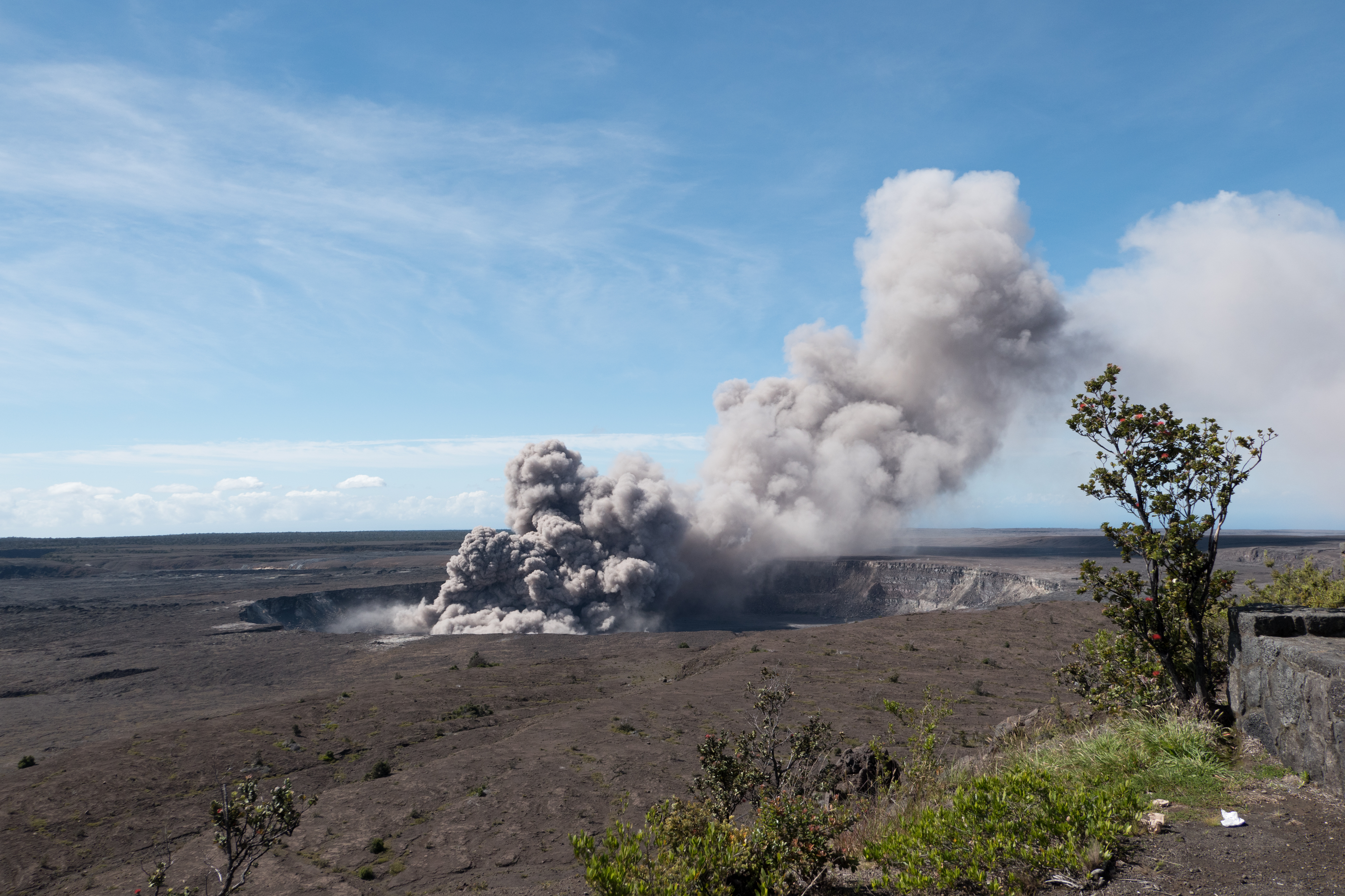
  • Minor ash explosions continue intermittently at Kilauea’s summit crater, Halemau’ma’u. Between explosions, white plume of steam seen on webcams.
  • This morning, another ash explosion, 10,000 foot cloud, 3:30 AM. Here’s this morning’s Civil Defense ashfall warning with advisory for Kau.
  • See NWSHonolulu on Twitter for ashfall advisories.
  • We don’t know if crater has ejected more “ballistics” (flying rocks) since USGS scientists aren’t risking personnel by entering the possible “flying rocks” zone. Right now they’re working from a temporary base of operations in Hilo.
  • Hawaii Volcanoes National Park remains closed, not only to keep public out of range of flying rocks, but because of earthquake damage to trails and some park structures. These need to be assessed/repaired.
  • Park Rangers have set up in Hilo Bayfront to educate public about this historic eruption.

Oh look, another hazard from lava entering ocean: WATERSPOUTS.

And even when fissures don’t spout lava, they can still be dangerous:


May 21: Daily Roundup, Fire & Water Edition

Mick Kalber’s daily helicopter flyover includes some intense views of the rivers of lava heading into the ocean, and the big complex of fountains— 20? 22? we’re starting to lose track— that have dominated the Lava Livestream With Rooster for the last several days.

May 21 Fissure Map (USGS Maps page)

The USGS thermal scan is very informative, too: an infrared satellite detects heat sources (the whiter the image, the hotter it is), and USGS then overlays it on a daylight satellite image of same area. Result, accurate map of where the main flows are, even when they crust over so the lava inside is hidden:

May 21 Heat map of today’s flows (USGS Maps page)

Below the cut: a digest of the day’s eruption news, USGS updates (summarized), and striking social media images and video clips like this:

Continue reading May 21: Daily Roundup, Fire & Water Edition

May 19 USGS Press Conference on Kilauea’s Explosive Side

BigIslandVideoNews just put up an edited video of Saturday’s USGS press conference. My hero Don Swanson is there. It’s INCREDIBLY informative on what they think is happening at the summit and why they think it’s a repeat of the “much smaller eruptions” of 1924 and not larger ones.

Transcription:

Continue reading May 19 USGS Press Conference on Kilauea’s Explosive Side

May 19 – Another Ash Explosion Last Night

USGS reports another explosion last night: “At 11:58 PM Local time, a short-lived explosion at from Halema’uma’u created an ash cloud that reached up to 10,000 ft asl and was carried southwest by the wind. Possible trace ash fall may have occurred along Highway 11.”

I’m not sure whether this was a steam explosion, or just yet another of these rockfall-triggered ashclouds, like this one in 2011:

Hawaii Volcano Observatory is so lucky to have one of the foremost experts in explosive eruptions, Don Swanon, who worked on St Helens so long ago and uncovered Kilauea’s explosive history after transferring to HVO in the 90s.

From KITV May 19:

Experts on this active volcano gathered to share what they know- and what they have discovered is Kilauea has a history of explosive ash eruptions. Hawaiian Volcano Observatory geologist Don Swanson sums, “For the past 2,500 years we’ve had explosions more than 50% of the time, so this is the norm for Kilauea. But most of the explosions are minor, like we saw today, with small plumes of ash and steam rising from the summit.”

May 17, Early Morning: Steam Explosion!

May 17, 4:17 AM, the first honest-to-gosh steam explosion like they’ve been predicting (instead of just a rock and lava explosion) sent an ash cloud up 30,000 feet. Gemini Observatory caught it on timelapse:

According to volcanologist Erik Klemetti, the blast threw some 1000-pound blocks, the only place I’ve seen this. See blog post (more pics).

By morning, things had settled down:

Continue reading May 17, Early Morning: Steam Explosion!

May 16: Summit Ash and Small “Ballistics”

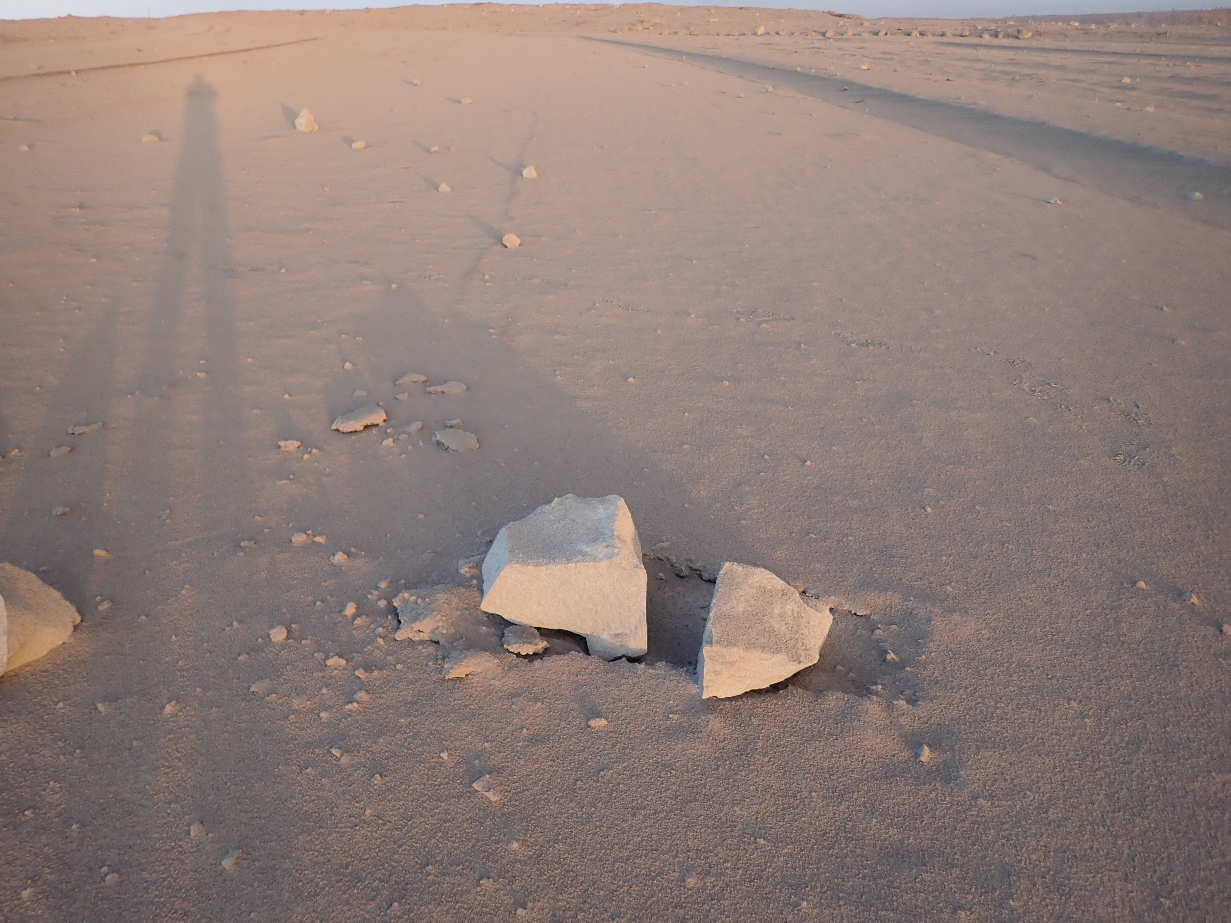
May 16, 8:36 AM, a 4.2 earthquake shook rocks from Halema’uma’u Overlook Crater’s walls that fell into the lava lake, caused an explosion, and sent (according to the USGS)  “dense ballistic blocks up to 60 cm (2 feet) across were found in the parking lot a few hundred yards from Halemaumau.”

USGS photo of “ballistic rocks” found in parking lot next to Halema’uma’u Crater, INSIDE Kilauea Caldera, morning of May 16

Here they be. They’re ballistic, in that they soar up and down like a cannonball, with the chimney above the lava lake acting sort of like a vertical cannon. But contrary to several headlines I saw, these rocks are not refrigerator-sized.

There is light ash dusting the area and turning it into a moonscape.


May 16: HVO Raises Aviation Color Code to Red

Media freaked out overnight when Hawaii Volcanoes Observatory issued a code red alert following a 12,000 foot tall ash explosion at the summit. The next morning they clarified:

USGS Volcanologist Michelle Coombs (EXCERPT):

So we’ve had some questions about what code red means. It sounds a little bit alarming, It’s really just to say that we see significant amounts of ash from this ongoing activity, and to warn aviators about that ash. It doesn’t mean that a really big eruption is imminent. it’s really just characterizing the aviation situation.


May 15: Still Not the Big One

May 15, 11:05 AM: A major ash explosion up to 12,000 feet — which HVO still guesses was caused by rockfall into the receding lava lake— prompted HVO to raise the aviation alert level to RED, warning aircraft to stay away from the summit and ash hazards.

Unfortunately, news media took this RED ALERT to be “major eruption imminent,” instead of “no more imminent than it already is, since, as a matter of fact, it’s already erupting. But it could increase activity.”

USGS Geologist @DrJanineKrippner has been playing whack-a-mole on Twitter rumors and addressed “Kilauea’s Alert Level Was Just Raised To Red – But What Does That Actually Mean?” on IFLScience, reiterating that it was mostly an aviation alert. So did volcanologist Erik Klemetti, with a good writeup of today’s steam explosions and fissure activity on his Rocky Planet blog.

May 9-10: USGS Warns of Possible Steam Explosions

Attention shifted back to the summit on May 9, when a 3.1 earthquake set off a rockfall that agitated the lava lake and sent up a 6000-foot poof of ash (video clip National Parks site):

Rockfall into Halema’uma’u lava lake sends up plume of ash, 8:27 May 9.

Rockfalls caused poofs of ash like this even back when the lava lake was full, but that was more than usual. (See also USGS video from May 7, when lava lake was still visible, showing how falling rocks agitate it).

However, that was just a teaser. The big news was the dropping lava lake…

…prompted HVO to issue its first warning about steam explosions if the lava dropped below the water table.

Hawaii Volcanoes National Park closed Friday May 11 as a precaution, since the lava lake was projected to reach the water table sometime that day. For the next few days it continued to send up a white plume of steam and/or ash clouds when rocks from the sides of the chimney fell in:

[USGS] May 11, 9:12 AM: second ash explosion
On steam (phreatic) explosions:

Continue reading May 9-10: USGS Warns of Possible Steam Explosions

April 30: Halema’uma’u Lava Lake Before It Dropped

Amateur video of Halema’uma’u lava lake in Overlook Crater, taken by Jeffrey Brown on April 30, 2018.

The week before, the summit had been inflating and the lava lake had been overflowing, as seen on this USGS timelapse video of Halema’uma’u Crater April 25-26.

Map of Halema’uma’u and Kilauea Summit, because it’s a little confusing:

Continue reading April 30: Halema’uma’u Lava Lake Before It Dropped