
This was not the first “real” subject I expected to paint (outside of cups & fruit for class exercises) when I started art lessons.
This was not the first “real” subject I expected to paint (outside of cups & fruit for class exercises) when I started art lessons.
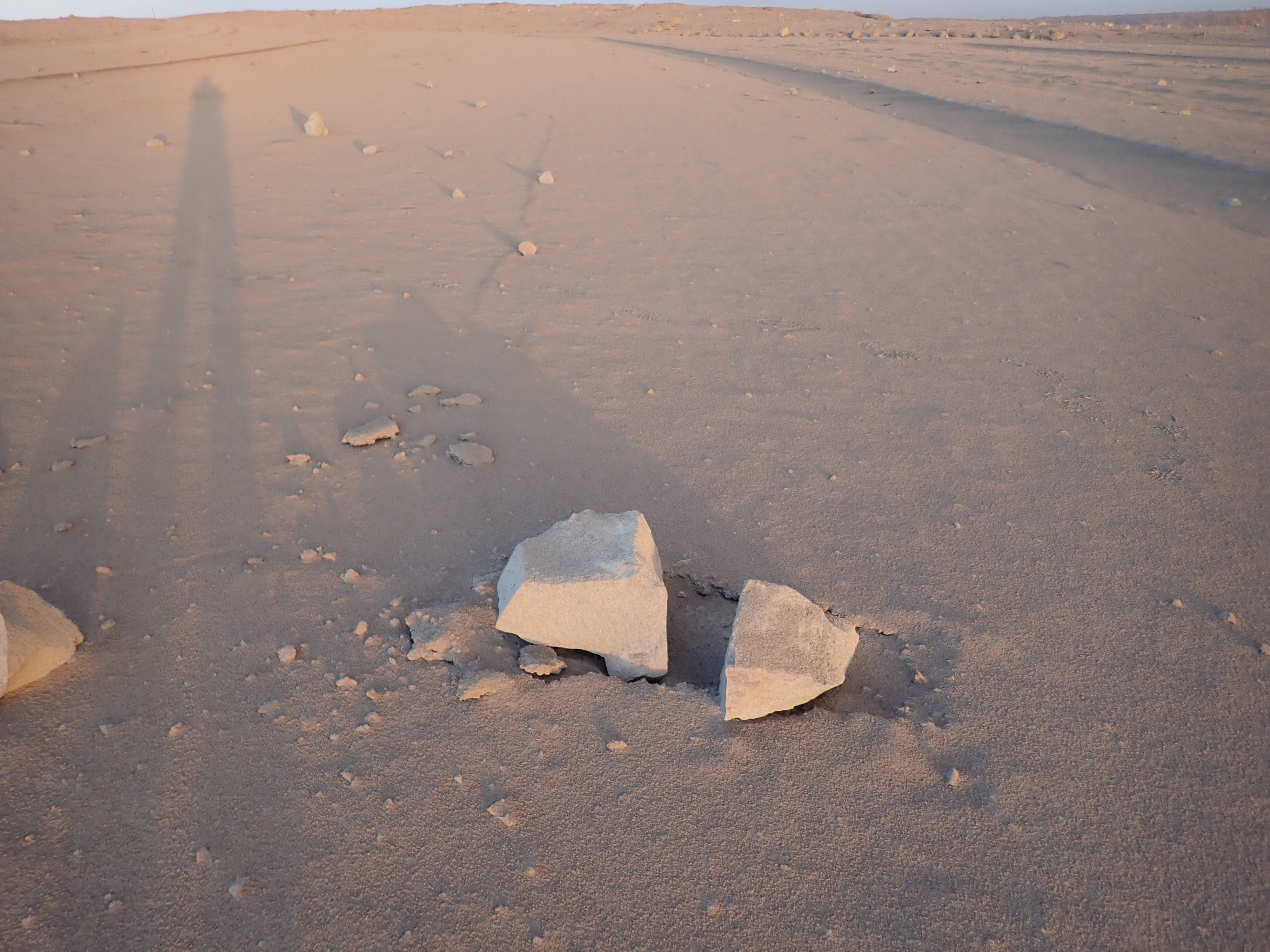
May 16, 8:36 AM, a 4.2 earthquake shook rocks from Halema’uma’u Overlook Crater’s walls that fell into the lava lake, caused an explosion, and sent (according to the USGS) “dense ballistic blocks up to 60 cm (2 feet) across were found in the parking lot a few hundred yards from Halemaumau.”

Here they be. They’re ballistic, in that they soar up and down like a cannonball, with the chimney above the lava lake acting sort of like a vertical cannon. But contrary to several headlines I saw, these rocks are not refrigerator-sized.
There is light ash dusting the area and turning it into a moonscape.
May 15, 11:05 AM: A major ash explosion up to 12,000 feet — which HVO still guesses was caused by rockfall into the receding lava lake— prompted HVO to raise the aviation alert level to RED, warning aircraft to stay away from the summit and ash hazards.
People continue to golf as an ash plume rises in the distance from the Kilauea volcano in Hawaii. pic.twitter.com/bAxOAA9zkN
— ESPN (@espn) May 16, 2018
Unfortunately, news media took this RED ALERT to be “major eruption imminent,” instead of “no more imminent than it already is, since, as a matter of fact, it’s already erupting. But it could increase activity.”
Halemauamau erupting on Hawaii RIGHT NOW. Thanks to @bigislandflow!
Halemauamau is part of Kilauea volcano, Hawaii.#geology #science #eruption #ash #hawaii #magma #leilanieruption #volcano pic.twitter.com/vaWNSxe1aY
— Rockodile Boyce (@volcanojulie) May 15, 2018
USGS Geologist @DrJanineKrippner has been playing whack-a-mole on Twitter rumors and addressed “Kilauea’s Alert Level Was Just Raised To Red – But What Does That Actually Mean?” on IFLScience, reiterating that it was mostly an aviation alert. So did volcanologist Erik Klemetti, with a good writeup of today’s steam explosions and fissure activity on his Rocky Planet blog.

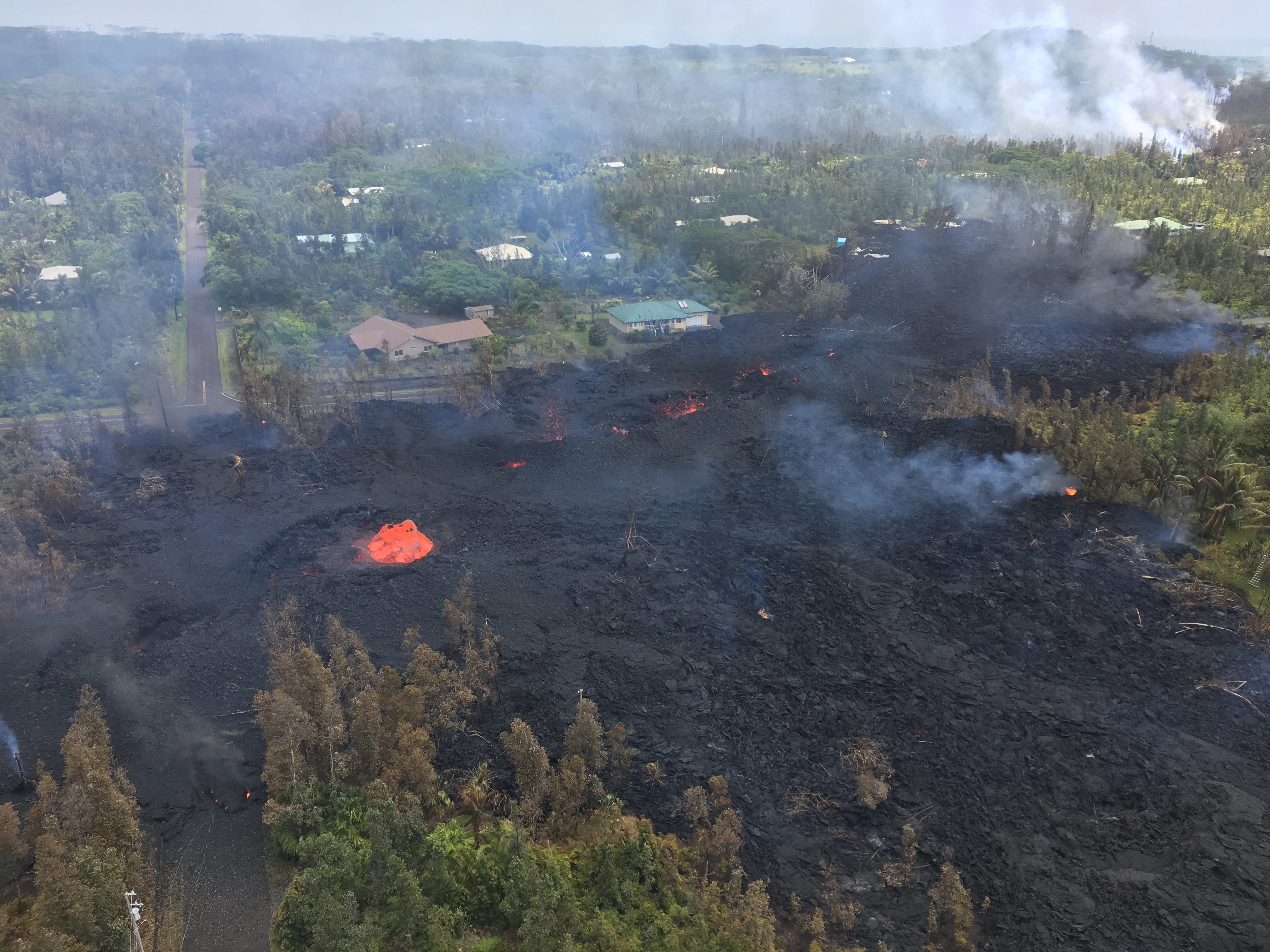
Evacuated residents of Leilani Estates were allowed back on Sunday May 6 to collect vital documents, pets and possessions. New fissures continued to open up and spatter, and officials warned about toxic sulfur dioxide gas (SO2) coming from fissures as well.
Screencaps from Mick Kalber flyover videos April 28 and May 4(?) as noted by @ReelNewsHawaii on Twitter.
To give you an idea of what's going on. This is Pu'u O'o crater April 28th full to the brim with lava & then yesterday completely drained like someone unplugged the tub. All the lava has flowed into lava tubes to were it's reaching the surface miles away in Leilani. pic.twitter.com/BzJwNC0Fvh
— Reel News Hawaii (@reelnewshawaii) May 6, 2018
Foggy/rainy weather had limited visibility, but the skies cleared May 3. A USGS overflight revealed the crater was completely drained:
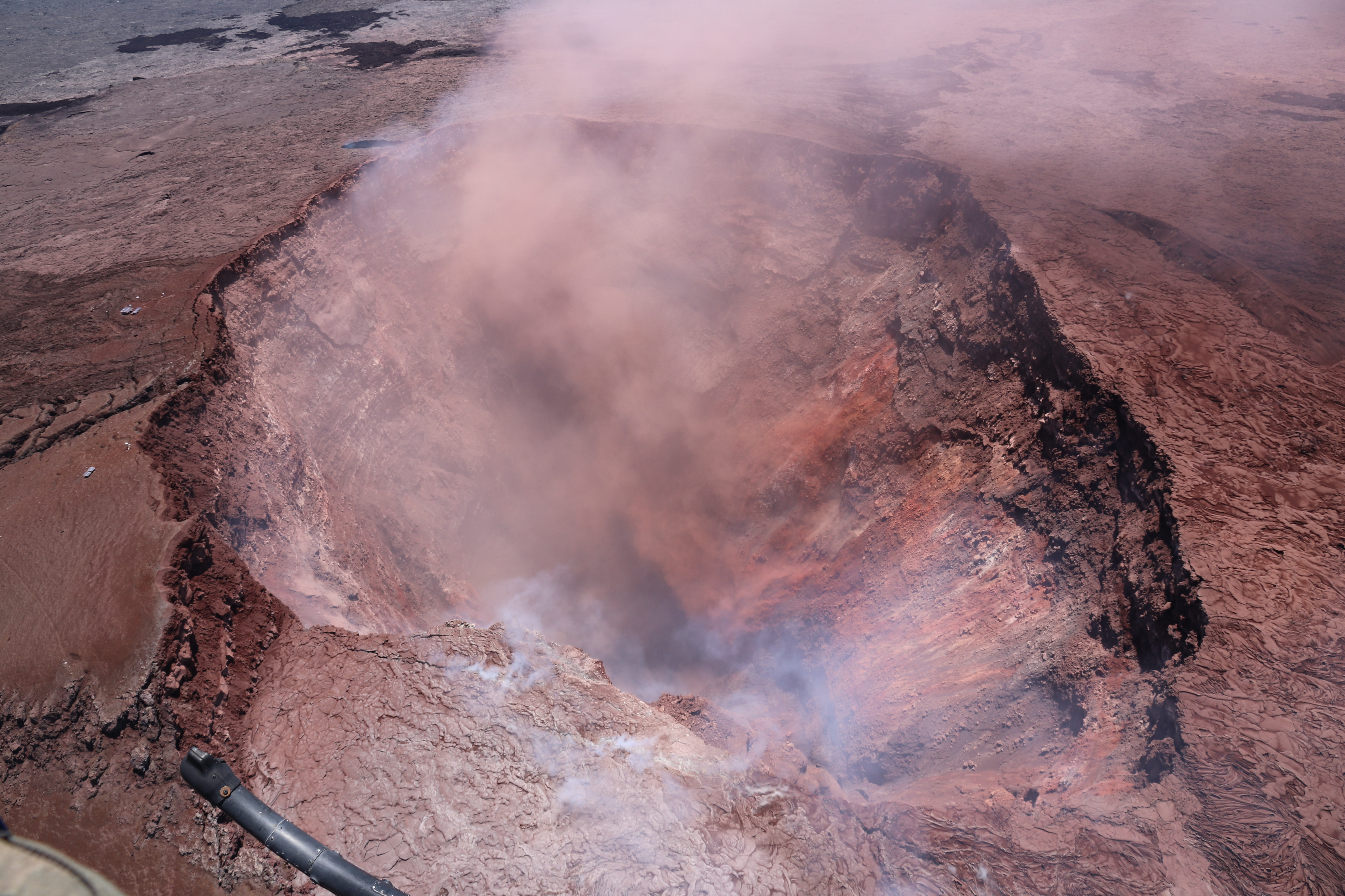
At 10:30 AM, a magnitude-5 earthquake caused more of the crater to collapse, throwing up a cloud of pink ash.
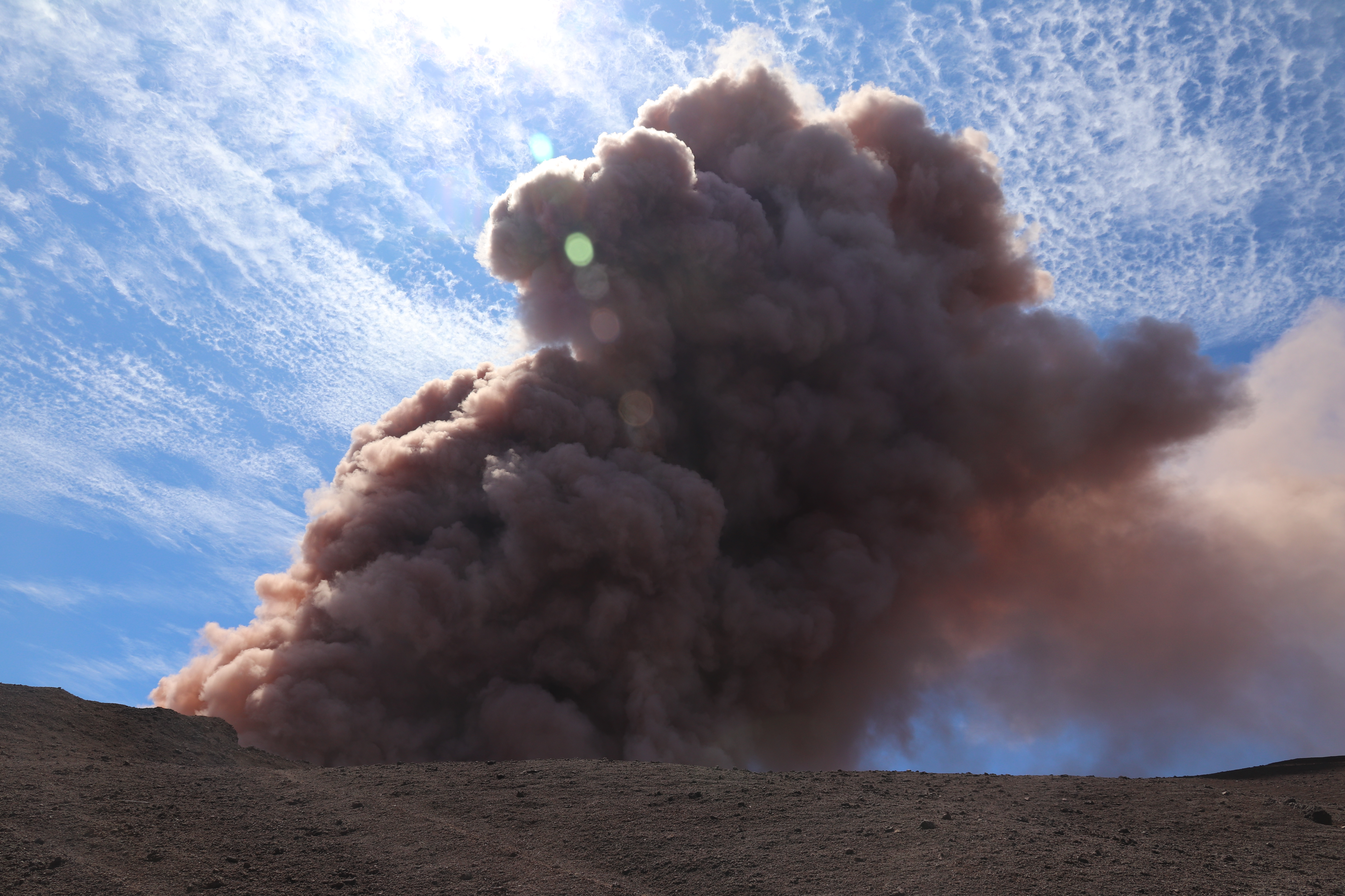
Pu’u O’o crater sends up cloud of ash after M5.0 earthquake. HVO Photo/Video blog. Again, Full-sized image is dramatic.
See also Mick Kalber’s May 2 flyover video.
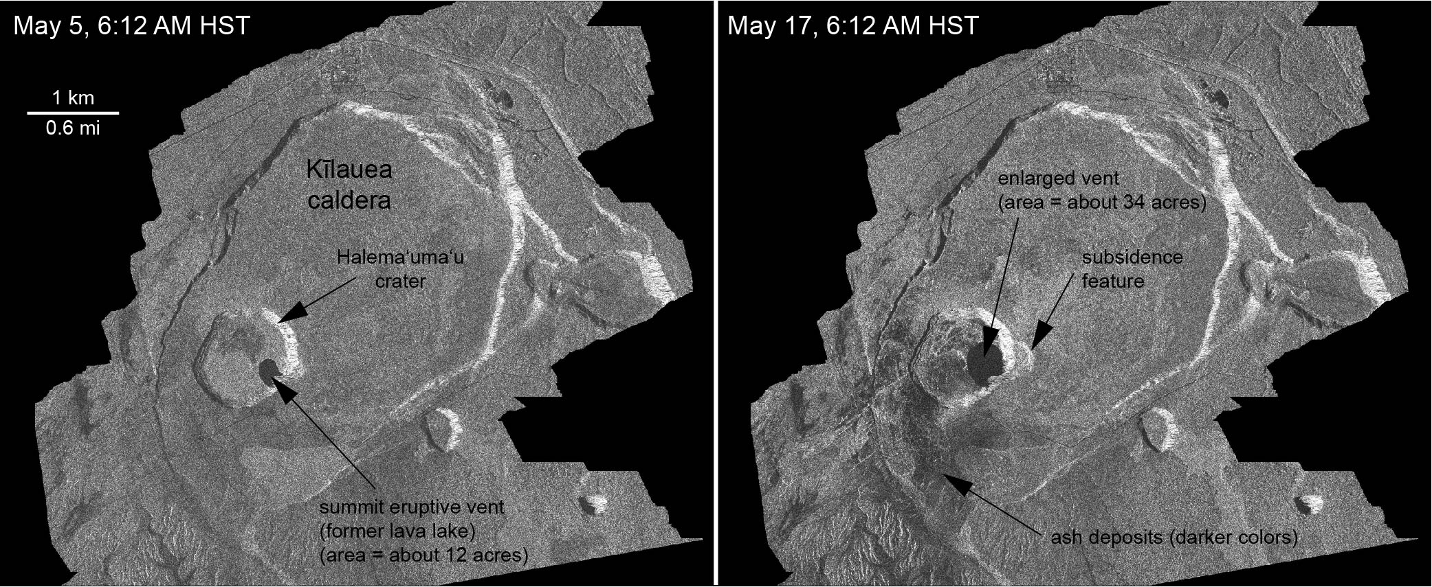
Meanwhile, increased seismicity at the summit coincided with the summit lava lake changing from inflation to deflation— this is when it began to drop (source: HVO Volcano Watch).
On May 2, residents in Leilani Estates noticed cracks in the roads:
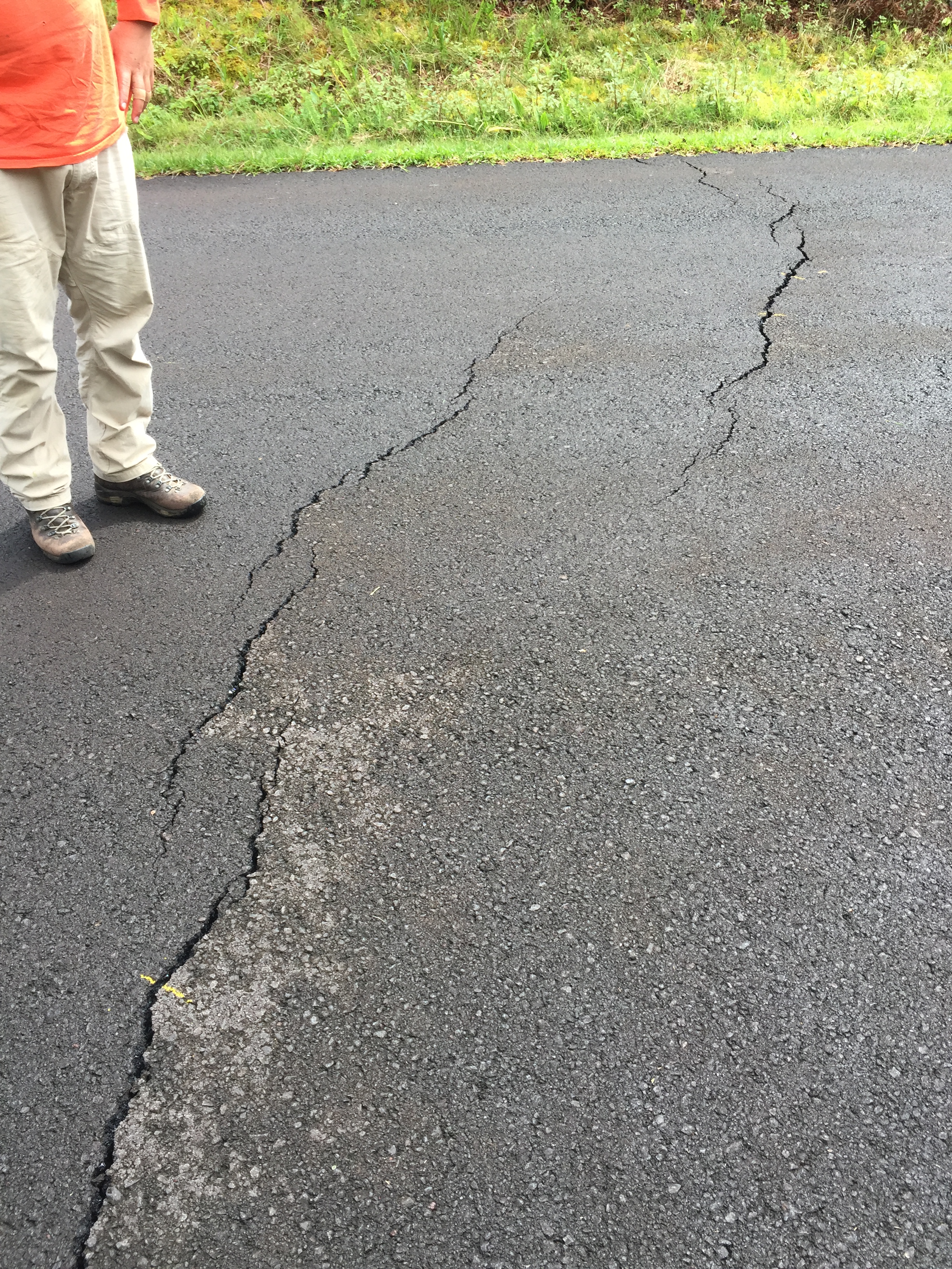
This was a warning sign… but of what?