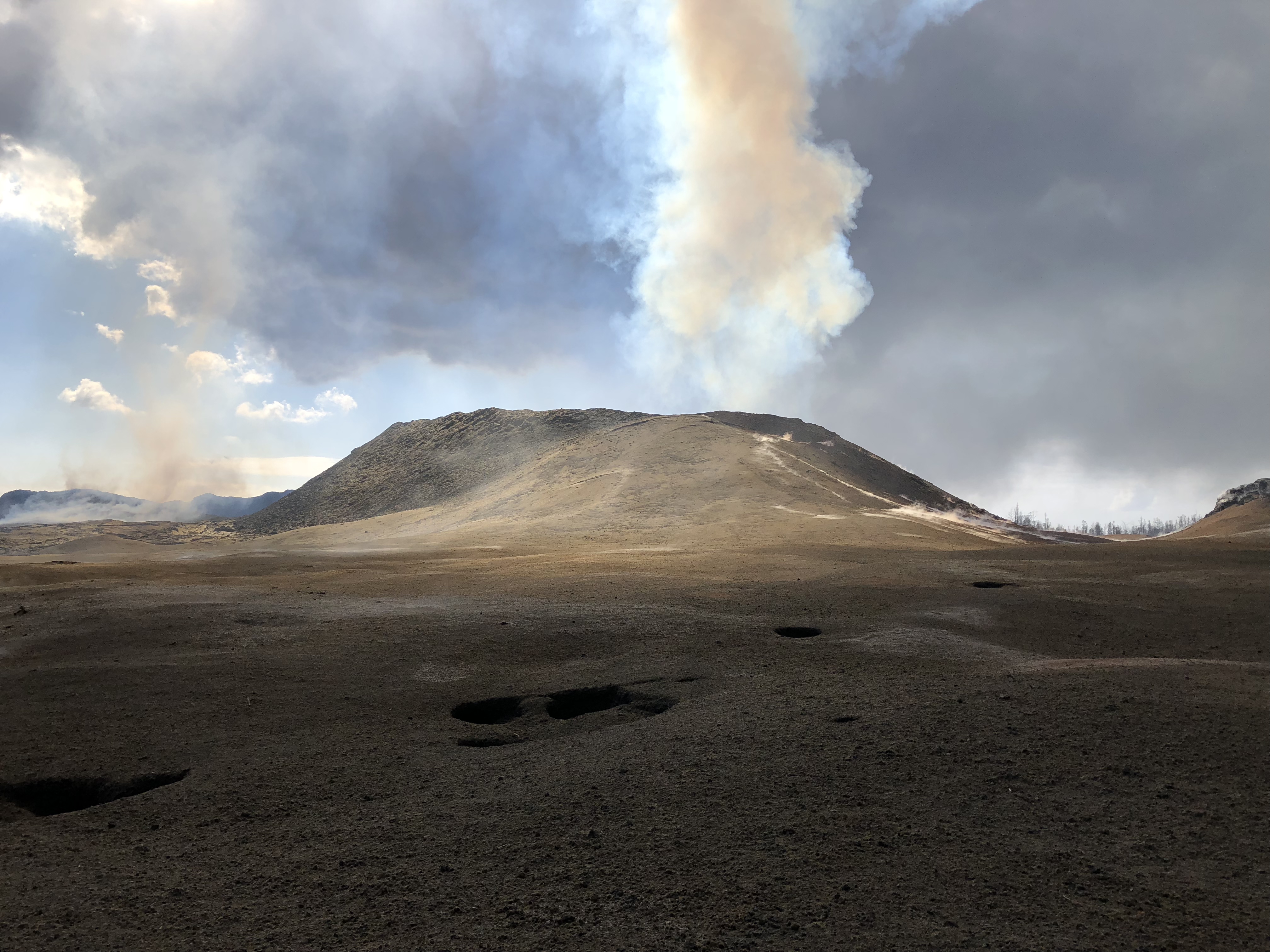
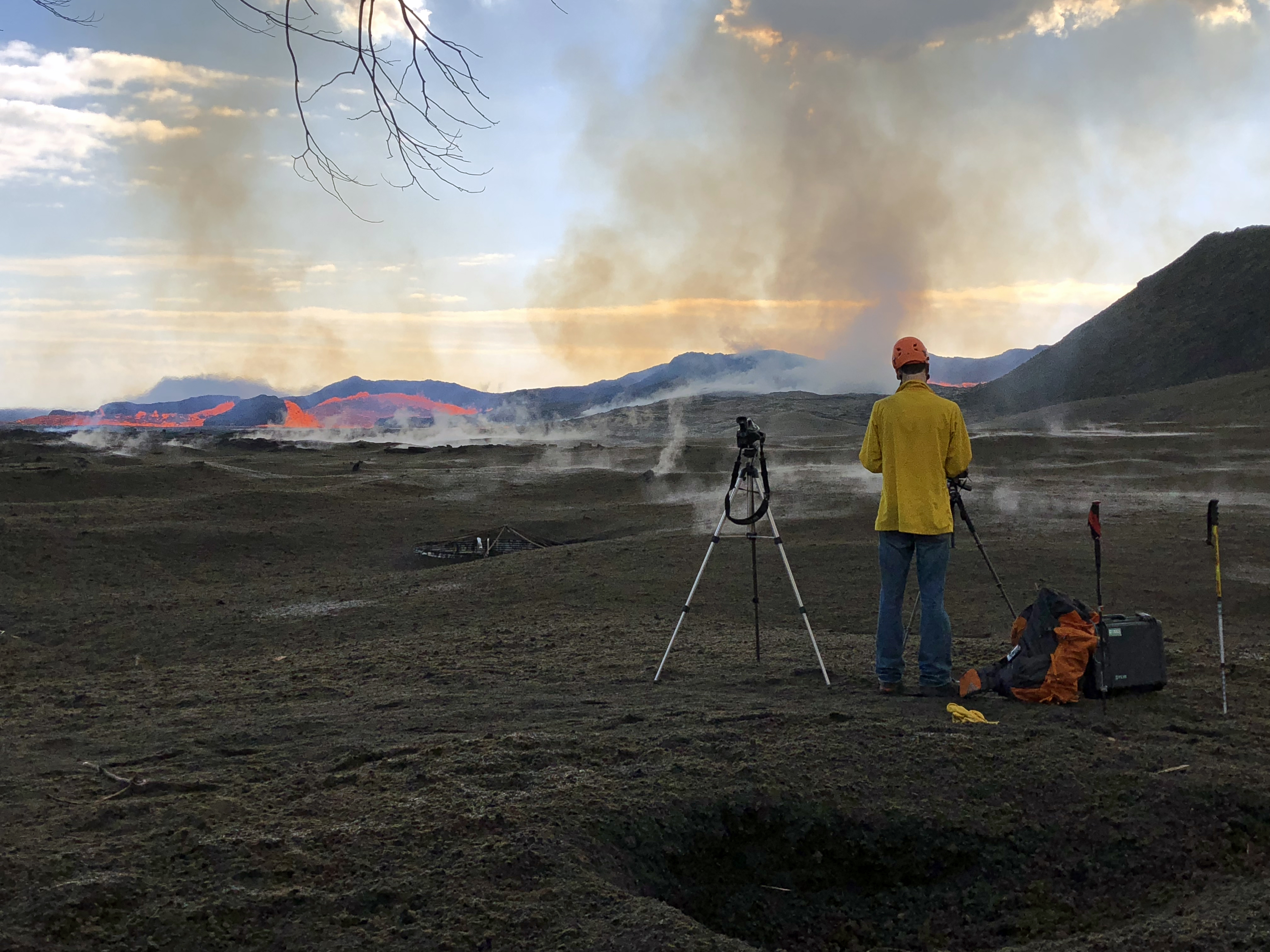
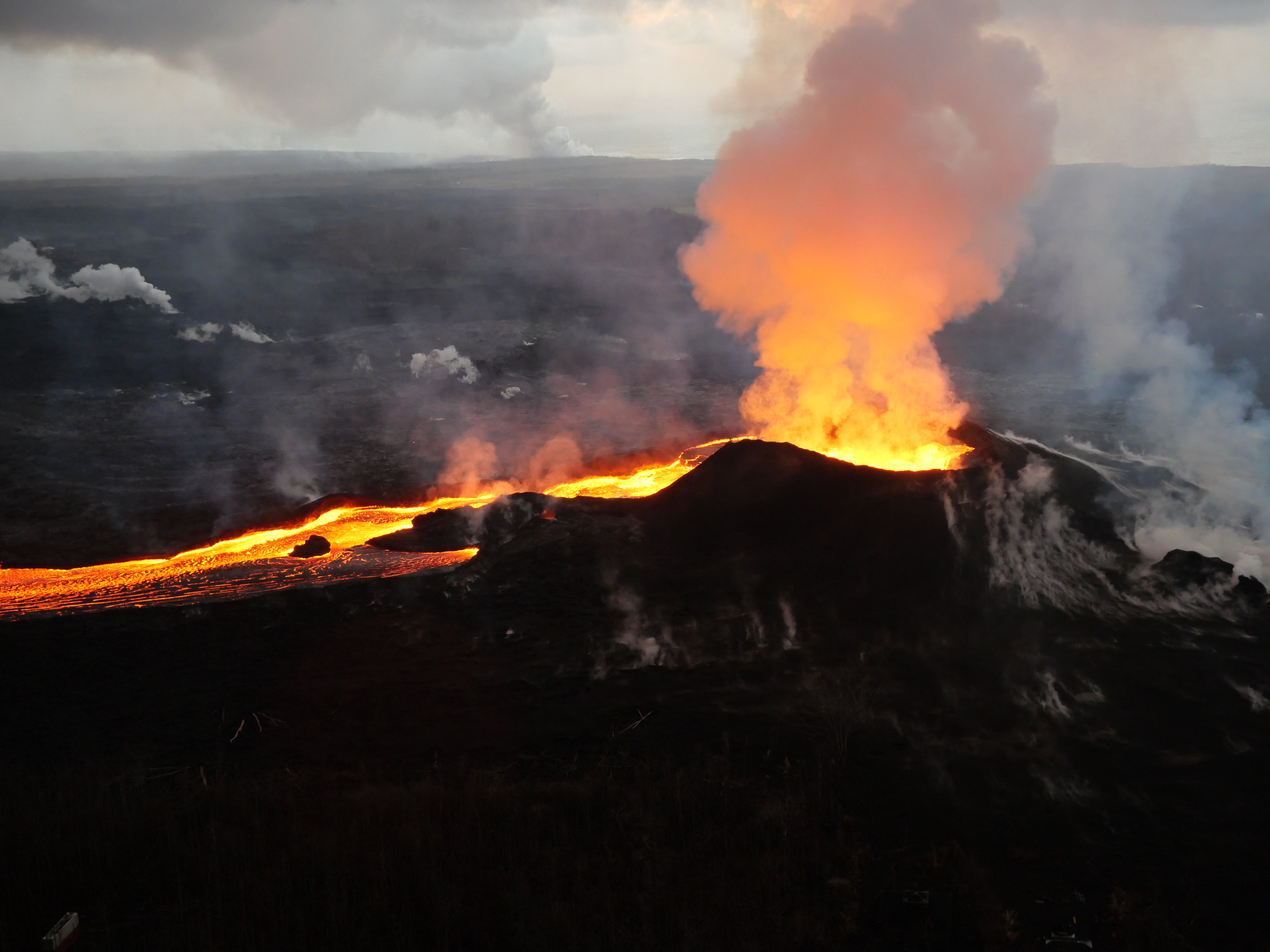
Today’s Eruption Summary
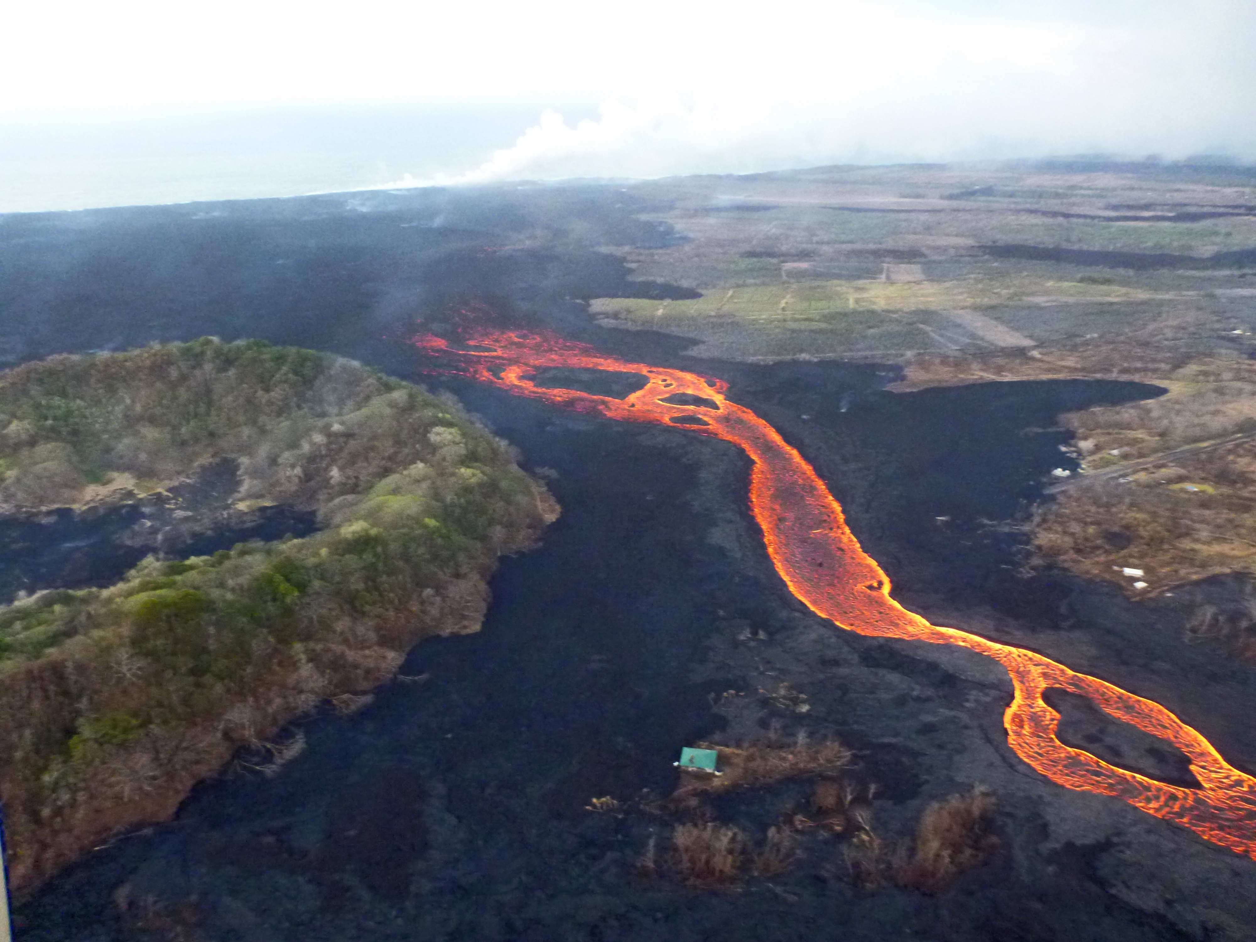
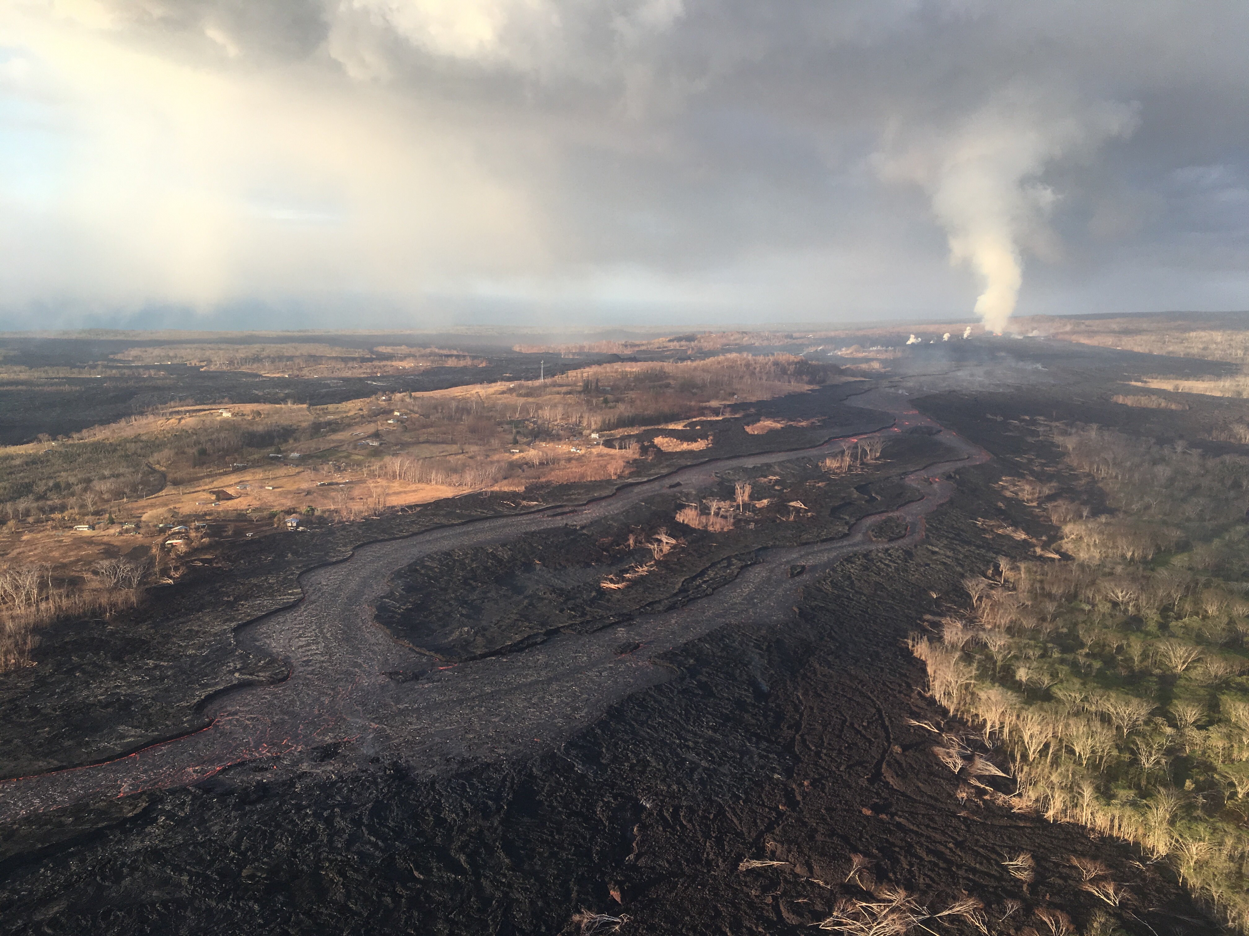
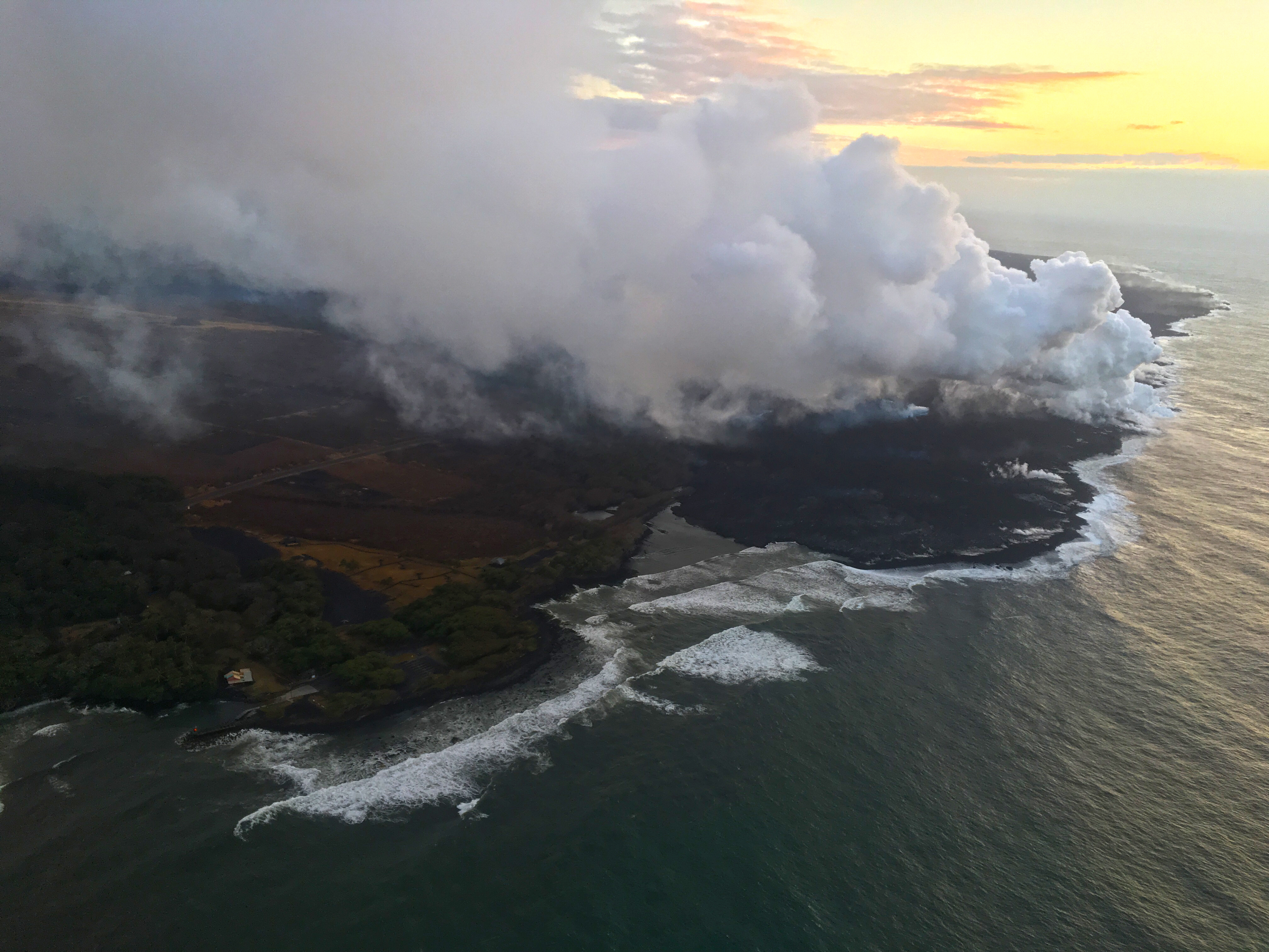
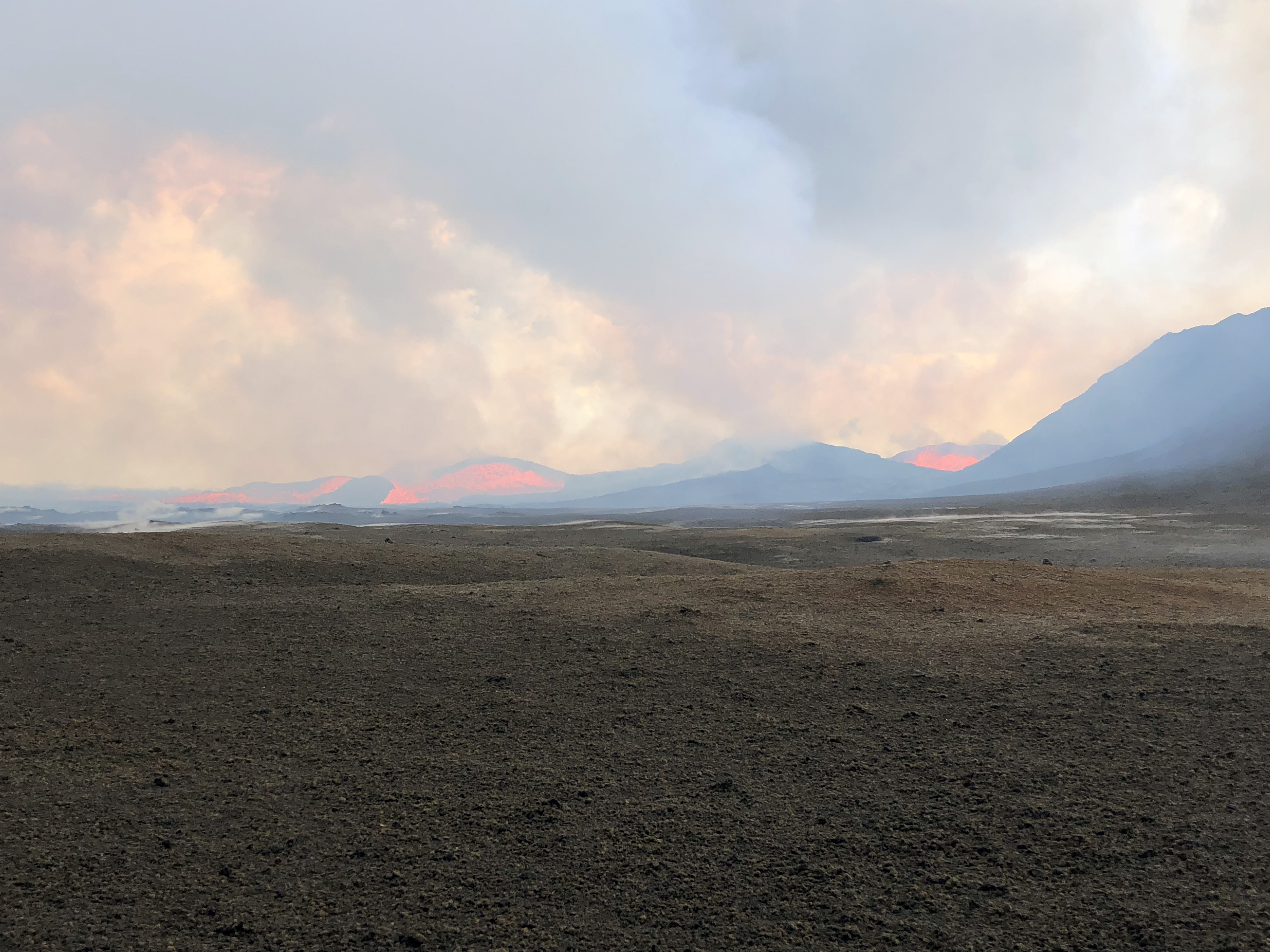
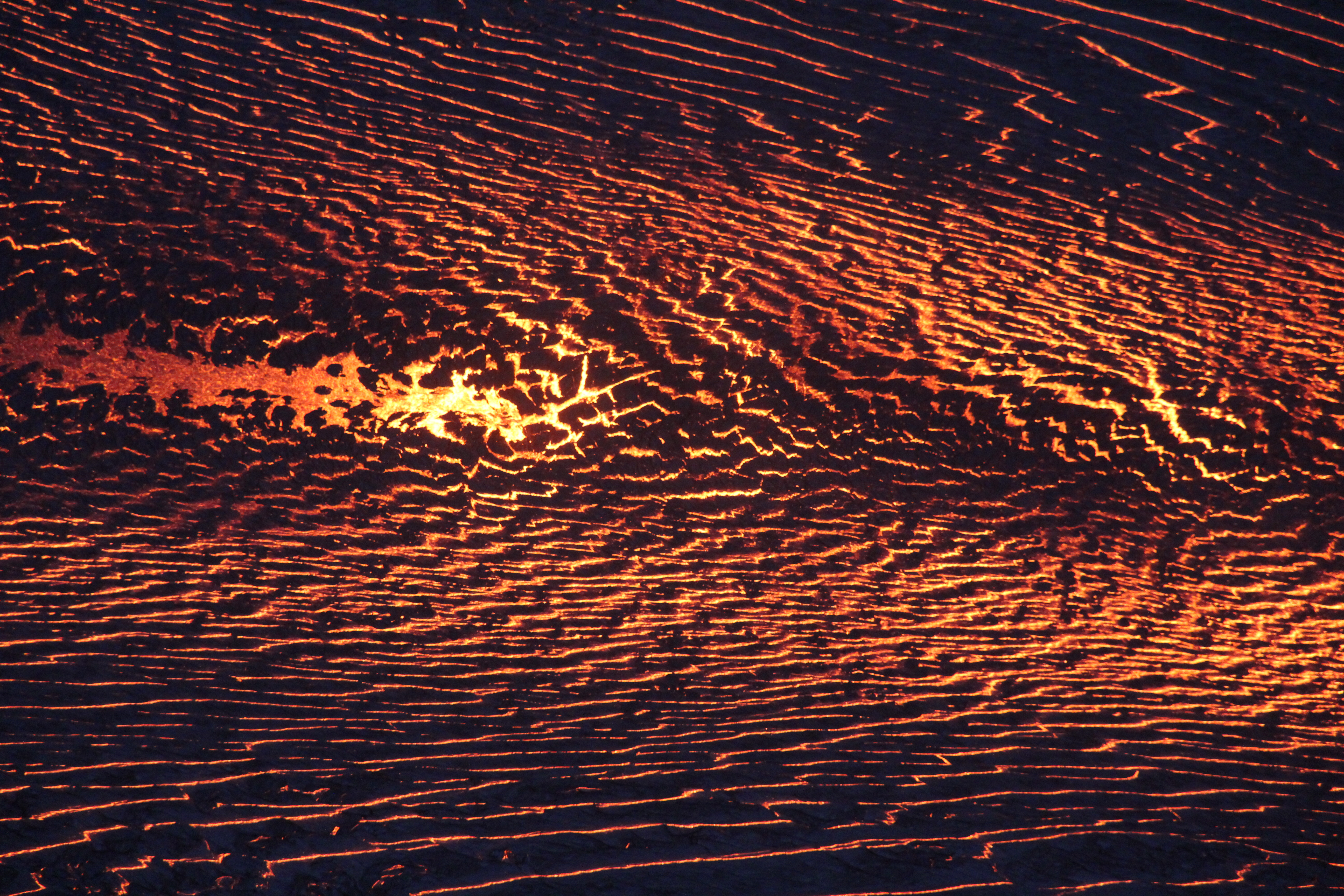
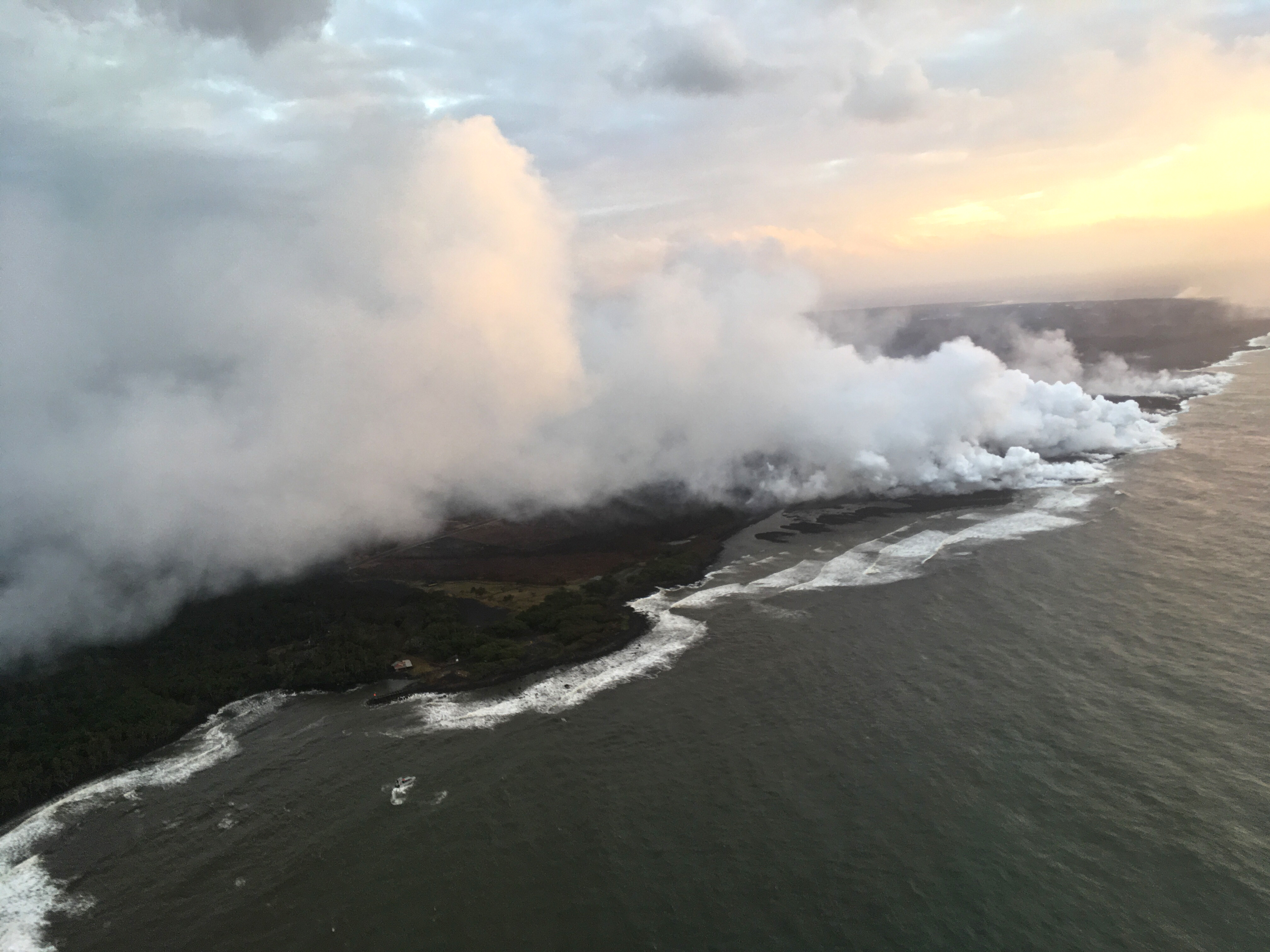
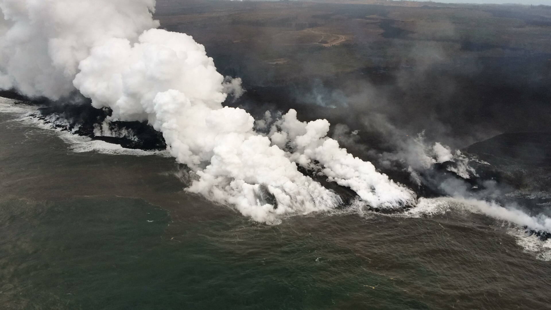
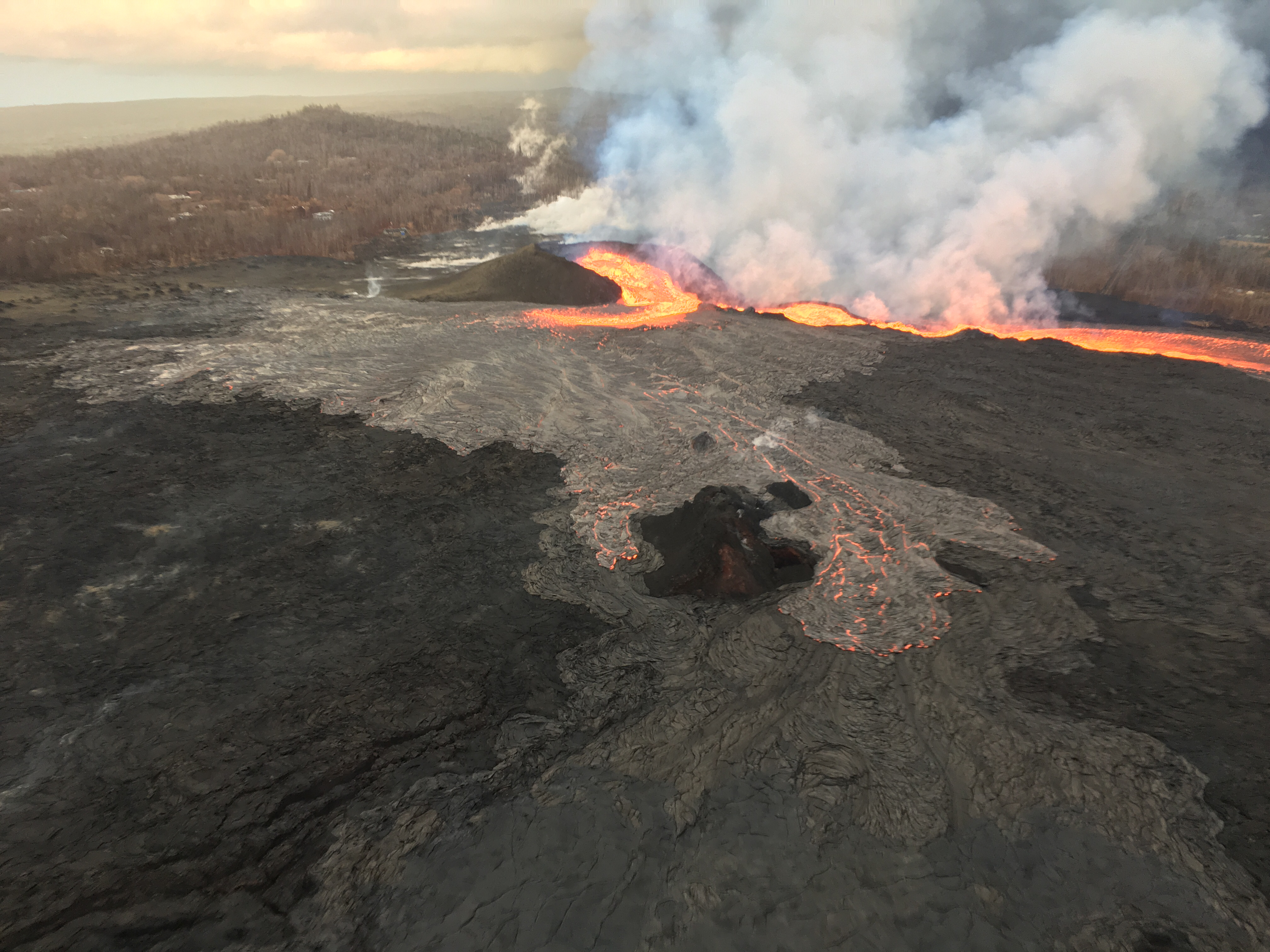
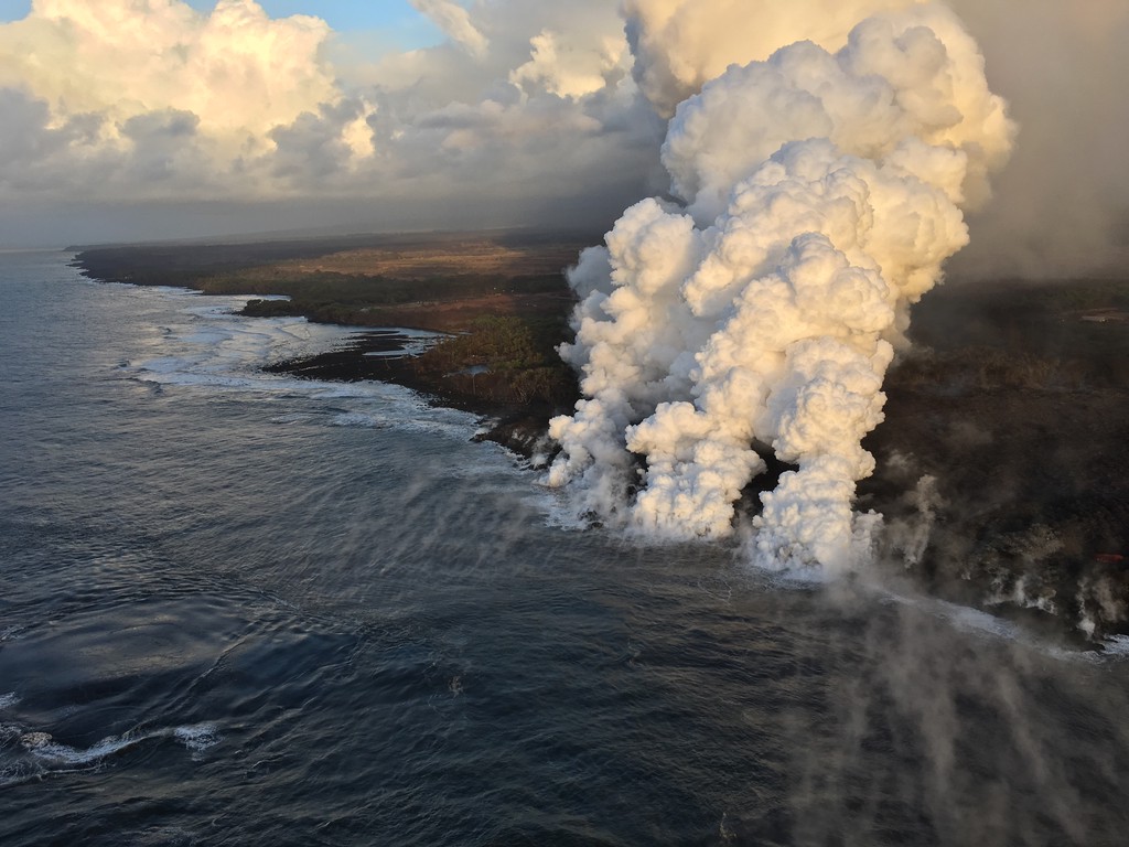
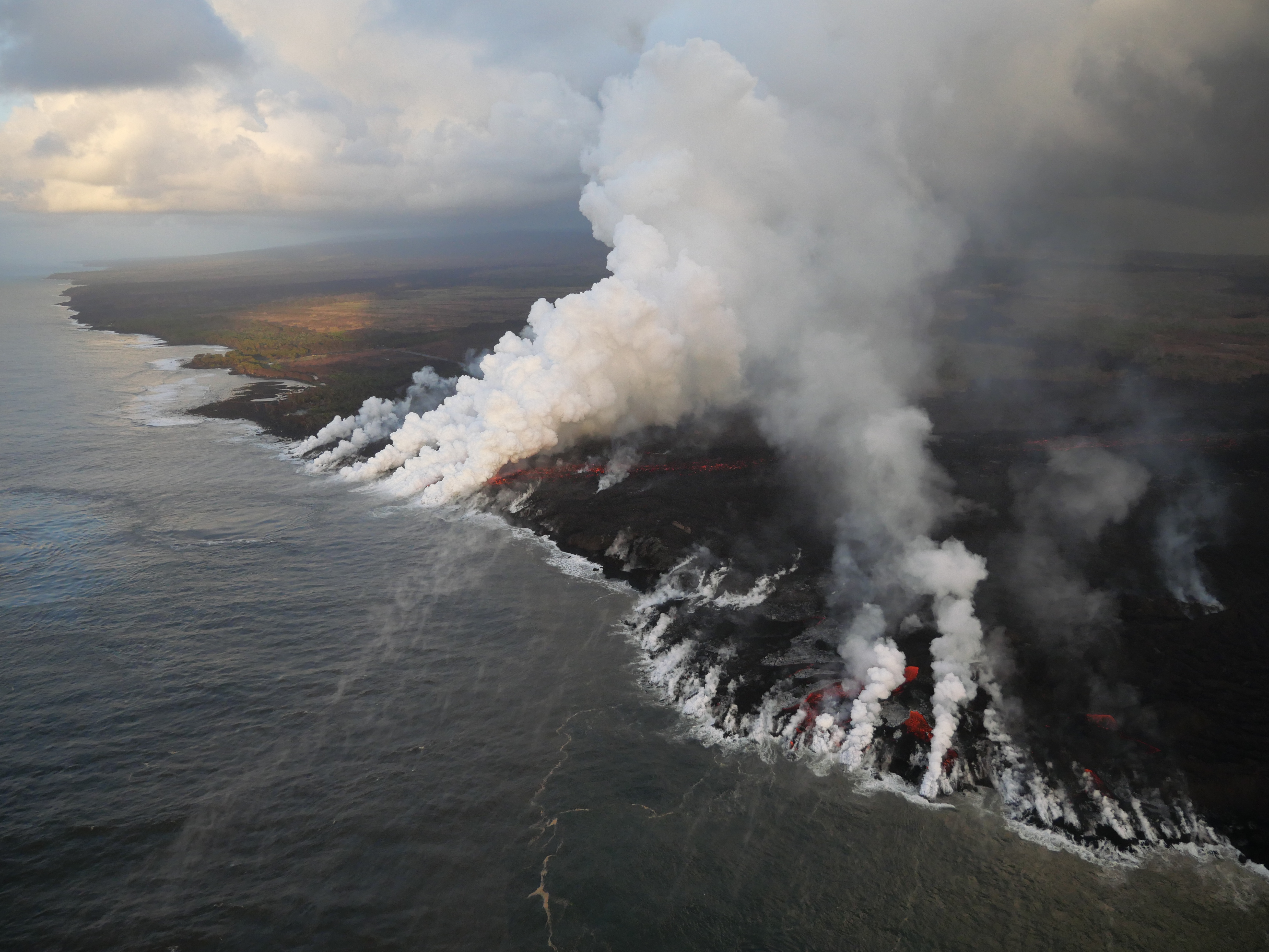
As per usual. Fissure 8 continues to feed the lava channel down to the ocean, where the southern margin of the flow was 500 m from Isaac Hale Park this morning. Lava levels in the channel this morning were low, with the previous collapse event coming at 1:28 am the day before.
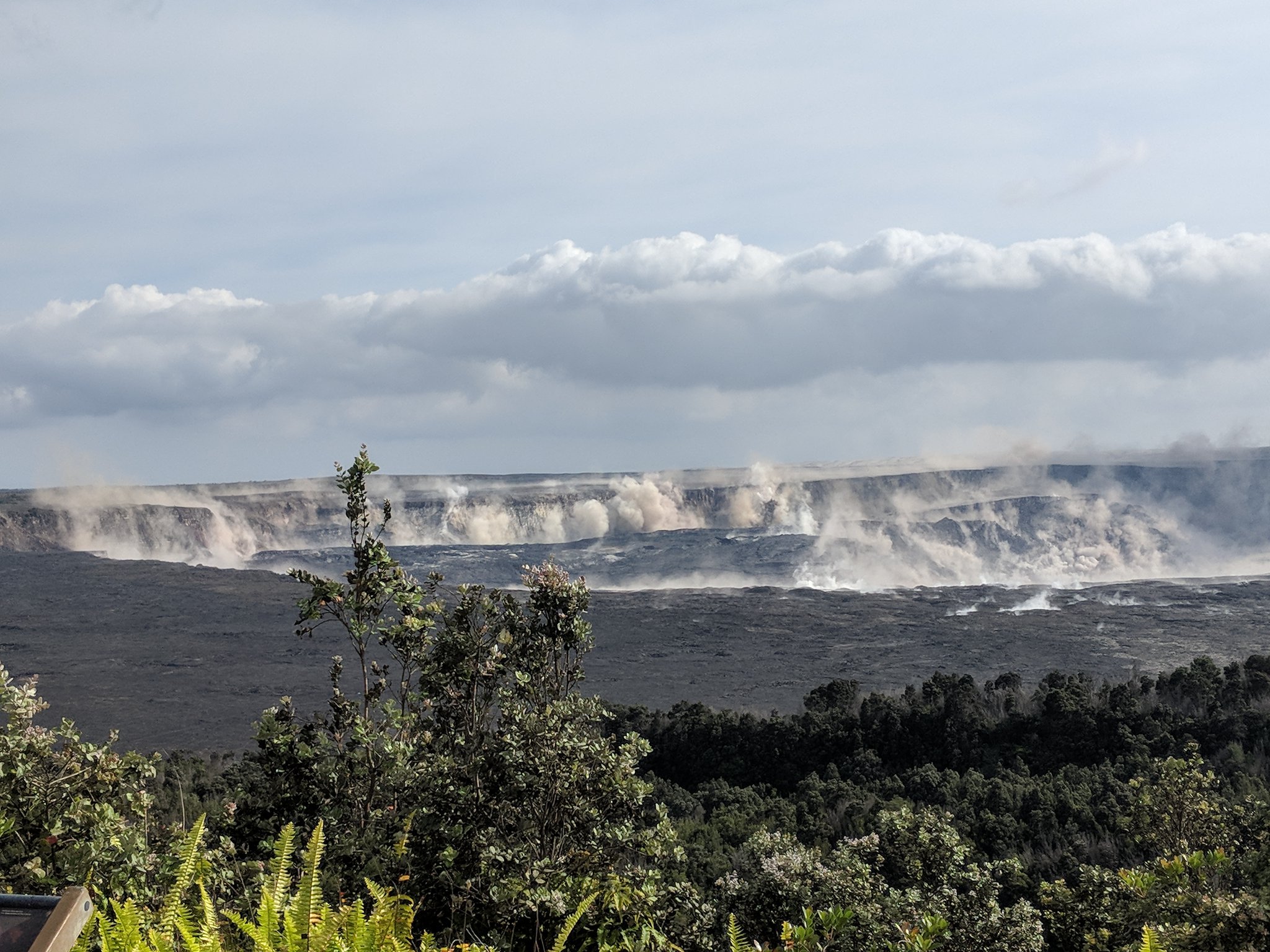
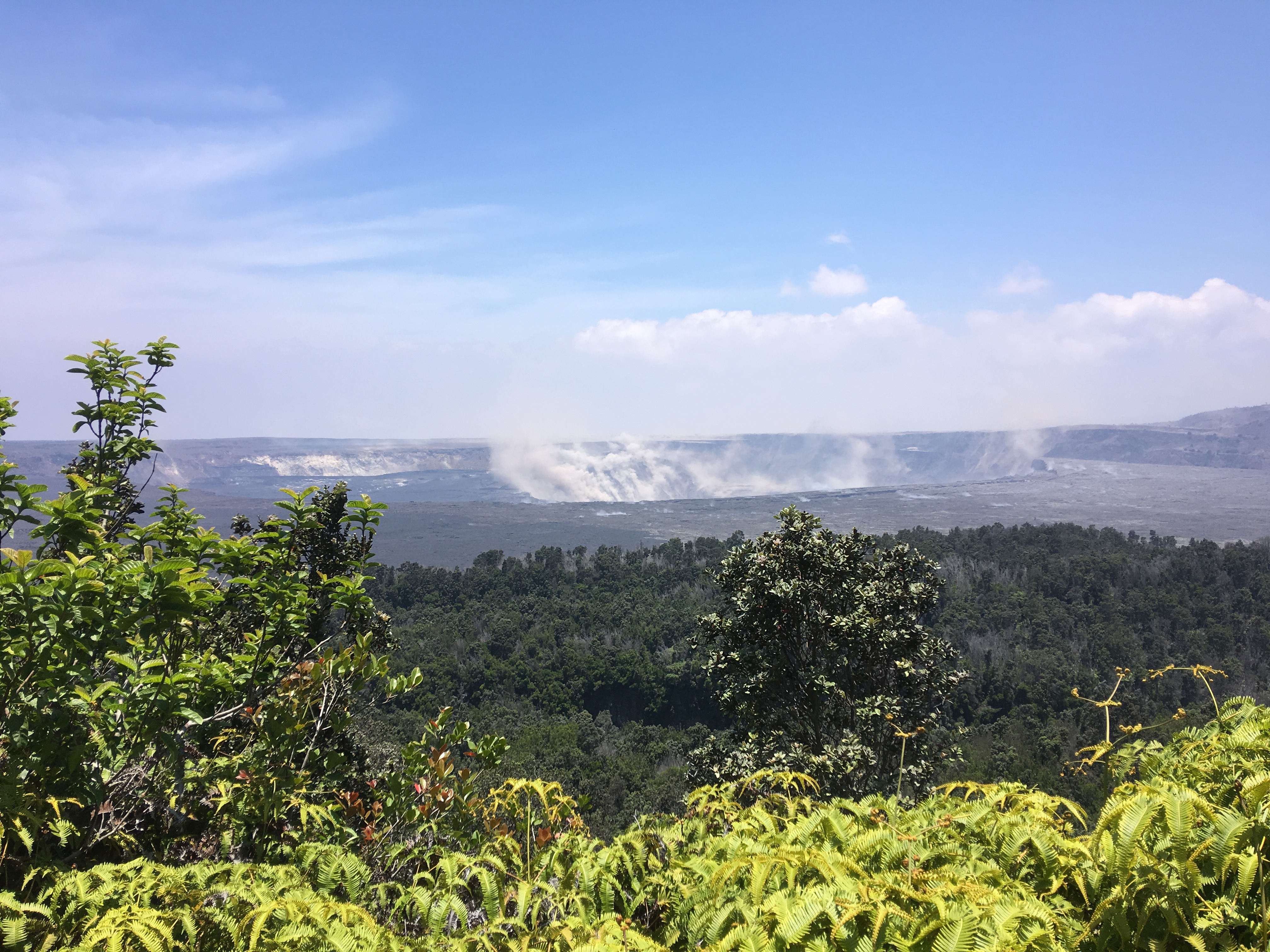
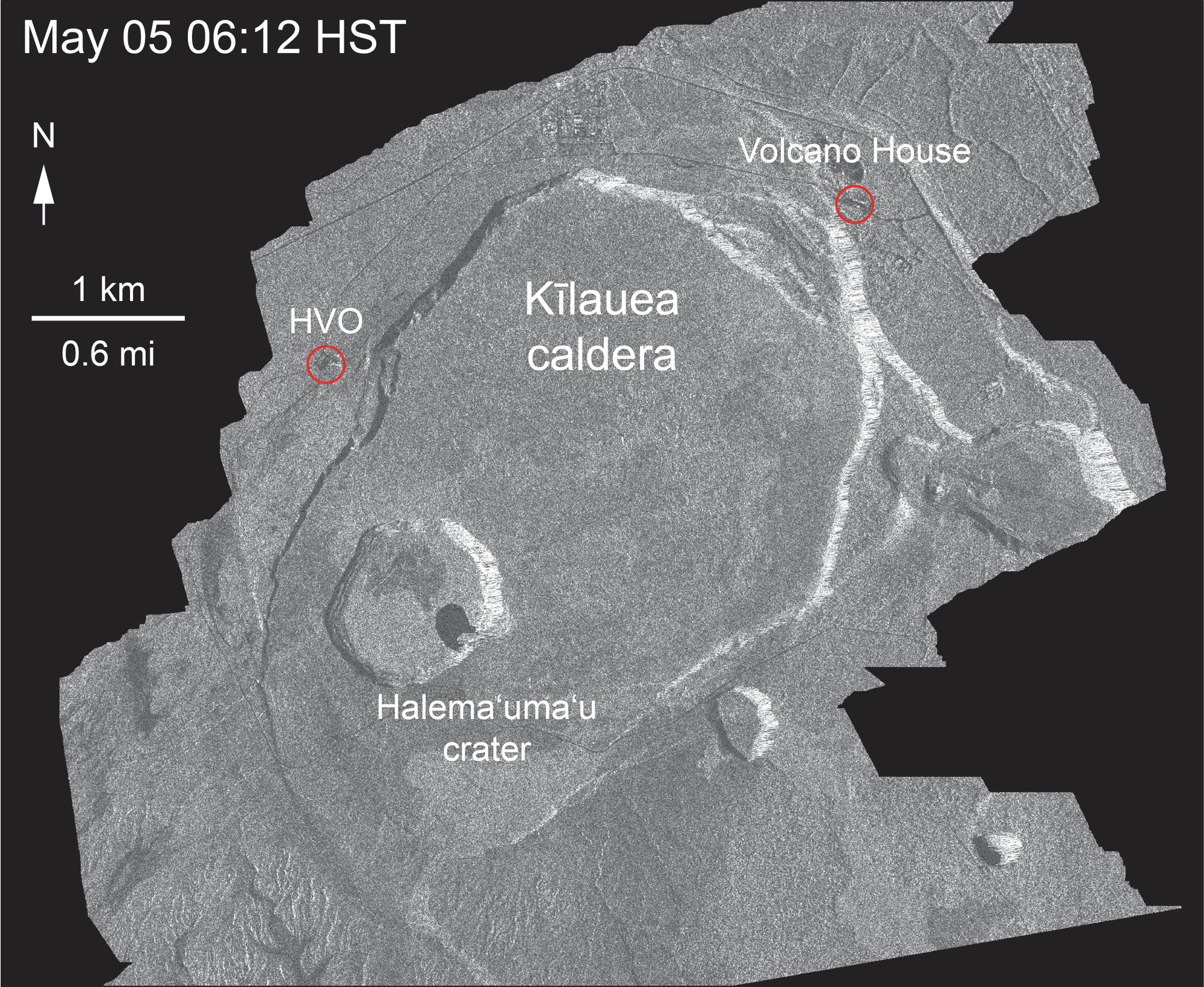
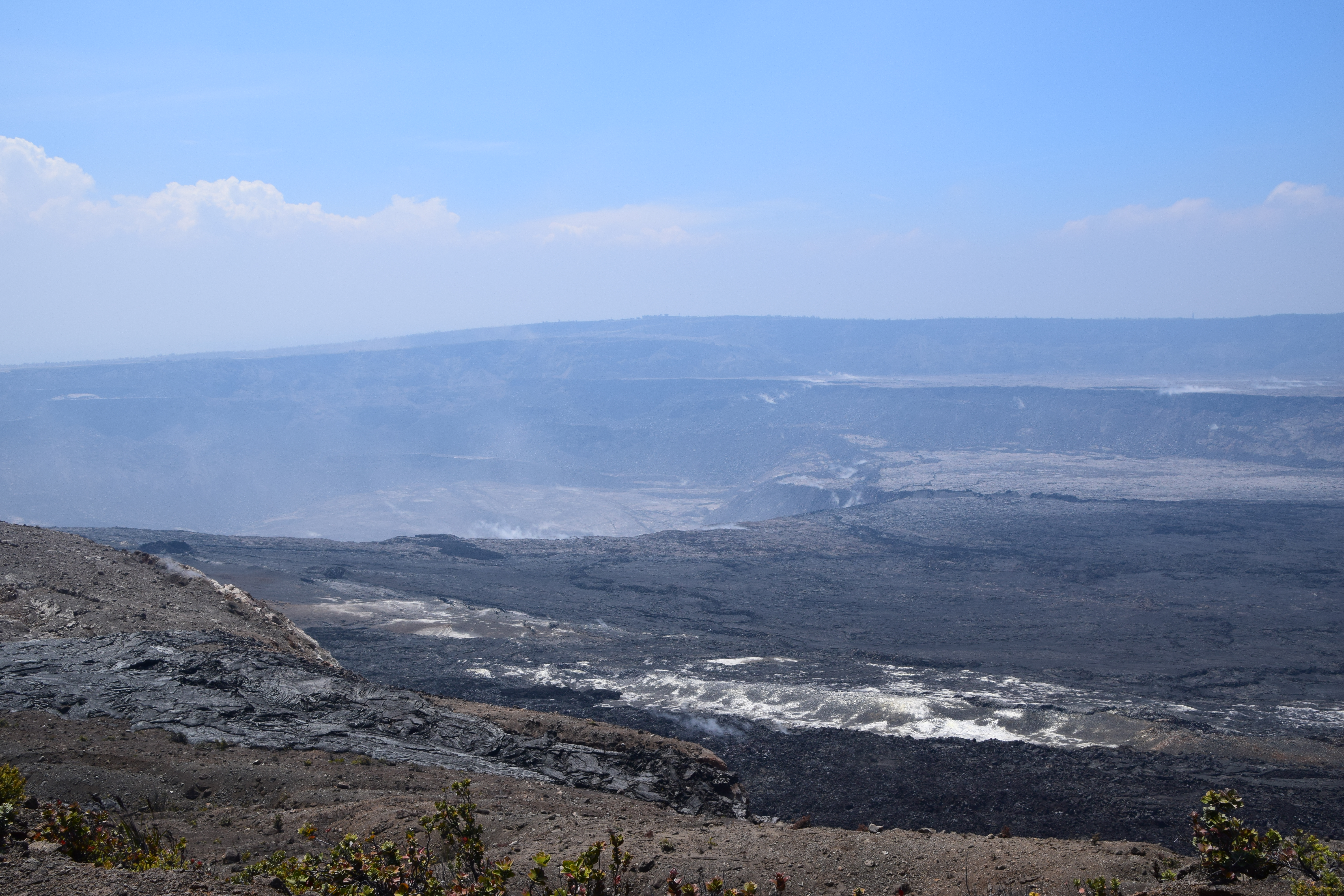
Today’s summit collapse event occurred at 4:33 pm.
The HVO Kīlauea livestream wasn’t too jerky today:
here’s the Northeast Caldera Rim livestream of same event.
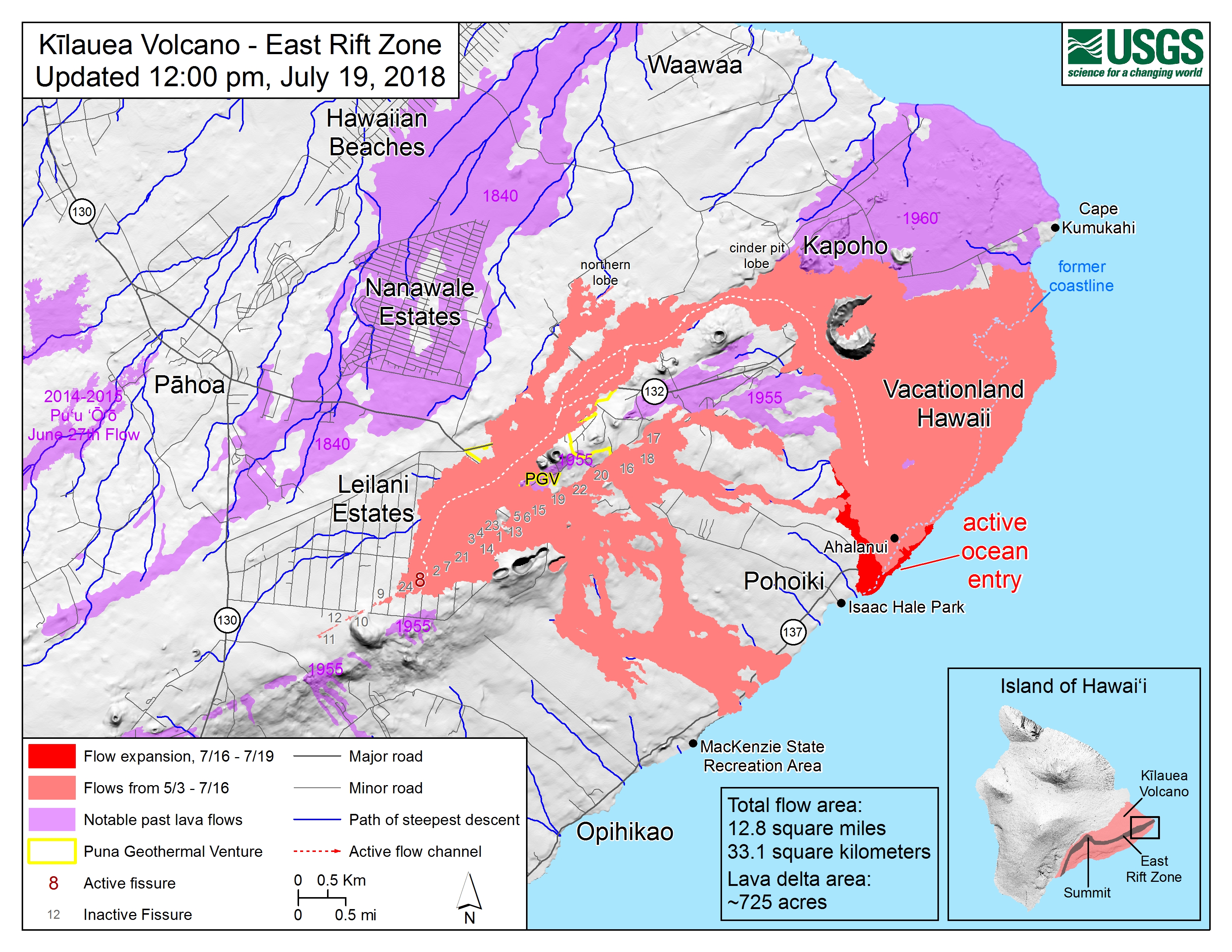
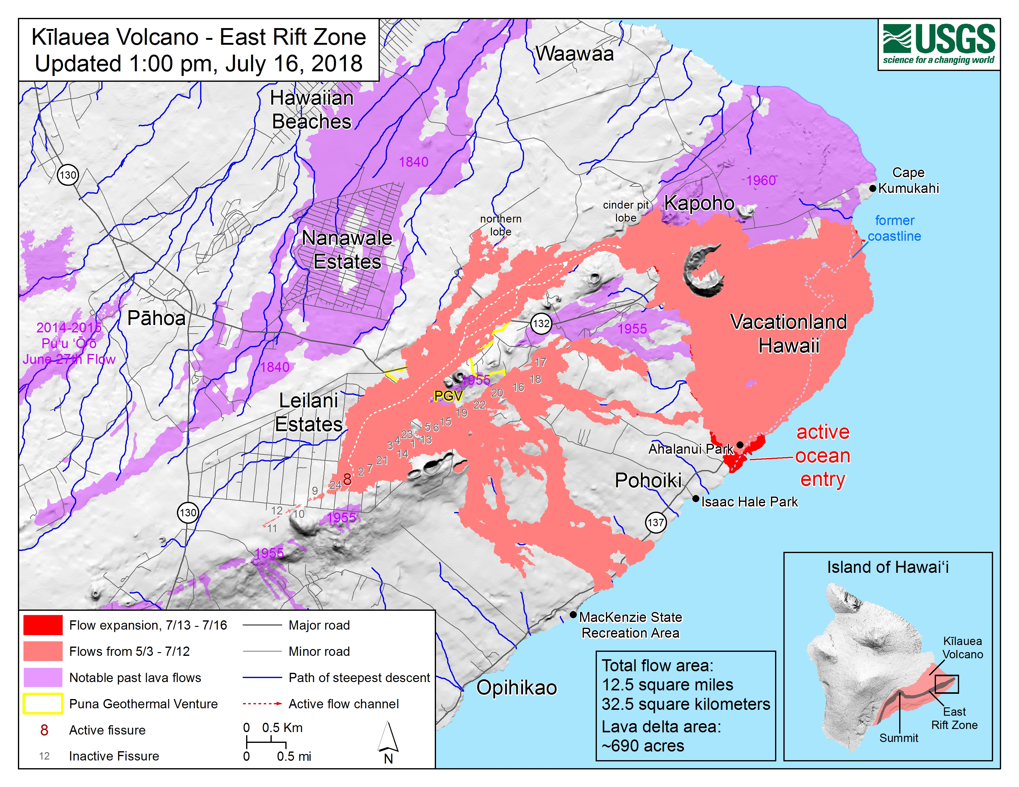
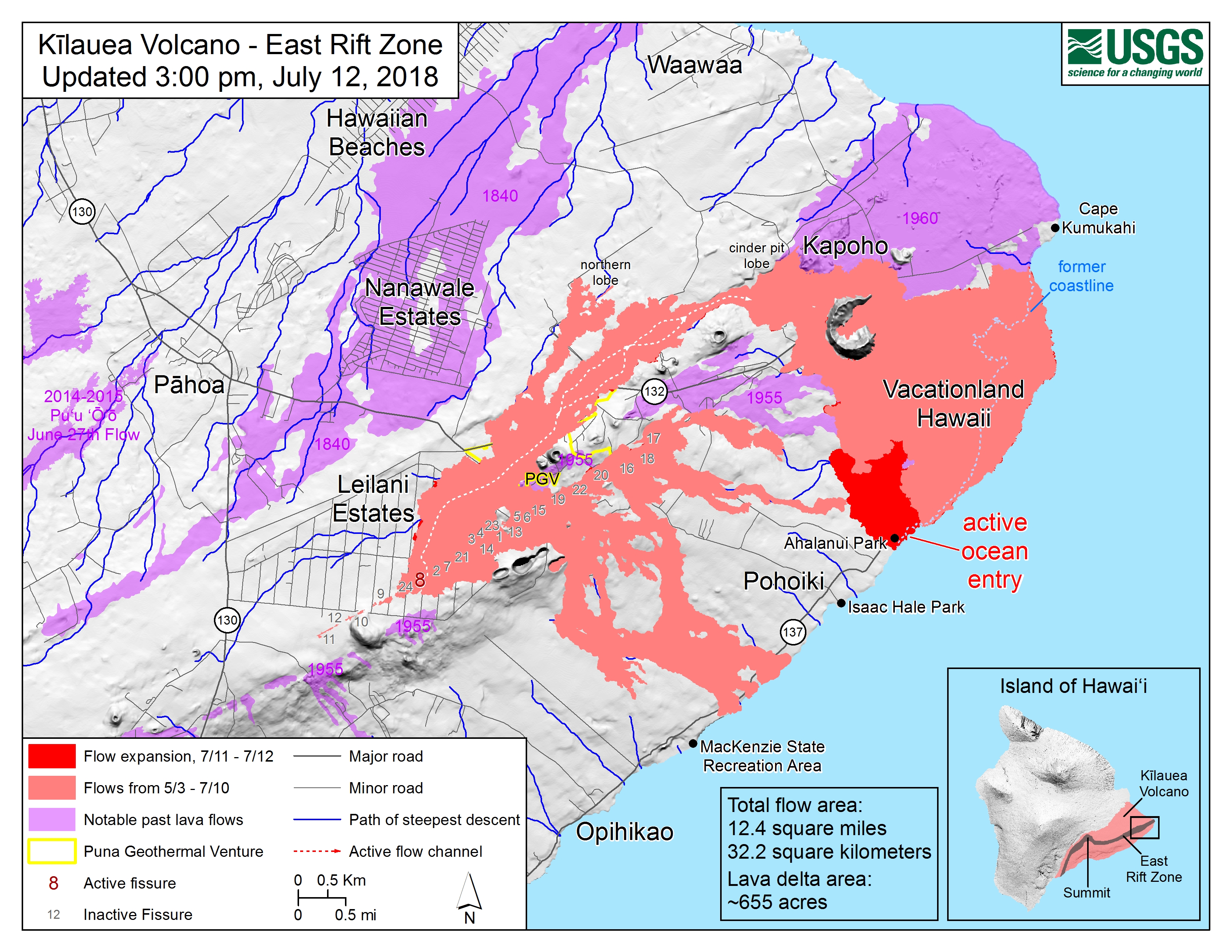
July 19 LERZ Lava Flow Map
HI Dept of Land and Natural Resources
- DLNR Press release with info on their recent observations/visit to Isaac Hale Park: “07/17/18 Land and Ocean Managers Keep Close Watch on East Rift Zone Eruption“
Thursday 1 pm USGS media conference call
Excerpts from BigIslandVideoNews:
Full conference call audio archived here.
From Local News Media
- HTH: “Lava edges closer to Isaac Hale park, Pohoiki boat ramp”
- HSA: “Tourists unfazed by lava bomb accident” (guess who’s still taking risks other lava tour companies don’t?)
- HNN: “Hawaii town hopes lava tourism will bring economic relief“
- HTH: “Finding safe lava viewing site proves challenging”
- HSA: “Lava closing in on Pohoiki boat ramp at Isaac Hale Park“
- HSA: “Disaster Recovery Center closing on Sundays”
- WHT: “Fire sparked during RIMPAC exercises consumes 2,000 acres” – As I suspected. Those fires on the saddle between Mauna Loa and Mauna Kea which prompted the usual “Is Mauna Loa erupting?” questions were started by military training exercises.
Mick Kalber Overflights
Mick posted yesterday’s June 18 overflight (good views, including that lava flow moving over a still-active but slower flow) and notes as well as today’s:
Here’s the notes/observations/blog post for this morning.
USGS Q&A on Social Media
Q: [Is Cape Kumakahi still the easternmost point of the island?]
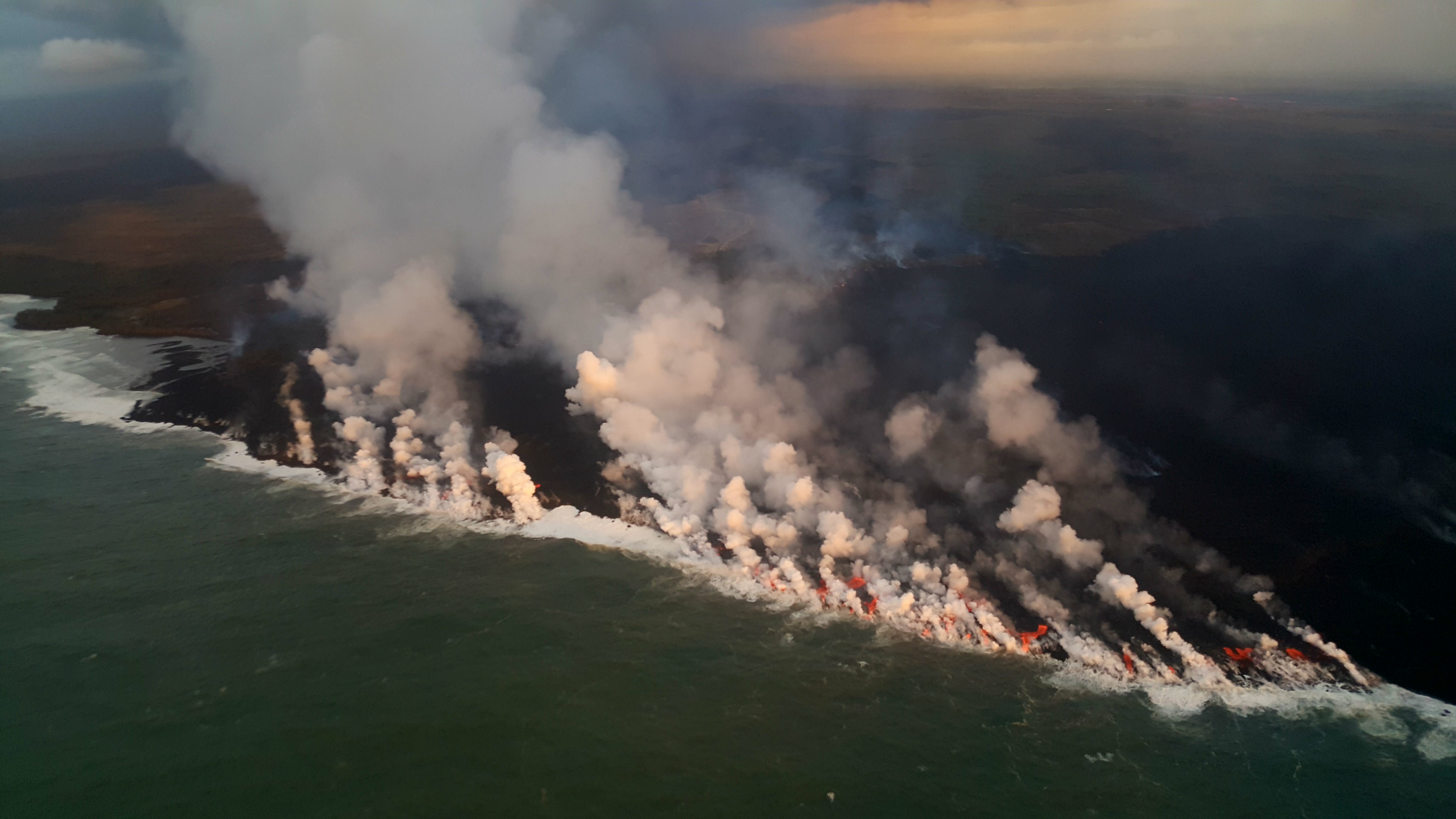
USGS: The area off Kapoho has a paltry supply of lava now – unless significant lava returns, the eastward advancement may cease.
Q: [Has there been any change in temperature of lava, now that it’s crusting over and/or not a fluid channel all the way to the ocean? Any sign eruption is ending?]
USGS: No, the temperature remains the same. Other factors are probably responsible for the crusting – blockages, flow velocity, precipitation, etc. Sometimes the channels remain fluid, and sometimes the surface can crust over – but that doesn’t mean there isn’t lava moving beneath the crust… No, no signs that the eruption is ending yet.
Q: [Someone asking about webcams and livestreams]
USGS: We weren’t able to adjust the bandwidth on the cam from HVO, but we did add the stream from the northeast caldera, which uses a different (and still challenged) connection.
Q: [Cinder cone is 120 feet now? Was 180; has it collapsed?]
USGS: Some settling has occurred, and some of the more precarious bits have probably fallen in or down the slopes.
[Same basic question, different day]
USGS: Yes it has succumbed to thermal erosion, collapse, and settling. There have been no sustained fountains depositing material on its outer slopes for several weeks, so there has been no additional accumulation of tephra.
Vladimir Vysotsky on FB: USGS Volcanoes: you keep characterizing this as a “perched channel”. I wonder if that is how lava tubes form – a channel builds the foundation and walls around itself, then crusts over while still flowing inside, and eventually forms a tube when the lava finally drains. Is that a correct assumption?
USGS Volcanoes: That is a very accurate description of lava tube formation! ][…] Hereʻs a video from Hawai’i Volcanoes National Park describing what you d[id] with video footage to accompany for visual reference. https://www.nps.gov/media/video/view.htm...
Q: [Is Fissure 8 how Diamond Head formed?]
USGS: – Diamond Head is a tuff cone that erupted through water. It is also considered “rejuvenation stage” volcanism. The eruption that formed it occurred after the Koʻolau Volcano (from where it erupted) had been dormant for about 2 million years! http://volcano.oregonstate.edu/post-erosional-rejuvenation
Q: [How long will this go? How will it end? Does a lava flow normally start slowing down and then stop?]
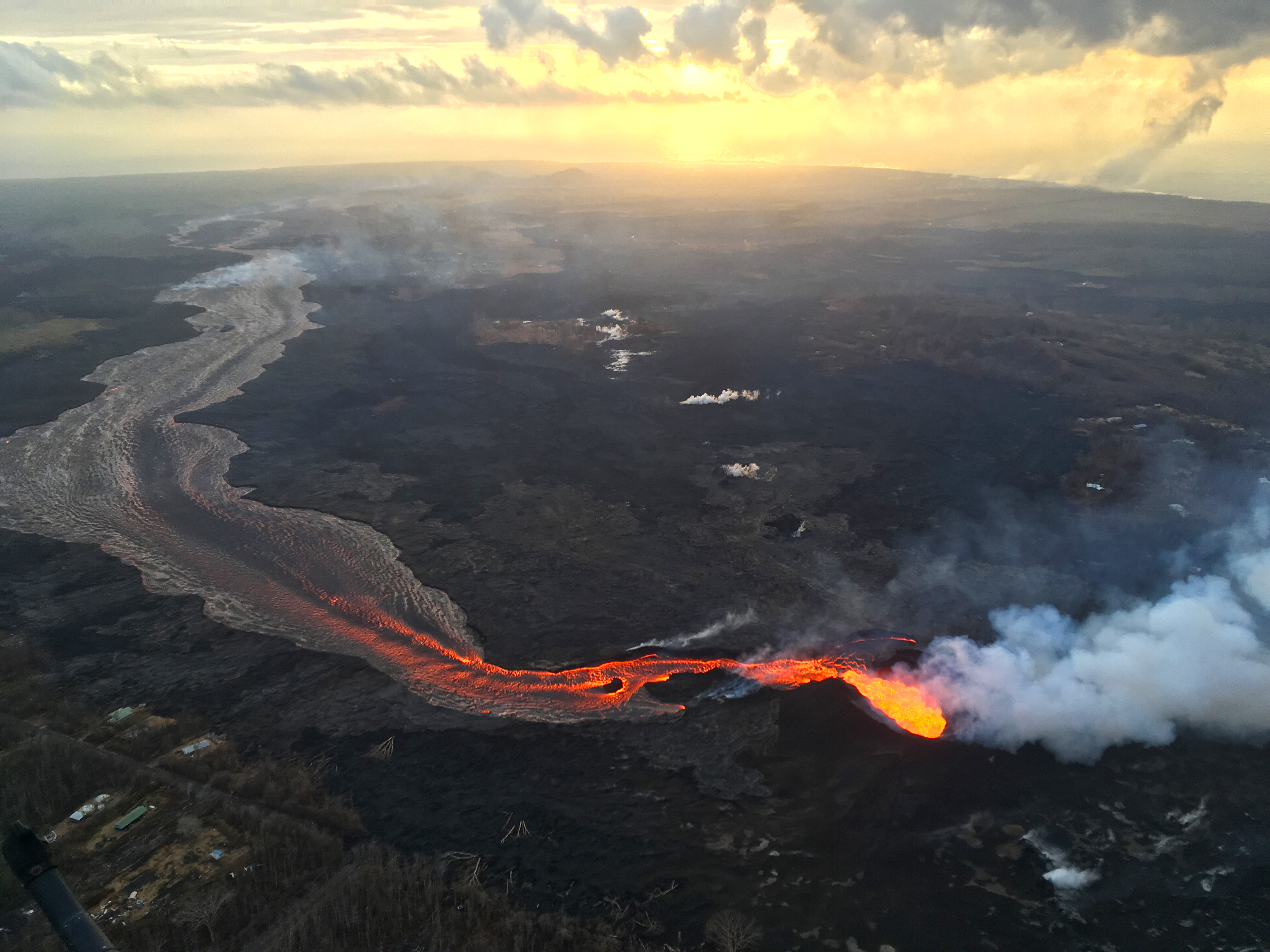
USGS: This could go on for any number of days, honestly. Typically these things don’t just turn off and stay turned off. We expect that activity in Fissure 8 will wane, then stop and start again (perhaps at other fissures). However, the eruption won’t stop all together until the pressure driving the magma out of the ground has been relieved.
Q: [How deep is lava channel?]
USGS: We have tried to calculate depths based upon lava-flow observations within the channel and known depths of dormant channels on other locations in the Hawaiian islands. The channel is meters in depth, but likely not more than 10. Depth varies throughout its length as well.
[In discussion that Fissure 8 is not a volcano— it’s a vent on Kilauea’s flank just like Puʻu ʻŌʻō was, with magma being piped down from Kīlauea’s magma storage system— someone brought up Lō‘ihi, which IS a new volcano (or seamount) off SE coast of Big Island, still underwater.]
Q: [Is the summit caldera sitting on the magma chamber?]
USGS: The subsidence area within the caldera essentially overlies the area of the shallow magma storage region that fed the lava lake in Halemaʻumaʻu. So, yes.
Q: [Could the floor collapse into the chamber? What would happen then?]
USGS: Technically speaking, the floor, and everything that was between it and the top of the chamber, is collapsing into it. Youʻre seeing the outcome – pressure drops and collapse events that manifest as M5.3 earthquakes.
From Other Photographers/Social Media
Live #lava #Hawaii #eruption over flight w @Paradisecopters https://t.co/Ky18fUrUHQ
— Hot Seat Hawai'i (@HotSeatHawaii) July 19, 2018
Mahalo to National Geographic for collaborating on a condensed geological essay on the eruption!
Posted by Andrew Richard Hara : Media on Thursday, July 19, 2018
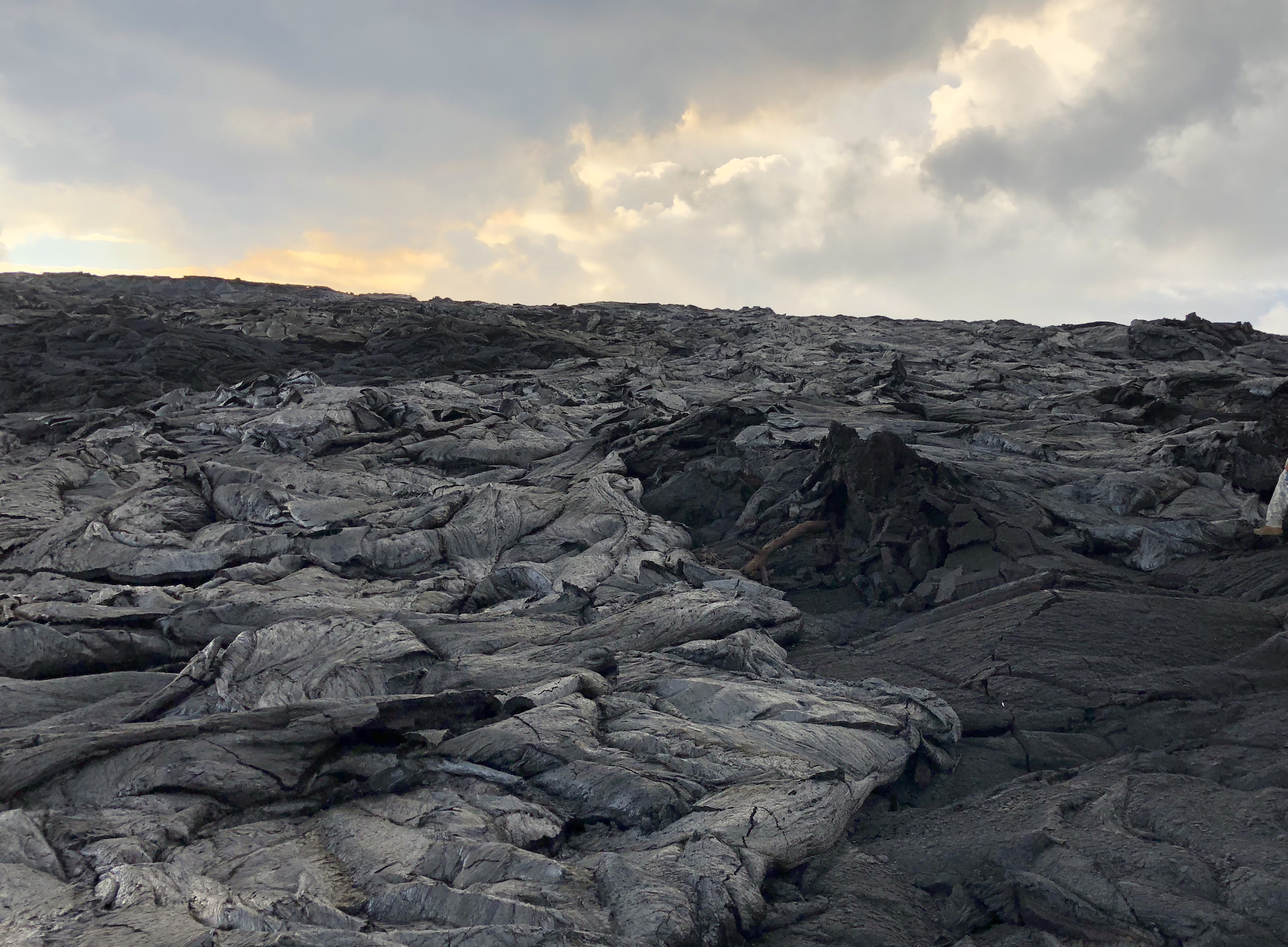
Lava channel crusted over is silvery;
Things too obscure to bug USGS about: why is it “littoral” when the Latin word for seashore has only one “t”? [Checks etymology: ah, yes, it’s a Medieval Latin spelling.)

