Today’s Eruption Summary
The big news today was a lava tour boat getting pelted by lava chunks from an ocean entry explosion, resulting in burns, bruises, and one broken leg. Next to that, the science of this eruption seems a bit trivial. But this blog is primarily oriented towards the latter, so let’s get volcanology news out of the way first.
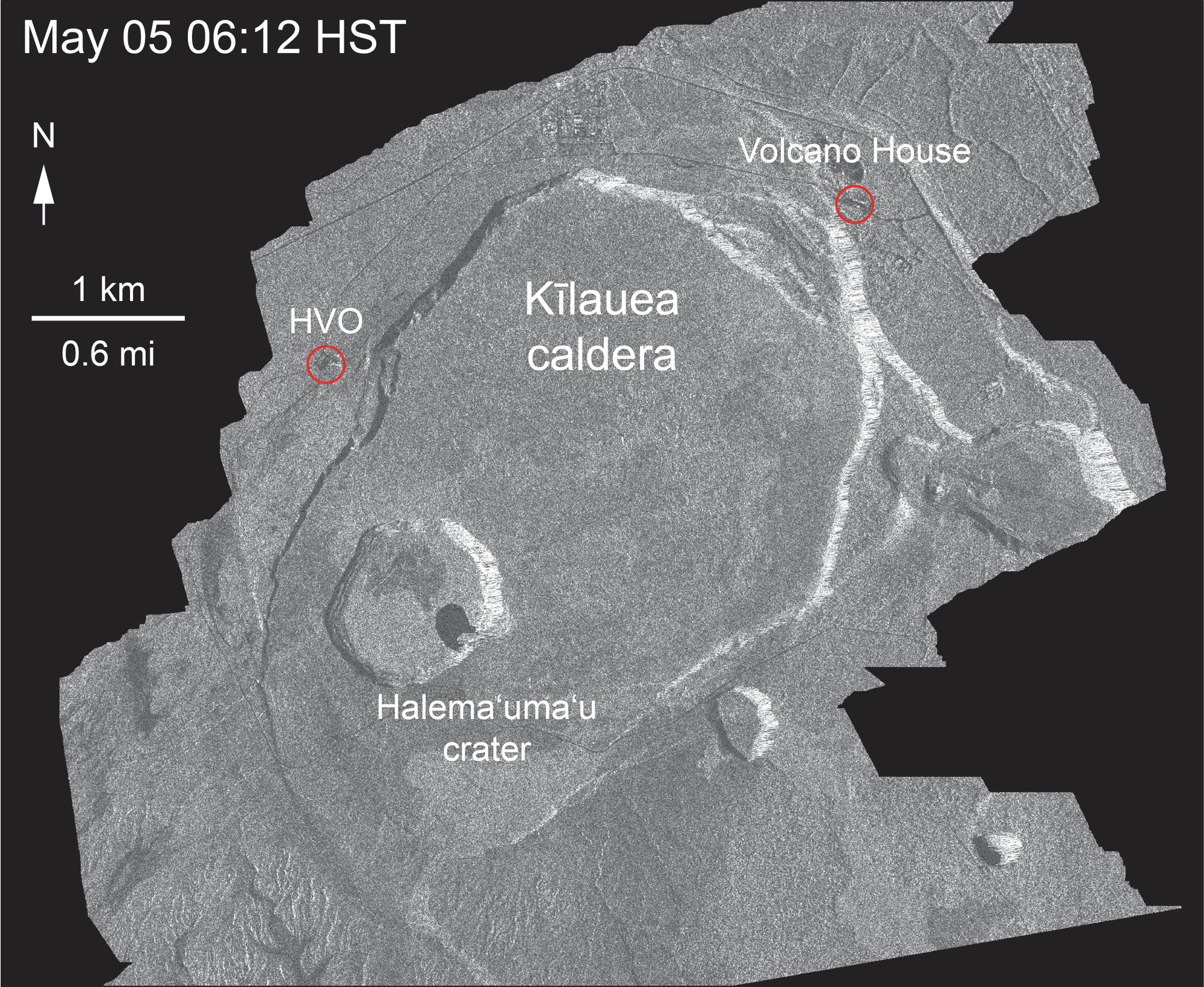
The Italian Space Agency released a new CosmoSkyMed radar scan of Kīlauea’s summit. Let’s hope this really is the new northern extent of Halemaʻumaʻu:
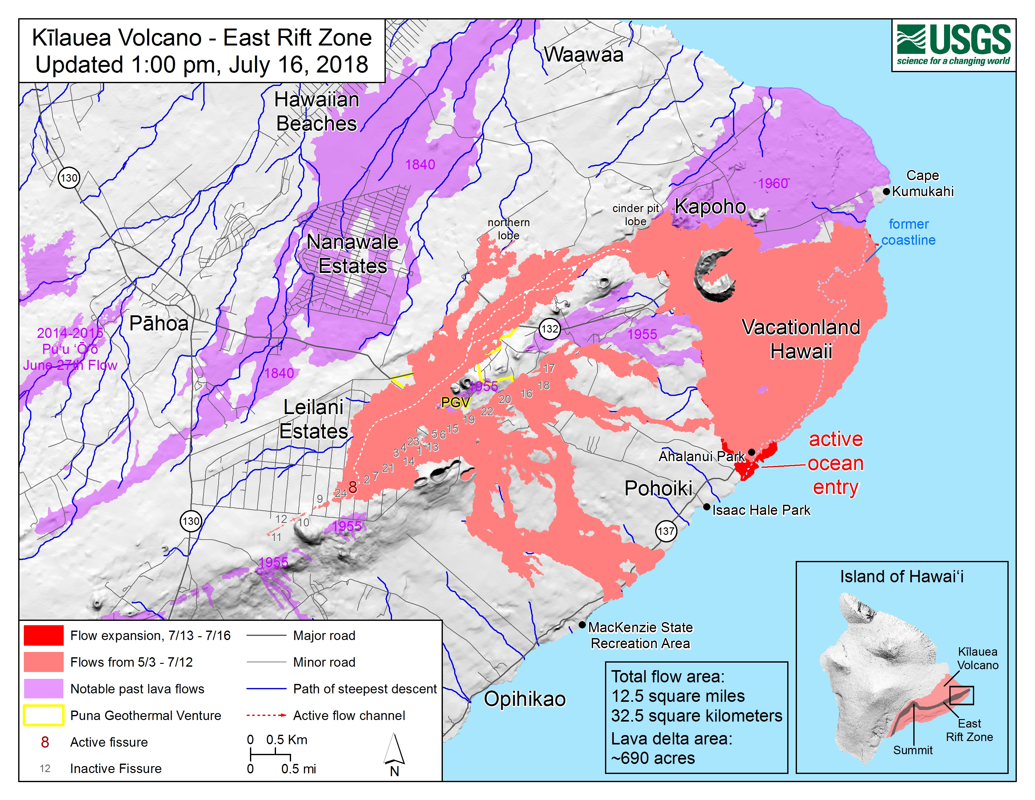
This morning, over 24 hours after the previous summit collapse, the lava channel below Fissure 8 was full but not overflowing. Even after today’s 11:42am summit collapse, there was no observed surge— “Nothing notable in the way of overflows.” Last night’s field crews heard Fissure 22 grumbling to itself, but saw no visible signs of renewed activity.
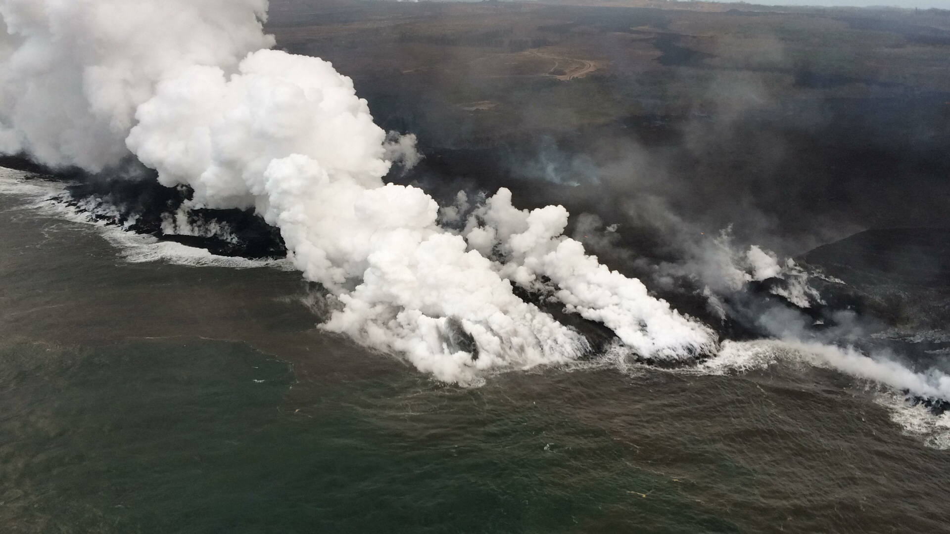
According to Civil Defense this afternoon, the southern edge of the main lava flow has stalled 1 km from Isaac Hale Park / Pohoiki boat ramp. Just north of there, the new ocean entry at Ahalanui is vigorous and dangerous. That’s where @hotseathawaii filmed an offshore explosion four days ago. There were more explosions this morning, “with at least one being quite strong” (USGS).
(The summit collapse was M 5.3 again. The livestream is still ailing, but even so it captured rockfalls, camera shake, and the earthquake’s progression from far to near in the field of view.)
July 16 Map of Active Lava Flows
Lava delta is up to 690 acres, by the way. “Tiny no-longer-island” is next to the c in “former coastline.”