June 1: Halema’uma’u Exposed

Today’s Eruption Summary

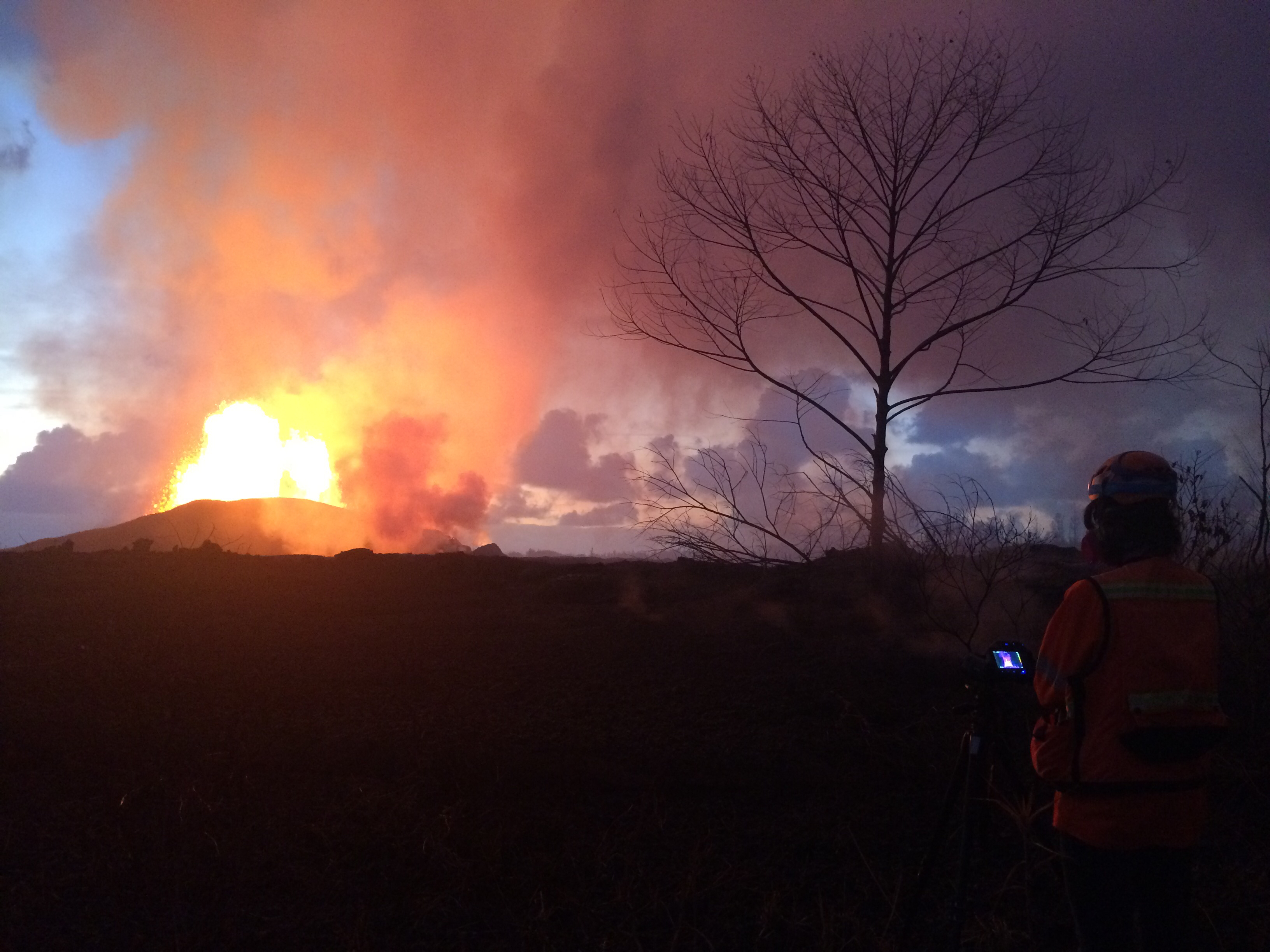
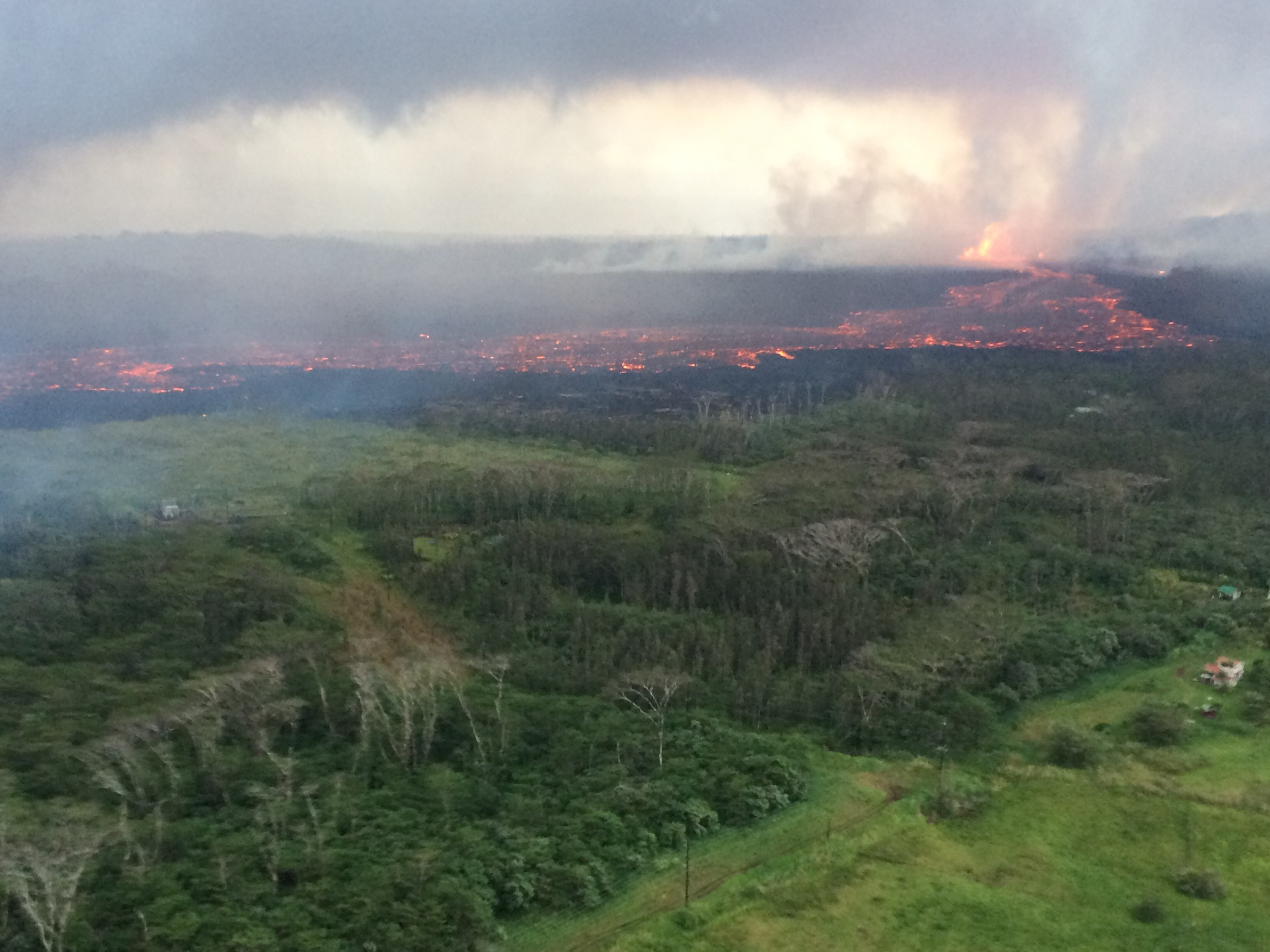
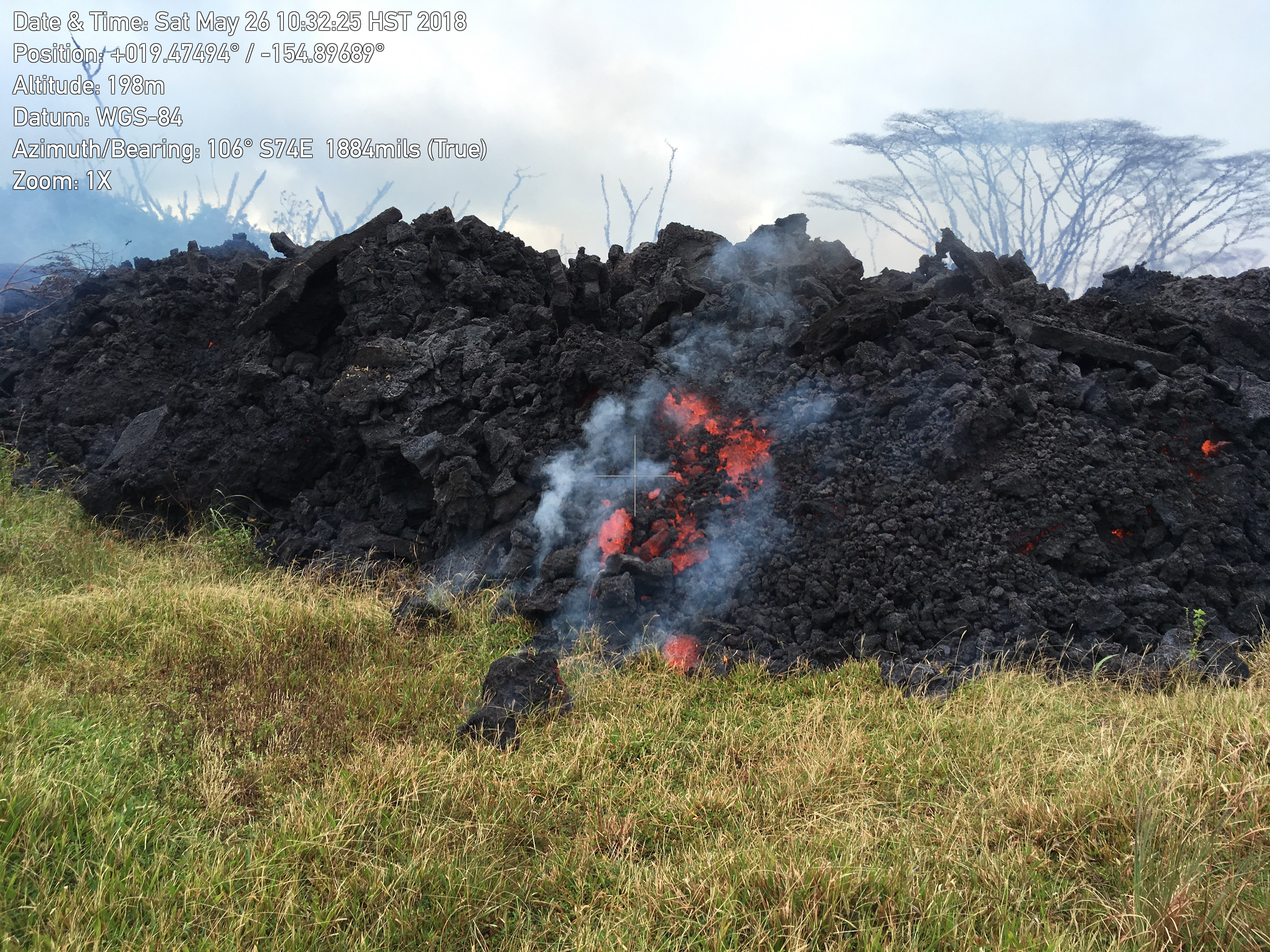
Fissure 8 continues to pump out vast amounts of lava, although it’s slacked off a tad from yesterday’s 260-foot display. One of its fingers burned a building or two at PGV. Other lobes closed in on Kapoho throughout the day, touching Highway 132 again half a mile north of Four Corners at 3:30. Fissure 18, which has been sending a flow east and down towards the ocean, has pretty much stalled apart from some small breakouts. Authorities were ordering Kapoho-area residents out today before lava cuts their only remaining road to the rest of the island.

Update: just as I was about to hit post.

(That’s a photo of Four Corners, which is the intersection of  Hwy 132 & 137. Apparently the lava’s started using 132 as a shortcut again.)

The summit has been steaming and vogging away, but the overlook vent has now been choked with debris falling from its walls. Ash explosions have nearly stopped since the 11am May 30 ash eruption that rose 12,000 ft.  Scientists are trying to figure out whether this means the main explosive phase is finished, or whether it’s going to build up enough pressure to blow out the clog. (That said, the crater has not “fallen quiet,” as many non-Hawaiian news stations claimed today. According to @NWSHonolulu, there was a minor “burp” of ash just after 1:30pm.)

Fantastic Kilauea Photo Gallery

@cheaptarts pointed me to photographer Andrew Richard Hara’s amazing Kilauea Instagram. A couple examples:

20180522 @ 03:30 HST – Methane field flames simmer in new cracks from Fissure 15 and 19 open up on the southeastern side of PGV, burning a State of Hawaii warehouse next to Pohoiki Road. Slow moving pahoehoe begins to approach PGV land at a crawl. . If you are worried about PGV, please remember that there are 23 fissures that have and emitting HF, H2S, and SO2 gases throughout this entire eruptive series. I'm not an expert by any means, but I try to remind myself that the gases that could be released at PGV are already being released into the atmosphere as we speak, outside of PGV's property. . For those who are wondering, I have official permission to be documenting this area. All areas that I have documented throughout this eruptive series have been through approved with legal access. Please kokua and do not attempt to trespass in areas unless official approval has been granted. . Many areas are now becoming inaccessible and the majority are dangerous due to volcanic hazards. . My respect and best wishes go out to the neighborhood of Leilani Estates, Lanipuna Gardens, and the areas within and between Kapoho. . #leilani #lava #pohoiki #lanipunagardens #bigisland#lavaflow #hawaii #geology #fissure #volcano @hawaiinewsnow

A post shared by Andrew Richard Hara (@andrewrichardhara) on

20180529 @ 15:30-19:30 HST – Fissure 8 on Luana Street . Moderate southwest trade winds shifted gaseous plumes of smoke and gas while Pele’s hair, light fragments of cinder, and reticulate showered from the skies up to five blocks (up to Alapai Street) in radius F8’s eruptive site. F8 generated massive channels of lava extending partially east and north over older flows on Luana Street. Nearby, F24 sputtered glimpses of orange lava a few feet in the air and is unlikely to be contributing any major part in F8’s aggressive effusion rate. Massive bodies of new pahoehoe lava beds radiated an intense amount of heat, keeping ambient temperatures consistently within ~90°F at our location. . All areas that I have documented throughout this eruptive series have been through approved with legal access. Please kokua and do not attempt to trespass in areas unless official approval has been granted. The majority of my efforts are without pay and all expenses are out of pocket. The content shared is being shared without cost to our local news networks for community awareness and support. Some footage does help to pay a very small portion of my expenses. . Many areas are now inaccessible and the majority are dangerous due to volcanic hazards. . My respect and best wishes go out to the neighborhood of Leilani Estates, Lanipuna Gardens, and the areas within and between Kapoho. My heart especially goes out to all of my friends who have lost their homes in this fissure eruption. I am at a loss of words. _____ #leilaniestates #eruption #bigisland #helicopter #hawaii #aerial #volcano #lanipunagardens @hawaiitribuneherald @hawaiinewsnow @natgeo @milekalincoln @bruceomori

A post shared by Andrew Richard Hara (@andrewrichardhara) on

Pretty, huh? Okay, let’s get down to the day’s Kilauea news, views, and eruption information:

Continue reading June 1: Halema’uma’u Exposed

June 1: Changes to Halema’uma’u Crater

A relatively clear day, May 31, finally allowed the USGS to get good, detailed drone footage of changes at the summit.

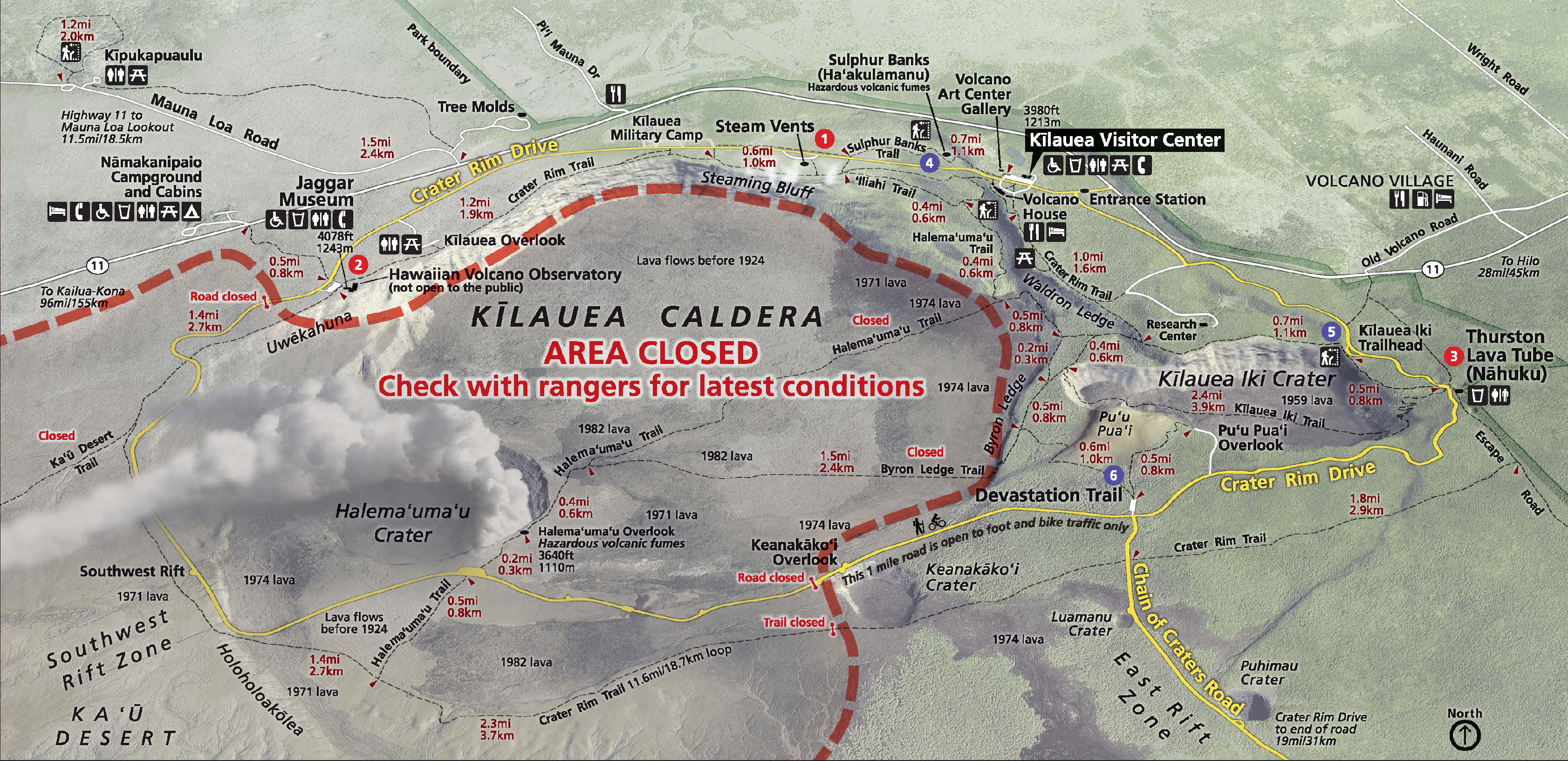
To orient you on the crater-within-a-crater-within-a-crater (Park Map):

  1. Kilauea Caldera is the megacrater, 2×3 miles across, on whose cliff walls are perched the Hawaiian Volcano Observatory, Kilauea Visitor Center and Volcano House.
  2. Halema’uma’u is a crater on the floor of Kilauea Caldera, about 2500 x 2900 feet. It held a lava lake in the 1800s, but drained and exploded in 1924, after which it was quiet for most of the 20th century.
  3. The Overlook Vent was a crater on the floor of Halema’uma’u containing a lava lake from 2008 until May 2018. It drained and has been exploding with steam and ash since the beginning of May. Rockfalls from its sides have enlarged it:
changes at kilauea’s summit, May 2018

May 5-29, USGS animation using radar data from Italian Space Agency’s Cosmo-SkyMed satellite:

May 23-31, new radar imagery shows more recent changes. The USGS caption notes that not only has the overlook vent widened, but also Halema’uma’u Crater:

USGS Animation of recent changes at Kilauea’s summit, radar images taken by Italian Space Agency’s Cosmo-Skymed satellite.


Below, a compilation of video footage of Halema’umau and its lava lake in August 2016. Go to timestamp 2:10 for a good view of Halema’uma’u Crater with the Overlook Vent’s lava lake inside. Compare that with the May 31 video above. The black area is lava that overflowed onto the floor of Halema’uma’u when the lake’s level was high.

Halema’uma’u crater and its lava lake in 2016 (USGS).

Note: the “Overlook Vent” was named after the old Halema’uma’u Overlook, because that’s the side where the lava lake vent opened in 2008. There used to be a parking lot and viewing area on Halema’uma’u’s crater rim where visitors could look down into it. In 2008, the Overlook area was closed to visitors, because whenever there was a rockfall into the lake it tended to do THIS:

May 31: One Month On

It’s been exactly a month since the first lava started emerging from fissures in Leilani Estates on May 3. And what a month it’s been.

USGS Caption: Crews make visual observations of activity at fissure 8 around 5:30 am HST. Fountain heights this morning continue to reach 70 to 80 m (230 to 260 ft above ground level. The fountaining feeds a lava flow that is moving to the northeast along Highway 132 into the area of Noni Farms Road. Full-sized)

The Lower East Rift Zone (LERZ) eruption has built in intensity by stages. Earthquakes, cracks, fissures, toxic gasses, spattering lava, larger and longer lava flows, and increasingly voluminous fountains have slowly engulfed two subdivisions and the forests and fields of lower Puna. They’ve heaped up acres of spatter ramparts, thick lava flows, overflowing ponds and rivers creeping down to the ocean. They’ve emitted a’a and pahoehoespatter and lava bombs, Pele’s Hair and Pele’s Tears, tephra/pyroclasts and cinders, vog, laze, and glowing blue flames.

Meanwhile, Pu’u O’o on Kilauea’s shoulder drained and died after a historic 35-year-long eruption. The summit lava lake in Halema’uma’u Crater followed suit, draining away more gradually but no less dramatically, with rockfalls and earthquakes and clouds of ash rising as high as 15,000 feet. Downwind communities are suffering from its ash and vog. The threat of steam explosions sending rocks flying half a mile has forced the closure of Hawaii Volcanoes National Park. That, coupled with jittery tourist cancellations, has struck almost as big a blow to the rest of the Big Island as lava has done to a few square miles of Puna.

The USGS and Hawaii Civil Defense have done a herculean job of monitoring, informing, warning, and moving people out of harm’s way in this fast-moving and complex natural disaster. And locals are rallying as best they can to support one another.

Today’s Eruption Summary

Kilauea’s still pulling some (alas, not all) of its punches. Early Wednesday morning, Fissure 8’s lava flow was surging towards Four Corners in sprints up to 600 yards an hour, causing emergency officials to go door to door ordering emergency evacuations. Luckily, it’s slowed, although it’s still inching towards the last remaining road in and out of Puna. People have had two precious days to go back and rescue pets and possessions before the lava cuts them off.

Meanwhile, the summit today was steaming with minor ash explosions. The USGS just released another drone survey of Halema’uma’u filmed May 26:

See caption on USGS website, and compare with drone footage of May 21.

USGS STATUS UPDATE: MAY 31 9:30 AM

Continue reading May 31: One Month On

May 31: 6PM Eruption Update – Conference Call

Normally I tuck the USGS media conference call into my digest for the day, but my notes are so long I decided to put this in its own post.

Summary: Eruption is continuing with no signs of stopping. Wendy Stovall gives all kinds of geeky tidbits about temperatures, heights, where the magma is coming from, plumbing system of Kilauea. She emphasizes that Kilauea receives a “continuous supply of magma from the deep mantle” thanks to its mantle plume. Scientists are starting to discuss calling this a new eruption, but their focus right now is on collecting data and getting info to Civil Defense.

Full notes (sorry they’re a little rough, but you’ve got the gist) below cut:

Continue reading May 31: 6PM Eruption Update – Conference Call

May 30: Pele Makes A Run For Four Corners

Today’s Eruption Summary

In fact, the current lava eruptions in Puna are as hot as Hawaii’s lava will ever get. “It can’t get hotter than where we are,” Stovall added. “We are pretty much tapping mantle temperatures right now.”

Honolulu Civil Beat

USGS Photo – Caption: “Lava flow erupted from fissure 8, photographed during HVO’s early morning overflight today. The lava channel was estimated to be about 100 feet wide.” (Full-sized)

Fissure 8 is beauty & the beast. Since Saturday it’s been pumping out a huge volume of lava, creating pahoehoe and even a’a flows that occasionally surge up to ~600yards/hour. Yesterday its main flow headed NE, skirted the geothermal plant, crossed and followed Hwy 132 for a while, and then started downslope past Noni Farms towards Four Corners, threatening to cut off Kapoho and Lower Puna.

Amazing overflight photo of Fissure 8 and its lava flow taken on May 29 by Hawaii Civil Defense. (Full-sized)

In the early morning hours, officials went door-to-door in the Kapoho area ordering emergency evacuations.  Newly-paved Beach Rd was pressed into service as a one-way evacuation route from Four Corners to Hawaiian Beaches. But it’s a race against time, as the lava is headed for that very road.

[ETA: Mick Kalber’s flyover. He’s always got notes on the video’s page.]

I saw no PGV news today, which is good. The summit produced yet more ash & earthquakes, one a pretty good thump (Mag 5.3 at 10:57am, no tsunami). Meanwhile, Fissure 18 is sending a channelized flow towards Hwy 137, just a little east of last week’s flows to the ocean:

TUESDAY EVENING IN PAHOA: USGS BRIEFING

Continue reading May 30: Pele Makes A Run For Four Corners

May 29: Day of Reckoning for PGV (and LavaCam)

I’m wiped after following events of the last two nights from 3 timezones later— nothing compared to the exhaustion of Puna residents or HVO geologists, I’m sure— so today’s post is going to be less meticulous.

Today’s Eruption Summary

Sunday and Monday nights, the new monster Fissure 8 tossed fragments high in the air that carried onto houses over a mile away: clinkerly bubbly volcanic cinders (also called tephra), fine glass strands called Pele’s hair, and small volcanic glass droplets called Pele’s tears. Authorities warned people to be careful of Pele’s hair, which is basically natural fiberglass, as it can cause skin and eye irritation.

Another spate of vigorous 200-foot-tall fountaining from Fissure 8 last night sent a second fast-moving flow northeast along the edge of Sunday night’s flow, triggering more emergency evacuations and (I’m afraid, haven’t seen any tally) the loss of more homes. At 6:30am Tuesday, civil defense closed Highway 132 near the geothermal plant in anticipation that lava would reach it today. At 3:30PM, the lava did indeed begin to encroach on 132, leaving only one other road still open to Lower Puna.

Before crossing 132, 8’s northeast lava flow marched towards and into PGV property, cut off plant’s main access road, prompted staff to evacuate, and began to burn and cover over buildings and equipment. I believe sensors have been left to monitor the wells. I’m guessing a’a is a better thing to get covered by: it’s somewhat cooler than pahoehoe, and it can’t seep into cracks.

At the summit, ash eruptions and earthquakes continue. A 2am ash eruption was 15,000 feet tall, followed by a 4.5 earthquake. Light winds are sending the ash nw, towards Volcano and Pahala. There’s a meeting at Pahala tonight to discuss vog and ashfall, which is going to be an ongoing problem for these communities however long this eruptive phase lasts. 

At night, the webcam is showing incandescent blocks flung out onto the rim of Halema’uma’u Crater, but we don’t know how big or how many because it’s unsafe for scientists to approach. However, they’re installing a new thermal cam soon that should help them see the blocks. (Source: 11AM conference call) 

Time for today’s roundup of USGS bulletins and info, relevant posts by geologists, images and videos, local news reports, and the eruption through the eyes of social media.

Continue reading May 29: Day of Reckoning for PGV (and LavaCam)

May 28: Rivers of Fire, Lava Livestream is back

Today’s Eruption Summary

About 7PM yesterday, a large pahoehoe flow suddenly burst out and went galloping through Leilani Estates. Civil Defense called for emergency evacuations. Firefighters had to guide one person to safety (with assistance of drone team tracking lava) when the flow covered his drivewayUSGS and Civil Defense reported that vigorous fountains 7 and especially 8 were responsible for the outbreak: fountaining 150-200 feet high, they built up a spatter rampart 100 feet tall and fueled a monster pahoehoe 20-40 feet thick. Speed augmented by the perched lava pond breaching (dam gave way, basically).

You can get a sense of last night’s outbreak from this timelapse of the Lower East Rift Zone webcam over the past few days.

The flows from yesterday slowed and stopped this morning. Most of the day’s activity was fairly subdued, with “only a minor ooze of residual lava” making it down to the ocean. But this evening, fissure 8 and other vents went into overdrive again, pouring out rivers of lava and prompting more emergency evacuations (Civil Defense notice) (HVO/USGS Alert).

Lava livestream

Honolulu Civil Beat is back to let us watch nature’s pyrotechnics from about 2km away and a crucial 200 feet up.

It’s mesmerizing to watch, but a sobering sight as well, knowing homes downstream are burning and some people are in danger. 

I can’t watch now; I have a post to write. Where was I? Continue reading May 28: Rivers of Fire, Lava Livestream is back

May 27: First Well Covered; Emergency Evacuations From Fast-Moving Lava

The dramatic light show I noticed on the East Rift Zone webcam last night was probably from fissure 7, featured on today’s Mick Kalber helicopter flyover (warning: noisy).


(Blog post: Mick Kalber’s observations from this flight)

Most of today’s news is about marauding lava flows in the Lower East Rift Zone, but the ESA just posted another satellite radar image of changes at Kilauea’s summit:


[EDIT] Things got a little TOO exciting this evening, and I kept having to update this post…

Continue reading May 27: First Well Covered; Emergency Evacuations From Fast-Moving Lava

May 27: Lava reaches PGV property

I see from Hawaii NWS that small summit ash explosions continue, probably dusting downwind communities. But events down at Leilani Estates have dominated the news today.

To recap: after much foot dragging and a history of safety violations, Puna Geothermal Venture has not won the confidence of many Puna residents.

But Hawaii Civil Defense also confirms the now-quenched wells are “essentially safe.” The concern is that toxic hydrogen sulfide could be released if lava breaches a geothermal well. PGV worked to secure these wells last week, but they’re flying in 200,000 pounds of clay from California today to contain explosions, so…we’ll see.

#LeilaniEstatesEruption #KilaueaVolcano UPDATE (May 27 at 10:15 AM): Hawaiʻi County Civil Defense agency officials cannot tell me what would trigger a mandatory mass evacuation of the area surrounding Puna Geothermal Venture — despite the fact lava has reached the 40 acres of their operational plant site and is approaching the well field. Civil Defense officials say no wells have been impacted and a team is working to prevent threats from developing. At this time, no hydrogen sulfide has been detected. I asked Civil Defense: “What would trigger a mass mandatory evacuation of the area?” We were sent this response: “If it becomes necessary for public safety. At that point, we will alert the public.” We followed up with these questions: “Can you explain what government officials have determined this threshold to be? It’s obviously not lava inundating PGV property, so can you clarify?” We were told there was no additional information beyond their statement. We have since reached out to the Governor’s office for assistance and have confirmed Gov. David Ige will be returning to Puna this afternoon. At last check at 7:30 AM, PGV spokesperson Mike Kaleikini said the nearest well was about 130 feet away from the lava flow front. “All of the production wells nearest to the lava flow are plugged and shut in. According to HVO scientists, movement is currently stalled. As long as conditions are safe, we will have personnel on site. Primary concern is sulfur dioxide from the eruption and lava coming on site. We monitor for hydrogen sulfide and sulfur dioxide on a continuous basis. There are no hydrogen sulfide emissions from PGV wells,” said Kaleikini. PGV officials maintain they believe they have mitigated the threat of an uncontrolled release of hydrogen sulfide if lava inundates their property and makes contact with their wells. However, PGV officials have conceded they don’t know if hydrogen sulfide is the only possible hazard the community could face if lava interacts with their wells. Stay tuned to @HawaiiNewsNow (Video: Civil Defense)

A post shared by Mileka Lincoln (@milekalincoln) on

UPDATE:  Half hour Press Conference with Gov. David Ige and Tom Travis of Hawaii Emergency Management. The gist: the wells are secure, and they’re being monitored.

Lava covered one well this evening. So far, so good: