Today’s Eruption Summary
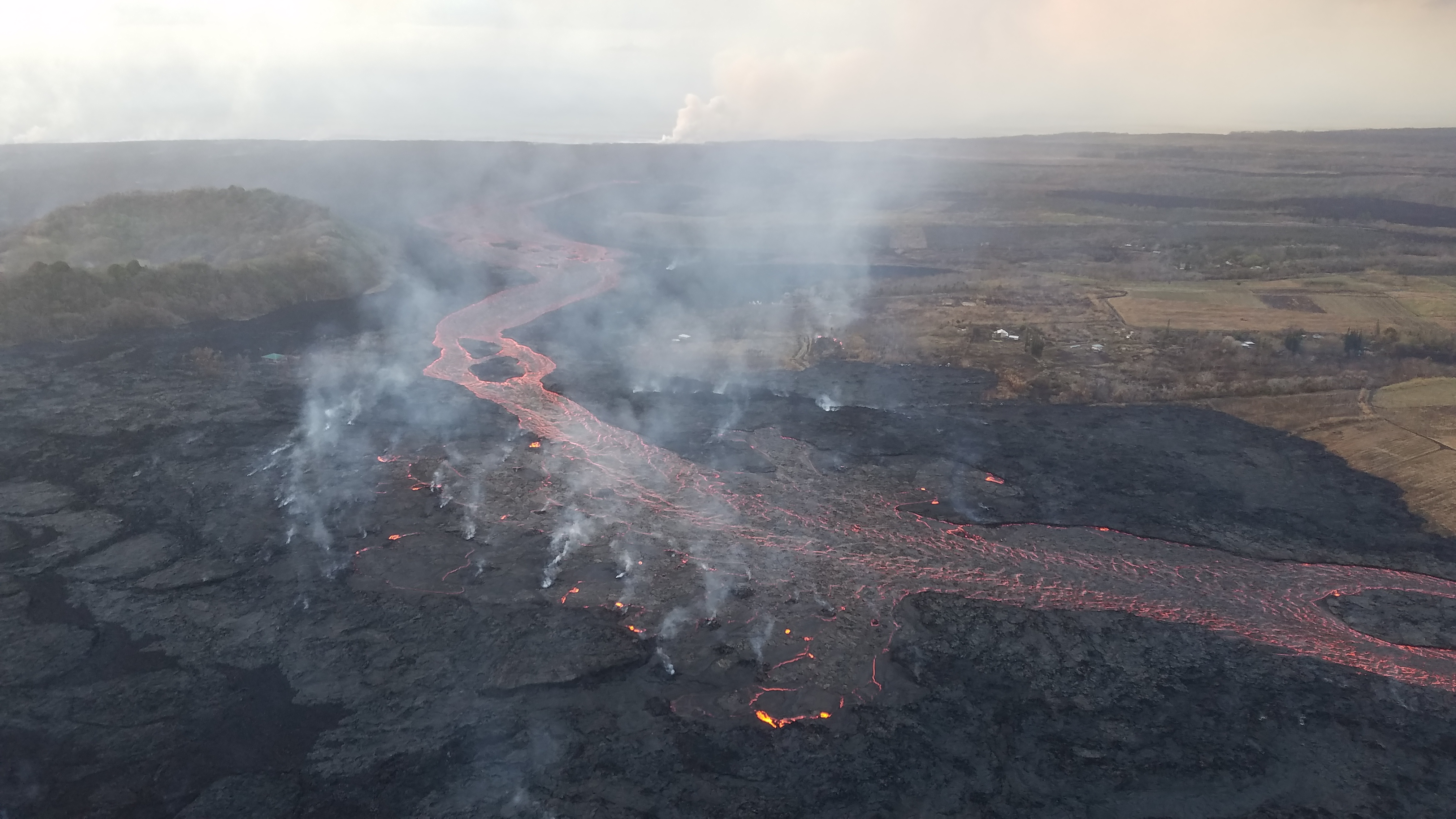
Fissure 8’s lava flow has settled into its new course, turning right just before Kapoho Cone and proceeding south-southeast to the ocean in a strong channelized a’a flow. Some lava, apparently following the earlier paths (lava tubes, maybe?) to the sea, is still squeezing out of the broad 6km (3.7) mile lava delta to the north of the new ocean entry.
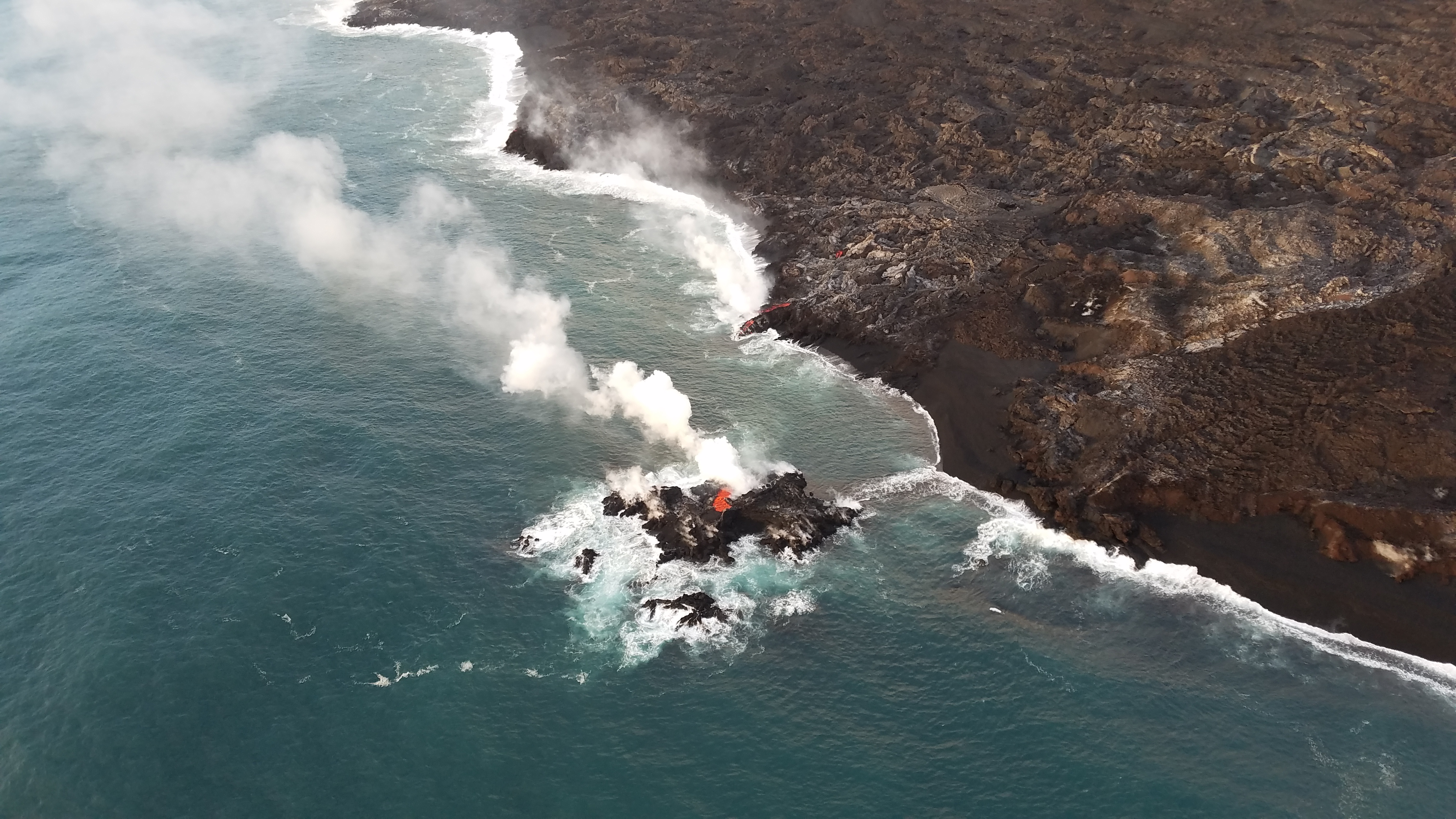
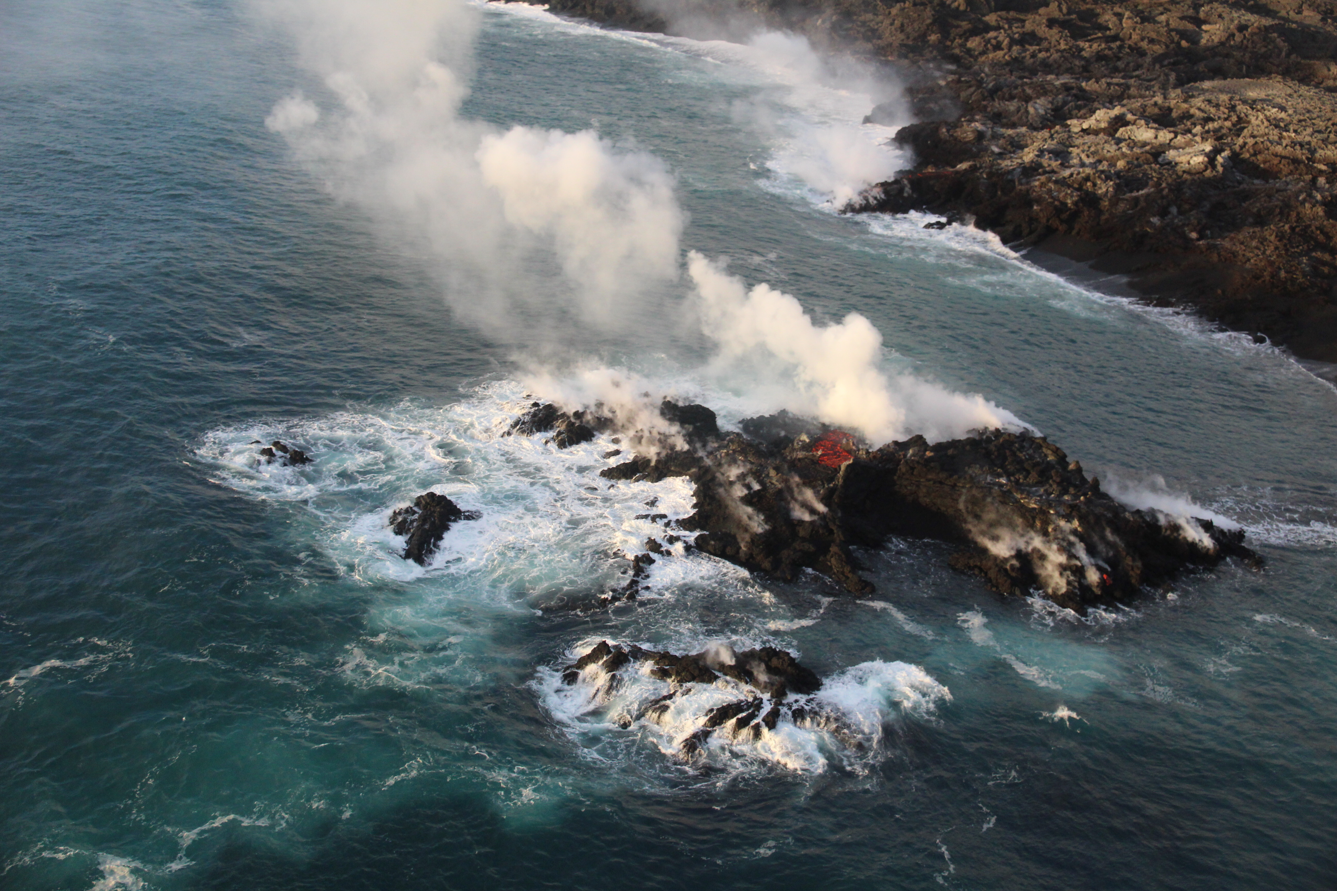
A fascinating footnote: while the northern “ooze-outs” are weakening, a tiny lava island popped up just offshore of them last night, and it is itself oozing lava:
Fissure 22 has stopped spattering. However, many inactive fissures were steaming today, “possibly due to the increasing humidity in the area.”
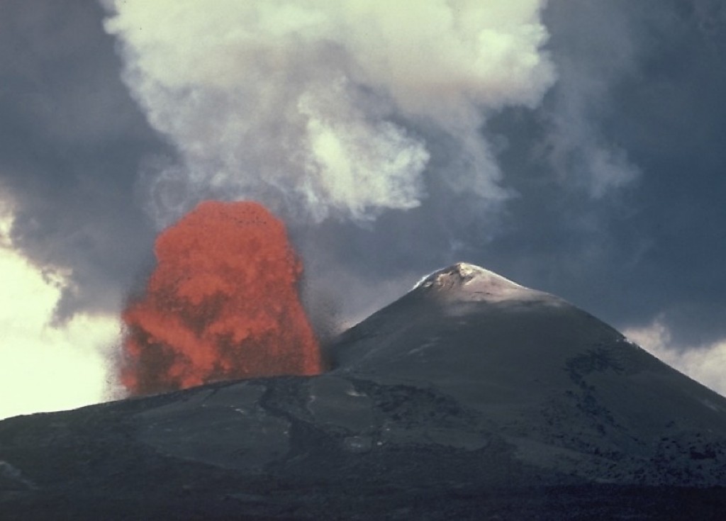
Today’s summit collapse occurred at 7:06pm HST, with the energy equivalent of a 5.3 earthquake, as usual. HVO is setting up a new livestream from Volcano House, but it’s not fully operational yet, so we made do with the ailing HVO webcam today (video clip).

It’s been fascinating watching geologists collect data, figure things out, and incorporate these discoveries into their daily Kilauea alerts. Just as the HVO team started predicting the summit’s cyclical collapse/explosions, now they’ve started predicting (or at least watching for) Fissure 8’s lava surges and possible spillovers a few hours after each summit collapse. Sure enough:
Kīlauea Message Fri, 13 Jul 2018 21:53:34 HST: Following the 19:08 HST summit collapse explosion today there was an increase in activity from fissure 8 resulting in channel overflows on the south side of the flow near the vent.
— USGS Volcanoes🌋 (@USGSVolcanoes) July 14, 2018
Also, we’ve got a new view of ever-expanding Halema’uma’u Crater in Kilauea’s summit caldera this morning:

I couldn’t find a comparable aerial photo with the observatory and Jaggar in shot, but this 2009 photo of Halema’uma’u is facing in approximately the same direction. (Look for Crater Rim Rd behind the crater on the left, and note the parking lot obscured by the lava lake’s plume in 2009— lava lake, parking lot, and part of that road collapsed into the crater in June.)
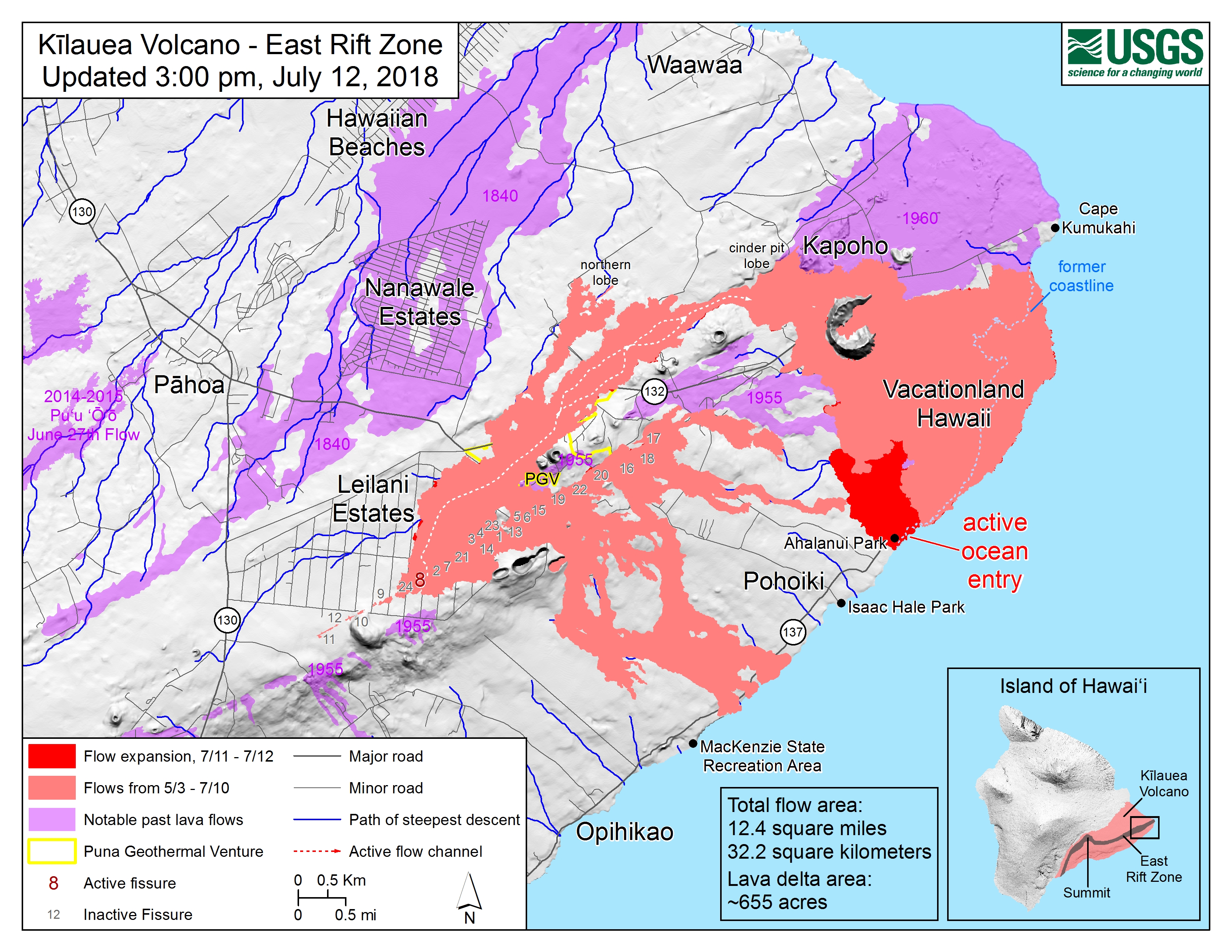
Latest Map of Lower East Rift Zone
No new lava flow diagram/map since yesterday, but thermal maps take a little longer to process, so yesterday’s thermal map was posted today:

Compare with Google’s satellite map of the area, which hasn’t been updated since before the eruption.
July 12 USGS/NPS/NWS Press Briefing
Audio file archived here.
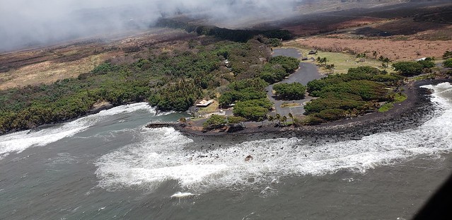
USGS Janet Babb summarized Tuesday through Wednesday night’s channelized flow diverting west of Kapoho Crater and taking out charter school and Ahalanui Beach Park, where a “robust ocean entry” has been established. Jessica Ferracane of Hawaii Volcanoes National Park discussed damage at summit and programs still available in parts of park that aren’t closed. And a weather report. Heavier showers through weekend (so watch for lava-boosted showers and thunderstorms) dry spell Monday-Tuesday, tradewinds throughout.
I haven’t had time to listen to all the Q&As (lots of good questions this time), but one interesting tidbit is that the sulfur dioxide emissions from Fissure 8’s lava flow are so high they’re off the scale, so they’re still trying to figure out a way to measure them accurately.
More Photos from USGS
USGS field crews were busy, busy before the weekend, taking too many photos for me to tuck into the rest of this post.
So let’s join the USGS morning overflight from vent to shore:

Quick detour behind Fissure 8, to its southwest:
This is looking back towards Fissure 8. Looks like a bit of a spillover left over from yesterday afternoon’s 2:42 surge:
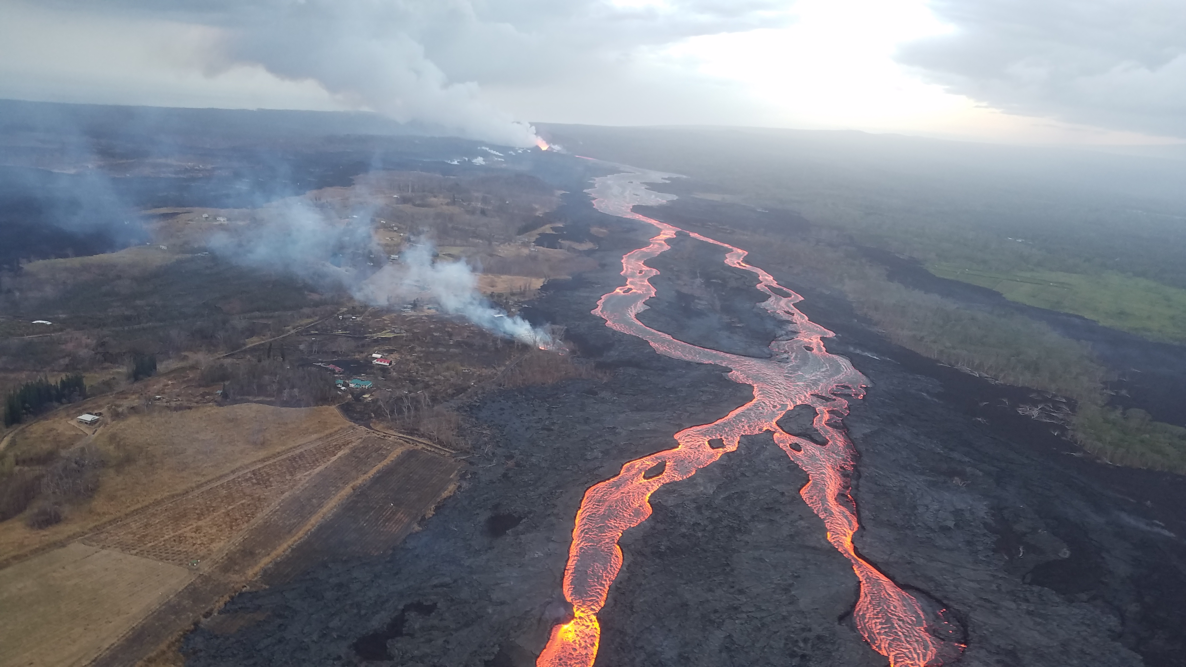
Turning around again, we see the new diverted flow bending to the right (south) to pass Kapoho Crater:
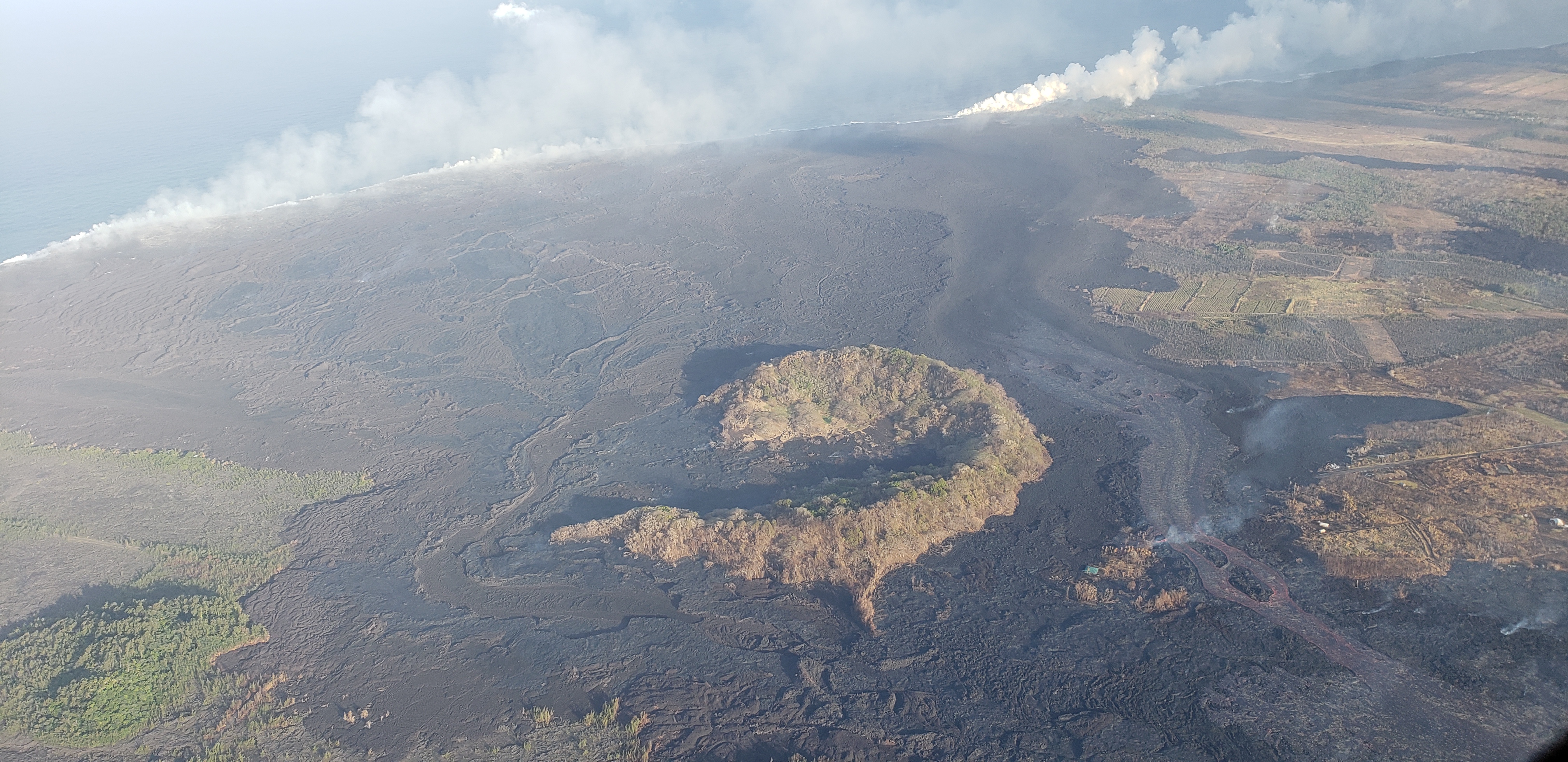
Another view of Kapoho Cater and the new southern ocean entry’s plume (right) as well as the older broad lava front with all the “ooze-outs” (left):
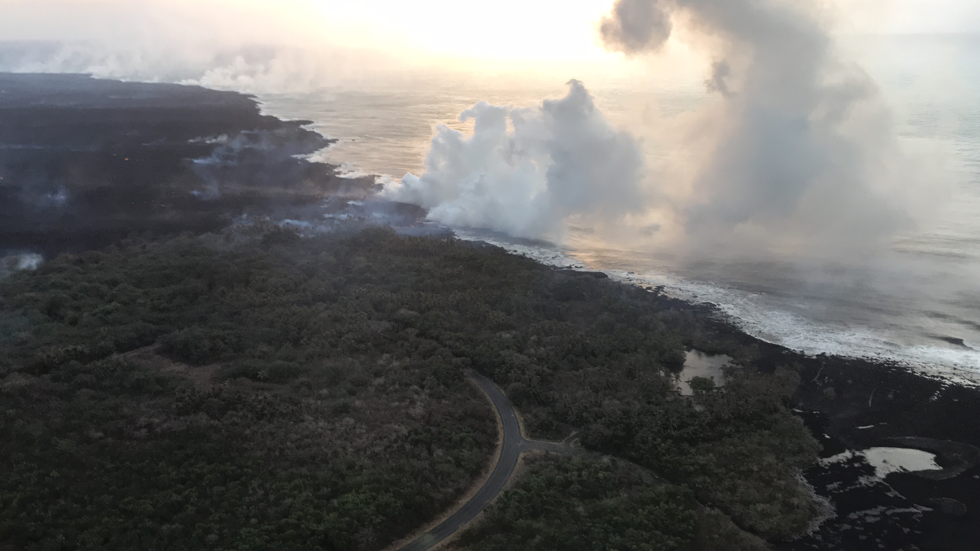
And finally, flying all the way to the coast, turning right, and then looking back at the two ocean entry plumes (“robust” one is closest to camera):
From Other Scientists
Larry O’Hanlon, Speaking of Geoscience blog, “Kīlauea: The science behind the headlines”
Great recap of everything I’ve been trying to cover: the eruption, how the USGS has tackled it, and what they’ve discovered so far. It includes comments from many of the scientists we’ve relied on in this eruption: Tina Neal, Don Swanson, Kyle Anderson, Weston Thelan, and also someone I haven’t heard of before, Angie Diefenbach who’s in charge of the drone team.
Current View of Pu’u O’o Crater
Hard to believe this hollow shell is the same dynamic Mini-Me on Kilauea’s shoulder that’s been erupting for 35 years, until it died April 30.
Here’s what it looked like in 2016, back when it was alive and vital.
It’s just a big scarred pile of rock, but I miss it. I haven’t seen all the wonderful places this eruption has destroyed, but this… this is a sight I’ll never forget.
From Local News Outlets
- BIVN (Video and article): “7AM Eruption Update — Lava Flow Heads Towards Pohoiki“*
- HTH: “Lava claims Ahalanui Beach Park; Isaac Hale [Park]’s fate uncertain” (other name for Pohoiki)
- HTH: “USGS employs high-tech laser mapping at Kilauea’s summit“
- HTH: “Loss of school stings: Destruction of Kua O Ka La ‘utterly devastating'”
- HNN: “Big hearts band together to build tiny homes for lava evacuees”
- HCB (Video): “Candi’s Ark: Meet the Woman Who Shelters Animals Rescued From the Lava“
- HTH: “Kim wants out of lost land deal: County awaits state decision on $2.7M open space purchase“
- HCB: “Big Island: Does Anyone Really Miss the Puna Geothermal Plant?”
*Pohoiki includes the all-important boat ramp that’s been used to rescue animals after lava flows to the ocean cut off the coast here on both sides… but also, sadly, it’s allowed some looters in and out of the area:
(Above photo from Fire Dept July 12 overflight)
#LeilaniEstatesEruption #KilaueaVolcano LATEST: Video from #IkaikaMarzo shows just how close #lava flow that claimed Ahalanui (Warm Ponds) is to taking another beloved Puna area: #Pohoiki. Officials estimate its less than a mile away https://t.co/KNoxttV3D9 @HawaiiNewsNow #HINews pic.twitter.com/BkhKjWSAEM
— Mileka Lincoln (@MilekaLincoln) July 13, 2018
USGS Q&A ON SOCIAL MEDIA
That tiny island that popped up today elicited a lot of comments, naturally.
Q: The start of the island was captured on this video, right?
Huge underwater explosion from Hawaii eruption. Bruce & Mick don't quite see it and I think the explanation for that is that the GoPro shoots such a wide angle that even though it looks like it is right in front of them, it was likely below their line of sight. pic.twitter.com/otJxmh9TAg
— Hot Seat Hawai'i (@HotSeatHawaii) July 12, 2018
USGS: We don’t think so. That shot appears to be at the southern end of the ocean entry, while the ‘island’ is at the northern end.
Q: Possible new volcano?
USGS: No, it still shares Kilauea’s magmatic plumbing and is on the volcano’s flank, so it’s not a separate volcano in its own right. Just a small surface feature.
Q: Looks like an underwater [lava] tube feeding the island?
USGS: Possibly. There has to be some sort of insulated path for the lava to follow before it gets to the surface.
Q: [Can you explain the tiny island?]
USGS: One explanation is that it might be a bit of the flow that has inflated above the water, since there’s molten lava visible in the center.
Q: Is the island an underwater fissure or is it a lava tube exit from the ocean entry?
USGS: There aren’t any underwater fissures. This island is from a part of the lava flow that extends underwater away form the coastline.
Q: So this is a whole new island?
USGS: Yes, but it is small, and connected to the lava flow on the coast. It’s one continuous lava flow field, it’s just that part of it is underwater. If the flow remains active, the small island will probably connect to the coastline. If not, it might erode away due to wave action.
Q: How does that happen?
USGS: There is clearly lava that is active on the sea floor extending out from the coastline. We suspect that pressure within the underwater lava flow pushed the flow surface upward. This is called a tumulus — they are very common in lava flow fields.
HVO posted most of this timelapse yesterday, but the side-by-side comparison at the end is useful:
Earthquakes at Kīlauea Volcano’s summit resumed following the July 12 collapse/explosion event; 25-30 occur per hour; another collapse/explosion event is expected late today or overnight. Watch this timelapse to see the changes. https://t.co/ZtvOW0jjQ2 pic.twitter.com/iMc3ANLeSi
— USGS Volcanoes🌋 (@USGSVolcanoes) July 13, 2018
Comment on above video: Someone might want to retrieve that camera sometime soon! *lol*
USGS: Well, the camera is attached to the HVO building…
Q: [How close can tourists get to the lava channel?]
USGS: There are currently no approved viewing locations in the Puna area. They are being discussed by Civil Defense, but until they announce their creation, you can be fined and arrested for attempting to approach the lava channel. It is still a very dangerous environment!
[Other FB members mentioned lava boat tours, charted helicopter tours.]
Q: [My rather incoherent question about the explosion seen by @HotSeatHawaii crew yesterday— could water from Warm Pond’s spring get trapped by lava and carried a short distance before bursting out?]
USGS: The answer is, yes, they were already developed hot springs. They would have come through existing lava flows.
Someone else asked for a followup.
USGS: Our current thinking is that it’s caused by trapped water vapor and/or other gases, building up to the point where they burst from beneath a relatively thin lava crust and create the offshore explosion.
Q: Someone suggests using a “tomahawk missile” to clear the blockage that caused the flow to divert earlier this week:
USGS: We hope you’re joking with this one. In the past, attempts to bomb lava flows for diversion purposes have been very unsuccessful – there were attempts to do this on Mauna Loa in 1935 and 1942, which did not work [link to HVO’s Volcano Watch newsletter column: “Can Hawaiian lava flows be diverted?”]
Q: Followup saying that modern guided missiles can target much more precisely.
USGS: Regardless of accuracy, bombing a lava flow to remove an obstruction could easily cause more problems than it fixes, since we don’t know what’s going on in the subsurface. It might create more breakouts than it stops.
(Hey, at least he didn’t pull out the oft-repeated “just nuke it!” suggestion which sounds to me like an effective way to spread radioactive waste over a large area. Annnndd… back to the summit)
Sentinel 2 time lapse (03/05/18-07/07/18) of the ongoing #Kilauea eruption in #Hawaii and subsequent land growth. Also interesting is the change in ocean colour. Using @Pierre_Markuse 's script to highlight IR from the flow. @sentinel_hub @CopernicusEU @USGSVolcanoes pic.twitter.com/S96LL4OmPC
— Ross (@RossVolc) July 13, 2018
Q: [Is the LERZ eruption slowing down? Are these signs it’s drawing to an end?
USGS: It’s very difficult to say. Eruptions have a tendency to wax and wane. Overall, activity seems to be down (the low fountains are a sign of that), and that is consistent with the idea that the summit pressure is very low, but we can’t rule out the possibility of some renewal of activity.
[Looks like Facebook minder got the memo about the surges, which they were denyingy
Q: Fissure 8 was “raging” during our overflight— can an earthquake at the summit cause a change in LERZ rift zone eruption 3 hours later?
USGS: We’ve wondered if this was possible, and looked at time-lapse movies of the channel across several summit collapse events. We haven’t noticed 100% consistent behavior that suggests a connection, but there are times when there is a correlation within two or so hours.
Q: Could eruption continue indefinitely? Could it empty the magma chamber until the roof caves in?
USGS: In theory, we suppose that could happen, but magma has a strength — it’s not like water in that respect. That means it really takes a lot of pressure to drive magma down the rift zone to erupt. So the eruption should stop well before the magma chamber drained. As it is, the upper magma reservoir beneath the summit largely has drained, and that’s why the caldera floor has dropped so dramatically. The lower reservoir is much larger and very unlikely to empty.
Q: When will the satellite image used on your earthquake map be updated to show current crater?
USGS: That’s one of those things we’ll get to eventually, but it’s fairly low on the priority list right now. That graphic is a compilation of numerous cloud-free images, so it might take a while to get new could-free (and plume-free) images of the summit and lower East Rift Zone that can be used to recompile the image.
From Other Photographers & Social Media
Looks like the KE webcam at the observatory is back online:
This is a pretty pic of the #Kilauea Grand Canyon with the white fluffy clouds drifting by#KilaueaErupts #LeilaniEstatesEruption #Pohoiki #kapoho #lowerpuna #puna #Pahoa #lavaflows #Fissure8 pic.twitter.com/kG1b8Q58wr
— Tay Austin (@Jasamsdestiny) July 14, 2018
Lava tours stir mixed feelings around erupting Kilauea https://t.co/9aITw16JzY pic.twitter.com/4blju4d1HT
— heba lissa (@heba_lissa) July 14, 2018
Unconfirmed eyewitness report:
Janice Wei, who (I think?) works for the National Park Service, captured Fissure 8’s surge a few hours after yesterday afternoon’s summit collapse: