This Week’s Eruption Summary
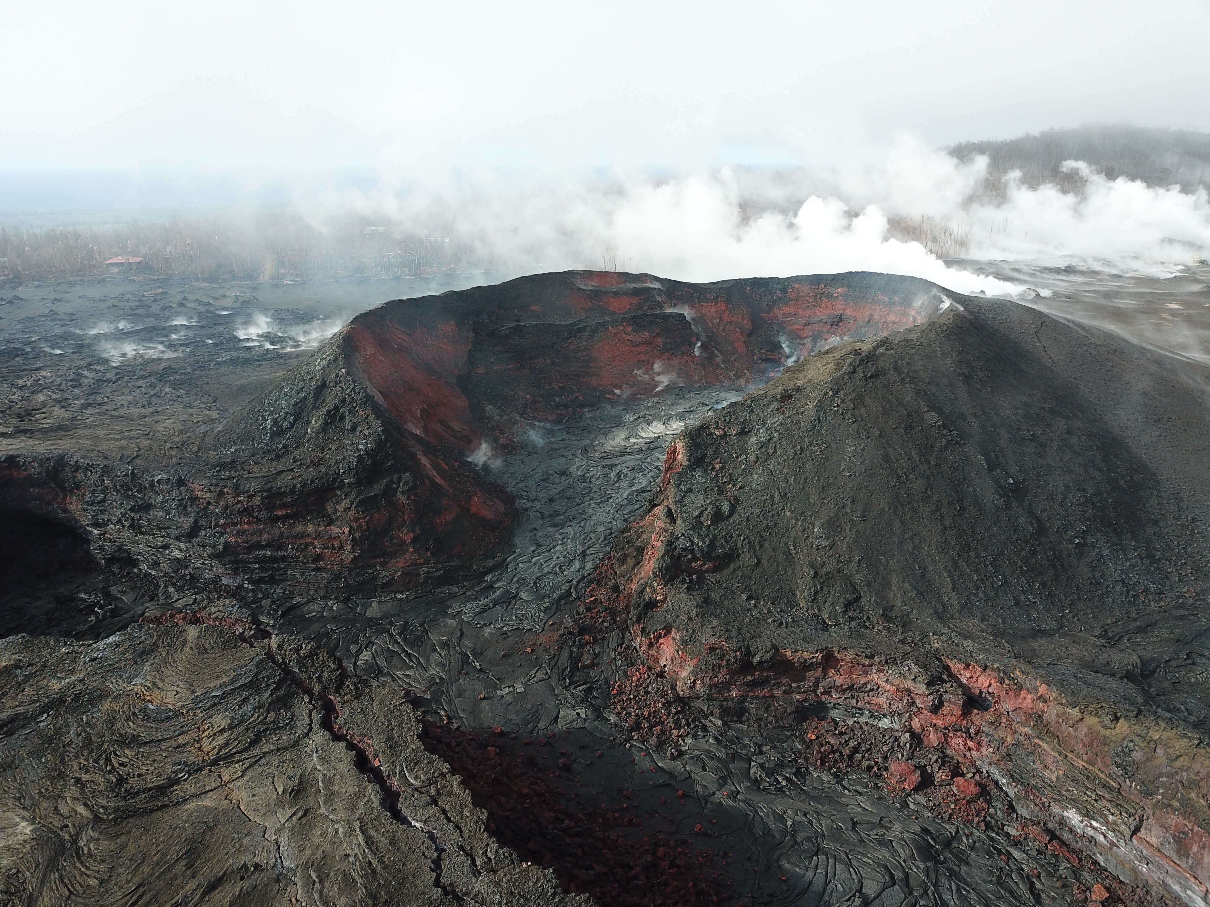
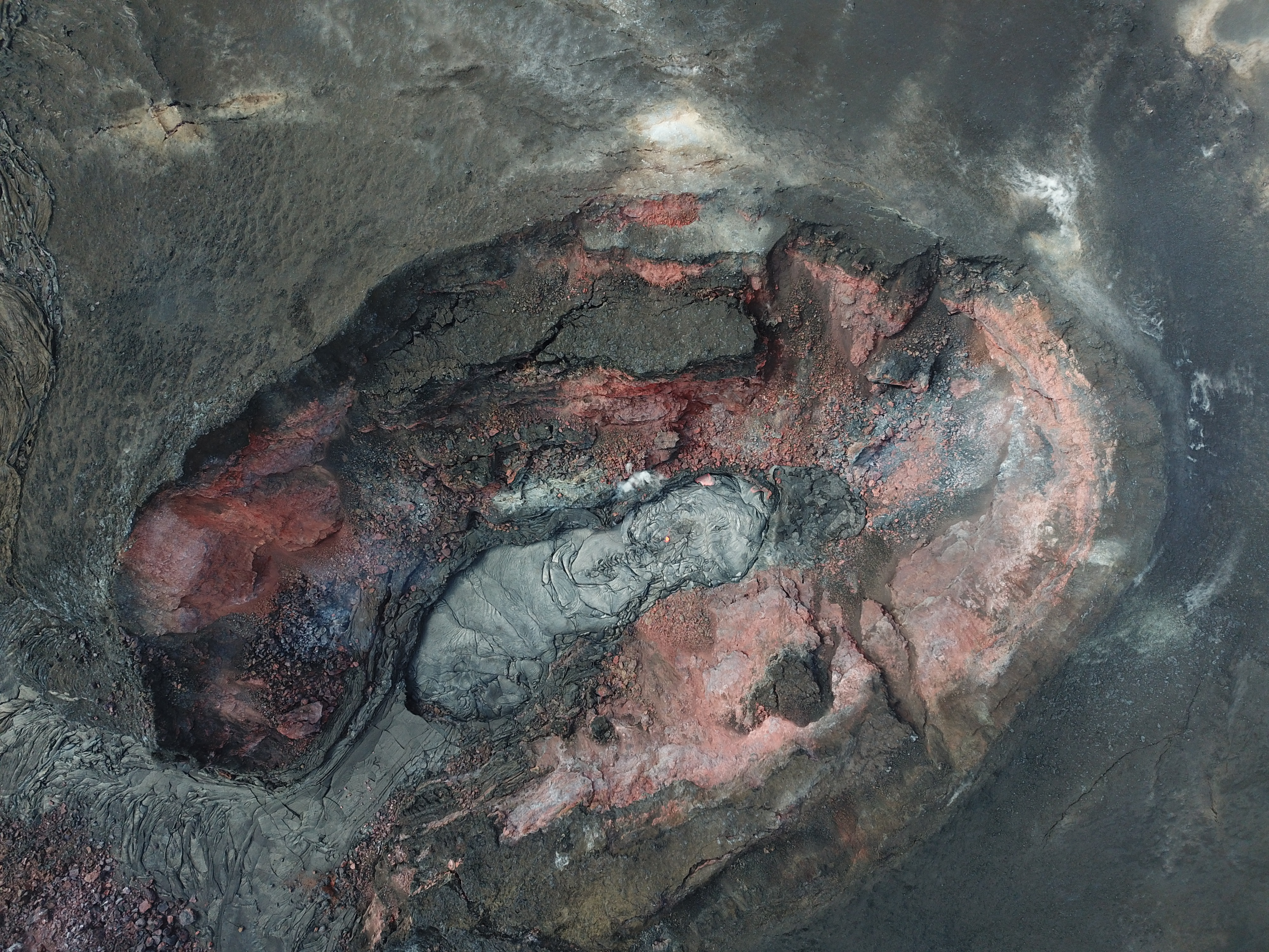
There’s been spots of incandescence, fuming, and small lava flows within the Fissure 8 cone for the past week, a few of which have oozed into the spillway, but eruptive activity remains confined to the cone. These have partly filled in the crater’s deep pit.
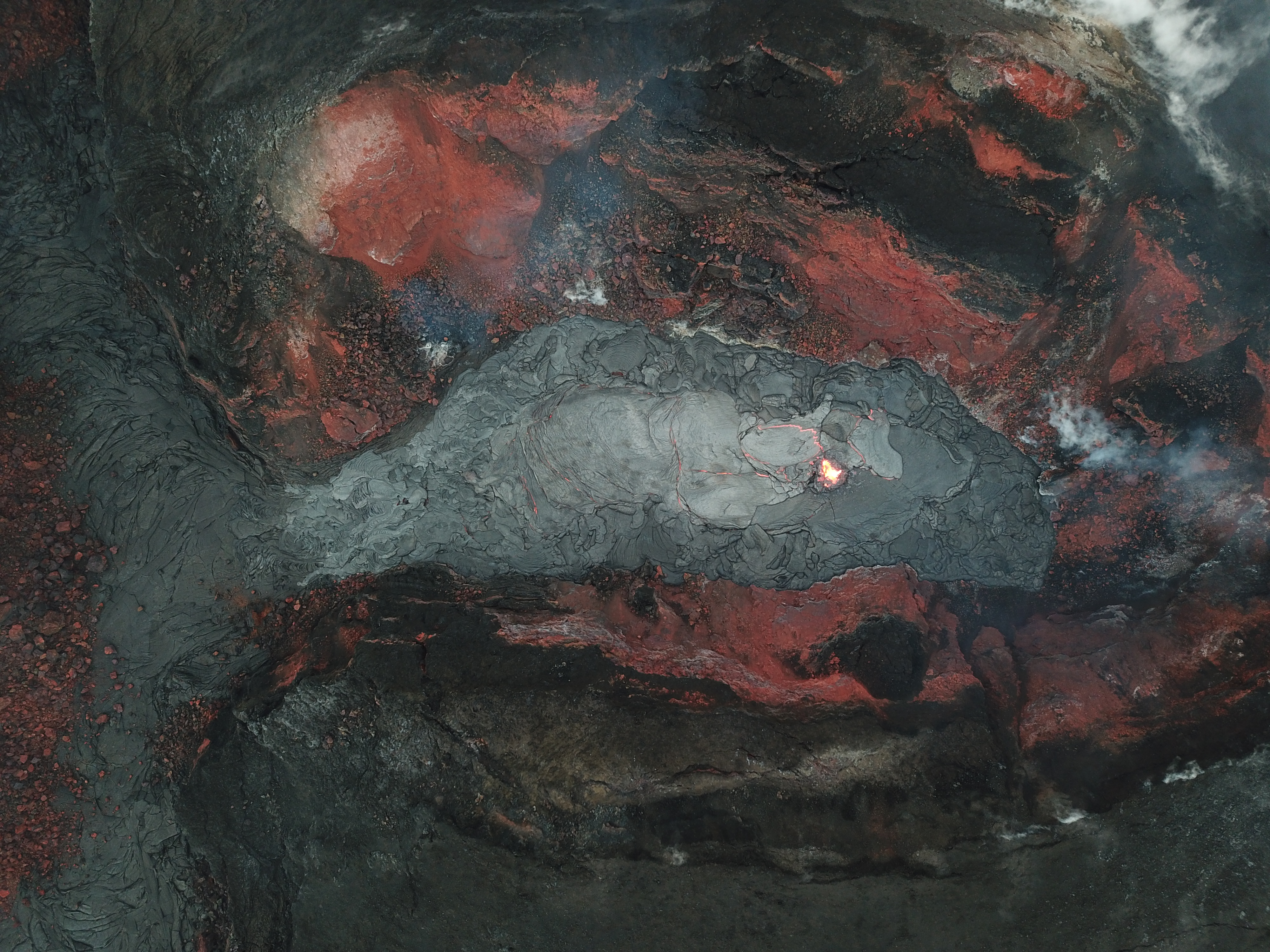
Earlier this week there was a sputtery little mini-cone building on the floor of the Fissure 8 cone.
It looks like the USGS is now using drone overflights instead of morning helicopter rides, which is probably a relief to residents living just outside the evacuation zone.
However, starting Thursday September 6, tiltmeters in the mid East Rift Zone have registered minor amounts of inflation. “The current rates [of inflation] are much smaller than those measured during the period of major eruptive activity and are not changing rapidly.” —HVO Thursday status report
Sulfur dioxide emissions remain lower than at any time since 2007, including those at LERZ vents which are now so low as to be barely detectable.
And yeah, there’s another small hurricane headed for Hawai’i. It’s very unusual for one to make landfall on any of the islands instead of just brushing past offshore, but Olivia looks set to cross the island chain.
- HVO Volcano Watch’s newsletter this week shows that we’ve transitioned from reports about current eruptive activity to studying and learning from it: “Scientists share lessons from Kilauea at “Cities on Volcanoes” conference
September 6 Video from Mick Kalber
At 6AM The LERZ was cloudy and steamy, but there’s some great views down into Pu’u O’o Crater. Be sure to check out timestamp 2:00; clear view of Halema’uma’u and summit in the distance. Notes/observations on lava update blog.
Bruce Omori also posted observations and 6 photos from this flight on his Facebook, including these lovely views of dawn-golden Kilauea Caldera from afar:
Thursday, Sep 6, 2018, 6:00 am – Kilauea's lower east rift zone overflight: Kīlauea, overshadowed by Mauna Loa.
Posted by Extreme Exposure Fine Art Gallery on Thursday, September 6, 2018
Thursday, Sep 6, 2018, 6:00 am – Kilauea's lower east rift zone overflight: A spectacular view of Halema‘uma‘u, with Kīlauea Iki in the foreground.
Posted by Extreme Exposure Fine Art Gallery on Thursday, September 6, 2018
More Photos, Vids, Q&A From HVO
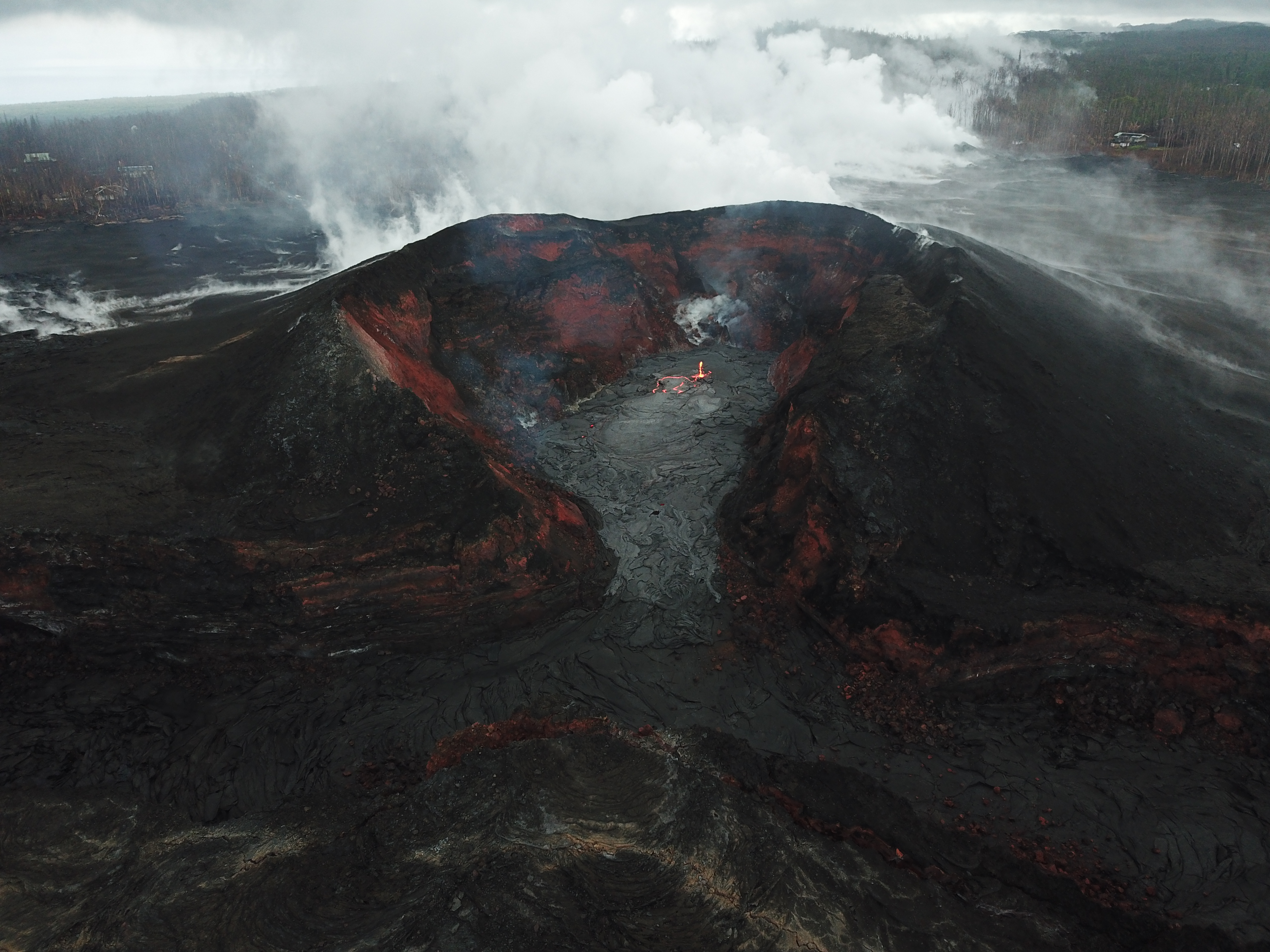
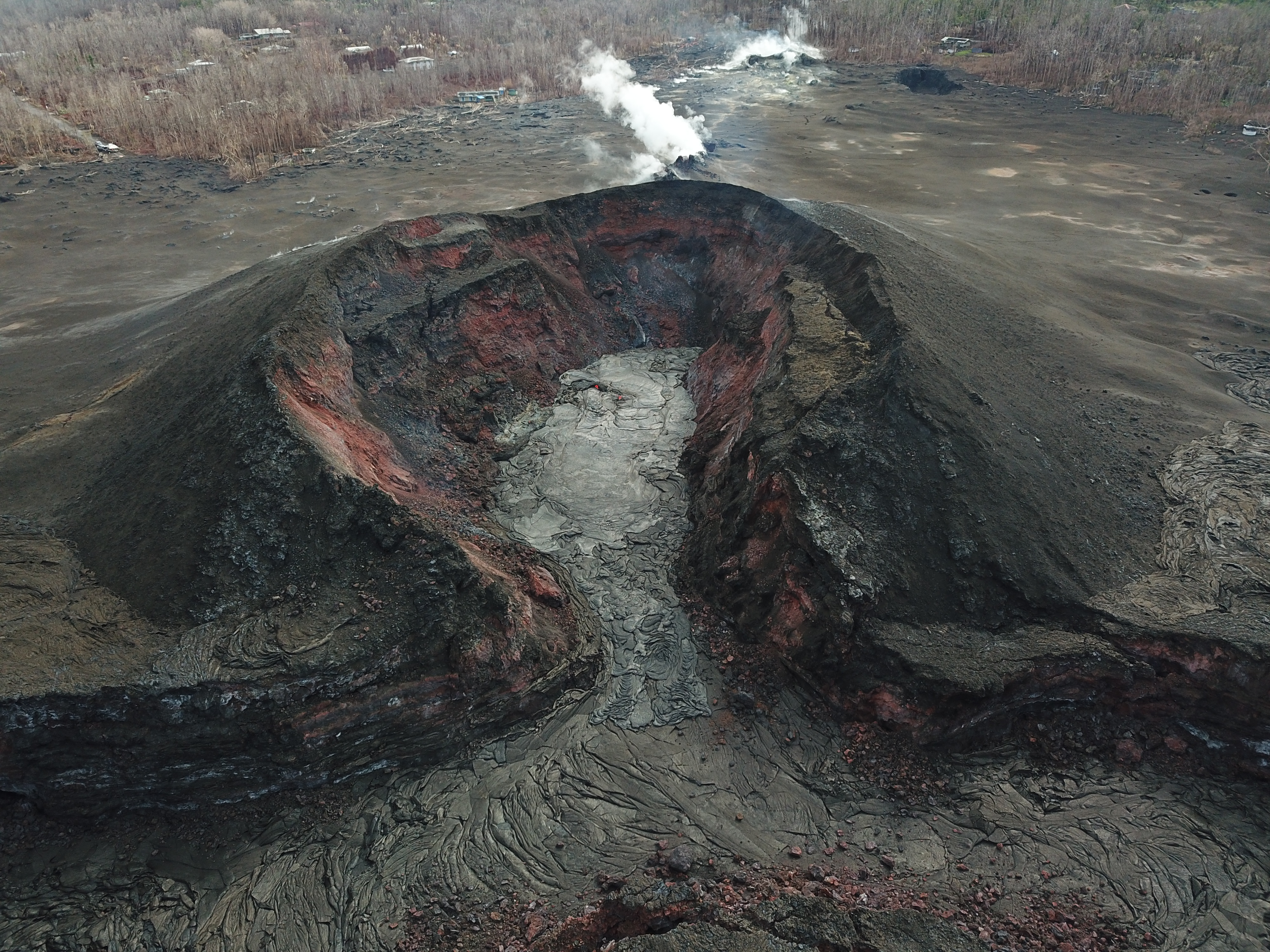
On USGSVolcanoes’ Facebook page, someone asked for scale on a photo of Fissure 8’s cone. The reply:
“I can give you some dimensions, if that helps. Measuring the cone’s rim, fissure 8 is about 320 ft wide by 450 ft long. The height of the cone wall (measuring from the lava pad inside fissure 8 to the highest point on the rim) is about 130 ft. If you zoom in at the upper left, you will see some houses, which provides some sense of scale.”

Yes! Exactly right! There's a lot of iron in the basaltic lava erupted by Hawaiian volcanoes…
— USGS Volcanoes🌋 (@USGSVolcanoes) September 4, 2018
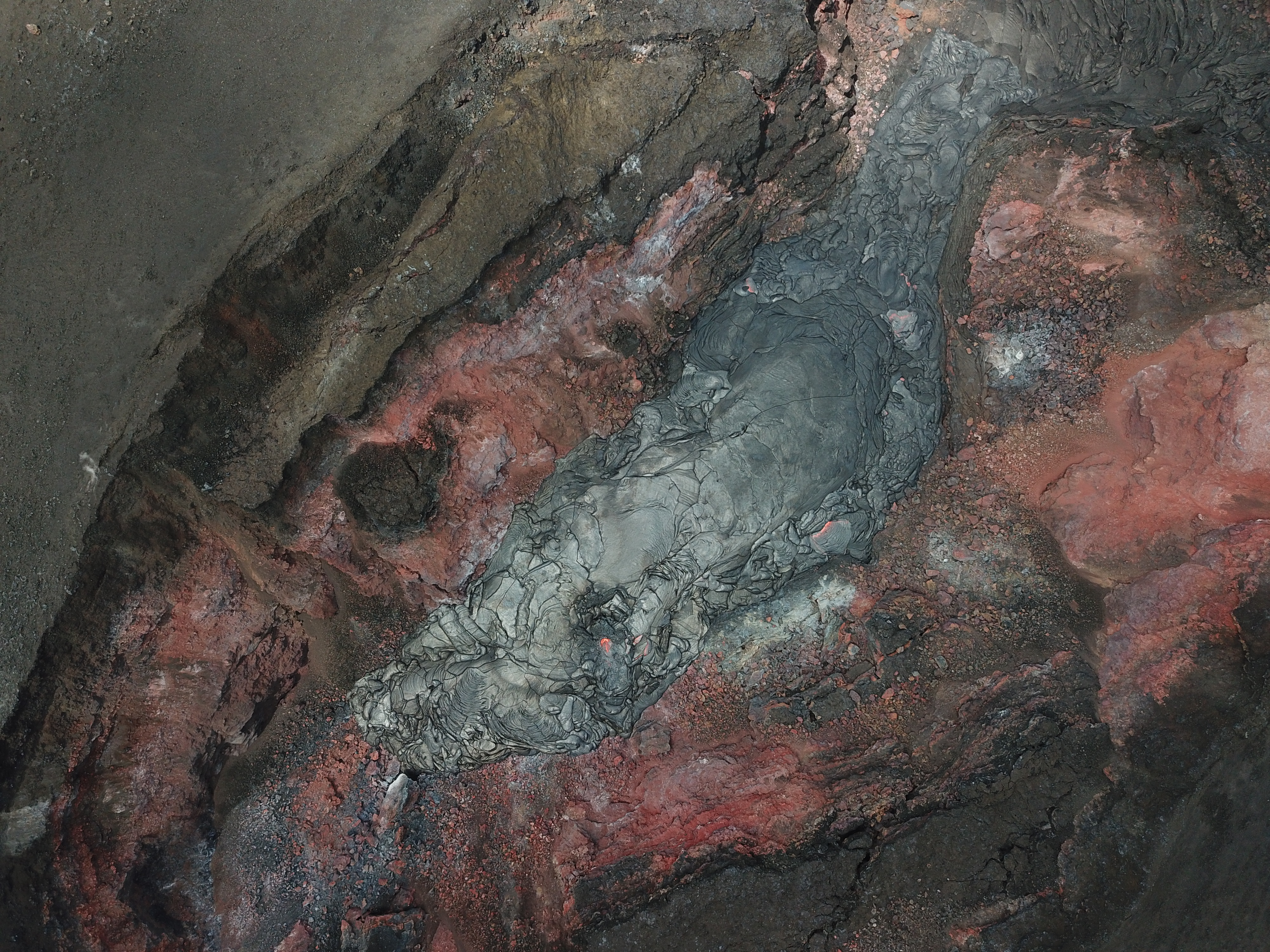
No. the lava flow is effectively dead, although there might still be molten pockets here and there (lava is a very good insulator). The Fissure 8 lava is upwelling from just beneath the cone.
— USGS Volcanoes🌋 (@USGSVolcanoes) September 4, 2018
Here’s a few videos from drone overflights this week. All 3 videos (including one above) with descriptions posted on HVO website: [Sep 3][Sep 4] [Sep 5]
A cone within a cone, spies the drone; video from fissure 8, #Kilauea Volcano’s #LERZ. https://t.co/8H3h3ABmP9 pic.twitter.com/V4XDiMBJv6
— USGS Volcanoes🌋 (@USGSVolcanoes) September 5, 2018
Surface deformation, seismicity and gases are all still low. The activity seems very localized to fissure 8, with a few sluggish flows that haven't left the confines of the cinder cone. Not a reactivation but a reminder to remain vigilant.
— USGS Volcanoes🌋 (@USGSVolcanoes) September 6, 2018
Watch the little cone grow, in this short video from inside fissure 8, on #Kilauea Volcano's #LERZ. It's 10-13 ft high! https://t.co/qy2rtfKc5m pic.twitter.com/fJZ9ljgJwA
— USGS Volcanoes🌋 (@USGSVolcanoes) September 6, 2018
From Local News Media
There was a Wednesday Pahoa community meeting with a brief USGS presentation, showing tiltmeters recording very minor reinflation of middle East Rift Zone:
BIVN also summarized and posted videos of the rest of the hour-long Wednesday meeting.
More eruption updates in the news:
- BIVN [Sep 9]: “Hawaii Volcano Update — Collapses Observed at Pu’u O’o“
- HSA [Sep 7]: “Baby volcanic cone develops within Kilauea’s fissure 8; small glow visible overnight”
- HTH [Sep 5]: “Kilauea’s sulfur dioxide emissions drop to lowest level in 11 years”
- BIVN [Sep 4]: “Volcano Update: Lava Filling Crater In Fissure 8 Cone“
And ongoing eruption impacts/recovery:
- HSA: “Severely damaged Jaggar Museum may have to relocate”
- HTH: “‘Highly unlikely’ Jaggar Museum will reopen“
- BIVN [Sep 7]: “VIDEO: Press Conference – Some Puna Restrictions Lifted This Weekend”
- HSA: “MacKenzie to reopen on Big Island, providing access to newly created beaches“
- HTH: “DLNR: MacKenzie park to reopen Saturday”
- HTH [Sep 9]: “Residents flock to MacKenzie to relax, see new beach”
- HTH: “County preps to reopen Isaac Hale”
- HNN: “Mandatory evacuation of lava-ravaged Leilani Estates lifted“
- HSA: “Evacuated Leilani Estates residents cleared to return home“
- HTH: “Mandatory evacuation pau: Leilani Estates residents being allowed to return home starting today“
- HNN: “‘A mixture of joy and sadness’ as Leilani Estates residents return home after eruption“
- HSA: “Leilani Estates residents return home in evacuation zone“
- HNN: “Big Island landowner plans 940 new homes in Puna after devastating lava flows“
- HTH: “State law change may be needed for redevelopment agency“
- And Dispatches From Volcano posts a lovely dawn photo of the summit, as well as a “birthday” photo of Fissure 8 when it opened 4 months ago.
From Other Photographers/Social Media
so Puʻu ʻŌʻō sent out a plume yesterday? It made me curious so I checked the thermals. Here she is side by side with #Kilauea. Puu is on the left, Killy on right.#kilaueaerupts #Puna #lowerpuna #Pahoa #LERZ #BigIsland pic.twitter.com/I7shbHQHEY
— Tay Austin (@Jasamsdestiny) September 10, 2018