July 31, 2018. USGS: “The fissure 8 ocean entry and laze plume as they appeared at sunrise this morning. The Pohoiki boat ramp is visible just below the plume (slightly left of center).” (Full-sized)
89 days. That’s how long it’s been since the first fissure started spattering lava in Leilani Estates. Which is one day longer than the 1955 Kapoho eruption, which had been the longest LERZ eruption since records started being kept.
July 31, 2018. USGS: ” In this aerial view, taken during HVO’s overflight this morning, you can follow the lava channel from fissure 8 (gas plume visible in far distance) as it wends its way toward Kapoho Crater (lower left), where it then heads south toward the ocean.” (Full-sized)
Today’s Eruption Summary
LERZ erupton as per usual. There’s “ooze-outs” of lava on the flow margin, but further inland from Pohoiki. Today’s M5.3 summit collapse was at 7:59 am, when the crater was steaming in the cool morning air.
From HVO, the livestream caught the pressure wave passing through the cloud:
From the NE Caldera Rim livestream, ground shaking and rockfalls were more visible:
HVO/USGS has updated and reorganized their 2018 Activity page, with FAQs, resources, and links to photos and videos.
Here’s a couple USGS photos of that growing cliff in the background:
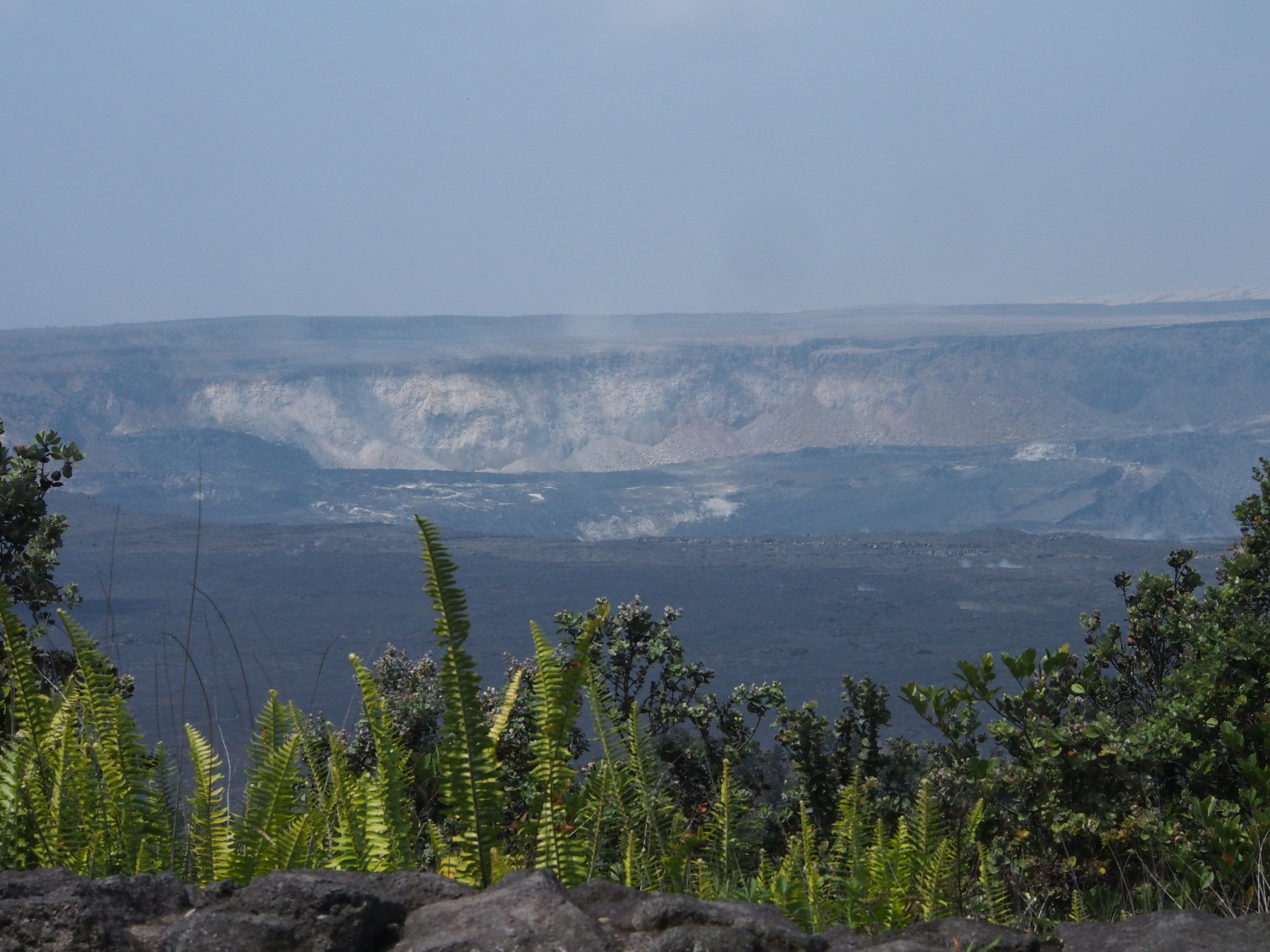
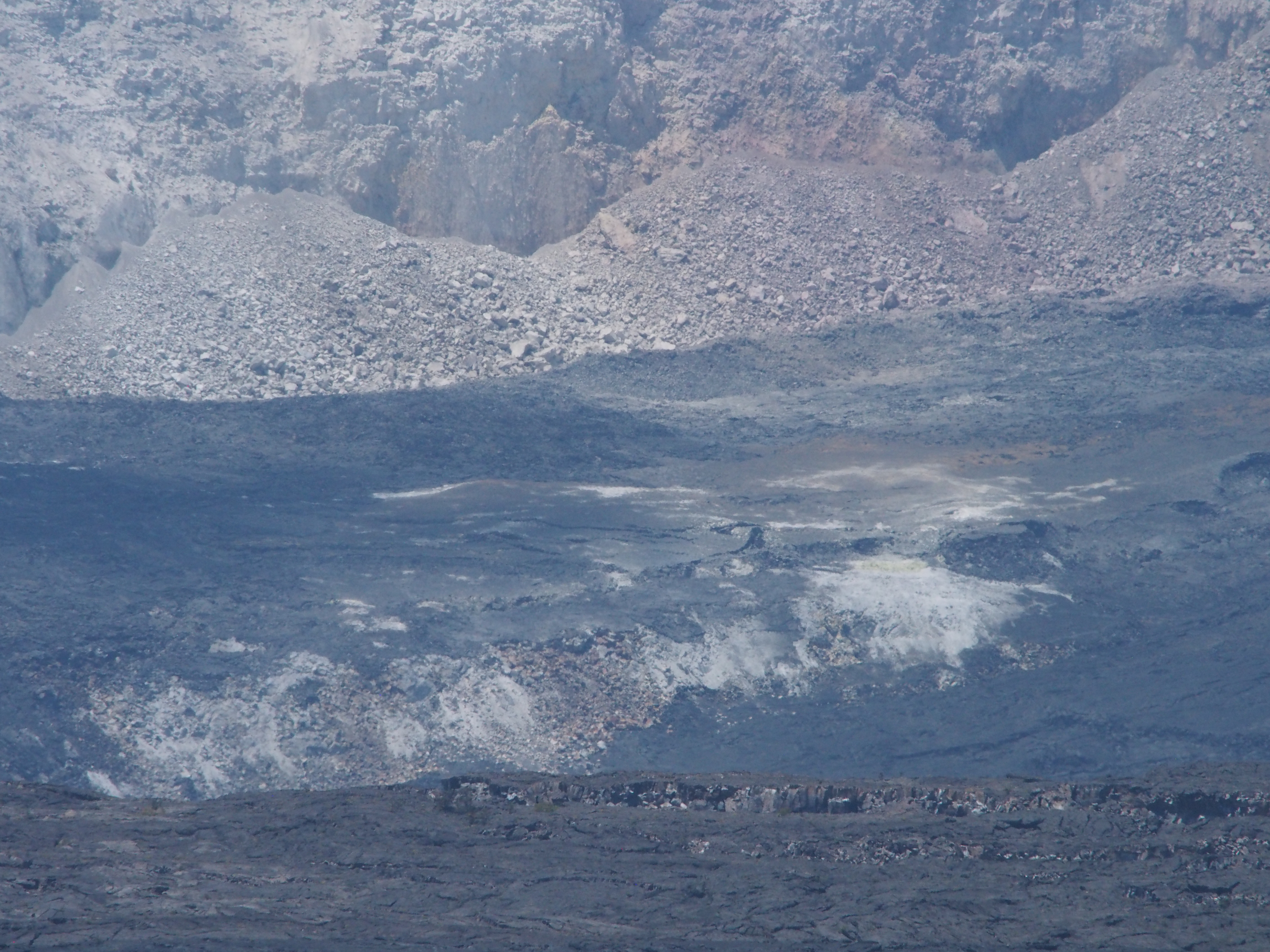
July 31, 2018. USGS: “Kīlauea Volcano’s most recent summit collapse occurred at 8:00 a.m. HST today (July 31). South Sulphur Bank, a cliff of altered, light-colored rock now more than 80 m (260 ft) high, is visible on the far caldera wall. Another area of altered rock that’s being exposed as part of the caldera floor drops is visible near the center of this image.” (Full-sized)July 31, 2018. USGS: ” A closer view of the area of altered rock that is being exposed as the caldera floor to the right drops down.” (Full-sized)
Here’s those “ooze-outs” along the SW margin of the flow, far enough inland that they’re not threatening Pohoiki:
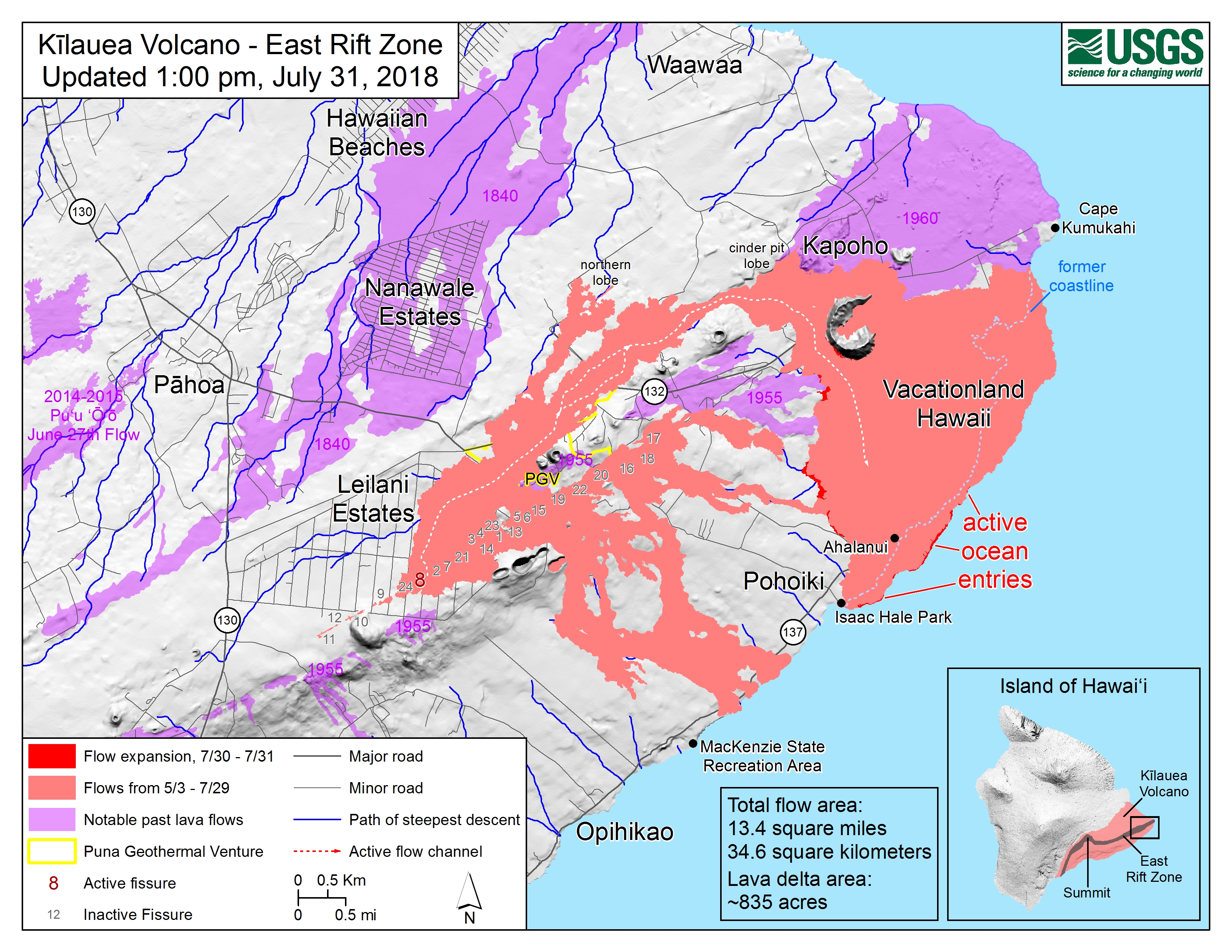
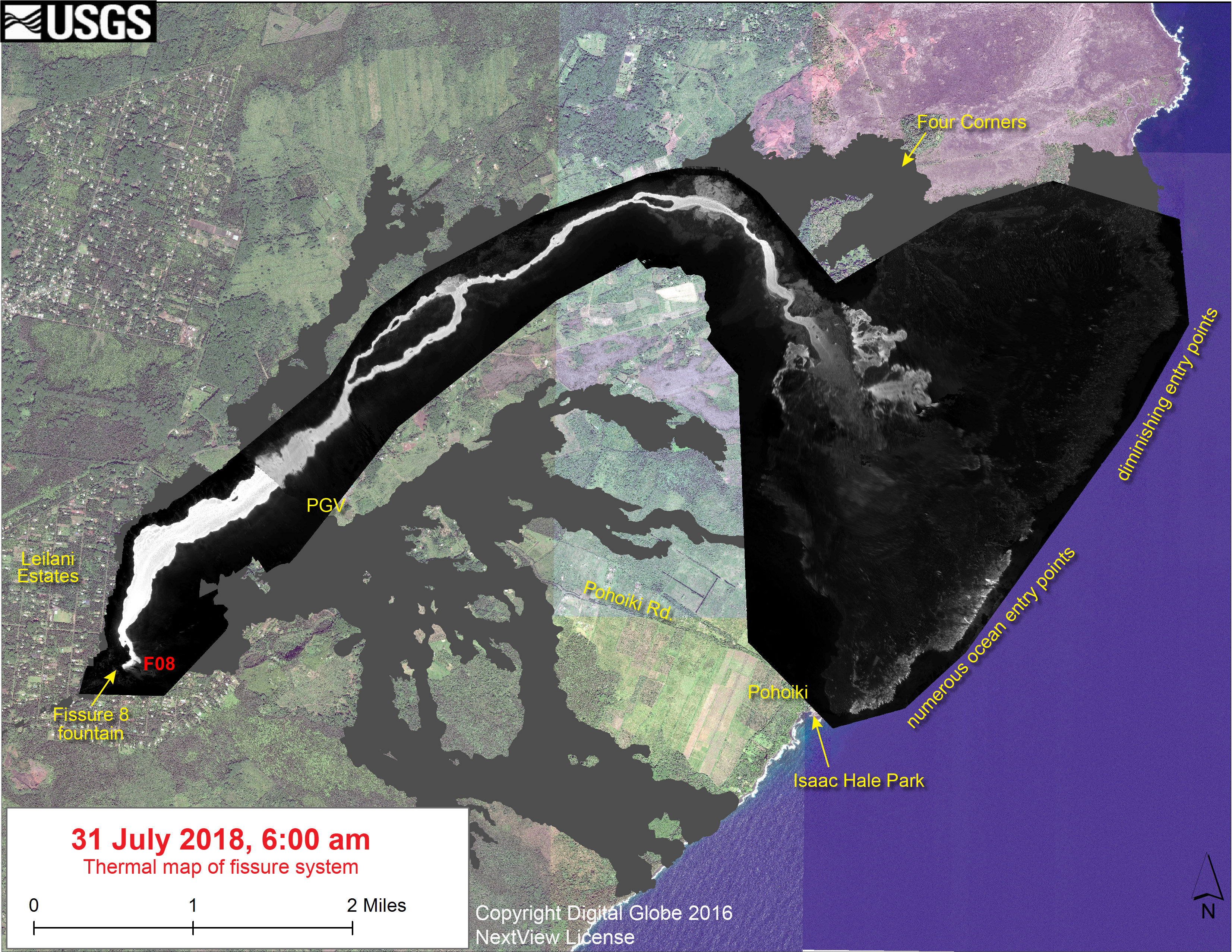
July 31, 2018. USGS map of LERZ as of 1 pm. (Full-sized)July 31, 2018. USGS thermal map of LERZ at 6 am. (Full-sized)