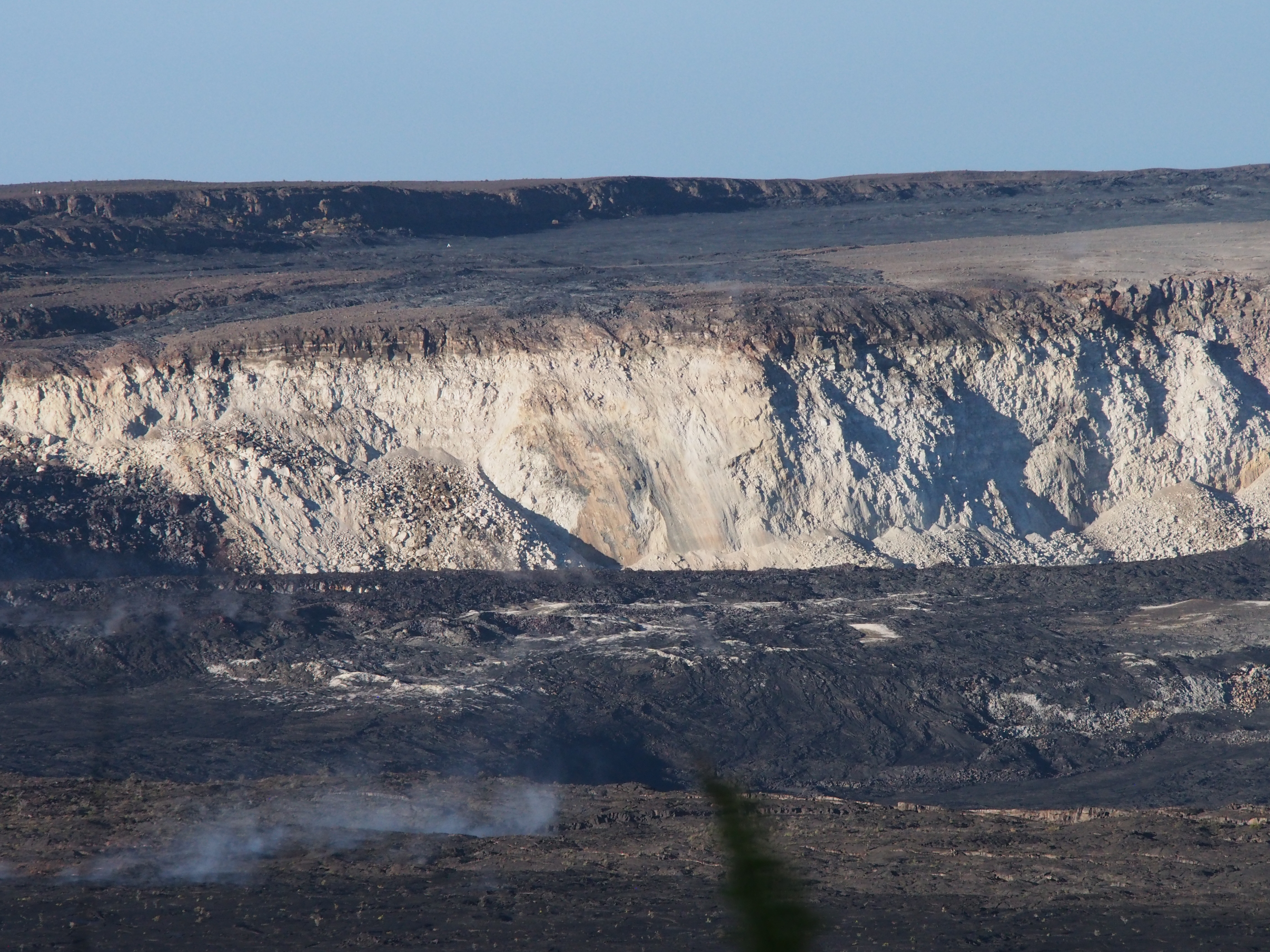
Before and after: a new aerial photo of HVO on the rim of Kīlauea Caldera shows how greatly Halemaʻumaʻu has changed. For comparison, I found this 2008 photo in the USGS archives:

And here’s today’s overflight photo, from farther away.

The scientists of HVO had to abandon their 100-year-old observatory on the caldera rim mid-May. During the summer session, the University of Hilo was able to provide them with plenty of space for a temporary HQ. With fall term around the corner, HVO has leased part of the U.S. Customs Building in Hilo while they seek a more permanent solution. Because if and when the summit stabilizes, the old observatory will have to be rebuilt, or at the very least, will require massive repairs.
Speaking of the summit, today’s collapse event was at 12:10 pm, energy equivalent of M5.4. I captured the rockfalls 3-4 minutes before, as well as the actual summit collapse:
The clock on the Northeast Caldera Rim livestream is about a minute fast, but it’s so tiny you can’t see it anyway. The actual collapse starts about 1:30 into this video:
No changes on the Lower East Rift Zone eruption today.
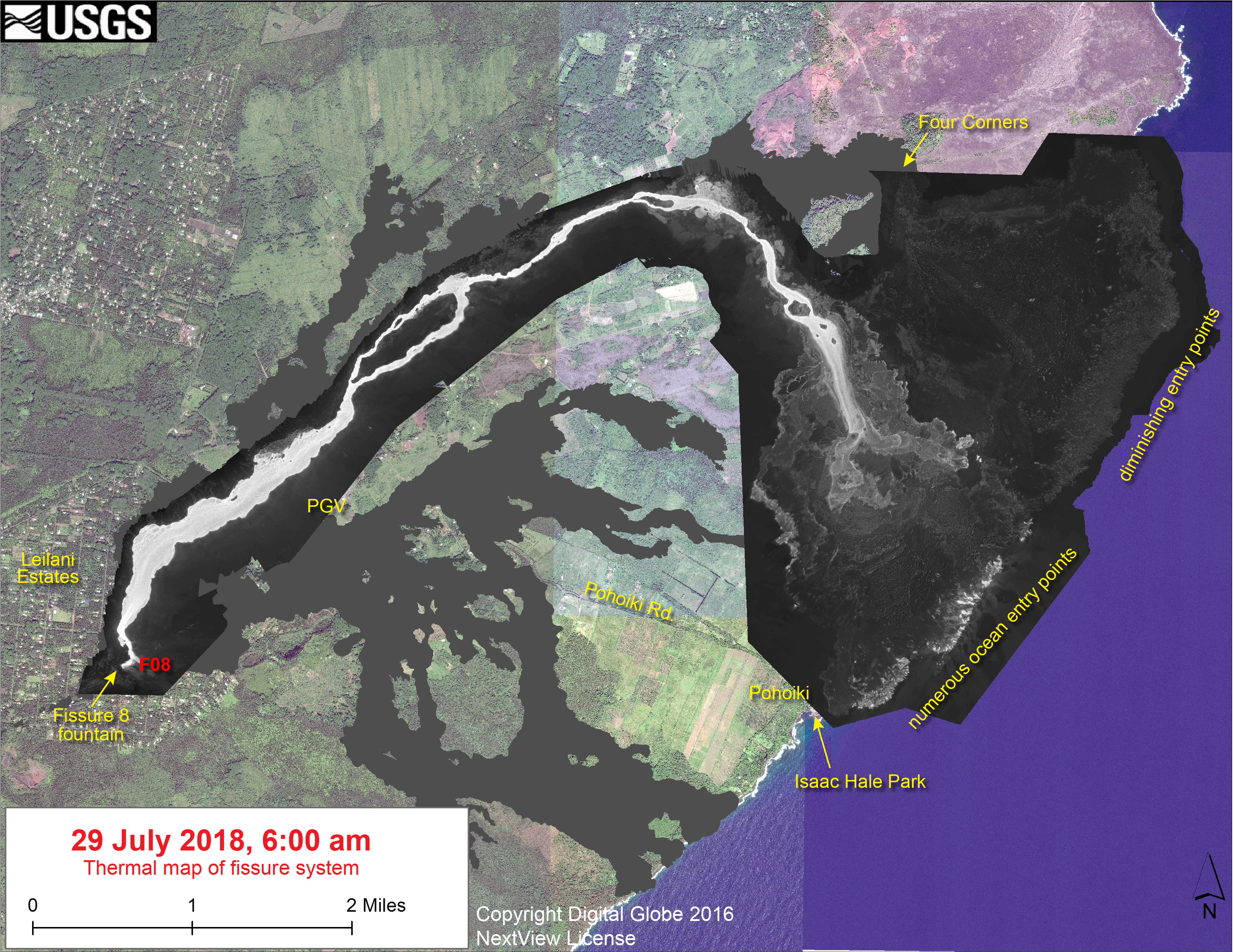
Here’s the other HVO images for July 29 (as usual, I’m mirroring them because the HVO “Photo and Video Chronology” page only shows the 20 most recent entries, making images older than two weeks somewhat inaccessible.)
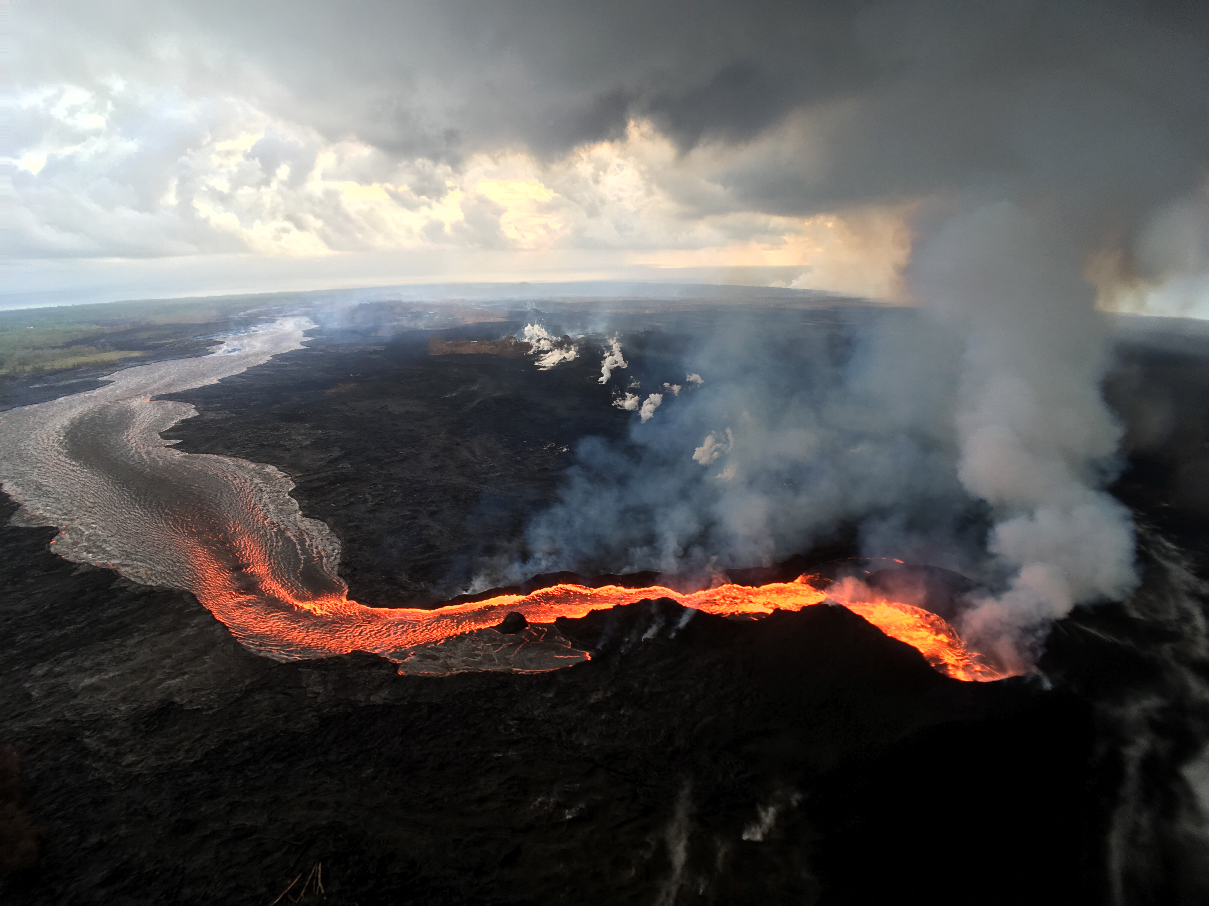

Additional Fissure 8 lava channel photos and observations may be found on Bruce Omori’s Facebook page today, including:
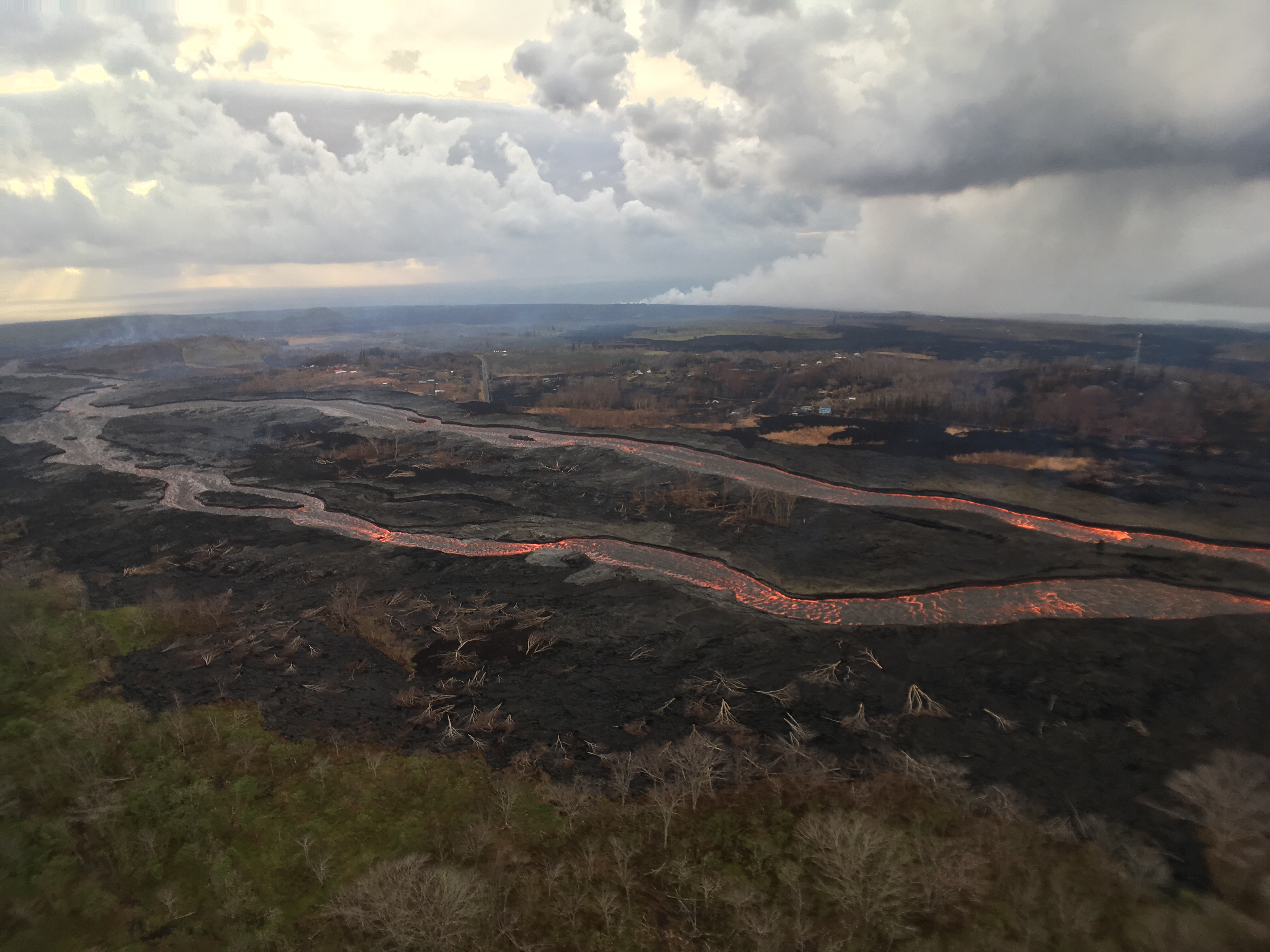
Sunday, July 29, 2018, 6:00 am – Kilauea's lower east rift zone overflight: The braided channel and area affected by the brush fire yesterday.
Posted by Extreme Exposure Fine Art Gallery on Sunday, July 29, 2018
Yesterday a brushfire was triggered by an overflow on the south side of the channel.
I was peering at this photo trying to see — yes, I’m sorry to report that John & David’s house was one of the houses that burned yesterday, confirmed on their GoFundMe page. They’re just two of the many, many people who have suffered through all this, but I feel like I was their guest, since they allowed us watch the first 2-3 weeks of this eruption from their front porch via livestream.
There were other houses around theirs lost in that brushfire as well. I hope that makes it slightly easier to collect insurance, since it’s fire loss not lava.
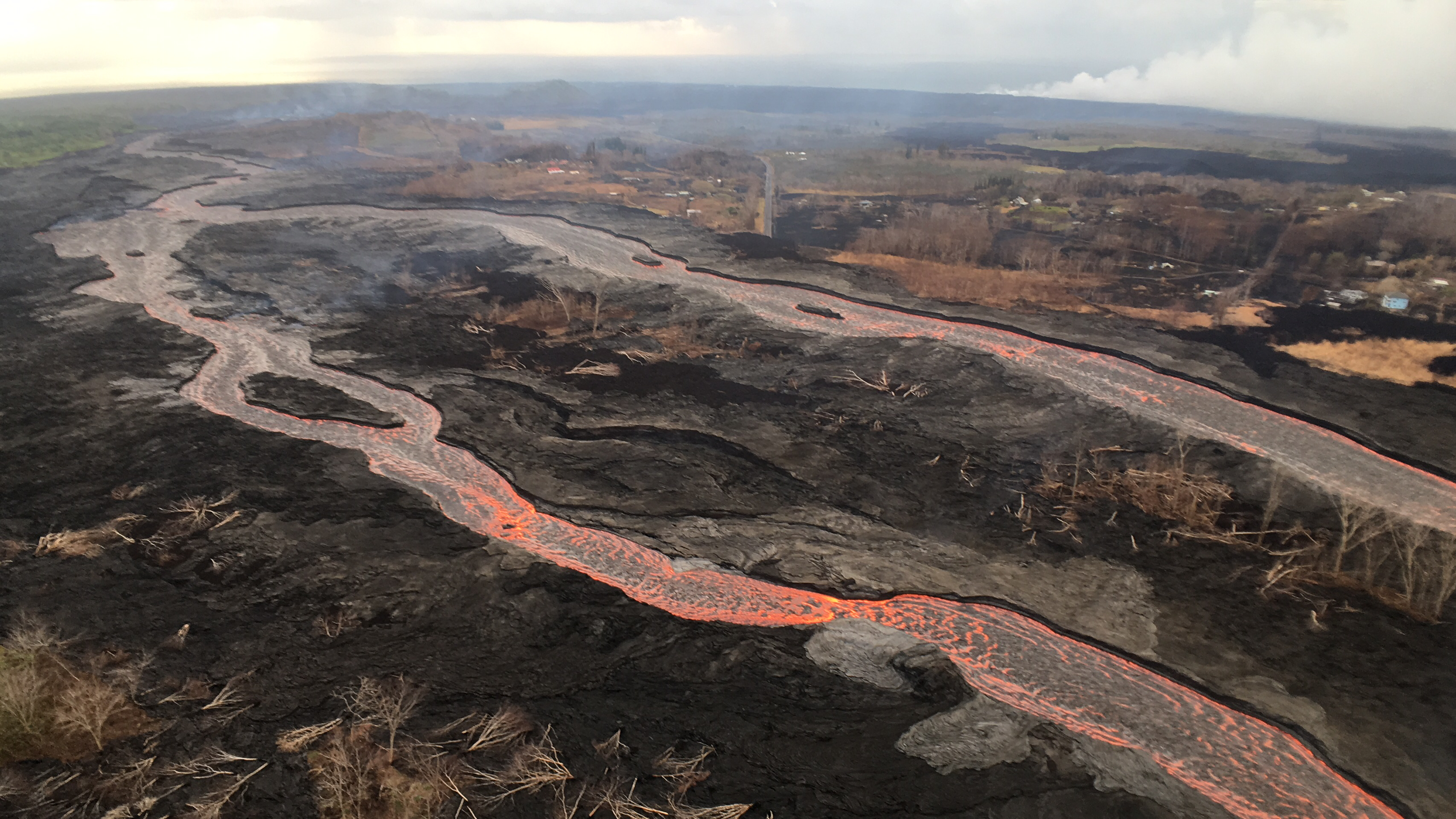
Here’s the overflow responsible for this mini tragedy within the larger disaster:
Sunday, July 29, 2018, 6:00 am – Kilauea's lower east rift zone overflight: Center of the frame shows the breach that started the brush fire.
Posted by Extreme Exposure Fine Art Gallery on Monday, July 30, 2018
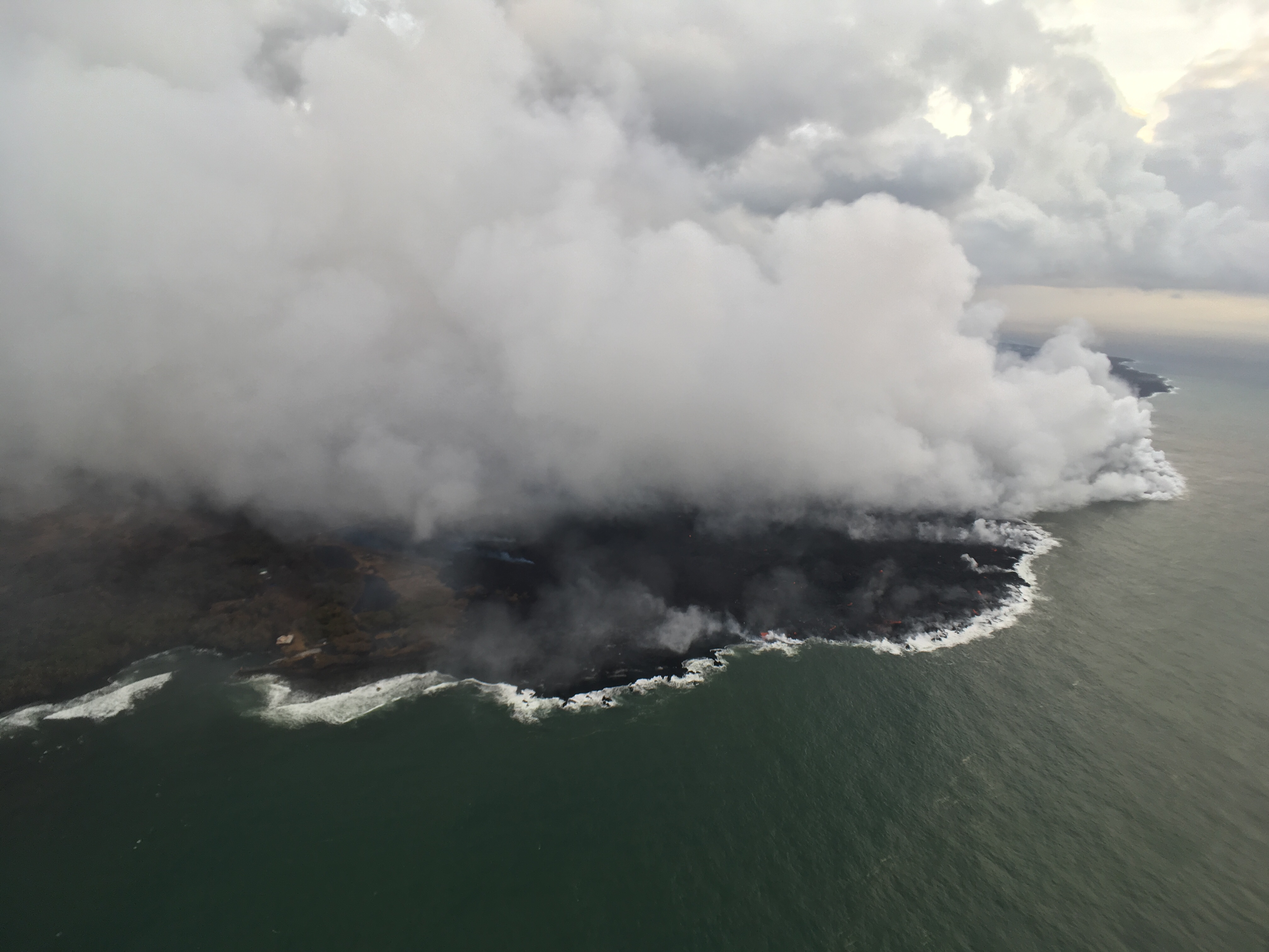
And the beautiful, terrible source of so much trouble:
Sunday, July 29, 2018, 6:00 am – Kilauea's lower east rift zone overflight: This very hazy photo shows how the lava…
Posted by Extreme Exposure Fine Art Gallery on Monday, July 30, 2018