Today’s Eruption Summary
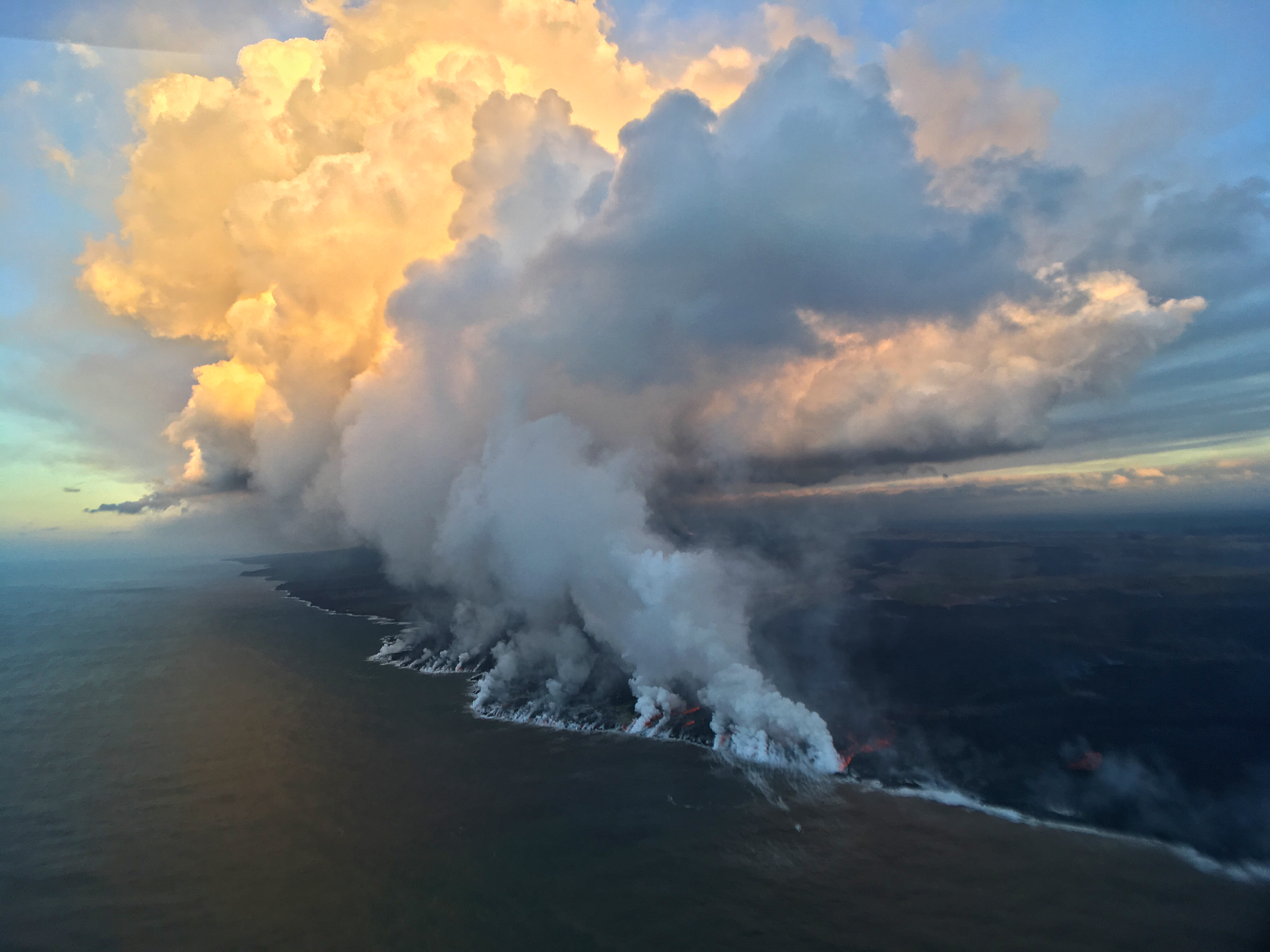
As we approach the 3-month mark— or pass it, since Puʻu ʻŌʻō’s floor collapsed 3 months ago this past Monday— Kīlauea’s 2018 eruption continues with no significant changes. During the USGS morning overflight, the lava’s southwestern margin was holding at less than a tenth of a mile from Pohoiki boat ramp. The vigorous ocean entry continues a few hundred yards to the east. No surges in lava output have been reported at Fissure 8 since Tuesday’s 6:41 am summit collapse.

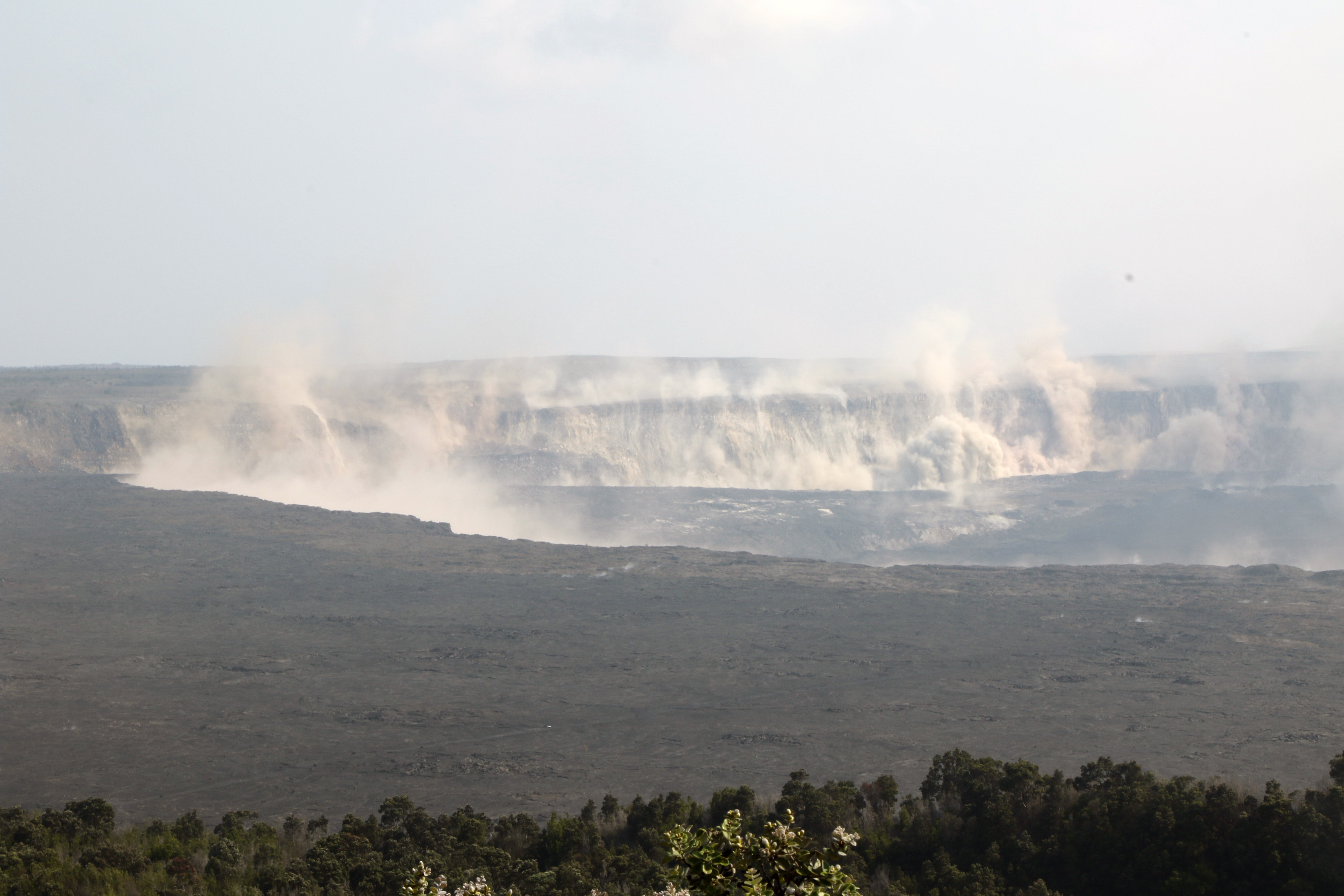
A deceptive moment of tranquility at the new, extensively remodeled summit:

Here’s HVO’s Steve Brantley giving the weekly eruption update at last night’s Pahoa community meeting (I’ll be transcribing it tomorrow or Friday).
He explains that complicated “lavashed” map released earlier this week, which predicts where lava is most likely to go if there’s a breakout along particular stretches of Fissure 8’s lava channel. This is an aid to residents living in neighboring areas not affected by lava now, but who are worried about what might happen if the flow diverts.
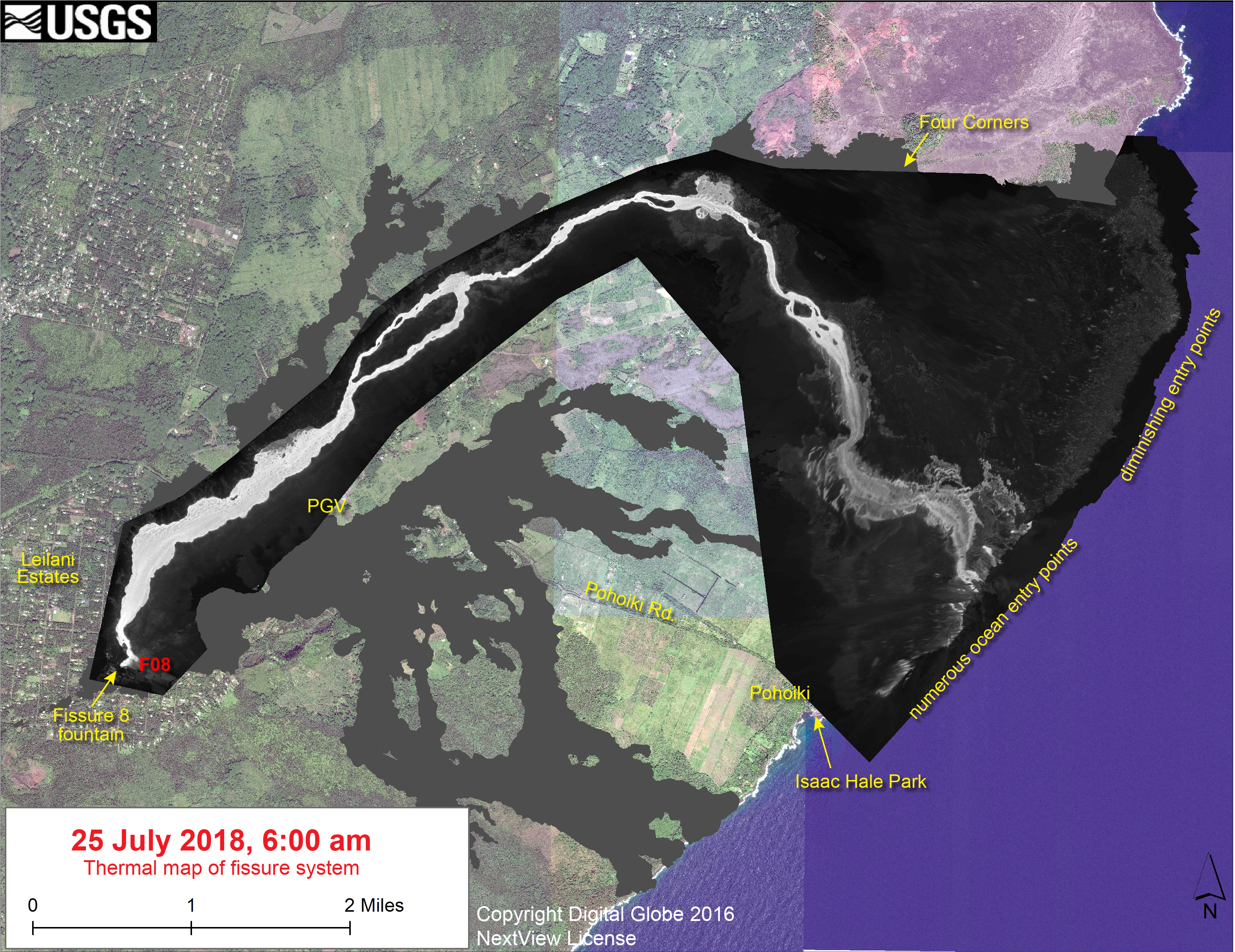
Today’s Lava Flow Maps
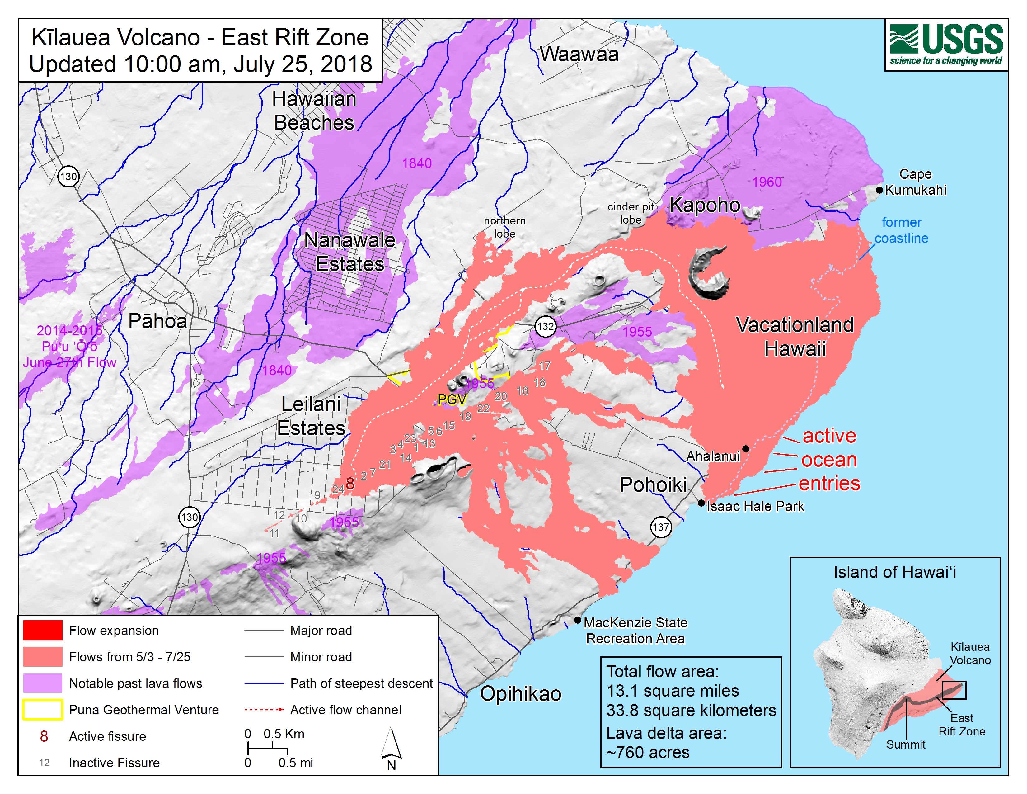
I haven’t checked the totals for a while. Current figures are:
- Total lava flow area: 12.8 square miles, 33.1 kilometers
- Size of delta (new land): about 725 acres
From Other Agencies
Expect delays on Highway 11 near mile marker 30 this evening. @DOTHawaii is looking at recent earthquake damage in preparation for future repairs. Drive carefully! pic.twitter.com/wXZEgGCsTP
— Hawaii Volcanoes NPS (@Volcanoes_NPS) July 26, 2018
From Local News Outlets
- BIN: “PHOTOS, VIDEOS: Tour of Leilani Estates [July 24]“
- BIVN: “6 pm Eruption Update — Lava Remains 475 feet from Pohoiki Boat Ramp” — misc eruption news for day
- BIN: “Coastline Inspected for Turtles Threatened By Lava” — barn door, horse?
- HTH: “City Council to consider resolution to rename Fissure 8” – not renaming, really; the fissures were numbered so HVO scientists could record their data, but USGS does not choose official place names; that’s up to locals
- HNN: “Big Island couple who sued insurer for not covering lava damage could be the first of many”
- KITV: “First lava lawsuit filed against insurer“
- HNN: “What’s causing the near-daily collapses and ‘earthquakes’ at Halemaumau?” — if you’re just tuning in, here’s a good brief explainer
- And Dispatches From Volcano advocates civil discourse, which is more on-topic for this eruption than one might think
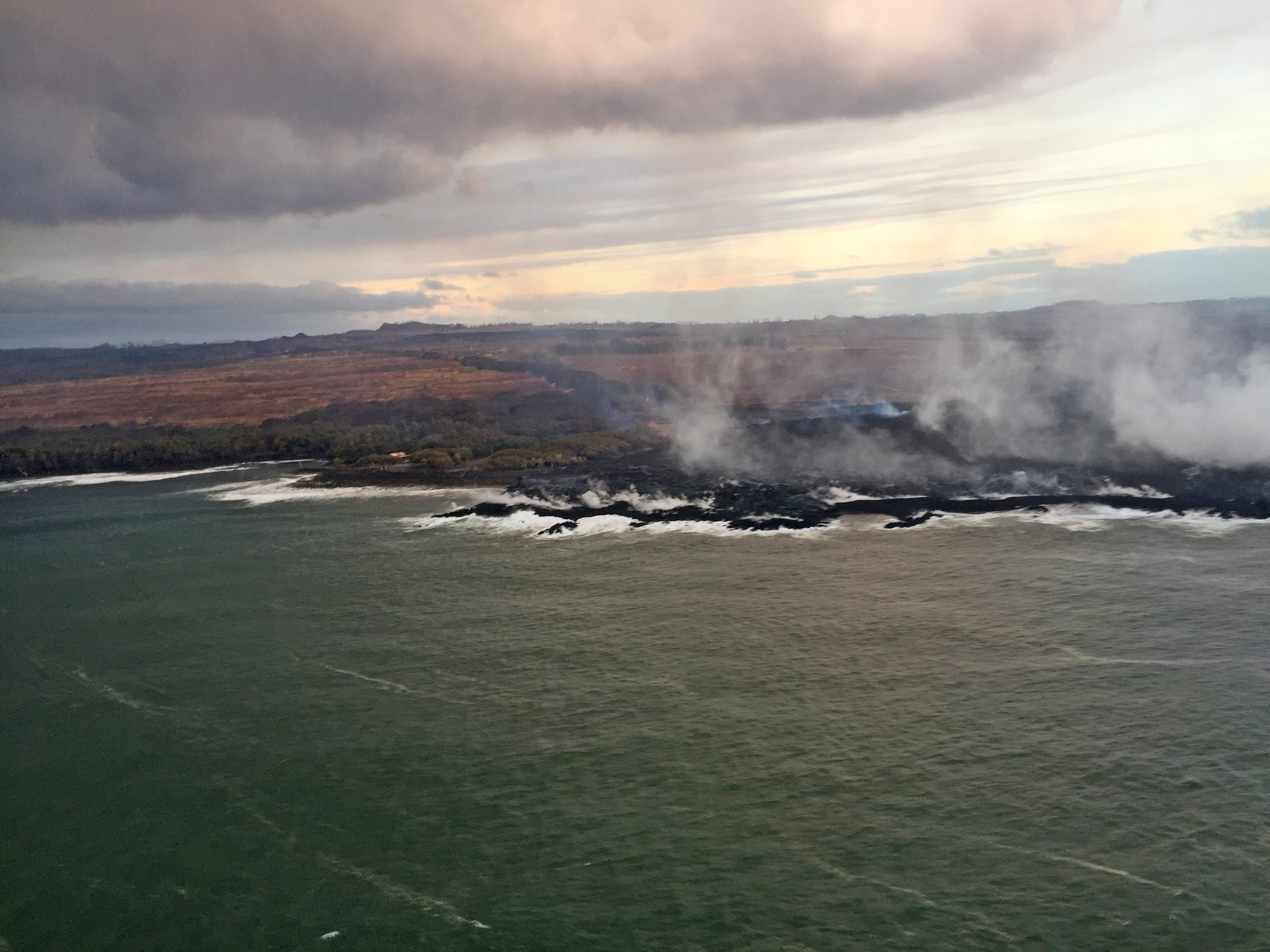
6AM Overflight Photos from Bruce Omori
Wednesday, July 25, 2018, 6:00 am – Kilauea's lower east rift zone overflight: The perched channel adjacent to PGV…
Posted by Extreme Exposure Fine Art Gallery on Wednesday, July 25, 2018
Laze plume finally cleared enough to get a good view of where the lava actually is:
Wednesday, July 25, 2018, 6:00 am – Kilauea's lower east rift zone overflight: Lava advancing in the direction of Dead…
Posted by Extreme Exposure Fine Art Gallery on Wednesday, July 25, 2018
Car-sized chunk of lava floating and hissing away in the open ocean:
Wednesday, July 25, 2018, 6:00 am – Kilauea's lower east rift zone overflight: A floating car-sized chunk of lava, steams wildly, bobbing and hissing until they cool and sink.
Posted by Extreme Exposure Fine Art Gallery on Wednesday, July 25, 2018
- Link: rest of photos for today plus overflight observation notes.
USGS Q&A on Social Media
[I’m learning so much about human psychology, seeing how internet users accuse the scientists trying to monitor this eruption and share what they’ve learned with civil defense and the general public. Personally I’m just interested to learn what was giving the seismologists trouble, so that they had to revise the magnitude estimates for the daily summit collapses of July 22-24. It’s a trivial detail, but I’m fascinated to see the scientific process in action, as geologists grapple with the puzzles and unique characteristics of this eruption.]
USGS: We are accountable for every action taken by our USGS and volcano observatory team. In this case, it was an error of errors in arrival time calculations (they were calculated as fractions of second too long), which artificially inflated magnitudes. Nothing to gain from mistakes.
USGS: Corrections like this are made as we collect more data about the events and our seismologists have more time to analyze it. Here’s a general explanation of why it can be difficult to pin down magnitudes (we don’t usually publish individual rationales): https://www.usgs.gov/faqs/why-do-usgs-earthquake-magnitudes-differ …
[And on the positive side of social media, I wonder if this comment on FB may led to the following photo being posted a little later on the HVO website…]
Jennifer Geraghty: Today’s M3.9 at 3:57 pm was a pretty spectacular collapse of the white scarp (?) at the southeast rim. Can you put together some video of it? It was really amazing on both live cams – especially for an M3!
[Continuing yesterday’s detailed discussion of the Kilauea plumbing diagram. H=Halemaʻumaʻu magma reservoir, K=Keanakakoi, ERZ = East Rift Zone.]
USGS: We don’t know how long it would take to drain the volume of magma in H, K and ERZ because we don’t have precise constraints on the size of all three parts of the system. H may be anywhere from 0.15 to 2.7 cubic km in size.
[What a find!]
FB member Ralph Majorie posted rare film footage of pre-1924 Halemaʻumaʻu and its lava lake on the USGS Volcanoes FB page:
Other Photographers and Social Media
The Weatherboy reminding us, as always, not to take too much pleasure in the beauty of nature and lava, because ground zero is a destroyed community:
As we walk back to our van with a @NationalGuard @ @CivilDefenseHI escort, the ground sparkles a bit; it's completely covered in fiberglass-like strands of volcanic glass known as Pele's Hair. Harmful to touch and even moreso to breathe in. #KilaueaEruption pic.twitter.com/O7lKByUTg1
— the Weatherboy (@theWeatherboy) July 26, 2018
(more photos from this rare visit to Leilani Estates’ evacuation zone on his Twitter)