May 16: Summit Ash and Small “Ballistics”

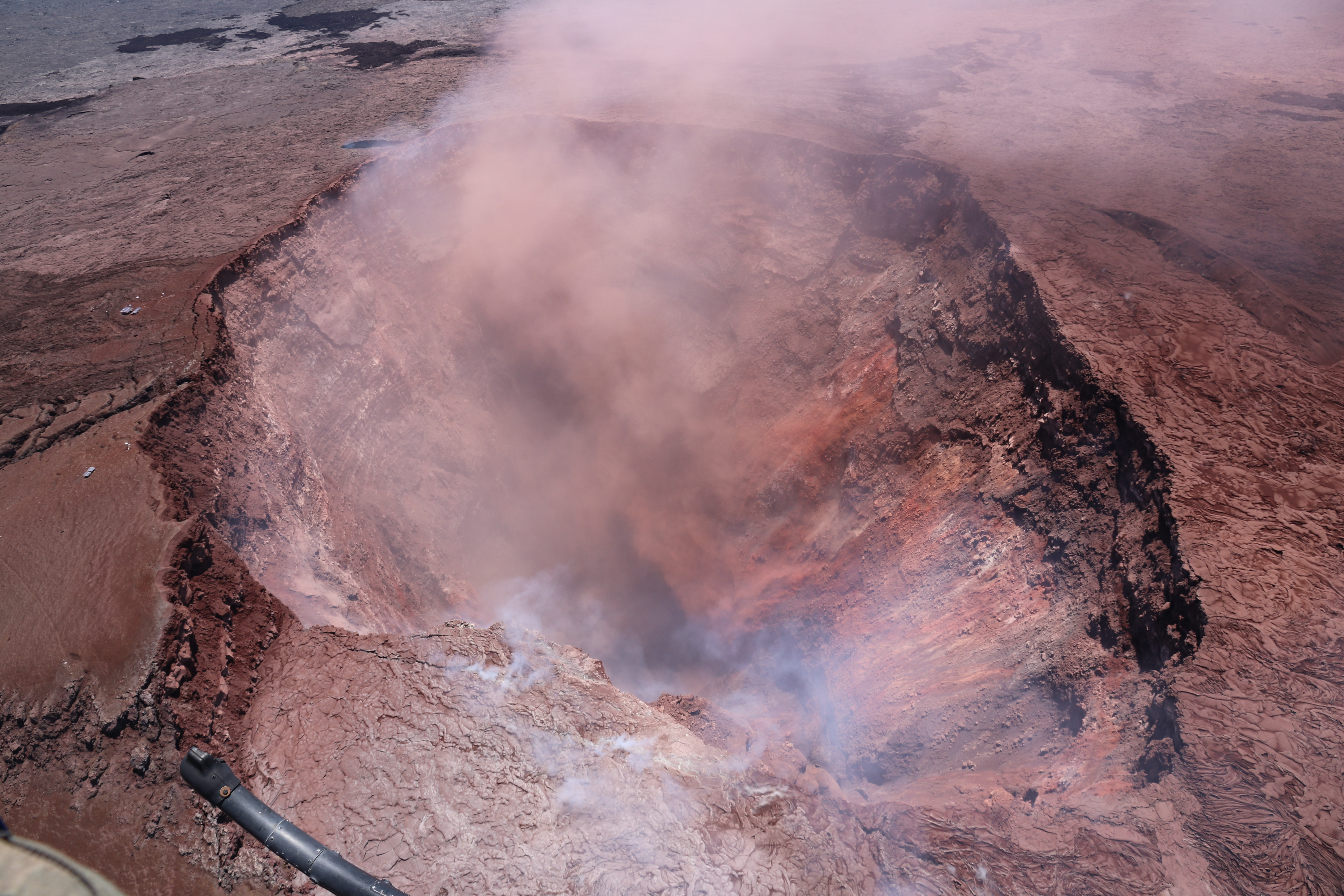
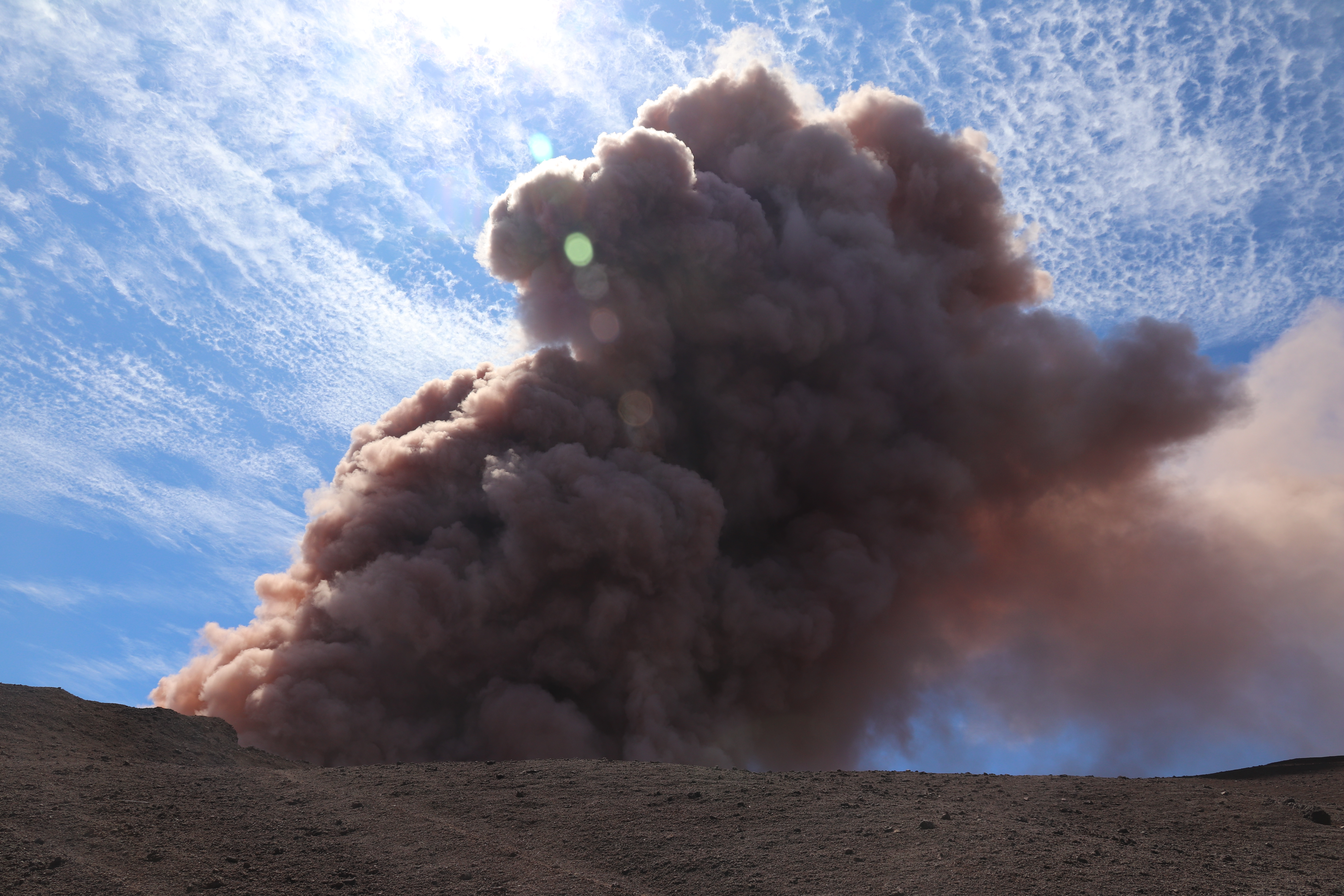
May 16, 8:36 AM, a 4.2 earthquake shook rocks from Halema’uma’u Overlook Crater’s walls that fell into the lava lake, caused an explosion, and sent (according to the USGS)  “dense ballistic blocks up to 60 cm (2 feet) across were found in the parking lot a few hundred yards from Halemaumau.”

USGS photo of “ballistic rocks” found in parking lot next to Halema’uma’u Crater, INSIDE Kilauea Caldera, morning of May 16

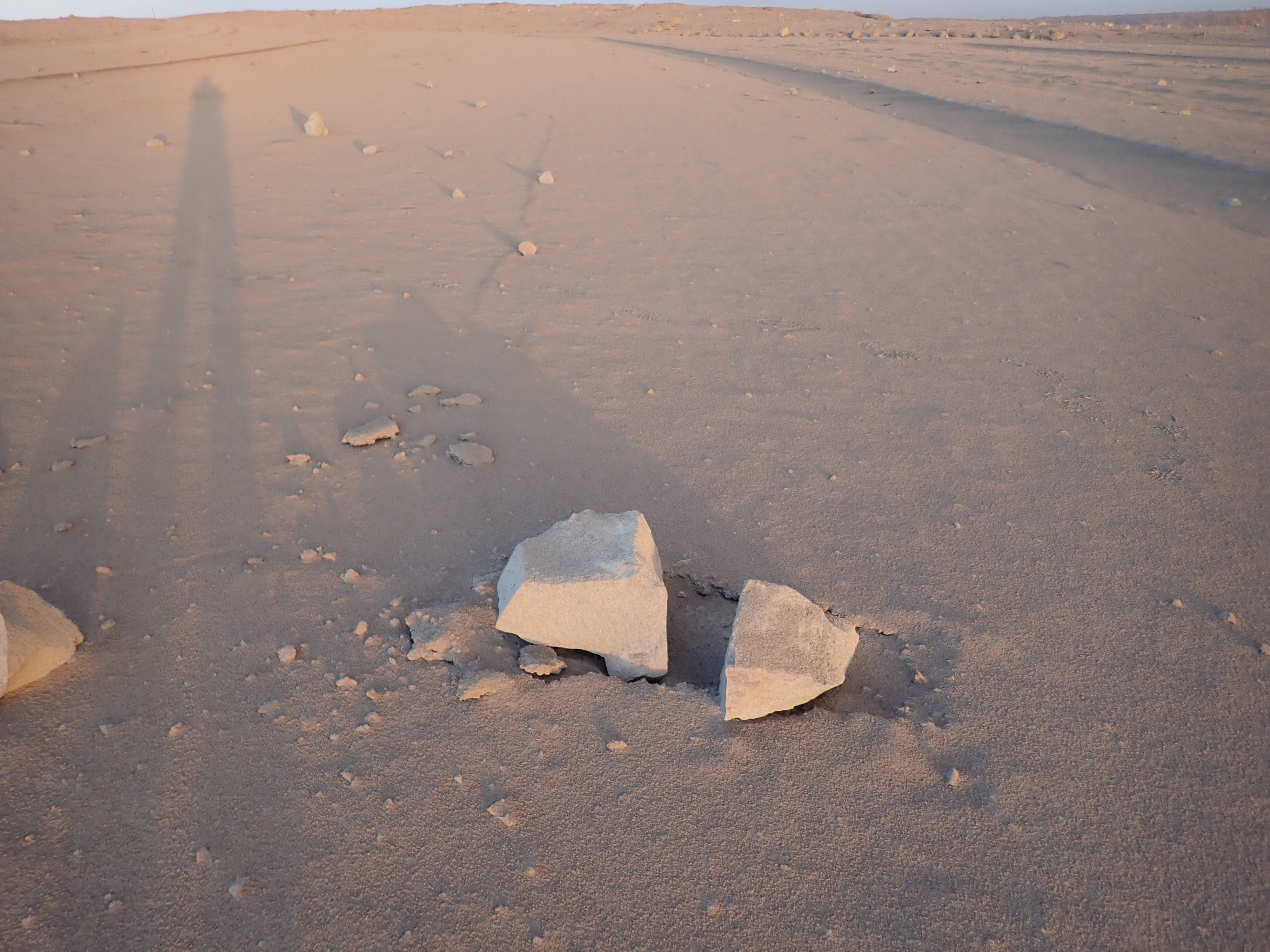
Here they be. They’re ballistic, in that they soar up and down like a cannonball, with the chimney above the lava lake acting sort of like a vertical cannon. But contrary to several headlines I saw, these rocks are not refrigerator-sized.

There is light ash dusting the area and turning it into a moonscape.


May 16: HVO Raises Aviation Color Code to Red

Media freaked out overnight when Hawaii Volcanoes Observatory issued a code red alert following a 12,000 foot tall ash explosion at the summit. The next morning they clarified:

USGS Volcanologist Michelle Coombs (EXCERPT):

So we’ve had some questions about what code red means. It sounds a little bit alarming, It’s really just to say that we see significant amounts of ash from this ongoing activity, and to warn aviators about that ash. It doesn’t mean that a really big eruption is imminent. it’s really just characterizing the aviation situation.


May 15: Still Not the Big One

May 15, 11:05 AM: A major ash explosion up to 12,000 feet — which HVO still guesses was caused by rockfall into the receding lava lake— prompted HVO to raise the aviation alert level to RED, warning aircraft to stay away from the summit and ash hazards.

Unfortunately, news media took this RED ALERT to be “major eruption imminent,” instead of “no more imminent than it already is, since, as a matter of fact, it’s already erupting. But it could increase activity.”

USGS Geologist @DrJanineKrippner has been playing whack-a-mole on Twitter rumors and addressed “Kilauea’s Alert Level Was Just Raised To Red – But What Does That Actually Mean?” on IFLScience, reiterating that it was mostly an aviation alert. So did volcanologist Erik Klemetti, with a good writeup of today’s steam explosions and fissure activity on his Rocky Planet blog.

May 3: Earthquakes, Empty Pu’u O’o

Foggy/rainy weather had limited visibility, but the skies cleared May 3. A USGS overflight revealed the crater was completely drained:

USGS Overflight reveals drained crater of Pu’u O’o. From HVO Photo & Video Chronology blog. Full Size image is worth seeing.

At 10:30 AM, a magnitude-5 earthquake caused more of the crater to collapse, throwing up a cloud of pink ash.

Pu’u O’o crater sends up cloud of ash after M5.0 earthquake. HVO Photo/Video blog. Again, Full-sized image is dramatic.

Pu’u O’o crater sends up cloud of ash after M5.0 earthquake. HVO Photo/Video blog. Again, Full-sized image is dramatic.

See also Mick Kalber’s May 2 flyover video.

Meanwhile, increased seismicity at the summit coincided with the summit lava lake changing from inflation to deflation— this is when it began to drop (source: HVO Volcano Watch).

May 1: Pu’u O’o’s Pink Ash Plume

On May 1st, the night after Pu’u O’o’s floor fell in, the newly-drained crater was sending up a huge plume of pink ash.*

Source: Mick Kalber of Tropical Visions, flying with Paradise Helicopters, annotated by Big Island Video News. Here’s Mick’s observations about this flyover on his vimeo page).

MORE VIDEO, LINKS, INFO ON PLUME:

Continue reading May 1: Pu’u O’o’s Pink Ash Plume