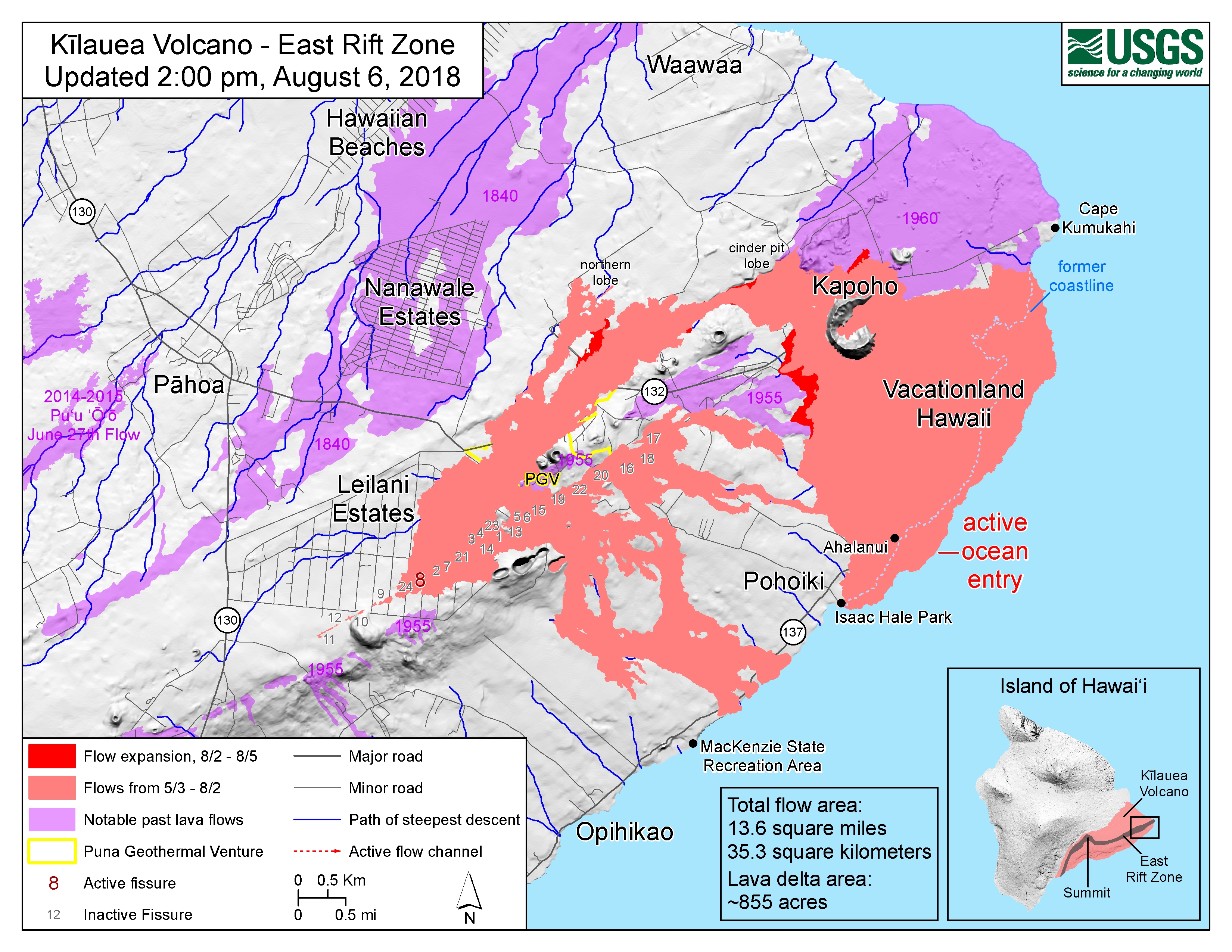
Today’s Eruption Summary
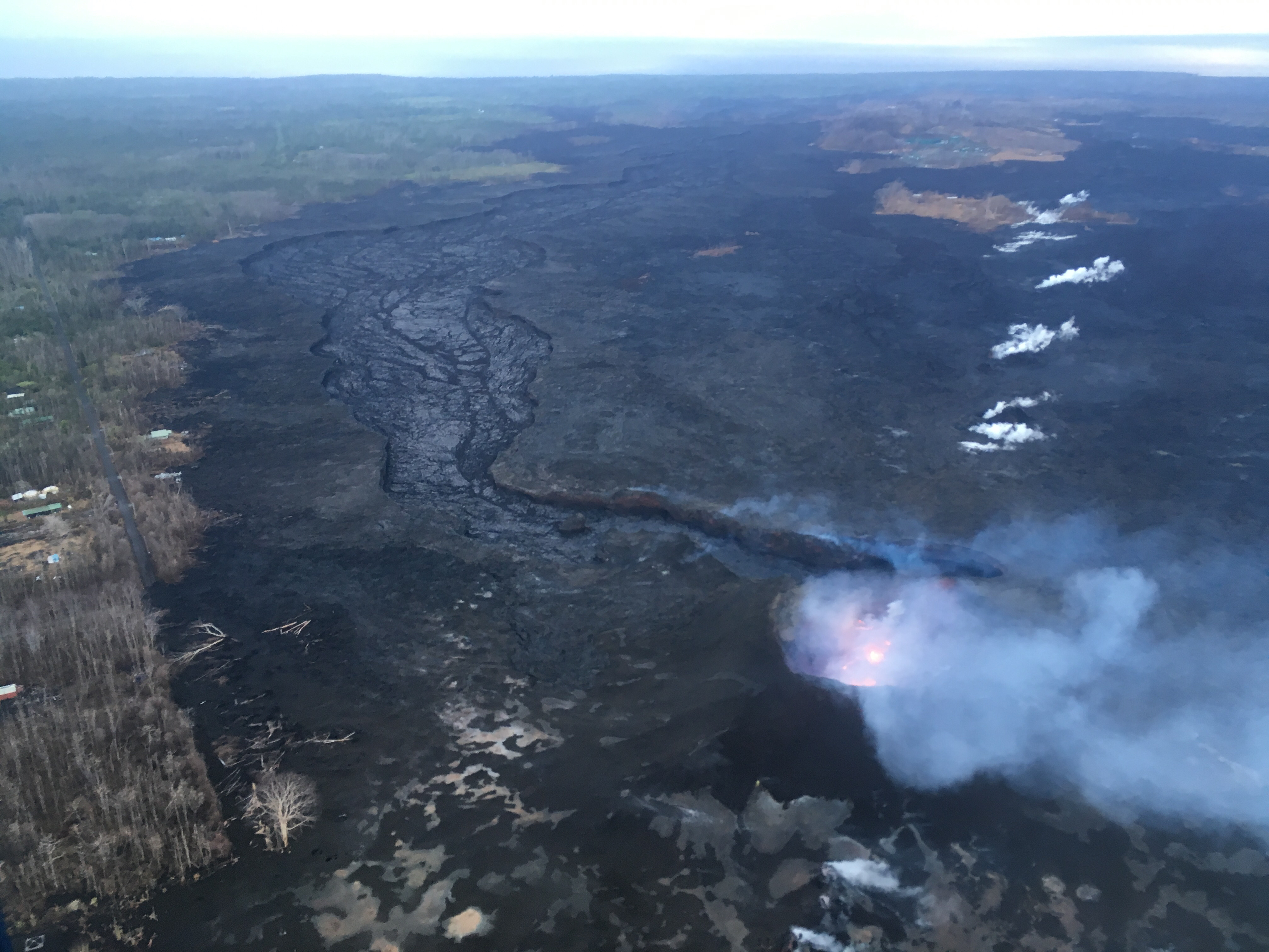
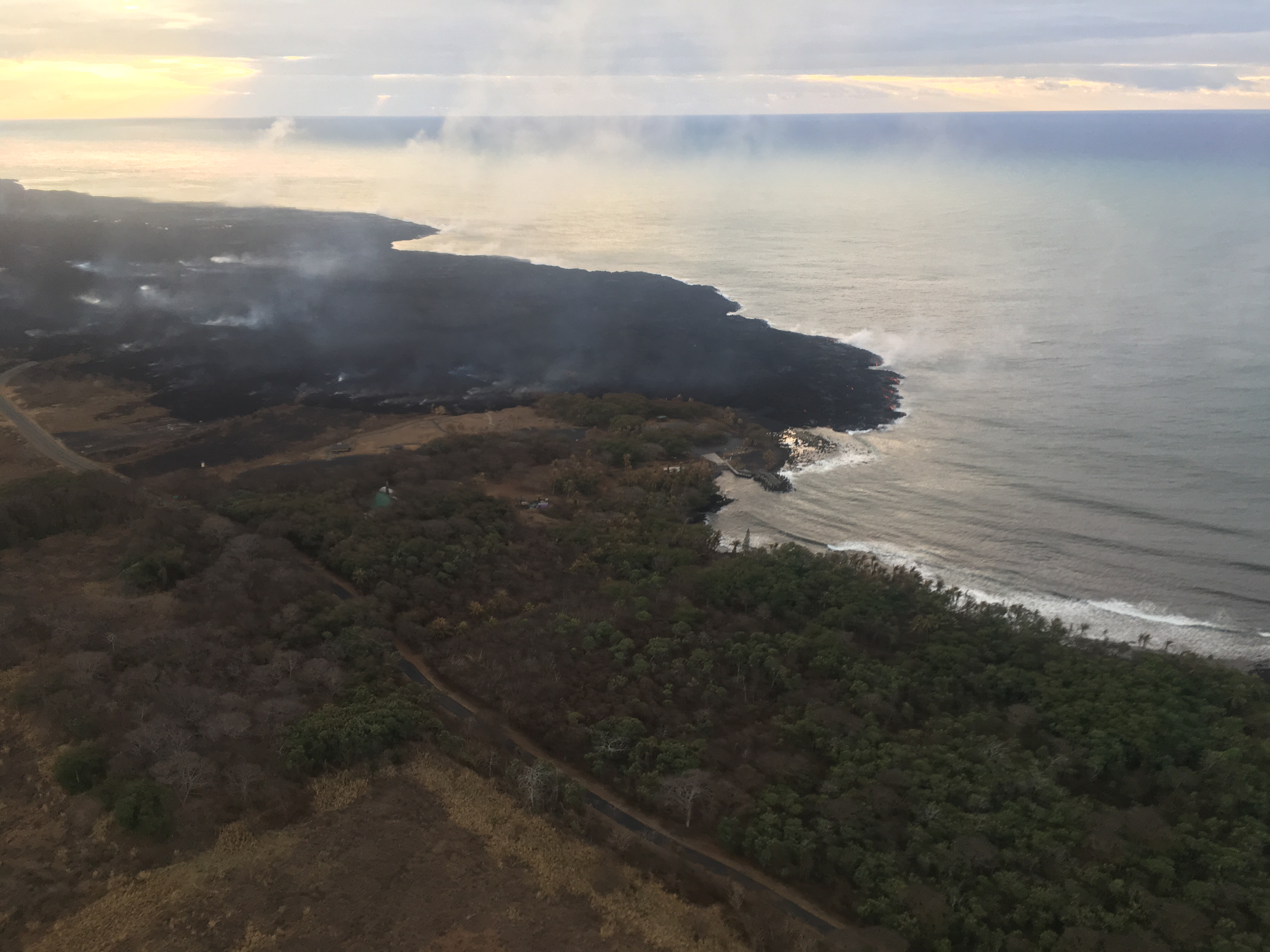
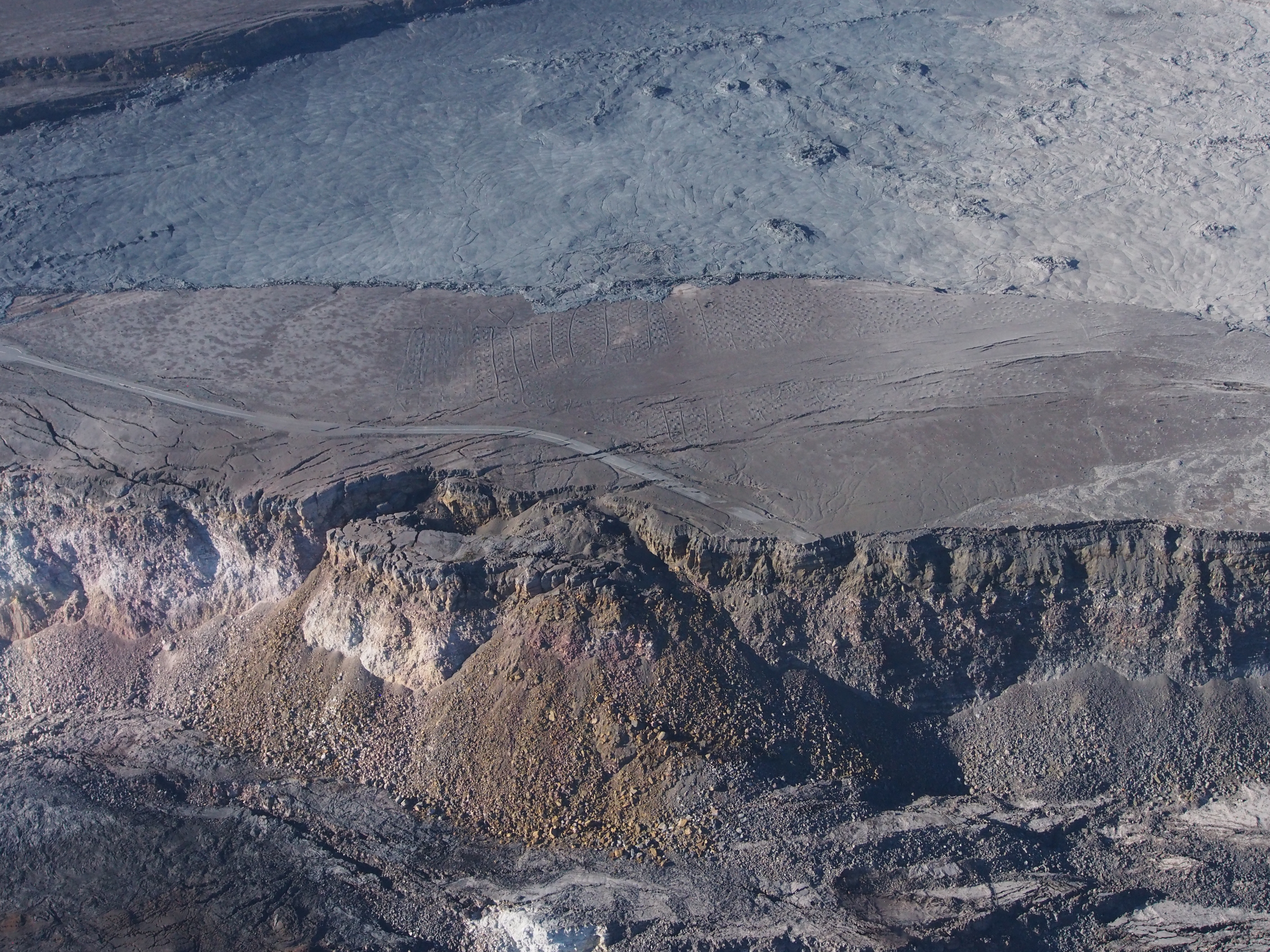
Little lava is leaving Fissure 8 today. It’s still bubbling away within the cone, but the channel below it is crusted over, with only residual lava draining down towards Ahalanui and the edge of Isaac Hale Park, and almost no laze plume. The summit’s seismicity is way down, and there’s almost no inflation or deflation since August 3. Now the question becomes: is this a temporary pause, or is this eruption really over?
Video from the early AM helicopter overflight provides a view inside the cone; a significant reduction in lava output from fissure 8, in Kīlauea Volcano’s #LERZ. https://t.co/Kal8hYiYOI pic.twitter.com/UMc0B3TSBE
— USGS Volcanoes🌋 (@USGSVolcanoes) August 6, 2018
(Full-sized version of this video)
Today’s
#HVO#Kīlauea Volcano update (12:49 PM HST) paints a picture of a pause – but we’re not yet ready to say if it’s a full stop. https://volcanoes.usgs.gov/volcanoes/kilauea/status.html@USGSVolcanoes on Twitter
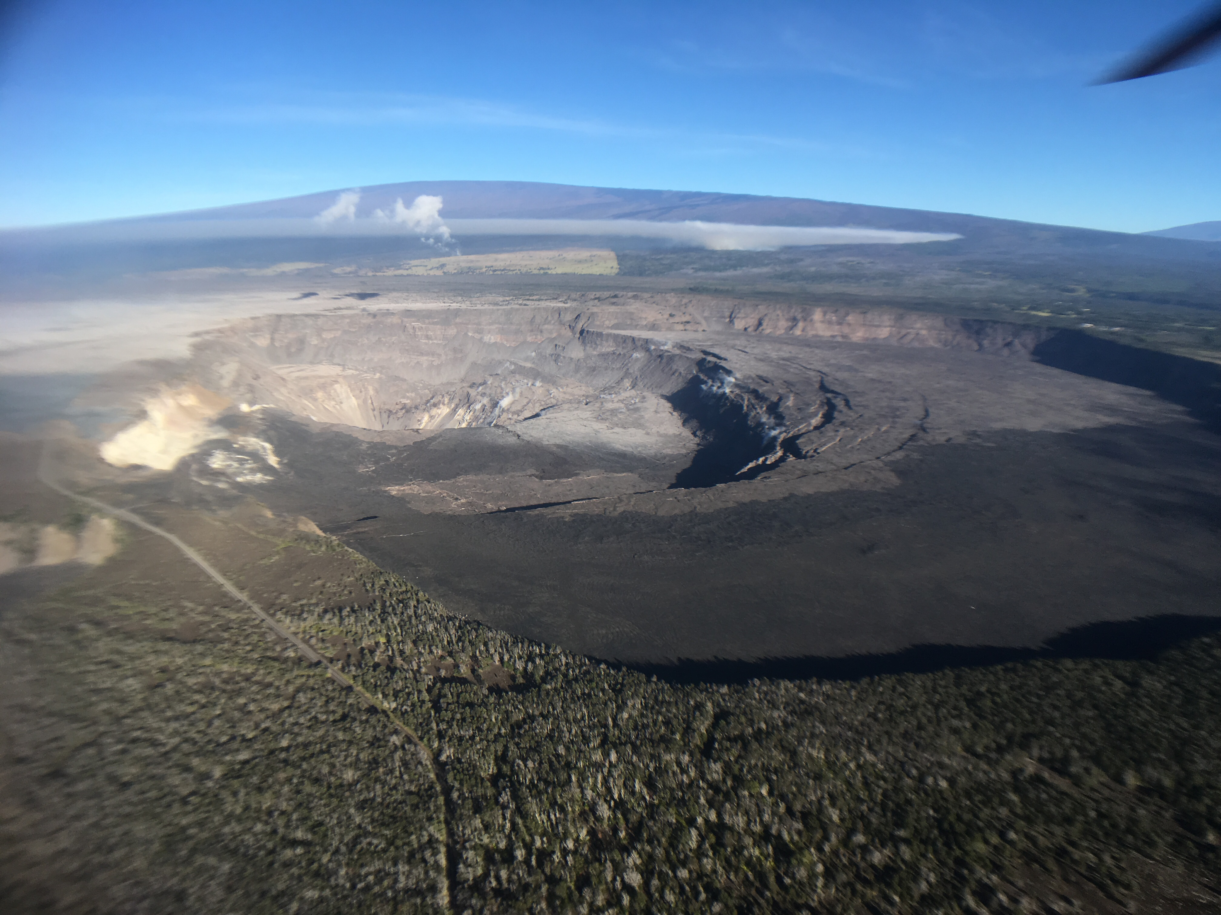
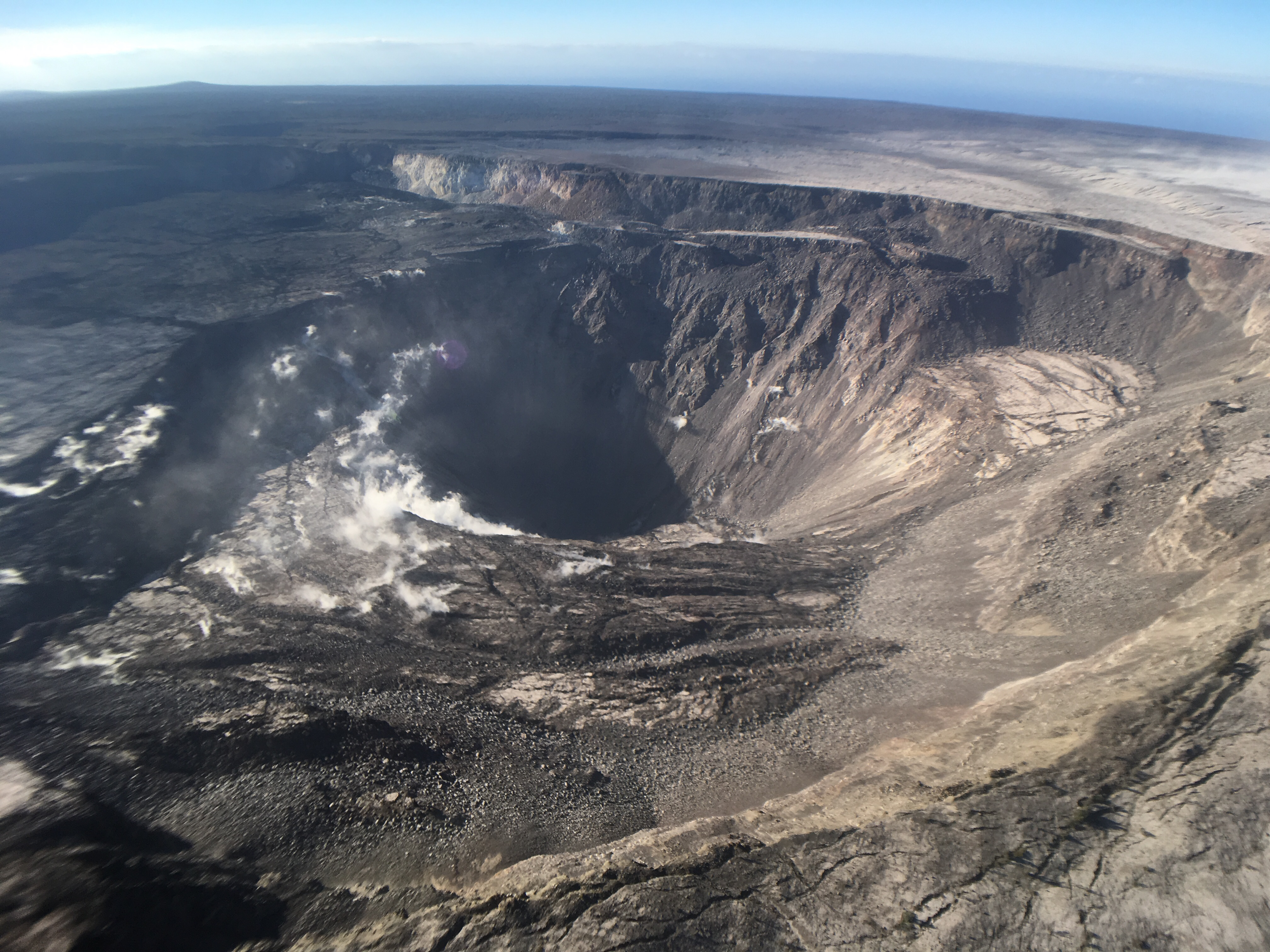
By the way, while trying to track down photos of the September 1982 lava flow, I found an old webpage (No datestamp, but Internet Archive first scraped it in 1999) with some interesting aerial photos of Kīlauea Caldera from the 70s and 80s. It would be fun to try to match the 1974 aerial photo with a new one, but I haven’t seen one taken from that high yet.
At the top of this post, I posted Mick Kalber’s overflight video from this morning. Bruce Omori posted his photos and notes from this flight on the Lava Update blog, same post mirrored on Facebook with a few more observations:
Lava Update for Monday, Aug 6, 2018, 6:00 am – Kilauea's lower east rift zone overflight:Kīlauea's eruptive activity…
Posted by Extreme Exposure Fine Art Gallery on Monday, August 6, 2018