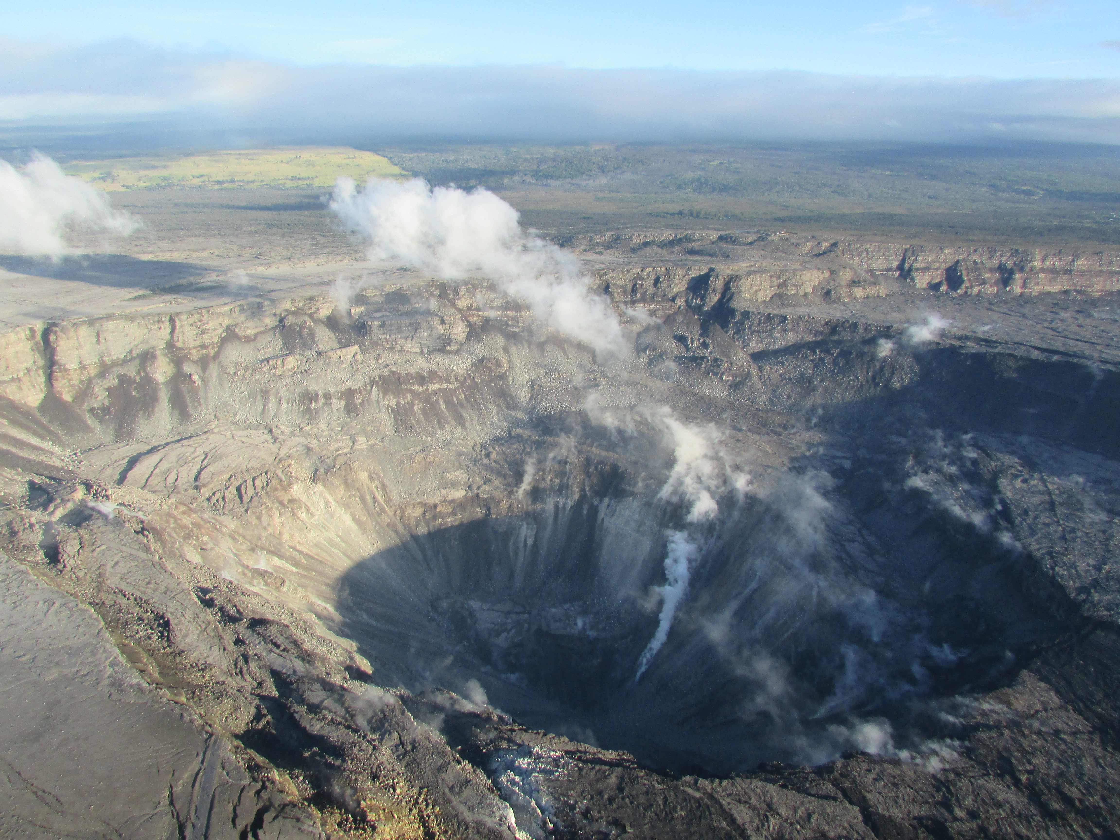
July 28, 2018. USGS: “Aerial view of the summit crater from this morning’s overflight. Zoom in to see HVO and the Park’s Jaggar Museum on the caldera rim (right side of photo).” (Full-sized)
Note the light green mostly-treeless area in background at left, and then zoom in to find museum & observatory on rim at right. Then compare with:
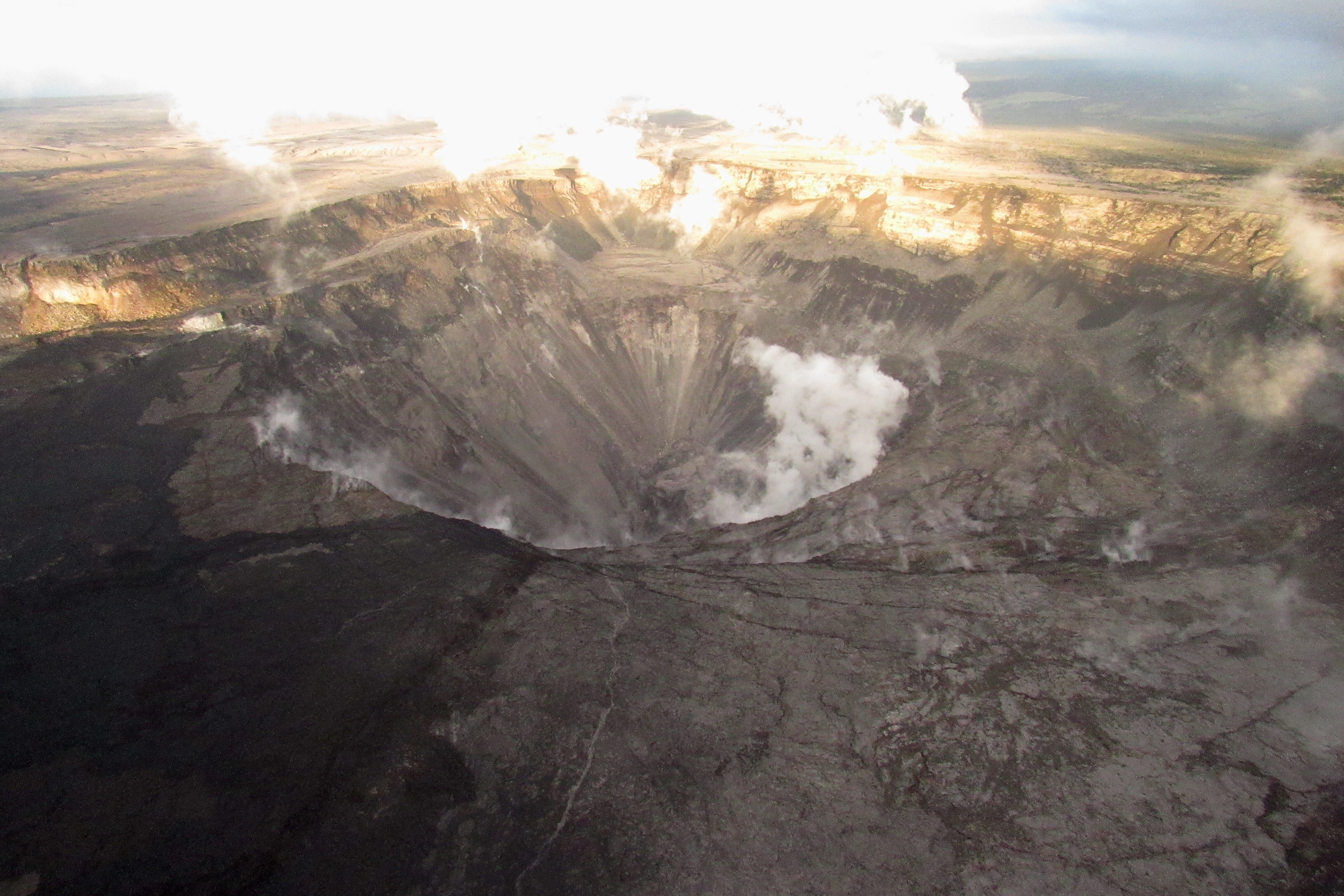
April 13, 2018
BEFORE the big event: Kilauea caldera, April 13, 2018. USGS: “The museum and HVO are perched on the caldera rim (middle right), with the slopes of Mauna Loa visible in the background.” (Full-sized)
Today’s Eruption Summary
Summit collapse event at 2:37 am HST, July 28, 2018. Energy release equivalent to M5.4. Minor overflows on Fissure 8’s channel reported a few hours afterwards. At the coast, the SW edge of the flow remains stalled 175 m from Pohoiki boat ramp, with ocean entry a few hundred meters to its east.
Road crews are monitoring cracks on Highway 130 after increased gas emissions were detected there.
Also, notwithstanding longer intervals between recent summit collapses and a few days where the lava channel seemed lower, HVO doesn’t see any strong indications the eruption is weakening:
We can't say for sure, but we don't think so. We've had long intervals between Type A events in the past, and the channel today appears to be as active as it has been in past days, with overflows on existing lava in some places.
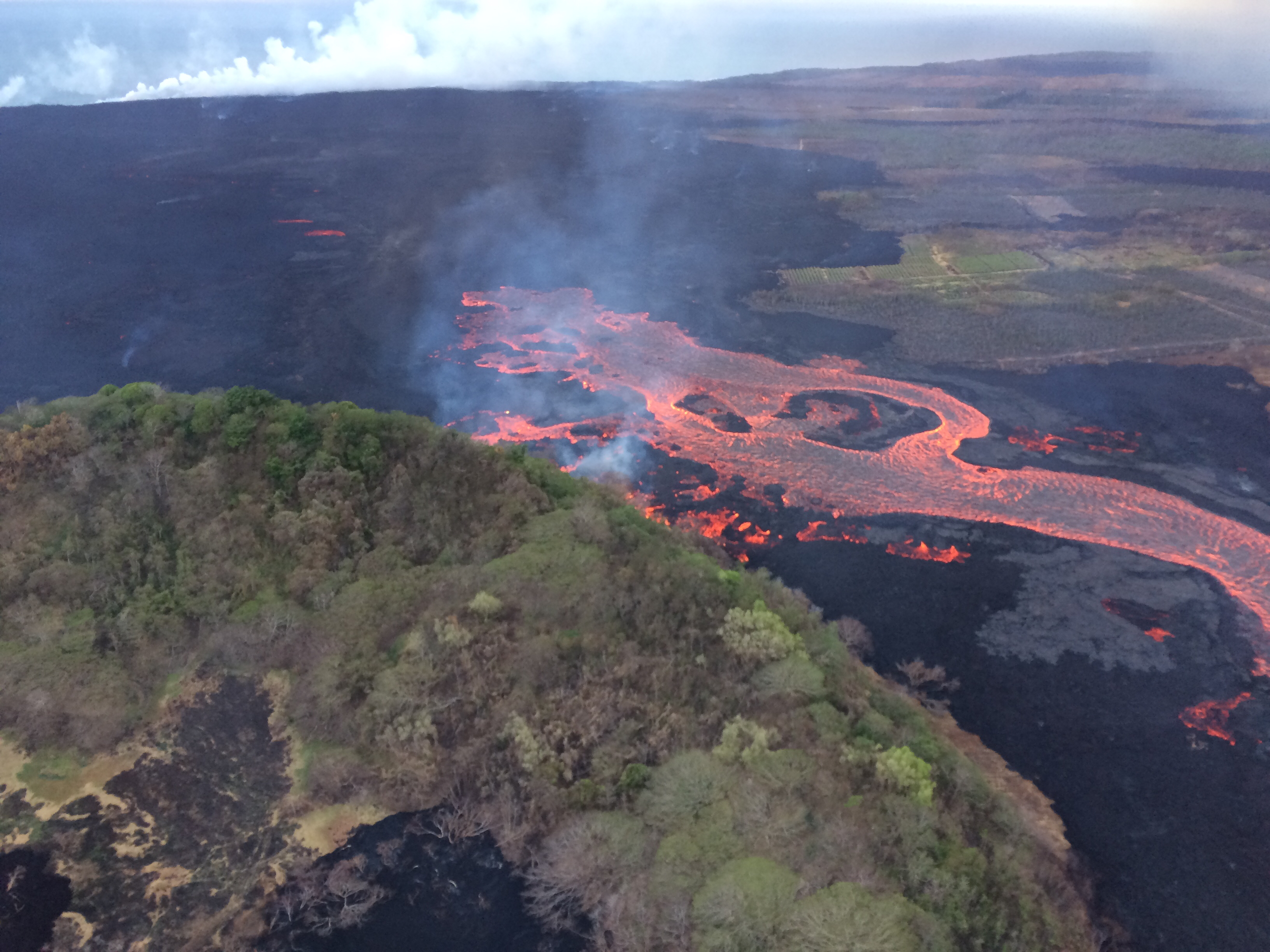
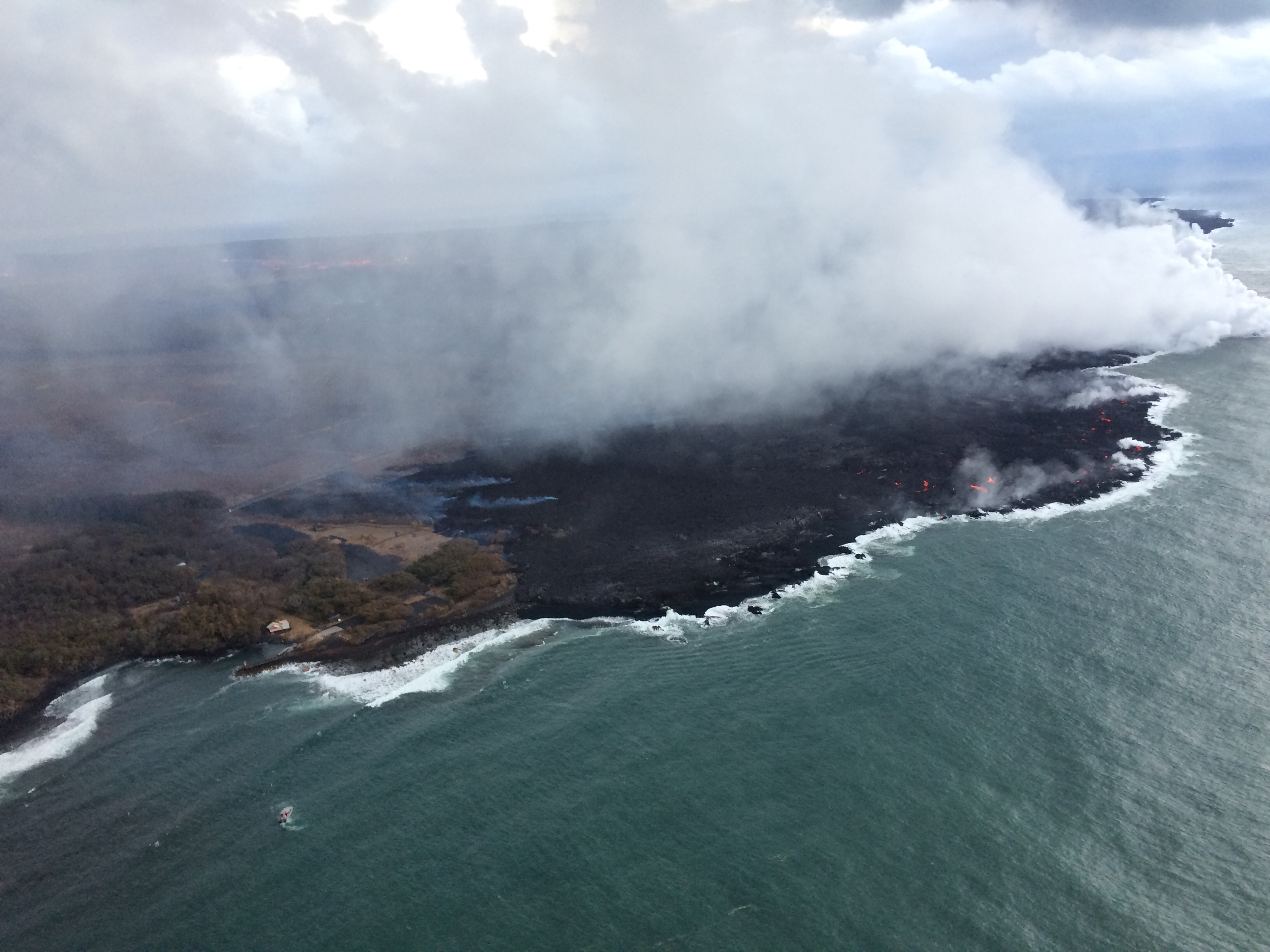
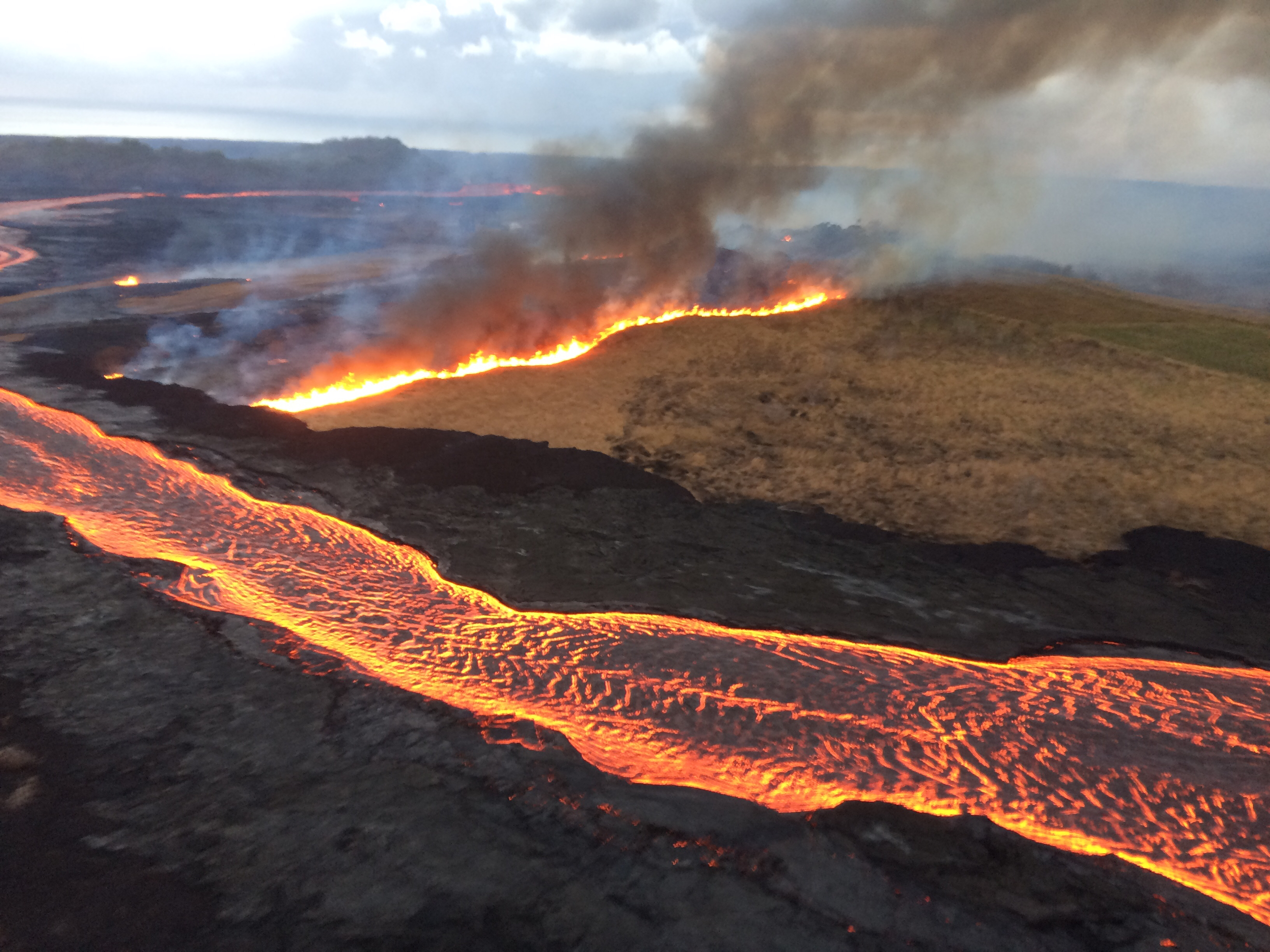
July 28, 2018. USGS: “A collapse event at Kīlauea’s summit occurred this morning at 02:37 a.m. HST. It was similar in character to previous collapse events, releasing energy equivalent to a magnitude-5.3 earthquake. This image, looking to the southwest, shows the summit crater during this morning’s overflight.” (Full-sized)July 28, 2018. USGS: “This view across the summit caldera shows ground cracks (center) just north of Halema‘uma‘u. Rockfalls within the crater and along the caldera walls continue to stir up dust that can be seen here rising above the caldera rim.” (Full-sized)July 28, 2018. USGS: “The incandescent lava overplating the ‘a‘ā flow between the fissure 8 lava channel and Kapoho Crater (lower left) is from an overflow that may have resulted from a channel surge following this morning’s summit collapse event. The active ocean entry can be seen in the far distance (upper left).” (Full-sized)July 28, 2018. USGS: “As of HVO’s early morning overflight today, the flow margin remained about 175 m (0.1 mi) from the Pohoiki boat ramp at Isaac Hale Park. The active ocean entry, located a few hundred meters (yards) to the east of the flow margin (visible here), produced a laze plume that was being blown slightly inland this morning.” (Full-sized)July 28, 2018. USGS: “Overflows from the fissure 8 lava channel may have ignited this fire (producing dark smoke) on Halekamahina, an older cinder-and-spatter cone to the west of Kapoho Crater.” (Full-sized)
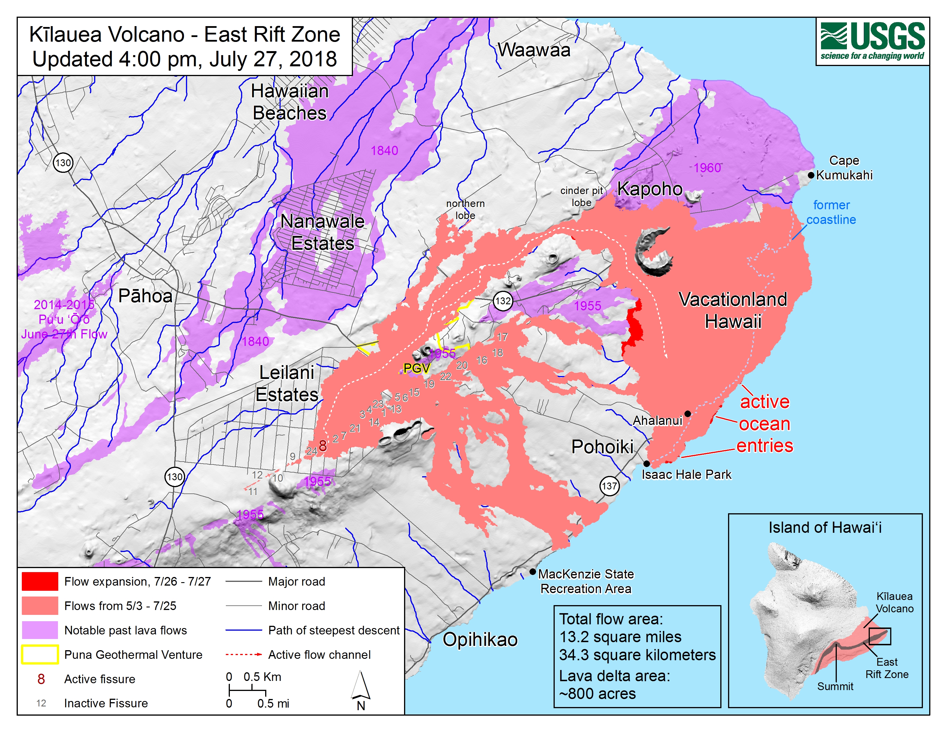
Friday Maps of Lower East Rift Zone
July 27, 2018, 4 pm lava flow map of LERZ by USGS/HVO. (Full-sized)
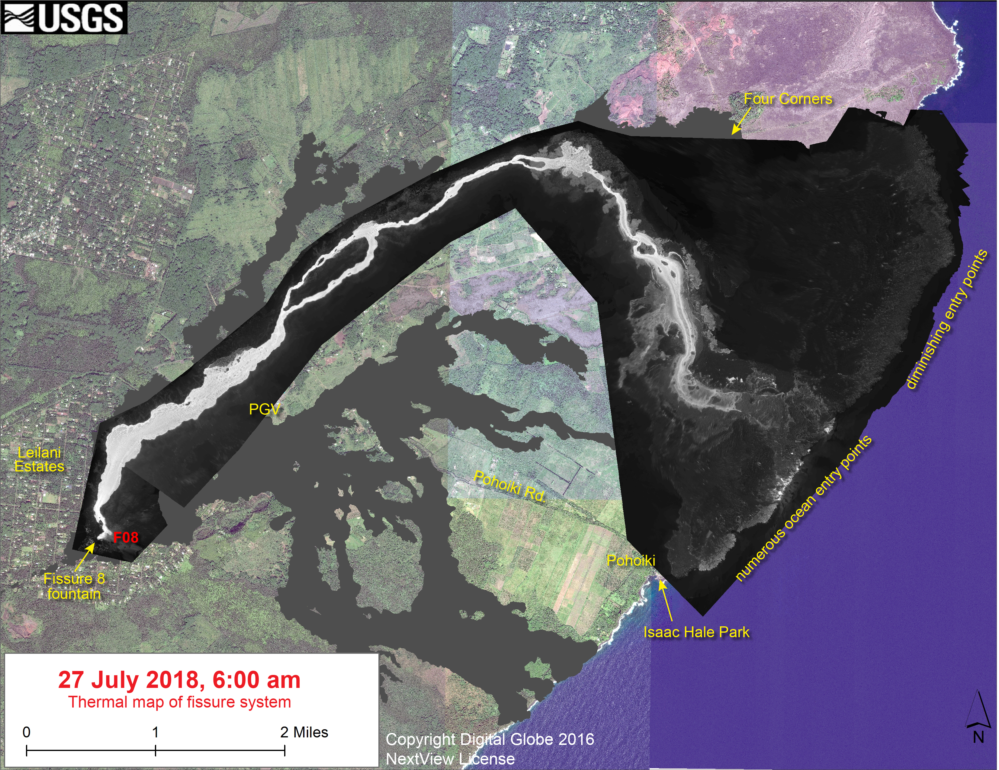
July 27, 2018. USGS: “This thermal map shows the fissure system and lava flows as of 6 am on Friday, July 27. The fountain at Fissure 8 remains active, with the lava flow entering the ocean. The dominant ocean entry points were on the section of coastline near Ahalanui.” (Full-sized)
Also see previous post for today, nice 3D renders of summit area using new LIDAR data.