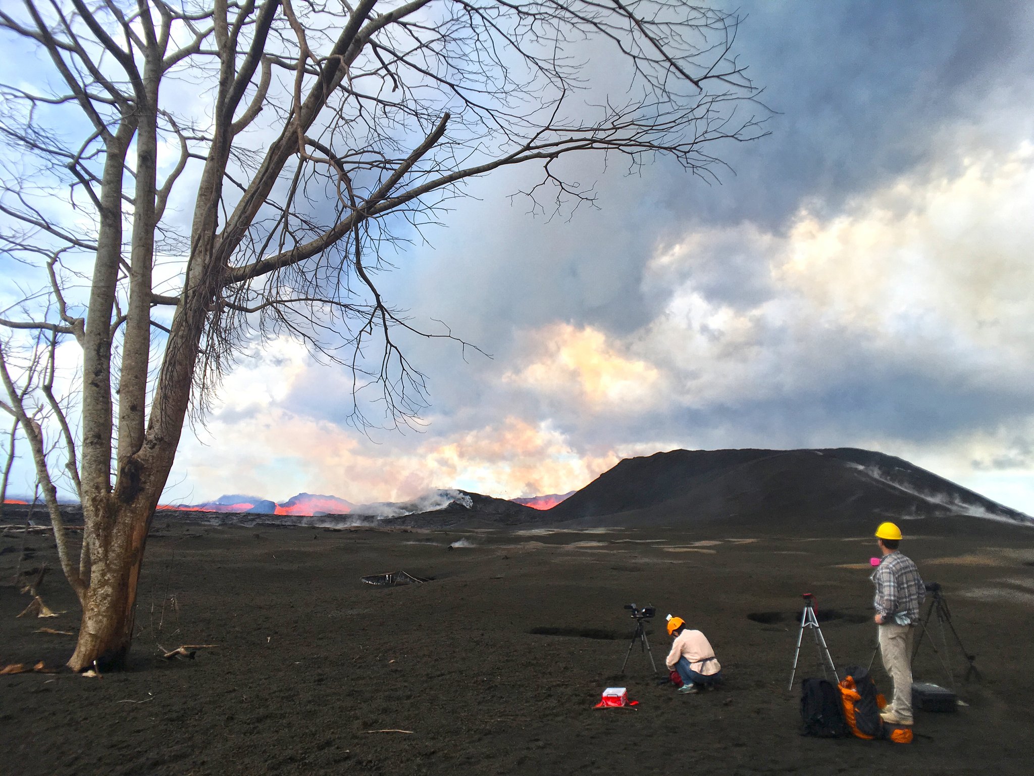
Today’s Eruption Summary
Today’s summit collapse event at 6:41 am was upgraded to 5.6 a 5.3, as usual. The USGS apologized for calculations errors for the past 3 days
Since I was out and missed it on livestream, I’m very glad HVO captured it. Here’s yet another trick from Pele’s repertoire:
There’s a lot to look at here. From USGS caption:
“In this video, watch as today’s event unfolds from the perspective of HVO’s live-stream camera. At 6:41:08 (time stamp at upper left), a small tree along the right margin of the video begins to sway. At 6:41:10, a pressure wave passes through the steam plume in the crater, and light is reflected back to the camera (highlights the passage of the expanding sound energy through the air.) At 6:41:11, a rockfall begins on the South Sulphur Banks, a distant light-colored scarp on the left.”
Field crews reported no surge at Fissure 8 following today’s summit collapse.
I notice the latest HVO Kilauea report says Fissure 8’s cone is down to 50 m, “or 55 yards.” It’s definitely crumbled or eroded— that may be responsible for some of the lava boats— but I’m never sure whether they’re measuring from the original ground level or the lava on which it sits. At any rate, the fountaining is lower, too, since it’s not rising above the lip of the cone.
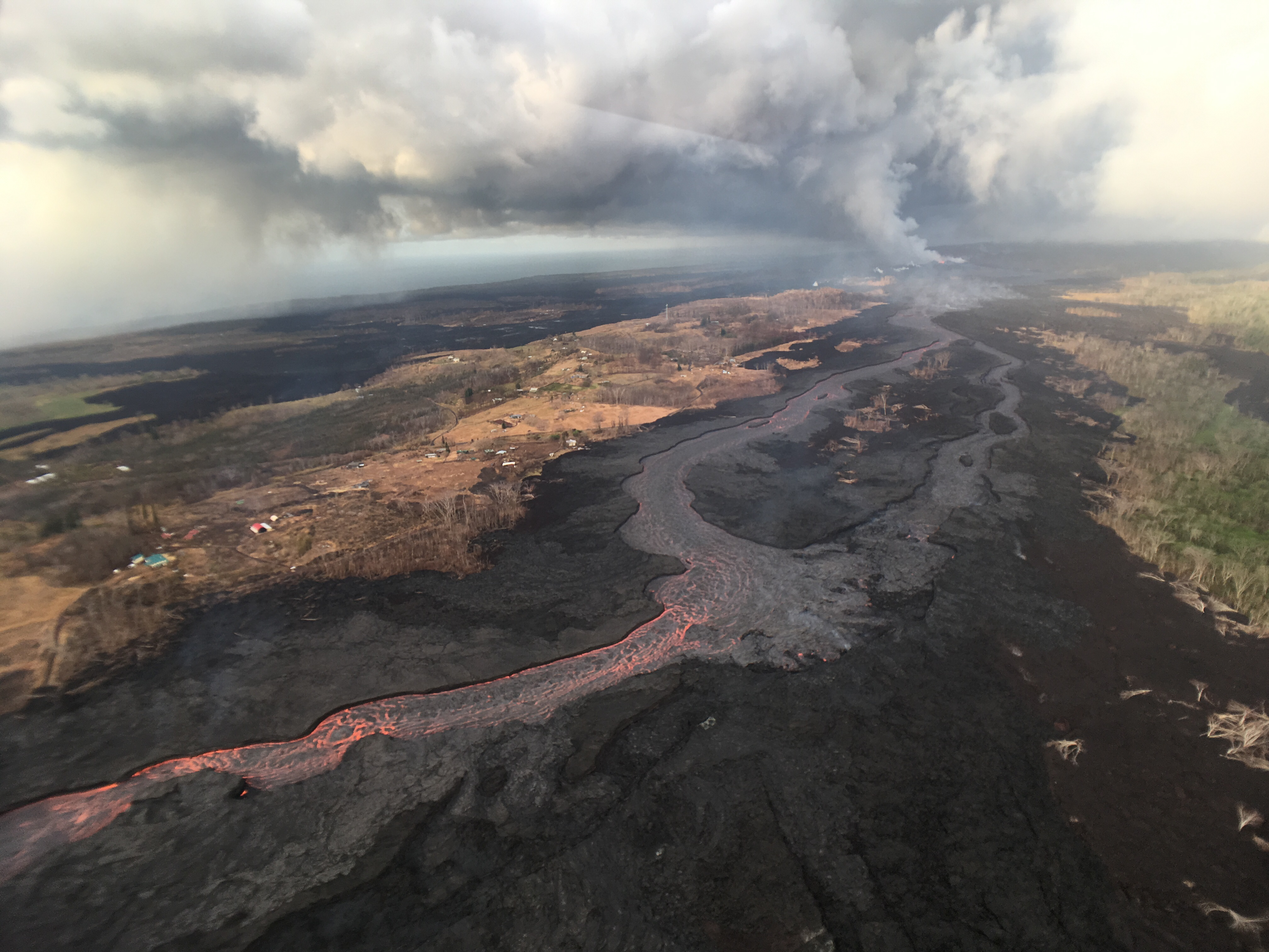
Down at the ocean entry, the main channel is still dumping into the sea from multiple toes near former Ahalanui.
I’m impressed HCFD was able to catch a glimpse under the thick, low laze plume, which was obstructing the view during @HotSeatHawaii’s overflight, which looked about like this (in fact the USGS helicopter was down below them):

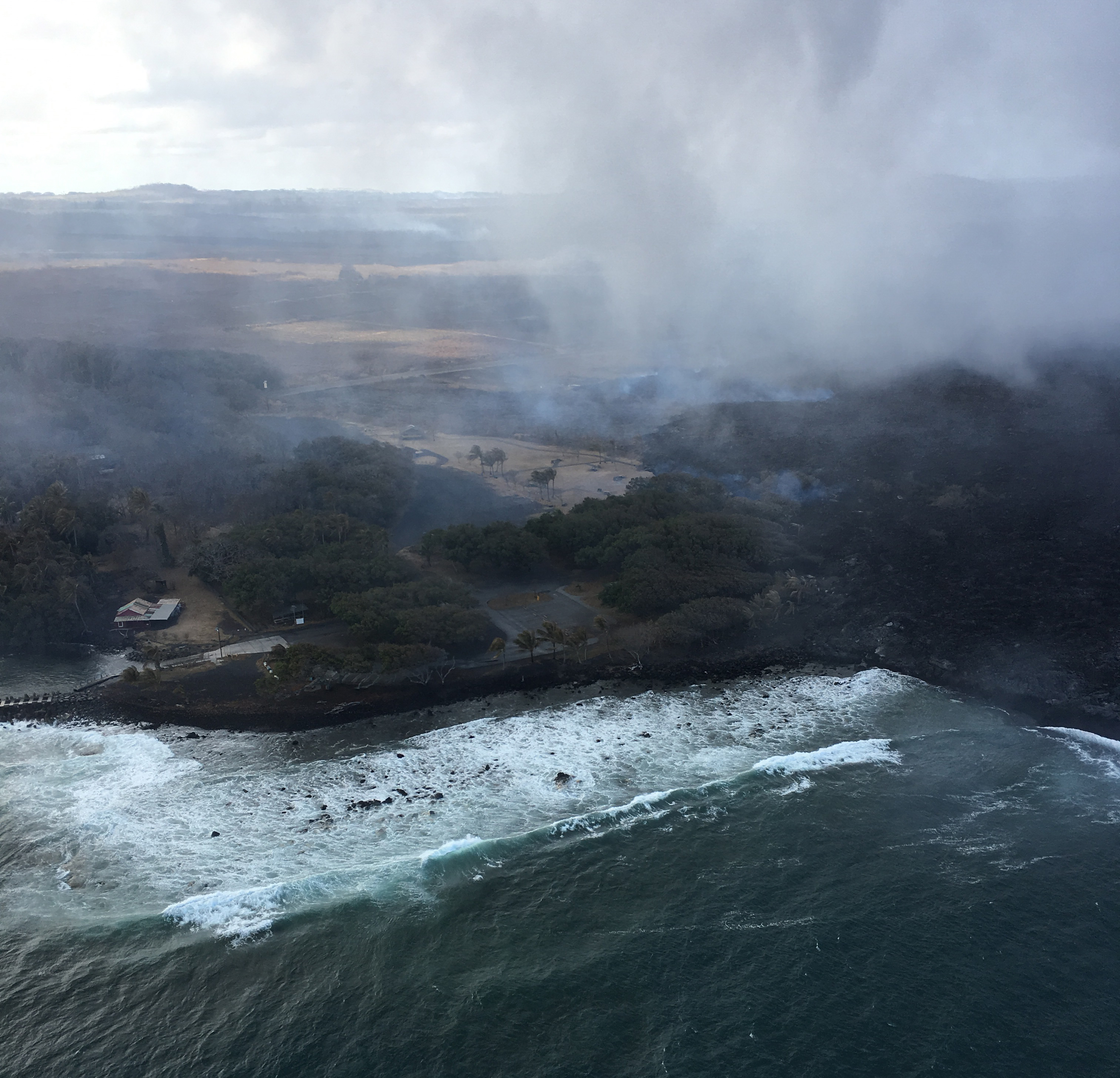
“Ooze-outs” are occurring along the west side of the active flow south Kapoho Crater, all the way down to the ocean (where it is threatening Isaac Hale).
Other news that slipped under the radar: HCFD took a swing by the summit yesterday! It was very dusty and hazy, but the new shape of Halemaʻumaʻu is becoming clear:
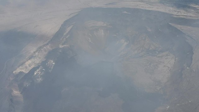
Look for Crater Rim Drive at lower left around 0:30, falling into the crater where it used to lead to the parking lot; HVO is really hard to glimpse at upper right.
There were several more photos, giving us a little more perspective on the whole of Kīlauea Caldera as it is now: